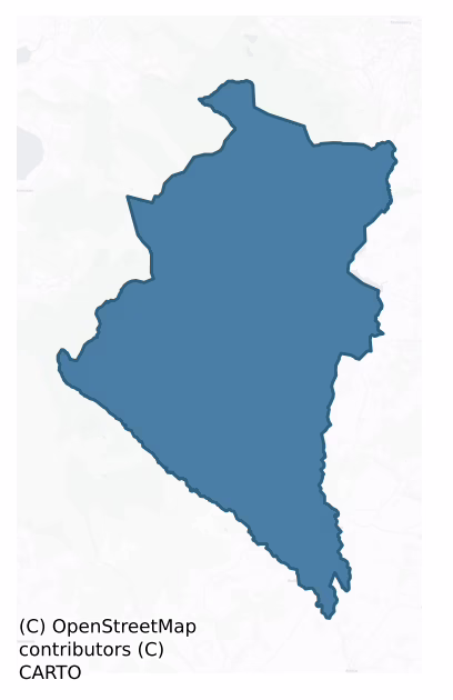
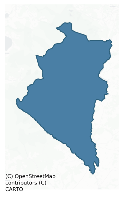
Ballinacor North is a barony of County Wicklow, in the historical province of Leinster (Irish: Baile na Corra Thuaidh), covering 300 km² of land. The barony records 408 NMS archaeological sites and 83 NIAH listed buildings, placing it at around the 26th percentile among 280 ROI baronies for sites per km². This means it is in the bottom third of all baronies for sites per km². Dated archaeological evidence runs from the Neolithic through to the Modern, spanning 8 of 9 archaeological periods, placing the barony in the 64th percentile among 280 ROI baronies for chronological depth. This means it is in the upper half of all baronies for chronological depth. The largest dated subset of recorded sites dates to the Early Medieval.

Heritage at a glance
Percentile rankings throughout this profile compare each barony only against the other 279 Republic of Ireland baronies.
The recorded heritage of Ballinacor North
The National Monuments Service Sites and Monuments Record (SMR) is the statutory inventory of archaeological sites for the Republic of Ireland, maintained by the Department of Tourism, Culture, Arts, Gaeltacht, Sport and Media. Sites recorded here include earthworks, ringforts, megalithic tombs, ecclesiastical remains, and post-medieval features; not every record is legally protected, but each is registered as a monument of archaeological interest.
The National Monuments Service records 408 archaeological sites in Ballinacor North, putting it at the 26th percentile among 280 ROI baronies for sites per km². This means it is in the bottom third of all baronies for sites per km². Protection coverage is near-universal — 403 sites (99%) fall within a recorded monument protection zone, indicating an extensively surveyed landscape. The dominant category is ecclesiastical sites — churches, graveyards, and holy wells (131 sites, 32% of the record). Bullaun stone is the most prevalent type, making up 12% of the barony's recorded sites (50 records) — well above the ROI average of 2% across all baronies where this type occurs. Bullaun stone is a boulder or rock outcrop with hemispherical hollows ('bulláin'), commonly associated with ecclesiastical sites and holy wells. Other significant types include Cross-slab (43) and Enclosure (20). Cross-slab is a stone slab inscribed with a cross, used as a grave-marker or memorial, dated pre-1200 AD; Enclosure is a banked or ditched feature of uncertain type, used as a catch-all where the original function cannot be determined from surface evidence. Across the barony's 300 km², this gives a recorded density of 1.36 sites per km².
Most common monument types
Hover or tap a monument type to see its definition.
| Type | Count |
|---|---|
| Bullaun stone a boulder or rock outcrop with hemispherical hollows ('bulláin'), commonly associated with ecclesiastical sites and holy wells | 50 |
| Cross-slab a stone slab inscribed with a cross, used as a grave-marker or memorial, dated pre-1200 AD | 43 |
| Enclosure a banked or ditched feature of uncertain type, used as a catch-all where the original function cannot be determined from surface evidence | 20 |
| Church a building used for public Christian worship, of any date from c. 500 AD onwards | 13 |
| Rock art geometric and other motifs carved on earthfast boulders or rock outcrops, mainly Bronze Age but with possible Neolithic origins | 12 |
| Hut site a low stone or earthen foundation enclosing a small circular or oval area, generally interpreted as a former dwelling, of any date from prehistory to the medieval period | 10 |
Chronological distribution
The dated archaeological record for Ballinacor North spans from the Neolithic through to the Modern, with activity attested across 8 of 9 archaeological periods. Every period from earliest to latest is represented in the record — an unbroken sequence of dated activity across the full chronological span. Activity concentrates most heavily in the Early Medieval (128 sites, 63% of dated material), with the Iron Age forming a secondary peak (32 sites, 16%). A further 204 recorded sites (50% of the overall NMS register for the barony) carry no period attribution — appearing as 'Unknown' in the bar chart below. This typically reflects either records that pre-date the standardised period vocabulary or sites awaiting specialist dating review, rather than a genuine absence of chronological evidence.
Sample of recorded monuments
Show 25 sample monuments (of 408 total)
A representative sample of 25 recorded monuments drawn from the barony’s 408 total NMS entries. Sites within a recorded monument protection zone and rarer site types are prioritised so the list shows a meaningful cross-section rather than only the most common type. Each entry shows the official Sites and Monuments Record reference number and the description published by the National Monuments Service.
Flat cemetery
Situated on SE edge of a plateau overlooking the Vartry River to the E. The 'Moat' was described in 1838 by John O'Donovan as a ‘remarkable round and pretty high hillock which they call a moate, but which, however, has…
Situated on SE edge of a plateau overlooking the Vartry River to the E. The 'Moat' was described in 1838 by John O'Donovan as a ‘remarkable round and pretty high hillock which they call a moate, but which, however, has no sign or vestige of a moate on or about it’ (O'Flanagan 1928, 81). It is depicted as a steep side hillock on the 1838 ed. OS 6-inch map with OS trig. station marking spot height of 907 ft. OD on the summit of the mound. The revised 1907 ed. OS 25-inch map shows that by this time a gravel pit had been opened in the W quadrant of the hillock and that the profile of the earthwork had been severely altered. This earthwork was visited in 1989 and described as a 'natural sand deposit whose interior has been almost completely removed through quarrying leaving a flat central area (dims. 160m E-W x 120m N-S)surrounded by the undug edge of the natural mound. No trace of any artificial features other than those created by quarrying (discontinued)' (ASI Field Report 09/11/1989). Two urn burials discovered in 1981 when they were exposed on the E side in the section of a natural hillock known locally as 'Sutton's Moat' (Cahill and Sikora 2011, Vol. 1, 656-63). Local folklore from Calary National School recorded that 'The Moate in front of my home was believed to be a "Fairy-Moate" (The Schools’ Collection, Volume 0912, Page 239).
Compiled by: Claire Breen
Revised by: Caimin O'Brien
Date of upload: 24 July 2012
Cross-inscribed pillar
Situated on the cliffs above Lough Ouler to the S of the summit of Tonelagee. A mica-schist pillar (H 1.38m; Wth 0.46m; T 0.09m) inscribed with a Latin cross on each face. That on the W face (dims. 0.13m x 0.25m) is…
Situated on the cliffs above Lough Ouler to the S of the summit of Tonelagee. A mica-schist pillar (H 1.38m; Wth 0.46m; T 0.09m) inscribed with a Latin cross on each face. That on the W face (dims. 0.13m x 0.25m) is slightly more distinct than that on the E side (dims. 0.16m x 0.09m); each is cut to a depth of about 10mm. (Information c. Manning, OPW)
The above description is derived from the published 'Archaeological Inventory of County Wicklow' (Dublin: Stationery Office, 1997). In certain instances the entries have been revised and updated in the light of recent research.
Date of upload/revision: 17 December 2008
Castle – motte and bailey
Situated on a ridge overlooking the marshy floor of a stream valley to N. Originally constructed c. 1214 by Henri de Londres, Archbishop of Dublin (Orpen 1908). Described in the 1838-40 Ordnance Survey Field Name Books…
Situated on a ridge overlooking the marshy floor of a stream valley to N. Originally constructed c. 1214 by Henri de Londres, Archbishop of Dublin (Orpen 1908). Described in the 1838-40 Ordnance Survey Field Name Books of Derrylossary parish (SMR File) as ‘ all that is perceptible is a square mound about 40 feet [12m] high with the remains of masonry, surrounded by a deep ditch. In 1308 Piers Gaveston fortified Castlekevin having first harrassed and defeated the O’Byrnes and O’Tooles, in order to conciliate the English.’
The present remains consist of an almost square-shaped motte with a possible large bailey area on the E side. The site was extensively rebuilt to act as the centre of a campaign against the O'Tooles and at this time it was probably enlarged to its present form. Later the site was granted to the O'Tooles but was destroyed before 1636 and not subsequently repaired. The motte (max. dims. 70m N-S; 46m E-W) has a level summit (dims. 34m N-S; 31m E-W; H 6-7m above base of fosse) and steep battered sides faced with uncoursed rubble. In the centre of the E portion are the remains of the castle (WI024-003001-). The platform is surrounded by a flat-bottomed fosse (Wth 6-8m; D 2-3m) and, on the N side, by a bank (Wth 7m; H 2.5m), a sunken road (WI024-003002-) and an outer bank (Wth 4.5m; H 1m). The possible bailey area consists of a subrectangular area (max. dims. 143m E-W; 67m N-S) tapering to the E. It is defined by a bank which is only visible at W end of N sid…
Gateway
National Monument in state ownership No. 134. Remains of a formerly two-storied gatehouse situated at the NE angle of the modern enclosure. It consists of a square building (c. 4.9m x 5m internally) with round granite…
National Monument in state ownership No. 134. Remains of a formerly two-storied gatehouse situated at the NE angle of the modern enclosure. It consists of a square building (c. 4.9m x 5m internally) with round granite arches and antae in the north and south walls. Some of the paving of the causeway through the gatehouse is still intact and the ground slopes markedly upwards towards the interior of the enclosure. Each archway, however, is 3m in height from the ground to the soffit. A second floor is indicated by the presence of corbels in the interior. A possible section of the enclosure wall adjoins the NE corner. There is a slab of mica schist (dims. 2.3m x 1.5m) on the W wall with an incised Latin cross. (Leask 1950, 30-32; Barrow 1992, 28-30)
See attached screenshots of 3D model of gateway created by The Discovery Programme. 3D model can be accessed at the following website: https://skfb.ly/ALPu
The above description is derived from the published 'Archaeological Inventory of County Wicklow' (Dublin: Stationery Office, 1997). In certain instances the entries have been revised and updated in the light of recent research.
Date of upload: 19 December 2012
See linked document with plan taken from Robert Cochrane Historical and Descriptive Notes with Ground Plans, Elevations, Sections and Details of the Ecclesiastical Remains at Glendalough, Co. Wicklow. Extract from the Eightieth Annual Report of the Commissioners of Public Works in Ireland 1911-12. Dublin,…
Round tower
National Monument in state ownership No. 134. Situated NW of the cathedral on slightly higher ground within the main graveyard. Built of mica-schist and granite (H 30.48m) on two offsets, with a further six floors…
National Monument in state ownership No. 134. Situated NW of the cathedral on slightly higher ground within the main graveyard. Built of mica-schist and granite (H 30.48m) on two offsets, with a further six floors carried on beams set into beam-holes. The round-headed granite doorway faces SE and is 3.2m above the upper offset. There are four trabeate windows at various levels and a further four at the cardinal points, just below the reconstructed conical cap. A rectangular channel (c. 0.2m x 0.15m) runs right through the thickness of the wall just below the doorway. Orpen (1907, 404) suggested it may have been used as a spy-hole. Healy (1972) recorded a number of cross-slabs in the vicinity of the round tower. (Leask 1950, 16-18; Barrow 1979, 197-200; Barrow 1992, 30-31)
See attached screenshots of 3D model of the Round Tower created by The Discovery Programme. 3D model can be accessed at the following website: https://skfb.ly/6o69n
The above description is derived from the published 'Archaeological Inventory of County Wicklow' (Dublin: Stationery Office, 1997). In certain instances the entries have been revised and updated in the light of recent research.
Date of upload: 19 December 2012
See linked document with plan taken from Robert Cochrane Historical and Descriptive Notes with Ground Plans, Elevations, Sections and Details of the Ecclesiastical Remains at Glendalough, Co. Wicklow. Extract from the Eightieth Annual Report of the Commissioners of Public…
Cathedral
The cathedral is the largest and most imposing structure at Glendalough and is situated in the SE sector of the main enclosure (WI023-008005-) on a small plateau overlooking the junction of the Glendasan and Glenealo…
The cathedral is the largest and most imposing structure at Glendalough and is situated in the SE sector of the main enclosure (WI023-008005-) on a small plateau overlooking the junction of the Glendasan and Glenealo rivers. It was dedicated to SS Peter and Paul (Price 1945, 46-7) and ceased to function as a cathedral when the diocese of Glendalough was united with Dublin in 1214. It consists of a multi-period nave and chancel church with a sacristy at the S. The earliest phase is evident in the cyclopean masonry in the nave walls while later rebuilding took place in the tenth century with the chancel added towards the end of the twelfth century. Some reconstruction took place in the 1870s. While the stone used is mainly mica schist some Dundry stone is employed for the later decorative features. The nave (dims. 14.88m x 9.3m) has antae at both E and W. The W door has inclined jambs, simple flat architraves and a round relieving arch above the lintel. There are two windows in the S wall, a N door, and a chancel arch of granite decorated with chevrons. The chancel, of inferior masonry and not quite in line with the nave, has two windows in the N wall and one in the S wall with a piscina and aumbry below. There is a tall, decorated, round-arched window and an external string course on the E gable. A door in the S wall of the chancel leads to the sacristy (dims. 4.87m x 3.2m). There are five cross-slabs against the inner N wall of the chancel; three of these are illustrated a…
Bridge
The annals record a bridge over the Glendasan river which was swept away in the great flood of 1177. A new bridge, opposite the main entrance to the monastic 'city', possibly on the site of the old bridge, was built…
The annals record a bridge over the Glendasan river which was swept away in the great flood of 1177. A new bridge, opposite the main entrance to the monastic 'city', possibly on the site of the old bridge, was built shortly before 1873 (Barrow 1992, 28).
The above description is derived from the published 'Archaeological Inventory of County Wicklow' (Dublin: Stationery Office, 1997). In certain instances the entries have been revised and updated in the light of recent research.
Date of upload/revision: 17 December 2008
Settlement platform
W of the church (WI023-020—-) is a platform (WI023-020004-) with paved causeway (Leask 1950, 9-10).
Compiled by: Gearóid Conroy and Caimin O'Brien
Date of upload: 19 December 2012
See linked document with…
W of the church (WI023-020—-) is a platform (WI023-020004-) with paved causeway (Leask 1950, 9-10).
Compiled by: Gearóid Conroy and Caimin O'Brien
Date of upload: 19 December 2012
See linked document with plan taken from Robert Cochrane Historical and Descriptive Notes with Ground Plans, Elevations, Sections and Details of the Ecclesiastical Remains at Glendalough, Co. Wicklow. Extract from the Eightieth Annual Report of the Commissioners of Public Works in Ireland 1911-12. Dublin, 1925.
Cave
National Monument in state ownership No. 134. Small rock-cut cave c. 9.5m above the level of the Upper Lake at Glendalough. Traditionally said to have been used as a sleeping place by St Kevin; sometimes cited as a…
National Monument in state ownership No. 134. Small rock-cut cave c. 9.5m above the level of the Upper Lake at Glendalough. Traditionally said to have been used as a sleeping place by St Kevin; sometimes cited as a Bronze Age burial site but possibly an opening for a mine – the beginning of a second possible opening is evident at a lower level. (Leask 1950, 10-11; Barrow 1992, 16-17)
See attached screenshots of 3D model of St. Kevins’ Bed created by The Discovery Programme. 3D model can be accessed at the following website: https://skfb.ly/6twZZ
The above description is derived from the published 'Archaeological Inventory of County Wicklow' (Dublin: Stationery Office, 1997). In certain instances the entries have been revised and updated in the light of recent research.
Date of upload/revision: 17 December 2008
Religious house – Augustinian canons
National Monument in state ownership No. 134. Situated about half a mile SE of the cathedral, on the south bank of the river, this Romanesque church is one of the latest at Glendalough. Said to have been founded for…
National Monument in state ownership No. 134. Situated about half a mile SE of the cathedral, on the south bank of the river, this Romanesque church is one of the latest at Glendalough. Said to have been founded for Augustinian Canons by St Lawrence O'Toole in 1162, it became Arroasian probably soon after 1163 (Gwynn and Hadcock 1988, 177). The buildings (now largely restored) consist of a nave (dims. 12.7m E-W; 6.35m N-S) and chancel (dims. 5.36m E-W; 3.56m N-S) with possible domestic building (c. 12.2m E-W; c. 5.8m N-S) attached to the N side of the nave. The chancel arch (of three orders) and the two-light E window have Romanesque ornament, including human and animal figures. The E wall has two aumbries one at each side of the window opening, and there are a number of small cupboards in the chancel. The nave has two doors and two windows in the S wall and one door in the N wall. The chancel was originally barrel-vaulted. A mural stairs rises southwards in the east wall of the attached building and led to an upper floor. (Leask 1950, 33-6; Barrow 1992, 43-8)
See attached screenshots of 3D model of church created by The Discovery Programme. 3D model can be accessed at the following website: https://skfb.ly/AKu6
The above description is derived from the published 'Archaeological Inventory of County Wicklow' (Dublin: Stationery Office, 1997). In certain instances the entries have been revised and updated in the light of recent research.
Date of upload: 19 Decemb…
Castle – tower house
Situated on a marked N-facing slope in pasture with commanding views over the Avonmore Valley. Price (1933, 240-41) described the foundations of a 17th-century O'Byrne castle (dims. 8.68m x 8.68m) with a circular tower…
Situated on a marked N-facing slope in pasture with commanding views over the Avonmore Valley. Price (1933, 240-41) described the foundations of a 17th-century O'Byrne castle (dims. 8.68m x 8.68m) with a circular tower at the NE corner standing on the eastern side of a large rectangular enclosure (WI023-036001-). No trace now remains apart from the earthworks which consist of two large conjoined terraced enclosures (W enclosure dims. 170m N-S; 63m E-W; E enclosure dims. 105m N-S; 67m E-W). The enclosures are linked by a well-defined causeway.
The above description is derived from the published 'Archaeological Inventory of County Wicklow' (Dublin: Stationery Office, 1997). In certain instances the entries have been revised and updated in the light of recent research.
Date of upload/revision: 17 December 2008
This monument is subject to a preservation order made under the National Monuments Acts 1930 to 2014 (PO no. 137/1940).
Megalithic structure
Situated on the eastern slopes of Kirikee Mountain. Marked as 'Giant's Grave' on the 1838 OS 6-inch map and as 'Giant's Grave (Site of)' on the current edition. The site is now under forest. No visible remains. (Borlase…
Situated on the eastern slopes of Kirikee Mountain. Marked as 'Giant's Grave' on the 1838 OS 6-inch map and as 'Giant's Grave (Site of)' on the current edition. The site is now under forest. No visible remains. (Borlase 1897, 413)
The above description is derived from the published 'Archaeological Inventory of County Wicklow' (Dublin: Stationery Office, 1997). In certain instances the entries have been revised and updated in the light of recent research.
Date of upload/revision: 17 December 2008
Ecclesiastical site
Situated on level ground with SW-facing slopes above and below the site. Gwynn and Hadcock (1970, 276) state that this is the site of an early 17th-century Franciscan monastery, but there is no other evidence and no…
Situated on level ground with SW-facing slopes above and below the site. Gwynn and Hadcock (1970, 276) state that this is the site of an early 17th-century Franciscan monastery, but there is no other evidence and no local memory of any remains. Not visible at ground level.
The above description is derived from the published 'Archaeological Inventory of County Wicklow' (Dublin: Stationery Office, 1997). In certain instances the entries have been revised and updated in the light of recent research.
Date of upload/revision: 17 December 2008
Mound
Mentioned in the OS Name Books as a mound in the N part of this townland. Not located.
The above description is derived from the published 'Archaeological Inventory of County Wicklow' (Dublin: Stationery Office,…
Mentioned in the OS Name Books as a mound in the N part of this townland. Not located.
The above description is derived from the published 'Archaeological Inventory of County Wicklow' (Dublin: Stationery Office, 1997). In certain instances the entries have been revised and updated in the light of recent research.
Date of upload/revision: 17 December 2008
Standing stone – pair
On flatish portion of ridge with good views to E, S and W, the Devil's Glen and Irish Sea are visible in the distance to the E in the gap between the two stones. Aligned roughly N-S, with the N stone (H 1m; Wth 0.75m; T…
On flatish portion of ridge with good views to E, S and W, the Devil's Glen and Irish Sea are visible in the distance to the E in the gap between the two stones. Aligned roughly N-S, with the N stone (H 1m; Wth 0.75m; T 0.75m) c. 1.7m away from the S stone (H 1.03m; 0.65m N-S; 0.55m E-W). Known as the 'Gossan stones' and 'Gossam stones'. (SMR file)
Compiled by: Claire Breen
Date of upload: 08 February 2013
Castle – Anglo-Norman masonry castle
Situated in the centre of the E portion of a square-shaped motte (WI024-003—-) located on the W end of a ridge running E-W overlooking a marshy river valley to the N. The remains consist of a projecting gate tower of…
Situated in the centre of the E portion of a square-shaped motte (WI024-003—-) located on the W end of a ridge running E-W overlooking a marshy river valley to the N. The remains consist of a projecting gate tower of uncoursed rubble and part of a corner tower surviving at the NE angle. Originally constructed c. 1214 by Henri de Londres, Archbishop of Dublin (Orpen 1908, 17-27). Described in the 1838-40 Ordnance Survey Field Name Books of Derrylossary parish (SMR File) as ‘ all that is perceptible is a square mound about 40 feet [12m] high with the remains of masonry, surrounded by a deep ditch. In 1308 Piers Gaveston fortified Castlekevin having first harrassed and defeated the O’Byrnes and O’Tooles, in order to conciliate the English.’ The fragamentary remains fo the stone castle are difficult to undertsand due to the poor condition of the upstanding remains. The monument consists of a high steep-sided square-shaped motte (WI024-003—-) enclosed by a a wide flat-bottomed fosse with remains of an external bank visible on the N side only. A short stretch of the wall of a stone castle or gatehouse can be seen rising from the base of the fosse on the E side of the motte, this wall rises to the summit of the motte on the E side with the remains of a possible broken out window or doorway embrasure visible at the base of the wall. A second stretch of walling belonging to the stone castle can be seen on the NE angle of the motte.
The OS 25-inch map depicts the upstandi…
Road – hollow-way
Situated on a ridge overlooking the marshy floor of a stream valley to N. Originally constructed c. 1214 by Henri de Londres, Archbishop of Dublin (Orpen 1908). The present remains consist of an almost square-shaped…
Situated on a ridge overlooking the marshy floor of a stream valley to N. Originally constructed c. 1214 by Henri de Londres, Archbishop of Dublin (Orpen 1908). The present remains consist of an almost square-shaped motte with a possible bailey area on the E side. The site was extensively rebuilt to act as the centre of a campaign against the O'Tooles and at this time it was probably enlarged to its present form. Later the site was granted to the O'Tooles but was destroyed before 1636 and not subsequently repaired. The motte (WI024-003—-) has a level summit and steep battered sides faced with uncoursed rubble. In the centre of the E portion are the remains of a Anglo-Norman stone castle or gatehouse (WI024-003001-). The base of the motte is enclosed by a flat-bottomed fosse and, on the N side, by an external bank. A sunken road (Wth 3.5m; L 150m) and an outer bank (Wth 4.5m; H 1m) aligned E-W can be seen running along the N side of the bailey area. This road runs up to the NE angle of the external bank and fosse of the motte and may represent the original access road into the fortification. The posible bailey of the motte consists of a subrectangular area tapering to the E. It is defined by a bank mainly reduced to a scarp along the N and E sides and by a fosse on the S. The sunken road continues along the N and E sides of the bailey. At the E side of the bailey the road appears to run off eastwards into the marshy area. On the N side of the bailey there are traces…
Children's burial ground
According to the field note on 'Trinity Church' (WI023-014001-), 'Two small (45cm high) gravemarkers (children?) occur c.6m W of enclosure'. The enclosure is presumably that around the graveyard (WI023-014005-). …
According to the field note on 'Trinity Church' (WI023-014001-), 'Two small (45cm high) gravemarkers (children?) occur c.6m W of enclosure'. The enclosure is presumably that around the graveyard (WI023-014005-). Trinity Church (WI023-014001-) stands in a small rectangular enclosure/churchyard (WI023-014005-). Lies on a narrow terrace in a S-facing slope overlooking low, wet, rushy, flooded pasture immediately to the S. No burial markers can be seen in the possible graveyard, or west of the enclosure as noted in the field note above, or evidence of it having been used as a graveyard (though there is a cross slab (WI023-014001-) reused as a step giving acccess to the site from the road to the N).
Compiled by: Gearóid Conroy
Date of upload: 12 October 2012
Cross-inscribed stone
Located 24.1m SSW of the round tower (WI023-008002-) – look for the modern headstone, 'Edward Magee 1912 – 1993', the slab stands 1.5m to the S of this headstone. This slab was not previously recorded. A low, roughly…
Located 24.1m SSW of the round tower (WI023-008002-) – look for the modern headstone, 'Edward Magee 1912 – 1993', the slab stands 1.5m to the S of this headstone. This slab was not previously recorded. A low, roughly dressed, earthfast and erect, thin granite slab, with rounded top (max. H 0.5m; Wth 0.54m; T 0.03-0.07m) carry's a small but deeply incised (1cm) Latin cross on its E-face (H 0.09m; Wth 0.06m) with a deeply incised horizontal line ending in T-shaped terminals just below (like an 'I', but horizontal). These features are above a deeply incised hemispherical depression (Wth 0.10m) (like a 'D' rotated anti-clockwise), which itself is above a crude rectangular hole in the slab (H0.09m; Wth 0.045m). The hemispherical depression and horizontal line might be the initials D I / I D sideways?
Date of upload: 10 October 2012
Headstone
Location: 2.30m E of E gable of Priest's House (29 August 2005). Upright slab, partly spalled along sides and top, with inscription on E face. 'Here lyeth ye body of/Murlaugh Doyle died/ [?] S [or 5 but looks like 'S']…
Location: 2.30m E of E gable of Priest's House (29 August 2005). Upright slab, partly spalled along sides and top, with inscription on E face. 'Here lyeth ye body of/Murlaugh Doyle died/ [?] S [or 5 but looks like 'S'] d [superscript] July ? ? [spalled but probably AD] 1697 aged 4.' There may be a final figure after the 4 but the edge of the slab is broken.
Date of upload: 10 October 2012
Cross – Market cross (present location)
Now situated in the Visitor Centre, this cross was moved from the location shown on the OS 6-inch map (given above). It may have had an earlier location also. A granite cross (H 1.66 m; Wth of arms 0.76m) with a…
Now situated in the Visitor Centre, this cross was moved from the location shown on the OS 6-inch map (given above). It may have had an earlier location also. A granite cross (H 1.66 m; Wth of arms 0.76m) with a crucifixion figure on the E face and patterns of zoomorphic interlace on the S and N sides, set into a truncated pyramidal base (dims. 0.32m x 0.18m). The figure of Christ is wearing a short tunic and the decoration is executed in high relief. (Harbison 1992, 95; Leask 1950, 39-45).
See WI023-007—- for details of its original location.
Date of upload: 03 October 2012
Souterrain
This record was created to cover a possible souterrain, the location of which is pencilled onto the Ordnance Survey 1st. ed. 6-inch map in the archive unit of the National Monuments Service (SMR File). The site of…
This record was created to cover a possible souterrain, the location of which is pencilled onto the Ordnance Survey 1st. ed. 6-inch map in the archive unit of the National Monuments Service (SMR File). The site of this possible souterrain is located 150m E of Trinity Church (WI023-014001-). Area marked on OS six-inch map now covered in furze bushes making detailed examination of this area impossible.
Compiled by: Caimin O'Brien
Date of upload: 16 November 2012
Holed stone
In St Kevin's Church (WI023-009—-) 'hidden' behind the slabs along the S wall. A small tapering slab (L 1.1m; Wth 0.45m tapering gently to a pointed end Wth 0.25m; T 0.06m) has a small circular hole (diam 0.04m)…
In St Kevin's Church (WI023-009—-) 'hidden' behind the slabs along the S wall. A small tapering slab (L 1.1m; Wth 0.45m tapering gently to a pointed end Wth 0.25m; T 0.06m) has a small circular hole (diam 0.04m) slightly off-centre some 0.12m from the broader end. Because of its location the stone could not be examined fully.
Date of upload: 12 October 2012
Decorated stone (present location)
This stone was found in 1908 by a group of men hunting ferrets near Hollywood, Co. Wicklow. It was lying face down at the edge of a grassy lane at Lockstown Upper (WI016-017—-). It consists of a boulder (dims. c.…
This stone was found in 1908 by a group of men hunting ferrets near Hollywood, Co. Wicklow. It was lying face down at the edge of a grassy lane at Lockstown Upper (WI016-017—-). It consists of a boulder (dims. c. 1.2m by 0.9m and 0.8m thick) carved with a labyrinth design (diam. c. 0.7m). A small section of the labyrinth is missing where a section was broken from the stone: this had been done prior to its discovery. The labyrinth appears to have been carved using the classical seed pattern and it is not known which way the labyrinth was intended to be viewed though it seems probable that it may been positioned so that its opening was at the bottom. The exact purpose of this stone is unknown though it seems likely that it had some connection with the pilgrimage to Glendalough and may have been used as a marker or station along the route where pilgrims stopped to pray. The labyrinth design has been replicated as a landscape feature in front of the Visitor Centre. (Orpen 1911; Price and Walshe 1933, 48)
See attached screenshot of 3D model of rock art created by Wicklow Rock Art Project, School of Archaeology, University College Dublin under the direction of Dr. Clíodhna Ní Lionáin. Photogrammetric 3D rock art model can be accessed at the following website: https://skfb.ly/zWJX
Compiled by: Paul Walsh
Date of upload: 25 February 2014
Charcoal-making site
One of 86 charcoal production sites recorded by Healy in 1972 and referred to by him as platform '76' (Healy 1972, 146). A test excavation was carried out on this platform (L 5m; Wth 3.5m) and two others (WI023-029003-…
One of 86 charcoal production sites recorded by Healy in 1972 and referred to by him as platform '76' (Healy 1972, 146). A test excavation was carried out on this platform (L 5m; Wth 3.5m) and two others (WI023-029003- and WI023-029004-) in 2009 by UCD School of Archaeology as part of its training fieldwork programme (Warren and McDermott 2012, 228; Warren et al. 2013, 85-112). The small test pit at this monument produced traces of charcoal (Warren and McDermott 2012, 228).
Compiled by: Claire Breen
Date of upload: 22 November 2013
Listed buildings
The National Inventory of Architectural Heritage (NIAH) is a state survey appraising buildings of architectural, historical, archaeological, artistic, cultural, scientific, social, or technical interest. Each surveyed structure receives a rating from International (the highest, for buildings of European importance) through National, Regional, Local, and Record-Only.
The NIAH records 83 listed buildings in Ballinacor North (43rd percentile across ROI baronies). The highest-graded structure include 1 of National significance. The Republic holds 937 National-graded buildings in total, so this barony accounts for around 0% of the national total. Construction dates concentrate most heavily in the Victorian (1830-1900) period. The most-recorded building type is house (38 examples, 46% of the listed stock).
Terrain and environment
Mean elevation across the barony is 353m — the 100th percentile among 280 ROI baronies for elevation. This means it is in the top tenth of all baronies for elevation. This is a relatively elevated landscape by ROI standards. Elevation matters for heritage because higher-altitude baronies typically favour defensive monuments — ringforts and hilltop forts placed on prominent ground — while lowland baronies are more likely to carry the dense settlement and church networks of intensive agricultural landscapes. The barony reaches 846m at its highest point — a vertical span of more than 492m within its boundary, indicating significant topographic diversity. Mean slope is 10.1° — the 98th percentile among 280 ROI baronies for slope. This means it is in the top tenth of all baronies for slope. This is consistently steep terrain by ROI standards, the kind of landscape that tends to preserve upstanding archaeological features well. Slope is a key control on both land use and archaeological preservation: steep ground resists ploughing and tends to preserve earthworks intact, while gentle slopes favour intensive cultivation that damages or destroys surface archaeology over time. The Topographic Wetness Index averages 8.7, the 1st percentile among 280 ROI baronies for wetness. This means it is in the bottom tenth of all baronies for wetness. This is well-drained ground by ROI standards — typical of upland or steeply-sloping country that sheds water rapidly. Drainage matters for heritage because poorly-drained ground preserves organic archaeology (wooden trackways, leather, textiles, and on rare occasions human remains) far better than free-draining soil; well-drained ground favours arable use but destroys organic material rapidly. The land cover is dominated by improved grassland (66%) and woodland (31%). In overall character, this is an upland landscape of steep, elevated terrain, with land use dominated by improved grassland.
Terrain measurements
Where this barony sits in the Republic of Ireland
Geology and preservation
Bedrock geology shapes the landscape long before any settlement begins — controlling soil drainage, agricultural potential, the survival of upstanding monuments, and the preservation of buried archaeology. The figures below come from the Geological Survey Ireland 1:100,000 bedrock map.
The bedrock underlying Ballinacor North is predominantly slate (57% of the barony by area), laid down during the Ordovician period (61% by area, around 485 to 444 million years ago). Slate weathers to thin upland soils but provides high-value building and roofing stone, which often shows in surviving 19th-century rural and ecclesiastical architecture. A substantial secondary geology of granite (21%) and adamellite (11%) adds further variety to the underlying landscape. The single largest mapped unit is the Maulin Formation (57% of the barony's bedrock).
Rock type composition
Largest mapped unit: Maulin Formation (57% of the barony)
Placename evidence
Logainm records 5 heritage-diagnostic placenames for Ballinacor North, a modest sample drawn predominantly from the townland record. The dominant stratum is pre-christian defensive. The most frequent diagnostic roots are ráth- (5). With a sample of this size the count should be treated as indicative rather than definitive.
Pre-Christian / Early Medieval Defensive
| Root | Count | Meaning |
|---|---|---|
| ráth- | 5 | earthen ringfort |
Other baronies in Wicklow
- Newcastle
- Arklow
- Talbotstown Upper
- Talbotstown Lower
- Shillelagh
- Ballinacor South
- Rathdown
- Clandonagh — Laois
- Moygoish — Westmeath
- Kilcullen — Kildare
See all 280 baronies in the Republic of Ireland Heritage Tool.

Explore further
Grounding History: 10 Maps of Northern Ireland’s Past
If you’re interested in Irish heritage more widely, the companion report for Northern Ireland brings together the analysis of all 462 NI wards into one place through 10 high-quality maps — covering monument density, archaeological periods, placename heritage, terrain, wetland, and the historic landscape at first survey. Take a look.
About this profile
Click any section below to expand.
What is a barony?
A barony is a historic administrative unit in Ireland, broadly equivalent to an English hundred. The 280 baronies used here are from the OSi 2019 National Statutory Boundaries (generalised 20m), covering the 26 counties of the Republic of Ireland. Baronies derive from the Norman period, were formalised in the 17th century, and have not been redrawn for statistical purposes. They vary enormously in area, from compact urban baronies in Dublin to vast upland baronies in Connacht, and should not be compared by raw site count without accounting for area differences.
What counts as a site?
This profile combines three distinct heritage registers, each with its own definition of what constitutes a recordable site:
- Archaeological sites (NMS). The National Monuments Service Sites and Monuments Record (SMR) catalogues every known archaeological monument or site of archaeological interest in the Republic, from prehistoric burial mounds and ringforts to medieval churches and post-medieval defensive works. Inclusion does not require legal protection — only that the site has been identified, surveyed, and assessed as having archaeological value. A separate subset of these sites lies within a recorded protection zone, which gives them statutory protection under the National Monuments Acts.
- Listed buildings (NIAH). The National Inventory of Architectural Heritage records buildings of architectural, historical, archaeological, artistic, cultural, scientific, social, or technical interest. Each surveyed structure is appraised on a five-tier scale: International, National, Regional, Local, and Record-Only. The NIAH appraisal is informational rather than strictly statutory, but it underpins local-authority Record of Protected Structures (RPS) listings.
- Heritage placenames (Logainm). Logainm is the authoritative database of Irish placenames maintained by the Placenames Branch. This profile applies a heritage-diagnostic classifier to the Irish-language form of each townland name, flagging roots that signal defensive sites (ráth-, lios-, dún-, caiseal-, cathair-), ecclesiastical foundations (cill-, teampall-, domhnach-, mainistir-), prehistoric burial-ritual features (tuaim-, carn-, leaba-), or Norse-contact settlement (gall-). Townlands without one of these diagnostic roots are not flagged here — they may still carry historical significance, but that significance is not encoded in the name itself.
Editorial principles
The narrative sections of this profile follow several explicit principles:
- Evidential. Every claim about this barony’s heritage character is anchored in the underlying register data. Where a site count, a placename count, or a percentile rank is cited, it is computed from the source datasets at export time, not estimated.
- Comparative. Counts and metrics are reported alongside their percentile rank against the other 279 ROI baronies. A barony with 50 ringforts in absolute terms could be unusually high or unusually low depending on its size and regional context; percentile ranking removes that ambiguity.
- Transparent on limits. Where a register has known coverage gaps, survey biases, or data-quality issues that affect this barony’s figures, the profile flags them rather than presenting the numbers as definitive.
- No interpretation beyond what the data supports. The narrative does not speculate about historical events, social dynamics, or cultural meaning beyond what the recorded heritage and placename evidence directly attests.
Data caveats and limits
- NMS Sites and Monuments Record is the product of survey campaigns conducted at different intensities across different counties and decades. Some baronies have been surveyed more thoroughly than others, and absolute counts should be read in that light. Sites destroyed by development before survey are typically not represented; sites in heavily forested or upland terrain are sometimes under-recorded.
- NIAH coverage is broadly complete for the Republic of Ireland but the survey was conducted on a rolling county-by-county basis, and the most recent appraisal date varies. Buildings demolished or substantially altered after their original survey may still appear in the register; conversely, recent buildings of merit may not yet have been appraised.
- Logainm classification applies a deliberately conservative pattern-matching approach to the Irish-language townland forms. The classifier prioritises true positives over recall: a townland may carry a heritage signal that the classifier doesn’t recognise, particularly where the diagnostic root has been heavily anglicised or where the townland name draws on a less common term. The 60,000+ townland records and ~9,800 classified placenames give a substantial signal at barony scale, but individual townland names should be checked against Logainm directly for definitive interpretation.
- Period attribution. The chronological distribution reflects only those NMS sites that carry a recognised period attribution in the source data. Sites listed as “Unknown” period are excluded from the dated subset.
- Boundary changes. Some baronies have undergone minor boundary adjustments since their 19th-century definition; the OSi 2019 generalised boundaries used here are the current statutory definition and may differ slightly from historical maps in border areas.
- Bedrock geology is mapped at 1:100,000 scale, which means local variation within a barony — small pockets of different rock type, mineral veins, alluvium overlying bedrock — is generalised. The dominant-system and rocktype figures are area-weighted, so a barony reading “70% Carboniferous limestone” may still contain small but archaeologically important pockets of older or younger rock. Around 3% of GSI polygons do not match the lexicon and contribute no rocktype or system attribution.
Data sources
- National Monuments Service — Sites and Monuments Record (SMR) https://data.gov.ie/dataset/national-monuments-service-archaeological-survey-of-ireland
- National Inventory of Architectural Heritage (NIAH) https://data.gov.ie/dataset/national-inventory-of-architectural-heritage-niah-national-dataset
- Logainm — Placenames Database of Ireland https://www.logainm.ie/
- Ordnance Survey Ireland — National Statutory Barony Boundaries 2019 https://data-osi.opendata.arcgis.com/
- EURODEM — European Digital Elevation Model https://www.mapsforeurope.org/datasets/euro-dem
- ESA WorldCover https://esa-worldcover.org/en
- Geological Survey Ireland — 1:100,000 Bedrock Geology https://www.gsi.ie/en-ie/data-and-maps/Pages/Bedrock.aspx
Explore more: Search any of the 280 ROI baronies, browse by historical province, or read the methodology and data sources for the full Republic of Ireland Heritage Tool.