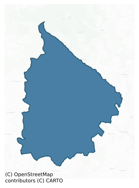
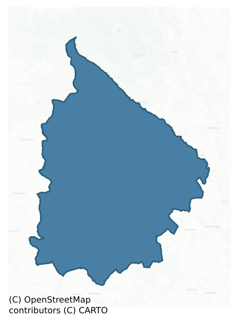
Ballinacor South is a barony of County Wicklow, in the historical province of Leinster (Irish: Baile na Corra Theas), covering 317 km² of land. The barony records 196 NMS archaeological sites and 88 NIAH listed buildings, placing it at around the 4th percentile among 280 ROI baronies for sites per km². This means it is in the bottom tenth of all baronies for sites per km². Dated archaeological evidence runs from the Neolithic through to the Modern, spanning 8 of 9 archaeological periods, placing the barony in the 63rd percentile among 280 ROI baronies for chronological depth. This means it is in the upper half of all baronies for chronological depth. The largest dated subset of recorded sites dates to the Iron Age. Logainm flags 28 placenames in the barony as carrying a recognised heritage root; the largest share — around 54% — are names associated with early Christian church and monastic foundations.
Heritage at a glance
Percentile rankings throughout this profile compare each barony only against the other 279 Republic of Ireland baronies.
The recorded heritage of Ballinacor South
The National Monuments Service Sites and Monuments Record (SMR) is the statutory inventory of archaeological sites for the Republic of Ireland, maintained by the Department of Tourism, Culture, Arts, Gaeltacht, Sport and Media. Sites recorded here include earthworks, ringforts, megalithic tombs, ecclesiastical remains, and post-medieval features; not every record is legally protected, but each is registered as a monument of archaeological interest.
The National Monuments Service records 196 archaeological sites in Ballinacor South, putting it at the 4th percentile among 280 ROI baronies for sites per km². This means it is in the bottom tenth of all baronies for sites per km². A sparse recorded total of this kind in Ireland often reflects survey priority rather than genuine absence of past activity. Protection coverage is near-universal — 191 sites (97%) fall within a recorded monument protection zone, indicating an extensively surveyed landscape. The record is dominated by defensive sites — ringforts, enclosures, hillforts, and stone forts (91 sites, 46% of the total), with ecclesiastical sites forming a substantial secondary presence (42 sites, 21%). The most diagnostically specific type is Ringfort – rath (32 records, 16% of the barony's NMS total) — compared to an ROI average of 20% across all baronies where this type occurs. Ringfort – rath is an earthen ringfort enclosed by a bank and external ditch — the most common Early Medieval farmstead, broadly dated 500–1000 AD. The broader 'Enclosure' classification — which catches unclassified ringforts and field enclosures — accounts for a further 44 records (22%) and reflects the difficulty of sub-classifying degraded earthworks from surface evidence alone. Across the barony's 317 km², this gives a recorded density of 0.62 sites per km².
Most common monument types
Hover or tap a monument type to see its definition.
| Type | Count |
|---|---|
| Enclosure a banked or ditched feature of uncertain type, used as a catch-all where the original function cannot be determined from surface evidence | 44 |
| Ringfort – rath an earthen ringfort enclosed by a bank and external ditch — the most common Early Medieval farmstead, broadly dated 500–1000 AD | 32 |
| Hut site a low stone or earthen foundation enclosing a small circular or oval area, generally interpreted as a former dwelling, of any date from prehistory to the medieval period | 15 |
| Graveyard a burial area associated with a church, in use from the medieval period onwards | 13 |
| Rock art geometric and other motifs carved on earthfast boulders or rock outcrops, mainly Bronze Age but with possible Neolithic origins | 13 |
| Church a building used for public Christian worship, of any date from c. 500 AD onwards | 11 |
| Ritual site – holy well a well or spring traditionally associated with a saint, often credited with healing properties; many trace earlier ritual origins but devotion is documented from the medieval period onwards | 6 |
Chronological distribution
The dated archaeological record for Ballinacor South spans from the Neolithic through to the Modern, with activity attested across 8 of 9 archaeological periods. Every period from earliest to latest is represented in the record — an unbroken sequence of dated activity across the full chronological span. Activity concentrates most heavily in the Iron Age (71 sites, 52% of dated material), with the Early Medieval forming a secondary peak (51 sites, 37%). A further 59 recorded sites (30% of the overall NMS register for the barony) carry no period attribution — appearing as 'Unknown' in the bar chart below. This typically reflects either records that pre-date the standardised period vocabulary or sites awaiting specialist dating review, rather than a genuine absence of chronological evidence.
Sample of recorded monuments
Show 25 sample monuments (of 196 total)
A representative sample of 25 recorded monuments drawn from the barony’s 196 total NMS entries. Sites within a recorded monument protection zone and rarer site types are prioritised so the list shows a meaningful cross-section rather than only the most common type. Each entry shows the official Sites and Monuments Record reference number and the description published by the National Monuments Service.
Castle – tower house
Situated on a marked NE-facing slope overlooking the Avonbeg valley. Local tradition locates the 17th-century stronghold of Phelim McFeagh O'Byrne to this site. Not visible at ground level and no other supporting…
Situated on a marked NE-facing slope overlooking the Avonbeg valley. Local tradition locates the 17th-century stronghold of Phelim McFeagh O'Byrne to this site. Not visible at ground level and no other supporting evidence.
The above description is derived from the published 'Archaeological Inventory of County Wicklow' (Dublin: Stationery Office, 1997). In certain instances the entries have been revised and updated in the light of recent research.
Date of upload/revision: 17 December 2008
Bridge
Price (1945, 21) noted a reference to the bridge at Greenan as 'the bridge at Ballenecor' in 1596. The present bridge here has a plaque which reads 'Greenan Bridge, AD 1844, Samuel Evans Builder'. There is no trace of…
Price (1945, 21) noted a reference to the bridge at Greenan as 'the bridge at Ballenecor' in 1596. The present bridge here has a plaque which reads 'Greenan Bridge, AD 1844, Samuel Evans Builder'. There is no trace of an earlier bridge.
Compiled by: Claire Breen
Date of upload: 05 July 2013
Pit-burial
Situated on a gentle S/SE-facing slope overlooking a marshy stream valley. A pit containing a vase urn (possibly inverted) (NMI 1932-6163), with acremation, clay, and charcoal, discovered c. 1870. Not visible at ground…
Situated on a gentle S/SE-facing slope overlooking a marshy stream valley. A pit containing a vase urn (possibly inverted) (NMI 1932-6163), with acremation, clay, and charcoal, discovered c. 1870. Not visible at ground level. (Price 1934, 47-8; Waddell 1990, 166)
The above description is derived from the published 'Archaeological Inventory of County Wicklow' (Dublin: Stationery Office, 1997). In certain instances the entries have been revised and updated in the light of recent research.
Date of upload/revision: 17 December 2008
Cairn – clearance cairn
Situated on a marked W-facing slope in uncleared stony pasture. Subrectangular hut (WI033-028—-) (max. int. dims. 2.1m E-W; 1.8m N-S) defined by a rough stone wall (Wth 1m; H 0.6m) with more regular internal facing.…
Situated on a marked W-facing slope in uncleared stony pasture. Subrectangular hut (WI033-028—-) (max. int. dims. 2.1m E-W; 1.8m N-S) defined by a rough stone wall (Wth 1m; H 0.6m) with more regular internal facing. Possible hut platform (WI033-028001-) (diam. 1.7m) 3m to SE, a second (WI033-028003-), edged with small boulders (diam. 5m), 5m to E and 5m further E is a natural rock cleft (WI033-028004-) roughly lined with boulders. Three small clearance cairns (TS033-028002-)occur within 10m of the huts. Since this monument was visited in 1990 this area has been planted with forestry. An inspection in 2012 revealed that this monument, as well as the associated monuments (WI033-028—-; WI033-028001-; WI033-028003-; WI033-028004-) are no longer visible above ground and are likely to be at least partially destroyed by the forestry.
The above description is derived from the published 'Archaeological Inventory of County Wicklow' (Dublin: Stationery Office, 1997). In certain instances the entries have been revised and updated in the light of recent research.
Compiled by: Jean Farrelly
Date of upload: 19 November 2012
Fortification
Situated on a gentle S-facing slope. Built by the Viceroy, William Cary, after 1628, and taken by the Confederates in 1641, after which it was allowed to fall into ruin. All that survives is part of a possible wall (L…
Situated on a gentle S-facing slope. Built by the Viceroy, William Cary, after 1628, and taken by the Confederates in 1641, after which it was allowed to fall into ruin. All that survives is part of a possible wall (L 5m; H 3m) to the SW of St Brigid's church in the modern graveyard. The field in which it stood is still called the 'castle field'. Part of Carysfort medieval borough (WI034-010—-). (Lewis 1837, vol. 1, 283).
The above description is derived from the published 'Archaeological Inventory of County Wicklow' (Dublin: Stationery Office, 1997). In certain instances the entries have been revised and updated in the light of recent research.
Date of upload/revision: 17 December 2008
Bullaun stone (present location)
Recent ground works associated with a roadside drain uncovered a previously unlocated bullaun stone at Crone Beg, Co. Wicklow. The boulder was no doubt originally in an earthfast position, but is presently fully exposed…
Recent ground works associated with a roadside drain uncovered a previously unlocated bullaun stone at Crone Beg, Co. Wicklow. The boulder was no doubt originally in an earthfast position, but is presently fully exposed and resting on the ground. There is a report in the National Museum of Ireland [NMI] topographical files from 1930 describing '6 or 8 stones having cuppings' on the land of Joseph Murphy at Crone Beg, Aughrim. A letter to the NMI in 1930 recorded the following details; 'I have recently come across a number of large stones with cuppings at the farm of Mr. J. Murphy, Cronebeg, Aughrim, Co. Wicklow. There are about 6 or 8 stones having cuppings which w[oul]d each hold, say 2 quarts or over, some stones have one, some two and some three cuppings, the stone are very large, except one I brought to my place at Ballymacsimon, Glenealy. Mr Murphy smashed up one large stone to make a road for his implements. He shifted a large stone with three cuppings from the field where it lay with the others down to the side of or near his farm-yard. All the stones were originally in one field directly at other side of road from Mr. Murphy’s house. There are thorns and scrub growing in the field and covering some of the stones. They mostly weigh from one to three tons. I believe they were stones used to grind corn and that the place was primitive but very important for the period mill. I can trace on one stone, it has 3 cuppings, the places where persons sat grinding…
Mound
Situated on a very gentle S-facing slope in an established forestry plantation. Oval earthen mound (dims. 7m N-S; 6m E-W) in poor condition. The edge is eroded but it appears to retain its original shape (H 1.2m on the…
Situated on a very gentle S-facing slope in an established forestry plantation. Oval earthen mound (dims. 7m N-S; 6m E-W) in poor condition. The edge is eroded but it appears to retain its original shape (H 1.2m on the S side and 0.8m on the N side). There is a slight dip in the ground level towards the S, and the mound is flat and level. Marked on the first edition OS 6-inch map.
The above description is derived from the published 'Archaeological Inventory of County Wicklow' (Dublin: Stationery Office, 1997). In certain instances the entries have been revised and updated in the light of recent research.
Date of upload/revision: 17 December 2008
Megalithic tomb – wedge tomb
Situated on a gentle S-facing slope in a small area of scrubby ground with outcropping rock beside a stream (10m W of the tomb). A rectangular chamber (dims. 1.3m x 4.55m) aligned NE-SW, which is largely intact, defined…
Situated on a gentle S-facing slope in a small area of scrubby ground with outcropping rock beside a stream (10m W of the tomb). A rectangular chamber (dims. 1.3m x 4.55m) aligned NE-SW, which is largely intact, defined by five sidestones at the N, two to the S, an inset backstone at the E end, and some earthfast boulders. A possible forecourt at the SW end is defined by a vertical slab with the same alignment as the chamber. There is some outer walling on the W side including a small cist-like structure. A raised area (Wth 7.7m; L 7.8m) surrounding the chamber marks the location of the cairn. A single capstone towards the SW entrance survives in situ. Structural stones are of granite and greywacke, and there is a suitable greywacke outcrop 20m to the NE. The tomb is not marked on the 1838 OS 6-inch map. It was investigated by Kinahan in or shortly before 1879, who found a few fragments of charcoal scattered about the gallery and a 'small heap of charcoal' at the E end (Kinahan 1880, 253-7).
The above description is derived from the published 'Archaeological Inventory of County Wicklow' (Dublin: Stationery Office, 1997). In certain instances the entries have been revised and updated in the light of recent research.
Date of upload/revision: 17 December 2008
This monument is subject to a preservation order made under the National Monuments Acts 1930 to 2014 (PO no. 142/1940).
Ringfort – unclassified
Situated on a gentle W-facing slope. Oval enclosure (dims. c. 40m x 30m) shown and named on the 1838 OS 6-inch map as 'Raheen'. Not visible at ground level.
The above description is derived from the published…
Situated on a gentle W-facing slope. Oval enclosure (dims. c. 40m x 30m) shown and named on the 1838 OS 6-inch map as 'Raheen'. Not visible at ground level.
The above description is derived from the published 'Archaeological Inventory of County Wicklow' (Dublin: Stationery Office, 1997). In certain instances the entries have been revised and updated in the light of recent research.
Date of upload/revision: 17 December 2008
Road – unclassified togher
According to Price (1946, 76) ‘The Togher is now the local name for the house at the cross-roads near the railway bridge between Killaveny and Lugduff townlands. The name evidently originally referred to the road going…
According to Price (1946, 76) ‘The Togher is now the local name for the house at the cross-roads near the railway bridge between Killaveny and Lugduff townlands. The name evidently originally referred to the road going from east to west across the bog here, which is called ‘Derry Bogg’ on A. R. Nevill’s map’. On the 1st ed. 6-inch OS map there is a house indicated at the cross-roads and c. 130m on the road westward from this house there is a section of the road, c. 130m long, which is indicated by a dashed line. This possibly indicates that this section of road had a different construction and may be where the togher was located. By the 2nd 1907 revision (1909 ed.) a railway line had been constructed, running N-S through this area of boggy marshland, possibly removing any existing togher.
Compiled by: Jean Farrelly
Date of upload: 17 October 2012
Castle – motte
Situated on the NE edge of a natural ridge. Oval site (max. ext. dims. 62m NNE-SSW; 50m NNW-SSE) consisting of a flat-topped mound (dims, on summit 41.5m NNE-SSW; 32m NNW-SSE) formed by the modification of the ridge.…
Situated on the NE edge of a natural ridge. Oval site (max. ext. dims. 62m NNE-SSW; 50m NNW-SSE) consisting of a flat-topped mound (dims, on summit 41.5m NNE-SSW; 32m NNW-SSE) formed by the modification of the ridge. Surrounded by a steep-sided fosse and an external bank (Wth 3.5-4.5m; H 1.5m). Access is via a ramp ascending to the summit by two bends from base of fosse at the SE side. A church stands 150m to the SW (WI039-015—-). (CUCAP, BDQ72)
The above description is derived from the published 'Archaeological Inventory of County Wicklow' (Dublin: Stationery Office, 1997). In certain instances the entries have been revised and updated in the light of recent research.
Date of upload/revision: 17 December 2008
Cross-slab
Situated on a very gentle ENE-facing slope in grassland. In the SW sector of an oval enclosure (WI039-022001-) with a graveyard (WI039-022002-) which has several small, uninscribed grave-markers set in rows and a…
Situated on a very gentle ENE-facing slope in grassland. In the SW sector of an oval enclosure (WI039-022001-) with a graveyard (WI039-022002-) which has several small, uninscribed grave-markers set in rows and a granite cross-slab with pointed head and arms (H 0.94m). The head is broken and lies beside the rest of the cross. One side had a crucifixion figure in low relief which is no longer visible (Price 1945, 257).
Compiled by: Jean Farrelly
Date of upload: 24 September 2012
House – 16th/17th century
Situated on a very gentle S-facing slope. No visible trace of the house built by Lord Stafford before 1637, the foundations of which survived into the 1940s (Price 1946, 91). The site is now occupied by farm buildings,…
Situated on a very gentle S-facing slope. No visible trace of the house built by Lord Stafford before 1637, the foundations of which survived into the 1940s (Price 1946, 91). The site is now occupied by farm buildings, and is known locally as 'Black Tom's Cellars'.
The above description is derived from the published 'Archaeological Inventory of County Wicklow' (Dublin: Stationery Office, 1997). In certain instances the entries have been revised and updated in the light of recent research.
Date of upload/revision: 17 December 2008
This monument is subject to a preservation order made under the National Monuments Acts 1930 to 2014 (PO no. 116/1940).
Rock shelter
Situated on a marked W-facing slope in uncleared stony pasture. Subrectangular hut (WI033-028—-) (max. int. dims. 2.1m E-W; 1.8m N-S) defined by a rough stone wall (Wth 1m; H 0.6m) with more regular internal facing.…
Situated on a marked W-facing slope in uncleared stony pasture. Subrectangular hut (WI033-028—-) (max. int. dims. 2.1m E-W; 1.8m N-S) defined by a rough stone wall (Wth 1m; H 0.6m) with more regular internal facing. Possible hut platform (WI033-028001-) (diam. 1.7m) 3m to SE, a second (WI033-028003-), edged with small boulders (diam. 5m), 5m to E and 5m further E is a natural rock cleft (WI033-028004-) roughly lined with boulders. Three small clearance cairns (TS033-028002-)occur within 10m of the huts. Since this monument was visited in 1990 this area has been planted with forestry. An inspection in 2012 revealed that this monument, as well as the associated monuments (WI033-028—-; WI033-028001-; WI033-028002-; WI033-028003-) are no longer visible above ground and are likely to be at least partially destroyed by the forestry.
The above description is derived from the published 'Archaeological Inventory of County Wicklow' (Dublin: Stationery Office, 1997). In certain instances the entries have been revised and updated in the light of recent research.
Compiled by: Jean Farrelly
Date of upload: 19 November 2012
Architectural fragment
Situated on the NE edge of a ridge on level ground with a short steep drop to the N and E. According to Price (1946, 90-91) this is an early ecclesiastical church (WI043-009001-) and enclosure (WI043-009003-). An…
Situated on the NE edge of a ridge on level ground with a short steep drop to the N and E. According to Price (1946, 90-91) this is an early ecclesiastical church (WI043-009001-) and enclosure (WI043-009003-). An architectural fragment, described as a lozenge-shaped trough (dims. c. 0.4m x 0.2m; D 0.2m), may be a stoup (D of depression c. 0.08m). A ruined early nineteenth-century structure with no surviving evidence of an earlier church. A cylindrical block of granite mentioned by Price (1946, 90) lies just outside the SW corner of the church, along with four granite fleur-de-lys which appear to have surmounted the four corner spires of the church. The graveyard contains a large number of mid-eighteenth-century headstones. The church and graveyard lie just S of the centre of a large oval enclosure (WI043-009003-).
The above description is derived from the published 'Archaeological Inventory of County Wicklow' (Dublin: Stationery Office, 1997). In certain instances the entries have been revised and updated in the light of recent research.
Compiled by: Jean Farrelly
Date of upload: 10 October 2012
Children's burial ground
Situated on a marked N-facing slope. A rectangular graveyard (dims. 35m E-W; 50m N-S) defined by an earth and stone bank (Wth 2-2.5m; H 1.3m), and named 'Kyle Grave Yard' on the 1838 OS 6-inch map. Price (1946, 93)…
Situated on a marked N-facing slope. A rectangular graveyard (dims. 35m E-W; 50m N-S) defined by an earth and stone bank (Wth 2-2.5m; H 1.3m), and named 'Kyle Grave Yard' on the 1838 OS 6-inch map. Price (1946, 93) states there was no trace of any church here, and suggests it may have been used for burying unbaptised children.
The above description is derived from the published 'Archaeological Inventory of County Wicklow' (Dublin: Stationery Office, 1997). In certain instances the entries have been revised and updated in the light of recent research.
Compiled by: Jean Farrelly
Date of upload: 17 September 2012
Barracks
A now unroofed three story structure (L c. 38m; Wth c. 7m) enclosed by an roughly square outer bawn wall with bastions at the NW and SE corners. Constructed c. 1800, in a strategic location overlooking the valley. It…
A now unroofed three story structure (L c. 38m; Wth c. 7m) enclosed by an roughly square outer bawn wall with bastions at the NW and SE corners. Constructed c. 1800, in a strategic location overlooking the valley. It was one of a group of barracks built on the Military Road after the 1798 rising. It is reputed that Michael Dwyer laid siege to the barracks from the surrounding high ground on at least one occasion.
Compiled by: Claire Breen
Date of upload: 19 July 2013
Font (present location)
The font presently held in the disused RC church at Knockananna came from Ballymaghroe Graveyard (WI033-009001-) having been moved from there sometime before 1933 (Corlett & Weaver 2002, vol. 1, 188). It consists of a…
The font presently held in the disused RC church at Knockananna came from Ballymaghroe Graveyard (WI033-009001-) having been moved from there sometime before 1933 (Corlett & Weaver 2002, vol. 1, 188). It consists of a large, cylindrical block of granite (diam. 0.68m; H 0.56m), the upper edge of which is damaged, containing a roughly circular basin (diam. 0.48m; D 0.21m) with a drain hole (diam. 0.035m) which exits the side of the font from where a linear groove (Wth 0.035m; D 0.05m) extends down the side of the stone (L 0.14m). On the outer edge of the font are two opposing crosses, both carved in low relief. One (dims. H 0.46m; Wth 0.19m) is formed by a low (H 0.02m; Wth 0.05-0.08m) raised band. The top of the second cross is missing (H 0.3m; Wth 0.18m), where the top of the font has been damaged. It is similarly defined by a low raised band (H 0.015m; Wth 0.06-0.08m).
Compiled by: Gearóid Conroy
Date of upload: 17 September 2012
Ring-ditch
Situated on a gentle N/NE-facing slope overlooking the steep side of a river valley. A small circular enclosure defined by a fosse, visible as a cropmark on aerial photograph (CUCAP, BDO 74). Not visible at ground…
Situated on a gentle N/NE-facing slope overlooking the steep side of a river valley. A small circular enclosure defined by a fosse, visible as a cropmark on aerial photograph (CUCAP, BDO 74). Not visible at ground level.
The above description is derived from the published 'Archaeological Inventory of County Wicklow' (Dublin: Stationery Office, 1997). In certain instances the entries have been revised and updated in the light of recent research.
Compiled by: Jean Farrelly
Date of upload: 24 September 2012
Standing stone
Situated on the western slopes of Lybagh mountain. Mentioned in the OS Name Books as a standing stone near a stream.
The above description is derived from the published 'Archaeological Inventory of County Wicklow'…
Situated on the western slopes of Lybagh mountain. Mentioned in the OS Name Books as a standing stone near a stream.
The above description is derived from the published 'Archaeological Inventory of County Wicklow' (Dublin: Stationery Office, 1997). In certain instances the entries have been revised and updated in the light of recent research.
Date of upload/revision: 17 December 2008
Booley hut
Situated on a fairly steep SSW-facing slope in rocky terrain. Hut complex with three chambers constructed of drystone walling (Wth 1m; max. H 1.5m) with entrance gaps at the W. Chamber A (int. dims. 4.4m E-W; 3.6m N-S)…
Situated on a fairly steep SSW-facing slope in rocky terrain. Hut complex with three chambers constructed of drystone walling (Wth 1m; max. H 1.5m) with entrance gaps at the W. Chamber A (int. dims. 4.4m E-W; 3.6m N-S) is to the N of Hut B (int. diam. 2.6m). Part of a third chamber (Wth 2.4m N-S) occurs to the north of A. The site was excavated in 1979 (NMI files) and produced sherds of nineteenth- and twentieth-century pottery and some fragments of iron. Since this monument was visited in 1990 this area has been planted with forestry. An inspection in 2012 revealed that this monument, constructed of rubble walling, has been partially destroyed by the forestry. The E-side of the larger chamber appears to be intact (L 3.8m) and a portion of the SW quadrant, as well as some associated walling 2m to the SSE.
The above description is derived from the published 'Archaeological Inventory of County Wicklow' (Dublin: Stationery Office, 1997). In certain instances the entries have been revised and updated in the light of recent research.
Compiled by: Jean Farrelly
Date of upload/revision: 19 November 2012
Booley hut
Situated on a SE-facing slope in rocky terrain. Circular arc of two courses of stones (diam. c. 8m) representing about one quarter of a possible hut site. The site was excavated in 1979 (NMI files) and produced sherds…
Situated on a SE-facing slope in rocky terrain. Circular arc of two courses of stones (diam. c. 8m) representing about one quarter of a possible hut site. The site was excavated in 1979 (NMI files) and produced sherds of 19th- and twentieth-century pottery and a fragment of iron. Since this monument was visited in 1990 this area has been planted with forestry.
The above description is derived from the published 'Archaeological Inventory of County Wicklow' (Dublin: Stationery Office, 1997). In certain instances the entries have been revised and updated in the light of recent research.
Date of upload/revision: 17 December 2008
Ringfort – cashel
Situated on a marked SE-facing slope. Circular area (diam. 36.7m), defined by a stone-faced earth and stone bank (max. ext. H 1.2m (at the SE); max. int. H 0.8m (at the N); max. Wth 1.8m). The entrance is a stone-faced…
Situated on a marked SE-facing slope. Circular area (diam. 36.7m), defined by a stone-faced earth and stone bank (max. ext. H 1.2m (at the SE); max. int. H 0.8m (at the N); max. Wth 1.8m). The entrance is a stone-faced gap (Wth 2m) at the NW. Described by Reynolds (1973, 40) as having two banks. The site has a level interior.
The above description is derived from the published 'Archaeological Inventory of County Wicklow' (Dublin: Stationery Office, 1997). In certain instances the entries have been revised and updated in the light of recent research.
Date of upload/revision: 17 December 2008
Ringfort – cashel
Situated on an E-facing slope. An approximately circular area (dims. 29.5m N-S; 31.4m E-W), defined by a stone-faced bank or wall (ext. H at E 1.4m; int H 0.4m; ext. H at W 0.25m; int H 0.9m). The gap at the SE (Wth…
Situated on an E-facing slope. An approximately circular area (dims. 29.5m N-S; 31.4m E-W), defined by a stone-faced bank or wall (ext. H at E 1.4m; int H 0.4m; ext. H at W 0.25m; int H 0.9m). The gap at the SE (Wth 1.2m) is probably not the original entrance. Described by Reynolds (1973, 40) as a small rath.
The above description is derived from the published 'Archaeological Inventory of County Wicklow' (Dublin: Stationery Office, 1997). In certain instances the entries have been revised and updated in the light of recent research.
Date of upload/revision: 17 December 2008
Enclosure
On the lower N facing slopes of Fananierin Mountain and the Drumgoff Brook valley, in rough grazing. Within the angle of a field fence not indicated on the OS 6-inch map. A small circular enclosure (diam. 8m), defined…
On the lower N facing slopes of Fananierin Mountain and the Drumgoff Brook valley, in rough grazing. Within the angle of a field fence not indicated on the OS 6-inch map. A small circular enclosure (diam. 8m), defined by an enclosing stone spread (Wth 1.4m-1.6m; H 0.2m) representing a collapsed and robbed-out stone wall. Stone is also scattered across the interior. One of a number of 'small rings of stones' noted by Price in 1937 (Corlett and Weaver 2002 Vol. 1, 286). (See also WI029-019—-, WI029-020001-, WI029-020002- and WI029-022—-).
Compiled by: Claire Breen
Date of upload: 05 July 2013
Listed buildings
The National Inventory of Architectural Heritage (NIAH) is a state survey appraising buildings of architectural, historical, archaeological, artistic, cultural, scientific, social, or technical interest. Each surveyed structure receives a rating from International (the highest, for buildings of European importance) through National, Regional, Local, and Record-Only.
The NIAH records 88 listed buildings in Ballinacor South (44th percentile across ROI baronies). All recorded buildings carry Regional or lower grading; the barony does not contain any structures appraised as being of National or International architectural importance. Construction dates concentrate most heavily in the Victorian (1830-1900) period. The most-recorded building type is house (40 examples, 45% of the listed stock).
Terrain and environment
Mean elevation across the barony is 266m — the 99th percentile among 280 ROI baronies for elevation. This means it is in the top tenth of all baronies for elevation. This is a relatively elevated landscape by ROI standards. Elevation matters for heritage because higher-altitude baronies typically favour defensive monuments — ringforts and hilltop forts placed on prominent ground — while lowland baronies are more likely to carry the dense settlement and church networks of intensive agricultural landscapes. The barony reaches 923m at its highest point — a vertical span of more than 657m within its boundary, indicating significant topographic diversity. Mean slope is 9.1° — the 96th percentile among 280 ROI baronies for slope. This means it is in the top tenth of all baronies for slope. This is consistently steep terrain by ROI standards, the kind of landscape that tends to preserve upstanding archaeological features well. Slope is a key control on both land use and archaeological preservation: steep ground resists ploughing and tends to preserve earthworks intact, while gentle slopes favour intensive cultivation that damages or destroys surface archaeology over time. The Topographic Wetness Index averages 8.8, the 3rd percentile among 280 ROI baronies for wetness. This means it is in the bottom tenth of all baronies for wetness. This is well-drained ground by ROI standards — typical of upland or steeply-sloping country that sheds water rapidly. Drainage matters for heritage because poorly-drained ground preserves organic archaeology (wooden trackways, leather, textiles, and on rare occasions human remains) far better than free-draining soil; well-drained ground favours arable use but destroys organic material rapidly. The land cover is dominated by improved grassland (64%) and woodland (33%). In overall character, this is an upland landscape of steep, elevated terrain, with land use dominated by improved grassland.
Terrain measurements
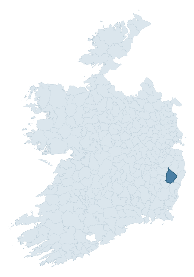
Where this barony sits in the Republic of Ireland
Geology and preservation
Bedrock geology shapes the landscape long before any settlement begins — controlling soil drainage, agricultural potential, the survival of upstanding monuments, and the preservation of buried archaeology. The figures below come from the Geological Survey Ireland 1:100,000 bedrock map.
The bedrock underlying Ballinacor South is predominantly schist (40% of the barony by area), laid down during the Ordovician period (59% by area, around 485 to 444 million years ago). Schist forms upland, often steep terrain with thin soils that limited agriculture but favoured the construction of stone-built monuments and field walls. Schist landscapes commonly carry megalithic monuments and prehistoric ritual sites. A substantial secondary geology of slate (17%) and granite (17%) adds further variety to the underlying landscape. The single largest mapped unit is the Ballybeg Member (Maulin Formation) (40% of the barony's bedrock). With 7 distinct rock types mapped, the barony sits in the top third of ROI baronies for geological diversity (70th percentile) — typically a sign of complex tectonic history or coastal mosaics of differing rock units.
Rock type composition
Largest mapped unit: Ballybeg Member (Maulin Formation) (40% of the barony)
Placename evidence
Logainm records 28 heritage-diagnostic placenames for Ballinacor South, drawn from townland and civil-parish names across the barony. The dominant stratum is Early Christian ecclesiastical — cill-, teampall-, and domhnach-prefixed names that record the dense network of early church foundations established between the fifth and tenth centuries. The leading diagnostic roots are cill- (13 — church), ráth- (10 — earthen ringfort), and sián- (3 — fairy mound). This is broadly in line with the ROI average of 30.7 heritage placenames per barony. The presence of multiple heritage strata side by side indicates layered occupation of the landscape across successive prehistoric and historic periods. Logainm records 165 placenames for Ballinacor South (predominantly townland names). Of these, 28 (17%) carry one of the diagnostic Gaelic roots tracked above; the remainder draw on more generic landscape vocabulary that does not encode a heritage period.
Pre-Christian / Early Medieval Defensive
| Root | Count | Meaning |
|---|---|---|
| ráth- | 10 | earthen ringfort |
Early Christian Ecclesiastical
| Root | Count | Meaning |
|---|---|---|
| cill- | 13 | church (early) |
| tobar- | 2 | holy well |
Burial, Ritual, and Norse-Contact
| Root | Count | Meaning |
|---|---|---|
| sián- | 3 | fairy mound |
Other baronies in Wicklow
- Arklow
- Newcastle
- Talbotstown Lower
- Shillelagh
- Ballinacor North
- Rathdown
- Talbotstown Upper
- Coolestown — Offaly
- Duleek Lower — Louth
- Newcastle — Dublin
See all 280 baronies in the Republic of Ireland Heritage Tool.

Explore further
Grounding History: 10 Maps of Northern Ireland’s Past
If you’re interested in Irish heritage more widely, the companion report for Northern Ireland brings together the analysis of all 462 NI wards into one place through 10 high-quality maps — covering monument density, archaeological periods, placename heritage, terrain, wetland, and the historic landscape at first survey. Take a look.
About this profile
Click any section below to expand.
What is a barony?
A barony is a historic administrative unit in Ireland, broadly equivalent to an English hundred. The 280 baronies used here are from the OSi 2019 National Statutory Boundaries (generalised 20m), covering the 26 counties of the Republic of Ireland. Baronies derive from the Norman period, were formalised in the 17th century, and have not been redrawn for statistical purposes. They vary enormously in area, from compact urban baronies in Dublin to vast upland baronies in Connacht, and should not be compared by raw site count without accounting for area differences.
What counts as a site?
This profile combines three distinct heritage registers, each with its own definition of what constitutes a recordable site:
- Archaeological sites (NMS). The National Monuments Service Sites and Monuments Record (SMR) catalogues every known archaeological monument or site of archaeological interest in the Republic, from prehistoric burial mounds and ringforts to medieval churches and post-medieval defensive works. Inclusion does not require legal protection — only that the site has been identified, surveyed, and assessed as having archaeological value. A separate subset of these sites lies within a recorded protection zone, which gives them statutory protection under the National Monuments Acts.
- Listed buildings (NIAH). The National Inventory of Architectural Heritage records buildings of architectural, historical, archaeological, artistic, cultural, scientific, social, or technical interest. Each surveyed structure is appraised on a five-tier scale: International, National, Regional, Local, and Record-Only. The NIAH appraisal is informational rather than strictly statutory, but it underpins local-authority Record of Protected Structures (RPS) listings.
- Heritage placenames (Logainm). Logainm is the authoritative database of Irish placenames maintained by the Placenames Branch. This profile applies a heritage-diagnostic classifier to the Irish-language form of each townland name, flagging roots that signal defensive sites (ráth-, lios-, dún-, caiseal-, cathair-), ecclesiastical foundations (cill-, teampall-, domhnach-, mainistir-), prehistoric burial-ritual features (tuaim-, carn-, leaba-), or Norse-contact settlement (gall-). Townlands without one of these diagnostic roots are not flagged here — they may still carry historical significance, but that significance is not encoded in the name itself.
Editorial principles
The narrative sections of this profile follow several explicit principles:
- Evidential. Every claim about this barony’s heritage character is anchored in the underlying register data. Where a site count, a placename count, or a percentile rank is cited, it is computed from the source datasets at export time, not estimated.
- Comparative. Counts and metrics are reported alongside their percentile rank against the other 279 ROI baronies. A barony with 50 ringforts in absolute terms could be unusually high or unusually low depending on its size and regional context; percentile ranking removes that ambiguity.
- Transparent on limits. Where a register has known coverage gaps, survey biases, or data-quality issues that affect this barony’s figures, the profile flags them rather than presenting the numbers as definitive.
- No interpretation beyond what the data supports. The narrative does not speculate about historical events, social dynamics, or cultural meaning beyond what the recorded heritage and placename evidence directly attests.
Data caveats and limits
- NMS Sites and Monuments Record is the product of survey campaigns conducted at different intensities across different counties and decades. Some baronies have been surveyed more thoroughly than others, and absolute counts should be read in that light. Sites destroyed by development before survey are typically not represented; sites in heavily forested or upland terrain are sometimes under-recorded.
- NIAH coverage is broadly complete for the Republic of Ireland but the survey was conducted on a rolling county-by-county basis, and the most recent appraisal date varies. Buildings demolished or substantially altered after their original survey may still appear in the register; conversely, recent buildings of merit may not yet have been appraised.
- Logainm classification applies a deliberately conservative pattern-matching approach to the Irish-language townland forms. The classifier prioritises true positives over recall: a townland may carry a heritage signal that the classifier doesn’t recognise, particularly where the diagnostic root has been heavily anglicised or where the townland name draws on a less common term. The 60,000+ townland records and ~9,800 classified placenames give a substantial signal at barony scale, but individual townland names should be checked against Logainm directly for definitive interpretation.
- Period attribution. The chronological distribution reflects only those NMS sites that carry a recognised period attribution in the source data. Sites listed as “Unknown” period are excluded from the dated subset.
- Boundary changes. Some baronies have undergone minor boundary adjustments since their 19th-century definition; the OSi 2019 generalised boundaries used here are the current statutory definition and may differ slightly from historical maps in border areas.
- Bedrock geology is mapped at 1:100,000 scale, which means local variation within a barony — small pockets of different rock type, mineral veins, alluvium overlying bedrock — is generalised. The dominant-system and rocktype figures are area-weighted, so a barony reading “70% Carboniferous limestone” may still contain small but archaeologically important pockets of older or younger rock. Around 3% of GSI polygons do not match the lexicon and contribute no rocktype or system attribution.
Data sources
- National Monuments Service — Sites and Monuments Record (SMR) https://data.gov.ie/dataset/national-monuments-service-archaeological-survey-of-ireland
- National Inventory of Architectural Heritage (NIAH) https://data.gov.ie/dataset/national-inventory-of-architectural-heritage-niah-national-dataset
- Logainm — Placenames Database of Ireland https://www.logainm.ie/
- Ordnance Survey Ireland — National Statutory Barony Boundaries 2019 https://data-osi.opendata.arcgis.com/
- EURODEM — European Digital Elevation Model https://www.mapsforeurope.org/datasets/euro-dem
- ESA WorldCover https://esa-worldcover.org/en
- Geological Survey Ireland — 1:100,000 Bedrock Geology https://www.gsi.ie/en-ie/data-and-maps/Pages/Bedrock.aspx
Explore more: Search any of the 280 ROI baronies, browse by historical province, or read the methodology and data sources for the full Republic of Ireland Heritage Tool.