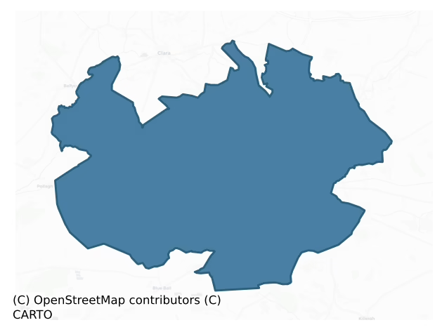
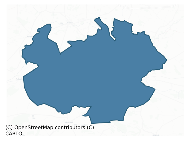
Ballycowan is a barony of County Offaly, in the historical province of Leinster (Irish: Baile Mhic Comhainn), covering 157 km² of land. The barony records 235 NMS archaeological sites and 177 NIAH listed buildings, placing it at around the 33rd percentile among 280 ROI baronies for sites per km². This means it is in the lower half of all baronies for sites per km². Dated archaeological evidence runs from the Early Bronze Age through to the Modern, spanning 7 of 9 archaeological periods, placing the barony in the 46th percentile among 280 ROI baronies for chronological depth. This means it is in the lower half of all baronies for chronological depth. The largest dated subset of recorded sites dates to the Early Medieval. Logainm flags 24 placenames in the barony as carrying a recognised heritage root; the largest share — around 50% — are names associated with early Christian church and monastic foundations.
Heritage at a glance
Percentile rankings throughout this profile compare each barony only against the other 279 Republic of Ireland baronies.
The recorded heritage of Ballycowan
The National Monuments Service Sites and Monuments Record (SMR) is the statutory inventory of archaeological sites for the Republic of Ireland, maintained by the Department of Tourism, Culture, Arts, Gaeltacht, Sport and Media. Sites recorded here include earthworks, ringforts, megalithic tombs, ecclesiastical remains, and post-medieval features; not every record is legally protected, but each is registered as a monument of archaeological interest.
The National Monuments Service records 235 archaeological sites in Ballycowan, putting it at the 33rd percentile among 280 ROI baronies for sites per km². This means it is in the lower half of all baronies for sites per km². Of these, 208 (88%) fall within a recorded monument protection zone. The record is dominated by defensive sites — ringforts, enclosures, hillforts, and stone forts (79 sites, 34% of the total), with ecclesiastical sites forming a substantial secondary presence (53 sites, 23%). The most diagnostically specific type is Ringfort – rath (14 records, 6% of the barony's NMS total) — compared to an ROI average of 20% across all baronies where this type occurs. Ringfort – rath is an earthen ringfort enclosed by a bank and external ditch — the most common Early Medieval farmstead, broadly dated 500–1000 AD. The broader 'Enclosure' classification — which catches unclassified ringforts and field enclosures — accounts for a further 33 records (14%) and reflects the difficulty of sub-classifying degraded earthworks from surface evidence alone. Across the barony's 157 km², this gives a recorded density of 1.50 sites per km².
Most common monument types
Hover or tap a monument type to see its definition.
| Type | Count |
|---|---|
| Enclosure a banked or ditched feature of uncertain type, used as a catch-all where the original function cannot be determined from surface evidence | 33 |
| Ringfort – rath an earthen ringfort enclosed by a bank and external ditch — the most common Early Medieval farmstead, broadly dated 500–1000 AD | 14 |
| Cross-slab a stone slab inscribed with a cross, used as a grave-marker or memorial, dated pre-1200 AD | 11 |
| Road – class 3 togher a short wooden peatland trackway up to 15m long, deliberately laid to cross a small area of bog; Neolithic to medieval | 11 |
| Ritual site – holy well a well or spring traditionally associated with a saint, often credited with healing properties; many trace earlier ritual origins but devotion is documented from the medieval period onwards | 9 |
| Church a building used for public Christian worship, of any date from c. 500 AD onwards | 8 |
| Graveslab a recumbent grave-marking slab, dated 1200–1700 AD | 8 |
| Castle – unclassified a castle whose form cannot be precisely classified, dating somewhere between the late 12th and 16th centuries | 7 |
Chronological distribution
The dated archaeological record for Ballycowan spans from the Early Bronze Age through to the Modern, with activity attested across 7 of 9 archaeological periods. Every period from earliest to latest is represented in the record — an unbroken sequence of dated activity across the full chronological span. Activity concentrates most heavily in the Early Medieval (58 sites, 34% of dated material), with the Iron Age forming a secondary peak (54 sites, 31%). A further 63 recorded sites (27% of the overall NMS register for the barony) carry no period attribution — appearing as 'Unknown' in the bar chart below. This typically reflects either records that pre-date the standardised period vocabulary or sites awaiting specialist dating review, rather than a genuine absence of chronological evidence.
Sample of recorded monuments
Show 25 sample monuments (of 235 total)
A representative sample of 25 recorded monuments drawn from the barony’s 235 total NMS entries. Sites within a recorded monument protection zone and rarer site types are prioritised so the list shows a meaningful cross-section rather than only the most common type. Each entry shows the official Sites and Monuments Record reference number and the description published by the National Monuments Service.
Cairn – unclassified
Situated on low rise in area of undulating countryside with nearby church (OF008-045001-) and high cross (OF008-045005-) to S. Circular shaped platform measuring 8.5m E/W by 8m N/S and 0.3m high above surrounding land.…
Situated on low rise in area of undulating countryside with nearby church (OF008-045001-) and high cross (OF008-045005-) to S. Circular shaped platform measuring 8.5m E/W by 8m N/S and 0.3m high above surrounding land. There is evidence for stone kerbing on the southern side of the platform where the sheep have eroded away the top soil. The interior of the site is very even with a few loose stones scattered about. The edge of the platform is lined with hawthorn trees. The site would appear to be some form of burial site which may have had a low central mound which has now been eroded down to a flat platform.
The above description is derived from the published 'Archaeological Inventory of County Offaly' (Dublin: Stationery Office, 1997). In certain instances the entries have been revised and updated in the light of recent research.
Date of upload: 23 May 2011
Mill – corn
18th-19th century mill located near church (OF008-045001-) and high cross (OF008-045005-). Depicted as Coleraine Flour Mill on the first edition of the OS 6-inch map.
The above description is derived from the…
18th-19th century mill located near church (OF008-045001-) and high cross (OF008-045005-). Depicted as Coleraine Flour Mill on the first edition of the OS 6-inch map.
The above description is derived from the published 'Archaeological Inventory of County Offaly' (Dublin: Stationery Office, 1997). In certain instances the entries have been revised and updated in the light of recent research.
Date of upload: 23 May 2011
Castle – motte
National Monument No. 313. The motte castle was built in 1186 by Hugh de Lacy, lord of meath who was killed at Durrow after the construction of this earth and timber castle. This event was described in the Annals of…
National Monument No. 313. The motte castle was built in 1186 by Hugh de Lacy, lord of meath who was killed at Durrow after the construction of this earth and timber castle. This event was described in the Annals of the Four Masters, which recorded that ‘after having finished the castle of Durrow, [Hugh de Lacy] set out, accompanied by three Englishmen, to view it. One of the men of Teffia, a youth named Gilla-gan-inathar O'Meyey [gutless lad], approached him, and drawing out an axe, which he had kept concealed, he, with one blow of it, severed his head from his body; and both head and trunk fell into the ditch of the castle. This was in revenge of Columbkille’ (O’Donovan 1856, 71-2). Situated on a slight rise of ground on the landscaped demesne of Durrow Abbey House which was probably built on site of a medieval stone castle (OF009-005002-). Durrow church (OF09-005013-), graveyard (OF009-005009-) and high cross (OF009-005010-) are 180m to the ESE. The 19th century country house marked on the OS 6-inch maps as ‘Durrow Abbey’ is located 60m to the NE. The motte is located within the landscaped grounds of Durrow Abbey House with pathways encircling the base of the motte and a walled garden area immediately to the W as shown on the 1908 ed. OS 25-inch map. Aerial photographs taken in 1973 (GSI N 535/6) indicated that the motte castle may have been constructed inside the ecclesiastical or monastic enclosure (OF009-005003-) of Durrow monastery. A sketch of the demesne…
Cross
A sixth century monastery was founded at Durrow reputedly by Colum Cille [of the church] who died in 597 and whose feastday is celebrated on the 9th of June (Ó Riain 2011, 213-14). Marked on the OS 6-inch map as the…
A sixth century monastery was founded at Durrow reputedly by Colum Cille [of the church] who died in 597 and whose feastday is celebrated on the 9th of June (Ó Riain 2011, 213-14). Marked on the OS 6-inch map as the 'Socket Stone' which appears to be the base of a small cross. It is situated to the SSE of the medieval church (OF009-005013-) outside the graveyard (OF009-005009-) wall. This pyramidal shaped stone (H 0.6m; 0.25m x 0.2m x 0.15m) acted as the base of a small cross which was located on top of the W gable of the church (OF009-005013-) and is now located in the National Museum of Ireland. The base of the cross was known locally as 'the headache stone' (De Courcy Williams 1897, 135). See attached image of cross taken from De Courcy Williams 1897.
Limited archaeological investigations were undertaken by Tracy Collins of Aegis Archaeology Ltd. under licence No. E3161 at Durrow as part of the ongoing conservation works at the National Monument on behalf of the OPW (Collins 2009, 449). Two trenches, measuring some 200m in length, 0.5m in depth and 0.5m in width, were excavated by mini-digger at either side of the avenue to Durrow House. Approximately half of the avenue’s length is within the zone of archaeological potential for the complex. These trenches are proposed for future service conduits for the church structure which now houses the high cross (OF009-005010-). The trenches were sealed with varying modern stony surfaces for the avenue, which was underlai…
Religious house – Augustinian canons
National Monument No. 313. No abbey building is depicted on the 1838 ed. OS 6-inch map. The revised 1908 ed. OS 25-inch map depicts ‘St. Columbkille’s Abbey (Site of)’ as being located in the NW quadrant of Durrow…
National Monument No. 313. No abbey building is depicted on the 1838 ed. OS 6-inch map. The revised 1908 ed. OS 25-inch map depicts ‘St. Columbkille’s Abbey (Site of)’ as being located in the NW quadrant of Durrow graveyard (OF009-005009-). The present late 18th century C of I church (OF009-005013-) standing in the SE quadrant of the graveyard may have been built on the site of the Augustinian Abbey church which was founded in the 12th century on the site of the sixth century monastery reputedly founded by St Colum Cille. The Augustinian abbey dedicated to St Mary was founded in the 1140s by Murchadh Ua Maoil Sheachlainn, high king of Midhe, who died at Durrow in 1153 (Ó Riain 2011, 67; Gwynn and Hadcock 1970, 174). In 1541 the Abbey was converted into a parish church and was restored in the 18th century and again in 1802. No surface traces remain of the ecclesiastical enclosure (OF009-005003-) (Orpen 1907, 140) or of the Augustinian abbey (Hadcock 1964, 128). (Crawford 1913, 262-65; Lionard 1961, 95-169; Moran 1966, 289; Harbison 1970, 205-6; Barrow 1979, 176).
In 2006 limited excavations were undertaken by Tracy Collins of Aegis Archaeology Ltd at Durrow under licence No. CO02, E3161, as part of the ongoing conservation works at the National Monument, on behalf of the OPW. Three areas were investigated. Two were dug around the church in order to facilitate the rendering of the structure and ducting. The third area was around where the high cross (OF009-005010-) h…
Hut site
On an esker ridge in undulating countryside. Hollow depression (5.5m E-W x 6m N-S) enclosed by a bank (Wth 1.5m; int. H 0.3m) of earth and stone construction. Overall the site measures 10m N-S. The hollow depression has…
On an esker ridge in undulating countryside. Hollow depression (5.5m E-W x 6m N-S) enclosed by a bank (Wth 1.5m; int. H 0.3m) of earth and stone construction. Overall the site measures 10m N-S. The hollow depression has a very even surface which indicates possible habitation site.
The above description is derived from the published 'Archaeological Inventory of County Offaly' (Dublin: Stationery Office, 1997). In certain instances the entries have been revised and updated in the light of recent research.
Date of upload: 23 May 2011
Cairn – burial cairn
Not visible at ground level. Excavation of a destroyed cairn (diam. 19.8m; H 1.2m) enclosed by a low bank which revealed seven cist burials and two pit burials of inhumations and cremations (Duignan 1936, 191-2). A…
Not visible at ground level. Excavation of a destroyed cairn (diam. 19.8m; H 1.2m) enclosed by a low bank which revealed seven cist burials and two pit burials of inhumations and cremations (Duignan 1936, 191-2). A central cist contained a crouched female skeleton with upright food vessel beside the head. A second undisturbed cist contained the cremated remains of a child and adult with no grave goods. Five other cists were discovered, two containing inhumations without pottery, two others containing cremation burials with pottery and one cist burial containing no human remains with evidence of a crushed food vessel. Two pit burials containing cremated bones and charcoal were found along the edge of the cairn (Waddell 1990, 129-30).
The National Museum of Ireland recorded that 'in the early 1900s a number of short cists were discovered in a cairn at Lug, near Tullamore, Co. Offaly. Owing to the fact that the site was to be put under cultivation for the first time, the cairn was in the process of being levelled by the landowner, Mr Michael Geoghegan. The site appears to have consisted of a large cairn of stones, as the owner describes removing over 100 cartloads of stone. During the removal of stones from the mound, the capstones of four cists were discovered. Two of the capstones were removed at this stage so as not to obstruct the plough. Subsequently, in 1934, while preparing for the coming season's crop, the owner discovered two more cists. These were later examined…
Cist
Disturbed cist which was discovered c. 1950 by local farmer containing a collection of burnt human bones and had according to local information contained an 'urn'. Not visible at ground level. Nearby cemetery cairn…
Disturbed cist which was discovered c. 1950 by local farmer containing a collection of burnt human bones and had according to local information contained an 'urn'. Not visible at ground level. Nearby cemetery cairn (OF009-036—-) excavated by Duignan (1935) located to the N.
The above description is derived from the published 'Archaeological Inventory of County Offaly' (Dublin: Stationery Office, 1997). In certain instances the entries have been revised and updated in the light of recent research.
Date of upload: 23 May 2011
Stone row
Not visible at ground level. Stanley (1870, 27-9) describes the site as a large tumulus (OF016-006001-) with three large stones placed in a line on its summit. According to local information the mound was bulldozed…
Not visible at ground level. Stanley (1870, 27-9) describes the site as a large tumulus (OF016-006001-) with three large stones placed in a line on its summit. According to local information the mound was bulldozed several years ago. According to Stanley there was a possible megalithic structure (OF016-043—-) known as the 'giants bed' located in close proximity to the mound.
The above description is derived from the published 'Archaeological Inventory of County Offaly' (Dublin: Stationery Office, 1997). In certain instances the entries have been revised and updated in the light of recent research.
Date of upload: 23 May 2011
Barrow – stepped barrow
Located on top of an esker ridge in an area of undulating countryside with good extensive views. Raised circular platform (8.5m N-S x 8m E-W; H 0.5 – 1m) enclosed by berm (Wth 2m) defined by a scarp which is…
Located on top of an esker ridge in an area of undulating countryside with good extensive views. Raised circular platform (8.5m N-S x 8m E-W; H 0.5 – 1m) enclosed by berm (Wth 2m) defined by a scarp which is particularly evident at E.
The above description is derived from the published 'Archaeological Inventory of County Offaly' (Dublin: Stationery Office, 1997). In certain instances the entries have been revised and updated in the light of recent research.
Date of upload: 23 May 2011
Sheela-na-gig
Discovered in 1971 in the ruined walls of the church or possible tower house (OF016-015009-) in the cemetery to the S of the present Church of Ireland church (OF016-015001-) which may have come out of an excavation for…
Discovered in 1971 in the ruined walls of the church or possible tower house (OF016-015009-) in the cemetery to the S of the present Church of Ireland church (OF016-015001-) which may have come out of an excavation for a burial N of and adjacent to the NW angle of the building (Newman Johnson 1971, 169-70). Described by Johnson as a figure carved in relief on a limestone block (H 0.37m; Wth 0.35m; D 0.25m) with flexed legs and large head with hair depicted by pitting and beading around the lip to indicate teeth. Described by Freitag (2004, 138) as 'a singular V-shaped groove starting in forehead of Sheela runs across top of head through to rear of block, and is inclined towards back of stone. Big head with hair or tight-fitting cap, wavy lines across forehead, prominent brow ridges, broad wrinkled nose and beading round upper lip, possibly representing teeth. Powerful shoulders; both arms somewhat mutilated. V-shaped vulva with indented ring around it. Wide open thighs; leg bent and held back behind body by hands'. The sheela-na-gig has been recently mounted on the wall inside the recently conserved C of I church under the guidance of the National Museum of Ireland.
The above description is derived from the published 'Archaeological Inventory of County Offaly' (Dublin: Stationery Office, 1997). In certain instances the entries have been revised and updated in the light of recent research.
Compiled by: Caimin O'Brien
Date of upload/revision: 01 May 2014
Inscribed stone
Located on a low natural mound in an area of undulating countryside with good extensive views. 17th-century fortified house (OF016-018001-) five storeys high with tall chimney stacks and square headed transomed and…
Located on a low natural mound in an area of undulating countryside with good extensive views. 17th-century fortified house (OF016-018001-) five storeys high with tall chimney stacks and square headed transomed and mullioned windows that was built in 1626 by Sir Jasper Harbert whose coat of arms can be seen above the two centred arch doorway of the entrance tower. The armorial stone (OF016-018004-) bears the arms of the Harbert family, with the motto below 'By God of might, I hold my right'. Over this entrance and below the armorial plaque there is an inscribed stone which reads 'This house was built by Sir Jasper Harbert Knight and Dame Joan Finglas in the year 1626'
The above description is derived from the published 'Archaeological Inventory of County Offaly' (Dublin: Stationery Office, 1997). In certain instances the entries have been revised and updated in the light of recent research.
Date of upload: 23 May 2011
Armorial plaque
Located on a low natural mound in an area of undulating countryside with good extensive views. 17th-century fortified house (OF016-018001-) five storeys high with tall chimney stacks and square headed transomed and…
Located on a low natural mound in an area of undulating countryside with good extensive views. 17th-century fortified house (OF016-018001-) five storeys high with tall chimney stacks and square headed transomed and mullioned windows that was built in 1626 by Sir Jasper Harbert whose coat of arms can be seen above the two centred arch doorway of the entrance tower. The armorial stone bears the arms of the Harbert family, with the motto below 'By God of might, I hold my right'. Over this entrance and below the armorial plaque there is an inscribed stone which reads 'This house was built by Sir Jasper Harbert Knight and Dame Joan Finglas in the year 1626'
The above description is derived from the published 'Archaeological Inventory of County Offaly' (Dublin: Stationery Office, 1997). In certain instances the entries have been revised and updated in the light of recent research.
Date of upload: 23 May 2011
Castle – motte and bailey
Located on a slight N-S ridge in low lying terrain with church and graveyard (OF016-031001/002-) to the N. Large flat topped circular mound (max. diam c. 38m at base, c. 16m top diam ; H 5m) which has a rectangular…
Located on a slight N-S ridge in low lying terrain with church and graveyard (OF016-031001/002-) to the N. Large flat topped circular mound (max. diam c. 38m at base, c. 16m top diam ; H 5m) which has a rectangular shaped depression on top measuring 1.5m deep. This depression is enclosed by the grass covered wall footings of a building of unknown date. The walls of this building measure approx. 1m thick and may have belonged to the site of a medieval tower house. This rectangular building measures 10.5m E-W by 9.5m N-S. Evidence of a wide fosse enclosing the base of the motte at N only. Possible raised bailey area to the N between the motte and the nearby church (SMR 16:31). Modern road intercepts the base of the motte at S.
The above description is derived from the published 'Archaeological Inventory of County Offaly' (Dublin: Stationery Office, 1997). In certain instances the entries have been revised and updated in the light of recent research.
Date of upload: 23 May 2011
Designed landscape – tree-ring
Unlocated tree-ring described in 1942 (ITA Survey 1942) as, 'a very slight mound at SW end of ridge, steep slope S & W, probably good view, but now situated in very thick wood. Apparently in a prominent position. Two…
Unlocated tree-ring described in 1942 (ITA Survey 1942) as, 'a very slight mound at SW end of ridge, steep slope S & W, probably good view, but now situated in very thick wood. Apparently in a prominent position. Two low banks of loosely piled stones 9' [2.7m] apart now bound and enclose the circular area, which cannot be measured but is c. 30yds [27m] across. This place might be a small fort, but may well be a folly, though there are no traces e.g. of a summerhouse on it' (ITA Survey 1942, SMR File). Depicted as a circular landscape feature located in the centre of Glaskill Wood which is accessed via a network of pathways indicated on all editions of the OS 6-inch maps. Probably built as an ornamental feature in the 19th century as part of the landscaping of Glaskill Wood. Not indicated as an antiquity on any edition of the OS 6-inch maps. The cartographic evidence would suggest that this is not an archaeological monument but rather a tree-ring of 19th century date.
The above description is derived from the published 'Archaeological Inventory of County Offaly' (Dublin: Stationery Office, 1997). In certain instances the entries have been revised and updated in the light of recent research.
Date of upload/revision: 28 December 2011
Platform – peatland
The site (dims. 6m min. E-W x 5m min. N-S; D 0.30m min.) consists of a degraded wooden platform on the field surface, which has been very disturbed by machinery making interpretation difficult. The site has no apparent…
The site (dims. 6m min. E-W x 5m min. N-S; D 0.30m min.) consists of a degraded wooden platform on the field surface, which has been very disturbed by machinery making interpretation difficult. The site has no apparent orientation or structure. The basal deposits consist of an irregular arrangement of mixed brushwood, heavy roundwood and two timbers which was densest in the NE and central areas of the site. The upper surface, as it survived, was comprised of irregularly laid and fragmented mixed brushwood, roundwood and two timbers with no evident orientation, although many of the larger elements had an E-W orientation. These elements consisted of a tight, dense band of brushwood and roundwood with other displaced or dispersed material around this, and a number of apparent pegs occurring throughout the site. A range of woodworking with signatures was evident, cut with metal tool, and a number of lengths of finely dressed wood (92E148:43-44, 46, 48-49, 57) were also recovered. This site appears to post-date the site SMR OF018-048—-, located 1.12m to the SW and is 3.70m NW of SMR OF018-038—-.
Compiled by: Irish Archaeological Wetland Unit (University College Dublin).
Date of upload: 23 May 2011
Glass works
Situated in the corner of a field of pasture beisde the townland boundary between Glasshouse and Mough or Greatwood in undulating countryside are the low grass covered wall footings of a 17th centuryglass working site.…
Situated in the corner of a field of pasture beisde the townland boundary between Glasshouse and Mough or Greatwood in undulating countryside are the low grass covered wall footings of a 17th centuryglass working site. The remains of the furnace form a low rocky mound (H 0.4m; dims. 16.8m E-W x 16.6m N-S) in the corner of the field. Several glass covered stones possibly the remains of a glass furnace protrude above the surface of the ground. Local landowner Mr. Deigan informed me that over the years of ploughing in this field numerous glass covered stones had been removed from the field. This furnace was located in the middle of a forest that in 17th centurywas known as 'The Great Wood of Fircall'. Probable 17th century Huguenot glass furnace. The glassworks are mentioned in the Civil Survey of 1654-56 as located 'in the barony of Ballyboy through the great wood of Fercall to the Glasshouse of Boneturrin and from the Glasshouse of Bonneturrin in an antient highway through the said greate wood of Fercall' (Simington 1961, vol. 10, 30).
Compiled by: Caimin O'Brien.
Date of upload: 23 May 2011
Bullaun stone (present location)
Located on a slight rise of natural rock outcrop in an area of undulating countryside with good views. Disused dried up holy well known locally as St Anthony's Well (OF016-027—-) and mass rock (OF016-027001-) located…
Located on a slight rise of natural rock outcrop in an area of undulating countryside with good views. Disused dried up holy well known locally as St Anthony's Well (OF016-027—-) and mass rock (OF016-027001-) located 5m and 4m to the N respectively. Mass rock (OF016-027001-) located beside the well which has several initials, an IHS and a date of 1706 carved on its surface (Davies 1942). Bullaun stone located in S corner of walled enclosure and consists of a large boulder (dims. 0.9m x 0.8m x 0.35m) with a deep circular hollow depression (dims. 0.39m x 0.2m), according to local information this bullaun stone came from Rahan monastery (OF016-015001-) (Pers. Comm. Darryl Hooper).
Compiled by: Caimin O'Brien.
Date of upload: 23 May 2011
Inscribed slab
Monastery founded here in the 6th century by Colmán Eala who died in 611 (Ó Riain 2011, 203; Gwynn and Hadcock 1988, 41). A decorated slab (dims. 0.56m x 0.2m x 0.13m) was found along with an early Christian…
Monastery founded here in the 6th century by Colmán Eala who died in 611 (Ó Riain 2011, 203; Gwynn and Hadcock 1988, 41). A decorated slab (dims. 0.56m x 0.2m x 0.13m) was found along with an early Christian cross-slab (OF016-031004-) now in the National Museum (NMI Reg No. L 1935:4; NMI Habitat Q 28:2 ) was found in a wheatfield near earthwork near lynally church and graveyard by local landowner, Mr Thomas Mooney. Macalister recorded the follwing inscription OR | ARA[…] | AINCA[– that can be expanded to OROIT AR A[NM]AIN CA[–] which translates as A Prayer for the soul of Ca[–].
Macalister, R. 1949, 70, Plate XVI drawing concise discussion
Compiled and revised by: Caimin O'Brien.
Date of revised upload: 8 June 2015
Road – road/trackway
Geophysical Survey carried out in 2000 and 2001 in the fields to the S of Durrow church (OF009-005013-) and graveyard (OF009-005009-) identified a possible trackway running up to the possible entrance on the SE side of…
Geophysical Survey carried out in 2000 and 2001 in the fields to the S of Durrow church (OF009-005013-) and graveyard (OF009-005009-) identified a possible trackway running up to the possible entrance on the SE side of the monastic enclosure (OF009-005003-) at Durrow (O'Brien 2012, 121). This trackway is visible as a cropmark on OSI aerial photographs of Durrow. A drawing of this field containing the monastic enclosure was drawn by Reverend Sterling de Courcy Williams in 1899 which shows the upstanding remains of the monastic enclosure along with a 'backache stone' now lost and the 'headache stone' which is the small base of the high cross standing along the avenue into Durrow Abbey house. This drawing clearly shows the remains of the old entrance into Durrow Abbey House which is now disused and covered in grass. See attached image of drawing of the termon of Durrow by De Courcy Williams in 1899.
Compiled by: Caimin O’Brien
Date of upload: 29 April 2014
House – indeterminate date
Geophysical Survey carried out in 2000 and 2001 in the fields to the S of Durrow church (OF009-005013-) and graveyard (OF009-005009-) identified a possible rectangular shaped house with internal hearth that was…
Geophysical Survey carried out in 2000 and 2001 in the fields to the S of Durrow church (OF009-005013-) and graveyard (OF009-005009-) identified a possible rectangular shaped house with internal hearth that was associated with a possible field system (OF009-005026-) which may represent the remains of a small farmstead located outside the monastic enclosure (OF009-005003-) to the SE (O'Brien 2012, 121).
Compiled by: Caimin O’Brien
Date of upload: 29 April 2014
Water mill – unclassified
A drawing of the fields to the W of Durrow Abbey House (OF009-005002-) drawn by Reverend Sterling de Courcy Williams in 1899 shows the 'probable site of mill' which may have been the location of a pre-1700 mill (De…
A drawing of the fields to the W of Durrow Abbey House (OF009-005002-) drawn by Reverend Sterling de Courcy Williams in 1899 shows the 'probable site of mill' which may have been the location of a pre-1700 mill (De Courcy Williams 1899, 223, 232). See attached drawing taken from De Courcy Williams 1899.
Compiled by: Caimin O’Brien
Date of upload: 30 April 2014
Enclosure – large enclosure
Situated on flat poorly drained lands on the floodplains of the River Clodiagh immediately to S. Outline of large circular-shaped area (approx. diam. 84m) defined by an earthen bank and fosse clearly visible at N and…
Situated on flat poorly drained lands on the floodplains of the River Clodiagh immediately to S. Outline of large circular-shaped area (approx. diam. 84m) defined by an earthen bank and fosse clearly visible at N and intersected at W and E by field boundaries running N-S. Outline of monument is clearly visible on Digital Globe aerial photograph taken 18/01/2019.
See attached image of Google Earth photograph taken 18/01/2019
Compiled by: Caimin O'Brien based on details provided by Ed O'Donovan
Date of upload: 09 April 2019
Crannog
Situated on flat poorly drained land, on the floodplains of the nearby river located 200m to the W. Circular flat topped area (diam. 19m) enclosed by a wide fosse with no evidence of an outer bank or entrance feature.…
Situated on flat poorly drained land, on the floodplains of the nearby river located 200m to the W. Circular flat topped area (diam. 19m) enclosed by a wide fosse with no evidence of an outer bank or entrance feature. Field drains run off the four sides of this area which has natural bedrock protruding. Site may be non-archaeological and may have been formed when digging the field drains which decided to go around the natural bedrock rather than dig through the rock thus forming the circular area. Described in 1977 as 'a small circular enclosure surrounded by a shallow fosse. The fosse on the NW side is very poorly preserved & can only be traced with difficulty. There is no trace of a bank around the interior. There are slight remains of an outer bank on SE & SW. This however appears to be a result of deepening the fosse on these sides. The interior has very slight rises & hollows, but no definite features which might be of archaeological interest. Field drains run into the fosse on North, South, East & West. This site does no immediately resemble a ringfort and it is difficult to say what type of monument it is. It is approx. 19m in diam. E-W & 19m in diam. N-S. It is set in flat pasture land which is moderately drained. Some large boulders lie on the edge of the interior on the inside of the fosse. Other boulders lie in the adjoining field perhaps this is an area of rock outcrop. Possibly it is the site of a crannog' (SMR File 1977).
Only the S half of t…
Enclosure
No surface remains visible of any earthwork/enclosure or any archaeological monument in the area marked on the OS 6-inch map. Described in 1977 as 'a fairly large quantity of earth, stones and boulders lying against the…
No surface remains visible of any earthwork/enclosure or any archaeological monument in the area marked on the OS 6-inch map. Described in 1977 as 'a fairly large quantity of earth, stones and boulders lying against the field bank here. This indicates that some land clearance and bulldozing has taken place here in fairly recent years. The surrounding area is fairly flat pasture. The area would have been suitable for a ringfort. However there is no definite indication that this was an archaeological monument' (ITA Survey 1942). Potential site pencilled in on 1838 ed. OS six inch map. Of doubtful antiquity.
The above description is derived from the published 'Archaeological Inventory of County Offaly' (Dublin: Stationery Office, 1997). In certain instances the entries have been revised and updated in the light of recent research.
Compiled by Caimin O'Brien
Date of upload/revision: 22 December 2011
Listed buildings
The National Inventory of Architectural Heritage (NIAH) is a state survey appraising buildings of architectural, historical, archaeological, artistic, cultural, scientific, social, or technical interest. Each surveyed structure receives a rating from International (the highest, for buildings of European importance) through National, Regional, Local, and Record-Only.
The NIAH records 177 listed buildings in Ballycowan, the 72nd percentile across ROI baronies for listed-building density. Among these, 6 are graded National — buildings of interest to the whole of Ireland rather than only its region. The Republic holds 937 National-graded buildings in total, so this barony accounts for around 1% of the national total. Construction dates concentrate most heavily in the Victorian (1830-1900) period. The most-recorded building type is house (70 examples, 40% of the listed stock).
Terrain and environment
Mean elevation across the barony is 60m — the 22nd percentile among 280 ROI baronies for elevation. This means it is in the bottom third of all baronies for elevation. This is a relatively low-lying landscape by ROI standards. Elevation matters for heritage because higher-altitude baronies typically favour defensive monuments — ringforts and hilltop forts placed on prominent ground — while lowland baronies are more likely to carry the dense settlement and church networks of intensive agricultural landscapes. Mean slope is 2.2° — the 16th percentile among 280 ROI baronies for slope. This means it is in the bottom fifth of all baronies for slope. This is broadly flat terrain, the kind of landscape best suited to intensive agriculture. Slope is a key control on both land use and archaeological preservation: steep ground resists ploughing and tends to preserve earthworks intact, while gentle slopes favour intensive cultivation that damages or destroys surface archaeology over time. The Topographic Wetness Index averages 11.8, the 92nd percentile among 280 ROI baronies for wetness. This means it is in the top tenth of all baronies for wetness. This is wet, slow-draining ground by ROI standards — the kind of landscape that may carry waterlogged archaeological sites of unusual preservation value. Drainage matters for heritage because poorly-drained ground preserves organic archaeology (wooden trackways, leather, textiles, and on rare occasions human remains) far better than free-draining soil; well-drained ground favours arable use but destroys organic material rapidly. The land-cover mosaic combines improved grassland (73%), woodland (15%), and arable farmland (8%), giving a mixed agricultural and semi-natural landscape. In overall character, this is low-lying, gently-sloping terrain — characteristic of Ireland's central plain and coastal lowlands, with land use dominated by improved grassland.
Terrain measurements
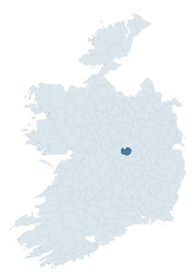
Where this barony sits in the Republic of Ireland
Geology and preservation
Bedrock geology shapes the landscape long before any settlement begins — controlling soil drainage, agricultural potential, the survival of upstanding monuments, and the preservation of buried archaeology. The figures below come from the Geological Survey Ireland 1:100,000 bedrock map.
The bedrock underlying Ballycowan is predominantly limestone (55% of the barony by area), laid down during the Carboniferous period (100% by area, around 359 to 299 million years ago). Limestone is the most heritage-rich bedrock in Ireland. It supports fertile, well-drained soils that favoured dense Early Medieval settlement and Norman manorial agriculture, and it weathers into karst features — sinkholes, caves, swallow holes, and souterrains — that frequently carry archaeology. Where peat overlies limestone, organic preservation can be exceptional. A substantial secondary geology of limestones (45%) adds further variety to the underlying landscape. The single largest mapped unit is the Visean Limestones (undifferentiated) (45% of the barony's bedrock). With only 2 distinct rock types mapped, the barony is geologically uniform compared to the rest of the Republic (19th percentile for diversity) — a single coherent bedrock landscape.
Rock type composition
Largest mapped unit: Visean Limestones (undifferentiated) (45% of the barony)
Placename evidence
Logainm records 24 heritage-diagnostic placenames for Ballycowan, drawn from townland and civil-parish names across the barony. The dominant stratum is Early Christian ecclesiastical — cill-, teampall-, and domhnach-prefixed names that record the dense network of early church foundations established between the fifth and tenth centuries. The leading diagnostic roots are cill- (11 — church), ráth- (9 — earthen ringfort), and gall- (3 — foreigner). This is broadly in line with the ROI average of 30.7 heritage placenames per barony. The presence of multiple heritage strata side by side indicates layered occupation of the landscape across successive prehistoric and historic periods. Logainm records 117 placenames for Ballycowan (predominantly townland names). Of these, 24 (21%) carry one of the diagnostic Gaelic roots tracked above; the remainder draw on more generic landscape vocabulary that does not encode a heritage period.
Pre-Christian / Early Medieval Defensive
| Root | Count | Meaning |
|---|---|---|
| ráth- | 9 | earthen ringfort |
Early Christian Ecclesiastical
| Root | Count | Meaning |
|---|---|---|
| cill- | 11 | church (early) |
| domhnach- | 1 | pre-Patrician or earliest Patrician church |
Burial, Ritual, and Norse-Contact
| Root | Count | Meaning |
|---|---|---|
| gall- | 3 | foreigner — Norse settlement marker |
| carn- | 1 | cairn |
| feart- | 1 | grave mound |
Other baronies in Offaly
- Ballyboy
- Philipstown Upper
- Clonlisk
- Ballybritt
- Philipstown Lower
- Warrenstown
- Eglish
- Gowran — Kilkenny
- Fassadinin — Kilkenny
- Idrone West — Carlow
See all 280 baronies in the Republic of Ireland Heritage Tool.

Explore further
Grounding History: 10 Maps of Northern Ireland’s Past
If you’re interested in Irish heritage more widely, the companion report for Northern Ireland brings together the analysis of all 462 NI wards into one place through 10 high-quality maps — covering monument density, archaeological periods, placename heritage, terrain, wetland, and the historic landscape at first survey. Take a look.
About this profile
Click any section below to expand.
What is a barony?
A barony is a historic administrative unit in Ireland, broadly equivalent to an English hundred. The 280 baronies used here are from the OSi 2019 National Statutory Boundaries (generalised 20m), covering the 26 counties of the Republic of Ireland. Baronies derive from the Norman period, were formalised in the 17th century, and have not been redrawn for statistical purposes. They vary enormously in area, from compact urban baronies in Dublin to vast upland baronies in Connacht, and should not be compared by raw site count without accounting for area differences.
What counts as a site?
This profile combines three distinct heritage registers, each with its own definition of what constitutes a recordable site:
- Archaeological sites (NMS). The National Monuments Service Sites and Monuments Record (SMR) catalogues every known archaeological monument or site of archaeological interest in the Republic, from prehistoric burial mounds and ringforts to medieval churches and post-medieval defensive works. Inclusion does not require legal protection — only that the site has been identified, surveyed, and assessed as having archaeological value. A separate subset of these sites lies within a recorded protection zone, which gives them statutory protection under the National Monuments Acts.
- Listed buildings (NIAH). The National Inventory of Architectural Heritage records buildings of architectural, historical, archaeological, artistic, cultural, scientific, social, or technical interest. Each surveyed structure is appraised on a five-tier scale: International, National, Regional, Local, and Record-Only. The NIAH appraisal is informational rather than strictly statutory, but it underpins local-authority Record of Protected Structures (RPS) listings.
- Heritage placenames (Logainm). Logainm is the authoritative database of Irish placenames maintained by the Placenames Branch. This profile applies a heritage-diagnostic classifier to the Irish-language form of each townland name, flagging roots that signal defensive sites (ráth-, lios-, dún-, caiseal-, cathair-), ecclesiastical foundations (cill-, teampall-, domhnach-, mainistir-), prehistoric burial-ritual features (tuaim-, carn-, leaba-), or Norse-contact settlement (gall-). Townlands without one of these diagnostic roots are not flagged here — they may still carry historical significance, but that significance is not encoded in the name itself.
Editorial principles
The narrative sections of this profile follow several explicit principles:
- Evidential. Every claim about this barony’s heritage character is anchored in the underlying register data. Where a site count, a placename count, or a percentile rank is cited, it is computed from the source datasets at export time, not estimated.
- Comparative. Counts and metrics are reported alongside their percentile rank against the other 279 ROI baronies. A barony with 50 ringforts in absolute terms could be unusually high or unusually low depending on its size and regional context; percentile ranking removes that ambiguity.
- Transparent on limits. Where a register has known coverage gaps, survey biases, or data-quality issues that affect this barony’s figures, the profile flags them rather than presenting the numbers as definitive.
- No interpretation beyond what the data supports. The narrative does not speculate about historical events, social dynamics, or cultural meaning beyond what the recorded heritage and placename evidence directly attests.
Data caveats and limits
- NMS Sites and Monuments Record is the product of survey campaigns conducted at different intensities across different counties and decades. Some baronies have been surveyed more thoroughly than others, and absolute counts should be read in that light. Sites destroyed by development before survey are typically not represented; sites in heavily forested or upland terrain are sometimes under-recorded.
- NIAH coverage is broadly complete for the Republic of Ireland but the survey was conducted on a rolling county-by-county basis, and the most recent appraisal date varies. Buildings demolished or substantially altered after their original survey may still appear in the register; conversely, recent buildings of merit may not yet have been appraised.
- Logainm classification applies a deliberately conservative pattern-matching approach to the Irish-language townland forms. The classifier prioritises true positives over recall: a townland may carry a heritage signal that the classifier doesn’t recognise, particularly where the diagnostic root has been heavily anglicised or where the townland name draws on a less common term. The 60,000+ townland records and ~9,800 classified placenames give a substantial signal at barony scale, but individual townland names should be checked against Logainm directly for definitive interpretation.
- Period attribution. The chronological distribution reflects only those NMS sites that carry a recognised period attribution in the source data. Sites listed as “Unknown” period are excluded from the dated subset.
- Boundary changes. Some baronies have undergone minor boundary adjustments since their 19th-century definition; the OSi 2019 generalised boundaries used here are the current statutory definition and may differ slightly from historical maps in border areas.
- Bedrock geology is mapped at 1:100,000 scale, which means local variation within a barony — small pockets of different rock type, mineral veins, alluvium overlying bedrock — is generalised. The dominant-system and rocktype figures are area-weighted, so a barony reading “70% Carboniferous limestone” may still contain small but archaeologically important pockets of older or younger rock. Around 3% of GSI polygons do not match the lexicon and contribute no rocktype or system attribution.
Data sources
- National Monuments Service — Sites and Monuments Record (SMR) https://data.gov.ie/dataset/national-monuments-service-archaeological-survey-of-ireland
- National Inventory of Architectural Heritage (NIAH) https://data.gov.ie/dataset/national-inventory-of-architectural-heritage-niah-national-dataset
- Logainm — Placenames Database of Ireland https://www.logainm.ie/
- Ordnance Survey Ireland — National Statutory Barony Boundaries 2019 https://data-osi.opendata.arcgis.com/
- EURODEM — European Digital Elevation Model https://www.mapsforeurope.org/datasets/euro-dem
- ESA WorldCover https://esa-worldcover.org/en
- Geological Survey Ireland — 1:100,000 Bedrock Geology https://www.gsi.ie/en-ie/data-and-maps/Pages/Bedrock.aspx
Explore more: Search any of the 280 ROI baronies, browse by historical province, or read the methodology and data sources for the full Republic of Ireland Heritage Tool.