Coolavin is a barony of County Sligo, in the historical province of Connacht (Irish: Cúil Ó bhFinn), covering 118 km² of land. The barony records 355 NMS archaeological sites and 10 NIAH listed buildings, placing it at around the 81st percentile among 280 ROI baronies for sites per km². This means it is in the top fifth of all baronies for sites per km². Dated archaeological evidence runs from the Neolithic through to the Modern, spanning 8 of 9 archaeological periods, placing the barony in the 67th percentile among 280 ROI baronies for chronological depth. This means it is in the top third of all baronies for chronological depth. The largest dated subset of recorded sites dates to the Early Medieval. Logainm flags 21 placenames in the barony as carrying a recognised heritage root; the largest share — around 48% — are names associated with pre-christian defensive.


Heritage at a glance
Percentile rankings throughout this profile compare each barony only against the other 279 Republic of Ireland baronies.
The recorded heritage of Coolavin
The National Monuments Service Sites and Monuments Record (SMR) is the statutory inventory of archaeological sites for the Republic of Ireland, maintained by the Department of Tourism, Culture, Arts, Gaeltacht, Sport and Media. Sites recorded here include earthworks, ringforts, megalithic tombs, ecclesiastical remains, and post-medieval features; not every record is legally protected, but each is registered as a monument of archaeological interest.
The National Monuments Service records 355 archaeological sites in Coolavin, putting it at the 81st percentile among 280 ROI baronies for sites per km². This means it is in the top fifth of all baronies for sites per km². Protection coverage is near-universal — 353 sites (99%) fall within a recorded monument protection zone, indicating an extensively surveyed landscape. The dominant category is defensive sites — ringforts, enclosures, hillforts, and stone forts (235 sites, 66% of the record). Crannog is the most prevalent type, making up 22% of the barony's recorded sites (78 records) — well above the ROI average of 5% across all baronies where this type occurs. Crannog is an artificial or partly artificial island built up on a lake or river bed, in use from the 6th to 17th centuries AD. Other significant types include Ringfort – rath (77) and Ringfort – cashel (34). Ringfort – rath is an earthen ringfort enclosed by a bank and external ditch — the most common Early Medieval farmstead, broadly dated 500–1000 AD; Ringfort – cashel is the stone-walled equivalent of the rath, found mainly in upland or western areas, broadly dated 500–1000 AD. Across the barony's 118 km², this gives a recorded density of 3.01 sites per km².
Most common monument types
Hover or tap a monument type to see its definition.
| Type | Count |
|---|---|
| Crannog an artificial or partly artificial island built up on a lake or river bed, in use from the 6th to 17th centuries AD | 78 |
| Ringfort – rath an earthen ringfort enclosed by a bank and external ditch — the most common Early Medieval farmstead, broadly dated 500–1000 AD | 77 |
| Ringfort – cashel the stone-walled equivalent of the rath, found mainly in upland or western areas, broadly dated 500–1000 AD | 34 |
| Cross-slab a stone slab inscribed with a cross, used as a grave-marker or memorial, dated pre-1200 AD | 22 |
| Enclosure a banked or ditched feature of uncertain type, used as a catch-all where the original function cannot be determined from surface evidence | 22 |
| Souterrain an underground stone-built passage and chamber, generally Early Medieval and often associated with ringforts as a defensive or storage feature | 13 |
| Fulacht fia a horseshoe-shaped Bronze Age burnt mound built around a sunken trough beside a water source, traditionally interpreted as a cooking site | 9 |
| Moated site | 7 |
Chronological distribution
The dated archaeological record for Coolavin spans from the Neolithic through to the Modern, with activity attested across 8 of 9 archaeological periods. Every period from earliest to latest is represented in the record — an unbroken sequence of dated activity across the full chronological span. Activity concentrates most heavily in the Early Medieval (233 sites, 69% of dated material), with the Iron Age forming a secondary peak (43 sites, 13%). A further 19 recorded sites (5% of the overall NMS register for the barony) carry no period attribution — appearing as 'Unknown' in the bar chart below. This typically reflects either records that pre-date the standardised period vocabulary or sites awaiting specialist dating review, rather than a genuine absence of chronological evidence.
Sample of recorded monuments
Show 25 sample monuments (of 355 total)
A representative sample of 25 recorded monuments drawn from the barony’s 355 total NMS entries. Sites within a recorded monument protection zone and rarer site types are prioritised so the list shows a meaningful cross-section rather than only the most common type. Each entry shows the official Sites and Monuments Record reference number and the description published by the National Monuments Service.
Religious house – Carmelite friars
In level pasture, at the foot of a S-facing slope; in the centre of Knockmore graveyard (SL044-003003-). All that remains of Knockmore Abbey is the ruin of a rectangular church (ext. 25.6m E-W; 8.65m N-S) built of…
In level pasture, at the foot of a S-facing slope; in the centre of Knockmore graveyard (SL044-003003-). All that remains of Knockmore Abbey is the ruin of a rectangular church (ext. 25.6m E-W; 8.65m N-S) built of uncoursed mortared stonework. Only a stump at the NE corner, the internal face of the S wall and a short return of the W wall, survive, and much of the E and S walls have recently been rebuilt as a drystone wall. The NE stump contains the N side of the central E window; this has a limestone jamb with chamfered edges. Near the E end of the S wall is a square recess (D 0.6m; H c. 0.8m) with a rounded arch and a ribbed band on both jambs. The base of the recess is covered by rubble but it is probably a piscina (M. A. Timoney 1997, 3). There is a much-ruined doorway near the W end of this wall. Just inside the boundary of the graveyard and NE of the church are two pieces of a window mullion, reused as grave-markers. These match the surviving side of the E window; one is decorated on its internal face with a simple knot motif. A drawing from the 1830s shows this window with three mullions rising to four round sub-arches with tracery overhead (OSNB vol. 1, 435). The interior of the church contains many 19th- and 20th-century burials. Knockmore Abbey was established for the Carmelites c. 1320 (Gwynn and Hadcock 1970, 290; M. A. Timoney 1997); according to Cowell (1997, 147), it was founded by Edmund O'Gara of Moygara Castle (SL044-052001-). The surviving architectural f…
Sweathouse
Named 'Sweat Ho' on the 1838 edition of the OS 6-inch map. It is not marked on the 1942-3 edition. There are no surviving remains visible.
Compiled by: Archaeological Survey Unit, UCC with revisions by Patrick F.…
Named 'Sweat Ho' on the 1838 edition of the OS 6-inch map. It is not marked on the 1942-3 edition. There are no surviving remains visible.
Compiled by: Archaeological Survey Unit, UCC with revisions by Patrick F. O'Donovan and Paul Walsh
Date of upload: 20 June 2011
Megalithic tomb – court tomb
Almost 1km W of the N end of Lough Gara on a patch of rocky pasture in gently rolling land. The remains of a court (min. L 6m; Wth c. 8m at its inner end) at the NW, its more westerly arm represented by four stones and…
Almost 1km W of the N end of Lough Gara on a patch of rocky pasture in gently rolling land. The remains of a court (min. L 6m; Wth c. 8m at its inner end) at the NW, its more westerly arm represented by four stones and the opposite arm by two, opens into two galleries set side by side. Little remains of the more westerly gallery (min. L 7m) the entrance to which is formed by two jambs. A sidestone abuts the more easterly of these and there is another on the same side almost 4m to the S. Opposite this there is another sidestone and between them what appears to be a segmenting jamb. Its presence indicates there was further gallery structure here. The second gallery (min. L 6.5m) consists of an antechamber represented by the more easterly entrance jamb and a sidestone abutting it. Segmenting jambs separate this from a chamber the E side of which is represented by a single stone and the W side by two stones. Another pair of segmenting jambs stand between the last and another chamber, its intact W side of two stones and two of a likely original three stones in place at the E. A segmenting jamb adjoins the outer end of the W side of this indicating that there was at least one further chamber here. There are some displaced stones at the site. (Ó Nualláin 1989, 79-80, no. 126)
The above description is derived from the published 'Archaeological Inventory of County Sligo' compiled by Ursula Egan, Elizabeth Byrne, Mary Sleeman with Sheila Ronan and Connie Murphy (Dublin Stationery…
Bawn
On a slight prominence in undulating pasture, overlooked by higher ground to S but with extensive views N-SE and overlooking Lough Gara to SE. Moygara Castle consists of a square bawn (L 51m) enclosed by a curtain wall…
On a slight prominence in undulating pasture, overlooked by higher ground to S but with extensive views N-SE and overlooking Lough Gara to SE. Moygara Castle consists of a square bawn (L 51m) enclosed by a curtain wall with a tower at each corner, a gate-tower in the centre of the W side, and the lower courses of a rectangular structure along the inside of the N wall (see plan in Casey 1992). The entire complex is built of uncoursed rubble stone in a lime mortar.
The earliest part of the complex would appear to be the rectangular structure (17m E-W; 12.5m N-S) which stands on the N side of the bawn, its N wall roughly on the same line as the curtain wall. This structure appears to pre-date the curtain wall as the curtain is butted up against its NW corner; the junction with the curtain wall at the NE corner is obscured by collapsed rubble. The only evident intact feature of the rectangular structure is a vertical shaft (1.4m x 0.65m) just inside its NW corner, which is probably the shaft for a garderobe. Otherwise the structure is largely reduced to an uneven mound of rubble covered by sod.
The curtain wall stands close to full height (average H 3.3m; T 1.24m) but is now topped by a sod layer with no indication of the original finish. Along all four walls, just above present ground level, are roughly evenly spaced gun loops: five in the N wall; ten in the E wall; thirteen in the S wall; and ten in the W wall. These loops are plain lintelled embrasures splayed from a sm…
Exhibitionist figure
In Moygara Castle (SL044-052001-). Listed in the SMR (1989) and in the RMP (1995) where it is classified as 'Sheela-na-gig' and 'Stone sculpture' respectively. According to Wakeman this carving was that of sheela-na-gig…
In Moygara Castle (SL044-052001-). Listed in the SMR (1989) and in the RMP (1995) where it is classified as 'Sheela-na-gig' and 'Stone sculpture' respectively. According to Wakeman this carving was that of sheela-na-gig which was located on the barbican of Moygara Castle (SL044-052001-) (Wakeman 1880, 282; Guest 1936, 111). Described by Guest as a ‘limestone block, on the corbelled end of which the figure is rudely carved, now lies on the ground near the castle entrance’ (Guest 1936, 111). The carving displays certain affinities with exhibitionist figures though the nature of the remains hardly permits classification as such with any degree of certainty and some caution is necessary in proposing this interpretation (Cherry 1992, 9). Another keystone (SL044-052003-) lies nearby and it has an equally worn carving, possibly of two figures facing each other (SMR (1989) file).
Compiled by: Caimin O'Brien and Paul Walsh
Date of upload/revision: 23 May 2012
Leacht
In a graveyard (SL045-011002-) and within a possible ecclesiastical enclosure (SL045-011003-). A leacht of St Ronán, consisting of a large square cairn with two stones on top and a number of round stones, was noted in…
In a graveyard (SL045-011002-) and within a possible ecclesiastical enclosure (SL045-011003-). A leacht of St Ronán, consisting of a large square cairn with two stones on top and a number of round stones, was noted in 1837 by G. Petrie on the W side of the church (SL045-011001-); Petrie also noted that 'stations' were held there on the saint's anniversary, Good Friday (Royal Irish Academy MS, 23L44, 13). There are no visible remains of this leacht though according to local information, some of the stone from it is incorporated into one of the five burial enclosures in the W half of the graveyard.
The above description is derived from the published 'Archaeological Inventory of County Sligo' compiled by Ursula Egan, Elizabeth Byrne, Mary Sleeman with Sheila Ronan and Connie Murphy (Dublin Stationery Office, 2005).
Date of upload: 18 January 2008
Rock art
On the top of a hill. Listed in the SMR (1989) and RMP (1995) and as 'Rock scribing\art possible'. The rock is known locally as the 'Danes Rock' and marks on it are thought to have been made by the Danes while…
On the top of a hill. Listed in the SMR (1989) and RMP (1995) and as 'Rock scribing\art possible'. The rock is known locally as the 'Danes Rock' and marks on it are thought to have been made by the Danes while sharpening their swords (pers. comm. M. A. Timoney). A large rock outcrop, partly covered in moss and heather, was identified here. However, no rock art is visible on the exposed surfaces of the rock; striations, aligned NE-SW, are likely to be of glacial origin.
Compiled by: Archaeological Survey Unit, UCC with revisions by Patrick F. O'Donovan and Paul Walsh
Date of upload: 20 June 2011
Cairn – ring-cairn
On a gentle slope, with a view of the Curlew Mountains to N. Excavated in 1973 by Wallace (1974, 23-4) who described 'two roughly concentric rings of orthostats, the diameters of which were 14.5m and 8m', the inner and…
On a gentle slope, with a view of the Curlew Mountains to N. Excavated in 1973 by Wallace (1974, 23-4) who described 'two roughly concentric rings of orthostats, the diameters of which were 14.5m and 8m', the inner and outer retaining walls for a 'ring-cairn of loosely placed stones' the height of which would have been at least 1.7m. The inner circular area was empty except for a segment in the SE quadrant which contained two short cists (SL046-003002-; SL046-003003-) covered by a thin layer of cairn stones and revetted by a low crescent-shaped setting of small orthostats. The soil under the cairn stones was flecked with charcoal. The site is now evident as a kidney-shaped sod-covered cairn (4.3m x 3m). (Waddell 1990, 133)
The above description is derived from the published 'Archaeological Inventory of County Sligo' compiled by Ursula Egan, Elizabeth Byrne, Mary Sleeman with Sheila Ronan and Connie Murphy (Dublin Stationery Office, 2005).
Date of upload: 18 January 2008
Boulder-burial
On level ground, on a slight dry rise in otherwise waterlogged ground. A boulder (1.8m x 1.5m; T 0.7m) rests on three support-stones. The two most northerly support-stones are each 0.35m H while the southerly stone is…
On level ground, on a slight dry rise in otherwise waterlogged ground. A boulder (1.8m x 1.5m; T 0.7m) rests on three support-stones. The two most northerly support-stones are each 0.35m H while the southerly stone is 0.25m H. Above the lowest support-stone is a pad-stone which serves to steady the cover-stone above its supports (Ó Nualláin 1986, 124).
The above description is derived from the published 'Archaeological Inventory of County Sligo' compiled by Ursula Egan, Elizabeth Byrne, Mary Sleeman with Sheila Ronan and Connie Murphy (Dublin Stationery Office, 2005).
Date of upload: 18 January 2008
Crucifixion plaque
On the N side of a holy well (SL046-013001-), set into a stone wall on top of which is a set of cursing stones (SL046-013004-). The plaque consists of a limestone slab (H 0.51m; Wth 0.31m) on which is carved a…
On the N side of a holy well (SL046-013001-), set into a stone wall on top of which is a set of cursing stones (SL046-013004-). The plaque consists of a limestone slab (H 0.51m; Wth 0.31m) on which is carved a crucifixion scene in relief. The arms of the cross extend the full width of the slab while the base of the shaft terminates on a low plinth. The head of the Christ figure is disproportionately large with simplified facial features while the hair and beard have been depicted with considerable attention to detail. Several symbols of the crucifixion are also depicted including a ladder and a bird as well as instruments of the passion, some of which are partially eroded. The plaque is centrally placed in the wall facade and is flanked on each side by two large vertically set limestone slabs. The slab immediately to the right bears a now worn inscription which was read by Wood-Martin (1892, 368) as 'IHS 1662 11. 1: G'.
The above description is derived from the published 'Archaeological Inventory of County Sligo' compiled by Ursula Egan, Elizabeth Byrne, Mary Sleeman with Sheila Ronan and Connie Murphy (Dublin Stationery Office, 2005).
Date of upload: 18 January 2008
Cursing stone
On top of a stone wall into which is set a 17th-century crucifixion plaque (SL046-013002-) and adjacent to a holy well (SL046-013001-) and bullaun stone (SL046-013003-). Wood-Martin (1892, 367) recorded 'thirteen round…
On top of a stone wall into which is set a 17th-century crucifixion plaque (SL046-013002-) and adjacent to a holy well (SL046-013001-) and bullaun stone (SL046-013003-). Wood-Martin (1892, 367) recorded 'thirteen round water-worn pebbles' here and during a previous site inspection in 1994 (SMR (1989) file) twelve of these were present. There are currently eight water-rolled cobbles, of varying sizes, and three irregular stones cemented onto the top of the wall. All are partially obscured by ivy. According to local tradition, these were 'cursing stones' (pers. comm. M. A. Timoney).
The above description is derived from the published 'Archaeological Inventory of County Sligo' compiled by Ursula Egan, Elizabeth Byrne, Mary Sleeman with Sheila Ronan and Connie Murphy (Dublin Stationery Office, 2005).
Date of upload: 18 January 2008
House – early medieval
In the NE quadrant of a Sroove cashel (SL046-018001-). Two roughly linear heaps of loose stones, at right angles to each other, generally define an area (c. 9m N-S; 9m E-W) of slightly sunken ground. This may be the…
In the NE quadrant of a Sroove cashel (SL046-018001-). Two roughly linear heaps of loose stones, at right angles to each other, generally define an area (c. 9m N-S; 9m E-W) of slightly sunken ground. This may be the remains of a house site. Immediately to S, and just E of the centre of the cashel interior, is a roughly oval cairn (3m N-S; 4.6m E-W; max. H 0.9m) with a further linear concentration of stones (3.8m NNW-SSE; Wth 1.3m; H 0.3m) extending north-westwards from it. There is a souterrain (SL046-018003-) immediately to NW.
Compiled by: Archaeological Survey Unit, UCC with revisions by Patrick F. O'Donovan and Paul Walsh
Date of upload: 20 June 2011
Earthwork
In pasture, on a NW-facing slope. A slightly raised circular area (diam. c. 14m) defined by a scarp (H 0.5m).
The above description is derived from the published 'Archaeological Inventory of County Sligo' compiled by…
In pasture, on a NW-facing slope. A slightly raised circular area (diam. c. 14m) defined by a scarp (H 0.5m).
The above description is derived from the published 'Archaeological Inventory of County Sligo' compiled by Ursula Egan, Elizabeth Byrne, Mary Sleeman with Sheila Ronan and Connie Murphy (Dublin Stationery Office, 2005).
Date of upload: 18 January 2008
Religious house – unclassified
In gently undulating pasture, in Killaraght graveyard (SL047-083002-) and within a field system (SL047-083004-). Probably the site of a convent founded by St Attracta which, according to tradition, was built by St…
In gently undulating pasture, in Killaraght graveyard (SL047-083002-) and within a field system (SL047-083004-). Probably the site of a convent founded by St Attracta which, according to tradition, was built by St Patrick (Gwynn and Hadcock 1970, 320-21). A nunnery and hospital (SL047-083007-) existed here into the 16th century and an abbess of Killaraght is mentioned in 1591 (ibid.). A 'house of nuns of Killaraght' still stood here in the 1680s (Ó Muraíle 2002, 242, n. 48). It is also probably the site of the medieval parish church of Killaraght. According to local tradition, there was a church ruin in the NW quadrant of the graveyard. Several blocks of dressed stone, found during a graveyard clean up, are the only recent indication of a church here (Mount 1994a). A road (SL047-083003-) lies c. 200m to the NE. 'Toberaraght' holy well (SL047-081—-) is c. 600m to the S.
The above description is derived from the published 'Archaeological Inventory of County Sligo' compiled by Ursula Egan, Elizabeth Byrne, Mary Sleeman with Sheila Ronan and Connie Murphy (Dublin Stationery Office, 2005).
Date of upload: 18 January 2008
Road – road/trackway
In undulating stony pasture. Indicated only on the 1914 OS 6-inch map as a linear feature (Wth c. 10m; L c. 750m), flanked by field boundaries, extending in a NE direction from c. 150m ENE of the mound barrow…
In undulating stony pasture. Indicated only on the 1914 OS 6-inch map as a linear feature (Wth c. 10m; L c. 750m), flanked by field boundaries, extending in a NE direction from c. 150m ENE of the mound barrow (SL047-083005-) to almost the Roscommon border. It was levelled during land reclamation and there are no visible remains of the SW half. The NE half is evident intermittently as a slight rise though its NE end has been truncated by a row of bungalows. Killaraght graveyard (SL047-083002-) and the site of a nunnery (SL047-083001-) lie c. 200m to SW.
The above description is derived from the published 'Archaeological Inventory of County Sligo' compiled by Ursula Egan, Elizabeth Byrne, Mary Sleeman with Sheila Ronan and Connie Murphy (Dublin Stationery Office, 2005).
Date of upload: 18 January 2008
Hospital
According to Gwynn and Hadcock (1970, 352), 'a hospital established in the fifth century by St Adrochta and connected with her convent of nuns, appears to have continued, with the convent, till the sixteenth…
According to Gwynn and Hadcock (1970, 352), 'a hospital established in the fifth century by St Adrochta and connected with her convent of nuns, appears to have continued, with the convent, till the sixteenth century'.
Compiled by: Archaeological Survey Unit, UCC with revisions by Patrick F. O'Donovan and Paul Walsh
Date of upload: 20 June 2011
Architectural fragment
In Moygara Castle (SL044-052001-). This is an architectural fragment, a limestone keystone which is lying on the ground near the gate tower of the castle. It has a carving on its outside face but this is now almost worn…
In Moygara Castle (SL044-052001-). This is an architectural fragment, a limestone keystone which is lying on the ground near the gate tower of the castle. It has a carving on its outside face but this is now almost worn beyond recognition. The carving appears to be two figures facing each. Another keystone (SL044-052002-) lies nearby and it has an equally worn carving of a single figure holding something in its arms (SMR (1989) file). Neither of these carvings appear to be the figure of a sheela-na-gig, though Guest (1936, 111 and fig. 7) implies that one might be.
Compiled by: Archaeological Survey Unit, UCC with revisions by Patrick F. O'Donovan and Paul Walsh
Date of upload: 20 June 2011
Field boundary
Listed in the RMP (1994) an classified as 'Enclosure'. Not marked on the 1838 edition of the OS 6" map. Depicted a small wedge-shaped field on the 1914 edition of the OS 6-inch map. On a natural terrace of dry ground,…
Listed in the RMP (1994) an classified as 'Enclosure'. Not marked on the 1838 edition of the OS 6" map. Depicted a small wedge-shaped field on the 1914 edition of the OS 6-inch map. On a natural terrace of dry ground, in otherwise waterlogged pasture. Upon inspection in 2000 the visible remains comprised a roughly triangular area (28.5m WNW-ESE; c. 39m NNE-SSW) defined by a flat-topped earthen bank (Wth 2.2m; int. H 0.2m; ext. H 1.1.2m) with an external flat-bottomed fosse (Wth 2m; ext. D 0.4m) on the NNW and SW sides and by a linear field boundary (Wth 2m; int. H 0.75m; ext. H 1.5m) with a substantial external drain, along the E side. There is a break (Wth c. 10m) at the NE end of the NNW side which allows cattle access to interior. Remnants of a counterscarp bank (Wth 1.5m; int. H 0.55m; ext. H 0.3m) are evident outside the fosse on the SW side. The interior is raised c. 0.8m above the external ground level on the NNW and SW sides. The field boundary extends beyond the enclosure to SSW while at the NNE end it intersects with another field boundary. It was concluded that this is a natural terrace which has been transformed, probably in recent times, into a roughly triangular field. It is likely to be post-1700 AD in date.
Compiled by: Archaeological Survey Unit, UCC
Date of upload: 06 December 2011
Field boundary
Listed in both the SMR (1989) and the RMP (1995) and classified as 'Enclosure'. In waterlogged pasture, immediately N of a triangular field (SL047-073001-). Inspection in 2000 revealed that this is a low,…
Listed in both the SMR (1989) and the RMP (1995) and classified as 'Enclosure'. In waterlogged pasture, immediately N of a triangular field (SL047-073001-). Inspection in 2000 revealed that this is a low, naturally-occurring elevation with sides that slope gently down to the E and SE. This area is now enclosed by field boundaries creating a roughly square field (c. 34.5m E-W; 33m N-S) with linear N and E sides and gently curved S and W sides. The interior slopes gently down to NW. The W half of the field is planted with conifers while much of the E half is occupied by a corrugated iron barn and a small concrete enclosure and cattle crush. It was concluded that there are no upstanding remains visible to suggest that this is an archaeological monument.
Compiled by: Archaeological Survey Unit, UCC
Date of upload: 06 December 2011
Penitential station
In pasture, at the base of a N-facing slope and 9m ESE of a holy well (SL044-047001-). A roughly circular cairn (4m N-S; 3.6m E-W; H 1.4m) of stones and slabs with a slightly domed profile, partially obscured by sod and…
In pasture, at the base of a N-facing slope and 9m ESE of a holy well (SL044-047001-). A roughly circular cairn (4m N-S; 3.6m E-W; H 1.4m) of stones and slabs with a slightly domed profile, partially obscured by sod and brambles. In places glimpses of coursed stonework are evident. Projecting slightly from the W side is a roughly coursed drystone facade (H 0.5m) of horizontally laid slabs with a flat top (0.5m E-W; 0.6m N-S). The cairn rises gently for c. 0.5m behind the top of the facade. Propped up on the flat top of the facade at W is a cross-slab (SL044-047003-). A large upright slab (H 0.65m; Wth 0.8m E-W; T c. 0.12m) is embedded in the ground at the base of the N side of the cairn. There is a small circular perforation (diam. 0.005m) close to the top edge on the E side of the slab. A cashel (SL044-048001-) is located at the top of the slope to S.
The above description is derived from the published 'Archaeological Inventory of County Sligo' compiled by Ursula Egan, Elizabeth Byrne, Mary Sleeman with Sheila Ronan and Connie Murphy (Dublin Stationery Office, 2005).
Attached image:
SL044-047002-_01.JPG
Date of upload: 18 January 2008
Kiln – lime
Not included in the SMR (1989) but listed in the RMP (1995) and classified 'Souterrain Possible'. Within Kilfree cashel (SL044-048001-). Built into the external face of the cashel wall at N is a small roofless U-shaped…
Not included in the SMR (1989) but listed in the RMP (1995) and classified 'Souterrain Possible'. Within Kilfree cashel (SL044-048001-). Built into the external face of the cashel wall at N is a small roofless U-shaped structure (2-2.5m N-S; 1.5m E-W) faced with stone (H 1m), open to NNE, possibly the remains of a ruined limekiln. It is likely to be post-1700 AD in date.
Compiled by: Archaeological Survey Unit, UCC
Date of upload: 10 January 2012
Megalithic tomb – wedge tomb
In a small isolated patch of unreclaimed bog in rolling pasture about 5km W of the N end of Lough Gara. The tomb, much of which is either missing or remains concealed in the bog, faces W and protrudes from a heel-shaped…
In a small isolated patch of unreclaimed bog in rolling pasture about 5km W of the N end of Lough Gara. The tomb, much of which is either missing or remains concealed in the bog, faces W and protrudes from a heel-shaped mound (L 9m E-W; max. Wth 7.5m at W). The forward 2.6m of the gallery is visible. Opposed stones, 1.45m apart, form the gallery entrance. A single sidestone adjoins the southern of these and 0.6m beyond this a partly concealed stone may be a fallen orthostat. Two orthostats adjoin the northern entrance stone. Outside these there are two stones that serve to double the gallery wall at this point. A lintel that covered the entrance has slipped off the S side of the gallery. Broken lines of outer-walling to the N and S join a facade running across the W end of the tomb. Two facade-stones link the S side of the gallery entrance to the outer-wall and these articulate with a line of three outer-wall stones, each of which has fallen outwards. The surviving facade-stone at the N articulates with the front of the outer-walling at this side of the monument. It adjoins a line of five stones, the middle three fallen outwards and the easternmost partly buried. Another outer-wall stone stands some 2.3m to the E. A small set stone 2.3m S of the last is of uncertain function. Three displaced stones lie on the mound at the NE. (Ó Nualláin 1989, 78-9, no. 125)
The above description is derived from the published 'Archaeological Inventory of County Sligo' compiled by Ursula…
Cairn – unclassified
On a low ridge, on a small peninsula which extends into Lough Gara. A sod-covered circular cairn (15.4m N-S; 16.1m E-W; H 1.8m) surrounded by oak trees. Several upright boulders protrude through the sod.
The above…
On a low ridge, on a small peninsula which extends into Lough Gara. A sod-covered circular cairn (15.4m N-S; 16.1m E-W; H 1.8m) surrounded by oak trees. Several upright boulders protrude through the sod.
The above description is derived from the published 'Archaeological Inventory of County Sligo' compiled by Ursula Egan, Elizabeth Byrne, Mary Sleeman with Sheila Ronan and Connie Murphy (Dublin Stationery Office, 2005).
Date of upload: 18 January 2008
Barrow – unclassified
In pasture, at the end of a low ridge and with a good view of two standing stones (SL044-057—-; SL044-058—-) c. 600m to SSE. A five-sided mound of earth and stone (7.3m N-S; 8.2m E-W; H 1-1.5m). The mound was…
In pasture, at the end of a low ridge and with a good view of two standing stones (SL044-057—-; SL044-058—-) c. 600m to SSE. A five-sided mound of earth and stone (7.3m N-S; 8.2m E-W; H 1-1.5m). The mound was probably originally circular and its present shape may be due to erosion. Its size and location suggest a barrow. The top of the mound is uneven and slopes down from W to E. It is partially overgrown with bushes.
The above description is derived from the published 'Archaeological Inventory of County Sligo' compiled by Ursula Egan, Elizabeth Byrne, Mary Sleeman with Sheila Ronan and Connie Murphy (Dublin Stationery Office, 2005).
Date of upload: 18 January 2008
Crannog
Attached to the summer shoreline, in a small lagoon in the NW corner of Lough Gara. A kidney-shaped low-cairn crannog (14m N-S; 14m E-W; H 1.02m above the muddy lake-bed) the surface of which consists of shattered…
Attached to the summer shoreline, in a small lagoon in the NW corner of Lough Gara. A kidney-shaped low-cairn crannog (14m N-S; 14m E-W; H 1.02m above the muddy lake-bed) the surface of which consists of shattered angular stones (diam. 0.03-0.05m) with some larger subangular stones (diam. 0.3-0.4m). The crannog is high in the centre, sloping gradually down towards the edges. Along the water's edge S-SW are c. 13 horizontal roundwood posts. Large horizontal timbers (L 3m; Wth 0.25m) are also evident in the water to E as well as a number of quite substantial flagstones placed on a layer of scattered stones. The crannog edge is distinct in material but not in shape. A few sally trees grow on it. This crannog has been radiocarbon dated to the early medieval period and artifacts associated with it support that date (Fredengren 2002, KILF 005). (Cross 1953, fig. 1).
The above description is derived from the published 'Archaeological Inventory of County Sligo' compiled by Ursula Egan, Elizabeth Byrne, Mary Sleeman with Sheila Ronan and Connie Murphy (Dublin Stationery Office, 2005).
Date of upload: 18 January 2008
Listed buildings
The National Inventory of Architectural Heritage (NIAH) is a state survey appraising buildings of architectural, historical, archaeological, artistic, cultural, scientific, social, or technical interest. Each surveyed structure receives a rating from International (the highest, for buildings of European importance) through National, Regional, Local, and Record-Only.
The NIAH records only 10 listed buildings in Coolavin, the 2nd percentile across ROI baronies — a relatively thin architectural record. All recorded buildings carry Regional or lower grading; the barony does not contain any structures appraised as being of National or International architectural importance. Construction dates concentrate most heavily in the Victorian (1830-1900) period.
Terrain and environment
Mean elevation across the barony is 90m — the 51st percentile among 280 ROI baronies for elevation. This means it is in the upper half of all baronies for elevation. Elevation matters for heritage because higher-altitude baronies typically favour defensive monuments — ringforts and hilltop forts placed on prominent ground — while lowland baronies are more likely to carry the dense settlement and church networks of intensive agricultural landscapes. A maximum elevation of 230m gives the barony meaningful vertical relief. Mean slope is 3.1° — the 39th percentile among 280 ROI baronies for slope. This means it is in the lower half of all baronies for slope. Slope is a key control on both land use and archaeological preservation: steep ground resists ploughing and tends to preserve earthworks intact, while gentle slopes favour intensive cultivation that damages or destroys surface archaeology over time. The Topographic Wetness Index averages 11.1, the 61st percentile among 280 ROI baronies for wetness. This means it is in the upper half of all baronies for wetness. Drainage matters for heritage because poorly-drained ground preserves organic archaeology (wooden trackways, leather, textiles, and on rare occasions human remains) far better than free-draining soil; well-drained ground favours arable use but destroys organic material rapidly. The land-cover mosaic combines improved grassland (69%), woodland (21%), and open water (9%), giving a mixed agricultural and semi-natural landscape.
Terrain measurements
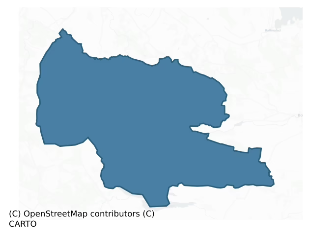
Where this barony sits in the Republic of Ireland
Geology and preservation
Bedrock geology shapes the landscape long before any settlement begins — controlling soil drainage, agricultural potential, the survival of upstanding monuments, and the preservation of buried archaeology. The figures below come from the Geological Survey Ireland 1:100,000 bedrock map.
The bedrock underlying Coolavin is predominantly shale, limestone (39% of the barony by area), laid down during the Carboniferous period (75% by area, around 359 to 299 million years ago). A substantial secondary geology of limestone (16%) and quartz rich sandstones (13%) adds further variety to the underlying landscape. The single largest mapped unit is the Lisgorman Shale Formation (39% of the barony's bedrock). With 8 distinct rock types mapped, the barony sits in the top third of ROI baronies for geological diversity (80th percentile) — typically a sign of complex tectonic history or coastal mosaics of differing rock units.
Rock type composition
Largest mapped unit: Lisgorman Shale Formation (39% of the barony)
Placename evidence
Logainm records 21 heritage-diagnostic placenames for Coolavin, drawn from townland and civil-parish names across the barony. The dominant stratum is pre-Christian and Early Medieval defensive — ráth-, lios-, dún-, and caiseal-prefixed names that mark Iron Age and early historic settlement. The leading diagnostic roots are cill- (6 — church), ráth- (4 — earthen ringfort), and lios- (4 — ringfort or enclosure). This is below the ROI average of 30.7 heritage placenames per barony, suggesting either lighter survey coverage or a townland-naming tradition that draws more on generic landscape vocabulary. The presence of multiple heritage strata side by side indicates layered occupation of the landscape across successive prehistoric and historic periods. Logainm records 69 placenames for Coolavin (predominantly townland names). Of these, 21 (30%) carry one of the diagnostic Gaelic roots tracked above; the remainder draw on more generic landscape vocabulary that does not encode a heritage period.
Pre-Christian / Early Medieval Defensive
| Root | Count | Meaning |
|---|---|---|
| ráth- | 4 | earthen ringfort |
| lios- | 4 | ringfort or enclosure |
| dún- | 1 | hilltop or promontory fort |
| caiseal- | 1 | stone ringfort |
Early Christian Ecclesiastical
| Root | Count | Meaning |
|---|---|---|
| cill- | 6 | church (early) |
| mainistir- | 2 | monastery |
| teampall- | 1 | church (later medieval) |
Burial, Ritual, and Norse-Contact
| Root | Count | Meaning |
|---|---|---|
| carn- | 1 | cairn |
| uaimh- | 1 | cave / souterrain |
| gall- | 1 | foreigner — Norse settlement marker |
Other baronies in Sligo
- Corran
- Leyny
- Carbury
- Tirerrill
- Tireragh
- Roscommon — Roscommon
- Ballynahinch — Galway
- Corran
- Loughrea — Galway
- Costello — Roscommon
See all 280 baronies in the Republic of Ireland Heritage Tool.

Explore further
Grounding History: 10 Maps of Northern Ireland’s Past
If you’re interested in Irish heritage more widely, the companion report for Northern Ireland brings together the analysis of all 462 NI wards into one place through 10 high-quality maps — covering monument density, archaeological periods, placename heritage, terrain, wetland, and the historic landscape at first survey. Take a look.
About this profile
Click any section below to expand.
What is a barony?
A barony is a historic administrative unit in Ireland, broadly equivalent to an English hundred. The 280 baronies used here are from the OSi 2019 National Statutory Boundaries (generalised 20m), covering the 26 counties of the Republic of Ireland. Baronies derive from the Norman period, were formalised in the 17th century, and have not been redrawn for statistical purposes. They vary enormously in area, from compact urban baronies in Dublin to vast upland baronies in Connacht, and should not be compared by raw site count without accounting for area differences.
What counts as a site?
This profile combines three distinct heritage registers, each with its own definition of what constitutes a recordable site:
- Archaeological sites (NMS). The National Monuments Service Sites and Monuments Record (SMR) catalogues every known archaeological monument or site of archaeological interest in the Republic, from prehistoric burial mounds and ringforts to medieval churches and post-medieval defensive works. Inclusion does not require legal protection — only that the site has been identified, surveyed, and assessed as having archaeological value. A separate subset of these sites lies within a recorded protection zone, which gives them statutory protection under the National Monuments Acts.
- Listed buildings (NIAH). The National Inventory of Architectural Heritage records buildings of architectural, historical, archaeological, artistic, cultural, scientific, social, or technical interest. Each surveyed structure is appraised on a five-tier scale: International, National, Regional, Local, and Record-Only. The NIAH appraisal is informational rather than strictly statutory, but it underpins local-authority Record of Protected Structures (RPS) listings.
- Heritage placenames (Logainm). Logainm is the authoritative database of Irish placenames maintained by the Placenames Branch. This profile applies a heritage-diagnostic classifier to the Irish-language form of each townland name, flagging roots that signal defensive sites (ráth-, lios-, dún-, caiseal-, cathair-), ecclesiastical foundations (cill-, teampall-, domhnach-, mainistir-), prehistoric burial-ritual features (tuaim-, carn-, leaba-), or Norse-contact settlement (gall-). Townlands without one of these diagnostic roots are not flagged here — they may still carry historical significance, but that significance is not encoded in the name itself.
Editorial principles
The narrative sections of this profile follow several explicit principles:
- Evidential. Every claim about this barony’s heritage character is anchored in the underlying register data. Where a site count, a placename count, or a percentile rank is cited, it is computed from the source datasets at export time, not estimated.
- Comparative. Counts and metrics are reported alongside their percentile rank against the other 279 ROI baronies. A barony with 50 ringforts in absolute terms could be unusually high or unusually low depending on its size and regional context; percentile ranking removes that ambiguity.
- Transparent on limits. Where a register has known coverage gaps, survey biases, or data-quality issues that affect this barony’s figures, the profile flags them rather than presenting the numbers as definitive.
- No interpretation beyond what the data supports. The narrative does not speculate about historical events, social dynamics, or cultural meaning beyond what the recorded heritage and placename evidence directly attests.
Data caveats and limits
- NMS Sites and Monuments Record is the product of survey campaigns conducted at different intensities across different counties and decades. Some baronies have been surveyed more thoroughly than others, and absolute counts should be read in that light. Sites destroyed by development before survey are typically not represented; sites in heavily forested or upland terrain are sometimes under-recorded.
- NIAH coverage is broadly complete for the Republic of Ireland but the survey was conducted on a rolling county-by-county basis, and the most recent appraisal date varies. Buildings demolished or substantially altered after their original survey may still appear in the register; conversely, recent buildings of merit may not yet have been appraised.
- Logainm classification applies a deliberately conservative pattern-matching approach to the Irish-language townland forms. The classifier prioritises true positives over recall: a townland may carry a heritage signal that the classifier doesn’t recognise, particularly where the diagnostic root has been heavily anglicised or where the townland name draws on a less common term. The 60,000+ townland records and ~9,800 classified placenames give a substantial signal at barony scale, but individual townland names should be checked against Logainm directly for definitive interpretation.
- Period attribution. The chronological distribution reflects only those NMS sites that carry a recognised period attribution in the source data. Sites listed as “Unknown” period are excluded from the dated subset.
- Boundary changes. Some baronies have undergone minor boundary adjustments since their 19th-century definition; the OSi 2019 generalised boundaries used here are the current statutory definition and may differ slightly from historical maps in border areas.
- Bedrock geology is mapped at 1:100,000 scale, which means local variation within a barony — small pockets of different rock type, mineral veins, alluvium overlying bedrock — is generalised. The dominant-system and rocktype figures are area-weighted, so a barony reading “70% Carboniferous limestone” may still contain small but archaeologically important pockets of older or younger rock. Around 3% of GSI polygons do not match the lexicon and contribute no rocktype or system attribution.
Data sources
- National Monuments Service — Sites and Monuments Record (SMR) https://data.gov.ie/dataset/national-monuments-service-archaeological-survey-of-ireland
- National Inventory of Architectural Heritage (NIAH) https://data.gov.ie/dataset/national-inventory-of-architectural-heritage-niah-national-dataset
- Logainm — Placenames Database of Ireland https://www.logainm.ie/
- Ordnance Survey Ireland — National Statutory Barony Boundaries 2019 https://data-osi.opendata.arcgis.com/
- EURODEM — European Digital Elevation Model https://www.mapsforeurope.org/datasets/euro-dem
- ESA WorldCover https://esa-worldcover.org/en
- Geological Survey Ireland — 1:100,000 Bedrock Geology https://www.gsi.ie/en-ie/data-and-maps/Pages/Bedrock.aspx
Explore more: Search any of the 280 ROI baronies, browse by historical province, or read the methodology and data sources for the full Republic of Ireland Heritage Tool.