
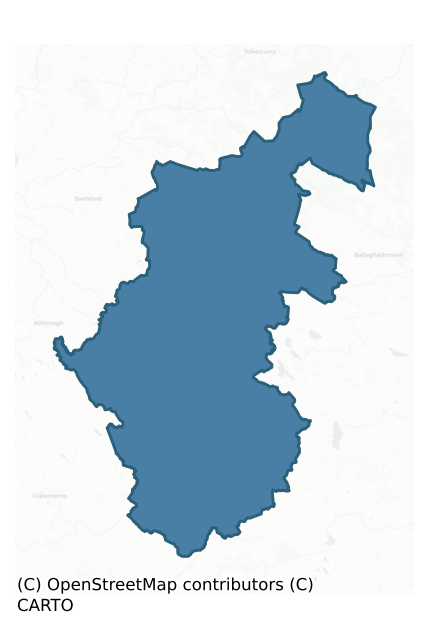
Costello is a barony of County Mayo, in the historical province of Connacht (Irish: Coistealaigh), covering 507 km² of land. The barony records 882 NMS archaeological sites and 69 NIAH listed buildings, placing it at around the 44th percentile among 280 ROI baronies for sites per km². This means it is in the lower half of all baronies for sites per km². Dated archaeological evidence runs from the Neolithic through to the Modern, spanning 7 of 9 archaeological periods, placing the barony in the 24th percentile among 280 ROI baronies for chronological depth. This means it is in the bottom third of all baronies for chronological depth. The largest dated subset of recorded sites dates to the Early Medieval. Logainm flags 62 placenames in the barony as carrying a recognised heritage root; the largest share — around 48% — are names associated with pre-christian defensive.
Heritage at a glance
Percentile rankings throughout this profile compare each barony only against the other 279 Republic of Ireland baronies.
The recorded heritage of Costello
The National Monuments Service Sites and Monuments Record (SMR) is the statutory inventory of archaeological sites for the Republic of Ireland, maintained by the Department of Tourism, Culture, Arts, Gaeltacht, Sport and Media. Sites recorded here include earthworks, ringforts, megalithic tombs, ecclesiastical remains, and post-medieval features; not every record is legally protected, but each is registered as a monument of archaeological interest.
The National Monuments Service records 882 archaeological sites in Costello, putting it at the 44th percentile among 280 ROI baronies for sites per km². This means it is in the lower half of all baronies for sites per km². Protection coverage is near-universal — 857 sites (97%) fall within a recorded monument protection zone, indicating an extensively surveyed landscape. The dominant category is defensive sites — ringforts, enclosures, hillforts, and stone forts (498 sites, 56% of the record). Ringfort – rath is the most prevalent type, making up 23% of the barony's recorded sites (200 records), broadly in line with the ROI average of 20% across all baronies where this type occurs. Ringfort – rath is an earthen ringfort enclosed by a bank and external ditch — the most common Early Medieval farmstead, broadly dated 500–1000 AD. Other significant types include Enclosure (116) and Souterrain (67). Enclosure is a banked or ditched feature of uncertain type, used as a catch-all where the original function cannot be determined from surface evidence; Souterrain is an underground stone-built passage and chamber, generally Early Medieval and often associated with ringforts as a defensive or storage feature. Across the barony's 507 km², this gives a recorded density of 1.74 sites per km².
Most common monument types
Hover or tap a monument type to see its definition.
| Type | Count |
|---|---|
| Ringfort – rath an earthen ringfort enclosed by a bank and external ditch — the most common Early Medieval farmstead, broadly dated 500–1000 AD | 200 |
| Enclosure a banked or ditched feature of uncertain type, used as a catch-all where the original function cannot be determined from surface evidence | 116 |
| Souterrain an underground stone-built passage and chamber, generally Early Medieval and often associated with ringforts as a defensive or storage feature | 67 |
| Fulacht fia a horseshoe-shaped Bronze Age burnt mound built around a sunken trough beside a water source, traditionally interpreted as a cooking site | 54 |
| Ringfort – cashel the stone-walled equivalent of the rath, found mainly in upland or western areas, broadly dated 500–1000 AD | 50 |
| Burnt mound a heap of fire-cracked stone, ash and charcoal, with no surviving trough, dated Bronze Age to early medieval | 40 |
| Children's burial ground an unconsecrated medieval and early-modern burial ground for unbaptised or stillborn children, often called a cillín or ceallúnach | 35 |
| Mound an artificial earthen elevation of unknown date and function that cannot be classified as another known monument type | 24 |
Chronological distribution
The dated archaeological record for Costello spans from the Neolithic through to the Modern, with activity attested across 7 of 9 archaeological periods. This is the 24th percentile across ROI baronies — a relatively narrow chronological band, with much of Irish prehistory not represented in the dated record. The record is near-continuous, with only the Medieval period falling inside the span without any recorded sites. Activity concentrates most heavily in the Early Medieval (66 sites, 62% of dated material), with the Iron Age forming a secondary peak (17 sites, 16%). A further 23 recorded sites (18% of the overall NMS register for the barony) carry no period attribution — appearing as 'Unknown' in the bar chart below. This typically reflects either records that pre-date the standardised period vocabulary or sites awaiting specialist dating review, rather than a genuine absence of chronological evidence.
Sample of recorded monuments
Show 25 sample monuments (of 882 total)
A representative sample of 25 recorded monuments drawn from the barony’s 882 total NMS entries. Sites within a recorded monument protection zone and rarer site types are prioritised so the list shows a meaningful cross-section rather than only the most common type. Each entry shows the official Sites and Monuments Record reference number and the description published by the National Monuments Service.
Barrow – bowl-barrow
In pasture, at the junction of four field fences, prominently located on a top of a hill, the highest point (OD 372’) in the locality, with panoramic views of the surrounding grassland mixed with expanses of bog.…
In pasture, at the junction of four field fences, prominently located on a top of a hill, the highest point (OD 372’) in the locality, with panoramic views of the surrounding grassland mixed with expanses of bog. Knocknarae, crowned by Maeve’s cairn (SL014-), is visible on the far horizon to N, with Ben Bulben to NW.
This bowl barrow is named ‘Doomore Fort’ on the 1838 and 1920 OS 6-inch maps. It consists of a substantial circular mound (diam. 27.4m; H 5m) with a domed profile. Enclosing the base of the mound is a broad, shallow depression/fosse, defined on its outer edge on the W half by an earthen field fence (Wth 0.8-1m; int. H 1.35m; ext. H 0.55m) and on the E half by a field wall (Wth 0.8m; int. H 1.1m; ext. H 0.3m). The fosse varies in width (Wth 7-8m at E and W, 5.5m at N, 6.5m at S). It appears slightly sunken relative to exterior ground level, suggesting that it is a primary fosse, rather than merely a gap intervening between the mound and field fence. The field fence is similar in form to others in the vicinity; it is relatively narrow relative to the fosse, and does not appear to be an original enclosing bank.
A small eroded section of the mound slope at W reveals that it is composed of earth and stone. It is grass-covered, with gorse bushes growing on S side. The encircling field fence is ringed with hawthorn bushes.
Compiled by: Jane O'Shaughnessy
Date of upload: 26 June 2020
Embanked enclosure
In pasture, prominently located on top of the highest ridge (OD 339’) in the locality, with excellent views in all directions; it overlooks Cloonakillina Lough, which is located c. 280m to SW there. Broad expanses of…
In pasture, prominently located on top of the highest ridge (OD 339’) in the locality, with excellent views in all directions; it overlooks Cloonakillina Lough, which is located c. 280m to SW there. Broad expanses of bog surround the base of the ridge.
This enclosure is indicated on the 1838 OS 6-inch map as a subrectangular embanked area (25m NW−SE; 18m NE−SW) bordered on the NE side by a field boundary; it is depicted on the 1920 edition as a subcircular area (diam. c. 15m) truncated at NE by a field boundary. It is evident as a slightly raised circular area (14m E−W; 13m N−S) defined by a scarp (H 0.8m at S) with a slightly raised internal rim. At N−NE the exterior edge of the scarp is clipped by a field ditch outside which is a field fence on a NW−SE axis.
The interior is level and grassy. A hawthorn tree stands in the N half, with a low heap (diam. 2-3m) of stones piled up at the base of the tree, partly covered by brambles.
Compiled by: Jane O'Shaughnessy
Date of upload: 26 June 2020
Bullaun stone (present location)
Located on top of a field wall at the SE corner of a pasture field.
Irregular-shaped boulder (1.5m x 1.25m; H 0.6m) with a bowl-shaped, circular depression (diam. 0.32-0.34m; D 0.14m) in its upper surface. According…
Located on top of a field wall at the SE corner of a pasture field.
Irregular-shaped boulder (1.5m x 1.25m; H 0.6m) with a bowl-shaped, circular depression (diam. 0.32-0.34m; D 0.14m) in its upper surface. According to local information, the original location (MA073-039001-) of the stone was at an enclosure (MA073-039—) 50m to N; it was removed to this location when the enclosure was levelled.
Compiled by: Jane O’Shaughnessy
Date of upload: 22 June 2021
Mass-rock
According to local tradition, there was a mass rock in Tavraun townland. It was listed in the RMP (1997) at this location based on information from a local source. No trace of the mass rock was found during an…
According to local tradition, there was a mass rock in Tavraun townland. It was listed in the RMP (1997) at this location based on information from a local source. No trace of the mass rock was found during an inspection in November 2016 (pers. comm. G. Walsh 2016).
Compiled by: Jane O’Shaughnessy
Date of upload: 22 June 2021
Chapel
The Archaeological Survey of Ireland (ASI) is in the process of providing information on all monuments on The Historic Environment Viewer (HEV). Currently the information for this record has not been uploaded. To…
The Archaeological Survey of Ireland (ASI) is in the process of providing information on all monuments on The Historic Environment Viewer (HEV). Currently the information for this record has not been uploaded. To access available information for research purposes please make an appointment in advance with the Archive Unit (open Fridays 10.00 am – 5.00 pm), Department of Culture, Heritage and the Gaeltacht, The Custom House, Dublin 1 D01W6XO or email nmarchive@chg.gov.ie.
Religious house – Dominican friars
The Archaeological Survey of Ireland (ASI) is in the process of providing information on all monuments on The Historic Environment Viewer (HEV). Currently the information for this record has not been uploaded. To…
The Archaeological Survey of Ireland (ASI) is in the process of providing information on all monuments on The Historic Environment Viewer (HEV). Currently the information for this record has not been uploaded. To access available information for research purposes please make an appointment in advance with the Archive Unit (open Fridays 10.00 am – 5.00 pm), Department of Culture, Heritage and the Gaeltacht, The Custom House, Dublin 1 D01W6XO or email nmarchive@chg.gov.ie.
Armorial plaque (present location)
The Archaeological Survey of Ireland (ASI) is in the process of providing information on all monuments on The Historic Environment Viewer (HEV). Currently the information for this record has not been uploaded. To…
The Archaeological Survey of Ireland (ASI) is in the process of providing information on all monuments on The Historic Environment Viewer (HEV). Currently the information for this record has not been uploaded. To access available information for research purposes please make an appointment in advance with the Archive Unit (open Fridays 10.00 am – 5.00 pm), Department of Culture, Heritage and the Gaeltacht, The Custom House, Dublin 1 D01W6XO or email nmarchive@chg.gov.ie.
Dovecote
The Archaeological Survey of Ireland (ASI) is in the process of providing information on all monuments on The Historic Environment Viewer (HEV). Currently the information for this record has not been uploaded. To…
The Archaeological Survey of Ireland (ASI) is in the process of providing information on all monuments on The Historic Environment Viewer (HEV). Currently the information for this record has not been uploaded. To access available information for research purposes please make an appointment in advance with the Archive Unit (open Fridays 10.00 am – 5.00 pm), Department of Culture, Heritage and the Gaeltacht, The Custom House, Dublin 1 D01W6XO or email nmarchive@chg.gov.ie.
House – 16th/17th century
The Archaeological Survey of Ireland (ASI) is in the process of providing information on all monuments on The Historic Environment Viewer (HEV). Currently the information for this record has not been uploaded. To…
The Archaeological Survey of Ireland (ASI) is in the process of providing information on all monuments on The Historic Environment Viewer (HEV). Currently the information for this record has not been uploaded. To access available information for research purposes please make an appointment in advance with the Archive Unit (open Fridays 10.00 am – 5.00 pm), Department of Culture, Heritage and the Gaeltacht, The Custom House, Dublin 1 D01W6XO or email nmarchive@chg.gov.ie.
Promontory fort – inland
The Archaeological Survey of Ireland (ASI) is in the process of providing information on all monuments on The Historic Environment Viewer (HEV). Currently the information for this record has not been uploaded. To…
The Archaeological Survey of Ireland (ASI) is in the process of providing information on all monuments on The Historic Environment Viewer (HEV). Currently the information for this record has not been uploaded. To access available information for research purposes please make an appointment in advance with the Archive Unit (open Fridays 10.00 am – 5.00 pm), Department of Culture, Heritage and the Gaeltacht, The Custom House, Dublin 1 D01W6XO or email nmarchive@chg.gov.ie.
Barrow – pond barrow
In pasture on the W edge of Knock village, located at the summit of a ridge with a gradual fall of ground NE–SE. The ridge commands excellent views, encompassing Croagh Patrick to W, Nephin Mountain to NW, the Ox…
In pasture on the W edge of Knock village, located at the summit of a ridge with a gradual fall of ground NE–SE. The ridge commands excellent views, encompassing Croagh Patrick to W, Nephin Mountain to NW, the Ox Mountains to N, and an extensive sweep of lowlying pasture and bog to NE−SE.
Oval sunken area (31m NW–SE; 36m NE–SW) defined by a broad earthen bank (Wth 5.8m at SE, 8.7m at NW; int. H 1.4m at SE, 1.7m at NW; ext. H 0.7m at SE, 0.9m at NW). A few stones protrude randomly from the bank but do not appear to constitute a formal kerb. The bank has a broad internal slump which merges seamlessly with the sunken interior giving it a distinctly saucer-like profile. While the ridge top affords panoramic views, when one stands in the sunken interior views are significantly restricted. There are two low or eroded areas in the bank, one at E (Wth 3m), the other (Wth 2m) at ESE.
Traces of cultivation ridges on NNE–SSW axis are visible in the base of the interior. A property wall, on a NW–SE axis, crosses the interior slightly N of centre. A concrete OS trigonometrical station is positioned on top of the bank at the W.
Compiled by: Jane O’Shaughnessy
Date of upload: 23 February 2022
Boulder-burial
In improved pasture, on a SW-facing slope. According to local information, a possible cist or boulder burial at roughly this location was destroyed during land reclamation (SMR file 1990). There is no visible trace at…
In improved pasture, on a SW-facing slope. According to local information, a possible cist or boulder burial at roughly this location was destroyed during land reclamation (SMR file 1990). There is no visible trace at ground level.
Compiled by: Jane O’Shaughnessy
Date of upload: 11 March 2022
Cross-inscribed stone
In rough ground, covered in long grass, on the margins of Ballyhaunis Golf Course, within an enclosure (MA093-0100001-) located towards the NE edge of the flat summit of a high hill, with excellent views in all…
In rough ground, covered in long grass, on the margins of Ballyhaunis Golf Course, within an enclosure (MA093-0100001-) located towards the NE edge of the flat summit of a high hill, with excellent views in all direction
Not indicated on the 1838 OS 6-inch map; indicated on the 1916 edition as ‘Standing Stone’.
Irregular-shaped sandstone slab (Wth 0.4m at base, 0.52m at top, E−W; T 0.23m; H 0.84m) set upright in the ground. The broad face of the stone expands at the top, projecting slightly to S.
A single-line ringed-cross is incised on the narrow N face of the stone at a height of c. 0.2m above current ground level and c. 0.4m below the top of the stone. The incised ring (diam. c. 11cm) spans the narrow width of the stone, and is in fact roughly C-shaped rather that a complete circle: The incised curve is incomplete on the E side where it is defined only by the straight edge of the stone. It is possible that a portion of the carving/edge of the stone broke off in the past, or it may simply have been a misjudgement in the execution of the carving due to the narrowness of this side of the stone. The horizontal arms of the cross span the full with of the circle. The shaft of the cross extends c. 11cm below the ring, giving an overall height of the cross of c. 22-22.5cm
The carving is now very indistinct, its outline more easily traced with fingers than the eye. The stone surface is mottled with pale-coloured lichen, and the moss grows on the lower part of the stone.
A l…
House – fortified house
On the shores of Island lake, associated with a moated site (MA093-017006-) and earthworks (MA093-017001-).
Named ‘Island House’ on the 1838 and 1916 OS 6-inch maps, this fortified house built of rubble limestone with…
On the shores of Island lake, associated with a moated site (MA093-017006-) and earthworks (MA093-017001-).
Named ‘Island House’ on the 1838 and 1916 OS 6-inch maps, this fortified house built of rubble limestone with dressed limestone quoins is T-shaped in plan. Aligned roughly NE−SW, it is described here for convenience as if on a N−S axis.
It appears to have been built in two phases: The earliest part is the almost square, tower-like N projection (stem of the ‘T’), to which the larger rectangular E−W block (bar of the ‘T’) was added; the wall join between the two parts is clearly visible. The earlier building may have been a form of tower house or small fortified house; gun loops suggest that it dates to late 16th- or early17th-century; the E−W block was added later in the 17th-century or early 18th century.
The house as a whole has three steep-pitched gables, each topped by a chimney, one on the N wall of the N projection, the other two at either end of the main E−W block. It is roofless; the walls stand to full height, but there are several breaches and damaged sections; the quoins are robbed out to a height of 1-1.5m above ground level from NW corner of the N tower and from the NE corner of E−W block; and most of the windows have been robbed of their stone lintels and sills. There were timber floors throughout; stone corbels projecting from the E and W walls of the tower and putlog holes in the walls of the E−W bock indicate their original position. Heaps of sto…
Bridge
Listed in the SMR (1991) and RMP (1997) as ‘Miscellaneous’, this record refers to a possible bridge reported to the SMR by a local source in 1990 A note in SMR file says it might be an ‘ancient’ bridge or a horizontal…
Listed in the SMR (1991) and RMP (1997) as ‘Miscellaneous’, this record refers to a possible bridge reported to the SMR by a local source in 1990 A note in SMR file says it might be an ‘ancient’ bridge or a horizontal mill –this suggests that timbers may have been visible here. Deer bones and antler fragments were also found (SMR 1990). No archaeological remains were visible when the location was inspected in 1998.
Compiled by: Jane O’Shaughnessy
Date of upload: 23 June 2022
Religious house – Augustinian friars
On a hill to the SE of the Ballyhaunis town. The Dalgan River skirts the base of the hill at N and W and a tributary stream borders the E side of the hill. It is in the townland of Friarsground, adjoined at S by the…
On a hill to the SE of the Ballyhaunis town. The Dalgan River skirts the base of the hill at N and W and a tributary stream borders the E side of the hill. It is in the townland of Friarsground, adjoined at S by the townland of Abbeyquarter, which may reflect the extent of the friary’s original precinct and possessions
According to the local tradition, the friary was established in 1348 by a descendant of Jordan Dubh MacCostello, who was killed in battle in 1367 and buried in the church. However, the first medieval reference to the friary is a 1432 entry in the Register of the Order’s Prior General, which mentions a friar Philip Nangle (Martin and de Meijer 1956, 87); F. X. Martin (1956, 364), historian of the order, therefore suggests a foundation date of c. 1430.
According to a tradition first recorded in the late 1600’s, the friary was founded on the site of a manor house (MA093-063003-) of the Anglo-Norman de Barry family (Flanagan 1927, 162 (394)), and Knox (1911, 334-336) speculated that earthworks (MA093-063001-) surrounding the friary church might date from that period; no evidence has been found to corroborate this.
In 1570 the friary was granted to the Earl of Clanricarde (Gwynn and Hadcock 1970, 296) but the friars remained in place, and in 1585 the authorities were informed that it was ‘possessed by friars or rebels’ (Brewer and Bullen 1870, 474). In 1649 it was burned down by Cromwellian soldiers (Waldron 1995, 3). In the late 1730’s Bernard O’Gara, Archb…
Tomb – unclassified
In a small side room/porch in Ballyhaunis friary church (MA093-063002-).
This tomb or altar dated 1739 was commissioned by Archbishop Bernard O’Gara, of Tuam, grandson of Fergal, the patron of the Four Masters, as a…
In a small side room/porch in Ballyhaunis friary church (MA093-063002-).
This tomb or altar dated 1739 was commissioned by Archbishop Bernard O’Gara, of Tuam, grandson of Fergal, the patron of the Four Masters, as a memorial for his father and his family.
The limestone tomb (overall H 1.46m) consists a horizontal table or upper element (L 1.38m; Wth 0.87m; H 0.31m), which oversails a square block (L 0.96m; Wth 0.63m; H 0.56m), with a dedication inscribed on one face, which in turn rests on a moulded pedestal (H 0.31m),
The finely carved six line inscription reads:
Pray for Y souls of
Charlis O Gara and Fa
mily for whom this
Tomb was made by his
Son Ber. Ar. Of Tuam
AN. DM. 1739
Centrally positioned above the inscription are the letters I H S. A simple cross rises from the centre of the letter H, and is flanked by the letters INRI. These are incorporated into a decorative band (Wth 0.1-0.12m) of simple scroll motif which surrounds the dedication.
The tomb was used as an altar in a thatched Penal chapel that Archbishop O’Gara established in the friary church, concealed behind the tall roofless gable of the ruined church (MacLeod 1947, 132).
Attached images:
MA093-063005-_01.JPG Tomb/altar
MA093-063005-_02.JPG Detail of inscription
Compiled by: Jane O’Shaughnessy
Date of upload: 7 December 2022
Cairn – clearance cairn
In undulating, hilly pasture, located on the S-facing slope of an esker. Included in the 1996 RMP as cairns on the basis of information from a local source. At this location there are several irregular heaps of stone…
In undulating, hilly pasture, located on the S-facing slope of an esker. Included in the 1996 RMP as cairns on the basis of information from a local source. At this location there are several irregular heaps of stone (Diam. 2-5m; H 0.4m), four of which occur in a rough E–W line on the slope, with two others are located at the base of the slope. They appear to be field clearance cairns of no great antiquity.
Compiled by: Jane O'Shaughnessy
Date of upload: 14 July 2015
Font
Deeply embedded in a small roughly oval, flat-topped earth and stone rise (5m NE−SW; 3.7m NW−SE; H 0.35m) on level ground 30m N of a graveyard (MA103-002002-) which encloses a church (MA103-002001-).
A large stone…
Deeply embedded in a small roughly oval, flat-topped earth and stone rise (5m NE−SW; 3.7m NW−SE; H 0.35m) on level ground 30m N of a graveyard (MA103-002002-) which encloses a church (MA103-002001-).
A large stone block (max. dim. c. 0.8m) with a central circular depression (diam. 38m; D 0.16m) in its upper surface. A narrow shallow dip or break (0.09m) extends from one edge of the stone to the central hollow. The stone is sunk in the ground, with its top flush with surrounding ground level, and it is not possible to determine its full size.
It is named ‘St. Patrick’s Font’ on the 1916 OS 6-inch map, and according to local tradition, water in the central hollow was used as a cure for warts.
Compiled by: Jane O’Shaughnessy
Date of upload: 4 October 2022
Castle – motte
In pasture, adjacent to a modern farmstead, located 30m N of a stream/drain in gently undulating terrain, with a broad expanse of wet, boggy ground c. 200m to W. There are excellent views in all directions from the top…
In pasture, adjacent to a modern farmstead, located 30m N of a stream/drain in gently undulating terrain, with a broad expanse of wet, boggy ground c. 200m to W. There are excellent views in all directions from the top of the platform.
This impressive earthwork castle or motte, which has given its name to the townland, consists of a large, oval domed platform (c. 73m NW−SE; 51m NE−SW) defined by a high, steeply sloping scarp, outside which it is enclosed by a broad fosse (3.5-4m) with an outer bank (3.6m; int. H 1m; ext. H 0.65m at SE). While roughly oval in overall plan, the platform has a squarish angle at its NE end, which appears to be part of an entrance feature. The motte was first recorded by Knox (1911, 301).
The platform is substantially raised, probably utilising a natural rise, and has a domed or tiered profile. A central raised spine has a level top (c. 30m NW−SE; c. 18m NE−SW) from which ground drops to a narrow, berm-like strip of level ground (Wth 1-2m). The drop in height varies between 1.8-2m at SW to c. 3m at NE. From the narrow berm there is a further steep scarp (H 2.5-3.4m) dropping to the level of the surrounding field, giving the top of the platform an overall height above exterior ground level of between 6-7m.
At the N side of the NE end the raised interior spine drops to a broader berm or level area (c. 13-14m N−S; c. 13-14m E−W) defined by a square angle, mirrored in the fosse and external bank. This appears to define the NE side of an entrance…
Enclosure – large enclosure
In pasture and larch plantation, located in an area of level grassland surrounded by expanses of bog, with a particularly extensive bog c. 350m to W. The Mayo-Roscommon county boundary is c. 750m to E.
This large…
In pasture and larch plantation, located in an area of level grassland surrounded by expanses of bog, with a particularly extensive bog c. 350m to W. The Mayo-Roscommon county boundary is c. 750m to E.
This large enclosure consists of a broadly oval area (c. 110m NW–SE; c. 100m NE–SW) defined by a low rise or undulation which represents a levelled bank or wall. The levelled enclosing element is visible at W–NW as a slight rise marked by rough vegetation and at NNW–N as a broad, low curving scarp (H 0.5m). At N-NNE it is truncated by, or possibly incorporated into, a property fence (Wth c.1m; H 0.5). At NE-SE it can be traced as an arc of slightly raised ground, marked by rough vegetation, with a break (Wth c. 3m) at ENE now providing access to the interior for farm machinery. The SE arc cannot be traced. The S−SW sector of the enclosure has been planted with larch trees, but the outline of the enclosure can still be traced in parts as a slight curving rise beneath the trees. The interior of the enclosure is not significantly raised above surrounding ground level. It is relatively level, with a slight rise or undulation apparent in the centre and NE of centre.
Two parallel property fences, on a NW–SE axis, cut across the enclosure; one clips the N–NNE edge and the other bisects the interior to SW of centre.
Compiled by: Jane O’Shaughnessy
Date of upload: 22 June 2021
Metalworking site
This field is known locally as ‘Muileann Iarn’ (iron mill) and suggests the former presence of a metal-working site here. There formerly were ‘holes or round openings’ in the field which the landowner’s father had…
This field is known locally as ‘Muileann Iarn’ (iron mill) and suggests the former presence of a metal-working site here. There formerly were ‘holes or round openings’ in the field which the landowner’s father had filled in to improve the land. A number of pieces of slag were recovered from a field c. 440m to the NE (ITM coordinates 544754, 800975) in 2003: these are considered to have come from a blast furnace and are in the National Museum of Ireland (pers. comm. A. Halpin). There are no structures or features indicated on the OS 1st. ed. 6-inch map (surveyed 1837) in this field which would suggest that the site had long been abandoned by the early 19th century: the possibility that it dates to the 17th century cannot be ruled out.
Compiled by: Paul Walsh
Date of upload: 5 November 2012
Pit
The Archaeological Survey of Ireland (ASI) is in the process of providing information on all monuments on The Historic Environment Viewer (HEV). Currently the information for this record has not been uploaded. To…
The Archaeological Survey of Ireland (ASI) is in the process of providing information on all monuments on The Historic Environment Viewer (HEV). Currently the information for this record has not been uploaded. To access available information for research purposes please make an appointment in advance with the Archive Unit (open Fridays 10.00 am – 5.00 pm), Department of Culture, Heritage and the Gaeltacht, The Custom House, Dublin 1 D01W6XO or email nmarchive@chg.gov.ie.
Crucifixion plaque
In a small side room/porch in Ballyhaunis friary church (MA093-063002-).
Roughly rectangular limestone slab (H 0.76m; Wth 0.41, narrowing to 0.16m at top; T 0.07m) on which the crucified Christ is carved. The stone…
In a small side room/porch in Ballyhaunis friary church (MA093-063002-).
Roughly rectangular limestone slab (H 0.76m; Wth 0.41, narrowing to 0.16m at top; T 0.07m) on which the crucified Christ is carved. The stone narrows at top to an almost triangular apex. The surface is roughly dressed, and the carving, executed in a naïve style, is in low or false relief.
Christ’s body (H 0.56m) appears to conceal the shaft of the cross, which is not depicted. The horizontal bar of the cross is however visible, and Christ’s arms span its full width, hanging in a deep V-shape, the palm of each hand pieced by a nail. The eye is drawn to Christ’s head which is boldly carved. It is erect, with just a hint of a tilt to his right. The face is oval, ringed by strongly marked short radiating grooves, representing waves of hair or possibly the crown of thorns; the beard is delineated by a series of fine linear grooves and does not include a moustache. Three short curving grooves radiate from the left side of the head –possibly representing hair. The simple facial features comprise round eyes, a long straight nose and a deep horizontal groove for a mouth. Three horizontal bars indicated the loin cloth. The feet are set vertically, positioned side by side rather than overlapping. They reach the very base of the slab, and may be incomplete; at any rate, the toes and nail are not clear.
The style of carving suggests that this slab dates to the Penal Era.
Attached images:
MA093-063007-_01.J…
Ringfort – rath
In pasture at the junction of two field fences, located on a low rise. Views are good to N, but somewhat restricted generally by field fences and trees.
Substantially raised circular area or platform (22.5m E−W; 19.8m…
In pasture at the junction of two field fences, located on a low rise. Views are good to N, but somewhat restricted generally by field fences and trees.
Substantially raised circular area or platform (22.5m E−W; 19.8m N−S) defined by a scarp (H 1.4m at S, 1.6m at NNW), which is enhanced by the natural slope. At S−W the scarp has been modified and incorporated into a N−S and a E−W field fence which intersect at the rath, and largely respect its curve; here the scarp is faced with drystone walling, and is topped by a low jumble of loose stones. The scarp on the E arc has an almost vertical face, and shows evidence of erosion.
The interior has a slight slope down from centre to SW. The original entrance is not obvious; it may have been at SE where there is a low section of scarp, now partly blocked by a field fence.
A ring of deciduous and coniferous trees are planted around the perimeter on top of the rath platform.
Compiled by: Jane O'Shaughnessy
Date of upload: 17 June 2020
Listed buildings
The National Inventory of Architectural Heritage (NIAH) is a state survey appraising buildings of architectural, historical, archaeological, artistic, cultural, scientific, social, or technical interest. Each surveyed structure receives a rating from International (the highest, for buildings of European importance) through National, Regional, Local, and Record-Only.
The NIAH records 69 listed buildings in Costello (37th percentile across ROI baronies). All recorded buildings carry Regional or lower grading; the barony does not contain any structures appraised as being of National or International architectural importance. Construction dates concentrate most heavily in the Victorian (1830-1900) period. The most-recorded building type is church/chapel (15 examples, 22% of the listed stock).
Terrain and environment
Mean elevation across the barony is 118m — the 71st percentile among 280 ROI baronies for elevation. This means it is in the top third of all baronies for elevation. This is a relatively elevated landscape by ROI standards. Elevation matters for heritage because higher-altitude baronies typically favour defensive monuments — ringforts and hilltop forts placed on prominent ground — while lowland baronies are more likely to carry the dense settlement and church networks of intensive agricultural landscapes. A maximum elevation of 224m gives the barony meaningful vertical relief. Mean slope is 2.8° — the 33rd percentile among 280 ROI baronies for slope. This means it is in the lower half of all baronies for slope. Slope is a key control on both land use and archaeological preservation: steep ground resists ploughing and tends to preserve earthworks intact, while gentle slopes favour intensive cultivation that damages or destroys surface archaeology over time. The Topographic Wetness Index averages 11.2, the 63rd percentile among 280 ROI baronies for wetness. This means it is in the upper half of all baronies for wetness. Drainage matters for heritage because poorly-drained ground preserves organic archaeology (wooden trackways, leather, textiles, and on rare occasions human remains) far better than free-draining soil; well-drained ground favours arable use but destroys organic material rapidly. The land cover is dominated by improved grassland (81%) and woodland (17%).
Terrain measurements
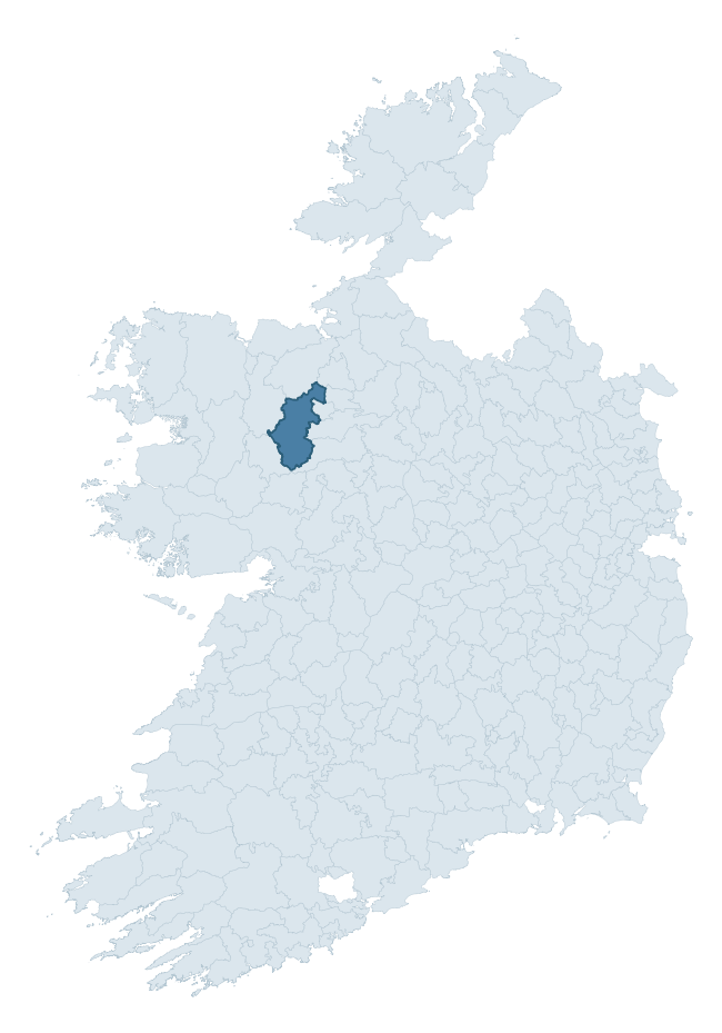
Where this barony sits in the Republic of Ireland
Geology and preservation
Bedrock geology shapes the landscape long before any settlement begins — controlling soil drainage, agricultural potential, the survival of upstanding monuments, and the preservation of buried archaeology. The figures below come from the Geological Survey Ireland 1:100,000 bedrock map.
The bedrock underlying Costello is predominantly black calcarenites and shales (33% of the barony by area), laid down during the Carboniferous period (87% by area, around 359 to 299 million years ago). A substantial secondary geology of limestone (18%) and sandstones and red green conglomerates (18%) adds further variety to the underlying landscape. The single largest mapped unit is the Ballymore Limestone Formation (33% of the barony's bedrock). With 11 distinct rock types mapped, the barony sits in the top third of ROI baronies for geological diversity (92nd percentile) — typically a sign of complex tectonic history or coastal mosaics of differing rock units.
Rock type composition
Largest mapped unit: Ballymore Limestone Formation (33% of the barony)
Placename evidence
Logainm records 62 heritage-diagnostic placenames for Costello, drawn from townland and civil-parish names across the barony. The dominant stratum is pre-Christian and Early Medieval defensive — ráth-, lios-, dún-, and caiseal-prefixed names that mark Iron Age and early historic settlement. The leading diagnostic roots are cill- (18 — church), lios- (14 — ringfort or enclosure), and ráth- (9 — earthen ringfort). This is well above the ROI average of 30.7 heritage placenames per barony — around 2.0× the typical figure. The presence of multiple heritage strata side by side indicates layered occupation of the landscape across successive prehistoric and historic periods. Logainm records 359 placenames for Costello (predominantly townland names). Of these, 62 (17%) carry one of the diagnostic Gaelic roots tracked above; the remainder draw on more generic landscape vocabulary that does not encode a heritage period.
Pre-Christian / Early Medieval Defensive
| Root | Count | Meaning |
|---|---|---|
| lios- | 14 | ringfort or enclosure |
| ráth- | 9 | earthen ringfort |
| caiseal- | 7 | stone ringfort |
Early Christian Ecclesiastical
| Root | Count | Meaning |
|---|---|---|
| cill- | 18 | church (early) |
| tobar- | 4 | holy well |
| cillín- | 4 | unconsecrated burial ground |
| teampall- | 1 | church (later medieval) |
Burial, Ritual, and Norse-Contact
| Root | Count | Meaning |
|---|---|---|
| carn- | 3 | cairn |
| tuaim- | 1 | burial mound |
| dumha- | 1 | mound |
Other baronies in Mayo
- Clanmorris
- Murrisk
- Tireragh
- Carra
- Kilmaine
- Gallen
- Tirawley
- Tirawley
- Carbury — Sligo
- Rosclogher — Leitrim
See all 280 baronies in the Republic of Ireland Heritage Tool.

Explore further
Grounding History: 10 Maps of Northern Ireland’s Past
If you’re interested in Irish heritage more widely, the companion report for Northern Ireland brings together the analysis of all 462 NI wards into one place through 10 high-quality maps — covering monument density, archaeological periods, placename heritage, terrain, wetland, and the historic landscape at first survey. Take a look.
About this profile
Click any section below to expand.
What is a barony?
A barony is a historic administrative unit in Ireland, broadly equivalent to an English hundred. The 280 baronies used here are from the OSi 2019 National Statutory Boundaries (generalised 20m), covering the 26 counties of the Republic of Ireland. Baronies derive from the Norman period, were formalised in the 17th century, and have not been redrawn for statistical purposes. They vary enormously in area, from compact urban baronies in Dublin to vast upland baronies in Connacht, and should not be compared by raw site count without accounting for area differences.
What counts as a site?
This profile combines three distinct heritage registers, each with its own definition of what constitutes a recordable site:
- Archaeological sites (NMS). The National Monuments Service Sites and Monuments Record (SMR) catalogues every known archaeological monument or site of archaeological interest in the Republic, from prehistoric burial mounds and ringforts to medieval churches and post-medieval defensive works. Inclusion does not require legal protection — only that the site has been identified, surveyed, and assessed as having archaeological value. A separate subset of these sites lies within a recorded protection zone, which gives them statutory protection under the National Monuments Acts.
- Listed buildings (NIAH). The National Inventory of Architectural Heritage records buildings of architectural, historical, archaeological, artistic, cultural, scientific, social, or technical interest. Each surveyed structure is appraised on a five-tier scale: International, National, Regional, Local, and Record-Only. The NIAH appraisal is informational rather than strictly statutory, but it underpins local-authority Record of Protected Structures (RPS) listings.
- Heritage placenames (Logainm). Logainm is the authoritative database of Irish placenames maintained by the Placenames Branch. This profile applies a heritage-diagnostic classifier to the Irish-language form of each townland name, flagging roots that signal defensive sites (ráth-, lios-, dún-, caiseal-, cathair-), ecclesiastical foundations (cill-, teampall-, domhnach-, mainistir-), prehistoric burial-ritual features (tuaim-, carn-, leaba-), or Norse-contact settlement (gall-). Townlands without one of these diagnostic roots are not flagged here — they may still carry historical significance, but that significance is not encoded in the name itself.
Editorial principles
The narrative sections of this profile follow several explicit principles:
- Evidential. Every claim about this barony’s heritage character is anchored in the underlying register data. Where a site count, a placename count, or a percentile rank is cited, it is computed from the source datasets at export time, not estimated.
- Comparative. Counts and metrics are reported alongside their percentile rank against the other 279 ROI baronies. A barony with 50 ringforts in absolute terms could be unusually high or unusually low depending on its size and regional context; percentile ranking removes that ambiguity.
- Transparent on limits. Where a register has known coverage gaps, survey biases, or data-quality issues that affect this barony’s figures, the profile flags them rather than presenting the numbers as definitive.
- No interpretation beyond what the data supports. The narrative does not speculate about historical events, social dynamics, or cultural meaning beyond what the recorded heritage and placename evidence directly attests.
Data caveats and limits
- NMS Sites and Monuments Record is the product of survey campaigns conducted at different intensities across different counties and decades. Some baronies have been surveyed more thoroughly than others, and absolute counts should be read in that light. Sites destroyed by development before survey are typically not represented; sites in heavily forested or upland terrain are sometimes under-recorded.
- NIAH coverage is broadly complete for the Republic of Ireland but the survey was conducted on a rolling county-by-county basis, and the most recent appraisal date varies. Buildings demolished or substantially altered after their original survey may still appear in the register; conversely, recent buildings of merit may not yet have been appraised.
- Logainm classification applies a deliberately conservative pattern-matching approach to the Irish-language townland forms. The classifier prioritises true positives over recall: a townland may carry a heritage signal that the classifier doesn’t recognise, particularly where the diagnostic root has been heavily anglicised or where the townland name draws on a less common term. The 60,000+ townland records and ~9,800 classified placenames give a substantial signal at barony scale, but individual townland names should be checked against Logainm directly for definitive interpretation.
- Period attribution. The chronological distribution reflects only those NMS sites that carry a recognised period attribution in the source data. Sites listed as “Unknown” period are excluded from the dated subset.
- Boundary changes. Some baronies have undergone minor boundary adjustments since their 19th-century definition; the OSi 2019 generalised boundaries used here are the current statutory definition and may differ slightly from historical maps in border areas.
- Bedrock geology is mapped at 1:100,000 scale, which means local variation within a barony — small pockets of different rock type, mineral veins, alluvium overlying bedrock — is generalised. The dominant-system and rocktype figures are area-weighted, so a barony reading “70% Carboniferous limestone” may still contain small but archaeologically important pockets of older or younger rock. Around 3% of GSI polygons do not match the lexicon and contribute no rocktype or system attribution.
Data sources
- National Monuments Service — Sites and Monuments Record (SMR) https://data.gov.ie/dataset/national-monuments-service-archaeological-survey-of-ireland
- National Inventory of Architectural Heritage (NIAH) https://data.gov.ie/dataset/national-inventory-of-architectural-heritage-niah-national-dataset
- Logainm — Placenames Database of Ireland https://www.logainm.ie/
- Ordnance Survey Ireland — National Statutory Barony Boundaries 2019 https://data-osi.opendata.arcgis.com/
- EURODEM — European Digital Elevation Model https://www.mapsforeurope.org/datasets/euro-dem
- ESA WorldCover https://esa-worldcover.org/en
- Geological Survey Ireland — 1:100,000 Bedrock Geology https://www.gsi.ie/en-ie/data-and-maps/Pages/Bedrock.aspx
Explore more: Search any of the 280 ROI baronies, browse by historical province, or read the methodology and data sources for the full Republic of Ireland Heritage Tool.