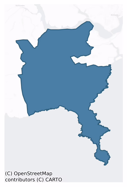
Courceys is a barony of County Cork, in the historical province of Munster (Irish: Cúrsaigh), covering 36.7 km² of land. The barony records 73 NMS archaeological sites and 20 NIAH listed buildings, placing it at around the 55th percentile among 280 ROI baronies for sites per km². This means it is in the upper half of all baronies for sites per km². Dated archaeological evidence runs from the Neolithic through to the Post Medieval, spanning 5 of 9 archaeological periods, placing the barony in the 6th percentile among 280 ROI baronies for chronological depth. This means it is in the bottom tenth of all baronies for chronological depth. The largest dated subset of recorded sites dates to the Iron Age.
Heritage at a glance
Percentile rankings throughout this profile compare each barony only against the other 279 Republic of Ireland baronies.
The recorded heritage of Courceys
The National Monuments Service Sites and Monuments Record (SMR) is the statutory inventory of archaeological sites for the Republic of Ireland, maintained by the Department of Tourism, Culture, Arts, Gaeltacht, Sport and Media. Sites recorded here include earthworks, ringforts, megalithic tombs, ecclesiastical remains, and post-medieval features; not every record is legally protected, but each is registered as a monument of archaeological interest.
The National Monuments Service records 73 archaeological sites in Courceys, putting it at the 55th percentile among 280 ROI baronies for sites per km². This means it is in the upper half of all baronies for sites per km². Protection coverage is near-universal — 68 sites (93%) fall within a recorded monument protection zone, indicating an extensively surveyed landscape. The dominant category is defensive sites — ringforts, enclosures, hillforts, and stone forts (38 sites, 52% of the record). Ringfort – rath is the most prevalent type, making up 29% of the barony's recorded sites (21 records) — well above the ROI average of 20% across all baronies where this type occurs. Ringfort – rath is an earthen ringfort enclosed by a bank and external ditch — the most common Early Medieval farmstead, broadly dated 500–1000 AD. Other significant types include Souterrain (8) and Enclosure (6). Souterrain is an underground stone-built passage and chamber, generally Early Medieval and often associated with ringforts as a defensive or storage feature; Enclosure is a banked or ditched feature of uncertain type, used as a catch-all where the original function cannot be determined from surface evidence. Across the barony's 36.7 km², this gives a recorded density of 1.99 sites per km².
Most common monument types
Hover or tap a monument type to see its definition.
| Type | Count |
|---|---|
| Ringfort – rath an earthen ringfort enclosed by a bank and external ditch — the most common Early Medieval farmstead, broadly dated 500–1000 AD | 21 |
| Souterrain an underground stone-built passage and chamber, generally Early Medieval and often associated with ringforts as a defensive or storage feature | 8 |
| Enclosure a banked or ditched feature of uncertain type, used as a catch-all where the original function cannot be determined from surface evidence | 6 |
| Hut site a low stone or earthen foundation enclosing a small circular or oval area, generally interpreted as a former dwelling, of any date from prehistory to the medieval period | 6 |
| Church a building used for public Christian worship, of any date from c. 500 AD onwards | 4 |
| Ritual site – holy well a well or spring traditionally associated with a saint, often credited with healing properties; many trace earlier ritual origins but devotion is documented from the medieval period onwards | 3 |
Chronological distribution
The dated archaeological record for Courceys spans from the Neolithic through to the Post Medieval, with activity attested across 5 of 9 archaeological periods. This is the 6th percentile across ROI baronies — a relatively narrow chronological band, with much of Irish prehistory not represented in the dated record. The record is periodic rather than continuous: the Early Bronze Age, and Middle Late Bronze Age periods fall inside the chronological span but record no dated sites — likely reflecting either genuine settlement discontinuity or limits of survey attribution. Activity concentrates most heavily in the Iron Age (28 sites, 57% of dated material), with the Early Medieval forming a secondary peak (18 sites, 37%). A further 24 recorded sites (33% of the overall NMS register for the barony) carry no period attribution — appearing as 'Unknown' in the bar chart below. This typically reflects either records that pre-date the standardised period vocabulary or sites awaiting specialist dating review, rather than a genuine absence of chronological evidence.
Sample of recorded monuments
Show 25 sample monuments (of 73 total)
A representative sample of 25 recorded monuments drawn from the barony’s 73 total NMS entries. Sites within a recorded monument protection zone and rarer site types are prioritised so the list shows a meaningful cross-section rather than only the most common type. Each entry shows the official Sites and Monuments Record reference number and the description published by the National Monuments Service.
Designed landscape – belvedere
The Archaeological Survey of Ireland (ASI) is in the process of providing information on all monuments on The Historic Environment Viewer (HEV). Currently the information for this record has not been uploaded. To…
The Archaeological Survey of Ireland (ASI) is in the process of providing information on all monuments on The Historic Environment Viewer (HEV). Currently the information for this record has not been uploaded. To access available information for research purposes please make an appointment in advance with the Archive Unit (open Fridays 10.00 am – 5.00 pm), Department of Culture, Heritage and the Gaeltacht, The Custom House, Dublin 1 D01W6XO or email nmarchive@chg.gov.ie.
Country house
Two early 18th century 2-storey wings with opposing identical elevations on elevated site. 'House planned for centre seems never to have been built' (Craig 1976, 90). Entrance fronts of 5 bays; 3-bay central pedimented…
Two early 18th century 2-storey wings with opposing identical elevations on elevated site. 'House planned for centre seems never to have been built' (Craig 1976, 90). Entrance fronts of 5 bays; 3-bay central pedimented breakfronts. Roughly coursed sandstone construction with cut limestone detail including quoin-pilasters framing elevations and breakfronts. S wing in repair with hipped roof. N wing in ruins; enlarged in late 18th century into residential quarters. Many demesne features survive including bricklined walled garden to S with 2-storey brick tower; orangery; remains of towers including a gazebo to S; serpentine lake to W and gatepiers with pineapple finials.
The above description is derived from the published 'Archaeological Inventory of County Cork. Volume 2: East and South Cork' (Dublin: Stationery Office, 1994). In certain instances the entries have been revised and updated in the light of recent research.
Date of upload/revision: 14 January 2009
Earthwork
In pasture, on a S-facing slope with views S over Courtmacsherry Bay. Indicated on the 1902 OS 6-inch map as a hachured arc (C c. 30m) S-N abutting the W side of a N-S field boundary. The stone-built field boundary is…
In pasture, on a S-facing slope with views S over Courtmacsherry Bay. Indicated on the 1902 OS 6-inch map as a hachured arc (C c. 30m) S-N abutting the W side of a N-S field boundary. The stone-built field boundary is obscured by briars and is of similar construction to other field boundaries in the area. There are no visible remains of the possible earthwork. There is a rath (CO124-055—-) c. 90m to the NNE and another rath (CO124-054—-) c. 200m to the NW. It is possible that the hachured arc on the OS 6-inch map indicated the remains of a third rath.
The above description is derived from 'The Archaeological Inventory of County Cork. Volume 5' (Dublin: Stationery Office, 2009).
Date of upload: 22 December 2009
Burial ground
In pasture, on E-facing slope. Marked 'Lispatrick Burial Ground' on 1842 OS 6-inch map. Rectangular area (34m E-W; 26m N-S) enclosed by low earthen bank (ext. H 0.4m) with shallow internal fosse (D 0.2m). Interior…
In pasture, on E-facing slope. Marked 'Lispatrick Burial Ground' on 1842 OS 6-inch map. Rectangular area (34m E-W; 26m N-S) enclosed by low earthen bank (ext. H 0.4m) with shallow internal fosse (D 0.2m). Interior divided in half by earthen bank (H 0.4m) running E-W; surface uneven in N half, with quartz stones exposed in NE corner.
The above description is derived from the published 'Archaeological Inventory of County Cork. Volume 2: East and South Cork' (Dublin: Stationery Office, 1994). In certain instances the entries have been revised and updated in the light of recent research.
Date of upload/revision: 14 January 2009
Signal tower
Situated towards the S end of a low hill to the N of the Old Head of Kinsale c. 250m N of the ‘narrow’ neck of the Old Head of Kinsale, and c. 1.9kms NNW\N of the tip of the Old Head Peninsula (OD c. 90m). Situated on…
Situated towards the S end of a low hill to the N of the Old Head of Kinsale c. 250m N of the ‘narrow’ neck of the Old Head of Kinsale, and c. 1.9kms NNW\N of the tip of the Old Head Peninsula (OD c. 90m). Situated on an area of level ground with steep slopes to the E, S and W. Located c. 134m W of the coastline of Heleopen Bay and c. 275m E of the coastline at Hopeopen Bay West. The surrounding landscape to N consists of large arable fields, defined by liner field boundaries, with short areas of rough unenclosed pastureland located between this site and the coastline to the SW and E\SE. The area around the signal station\tower site has been landscaped as part of the renovation of the site to create a visitor attraction. The adjacent stations in the signal station\tower chain are found at Ballymacedmond, Seven Heads (CO145-008—-), which is located c. 13.1kms to the WSW, where the signal station\tower survives in relatively good condition, and at Barry’s Head (SMR CO113-032—-), which was located c. 13.7kms to the NE, now demolished. This signal station\tower site at the Old Head of Kinsale is situated c. 240m N of a tower house (CO137-009001-), with associated defensive features, located at the ‘neck’ of the peninsula, and c. 1.85kms NNW\N of the lighthouse (NIAH Reg. No. 20913710) located close to the of the peninsula.
An early-nineteenth-century (c. 1804-5) two-storey over partial raised basement square-plan signal station\tower (ext. dims. c. 5.8m NW-SE x c. 5.8…
Castle – tower house
Across narrow neck (Wth c. 120m) of Old Head of Kinsale; two lines of defence, c. 70m apart (see plan Westropp 1914, plate xi). Outer line (to N facing inland) consists of rock-cut fosse (D 2.5m-6m; Wth 6m) with…
Across narrow neck (Wth c. 120m) of Old Head of Kinsale; two lines of defence, c. 70m apart (see plan Westropp 1914, plate xi). Outer line (to N facing inland) consists of rock-cut fosse (D 2.5m-6m; Wth 6m) with curtainwall/revetment along inside (S) edge, incorporating central tower house and mural tower half-way along either side. Inner or rear defences face S; consist of rock-cut fosse (D c. 4m; Wth 8m) with slight bank on inside (N) edge (max. H 1m). Outer defences face rising ground with signal tower (CO137-008—-) at summit. Both defences pierced by modern roadway, leading to lighthouse; recent gateway (Wth 10.35m) cuts through curtain wall immediately W of tower house. Curtain wall probably originally stood proud of ground but for most part now reduced to revetment along inner edge of fosse; both sections, to E and W of tower, show evidence of rebuilding and repair. Two mural towers project c. 1.2m beyond line of curtain. Tower to W (Wth 3.7m; ext. H c. 5m) barely rises above ground level on inside, where defined by low sod-covered platform (6.5m N-S; 4m E-W). Tower to E (Wth 5.15m; ext. H c. 5m; int. H c. 2.5m) defined by N wall, with short returns of E and W walls; lintelled window ope with round-headed light on N wall, just above present internal ground level. Immediately inside line of curtain wall, 3m from E wall of tower house, rectangular sunken area (14.8m E-W; 6m N-S) defined by stone facing (max. H 1.5m); rectangular set-back at N end of W side (1.9m N-S;…
Megalithic structure
On a coastal promontory, on a fairway on the Old Head of Kinsale Golf Course. According to local information there were once stones here called 'Leaba Diarmuid' which translates as Diarmuid's bed. A number of stones,…
On a coastal promontory, on a fairway on the Old Head of Kinsale Golf Course. According to local information there were once stones here called 'Leaba Diarmuid' which translates as Diarmuid's bed. A number of stones, which appear to be leaning and prostrate, are shown on an aerial photograph (Dr D.D.C. Pochin Mould, 16.03.1981), and may have been part of a megalithic structure. There is no visible trace of this possible structure at ground level.
The above description is derived from 'The Archaeological Inventory of County Cork. Volume 5' (Dublin: Stationery Office, 2009).
Date of upload: 22 December 2009
This monument is subject to a preservation order made under the National Monuments Acts 1930 to 2014 (PO no. 9/1978).
Bawn
Across narrow neck (Wth c. 120m) of Old Head of Kinsale; two lines of defence, c. 70m apart (see plan Westropp 1914, plate xi). Outer line (to N facing inland) consists of rock-cut fosse (D 2.5m-6m; Wth 6m) with…
Across narrow neck (Wth c. 120m) of Old Head of Kinsale; two lines of defence, c. 70m apart (see plan Westropp 1914, plate xi). Outer line (to N facing inland) consists of rock-cut fosse (D 2.5m-6m; Wth 6m) with curtainwall/revetment along inside (S) edge, incorporating central tower house and mural tower half-way along either side. Inner or rear defences face S; consist of rock-cut fosse (D c. 4m; Wth 8m) with slight bank on inside (N) edge (max. H 1m). Outer defences face rising ground with signal tower (CO137-008—-) at summit. Both defences pierced by modern roadway, leading to lighthouse; recent gateway (Wth 10.35m) cuts through curtain wall immediately W of tower house. Curtain wall probably originally stood proud of ground but for most part now reduced to revetment along inner edge of fosse; both sections, to E and W of tower, show evidence of rebuilding and repair. Two mural towers project c. 1.2m beyond line of curtain. Tower to W (Wth 3.7m; ext. H c. 5m) barely rises above ground level on inside, where defined by low sod-covered platform (6.5m N-S; 4m E-W). Tower to E (Wth 5.15m; ext. H c. 5m; int. H c. 2.5m) defined by N wall, with short returns of E and W walls; lintelled window ope with round-headed light on N wall, just above present internal ground level. Immediately inside line of curtain wall, 3m from E wall of tower house, rectangular sunken area (14.8m E-W; 6m N-S) defined by stone facing (max. H 1.5m); rectangular set-back at N end of W side (1.9m N-S;…
Graveyard
On E side of avenue into Rectory; subrectangular graveyard (c. 55m N-S; c. 35m E-W); enclosed by stone wall. Still in use but parts overgrown, earliest noted headstone dated to 1832. Stump of wall (L c. 2m; H 1.9m)…
On E side of avenue into Rectory; subrectangular graveyard (c. 55m N-S; c. 35m E-W); enclosed by stone wall. Still in use but parts overgrown, earliest noted headstone dated to 1832. Stump of wall (L c. 2m; H 1.9m) running E-W, just S of centre in yard, may be remains of ancient parish church (CO124-035003-) of Templetrine which is shown as rectangular structure on 1842 OS 6-inch map; it was in repair in 1639 but in need of repairs by 1680s (Brady 1863, vol. 1, 346). At N end of graveyard C of I church (CO124-035002-) built in 1821 (ibid., 348); small rectangular church with tall three-storey crenellated tower against W gable; semicircular apse on E wall, and vestry at NE corner, are additions post 1842. Door in S wall of tower; two windows each in N and S walls with pointer arches and hood mouldings, apse lit by three small lancets; unusual hour-glass-like first storey openings in tower. Church still in use.
The above description is derived from the published 'Archaeological Inventory of County Cork. Volume 2: East and South Cork' (Dublin: Stationery Office, 1994). In certain instances the entries have been revised and updated in the light of recent research.
Date of upload/revision: 14 January 2009
Graveyard
On top of a cliff, overlooking outer reaches of Kinsale harbour to E. Wedge-shaped area (c. 70m E-W; Wth c. 25m at W end, c. 40m at E end), enclosed to N, S and W by iron railing, cliff-edge to E. Numerous low…
On top of a cliff, overlooking outer reaches of Kinsale harbour to E. Wedge-shaped area (c. 70m E-W; Wth c. 25m at W end, c. 40m at E end), enclosed to N, S and W by iron railing, cliff-edge to E. Numerous low uninscribed gravemarkers; 'only half-a-dozen inscriptions here' (Coleman 1917-20b), the earliest dated 1789. In occasional use. Ruins of church (CO125-021002-) near E end.
The above description is derived from the published 'Archaeological Inventory of County Cork. Volume 2: East and South Cork' (Dublin: Stationery Office, 1994). In certain instances the entries have been revised and updated in the light of recent research.
Date of upload/revision: 14 January 2009
Burial
Burial partially washed away by storm, exposed January 1990, on edge of cliff at Lispatrick Point. Three skeletons, one on top of another, lying 0.3-0.4m below ground level. (pers. comm. Rose Cleary)
The above…
Burial partially washed away by storm, exposed January 1990, on edge of cliff at Lispatrick Point. Three skeletons, one on top of another, lying 0.3-0.4m below ground level. (pers. comm. Rose Cleary)
The above description is derived from the published 'Archaeological Inventory of County Cork. Volume 2: East and South Cork' (Dublin: Stationery Office, 1994). In certain instances the entries have been revised and updated in the light of recent research.
Date of upload/revision: 14 January 2009
Lighthouse
Remains of two early lighthouses (see also CO137A001003-), on high ground on E side of Old Head of Kinsale (CO137-007—). Roadway to current lighthouse runs between two ruins; to W earlier 'brazier lighthouse'; to E…
Remains of two early lighthouses (see also CO137A001003-), on high ground on E side of Old Head of Kinsale (CO137-007—). Roadway to current lighthouse runs between two ruins; to W earlier 'brazier lighthouse'; to E circular lighthouse (CO137A001003-) which replaced former in 1805 (Beaver 1971, 86-8). Earlier structure consists of 1-storey rectangular (6.1m E-W; 16.7m N-S) building covered by rounded brick vault (axis N-S). Divided into three rooms (see drawings Beaver ibid) with internal stairway to roof, now badly ruined, where 'openfire' was maintained. Fire replaced by candle light 1703 to 1714 but openfire reverted to until 1804. After abandonment, central room converted to smithy. In 1805 circular lighthouse built as replacement by Thomas Rogers(ibid). Central circular well (int. diam. 3.2m) housed spiral granite stairs; outer circular wall (int. diam. 14.6m) enclosed domestic buidings;both walls only stand to c. 2m. To N, ruins of associated buildings. Replaced by present lighthouse on head of promontory in 1853.
The above description is derived from the published 'Archaeological Inventory of County Cork. Volume 2: East and South Cork' (Dublin: Stationery Office, 1994). In certain instances the entries have been revised and updated in the light of recent research.
Date of upload/revision: 14 January 2009
This monument is subject to a preservation order made under the National Monuments Acts 1930 to 2014 (PO no. 9/1978).
Lighthouse
This lighthouse is referred to in the 'Archaeological Inventory of County Cork – vol. 2 East and South Cork' (1994, 295) under the entry (no. 5887) for another nearby lighthouse (CO137A001002-). (S. Ronan…
This lighthouse is referred to in the 'Archaeological Inventory of County Cork – vol. 2 East and South Cork' (1994, 295) under the entry (no. 5887) for another nearby lighthouse (CO137A001002-). (S. Ronan 21/11/2007)
The above description is derived from the published 'Archaeological Inventory of County Cork. Volume 2: East and South Cork' (Dublin: Stationery Office, 1994). In certain instances the entries have been revised and updated in the light of recent research.
Date of upload/revision: 14 January 2009
This monument is subject to a preservation order made under the National Monuments Acts 1930 to 2014 (PO no. 9/1978).
Burial
The Archaeological Survey of Ireland (ASI) is in the process of providing information on all monuments on The Historic Environment Viewer (HEV). Currently the information for this record has not been uploaded. To…
The Archaeological Survey of Ireland (ASI) is in the process of providing information on all monuments on The Historic Environment Viewer (HEV). Currently the information for this record has not been uploaded. To access available information for research purposes please make an appointment in advance with the Archive Unit (open Fridays 10.00 am – 5.00 pm), Department of Culture, Heritage and the Gaeltacht, The Custom House, Dublin 1 D01W6XO or email nmarchive@chg.gov.ie.
Ritual site – holy well
In woodland; gate at roadside with path to well. Oval, stone-lined well (0.75m x 0.6m; D 0.75m) covered by stone lintel on S side; loose stones form edge. Plaque set in concrete behind well to S. According to plaque…
In woodland; gate at roadside with path to well. Oval, stone-lined well (0.75m x 0.6m; D 0.75m) covered by stone lintel on S side; loose stones form edge. Plaque set in concrete behind well to S. According to plaque called 'Tober Rí an Domnaig' and visited in 'olden days to cure sore eyes'. According to Holland (1908, 37-8) 'local tradition tells that the well was formerly located 60 yards west of its present site, but that one of the lords of the manor gave orders to his stewart to have the well closed…very soon the water sprang up again in its present site and the people continued to "pay their rounds" at it as before'.
The above description is derived from the published 'Archaeological Inventory of County Cork. Volume 2: East and South Cork' (Dublin: Stationery Office, 1994). In certain instances the entries have been revised and updated in the light of recent research.
Date of upload/revision: 14 January 2009
Images provided by and copyright of Amanda Clarke 2016-2022 https://holywellscorkandkerry.com/
Ritual site – holy well
Under an ivy-covered bank on the SW side of the path leading down to a graveyard (CO125-021001-) and a church (CO125-021002-). A roughly rectangular, rock-cut depression (1.2m NE-SW; 0.8m NW-SE; D 0.2m) is lined with…
Under an ivy-covered bank on the SW side of the path leading down to a graveyard (CO125-021001-) and a church (CO125-021002-). A roughly rectangular, rock-cut depression (1.2m NE-SW; 0.8m NW-SE; D 0.2m) is lined with concrete and its SW half is covered with flag stones. Quartz stones and pebbles lie on the debris-covered bottom, which is largely dry. According to Seán MacCarthaigh (I.T.A. Survey 1942), 'near Courtaparteen church (ruin) (CO125-02102-), a short distance south of Sandycove, in Desmond's lane is Tobar Ruuadáin (i.e. St. Ruadháin or Rohan's Well) into which pilgrims throw a little white stone and bathe their sore eyes. There are no special pattern days now'.
The above description is derived from the published 'Archaeological Inventory of County Cork. Volume 2: East and South Cork' (Dublin: Stationery Office, 1994). In certain instances the entries have been revised and updated in the light of recent research.
Date of upload/revision: 14 January 2009
Images provided by and copyright of Amanda Clarke 2016-2022 https://holywellscorkandkerry.com/
Ritual site – holy well
At the base of an ivy-covered roadside rocky field boundary on the SW side of the road leading to Courtaparteen church (CO125-021002-) and graveyard (CO125-021001-). Water emerges from fissured rock at the back of a…
At the base of an ivy-covered roadside rocky field boundary on the SW side of the road leading to Courtaparteen church (CO125-021002-) and graveyard (CO125-021001-). Water emerges from fissured rock at the back of a roughly concave depression (Wth 0.8m; H 0.85m; D 0.6m) in the rock face and forms a well which overflows on to the side of the road. Religious objects and coins are displayed on the rock surface at the back of the well. According to local information, water from the holy well is said to cure warts and sore eyes. Another holy well (CO125-028—-) is c. 50m to the E.
The above description is derived from 'The Archaeological Inventory of County Cork. Volume 5' (Dublin: Stationery Office, 2009).
Date of upload: 22 December 2009
Images provided by and copyright of Amanda Clarke 2016-2022 https://holywellscorkandkerry.com/
Mass-rock
The Archaeological Survey of Ireland (ASI) is in the process of providing information on all monuments on The Historic Environment Viewer (HEV). Currently the information for this record has not been uploaded. To…
The Archaeological Survey of Ireland (ASI) is in the process of providing information on all monuments on The Historic Environment Viewer (HEV). Currently the information for this record has not been uploaded. To access available information for research purposes please make an appointment in advance with the Archive Unit (open Fridays 10.00 am – 5.00 pm), Department of Culture, Heritage and the Gaeltacht, The Custom House, Dublin 1 D01W6XO or email nmarchive@chg.gov.ie.
Church
At N end of graveyard (CO124-035001-) C of I church built in 1821 (Brady 1863, vol. 1, 348); small rectangular church with tall three-storey crenellated tower against W gable; semi-circular apse on E wall, and vestry at…
At N end of graveyard (CO124-035001-) C of I church built in 1821 (Brady 1863, vol. 1, 348); small rectangular church with tall three-storey crenellated tower against W gable; semi-circular apse on E wall, and vestry at NE corner, are additions post 1842. Door in S wall of tower; two windows each in N and S walls with pointer arches and hood mouldings, apse lit by three small lancets; unusual hour-glass-like first storey openings in tower. Church still in use.
The above description is derived from the published 'Archaeological Inventory of County Cork. Volume 1: West Cork' (Dublin: Stationery Office, 1992). In certain instances the entries have been revised and updated in the light of recent research.
Date of upload/revision: 14 January 2009
Church
In graveyard (CO124-035001-). Stump of wall (L c. 2m; H 1.9m) running E-W, just S of centre in yard, may be remains of ancient parish church of Templetrine which is shown as rectangular structure on 1842 OS 6-inch map;…
In graveyard (CO124-035001-). Stump of wall (L c. 2m; H 1.9m) running E-W, just S of centre in yard, may be remains of ancient parish church of Templetrine which is shown as rectangular structure on 1842 OS 6-inch map; it was in repair in 1639 but in need of repairs by 1680s (Brady 1863, vol. 1, 346).
The above description is derived from the published 'Archaeological Inventory of County Cork. Volume 1: West Cork' (Dublin: Stationery Office, 1992). In certain instances the entries have been revised and updated in the light of recent research.
Date of upload/revision: 14 January 2009
Church
In pasture, on level ground. According to local information, tradition of site of church; field known as "keel field". (CMSS)
The above description is derived from the published 'Archaeological Inventory of County…
In pasture, on level ground. According to local information, tradition of site of church; field known as "keel field". (CMSS)
The above description is derived from the published 'Archaeological Inventory of County Cork. Volume 2: East and South Cork' (Dublin: Stationery Office, 1994). In certain instances the entries have been revised and updated in the light of recent research.
Date of upload/revision: 14 January 2009
Church
Near E end of graveyard (CO125-021001-), ruins of small rectangular church (10.5m E-W; 7.17m N-S). Steep-pitched E gable has central splayed, round-headed embrasure with narrow round-headed light; flanked by small…
Near E end of graveyard (CO125-021001-), ruins of small rectangular church (10.5m E-W; 7.17m N-S). Steep-pitched E gable has central splayed, round-headed embrasure with narrow round-headed light; flanked by small wall-presses. West gable has central door ope. Large gaps W of centre in N and S walls. Near E end of S wall, window with narrow lintelled light inserted in larger splayed window embrasure, the W in going of which is visible. Surviving remains difficult to precisely date but probably medieval in date. Parish church of Kilrone or Kilroan, in ruins since at least 1693 (Brunicardi 1913, 52-3).
The above description is derived from the published 'Archaeological Inventory of County Cork. Volume 2: East and South Cork' (Dublin: Stationery Office, 1994). In certain instances the entries have been revised and updated in the light of recent research.
Date of upload/revision: 14 January 2009
Images provided by and copyright of Amanda Clarke 2016-2022 https://holywellscorkandkerry.com/
Ringfort – rath
In tillage. Shown on 1842 OS 6-inch map as circular enclosure (diam. c. 35m); as E->W arc of hachures on 1902 OS 6-inch map. Levelled; no visible surface trace. Field fence curves to respect enclosure. Possible…
In tillage. Shown on 1842 OS 6-inch map as circular enclosure (diam. c. 35m); as E->W arc of hachures on 1902 OS 6-inch map. Levelled; no visible surface trace. Field fence curves to respect enclosure. Possible souterrain (CO124-009002-) in interior.
The above description is derived from the published 'Archaeological Inventory of County Cork. Volume 2: East and South Cork' (Dublin: Stationery Office, 1994). In certain instances the entries have been revised and updated in the light of recent research.
Date of upload/revision: 14 January 2009
Listed buildings
The National Inventory of Architectural Heritage (NIAH) is a state survey appraising buildings of architectural, historical, archaeological, artistic, cultural, scientific, social, or technical interest. Each surveyed structure receives a rating from International (the highest, for buildings of European importance) through National, Regional, Local, and Record-Only.
The NIAH records only 20 listed buildings in Courceys, the 6th percentile across ROI baronies — a relatively thin architectural record. All recorded buildings carry Regional or lower grading; the barony does not contain any structures appraised as being of National or International architectural importance. Construction dates concentrate most heavily in the Victorian (1830-1900) period. The most-recorded building type is house (5 examples, 25% of the listed stock).
Terrain and environment
Mean elevation across the barony is 60m — the 23rd percentile among 280 ROI baronies for elevation. This means it is in the bottom third of all baronies for elevation. This is a relatively low-lying landscape by ROI standards. Elevation matters for heritage because higher-altitude baronies typically favour defensive monuments — ringforts and hilltop forts placed on prominent ground — while lowland baronies are more likely to carry the dense settlement and church networks of intensive agricultural landscapes. Mean slope is 6.1° — the 85th percentile among 280 ROI baronies for slope. This means it is in the top fifth of all baronies for slope. This is consistently steep terrain by ROI standards, the kind of landscape that tends to preserve upstanding archaeological features well. Slope is a key control on both land use and archaeological preservation: steep ground resists ploughing and tends to preserve earthworks intact, while gentle slopes favour intensive cultivation that damages or destroys surface archaeology over time. Localised maximum slopes reach 17°, typical of stream-cut valleys, escarpments, or coastal bluffs within the wider landscape. The Topographic Wetness Index averages 9.8, the 15th percentile among 280 ROI baronies for wetness. This means it is in the bottom fifth of all baronies for wetness. This is well-drained ground by ROI standards — typical of upland or steeply-sloping country that sheds water rapidly. Drainage matters for heritage because poorly-drained ground preserves organic archaeology (wooden trackways, leather, textiles, and on rare occasions human remains) far better than free-draining soil; well-drained ground favours arable use but destroys organic material rapidly. The land-cover mosaic combines improved grassland (66%), arable farmland (17%), and woodland (13%), giving a mixed agricultural and semi-natural landscape. In overall character, this is steeply-sloping terrain at modest elevation, with land use dominated by improved grassland.
Terrain measurements
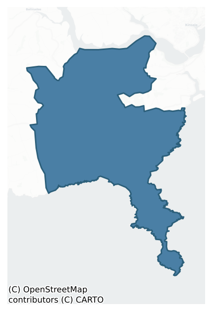
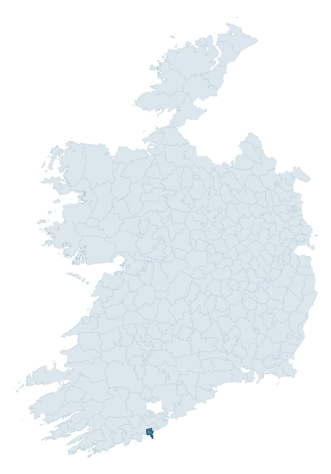
Where this barony sits in the Republic of Ireland
Geology and preservation
Bedrock geology shapes the landscape long before any settlement begins — controlling soil drainage, agricultural potential, the survival of upstanding monuments, and the preservation of buried archaeology. The figures below come from the Geological Survey Ireland 1:100,000 bedrock map.
The bedrock underlying Courceys is predominantly mudstone (58% of the barony by area), laid down during the Carboniferous period (84% by area, around 359 to 299 million years ago). Mudstone breaks down into heavy, often poorly-drained clay soils that historically limited intensive arable use. The lower density of ploughing tends to preserve subsurface archaeology better than in sandstone or limestone terrain, though waterlogging can be a factor for site survival. A substantial secondary geology of sandstone (42%) adds further variety to the underlying landscape. The single largest mapped unit is the Pig's Cove Member (Kinsale Formation) (27% of the barony's bedrock). With only 2 distinct rock types mapped, the barony is geologically uniform compared to the rest of the Republic (13th percentile for diversity) — a single coherent bedrock landscape.
Rock type composition
Largest mapped unit: Pig's Cove Member (Kinsale Formation) (27% of the barony)
Placename evidence
Logainm records 14 heritage-diagnostic placenames for Courceys, a modest sample drawn predominantly from the townland record. The dominant stratum is early christian ecclesiastical. The most frequent diagnostic roots are cill- (6) and dún- (3). With a sample of this size the count should be treated as indicative rather than definitive.
Pre-Christian / Early Medieval Defensive
| Root | Count | Meaning |
|---|---|---|
| dún- | 3 | hilltop or promontory fort |
| lios- | 2 | ringfort or enclosure |
| ráth- | 1 | earthen ringfort |
Early Christian Ecclesiastical
| Root | Count | Meaning |
|---|---|---|
| cill- | 6 | church (early) |
| teampall- | 1 | church (later medieval) |
Burial, Ritual, and Norse-Contact
| Root | Count | Meaning |
|---|---|---|
| dumha- | 1 | mound |
Other baronies in Cork
- Bear
- Kinsale
- Barretts
- Cork
- Kerrycurrihy
- Kinalmeaky
- Duhallow
- Kenry — Limerick
- Inchiquin — Clare
- Ikerrin — Tipperary
See all 280 baronies in the Republic of Ireland Heritage Tool.

Explore further
Grounding History: 10 Maps of Northern Ireland’s Past
If you’re interested in Irish heritage more widely, the companion report for Northern Ireland brings together the analysis of all 462 NI wards into one place through 10 high-quality maps — covering monument density, archaeological periods, placename heritage, terrain, wetland, and the historic landscape at first survey. Take a look.
About this profile
Click any section below to expand.
What is a barony?
A barony is a historic administrative unit in Ireland, broadly equivalent to an English hundred. The 280 baronies used here are from the OSi 2019 National Statutory Boundaries (generalised 20m), covering the 26 counties of the Republic of Ireland. Baronies derive from the Norman period, were formalised in the 17th century, and have not been redrawn for statistical purposes. They vary enormously in area, from compact urban baronies in Dublin to vast upland baronies in Connacht, and should not be compared by raw site count without accounting for area differences.
What counts as a site?
This profile combines three distinct heritage registers, each with its own definition of what constitutes a recordable site:
- Archaeological sites (NMS). The National Monuments Service Sites and Monuments Record (SMR) catalogues every known archaeological monument or site of archaeological interest in the Republic, from prehistoric burial mounds and ringforts to medieval churches and post-medieval defensive works. Inclusion does not require legal protection — only that the site has been identified, surveyed, and assessed as having archaeological value. A separate subset of these sites lies within a recorded protection zone, which gives them statutory protection under the National Monuments Acts.
- Listed buildings (NIAH). The National Inventory of Architectural Heritage records buildings of architectural, historical, archaeological, artistic, cultural, scientific, social, or technical interest. Each surveyed structure is appraised on a five-tier scale: International, National, Regional, Local, and Record-Only. The NIAH appraisal is informational rather than strictly statutory, but it underpins local-authority Record of Protected Structures (RPS) listings.
- Heritage placenames (Logainm). Logainm is the authoritative database of Irish placenames maintained by the Placenames Branch. This profile applies a heritage-diagnostic classifier to the Irish-language form of each townland name, flagging roots that signal defensive sites (ráth-, lios-, dún-, caiseal-, cathair-), ecclesiastical foundations (cill-, teampall-, domhnach-, mainistir-), prehistoric burial-ritual features (tuaim-, carn-, leaba-), or Norse-contact settlement (gall-). Townlands without one of these diagnostic roots are not flagged here — they may still carry historical significance, but that significance is not encoded in the name itself.
Editorial principles
The narrative sections of this profile follow several explicit principles:
- Evidential. Every claim about this barony’s heritage character is anchored in the underlying register data. Where a site count, a placename count, or a percentile rank is cited, it is computed from the source datasets at export time, not estimated.
- Comparative. Counts and metrics are reported alongside their percentile rank against the other 279 ROI baronies. A barony with 50 ringforts in absolute terms could be unusually high or unusually low depending on its size and regional context; percentile ranking removes that ambiguity.
- Transparent on limits. Where a register has known coverage gaps, survey biases, or data-quality issues that affect this barony’s figures, the profile flags them rather than presenting the numbers as definitive.
- No interpretation beyond what the data supports. The narrative does not speculate about historical events, social dynamics, or cultural meaning beyond what the recorded heritage and placename evidence directly attests.
Data caveats and limits
- NMS Sites and Monuments Record is the product of survey campaigns conducted at different intensities across different counties and decades. Some baronies have been surveyed more thoroughly than others, and absolute counts should be read in that light. Sites destroyed by development before survey are typically not represented; sites in heavily forested or upland terrain are sometimes under-recorded.
- NIAH coverage is broadly complete for the Republic of Ireland but the survey was conducted on a rolling county-by-county basis, and the most recent appraisal date varies. Buildings demolished or substantially altered after their original survey may still appear in the register; conversely, recent buildings of merit may not yet have been appraised.
- Logainm classification applies a deliberately conservative pattern-matching approach to the Irish-language townland forms. The classifier prioritises true positives over recall: a townland may carry a heritage signal that the classifier doesn’t recognise, particularly where the diagnostic root has been heavily anglicised or where the townland name draws on a less common term. The 60,000+ townland records and ~9,800 classified placenames give a substantial signal at barony scale, but individual townland names should be checked against Logainm directly for definitive interpretation.
- Period attribution. The chronological distribution reflects only those NMS sites that carry a recognised period attribution in the source data. Sites listed as “Unknown” period are excluded from the dated subset.
- Boundary changes. Some baronies have undergone minor boundary adjustments since their 19th-century definition; the OSi 2019 generalised boundaries used here are the current statutory definition and may differ slightly from historical maps in border areas.
- Bedrock geology is mapped at 1:100,000 scale, which means local variation within a barony — small pockets of different rock type, mineral veins, alluvium overlying bedrock — is generalised. The dominant-system and rocktype figures are area-weighted, so a barony reading “70% Carboniferous limestone” may still contain small but archaeologically important pockets of older or younger rock. Around 3% of GSI polygons do not match the lexicon and contribute no rocktype or system attribution.
Data sources
- National Monuments Service — Sites and Monuments Record (SMR) https://data.gov.ie/dataset/national-monuments-service-archaeological-survey-of-ireland
- National Inventory of Architectural Heritage (NIAH) https://data.gov.ie/dataset/national-inventory-of-architectural-heritage-niah-national-dataset
- Logainm — Placenames Database of Ireland https://www.logainm.ie/
- Ordnance Survey Ireland — National Statutory Barony Boundaries 2019 https://data-osi.opendata.arcgis.com/
- EURODEM — European Digital Elevation Model https://www.mapsforeurope.org/datasets/euro-dem
- ESA WorldCover https://esa-worldcover.org/en
- Geological Survey Ireland — 1:100,000 Bedrock Geology https://www.gsi.ie/en-ie/data-and-maps/Pages/Bedrock.aspx
Explore more: Search any of the 280 ROI baronies, browse by historical province, or read the methodology and data sources for the full Republic of Ireland Heritage Tool.