
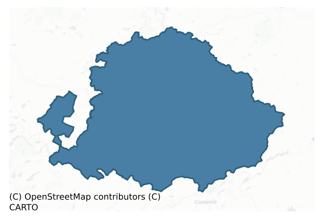
Dartree is a barony of County Monaghan, in the historical province of Ulster (Irish: Dartraí), covering 241 km² of land. The barony records 309 NMS archaeological sites and 270 NIAH listed buildings, placing it at around the 22nd percentile among 280 ROI baronies for sites per km². This means it is in the bottom third of all baronies for sites per km². Dated archaeological evidence runs from the Neolithic through to the Post Medieval, spanning 7 of 9 archaeological periods, placing the barony in the 37th percentile among 280 ROI baronies for chronological depth. This means it is in the lower half of all baronies for chronological depth. The largest dated subset of recorded sites dates to the Early Medieval. Logainm flags 83 placenames in the barony as carrying a recognised heritage root; the largest share — around 52% — are names associated with pre-christian defensive.
Heritage at a glance
Percentile rankings throughout this profile compare each barony only against the other 279 Republic of Ireland baronies.
The recorded heritage of Dartree
The National Monuments Service Sites and Monuments Record (SMR) is the statutory inventory of archaeological sites for the Republic of Ireland, maintained by the Department of Tourism, Culture, Arts, Gaeltacht, Sport and Media. Sites recorded here include earthworks, ringforts, megalithic tombs, ecclesiastical remains, and post-medieval features; not every record is legally protected, but each is registered as a monument of archaeological interest.
The National Monuments Service records 309 archaeological sites in Dartree, putting it at the 22nd percentile among 280 ROI baronies for sites per km². This means it is in the bottom third of all baronies for sites per km². Protection coverage is near-universal — 302 sites (98%) fall within a recorded monument protection zone, indicating an extensively surveyed landscape. The dominant category is defensive sites — ringforts, enclosures, hillforts, and stone forts (222 sites, 72% of the record). Ringfort – rath is the most prevalent type, making up 55% of the barony's recorded sites (169 records) — well above the ROI average of 20% across all baronies where this type occurs. Ringfort – rath is an earthen ringfort enclosed by a bank and external ditch — the most common Early Medieval farmstead, broadly dated 500–1000 AD. Other significant types include Crannog (28) and Enclosure (9). Crannog is an artificial or partly artificial island built up on a lake or river bed, in use from the 6th to 17th centuries AD; Enclosure is a banked or ditched feature of uncertain type, used as a catch-all where the original function cannot be determined from surface evidence. Across the barony's 241 km², this gives a recorded density of 1.28 sites per km².
Most common monument types
Hover or tap a monument type to see its definition.
| Type | Count |
|---|---|
| Ringfort – rath an earthen ringfort enclosed by a bank and external ditch — the most common Early Medieval farmstead, broadly dated 500–1000 AD | 169 |
| Crannog an artificial or partly artificial island built up on a lake or river bed, in use from the 6th to 17th centuries AD | 28 |
| Enclosure a banked or ditched feature of uncertain type, used as a catch-all where the original function cannot be determined from surface evidence | 9 |
| Church a building used for public Christian worship, of any date from c. 500 AD onwards | 8 |
| Graveyard a burial area associated with a church, in use from the medieval period onwards | 8 |
| Standing stone a deliberately set upright stone, used variously as a Bronze/Iron Age burial marker, route marker or commemorative monument | 8 |
| Cairn – unclassified a stone mound that cannot be assigned to a specific cairn type | 6 |
Chronological distribution
The dated archaeological record for Dartree spans from the Neolithic through to the Post Medieval, with activity attested across 7 of 9 archaeological periods. Every period from earliest to latest is represented in the record — an unbroken sequence of dated activity across the full chronological span. Activity concentrates most heavily in the Early Medieval (183 sites, 65% of dated material), with the Iron Age forming a secondary peak (52 sites, 18%). A further 26 recorded sites (8% of the overall NMS register for the barony) carry no period attribution — appearing as 'Unknown' in the bar chart below. This typically reflects either records that pre-date the standardised period vocabulary or sites awaiting specialist dating review, rather than a genuine absence of chronological evidence.
Sample of recorded monuments
Show 25 sample monuments (of 309 total)
A representative sample of 25 recorded monuments drawn from the barony’s 309 total NMS entries. Sites within a recorded monument protection zone and rarer site types are prioritised so the list shows a meaningful cross-section rather than only the most common type. Each entry shows the official Sites and Monuments Record reference number and the description published by the National Monuments Service.
Castle – motte and bailey
The motte at Clones is at the highest point of a NNE-SSW drumlin ridge. The barony of Dartree, together with the baronies of Cremorne and Farney were part of the grant of Ardee made to Peter Pippard c. 1190…
The motte at Clones is at the highest point of a NNE-SSW drumlin ridge. The barony of Dartree, together with the baronies of Cremorne and Farney were part of the grant of Ardee made to Peter Pippard c. 1190 (Otway-Ruthven 1968, 70). In 1211 the castle of Clones was erected by the ‘English and the English bishop, and they made a predatory incursion into Tyrone; but Hugh O’Neill overtook them, and routed and slaughtered them, and slew amongst others, Myler, the son of Robert’ (AFM). Robert Pipard built the castle with the active support of John de Grey, the bishop of Norwich and Justiciar of Ireland (1208-13) as Pipard’s financial accounts for Oriel and Ulster in 1211-12 testify (Davies and Quinn 1941, 63, 67). The Justiciar had the feudal army at Clones in 1211 to support Pipard (Otway-Ruthven 1968, 82-3), but the following year Hugh O’Neill and the men of the north burnt the castle (AFM). It was probably abandoned after this as there is no further mention of it. (Shirley 1879, 167)
The motte is a wooded mound (diam. of base c. 50-55m; H c. 6-8m) with a fosse at its base, and a second fosse (Wth c. 3m) that is c. 3m above the basal fosse on the sides of the motte. The basal fosse (Wth c. 4.5-5.5m; ext. D 0.75m at NW to 2.5m at SW) is often water-logged but is absent N-SE where the bailey is situated c. 3m above the level of the basal fosse. The upper fosse is largely silted up and forms a terrace but it has a bank (Wth c. 1.8-2m; int. H c. 0.5m) on its outer edge except w…
Round tower
Situated towards the bottom of a S-facing slope, and incorporated into the perimeter of the graveyard (MO011-010003-) at W. The doorway and lights are completely plain with simple lintels, suggesting an early date. The…
Situated towards the bottom of a S-facing slope, and incorporated into the perimeter of the graveyard (MO011-010003-) at W. The doorway and lights are completely plain with simple lintels, suggesting an early date. The lintelled and battered doorway, which entered at the first floor, is c. 1.5m the level of the graveyard and faces E. At this level the floor of the tower (int. diam. 2.7m; ext. diam. c. 4.9m) was supported on rebates but above this three floors were supported only partly on offsets and partly on beams set into the walls. The tower survives to the level of the cap (H c. 23m), which is missing. The interior was cleared of rubble in the 1840s when two archaeological floors, the lower with mortar, were noted. Beneath the mortar was a jumble of inhumed remains, undoubtedly disturbed in building the tower from a pre-existing cemetery. Archaeological testing (01E0879) c. 30m W of the round tower produced no related material (Clarke 2003) and further testing (05E0251) c. 35m SW of the tower had a similar negative result (McLoughlin, 2008). (Wakeman 1875, 329-32; Barrow 1979, 171-2)
Compiled by: Michael Moore
This is a National Monument in state ownership: No. 111
See the attached views: _1 aerial from NW; _2 from NE; _3 doorway
Date of revised upload: 29 November 2016
Amended: 13 January 2020
Shrine
Wakeman (1875, 335) describes this feature as a single block of sandstone (dims 1.85m x 0.67m; H 0.94m), which is hollow and shaped into the form of a wooden house or church. It displays construction features such as…
Wakeman (1875, 335) describes this feature as a single block of sandstone (dims 1.85m x 0.67m; H 0.94m), which is hollow and shaped into the form of a wooden house or church. It displays construction features such as barge-boards emphasising the junction of the gables and the roof and their extension into decorated finials. It has carvings of ecclesiastics on the gables and the walls, which are now very eroded. It was utilised in post-medieval burial rituals, and modern inscriptions have attempted to appropriate it to various factions with the result that it has split into two portions from rough treatment. It is probably the earliest surviving feature of St Tigearnach’s monastery, which could date to the period of the earliest stone churches in the ninth or tenth century, and it is now displayed inside the perimeter of the graveyard (MO011-010003-) at S.
See the attached images _1 from S; _2 from SW
Compiled by: Michael Moore
Date of revised upload: 29 November 2016
Cross – High cross
Situated in the Diamond, original location is believed to have been close to the round tower (MO011-010002-). Composed of two separate parts which didn't originally belong together. Depictions of Adam and Eve and the…
Situated in the Diamond, original location is believed to have been close to the round tower (MO011-010002-). Composed of two separate parts which didn't originally belong together. Depictions of Adam and Eve and the Sacrifice of Isaac and Daniel in the Den of Lions on W face while E face displays illustrations of the Adoration of the Magi, the Marriage Feast of Cana, the Multiplication of the Loves and Fishes and the Crucifixion. The two sides are decorated with geometric designs and bosses. (Harbison 1992, 45-7; Nos 48/49; figs 126-7)
This is a National Monument in state ownership: No. 112
See the attached views _1 from SE; _2 from NW; _3 Christ in Glory on the S face; _4 Daniel in the Lion's den
Date of upload: 14 April 2011
Inscribed stone
A stone (Wth 0.4m; H 0.28m) with the date 1696 carved proud on it is set into the inner face of the graveyard wall.
Date of upload: 14 April 2011
Moated site
Situated on top of a drumlin overlooking a N-S section of the River Finn which is c. 70m to the W, and c. 300m N of where a NE-SW branch joins the main stream. This is a rectangular grass-covered area (max. dims 45.6m…
Situated on top of a drumlin overlooking a N-S section of the River Finn which is c. 70m to the W, and c. 300m N of where a NE-SW branch joins the main stream. This is a rectangular grass-covered area (max. dims 45.6m NE-SW; 27.4m NW-SE at SW to 35.4m NW-SE at NE) that slopes down to the SE, which is defined by broad and low earthen banks on each side with outer fosses (Wth of top 3.5-4m; int. D 2-2.4m; ext. D 1-1.5m) and external banks or field banks. There is an entrance though the inner (Wth of base 3.7m) and outer (Wth of base 4m) banks and a causeway (Wth of top 3m; H 0.5m) across the fosse at NE, but the defences at SE have been levelled into the fosse. There is a broad grass-covered hollow (diam. c. 14m) at the centre that is probably an old quarry.
The above description is derived from the published 'Archaeological Inventory of County Monaghan' (Dublin: Stationery Office, 1986). In certain instances the entries have been revised and updated in the light of recent research.
Revised by: Michael Moore
Date of revision: 29 January 2018
Castle – unclassified
A local tradition recorded in the Schools Collection of the Irish Folklore Commission relates that the ruins of Mahon’s castle were on land then (1930s) owned by George Manly, on top of a hill in Conaghy. See this…
A local tradition recorded in the Schools Collection of the Irish Folklore Commission relates that the ruins of Mahon’s castle were on land then (1930s) owned by George Manly, on top of a hill in Conaghy. See this web-page accessed on 20/04/2016. http://www.duchas.ie/en/cbes/4723854/4719271 Another page records that the castle was beside a fort http://www.duchas.ie/en/cbes/4723854/4719305 There is no other record of this castle. Conagh (5) is marked on the Down Survey (1656-8) map parish map, for which see this web-page http://downsurvey.tcd.ie/down-survey-maps.php#bm=Dartry&c=Monaghan but no structures are depicted there. No fort or castle at Conaghy is know from the OS 6-inch maps, but a fort is indicated there on William McCrea’s map of Co. Monaghan (1793) on top of a hill. The hill is easily identified but the exact positions of either the castle or ringfort are not known.
The above description is derived from the published 'Archaeological Inventory of County Monaghan' (Dublin: Stationery Office, 1986). In certain instances the entries have been revised and updated in the light of recent research.
Compiled by: Michael Moore
Date of revision: 20 April 2017
Castle – ringwork
Situated on a low N-S spur at the E end of the N arm of Roosky Lough (max. dims c. 370m WNW-ESE; c. 160m NNE-SSW), with a small N-S stream forming the E and S edges and with the crannog (MO012-052—-) just 50m offshore…
Situated on a low N-S spur at the E end of the N arm of Roosky Lough (max. dims c. 370m WNW-ESE; c. 160m NNE-SSW), with a small N-S stream forming the E and S edges and with the crannog (MO012-052—-) just 50m offshore to the W. Roosky was a power centre of the Dartry McMahons, and Brian Mac Aodha Óg Mac Mahon, the last elected chief of the Mac Mahons who died in 1622 made it his base (Smythe 1954, 5). He was said to have ‘a faire new House’ there to which he retired after 1614 (Ó Mórdha 1957, 155-9), and this may be what was called the castle.
This location is described only on the 1907 edition of the OS 6-inch map as the ‘site of Roosky Castle’. Ruskill (Roosky (6)) is indicated in Killkeevan parish on the Down Survey (1656-8) barony map of Dartry, for which see this web-page accessed on 20/04/2016 http://downsurvey.tcd.ie/down-survey but no structure is indicated. In the local folk tradition (IFC 951, 326: https://www.duchas.ie/en/cbes) it was known to be a McMahon castle.
A grass-covered fosse (Wth of top 12m; Wth of base 4m; int. D 1.4m; ext. D c. 1.2m) WNW-N-NE and curving out to the N separates the promontory from the land to the N creating an oval, grass-covered enclosure (dims 65m NNW-SSE; 30m WSW-ENE) with scarped sides at W and E (H c. 1.8-2.4m). There are no internal structures visible or any evidence of a causeway across the fosse.
The above description is derived from the published 'Archaeological Inventory of County Monaghan' (Dublin: Statione…
Ecclesiastical site
Located in woodland at the crest of the W-facing slope of a NE-SW spur. There is a local tradition that there was a convent here dedicated to a holy woman named Una. It was reputedly burned in 1703 by a settler family…
Located in woodland at the crest of the W-facing slope of a NE-SW spur. There is a local tradition that there was a convent here dedicated to a holy woman named Una. It was reputedly burned in 1703 by a settler family called Barnett (IFC: 950, 201: https://www.duchas.ie/en/cbes). It was a daughter house of a convent in Clones, and in crossing the Finn River just to the W by means of stepping stones a precious book was lost (IFC: 950, 473:). The reputed location is a small subrectangular or D-shaped area (dims c. 20m NE-SW; c. 18m NW-SE) defined by the bases of stone walls. The enclosed area is growing laurel and is connected by a laurel walk to Killycoonagh House c. 150m to the ESE. It was probably a landscape feature.
The above description is derived from the published 'Archaeological Inventory of County Monaghan' (Dublin: Stationery Office, 1986). In certain instances the entries have been revised and updated in the light of recent research.
Revised by: Michael Moore
Date of revision: 29 January 2018
Megalithic tomb – portal tomb
Located on a broad E-W spur and incorporated in a kink of a NW-SE field bank on the SW side. A chamber (L 2m; Wth 1m), opening to the NNW, is represented by two portal stones, two side stones on either side, and a back…
Located on a broad E-W spur and incorporated in a kink of a NW-SE field bank on the SW side. A chamber (L 2m; Wth 1m), opening to the NNW, is represented by two portal stones, two side stones on either side, and a back stone. The roof stone is displaced and leaning against one of the E side-stones. It is listed as a portal tomb (Ó Nualláin 1983, 100), and is a nearly perfect example of one.
The above description is derived from the published 'Archaeological Inventory of County Monaghan' (Dublin: Stationery Office, 1986). In certain instances the entries have been revised and updated in the light of recent research.
Date of upload: 17 July 2007
Designed landscape feature
Situated on top of a drumlin overlooking Bishops Lough to the NE. It is depicted as an oval wood on the 1834 and 1907 editions of the OS 6-inch map. This is an oval domed area (max. dims c. 85m NNW-SSE; c. 50m ENE-WSW)…
Situated on top of a drumlin overlooking Bishops Lough to the NE. It is depicted as an oval wood on the 1834 and 1907 editions of the OS 6-inch map. This is an oval domed area (max. dims c. 85m NNW-SSE; c. 50m ENE-WSW) of deciduous woodland defined by the scarped edge of the hill with a slight lip, which is most marked (Wth c. 3m; int. H c. 0.6m; ext. H 2m) at SE. There is no visible fosse or drain, or recognisable entrance. There is a local tradition that it is a fort, but it is probably a landscape feature.
revised by: Michael Moore
Date of revised upload: 30 January 2018
Children's burial ground
Located on a small rise at the bottom of a steep NW-facing slope and on the flood-plain of an E-W section of the Finn River which is c. 160m to the N. This was described in 1942 as a circular raised area (diam. c. 14m)…
Located on a small rise at the bottom of a steep NW-facing slope and on the flood-plain of an E-W section of the Finn River which is c. 160m to the N. This was described in 1942 as a circular raised area (diam. c. 14m) defined by an earthen bank or scarp (H c. 2.1-2.4m-and an outer fosse (Wth of top c. 2m; ext. D c. 0.9m), which was known locally as a childrens’ burial ground (SMR file). It had been removed by 1995 (OSAP).
The above description is derived from the published 'Archaeological Inventory of County Monaghan' (Dublin: Stationery Office, 1986). In certain instances the entries have been revised and updated in the light of recent research.
Revised by: Michael Moore
Date of revision: 8 May 2018
Stone row
Situated on a NE-facing slope on one of the summits on an ENE-WSW drumlin ridge. Three stones in a line ENE-WSW are incorporated in a field bank and are known as the ‘Grey stones’. A fourth stone 5m to the S, has a…
Situated on a NE-facing slope on one of the summits on an ENE-WSW drumlin ridge. Three stones in a line ENE-WSW are incorporated in a field bank and are known as the ‘Grey stones’. A fourth stone 5m to the S, has a similar orientation.
The above description is derived from the published 'Archaeological Inventory of County Monaghan' (Dublin: Stationery Office, 1986). In certain instances the entries have been revised and updated in the light of recent research.
Revised by: Michael Moore
Date of revision: 9 May 2018
Ringfort – cashel
Located on a rise on a NE-facing slope, with the headwaters of a small SE-NW stream c. 50m to the SW. It is depicted only on the 1907 edition of the OS 6-inch map as a D-shaped enclosure defined by field walls. This is…
Located on a rise on a NE-facing slope, with the headwaters of a small SE-NW stream c. 50m to the SW. It is depicted only on the 1907 edition of the OS 6-inch map as a D-shaped enclosure defined by field walls. This is an oval grass-covered area (dims 28.5m N-S; 22.5m E-W) defined by a grass-covered stone spread (Wth c. 4m; int. H c. 0.2m; ext. H 1.2-1.5m) but no facing stones are identified. The original entrance is not recognised, but the perimeter is slightly clipped by a NW-SE field wall at SW.
The above description is derived from the published 'Archaeological Inventory of County Monaghan' (Dublin: Stationery Office, 1986). In certain instances the entries have been revised and updated in the light of recent research.
Date of revision: 21 June 2018
Ritual site – holy well
Situated at the bottom of a S and E-facing slope and c. 10m N of a SW-NE stream close to a point where the stream turns NW. It is described as a ‘Holy Well’ in gothic lettering on the 1834 and 1907 editions of the OS…
Situated at the bottom of a S and E-facing slope and c. 10m N of a SW-NE stream close to a point where the stream turns NW. It is described as a ‘Holy Well’ in gothic lettering on the 1834 and 1907 editions of the OS 6-inch map and it is known locally as St. Patrick’s Well of the Wart Well. A rectangular pool (dims 2.6m NE-SW; c. 1m NW-SE; D 0.6m) has an arm (dims 3.5m NW-SE) extending NW from its NE end. It is partly defined by small stones. A bullaun stone (MO021-012002-), which had a cure for warts is now thought to be in the floor of the well. The ecclesiastical enclosure (MO21-001—-) is c. 100m to the NW.
Revised by: Michael Moore
Date of revised upload: 21 June 2018
Barrow – ring-barrow
Located towards the top of the S-facing slope of a drumlin. It is depicted as a small circular embanked enclosure (ext. diam. c. 20m) only on the 1834 edition of the OS 6-inch map where it is described in gothic…
Located towards the top of the S-facing slope of a drumlin. It is depicted as a small circular embanked enclosure (ext. diam. c. 20m) only on the 1834 edition of the OS 6-inch map where it is described in gothic lettering as a ‘fort’. It was described in 1945 (SMR file) as a curve of a bank (ext. H c. 0.6m; int. H c. 0.9m) with an internal ditch or fosse (Wth of base c. 0.3m) and a slightly domed interior that was truncated by a NNW-SSE field bank at E. No archaeological feature is visible at ground level in pasture (OSAP).
The above description is derived from the published 'Archaeological Inventory of County Monaghan' (Dublin: Stationery Office, 1986). In certain instances the entries have been revised and updated in the light of recent research.
Revised by: Michael Moore
Date of revision: 20 June 2018
Building
Discovered during the excavation of test trenches prior to development (Excavation Licence 00E0301). Two walls were exposed. One was interpreted as remains of the 17th/18th century curtain-wall of Clones Castle, which…
Discovered during the excavation of test trenches prior to development (Excavation Licence 00E0301). Two walls were exposed. One was interpreted as remains of the 17th/18th century curtain-wall of Clones Castle, which is unlikely, while the other is thought to be remains of a 17th/18th century tower wall. (Moore 2002)
Date of upload: 14 April 2011
Bastioned fort
The bailey, which had originally been built to support the motte (MO011-008001-), is a subrectangular grass and scrub-covered area (dims 28m NE-SW at SE; 34.5m NE-SW at NW; 38-40m NW-SE) defined by overgrown scarps (H…
The bailey, which had originally been built to support the motte (MO011-008001-), is a subrectangular grass and scrub-covered area (dims 28m NE-SW at SE; 34.5m NE-SW at NW; 38-40m NW-SE) defined by overgrown scarps (H c. 2-3m) with a fosse (Wth 4.5-5m; int. D 2.7m; ext. D 0.6m) surviving only on the NW side, which has a pond at its N end. There are raised triangular projections at the N (dims 8m N-S: 8.5m E-W at S; H 1.6m over interior) and W (dims 12m E-W; 6.5m N-S at SE; H 1.1m over interior) angles. These angle bastions could indicate that the bailey was re-fortified in the late sixteenth or seventeenth centuries, and the Down Survey barony map (1656-8) depicts and names a rectangular ‘fort’ with concave sides at this location. It may have been strengthened by the garrisons occasionally noted at Clones in the early seventeenth century. In 1689 Jacobite forces made it their base when they attacked the settlers’ castle (MO011-015—-), which is probably the last active use of the monument (Schlegel 1999, 38), (Livingstone 1980, 535-6)
The above description is derived from the published 'Archaeological Inventory of County Monaghan' (Dublin: Stationery Office, 1986). In certain instances the entries have been revised and updated in the light of recent research.
See the image from the Down Survey showing the 'fort'.
Date of revised upload: 26 January 2018
Bullaun stone
Situated at the bottom of a S and E-facing slope and c. 10m N of a SW-NE stream close to a point where the stream turns NW. A bullaun stone, which was described in the 1940s (SMR file) as a rough boulder with a basin…
Situated at the bottom of a S and E-facing slope and c. 10m N of a SW-NE stream close to a point where the stream turns NW. A bullaun stone, which was described in the 1940s (SMR file) as a rough boulder with a basin ’15 inches by 12 inches by 6 inches deep (c. 0.4m x c. 0.3m; D 0.15m)’ had a cure for warts but it is now thought to be in the floor of St Patrick’s holy well (MO021-012001-).
Revised by: Michael Moore
Date of revised upload: 21 June 2018
Barrow – ditch barrow
Situated on top of a drumlin. A hachured mound is depicted as within a larger enclosure (MO011-003001-) only on the 1907 edition of the OS 6-inch map, and both are depicted as a planation on the 1834 edition. The barrow…
Situated on top of a drumlin. A hachured mound is depicted as within a larger enclosure (MO011-003001-) only on the 1907 edition of the OS 6-inch map, and both are depicted as a planation on the 1834 edition. The barrow is a low grass-covered mound (diam. of top 7.5m N-S; 7.5m E-W; H 0.65m) with some deciduous trees defined by a fosse (Wth of base 0.8m; ext. D 0.3m). There is no outer bank (max. ext. diam. 14m), and there is no evidence now of an outer enclosure, but that was recorded in 1948 (OSFM) as a circular area (diam. c. 40m N-S) defined by a scarp (H c. 1m) NW-E-SW that melded into the slope elsewhere.
Date of revised upload: 26 January 2018
Headstone
Located on a rise in a slight col with higher ground to the WSW (c. 220m), E (c. 400m) and SE (c. 350m), but the E end of Rafinny Lough is c. 200m to the N. What is described locally to be a gravestone is said to have…
Located on a rise in a slight col with higher ground to the WSW (c. 220m), E (c. 400m) and SE (c. 350m), but the E end of Rafinny Lough is c. 200m to the N. What is described locally to be a gravestone is said to have been found at the earthwork (MO013-044001-) but its present location is not known.
Date of revised upload: 23 February 2018
House – 17th century
Situated just off the shelf of the lower Diamond at Clones on the E side. It is on an E-facing slope, and on the side of the Diamond that was known as Castle Street. The lands of the monastery of Clones (MO011-010001-)…
Situated just off the shelf of the lower Diamond at Clones on the E side. It is on an E-facing slope, and on the side of the Diamond that was known as Castle Street. The lands of the monastery of Clones (MO011-010001-) were leased to Sir Henry Duke of Castlejordan, Co. Meath (ME052-005—-) in 1586 and to Sir Francis Rushe in 1603. Rushe, who was married to Duke’s daughter, Mary, would probably have made a greater effort to develop the property, especially after the death of Sir Brian MacMahon in 1622. In 1623 Rushe was granted a charter for a weekly market and two fairs each year, which would have boosted the development of the town.
The castle, as it is always referred to, is first mentioned in a lease of 1636, but it was clearly well established by then. It mentions ‘.. the brew house, kitchen, stable, and half the bawn from the north side of the great door…’ (Schlegel 2003, 53). At the outbreak of rebellion in October 1641 Clones was occupied by rebels and, according to the deposition of Robert Aldrich, the Protestant settlers took refuge in the castle and successfully repulsed three assaults. However, they surrendered on promises of security only to find their homes had been pillaged. At least 30 Protestants were murdered by the rebels, but Aldrich and some others eventually escaped to Enniskillen (Shirley 1879, 174-5). After the battle of Clones in 1643 the rebels departed the area.
The castle is represented as a tower on the Down Survey barony map (1656-8),…
Wall monument
A large window in the W wall of the church (MO017-033001-) was removed and the embrasure blocked when a memorial to the Ley family was built inside it. The inscription was recorded by Shirley (1879, 336), but the date…
A large window in the W wall of the church (MO017-033001-) was removed and the embrasure blocked when a memorial to the Ley family was built inside it. The inscription was recorded by Shirley (1879, 336), but the date was not legible, and the inscription is completely eroded now. However, it is likely to date from the late seventeenth century as it was erected by William Ley, the grandson of Emanuell Ley who received land grants in the 1610s, although Taylor (1896) read the date as 1750. Leyborow was their estate centred on what is now Annaghmakerig (Lee 1998, 203).
The inscription on slate was surmounted by a white marble plaque displaying the Lee arms of a lion rampant. Both the inscription and the arms are enclosed by limestone or slate surrounds but an entablature over the arms does not survive. Shirley (ibid.) transcribed the legend as: This Monument was Erected by William Ley of Leyborow in memory of his father Richard Lee Esq., Son of Emmanuel Ley Esq. and likewise in memory of his mother Mrs Elizabeth Ley who both died in ye year of Our Lord….
See the attached image
Compiled by: Michael Moore
Date of upload: 30 November, 2016
Hut site
Located on one of the summits of an E-W drumlin ridge and planted with coniferous trees. There is a circular platform (diam. 12m N-S; 12m E-W) H 0.3m) just W of the centre of rath (MO018-034—-) that could be a…
Located on one of the summits of an E-W drumlin ridge and planted with coniferous trees. There is a circular platform (diam. 12m N-S; 12m E-W) H 0.3m) just W of the centre of rath (MO018-034—-) that could be a hut-site.
Compiled by: Michael Moore
Date of upload: 18 June 2018
Ringfort – rath
Located on the summit of a small drumlin. A small embanked enclosure (ext. diam. c. 30m) is depicted on the 1834 edition of the OS 6-inch map where it is described in gothic lettering as a ‘fort’. It was destroyed by a…
Located on the summit of a small drumlin. A small embanked enclosure (ext. diam. c. 30m) is depicted on the 1834 edition of the OS 6-inch map where it is described in gothic lettering as a ‘fort’. It was destroyed by a WNW-ESE railway cutting and no archaeological feature survived in the 1940s (SMR file).
The above description is derived from the published 'Archaeological Inventory of County Monaghan' (Dublin: Stationery Office, 1986). In certain instances the entries have been revised and updated in the light of recent research.
Date of revision: 26 January 2018
Revised by: Michael Moore
Listed buildings
The National Inventory of Architectural Heritage (NIAH) is a state survey appraising buildings of architectural, historical, archaeological, artistic, cultural, scientific, social, or technical interest. Each surveyed structure receives a rating from International (the highest, for buildings of European importance) through National, Regional, Local, and Record-Only.
The NIAH records 270 listed buildings in Dartree, the 85th percentile across ROI baronies for listed-building density. Among these, 5 are graded National — buildings of interest to the whole of Ireland rather than only its region. The Republic holds 937 National-graded buildings in total, so this barony accounts for around 1% of the national total. Construction dates concentrate most heavily in the Victorian (1830-1900) period. The most-recorded building type is house (67 examples, 25% of the listed stock).
Terrain and environment
Mean elevation across the barony is 97m — the 58th percentile among 280 ROI baronies for elevation. This means it is in the upper half of all baronies for elevation. Elevation matters for heritage because higher-altitude baronies typically favour defensive monuments — ringforts and hilltop forts placed on prominent ground — while lowland baronies are more likely to carry the dense settlement and church networks of intensive agricultural landscapes. A maximum elevation of 212m gives the barony meaningful vertical relief. Mean slope is 5.6° — the 78th percentile among 280 ROI baronies for slope. This means it is in the top third of all baronies for slope. This is consistently steep terrain by ROI standards, the kind of landscape that tends to preserve upstanding archaeological features well. Slope is a key control on both land use and archaeological preservation: steep ground resists ploughing and tends to preserve earthworks intact, while gentle slopes favour intensive cultivation that damages or destroys surface archaeology over time. The Topographic Wetness Index averages 9.8, the 15th percentile among 280 ROI baronies for wetness. This means it is in the bottom fifth of all baronies for wetness. This is well-drained ground by ROI standards — typical of upland or steeply-sloping country that sheds water rapidly. Drainage matters for heritage because poorly-drained ground preserves organic archaeology (wooden trackways, leather, textiles, and on rare occasions human remains) far better than free-draining soil; well-drained ground favours arable use but destroys organic material rapidly. The land cover is dominated by improved grassland (81%) and woodland (16%). In overall character, this is steeply-sloping terrain at modest elevation, with land use dominated by improved grassland.
Terrain measurements
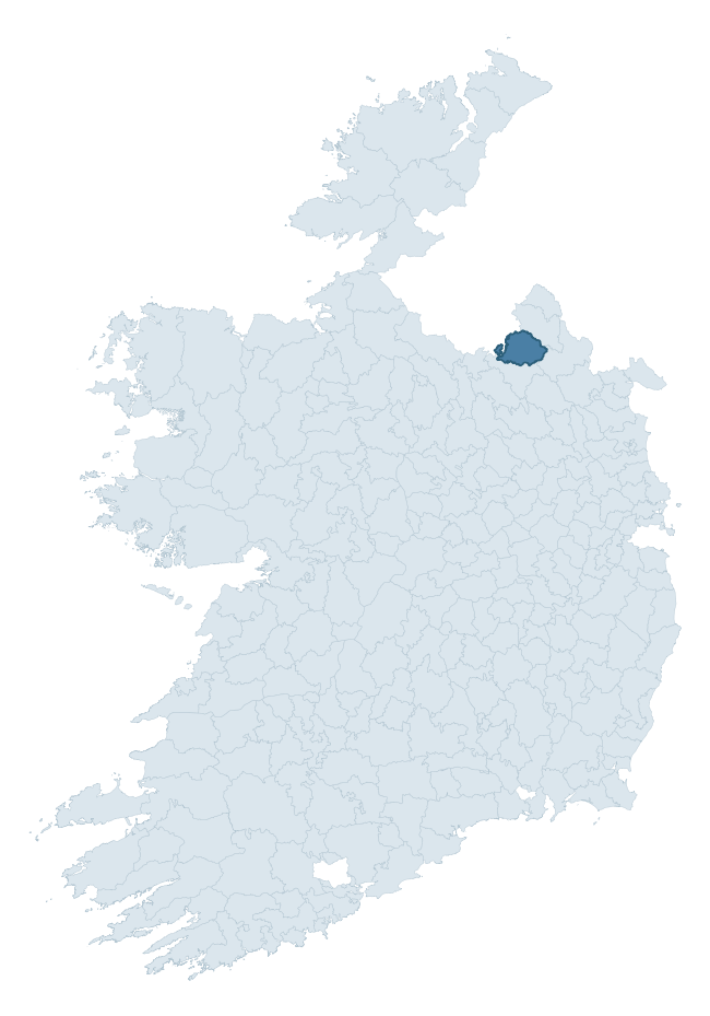
Where this barony sits in the Republic of Ireland
Geology and preservation
Bedrock geology shapes the landscape long before any settlement begins — controlling soil drainage, agricultural potential, the survival of upstanding monuments, and the preservation of buried archaeology. The figures below come from the Geological Survey Ireland 1:100,000 bedrock map.
The bedrock underlying Dartree is predominantly greywacke (40% of the barony by area), laid down during the Ordovician period (72% by area, around 485 to 444 million years ago). Greywacke is a hard, dark, fine-grained sandstone that weathers to thin upland soils. Greywacke baronies typically carry sparser settlement archaeology but provide high-quality building stone visible in older field walls and farm buildings. A substantial secondary geology of greywacke and shale (31%) and limestone (11%) adds further variety to the underlying landscape. The single largest mapped unit is the Red Island Formation (40% of the barony's bedrock). With 7 distinct rock types mapped, the barony sits in the top third of ROI baronies for geological diversity (73rd percentile) — typically a sign of complex tectonic history or coastal mosaics of differing rock units.
Rock type composition
Largest mapped unit: Red Island Formation (40% of the barony)
Placename evidence
Logainm records 83 heritage-diagnostic placenames for Dartree, drawn from townland and civil-parish names across the barony. The dominant stratum is pre-Christian and Early Medieval defensive — ráth-, lios-, dún-, and caiseal-prefixed names that mark Iron Age and early historic settlement. The leading diagnostic roots are cill- (28 — church), lios- (24 — ringfort or enclosure), and ráth- (12 — earthen ringfort). This is well above the ROI average of 30.7 heritage placenames per barony — around 2.7× the typical figure. The presence of multiple heritage strata side by side indicates layered occupation of the landscape across successive prehistoric and historic periods. Logainm records 390 placenames for Dartree (predominantly townland names). Of these, 83 (21%) carry one of the diagnostic Gaelic roots tracked above; the remainder draw on more generic landscape vocabulary that does not encode a heritage period.
Pre-Christian / Early Medieval Defensive
| Root | Count | Meaning |
|---|---|---|
| lios- | 24 | ringfort or enclosure |
| ráth- | 12 | earthen ringfort |
| dún- | 5 | hilltop or promontory fort |
Early Christian Ecclesiastical
| Root | Count | Meaning |
|---|---|---|
| cill- | 28 | church (early) |
| teampall- | 1 | church (later medieval) |
Burial, Ritual, and Norse-Contact
| Root | Count | Meaning |
|---|---|---|
| carn- | 6 | cairn |
| leacht- | 5 | grave monument |
| gall- | 1 | foreigner — Norse settlement marker |
Other baronies in Monaghan
- Farney
- Monaghan
- Cremorne
- Trough
- Tullygarvey — Cavan
- Clanmahon — Cavan
- Loughtee Lower — Cavan
- Tirhugh — Donegal
- Clankee — Cavan
- Farney
See all 280 baronies in the Republic of Ireland Heritage Tool.

Explore further
Grounding History: 10 Maps of Northern Ireland’s Past
If you’re interested in Irish heritage more widely, the companion report for Northern Ireland brings together the analysis of all 462 NI wards into one place through 10 high-quality maps — covering monument density, archaeological periods, placename heritage, terrain, wetland, and the historic landscape at first survey. Take a look.
About this profile
Click any section below to expand.
What is a barony?
A barony is a historic administrative unit in Ireland, broadly equivalent to an English hundred. The 280 baronies used here are from the OSi 2019 National Statutory Boundaries (generalised 20m), covering the 26 counties of the Republic of Ireland. Baronies derive from the Norman period, were formalised in the 17th century, and have not been redrawn for statistical purposes. They vary enormously in area, from compact urban baronies in Dublin to vast upland baronies in Connacht, and should not be compared by raw site count without accounting for area differences.
What counts as a site?
This profile combines three distinct heritage registers, each with its own definition of what constitutes a recordable site:
- Archaeological sites (NMS). The National Monuments Service Sites and Monuments Record (SMR) catalogues every known archaeological monument or site of archaeological interest in the Republic, from prehistoric burial mounds and ringforts to medieval churches and post-medieval defensive works. Inclusion does not require legal protection — only that the site has been identified, surveyed, and assessed as having archaeological value. A separate subset of these sites lies within a recorded protection zone, which gives them statutory protection under the National Monuments Acts.
- Listed buildings (NIAH). The National Inventory of Architectural Heritage records buildings of architectural, historical, archaeological, artistic, cultural, scientific, social, or technical interest. Each surveyed structure is appraised on a five-tier scale: International, National, Regional, Local, and Record-Only. The NIAH appraisal is informational rather than strictly statutory, but it underpins local-authority Record of Protected Structures (RPS) listings.
- Heritage placenames (Logainm). Logainm is the authoritative database of Irish placenames maintained by the Placenames Branch. This profile applies a heritage-diagnostic classifier to the Irish-language form of each townland name, flagging roots that signal defensive sites (ráth-, lios-, dún-, caiseal-, cathair-), ecclesiastical foundations (cill-, teampall-, domhnach-, mainistir-), prehistoric burial-ritual features (tuaim-, carn-, leaba-), or Norse-contact settlement (gall-). Townlands without one of these diagnostic roots are not flagged here — they may still carry historical significance, but that significance is not encoded in the name itself.
Editorial principles
The narrative sections of this profile follow several explicit principles:
- Evidential. Every claim about this barony’s heritage character is anchored in the underlying register data. Where a site count, a placename count, or a percentile rank is cited, it is computed from the source datasets at export time, not estimated.
- Comparative. Counts and metrics are reported alongside their percentile rank against the other 279 ROI baronies. A barony with 50 ringforts in absolute terms could be unusually high or unusually low depending on its size and regional context; percentile ranking removes that ambiguity.
- Transparent on limits. Where a register has known coverage gaps, survey biases, or data-quality issues that affect this barony’s figures, the profile flags them rather than presenting the numbers as definitive.
- No interpretation beyond what the data supports. The narrative does not speculate about historical events, social dynamics, or cultural meaning beyond what the recorded heritage and placename evidence directly attests.
Data caveats and limits
- NMS Sites and Monuments Record is the product of survey campaigns conducted at different intensities across different counties and decades. Some baronies have been surveyed more thoroughly than others, and absolute counts should be read in that light. Sites destroyed by development before survey are typically not represented; sites in heavily forested or upland terrain are sometimes under-recorded.
- NIAH coverage is broadly complete for the Republic of Ireland but the survey was conducted on a rolling county-by-county basis, and the most recent appraisal date varies. Buildings demolished or substantially altered after their original survey may still appear in the register; conversely, recent buildings of merit may not yet have been appraised.
- Logainm classification applies a deliberately conservative pattern-matching approach to the Irish-language townland forms. The classifier prioritises true positives over recall: a townland may carry a heritage signal that the classifier doesn’t recognise, particularly where the diagnostic root has been heavily anglicised or where the townland name draws on a less common term. The 60,000+ townland records and ~9,800 classified placenames give a substantial signal at barony scale, but individual townland names should be checked against Logainm directly for definitive interpretation.
- Period attribution. The chronological distribution reflects only those NMS sites that carry a recognised period attribution in the source data. Sites listed as “Unknown” period are excluded from the dated subset.
- Boundary changes. Some baronies have undergone minor boundary adjustments since their 19th-century definition; the OSi 2019 generalised boundaries used here are the current statutory definition and may differ slightly from historical maps in border areas.
- Bedrock geology is mapped at 1:100,000 scale, which means local variation within a barony — small pockets of different rock type, mineral veins, alluvium overlying bedrock — is generalised. The dominant-system and rocktype figures are area-weighted, so a barony reading “70% Carboniferous limestone” may still contain small but archaeologically important pockets of older or younger rock. Around 3% of GSI polygons do not match the lexicon and contribute no rocktype or system attribution.
Data sources
- National Monuments Service — Sites and Monuments Record (SMR) https://data.gov.ie/dataset/national-monuments-service-archaeological-survey-of-ireland
- National Inventory of Architectural Heritage (NIAH) https://data.gov.ie/dataset/national-inventory-of-architectural-heritage-niah-national-dataset
- Logainm — Placenames Database of Ireland https://www.logainm.ie/
- Ordnance Survey Ireland — National Statutory Barony Boundaries 2019 https://data-osi.opendata.arcgis.com/
- EURODEM — European Digital Elevation Model https://www.mapsforeurope.org/datasets/euro-dem
- ESA WorldCover https://esa-worldcover.org/en
- Geological Survey Ireland — 1:100,000 Bedrock Geology https://www.gsi.ie/en-ie/data-and-maps/Pages/Bedrock.aspx
Explore more: Search any of the 280 ROI baronies, browse by historical province, or read the methodology and data sources for the full Republic of Ireland Heritage Tool.