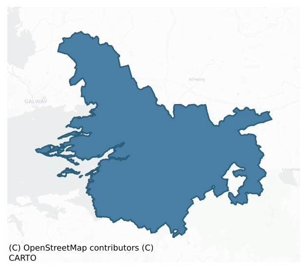
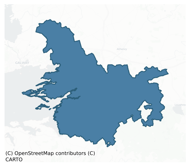
Dunkellin is a barony of County Galway, in the historical province of Connacht (Irish: Dún Coillín), covering 337 km² of land. The barony records 1,394 NMS archaeological sites and 159 NIAH listed buildings, placing it at around the 94th percentile among 280 ROI baronies for sites per km². This means it is in the top tenth of all baronies for sites per km². Dated archaeological evidence runs from the Neolithic through to the Modern, spanning 8 of 9 archaeological periods, placing the barony in the 59th percentile among 280 ROI baronies for chronological depth. This means it is in the upper half of all baronies for chronological depth. The largest dated subset of recorded sites dates to the Early Medieval. Logainm flags 86 placenames in the barony as carrying a recognised heritage root; the largest share — around 56% — are names associated with pre-christian defensive.
Heritage at a glance
Percentile rankings throughout this profile compare each barony only against the other 279 Republic of Ireland baronies.
The recorded heritage of Dunkellin
The National Monuments Service Sites and Monuments Record (SMR) is the statutory inventory of archaeological sites for the Republic of Ireland, maintained by the Department of Tourism, Culture, Arts, Gaeltacht, Sport and Media. Sites recorded here include earthworks, ringforts, megalithic tombs, ecclesiastical remains, and post-medieval features; not every record is legally protected, but each is registered as a monument of archaeological interest.
The National Monuments Service records 1,394 archaeological sites in Dunkellin, putting it at the 94th percentile among 280 ROI baronies for sites per km². This means it is in the top tenth of all baronies for sites per km². Protection coverage is near-universal — 1,274 sites (91%) fall within a recorded monument protection zone, indicating an extensively surveyed landscape. The dominant category is defensive sites — ringforts, enclosures, hillforts, and stone forts (721 sites, 52% of the record). Ringfort – cashel is the most prevalent type, making up 17% of the barony's recorded sites (231 records) — well above the ROI average of 5% across all baronies where this type occurs. Ringfort – cashel is the stone-walled equivalent of the rath, found mainly in upland or western areas, broadly dated 500–1000 AD. Other significant types include Ringfort – rath (172) and Souterrain (148). Ringfort – rath is an earthen ringfort enclosed by a bank and external ditch — the most common Early Medieval farmstead, broadly dated 500–1000 AD; Souterrain is an underground stone-built passage and chamber, generally Early Medieval and often associated with ringforts as a defensive or storage feature. Across the barony's 337 km², this gives a recorded density of 4.14 sites per km².
Most common monument types
Hover or tap a monument type to see its definition.
| Type | Count |
|---|---|
| Ringfort – cashel the stone-walled equivalent of the rath, found mainly in upland or western areas, broadly dated 500–1000 AD | 231 |
| Ringfort – rath an earthen ringfort enclosed by a bank and external ditch — the most common Early Medieval farmstead, broadly dated 500–1000 AD | 172 |
| Souterrain an underground stone-built passage and chamber, generally Early Medieval and often associated with ringforts as a defensive or storage feature | 148 |
| House – indeterminate date a habitation building whose date cannot be determined from available evidence | 103 |
| Enclosure a banked or ditched feature of uncertain type, used as a catch-all where the original function cannot be determined from surface evidence | 89 |
| Church a building used for public Christian worship, of any date from c. 500 AD onwards | 44 |
| Children's burial ground an unconsecrated medieval and early-modern burial ground for unbaptised or stillborn children, often called a cillín or ceallúnach | 34 |
Chronological distribution
The dated archaeological record for Dunkellin spans from the Neolithic through to the Modern, with activity attested across 8 of 9 archaeological periods. Every period from earliest to latest is represented in the record — an unbroken sequence of dated activity across the full chronological span. Activity concentrates most heavily in the Early Medieval (597 sites, 57% of dated material), with the Iron Age forming a secondary peak (225 sites, 21%). A further 345 recorded sites (25% of the overall NMS register for the barony) carry no period attribution — appearing as 'Unknown' in the bar chart below. This typically reflects either records that pre-date the standardised period vocabulary or sites awaiting specialist dating review, rather than a genuine absence of chronological evidence.
Sample of recorded monuments
Show 25 sample monuments (of 1,394 total)
A representative sample of 25 recorded monuments drawn from the barony’s 1,394 total NMS entries. Sites within a recorded monument protection zone and rarer site types are prioritised so the list shows a meaningful cross-section rather than only the most common type. Each entry shows the official Sites and Monuments Record reference number and the description published by the National Monuments Service.
Barrow – unclassified
One of four barrows on Athenry golf course (GA083-066—-; GA083-067—-; GA083-068—-; GA083-075—-). Situated on a slight S-facing slope, it now acts as a trap in front of the 9th tee. It consists of a poorly…
One of four barrows on Athenry golf course (GA083-066—-; GA083-067—-; GA083-068—-; GA083-075—-). Situated on a slight S-facing slope, it now acts as a trap in front of the 9th tee. It consists of a poorly preserved subcircular area (13.6m N-S; 12m E-W) comprising a low central mound (diam. c. 5.5m), which appears to have been dug out, surrounded by a low earthen bank.
Compiled by: Paul Walsh
Date of upload: 2 March 2015
Megalithic tomb – portal tomb
In a shallow valley at the head of Leckanaloy Creek, c. 100m from the seashore. Described by de Valera and Ó Nualláin (1972, 14) as a small chamber (L 2.5m, Wth c. 1.8m), aligned ESE-WNW, composed of two portal-stones…
In a shallow valley at the head of Leckanaloy Creek, c. 100m from the seashore. Described by de Valera and Ó Nualláin (1972, 14) as a small chamber (L 2.5m, Wth c. 1.8m), aligned ESE-WNW, composed of two portal-stones at E, a backstone at W and N sidestone. The S portal leans markedly outwards and a large displaced roofstone lies across the chamber. The remains of a small earthen enclosure (3m by 2.5m) abut its N side. Fragments of cremated bone and sherds of coarse pottery were recovered from the chamber. (McCaffrey 1952, 9; Waddell 1977, 58-9)
See linked document with details from Ruaidhrí de Valera and Seán Ó Nualláin, Survey of the Megalithic Tombs of Ireland. Volume III. Counties Galway, Roscommon, Leitrim, Longford, Westmeath, Laoighis, Offaly, Kildare, Cavan. (Dublin: Stationery Office, 1972).
Compiled by: Galway Archaeological Survey, UCG
Date of upload: 19 August 2019
Bee-boles
The Archaeological Survey of Ireland (ASI) is in the process of providing information on all monuments on The Historic Environment Viewer (HEV). Currently the information for this record has not been uploaded. To…
The Archaeological Survey of Ireland (ASI) is in the process of providing information on all monuments on The Historic Environment Viewer (HEV). Currently the information for this record has not been uploaded. To access available information for research purposes please make an appointment in advance with the Archive Unit (open Fridays 10.00 am – 5.00 pm), Department of Culture, Heritage and the Gaeltacht, The Custom House, Dublin 1 D01W6XO or email nmarchive@chg.gov.ie.
Monumental structure
The Archaeological Survey of Ireland (ASI) is in the process of providing information on all monuments on The Historic Environment Viewer (HEV). Currently the information for this record has not been uploaded. To…
The Archaeological Survey of Ireland (ASI) is in the process of providing information on all monuments on The Historic Environment Viewer (HEV). Currently the information for this record has not been uploaded. To access available information for research purposes please make an appointment in advance with the Archive Unit (open Fridays 10.00 am – 5.00 pm), Department of Culture, Heritage and the Gaeltacht, The Custom House, Dublin 1 D01W6XO or email nmarchive@chg.gov.ie.
Megalithic tomb – court tomb
In pastureland with outcropping rock, some 350m to the S of the seashore at the inner reaches of Mweeloon Bay. This tomb comprised the ruins of a gallery (L 5.5m), aligned NW-SE, divided into two chambers by a…
In pastureland with outcropping rock, some 350m to the S of the seashore at the inner reaches of Mweeloon Bay. This tomb comprised the ruins of a gallery (L 5.5m), aligned NW-SE, divided into two chambers by a sill-stone. The entrance, at SE, was between two jambs; the N jamb was flanked by a single courtstone. A large displaced stone, possibly a roofstone, lay in the front chamber. The tomb was bulldozed during the course of land clearance in 1964. The orthostats were pushed to the fence at the N boundary of the field. (Holt 1912, 249-50; McCaffrey 1952, 11-12; de Valera and Ó Nualláin 1972, 15-16)
See linked document with details from Ruaidhrí de Valera and Seán Ó Nualláin, Survey of the Megalithic Tombs of Ireland. Volume III. Counties Galway, Roscommon, Leitrim, Longford, Westmeath, Laoighis, Offaly, Kildare, Cavan. (Dublin: Stationery Office, 1972).
Compiled by: Galway Archaeological Survey, UCG
Date of upload: 19 August 2019
Hilltop enclosure
On a ridge in pastureland. Described by Holt (1912, 225) as a 'large rath', which was located on the 'N.W. shoulder of a considerable hill'. It consists of a poorly preserved hilltop enclosure (69.8m E-W; 45m N-S)…
On a ridge in pastureland. Described by Holt (1912, 225) as a 'large rath', which was located on the 'N.W. shoulder of a considerable hill'. It consists of a poorly preserved hilltop enclosure (69.8m E-W; 45m N-S) defined by a bank and external fosse with slight traces of an outer bank from SE to S. A possible souterrain (GA095-147001-) is associated. (McCaffrey 1952, 147. no. 18a)
Compiled by: Galway Archaeological Survey, UCG
Date of upload: 25 July 2017
Castle – motte and bailey
In undulating pastureland, c. 100m to the S of the old course of the Dooyertha River and c. 250m to the E of Rathgorgin Castle (GA096-151—-). Orpen (1916, 34-44) recorded that this motte and bailey was known locally…
In undulating pastureland, c. 100m to the S of the old course of the Dooyertha River and c. 250m to the E of Rathgorgin Castle (GA096-151—-). Orpen (1916, 34-44) recorded that this motte and bailey was known locally as ‘Cruckawootha’ or the 'Knock of the Moat' and he suggested that it ‘was erected by Gilbert de Angulo or one of his feoffees [sic] about the close of the 12th century’. It is defined by a steep-sided flat-topped and very heavily overgrown circular mound of earth and stone (diam. 31m; H 4.45m), which is encircled by a wide deep fosse (Wth 3.2m) and an outer bank (base Wth 7.6m; int. H 1.1m; ext. H 1.8m) from NE through S to NW. Orpen (ibid., 39-40) also described a bailey (41m N-S), defined by a scarp, which extended off the motte to the N; it narrowed towards its N end (Wth c. 20m). His plan shows a circular building (GA096-144001-) and a possible enclosure (GA096-114002-) at the NW end of the bailey and he also referred to another enclosure (GA096-144003-) to the E of the motte. No visible surface traces of the latter features survive but the outline of the bailey is indicated by a slight rise in the ground level. (O’Flanagan 1927, Vol. 1, 425; McCaffrey 1952, 163, no. 39)
Compiled by: Galway Archaeological Survey, UCG
Date of upload: 10 December 2019
Tide mill – unclassified
At the S end of Shamullen Channel on the foreshore at Carrowmore townland on the inner reaches of Galway Bay. Holt (1911-12, 251) recorded the site of a tidal mill here and noted that the millstones were said to be…
At the S end of Shamullen Channel on the foreshore at Carrowmore townland on the inner reaches of Galway Bay. Holt (1911-12, 251) recorded the site of a tidal mill here and noted that the millstones were said to be extant. Following Storm Eleanor in January 2018, a millstone (Wth 0.59-0.64m T 0.33-0.34m), which had been partially exposed prior to the storm, became more fully exposed revealing that over half of it survived. While broken in the past, enough remained to indicate that it was an upper stone fashioned from pink granite. Half of the central perforation (diam. 0.18m), which is straight sided and smooth, survives. The fragment indicates that the overall diameter of the stone was between c. 1.18m and 1.28m. A narrow rebate visible inside the lip of the perforation was designed to take the ‘bridge’, a device which positioned the drive-shaft and facilitated the rotation of the stone. On present evidence it is not possible to determine whether the mill was a horizontal or vertical mill (Gosling 2018). According to local information, another millstone fragment is lodged in a nearby field wall (information from P. Gosling 12 January 2018).
Compiled by: Olive Alcock
Date of upload: 31 July 2018
Mass-rock
The Archaeological Survey of Ireland (ASI) is in the process of providing information on all monuments on The Historic Environment Viewer (HEV). Currently the information for this record has not been uploaded. To…
The Archaeological Survey of Ireland (ASI) is in the process of providing information on all monuments on The Historic Environment Viewer (HEV). Currently the information for this record has not been uploaded. To access available information for research purposes please make an appointment in advance with the Archive Unit (open Fridays 10.00 am – 5.00 pm), Department of Culture, Heritage and the Gaeltacht, The Custom House, Dublin 1 D01W6XO or email nmarchive@chg.gov.ie.
Sheepfold
This record was incorrectly classified as Enclosure in the RMP (1997). It has been reclassified as a Sheepfold as it was described in 1969 (Topgr. Files, Dúchas) as 'a very small sheepfold'. Due to extensive field…
This record was incorrectly classified as Enclosure in the RMP (1997). It has been reclassified as a Sheepfold as it was described in 1969 (Topgr. Files, Dúchas) as 'a very small sheepfold'. Due to extensive field clearance in the area no visible surface trace survives.
Compiled by: Olive Alcock
Date of upload: 8 August 2014
Castle – hall-house
On flat pastureland that slopes away to the NNW towards a turlough. Described by Redington (1916, 123) as a small 13th-century keep castle. In 1574 it was in the possession of 'Willm McRichard' (Nolan 1901, 113). It…
On flat pastureland that slopes away to the NNW towards a turlough. Described by Redington (1916, 123) as a small 13th-century keep castle. In 1574 it was in the possession of 'Willm McRichard' (Nolan 1901, 113). It consists of a rectangular two-storey high building (16.75m NNW-SSE; 10.6m ENE-WSW), in fair condition, though little of the walls of the 1st floor survive. It is constructed of well-coursed mortared masonry but all the quoinstones and dressed stonework has been robbed out and only small portions of the once prominent base-batter survives. Doorways to hall-houses are generally found at 1st-floor level but here what appears to be the original doorway is on the ground floor, towards S end of NE wall where a large breach still retains fragments of its arch and N jamb. There were four windows on this floor; two in the SW wall and one each in the NE and NW walls. They consisted of a narrow slit set in a wide embrasure. The interior is rubble-filled. Access from the ground to 1st floor was via an intramural stairs in the SE wall. On this floor the base of a window is visible in the NW wall. Only the joist holes survive to indicate the level of the wooden floor between the ground and 1st floor. A church (GA103-031—-) lies 100m to the E and a settlement cluster (GA103-198—-) c. 165m to the N. (Sweetman 1999, 91)
Compiled by: Galway Archaeological Survey, UCG
Date of upload: 31 August 2021
Altar
On low-lying ground on the S bank of the estuary of the Kilcolgan River. This poorly preserved and overgrown altar consists of a cairn of loose stones (L 5m; Wth 3m) upon which stands an 18th-century inscribed…
On low-lying ground on the S bank of the estuary of the Kilcolgan River. This poorly preserved and overgrown altar consists of a cairn of loose stones (L 5m; Wth 3m) upon which stands an 18th-century inscribed rectangular slab (GA103-127001-). According to McCaffrey (1952, 196, no. 23), the altar was designed ‘to protect a well' at which 'Offerings are left’, but no visible surface trace of the latter survives. (Bradley and Dunne 1992, 134)
Compiled by: Galway Archaeological Survey, UCG
Date of upload: 20 February 2020
Mine
The Archaeological Survey of Ireland (ASI) is in the process of providing information on all monuments on The Historic Environment Viewer (HEV). Currently the information for this record has not been uploaded. To…
The Archaeological Survey of Ireland (ASI) is in the process of providing information on all monuments on The Historic Environment Viewer (HEV). Currently the information for this record has not been uploaded. To access available information for research purposes please make an appointment in advance with the Archive Unit (open Fridays 10.00 am – 5.00 pm), Department of Culture, Heritage and the Gaeltacht, The Custom House, Dublin 1 D01W6XO or email nmarchive@chg.gov.ie.
Mill – unclassified
On the S bank of the Kilcolgan River is a rectangular building (14m N-S; 6m E-W) defined by grassed-over oundation lines except at S where a gable wall containing
two plain rectangular windows survives. Traces of a…
On the S bank of the Kilcolgan River is a rectangular building (14m N-S; 6m E-W) defined by grassed-over oundation lines except at S where a gable wall containing
two plain rectangular windows survives. Traces of a race, now filled with field clearance rubble, are visible within this structure. This is possibly the site of the medieval mill attached to the borough of Kilcolgan (Holland 1988, 81).
Cairn – burial cairn
On a slight rise in farmland. This roughly circular flat-topped cairn (base diam. c. 9m; top 5m; H c. 1.25m) is built of grassed-over stones. According to the landowner, it is ‘modern’ but it covers four stone slabs.…
On a slight rise in farmland. This roughly circular flat-topped cairn (base diam. c. 9m; top 5m; H c. 1.25m) is built of grassed-over stones. According to the landowner, it is ‘modern’ but it covers four stone slabs. McCaffrey (1952, 19, no. 32a) noted that in a depression (L c. 3m; Wth 1.8m; D 0.8m) in its centre, a stone (L 1.2m; H 0.7m) set on edge was indicative of the ‘remains of a plundered cist or chamber’.
Compiled by: Galway Archaeological Survey, UCG
Date of upload: 14 November 2019
Megalithic tomb – unclassified
The Archaeological Survey of Ireland (ASI) is in the process of providing information on all monuments on The Historic Environment Viewer (HEV). Currently the information for this record has not been uploaded. To…
The Archaeological Survey of Ireland (ASI) is in the process of providing information on all monuments on The Historic Environment Viewer (HEV). Currently the information for this record has not been uploaded. To access available information for research purposes please make an appointment in advance with the Archive Unit (open Fridays 10.00 am – 5.00 pm), Department of Culture, Heritage and the Gaeltacht, The Custom House, Dublin 1 D01W6XO or email nmarchive@chg.gov.ie.
Windmill
The Archaeological Survey of Ireland (ASI) is in the process of providing information on all monuments on The Historic Environment Viewer (HEV). Currently the information for this record has not been uploaded. To…
The Archaeological Survey of Ireland (ASI) is in the process of providing information on all monuments on The Historic Environment Viewer (HEV). Currently the information for this record has not been uploaded. To access available information for research purposes please make an appointment in advance with the Archive Unit (open Fridays 10.00 am – 5.00 pm), Department of Culture, Heritage and the Gaeltacht, The Custom House, Dublin 1 D01W6XO or email nmarchive@chg.gov.ie.
Anomalous stone group
The Archaeological Survey of Ireland (ASI) is in the process of providing information on all monuments on The Historic Environment Viewer (HEV). Currently the information for this record has not been uploaded. To…
The Archaeological Survey of Ireland (ASI) is in the process of providing information on all monuments on The Historic Environment Viewer (HEV). Currently the information for this record has not been uploaded. To access available information for research purposes please make an appointment in advance with the Archive Unit (open Fridays 10.00 am – 5.00 pm), Department of Culture, Heritage and the Gaeltacht, The Custom House, Dublin 1 D01W6XO or email nmarchive@chg.gov.ie.
Ecclesiastical residence
The Archaeological Survey of Ireland (ASI) is in the process of providing information on all monuments on The Historic Environment Viewer (HEV). Currently the information for this record has not been uploaded. To…
The Archaeological Survey of Ireland (ASI) is in the process of providing information on all monuments on The Historic Environment Viewer (HEV). Currently the information for this record has not been uploaded. To access available information for research purposes please make an appointment in advance with the Archive Unit (open Fridays 10.00 am – 5.00 pm), Department of Culture, Heritage and the Gaeltacht, The Custom House, Dublin 1 D01W6XO or email nmarchive@chg.gov.ie.
Historic town
The Archaeological Survey of Ireland (ASI) is in the process of providing information on all monuments on The Historic Environment Viewer (HEV). Currently the information for this record has not been uploaded. To…
The Archaeological Survey of Ireland (ASI) is in the process of providing information on all monuments on The Historic Environment Viewer (HEV). Currently the information for this record has not been uploaded. To access available information for research purposes please make an appointment in advance with the Archive Unit (open Fridays 10.00 am – 5.00 pm), Department of Culture, Heritage and the Gaeltacht, The Custom House, Dublin 1 D01W6XO or email nmarchive@chg.gov.ie.
Kiln – lime
The Archaeological Survey of Ireland (ASI) is in the process of providing information on all monuments on The Historic Environment Viewer (HEV). Currently the information for this record has not been uploaded. To…
The Archaeological Survey of Ireland (ASI) is in the process of providing information on all monuments on The Historic Environment Viewer (HEV). Currently the information for this record has not been uploaded. To access available information for research purposes please make an appointment in advance with the Archive Unit (open Fridays 10.00 am – 5.00 pm), Department of Culture, Heritage and the Gaeltacht, The Custom House, Dublin 1 D01W6XO or email nmarchive@chg.gov.ie.
Gallows
The Archaeological Survey of Ireland (ASI) is in the process of providing information on all monuments on The Historic Environment Viewer (HEV). Currently the information for this record has not been uploaded. To…
The Archaeological Survey of Ireland (ASI) is in the process of providing information on all monuments on The Historic Environment Viewer (HEV). Currently the information for this record has not been uploaded. To access available information for research purposes please make an appointment in advance with the Archive Unit (open Fridays 10.00 am – 5.00 pm), Department of Culture, Heritage and the Gaeltacht, The Custom House, Dublin 1 D01W6XO or email nmarchive@chg.gov.ie.
Stone circle
On Tawin Island, in grazing land close to the foreshore. Holt (1911-12, 249) recorded a slight elevation that was partly enclosed by the arms of a large shallow pool, and on which there were a number of granite boulders…
On Tawin Island, in grazing land close to the foreshore. Holt (1911-12, 249) recorded a slight elevation that was partly enclosed by the arms of a large shallow pool, and on which there were a number of granite boulders that may have formed part of an irregular stone circle. He was informed that 'the appearance of a circle was more marked, before other boulders of the series were broken up for building.' On inspection in May 1992, five irregularly shaped granite boulders (max. H 1.7m; Wth 2.4m; T 1.8m) enclosed a roughly oval area (30m NE-SW; 26m NW-SE); a slight depression in the interior at N may have marked the socket of a boulder that had been removed. Two of the boulders were recumbent but one of them was not set into the ground; one other boulder also did not appear to be set. On re-inspection in May 2008 no visible surface trace of the boulders survived. According to local information, large boulders were removed from this area in the late 1990s to build up coastal defences along the shoreline to the N. Not precisely located.
Compiled by: Olive Alcock
Date of upload: 13 December 2019
Inauguration site
The Archaeological Survey of Ireland (ASI) is in the process of providing information on all monuments on The Historic Environment Viewer (HEV). Currently the information for this record has not been uploaded. To…
The Archaeological Survey of Ireland (ASI) is in the process of providing information on all monuments on The Historic Environment Viewer (HEV). Currently the information for this record has not been uploaded. To access available information for research purposes please make an appointment in advance with the Archive Unit (open Fridays 10.00 am – 5.00 pm), Department of Culture, Heritage and the Gaeltacht, The Custom House, Dublin 1 D01W6XO or email nmarchive@chg.gov.ie.
Ringfort – cashel
In gently undulating farmland. Named 'Caher or Circle of Stones' on the OS Fair Plan. When initially visited by the Survey in 1983, this poorly preserved circular cashel (diam. 52.5m) was defined by a drystone wall from…
In gently undulating farmland. Named 'Caher or Circle of Stones' on the OS Fair Plan. When initially visited by the Survey in 1983, this poorly preserved circular cashel (diam. 52.5m) was defined by a drystone wall from N through E to SW and elsewhere by a grassed-over stony bank. A field boundary, with a modern trackway on its E side, cut through the monument from N to S. There was an entrance gap (Wth 2.7m) at E. A subrectangular area defined by grassed-over collapse in the SE quadrant may have been one of two ‘enclosures’ noted by McCaffrey (1952, 111, no. 6) in each half of the interior. Some
earthworks were also noted in the field immediately to the SE. However, as a result of field clearance, most of the cashel wall, apart from a section between ENE to ESE (L 15m), and
the earthworks have been levelled.
Compiled by: Galway Archaeological Survey, UCG
Date of upload: 20 January 2017
Listed buildings
The National Inventory of Architectural Heritage (NIAH) is a state survey appraising buildings of architectural, historical, archaeological, artistic, cultural, scientific, social, or technical interest. Each surveyed structure receives a rating from International (the highest, for buildings of European importance) through National, Regional, Local, and Record-Only.
The NIAH records 159 listed buildings in Dunkellin (69th percentile across ROI baronies). The highest-graded structure include 1 of National significance. The Republic holds 937 National-graded buildings in total, so this barony accounts for around 0% of the national total. Construction dates concentrate most heavily in the Late Georgian (1800-1830) period. The most-recorded building type is house (69 examples, 43% of the listed stock).
Terrain and environment
Mean elevation across the barony is 26m — the 3rd percentile among 280 ROI baronies for elevation. This means it is in the bottom tenth of all baronies for elevation. This is a relatively low-lying landscape by ROI standards. Elevation matters for heritage because higher-altitude baronies typically favour defensive monuments — ringforts and hilltop forts placed on prominent ground — while lowland baronies are more likely to carry the dense settlement and church networks of intensive agricultural landscapes. A maximum elevation of 220m gives the barony meaningful vertical relief. Mean slope is 2.3° — the 18th percentile among 280 ROI baronies for slope. This means it is in the bottom fifth of all baronies for slope. This is broadly flat terrain, the kind of landscape best suited to intensive agriculture. Slope is a key control on both land use and archaeological preservation: steep ground resists ploughing and tends to preserve earthworks intact, while gentle slopes favour intensive cultivation that damages or destroys surface archaeology over time. The Topographic Wetness Index averages 11.6, the 78th percentile among 280 ROI baronies for wetness. This means it is in the top third of all baronies for wetness. This is wet, slow-draining ground by ROI standards — the kind of landscape that may carry waterlogged archaeological sites of unusual preservation value. Drainage matters for heritage because poorly-drained ground preserves organic archaeology (wooden trackways, leather, textiles, and on rare occasions human remains) far better than free-draining soil; well-drained ground favours arable use but destroys organic material rapidly. The land cover is dominated by improved grassland (84%) and woodland (12%). In overall character, this is low-lying, gently-sloping terrain — characteristic of Ireland's central plain and coastal lowlands, with land use dominated by improved grassland.
Terrain measurements
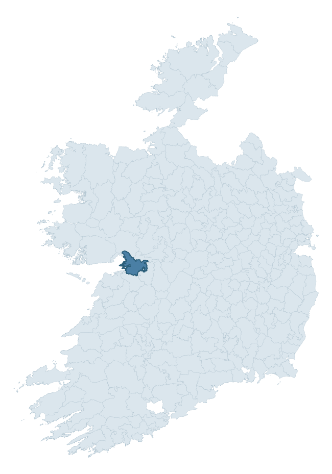
Where this barony sits in the Republic of Ireland
Geology and preservation
Bedrock geology shapes the landscape long before any settlement begins — controlling soil drainage, agricultural potential, the survival of upstanding monuments, and the preservation of buried archaeology. The figures below come from the Geological Survey Ireland 1:100,000 bedrock map.
The bedrock underlying Dunkellin is predominantly limestone (98% of the barony by area), laid down during the Carboniferous period (99% by area, around 359 to 299 million years ago). Limestone is the most heritage-rich bedrock in Ireland. It supports fertile, well-drained soils that favoured dense Early Medieval settlement and Norman manorial agriculture, and it weathers into karst features — sinkholes, caves, swallow holes, and souterrains — that frequently carry archaeology. Where peat overlies limestone, organic preservation can be exceptional. The single largest mapped unit is the Burren Formation (52% of the barony's bedrock). With only 1 distinct rock type mapped, the barony is geologically uniform compared to the rest of the Republic (1st percentile for diversity) — a single coherent bedrock landscape.
Largest mapped unit: Burren Formation (52% of the barony)
Placename evidence
Logainm records 86 heritage-diagnostic placenames for Dunkellin, drawn from townland and civil-parish names across the barony. The dominant stratum is pre-Christian and Early Medieval defensive — ráth-, lios-, dún-, and caiseal-prefixed names that mark Iron Age and early historic settlement. The leading diagnostic roots are cill- (23 — church), cathair- (22 — stone fort), and ráth- (10 — earthen ringfort). This is well above the ROI average of 30.7 heritage placenames per barony — around 2.8× the typical figure. The presence of multiple heritage strata side by side indicates layered occupation of the landscape across successive prehistoric and historic periods. Logainm records 369 placenames for Dunkellin (predominantly townland names). Of these, 86 (23%) carry one of the diagnostic Gaelic roots tracked above; the remainder draw on more generic landscape vocabulary that does not encode a heritage period.
Pre-Christian / Early Medieval Defensive
| Root | Count | Meaning |
|---|---|---|
| cathair- | 22 | stone fort |
| ráth- | 10 | earthen ringfort |
| lios- | 10 | ringfort or enclosure |
| caiseal- | 4 | stone ringfort |
| dún- | 2 | hilltop or promontory fort |
Early Christian Ecclesiastical
| Root | Count | Meaning |
|---|---|---|
| cill- | 23 | church (early) |
| cillín- | 5 | unconsecrated burial ground |
| teampall- | 2 | church (later medieval) |
| tobar- | 2 | holy well |
| díseart- | 1 | hermitage |
Burial, Ritual, and Norse-Contact
| Root | Count | Meaning |
|---|---|---|
| carn- | 3 | cairn |
| leacht- | 1 | grave monument |
| uaimh- | 1 | cave / souterrain |
Other baronies in Galway
- Clare
- Loughrea
- Kiltartan
- Ross
- Moycarn
- Clonmacnowen
- Kilconnell
- Ross — Mayo
- Leyny — Sligo
- Gallen — Mayo
See all 280 baronies in the Republic of Ireland Heritage Tool.

Explore further
Grounding History: 10 Maps of Northern Ireland’s Past
If you’re interested in Irish heritage more widely, the companion report for Northern Ireland brings together the analysis of all 462 NI wards into one place through 10 high-quality maps — covering monument density, archaeological periods, placename heritage, terrain, wetland, and the historic landscape at first survey. Take a look.
About this profile
Click any section below to expand.
What is a barony?
A barony is a historic administrative unit in Ireland, broadly equivalent to an English hundred. The 280 baronies used here are from the OSi 2019 National Statutory Boundaries (generalised 20m), covering the 26 counties of the Republic of Ireland. Baronies derive from the Norman period, were formalised in the 17th century, and have not been redrawn for statistical purposes. They vary enormously in area, from compact urban baronies in Dublin to vast upland baronies in Connacht, and should not be compared by raw site count without accounting for area differences.
What counts as a site?
This profile combines three distinct heritage registers, each with its own definition of what constitutes a recordable site:
- Archaeological sites (NMS). The National Monuments Service Sites and Monuments Record (SMR) catalogues every known archaeological monument or site of archaeological interest in the Republic, from prehistoric burial mounds and ringforts to medieval churches and post-medieval defensive works. Inclusion does not require legal protection — only that the site has been identified, surveyed, and assessed as having archaeological value. A separate subset of these sites lies within a recorded protection zone, which gives them statutory protection under the National Monuments Acts.
- Listed buildings (NIAH). The National Inventory of Architectural Heritage records buildings of architectural, historical, archaeological, artistic, cultural, scientific, social, or technical interest. Each surveyed structure is appraised on a five-tier scale: International, National, Regional, Local, and Record-Only. The NIAH appraisal is informational rather than strictly statutory, but it underpins local-authority Record of Protected Structures (RPS) listings.
- Heritage placenames (Logainm). Logainm is the authoritative database of Irish placenames maintained by the Placenames Branch. This profile applies a heritage-diagnostic classifier to the Irish-language form of each townland name, flagging roots that signal defensive sites (ráth-, lios-, dún-, caiseal-, cathair-), ecclesiastical foundations (cill-, teampall-, domhnach-, mainistir-), prehistoric burial-ritual features (tuaim-, carn-, leaba-), or Norse-contact settlement (gall-). Townlands without one of these diagnostic roots are not flagged here — they may still carry historical significance, but that significance is not encoded in the name itself.
Editorial principles
The narrative sections of this profile follow several explicit principles:
- Evidential. Every claim about this barony’s heritage character is anchored in the underlying register data. Where a site count, a placename count, or a percentile rank is cited, it is computed from the source datasets at export time, not estimated.
- Comparative. Counts and metrics are reported alongside their percentile rank against the other 279 ROI baronies. A barony with 50 ringforts in absolute terms could be unusually high or unusually low depending on its size and regional context; percentile ranking removes that ambiguity.
- Transparent on limits. Where a register has known coverage gaps, survey biases, or data-quality issues that affect this barony’s figures, the profile flags them rather than presenting the numbers as definitive.
- No interpretation beyond what the data supports. The narrative does not speculate about historical events, social dynamics, or cultural meaning beyond what the recorded heritage and placename evidence directly attests.
Data caveats and limits
- NMS Sites and Monuments Record is the product of survey campaigns conducted at different intensities across different counties and decades. Some baronies have been surveyed more thoroughly than others, and absolute counts should be read in that light. Sites destroyed by development before survey are typically not represented; sites in heavily forested or upland terrain are sometimes under-recorded.
- NIAH coverage is broadly complete for the Republic of Ireland but the survey was conducted on a rolling county-by-county basis, and the most recent appraisal date varies. Buildings demolished or substantially altered after their original survey may still appear in the register; conversely, recent buildings of merit may not yet have been appraised.
- Logainm classification applies a deliberately conservative pattern-matching approach to the Irish-language townland forms. The classifier prioritises true positives over recall: a townland may carry a heritage signal that the classifier doesn’t recognise, particularly where the diagnostic root has been heavily anglicised or where the townland name draws on a less common term. The 60,000+ townland records and ~9,800 classified placenames give a substantial signal at barony scale, but individual townland names should be checked against Logainm directly for definitive interpretation.
- Period attribution. The chronological distribution reflects only those NMS sites that carry a recognised period attribution in the source data. Sites listed as “Unknown” period are excluded from the dated subset.
- Boundary changes. Some baronies have undergone minor boundary adjustments since their 19th-century definition; the OSi 2019 generalised boundaries used here are the current statutory definition and may differ slightly from historical maps in border areas.
- Bedrock geology is mapped at 1:100,000 scale, which means local variation within a barony — small pockets of different rock type, mineral veins, alluvium overlying bedrock — is generalised. The dominant-system and rocktype figures are area-weighted, so a barony reading “70% Carboniferous limestone” may still contain small but archaeologically important pockets of older or younger rock. Around 3% of GSI polygons do not match the lexicon and contribute no rocktype or system attribution.
Data sources
- National Monuments Service — Sites and Monuments Record (SMR) https://data.gov.ie/dataset/national-monuments-service-archaeological-survey-of-ireland
- National Inventory of Architectural Heritage (NIAH) https://data.gov.ie/dataset/national-inventory-of-architectural-heritage-niah-national-dataset
- Logainm — Placenames Database of Ireland https://www.logainm.ie/
- Ordnance Survey Ireland — National Statutory Barony Boundaries 2019 https://data-osi.opendata.arcgis.com/
- EURODEM — European Digital Elevation Model https://www.mapsforeurope.org/datasets/euro-dem
- ESA WorldCover https://esa-worldcover.org/en
- Geological Survey Ireland — 1:100,000 Bedrock Geology https://www.gsi.ie/en-ie/data-and-maps/Pages/Bedrock.aspx
Explore more: Search any of the 280 ROI baronies, browse by historical province, or read the methodology and data sources for the full Republic of Ireland Heritage Tool.