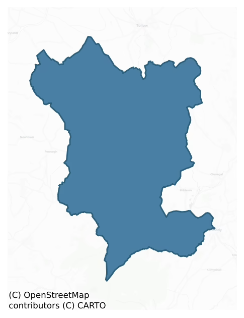
Forth is a barony of County Carlow, in the historical province of Leinster (Irish: Fotharta), covering 160 km² of land. The barony records 205 NMS archaeological sites and 33 NIAH listed buildings, placing it at around the 23rd percentile among 280 ROI baronies for sites per km². This means it is in the bottom third of all baronies for sites per km². Dated archaeological evidence runs from the Neolithic through to the Modern, spanning 8 of 9 archaeological periods, placing the barony in the 60th percentile among 280 ROI baronies for chronological depth. This means it is in the upper half of all baronies for chronological depth. The largest dated subset of recorded sites dates to the Iron Age. Logainm flags 21 placenames in the barony as carrying a recognised heritage root; the largest share — around 67% — are names associated with early Christian church and monastic foundations.
Heritage at a glance
Percentile rankings throughout this profile compare each barony only against the other 279 Republic of Ireland baronies.
The recorded heritage of Forth
The National Monuments Service Sites and Monuments Record (SMR) is the statutory inventory of archaeological sites for the Republic of Ireland, maintained by the Department of Tourism, Culture, Arts, Gaeltacht, Sport and Media. Sites recorded here include earthworks, ringforts, megalithic tombs, ecclesiastical remains, and post-medieval features; not every record is legally protected, but each is registered as a monument of archaeological interest.
The National Monuments Service records 205 archaeological sites in Forth, putting it at the 23rd percentile among 280 ROI baronies for sites per km². This means it is in the bottom third of all baronies for sites per km². Protection coverage is near-universal — 202 sites (98%) fall within a recorded monument protection zone, indicating an extensively surveyed landscape. The dominant category is defensive sites — ringforts, enclosures, hillforts, and stone forts (95 sites, 46% of the record). The most diagnostically specific type is Ring-ditch (13 records, 6% of the barony's NMS total) — compared to an ROI average of 6% across all baronies where this type occurs. Ring-ditch is a circular ditch under 20m across, often the ploughed-out remains of a barrow, ring-barrow or roundhouse. The broader 'Enclosure' classification — which catches unclassified ringforts and field enclosures — accounts for a further 70 records (34%) and reflects the difficulty of sub-classifying degraded earthworks from surface evidence alone. Across the barony's 160 km², this gives a recorded density of 1.28 sites per km².
Most common monument types
Hover or tap a monument type to see its definition.
| Type | Count |
|---|---|
| Enclosure a banked or ditched feature of uncertain type, used as a catch-all where the original function cannot be determined from surface evidence | 70 |
| Ring-ditch a circular ditch under 20m across, often the ploughed-out remains of a barrow, ring-barrow or roundhouse | 13 |
| Church a building used for public Christian worship, of any date from c. 500 AD onwards | 9 |
| Ringfort – rath an earthen ringfort enclosed by a bank and external ditch — the most common Early Medieval farmstead, broadly dated 500–1000 AD | 9 |
| Ritual site – holy well a well or spring traditionally associated with a saint, often credited with healing properties; many trace earlier ritual origins but devotion is documented from the medieval period onwards | 9 |
| Burial ground an area set apart for burial that is not associated with a church, in use from the medieval period onwards | 8 |
| Graveyard a burial area associated with a church, in use from the medieval period onwards | 8 |
| Standing stone a deliberately set upright stone, used variously as a Bronze/Iron Age burial marker, route marker or commemorative monument | 6 |
Chronological distribution
The dated archaeological record for Forth spans from the Neolithic through to the Modern, with activity attested across 8 of 9 archaeological periods. Every period from earliest to latest is represented in the record — an unbroken sequence of dated activity across the full chronological span. Activity concentrates most heavily in the Iron Age (149 sites, 43% of dated material), with the Early Medieval forming a secondary peak (61 sites, 18%). A further 119 recorded sites (25% of the overall NMS register for the barony) carry no period attribution — appearing as 'Unknown' in the bar chart below. This typically reflects either records that pre-date the standardised period vocabulary or sites awaiting specialist dating review, rather than a genuine absence of chronological evidence.
Sample of recorded monuments
Show 25 sample monuments (of 205 total)
A representative sample of 25 recorded monuments drawn from the barony’s 205 total NMS entries. Sites within a recorded monument protection zone and rarer site types are prioritised so the list shows a meaningful cross-section rather than only the most common type. Each entry shows the official Sites and Monuments Record reference number and the description published by the National Monuments Service.
Castle – tower house
The following description is derived from the published 'Archaeological Inventory of County Carlow' (Dublin: Stationery Office, 1993). In certain instances the entries have been revised and updated in the light of…
The following description is derived from the published 'Archaeological Inventory of County Carlow' (Dublin: Stationery Office, 1993). In certain instances the entries have been revised and updated in the light of recent research.
Date of upload/revision: 17 July 2007
According to ITA Survey (1945), building was rectangular (dims. c. 9m x 7.5m) and constructed of granite (max. H of walls c. 3m). ' … there was a low arched doorway but the form of the other openings had been destroyed'. Now levelled.
Holed stone
National Monument No. 347. Granite stone (L 2.40m; Wth 1.56m; T 0.45m), now standing at angle and propped up. Top is damaged. Equidistant from top and sides is circular hole (D 0.32m) similar in appearance to bullaun…
National Monument No. 347. Granite stone (L 2.40m; Wth 1.56m; T 0.45m), now standing at angle and propped up. Top is damaged. Equidistant from top and sides is circular hole (D 0.32m) similar in appearance to bullaun basin (JKAS 1933, 248-252).
This is a monument in State care (Guardianship), No. 347.
The above description is derived from the published 'Archaeological Inventory of County Carlow' (Dublin: Stationery Office, 1993). In certain instances the entries have been revised and updated in the light of recent research.
Revised by: Paul Walsh
Revised date of upload: 5 September 2016
Megalithic tomb – portal tomb
The following description is derived from the published 'Archaeological Inventory of County Carlow' (Dublin: Stationery Office, 1993). In certain instances the entries have been revised and updated in the light of…
The following description is derived from the published 'Archaeological Inventory of County Carlow' (Dublin: Stationery Office, 1993). In certain instances the entries have been revised and updated in the light of recent research.
Date of upload/revision: 17 July 2007
Monument No. HM00320/321/322, this monument was entered in the Register of Historic Monuments on the 23 August 1977. Capstone (3.5m x 3.2m x 0.8m) resting on single orthostat (other collapsed) and small flat stone. Small endstone visible. Facing upslope to E, at end rock outcrop. No visible trace of cairn or cover mound (JRSAI 1983, 91)
Cist
The following description is derived from the published 'Archaeological Inventory of County Carlow' (Dublin: Stationery Office, 1993). In certain instances the entries have been revised and updated in the light of…
The following description is derived from the published 'Archaeological Inventory of County Carlow' (Dublin: Stationery Office, 1993). In certain instances the entries have been revised and updated in the light of recent research.
Date of upload/revision: 17 July 2007
Rectangular cist (1.1m x 0.5m) orientated E-W, contained crouched inhumation of adult male. Standing stone (CW019-066—-) c. 30m distant (JKAS 1930, 26-8; JRSAI 1970, 109).
Castle – motte
The following description is derived from the published 'Archaeological Inventory of County Carlow' (Dublin: Stationery Office, 1993). In certain instances the entries have been revised and updated in the light of…
The following description is derived from the published 'Archaeological Inventory of County Carlow' (Dublin: Stationery Office, 1993). In certain instances the entries have been revised and updated in the light of recent research.
In a commanding position in gently undulating terrain, in tillage. A large gravel mound (H 7.3m; diam. at top 16m N-S; 20.2m E-W; base c. 36m E-W), possibly partly natural in origin. The S side from WSE-ESE was severely truncated in the 1970s, leaving a steep cut section exposed. There is no visible evidence at ground level of a fosse or associated bailey. O'Toole (1933, 257) identifies Castlegrace as the site of a castle near Tullow, built by Hugh de Lacy in 1175 for his brother-in-law, Raymond Le Gros. He identifies a structure (CW013-055—-) incorporated in the former outhouses of Castlegrace farm at this castle (ibid.). However, the reference is more likely to apply to the motte. Preservation Order number: 6/1978.
See attached photographs:
CW013-054—-_01 S and E faces from SE
CW013-054—-_02 S face
CW013-054—-_03 N face
CW013-054—-_04 NE face
Date of revised upload: 27 November 2018
This monument is subject to a preservation order made under the National Monuments Acts 1930 to 2014 (PO no. 6/1978).
Religious house – Augustinian nuns
The following description is derived from the published 'Archaeological Inventory of County Carlow' (Dublin: Stationery Office, 1993). In certain instances the entries have been revised and updated in the light of…
The following description is derived from the published 'Archaeological Inventory of County Carlow' (Dublin: Stationery Office, 1993). In certain instances the entries have been revised and updated in the light of recent research.
Date of revision: 16 December 2009
Revised by: J. Farrelly
O'Donovan (OSL 1839, 138-40) quotes Archdall Monasticon: '… about the year 1151 an Abbey was founded here, for nuns of the order of St. Augustine by Dermot the son of Murchad King of Leinster…' Aghade Rectory is mentioned in Inquisition of 1549 (JKAS 1933, 255) and shown on Down Survey (1655-6) map. Present remains consist of single basin bullaun stone (CW013-057003-) in granite boulder (the 'Baptismal Font') and unnamed but supposedly holy well (CW013-057004-). (Gwynn and Hadcock 1988, 372). There is an associated graveyard (CW013-057002-).
Country house
According to J. Keogh (personal communication) this building is early in date.
Compiled by: Claire Breen
Date of upload: 19 August 2011
Megalithic structure
According to O’Toole (1933, 235), within a roughly rectangular ‘garden’ (dims. c. 22m NW-SE; c. 17m NE-SW) there is, ‘a small enclosure which is called the “old Church-yard.” It is stated that it was formerly used for…
According to O’Toole (1933, 235), within a roughly rectangular ‘garden’ (dims. c. 22m NW-SE; c. 17m NE-SW) there is, ‘a small enclosure which is called the “old Church-yard.” It is stated that it was formerly used for the burial of unbaptized children [CW013-071002-] and that within this enclosure there was, ‘a very remarkable stone [CW013-071003-]’. The enclosure was levelled c. 1970 (Seaver and O’Neill, unpublished report, February 2022). According to an ASI field report (September 1988), ‘The stone formerly stood at the centre of a small enclosure defined by an earthen bank about 8m distant from the stone. To N of stone and inside [the] bank a trench (L c. 3m) with baked sides and filled with white ash or burnt bone was found during cultivation. There are no visible surface traces of the bank and the stone has been moved to the adjacent field boundary’.
O’Toole describes the stone as being, ‘hexagonal in shape, five of the sides consisting of straight lines and the sixth is curved. It is six feet eight inches [2.03m] in length from east to west, and five feet ten inches [1.78m] from north to south; the depth is two feet [0.61m]. It is high in the centre and curves gently to the sides. In the middle of the upper surface there is a shallow basin-shaped hollow from which fourteen groovings or flutings, run to the outer edge. The sides of the stone seem to have been chiselled, but they are now overgrown with moss’ (ibid.). The ASI field report (September 1988) describes,…
Barrow – ring-barrow
The following description is derived from the published 'Archaeological Inventory of County Carlow' (Dublin: Stationery Office, 1993). In certain instances the entries have been revised and updated in the light of…
The following description is derived from the published 'Archaeological Inventory of County Carlow' (Dublin: Stationery Office, 1993). In certain instances the entries have been revised and updated in the light of recent research.
Date of upload/revision: 17 July 2007
Small circular area enclosed by low earthen bank. Rises very slightly to centre (overall diam.. 14m; Wth of bank c. 1.5m).
Designed landscape feature
Appears as a small enclosed feature on the 1839 OS 6-inch map. Field boundary now runs across site and only a slight rise visible. Probably a landscape feature associated with Kilbride House.
Compiled by: Claire…
Appears as a small enclosed feature on the 1839 OS 6-inch map. Field boundary now runs across site and only a slight rise visible. Probably a landscape feature associated with Kilbride House.
Compiled by: Claire Breen
Date of upload: 19 August 2011
Architectural fragment
During land clearance, bones, one double bullaun stone (CW017-010001-) and two single-basin bullauns (CW017-010002- and CW017-010003-), a circular shallow stone basin (CW017-010004-) and a small stone stoup or mortar…
During land clearance, bones, one double bullaun stone (CW017-010001-) and two single-basin bullauns (CW017-010002- and CW017-010003-), a circular shallow stone basin (CW017-010004-) and a small stone stoup or mortar (CW007-010005-) were uncovered; later removed to Tullow Parochial House.
Compiled by: Claire Breen
Date of upload: 19 August 2011
Barrow – unclassified
The following description is derived from the published 'Archaeological Inventory of County Carlow' (Dublin: Stationery Office, 1993). In certain instances the entries have been revised and updated in the light of…
The following description is derived from the published 'Archaeological Inventory of County Carlow' (Dublin: Stationery Office, 1993). In certain instances the entries have been revised and updated in the light of recent research.
Date of upload/revision: 17 July 2007
Shown as very small circular feature on 1908 'OS 6-inch' map. Described as small circular enclosure (diam. c. 15m) defined by low bank, and similar to Ballon ring-barrow (CW013-074—-). (Local information). No visible surface traces.
Racecourse
Visible on aerial photograph (GSIAP R4/11-12). When inspected by ASI in 1988 it was described as a circular enclosure (D c. 100m) defined by low bank (ext. H 1 – 1.3m) enclosing the summit of a large hill. It appears to…
Visible on aerial photograph (GSIAP R4/11-12). When inspected by ASI in 1988 it was described as a circular enclosure (D c. 100m) defined by low bank (ext. H 1 – 1.3m) enclosing the summit of a large hill. It appears to have been levelled sometime between 2009 and 2011 (see Google Earth imagery). According to local information it was used as a racecourse in the 19th century.
Compiled by: Claire Breen
Date of upload: 20 November 2012
Cross
Cross-shaped stone (H 0.5m; Wth across arms 0.35m; T 0.1m) aligned N-S near N edge of interior of graveyard (CW020-020001-).
Compiled by: Claire Breen
Date of upload: 19 August 2011
Excavation – miscellaneous
A number of prehistoric pits and postholes were exposed immediately to the E of 'Round O Rath' (CW006-001—-) during the development of a golf-course in 2006 (Excavation Licence number 06E0499). These features were…
A number of prehistoric pits and postholes were exposed immediately to the E of 'Round O Rath' (CW006-001—-) during the development of a golf-course in 2006 (Excavation Licence number 06E0499). These features were preserved in situ. (McLoughlin C. 2009, 43). Monitoring in 2007 exposed further pits and post-holes which were excavated. Initial analysis of these suggested they were of Late Neolithic/Early Bronze Age date. (McLoughlin C. 2010, 21)
Reference:
McLoughlin, C. (2010),Carrickduff Prehistoric. In I. Bennett (ed.), Excavations 2007: summary accounts of archaeological excavations in Ireland, 21 (101). Bray. Wordwell
Compiled by: Claire Breen
Date of upload: 10 November 2010
Burnt spread
Near the base of a gentle E facing slope of a low ridge. Visible, after having being ploughed and finely raked, as a clear patch of dark charcoal rich soil with some burnt stone (12m N-S x 12m E-W).
Compiled by:…
Near the base of a gentle E facing slope of a low ridge. Visible, after having being ploughed and finely raked, as a clear patch of dark charcoal rich soil with some burnt stone (12m N-S x 12m E-W).
Compiled by: Claire Breen and Chris Corlett.
Date of upload: 12 December 2013
Attached image taken by Chris Corlett.
Hilltop enclosure
A large roughly circular enclosure (diam. c. 120-140m) encompassing the summit of Ballon Hill. The monument is visible on Bing aerial imagery (identified by Nial O’Neill, Ballon Hill Archaeology Project). The S and SW…
A large roughly circular enclosure (diam. c. 120-140m) encompassing the summit of Ballon Hill. The monument is visible on Bing aerial imagery (identified by Nial O’Neill, Ballon Hill Archaeology Project). The S and SW sector is defined by a field boundary and elsewhere the monument appears to be defined by scarp. A smaller enclosure (CW013-068—-) has been identified within this possible hilltop enclosure, off-centre in the NW quadrant (Ballon Hill Archaeology Project). Graves (1852-3, 296), in his article on the Ballon Hill cemetery (CW013-065—-), notes that, 'On the summit … were formerly large and curious entrenchments, locally known as "The walls of Troy". These … have from time to time been all carted away by the neighbouring farmers for manure, so that not a trace … now remains'.
Compiled by: Jean Farrelly
Date of upload: 11 March 2014
Cairn – ring-cairn
On a NNE-facing slope in undulating terrain, in upland region, under pasture. It is on the lower slope of a hill which rises to the SW. There are extensive views to the N and good to the E but the view is impeded by the…
On a NNE-facing slope in undulating terrain, in upland region, under pasture. It is on the lower slope of a hill which rises to the SW. There are extensive views to the N and good to the E but the view is impeded by the rise in slope to the S and W. This monument consists of roughly circular area (int. diam. 20m N-S; 19.2m E-W; ext. diam. 30.6m N-S; 29.3m E-W) enclosed by a bank composed of small stones. The bank (int. H 0.1m; ext. H 1.7m; Wth of kerbed bank 4-4.6m; overall Wth including slip 5.1m) is retained by kerbing stones internally (average dims. H 0.4m; 0.3-04m x 0.4-0.5m), these being best preserved in the NE quadrant. There is also a suggestion of external kerbing, with several possible kerbstones protruding from the bank slip from N-S. In the ESE there is a large external kerbstone (H 0.66m; Wth 0.8m; T 0.2m) with another large more rounded boulder immediately to the N, though on a slightly different line suggesting it may have slipped forward. Though built on a hillslope the interior is relatively level, though slightly hummocky. The bank (int. H 1.47m; ext. H 0.2m; overall Wth 5m)from S-N is grass covered and falls sharply to the interior, particularly where the slope is highest. There has been a lot of field clearance stones dumped on the bank, particularly along the inner face of the bank from S-WNW, with some spillage into the interior. There is a slightly depression in the bank in the NW quadrant and the inner portion of the bank is denuded in the ESE. The…
Concentric enclosure
In tillage. A concentric enclosure identified as a cropmark by Faith Bailey and Simon Dowling on satellite imagery (Google Earth Pro, imagery date 14 July 2018). It consists of an inner, somewhat irregular enclosure…
In tillage. A concentric enclosure identified as a cropmark by Faith Bailey and Simon Dowling on satellite imagery (Google Earth Pro, imagery date 14 July 2018). It consists of an inner, somewhat irregular enclosure (dims. c. 43m N-S; c. 40m E-W) and an outer roughly oval enclosure (dims. c. 85m N-S; c. 76m E-W). The space or berm between the two enclosures varies from 15m up to 23m.
See attached image:
CW017-064—-_01 Google Earth Pro Image © 2019 CNES/Airbus
CW017-064—-_02 Google Earth Pro Image © 2019 CNES/Airbus with enclosure highlighted
Compiled by: Jean Farrelly
Date of upload: 21 October 2019
Graveslab
Grave-slab with cross and circle together with font (CW012-057002-) located in nave of church (CW012-057001-).
Compiled by: Claire Breen
Date of upload: 19 August 2011
Flat cemetery
The following description is derived from the published 'Archaeological Inventory of County Carlow' (Dublin: Stationery Office, 1993). In certain instances the entries have been revised and updated in the light of…
The following description is derived from the published 'Archaeological Inventory of County Carlow' (Dublin: Stationery Office, 1993). In certain instances the entries have been revised and updated in the light of recent research.
Date of upload/revision: 17 July 2007
One of two burials, at least one of which was cremated discovered during ploughing. At least one small rectangular cist (int. dims. 0.3m x 0.3m x D 0.5m) also found (JRSAI 1970, 109).
Flat cemetery
Extensive cemetery of pit and cist burials associated with bowl and vase food vessel and cordoned urn pottery, apparently covering much of Ballon Hill. References to largely levelled entrenchments and earthworks and…
Extensive cemetery of pit and cist burials associated with bowl and vase food vessel and cordoned urn pottery, apparently covering much of Ballon Hill. References to largely levelled entrenchments and earthworks and 'the site of old rath', suggest hilltop may have been enclosed, possibly with ringfort or with ring-barrow associated with complex. No visible surface traces. Area has been cleared and improved. (JRSAI 1853, 295; JRSAI 1959, 31-3, with refs; JRSAI 1970, 109).
Test trenching carried out within area of constraint in 2005 by Coilin Ó Drisceoil (Ó Drisceoil, 2008, p. 18) failed to reveal anything of archaeological significance.
The above description is derived from the published 'Archaeological Inventory of County Carlow' (Dublin: Stationery Office, 1993). In certain instances the entries have been revised and updated in the light of recent research.
Date of upload/revision: 03 February 2009
Children's burial ground
According to O’Toole (1933, 235), within a roughly rectangular ‘garden’ (dims. c. 22m NW-SE; c. 17m NE-SW) there is, ‘a small enclosure [CW013-071001-] which is called the “old Church-yard.” It is stated that it was…
According to O’Toole (1933, 235), within a roughly rectangular ‘garden’ (dims. c. 22m NW-SE; c. 17m NE-SW) there is, ‘a small enclosure [CW013-071001-] which is called the “old Church-yard.” It is stated that it was formerly used for the burial of unbaptized children and that within this enclosure there was, ‘a very remarkable stone [CW013-071003-].’ The enclosure was levelled c. 1970 (Seaver and O’Neill, unpublished report, February 2022). According to an ASI field report (September 1988), ‘The stone formerly stood at the centre of a small enclosure defined by an earthen bank about 8m distant from the stone…There are no visible surface traces of the bank’.
Compiled by: Jean Farrelly
Date of revised upload: 21 February 2022
House – fortified house
The following description is derived from the published 'Archaeological Inventory of County Carlow' (Dublin: Stationery Office, 1993). In certain instances the entries have been revised and updated in the light of…
The following description is derived from the published 'Archaeological Inventory of County Carlow' (Dublin: Stationery Office, 1993). In certain instances the entries have been revised and updated in the light of recent research.
Date of upload/revision: 17 July 2007
Earliest portion of house distinguishable from later additions (early eighteenth century and later) by massive walls, in which one gun loop is still visible. Walls at N are c. 1m thick, those at S are considerably thicker, possibly to incorporate kitchens said to have been in this part of the house. There are no vaulted ceilings; above basement walls are narrower than those below. House said to have originally faced E (Bence-Jones 1978, 3).
Enclosure
The following description is derived from the published 'Archaeological Inventory of County Carlow' (Dublin: Stationery Office, 1993). In certain instances the entries have been revised and updated in the light of…
The following description is derived from the published 'Archaeological Inventory of County Carlow' (Dublin: Stationery Office, 1993). In certain instances the entries have been revised and updated in the light of recent research.
Date of upload/revision: 17 July 2007
Shown on 1908 'OS 6-inch' map as circular area enclosed by bank (max. diam. c. 60m) with raised interior (shown by 300ft contour line). No visible surface traces. Possibly a ringfort.
Aerial photograph (GB89.AH.31) shows cropmark of a circular enclosure defined by two concentric fosses, with an additional, intervening narrow fosse (possibly a palisade trench). The aerial photograph adds considerable additional detail to the morphology of this monument (Barrett 1989). Enclosure also visible as a cropmark on Google Earth (imagery date 14 July 2018).
See attached:
CW013-010—-_01 Google Earth image (imagery date 14 July 2018)
Listed buildings
The National Inventory of Architectural Heritage (NIAH) is a state survey appraising buildings of architectural, historical, archaeological, artistic, cultural, scientific, social, or technical interest. Each surveyed structure receives a rating from International (the highest, for buildings of European importance) through National, Regional, Local, and Record-Only.
The NIAH records only 33 listed buildings in Forth, the 16th percentile across ROI baronies — a relatively thin architectural record. The highest-graded structure include 1 of National significance. The Republic holds 937 National-graded buildings in total, so this barony accounts for around 0% of the national total. Construction dates concentrate most heavily in the Late Georgian (1800-1830) period.
Terrain and environment
Mean elevation across the barony is 27m — the 4th percentile among 280 ROI baronies for elevation. This means it is in the bottom tenth of all baronies for elevation. This is a relatively low-lying landscape by ROI standards. Elevation matters for heritage because higher-altitude baronies typically favour defensive monuments — ringforts and hilltop forts placed on prominent ground — while lowland baronies are more likely to carry the dense settlement and church networks of intensive agricultural landscapes. The barony reaches 229m at its highest point — a vertical span of more than 202m within its boundary, indicating significant topographic diversity. Mean slope is 2.2° — the 12th percentile among 280 ROI baronies for slope. This means it is in the bottom fifth of all baronies for slope. This is broadly flat terrain, the kind of landscape best suited to intensive agriculture. Slope is a key control on both land use and archaeological preservation: steep ground resists ploughing and tends to preserve earthworks intact, while gentle slopes favour intensive cultivation that damages or destroys surface archaeology over time. The Topographic Wetness Index averages 11.7, the 83rd percentile among 280 ROI baronies for wetness. This means it is in the top fifth of all baronies for wetness. This is wet, slow-draining ground by ROI standards — the kind of landscape that may carry waterlogged archaeological sites of unusual preservation value. Drainage matters for heritage because poorly-drained ground preserves organic archaeology (wooden trackways, leather, textiles, and on rare occasions human remains) far better than free-draining soil; well-drained ground favours arable use but destroys organic material rapidly. The land-cover mosaic combines improved grassland (56%), arable farmland (21%), and woodland (16%), giving a mixed agricultural and semi-natural landscape. In overall character, this is low-lying, gently-sloping terrain — characteristic of Ireland's central plain and coastal lowlands, with land use dominated by improved grassland.
Terrain measurements
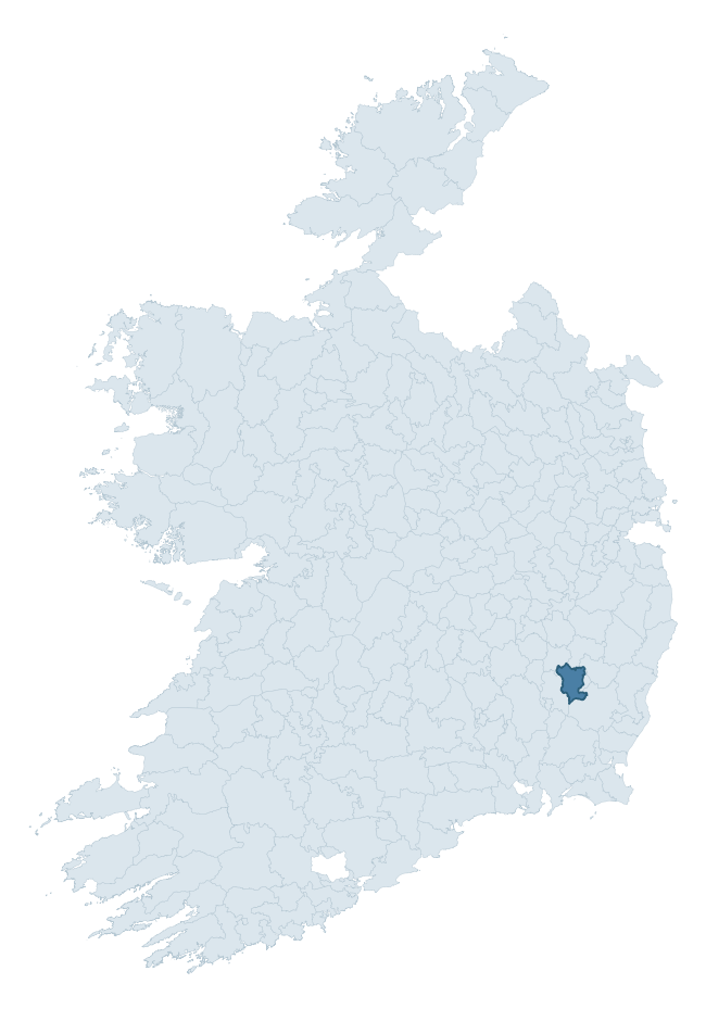
Where this barony sits in the Republic of Ireland
Geology and preservation
Bedrock geology shapes the landscape long before any settlement begins — controlling soil drainage, agricultural potential, the survival of upstanding monuments, and the preservation of buried archaeology. The figures below come from the Geological Survey Ireland 1:100,000 bedrock map.
The bedrock underlying Forth is predominantly granite (73% of the barony by area), laid down during the Caledonian period (73% by area, during the Caledonian orogeny (around 490–390 million years ago)). Granite weathers slowly and produces thin, acidic, often poorly-drained soils that historically limited arable agriculture but favoured pastoralism, upland settlement, and the construction of stone monuments. Granite-dominated landscapes typically carry fewer ringforts but a higher density of megalithic tombs, standing stones, and stone circles, which survive well against the resistant bedrock. The single largest mapped unit is the Type 2 Microcline Porphyritic Granite (Tullow Pluton) (46% of the barony's bedrock).
Rock type composition
Largest mapped unit: Type 2 Microcline Porphyritic Granite (Tullow Pluton) (46% of the barony)
Placename evidence
Logainm records 21 heritage-diagnostic placenames for Forth, drawn from townland and civil-parish names across the barony. The dominant stratum is Early Christian ecclesiastical — cill-, teampall-, and domhnach-prefixed names that record the dense network of early church foundations established between the fifth and tenth centuries. The leading diagnostic roots are cill- (11 — church), ráth- (4 — earthen ringfort), and teampall- (3 — church). This is below the ROI average of 30.7 heritage placenames per barony, suggesting either lighter survey coverage or a townland-naming tradition that draws more on generic landscape vocabulary. The presence of multiple heritage strata side by side indicates layered occupation of the landscape across successive prehistoric and historic periods. Logainm records 119 placenames for Forth (predominantly townland names). Of these, 21 (18%) carry one of the diagnostic Gaelic roots tracked above; the remainder draw on more generic landscape vocabulary that does not encode a heritage period.
Pre-Christian / Early Medieval Defensive
| Root | Count | Meaning |
|---|---|---|
| ráth- | 4 | earthen ringfort |
| lios- | 2 | ringfort or enclosure |
Early Christian Ecclesiastical
| Root | Count | Meaning |
|---|---|---|
| cill- | 11 | church (early) |
| teampall- | 3 | church (later medieval) |
Burial, Ritual, and Norse-Contact
| Root | Count | Meaning |
|---|---|---|
| sián- | 1 | fairy mound |
Other baronies in Carlow
- Slievemargy
- Idrone West
- St. Mullin's Lower
- Idrone East
- St. Mullin's Upper
- Carlow
- Rathvilly
- Coolestown — Offaly
- Narragh And Reban East — Kildare
- Duleek Lower — Meath
See all 280 baronies in the Republic of Ireland Heritage Tool.

Explore further
Grounding History: 10 Maps of Northern Ireland’s Past
If you’re interested in Irish heritage more widely, the companion report for Northern Ireland brings together the analysis of all 462 NI wards into one place through 10 high-quality maps — covering monument density, archaeological periods, placename heritage, terrain, wetland, and the historic landscape at first survey. Take a look.
About this profile
Click any section below to expand.
What is a barony?
A barony is a historic administrative unit in Ireland, broadly equivalent to an English hundred. The 280 baronies used here are from the OSi 2019 National Statutory Boundaries (generalised 20m), covering the 26 counties of the Republic of Ireland. Baronies derive from the Norman period, were formalised in the 17th century, and have not been redrawn for statistical purposes. They vary enormously in area, from compact urban baronies in Dublin to vast upland baronies in Connacht, and should not be compared by raw site count without accounting for area differences.
What counts as a site?
This profile combines three distinct heritage registers, each with its own definition of what constitutes a recordable site:
- Archaeological sites (NMS). The National Monuments Service Sites and Monuments Record (SMR) catalogues every known archaeological monument or site of archaeological interest in the Republic, from prehistoric burial mounds and ringforts to medieval churches and post-medieval defensive works. Inclusion does not require legal protection — only that the site has been identified, surveyed, and assessed as having archaeological value. A separate subset of these sites lies within a recorded protection zone, which gives them statutory protection under the National Monuments Acts.
- Listed buildings (NIAH). The National Inventory of Architectural Heritage records buildings of architectural, historical, archaeological, artistic, cultural, scientific, social, or technical interest. Each surveyed structure is appraised on a five-tier scale: International, National, Regional, Local, and Record-Only. The NIAH appraisal is informational rather than strictly statutory, but it underpins local-authority Record of Protected Structures (RPS) listings.
- Heritage placenames (Logainm). Logainm is the authoritative database of Irish placenames maintained by the Placenames Branch. This profile applies a heritage-diagnostic classifier to the Irish-language form of each townland name, flagging roots that signal defensive sites (ráth-, lios-, dún-, caiseal-, cathair-), ecclesiastical foundations (cill-, teampall-, domhnach-, mainistir-), prehistoric burial-ritual features (tuaim-, carn-, leaba-), or Norse-contact settlement (gall-). Townlands without one of these diagnostic roots are not flagged here — they may still carry historical significance, but that significance is not encoded in the name itself.
Editorial principles
The narrative sections of this profile follow several explicit principles:
- Evidential. Every claim about this barony’s heritage character is anchored in the underlying register data. Where a site count, a placename count, or a percentile rank is cited, it is computed from the source datasets at export time, not estimated.
- Comparative. Counts and metrics are reported alongside their percentile rank against the other 279 ROI baronies. A barony with 50 ringforts in absolute terms could be unusually high or unusually low depending on its size and regional context; percentile ranking removes that ambiguity.
- Transparent on limits. Where a register has known coverage gaps, survey biases, or data-quality issues that affect this barony’s figures, the profile flags them rather than presenting the numbers as definitive.
- No interpretation beyond what the data supports. The narrative does not speculate about historical events, social dynamics, or cultural meaning beyond what the recorded heritage and placename evidence directly attests.
Data caveats and limits
- NMS Sites and Monuments Record is the product of survey campaigns conducted at different intensities across different counties and decades. Some baronies have been surveyed more thoroughly than others, and absolute counts should be read in that light. Sites destroyed by development before survey are typically not represented; sites in heavily forested or upland terrain are sometimes under-recorded.
- NIAH coverage is broadly complete for the Republic of Ireland but the survey was conducted on a rolling county-by-county basis, and the most recent appraisal date varies. Buildings demolished or substantially altered after their original survey may still appear in the register; conversely, recent buildings of merit may not yet have been appraised.
- Logainm classification applies a deliberately conservative pattern-matching approach to the Irish-language townland forms. The classifier prioritises true positives over recall: a townland may carry a heritage signal that the classifier doesn’t recognise, particularly where the diagnostic root has been heavily anglicised or where the townland name draws on a less common term. The 60,000+ townland records and ~9,800 classified placenames give a substantial signal at barony scale, but individual townland names should be checked against Logainm directly for definitive interpretation.
- Period attribution. The chronological distribution reflects only those NMS sites that carry a recognised period attribution in the source data. Sites listed as “Unknown” period are excluded from the dated subset.
- Boundary changes. Some baronies have undergone minor boundary adjustments since their 19th-century definition; the OSi 2019 generalised boundaries used here are the current statutory definition and may differ slightly from historical maps in border areas.
- Bedrock geology is mapped at 1:100,000 scale, which means local variation within a barony — small pockets of different rock type, mineral veins, alluvium overlying bedrock — is generalised. The dominant-system and rocktype figures are area-weighted, so a barony reading “70% Carboniferous limestone” may still contain small but archaeologically important pockets of older or younger rock. Around 3% of GSI polygons do not match the lexicon and contribute no rocktype or system attribution.
Data sources
- National Monuments Service — Sites and Monuments Record (SMR) https://data.gov.ie/dataset/national-monuments-service-archaeological-survey-of-ireland
- National Inventory of Architectural Heritage (NIAH) https://data.gov.ie/dataset/national-inventory-of-architectural-heritage-niah-national-dataset
- Logainm — Placenames Database of Ireland https://www.logainm.ie/
- Ordnance Survey Ireland — National Statutory Barony Boundaries 2019 https://data-osi.opendata.arcgis.com/
- EURODEM — European Digital Elevation Model https://www.mapsforeurope.org/datasets/euro-dem
- ESA WorldCover https://esa-worldcover.org/en
- Geological Survey Ireland — 1:100,000 Bedrock Geology https://www.gsi.ie/en-ie/data-and-maps/Pages/Bedrock.aspx
Explore more: Search any of the 280 ROI baronies, browse by historical province, or read the methodology and data sources for the full Republic of Ireland Heritage Tool.