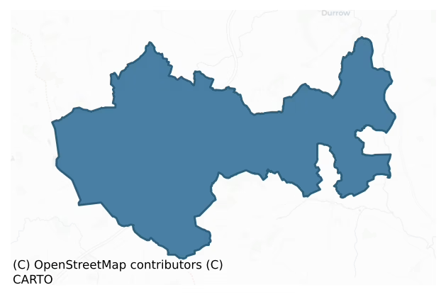
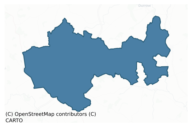
Galmoy is a barony of County Kilkenny, in the historical province of Leinster (Irish: Gabhalmhaigh), covering 163 km² of land. The barony records 522 NMS archaeological sites and 69 NIAH listed buildings, placing it at around the 85th percentile among 280 ROI baronies for sites per km². This means it is in the top fifth of all baronies for sites per km². Dated archaeological evidence runs from the Neolithic through to the Modern, spanning 8 of 9 archaeological periods, placing the barony in the 77th percentile among 280 ROI baronies for chronological depth. This means it is in the top third of all baronies for chronological depth. The largest dated subset of recorded sites dates to the Iron Age. Logainm flags 20 placenames in the barony as carrying a recognised heritage root; the largest share — around 65% — are names associated with pre-christian defensive.
Heritage at a glance
Percentile rankings throughout this profile compare each barony only against the other 279 Republic of Ireland baronies.
The recorded heritage of Galmoy
The National Monuments Service Sites and Monuments Record (SMR) is the statutory inventory of archaeological sites for the Republic of Ireland, maintained by the Department of Tourism, Culture, Arts, Gaeltacht, Sport and Media. Sites recorded here include earthworks, ringforts, megalithic tombs, ecclesiastical remains, and post-medieval features; not every record is legally protected, but each is registered as a monument of archaeological interest.
The National Monuments Service records 522 archaeological sites in Galmoy, putting it at the 85th percentile among 280 ROI baronies for sites per km². This means it is in the top fifth of all baronies for sites per km². Protection coverage is near-universal — 482 sites (92%) fall within a recorded monument protection zone, indicating an extensively surveyed landscape. The dominant category is defensive sites — ringforts, enclosures, hillforts, and stone forts (256 sites, 49% of the record). The most diagnostically specific type is Ringfort – rath (65 records, 12% of the barony's NMS total) — compared to an ROI average of 20% across all baronies where this type occurs. Ringfort – rath is an earthen ringfort enclosed by a bank and external ditch — the most common Early Medieval farmstead, broadly dated 500–1000 AD. The broader 'Enclosure' classification — which catches unclassified ringforts and field enclosures — accounts for a further 137 records (26%) and reflects the difficulty of sub-classifying degraded earthworks from surface evidence alone. Across the barony's 163 km², this gives a recorded density of 3.21 sites per km².
Most common monument types
Hover or tap a monument type to see its definition.
| Type | Count |
|---|---|
| Enclosure a banked or ditched feature of uncertain type, used as a catch-all where the original function cannot be determined from surface evidence | 137 |
| Ringfort – rath an earthen ringfort enclosed by a bank and external ditch — the most common Early Medieval farmstead, broadly dated 500–1000 AD | 65 |
| Fulacht fia a horseshoe-shaped Bronze Age burnt mound built around a sunken trough beside a water source, traditionally interpreted as a cooking site | 44 |
| Church a building used for public Christian worship, of any date from c. 500 AD onwards | 18 |
| Road – class 3 togher a short wooden peatland trackway up to 15m long, deliberately laid to cross a small area of bog; Neolithic to medieval | 17 |
| Graveyard a burial area associated with a church, in use from the medieval period onwards | 16 |
| Ring-ditch a circular ditch under 20m across, often the ploughed-out remains of a barrow, ring-barrow or roundhouse | 14 |
| Structure – peatland a construction of unknown function, either extant or implied by archaeological evidence, of any date | 14 |
Chronological distribution
The dated archaeological record for Galmoy spans from the Neolithic through to the Modern, with activity attested across 8 of 9 archaeological periods. This is the 77th percentile across ROI baronies for chronological depth — an above-average span. Every period from earliest to latest is represented in the record — an unbroken sequence of dated activity across the full chronological span. Activity concentrates most heavily in the Iron Age (180 sites, 41% of dated material), with the Early Medieval forming a secondary peak (108 sites, 24%). A further 81 recorded sites (16% of the overall NMS register for the barony) carry no period attribution — appearing as 'Unknown' in the bar chart below. This typically reflects either records that pre-date the standardised period vocabulary or sites awaiting specialist dating review, rather than a genuine absence of chronological evidence.
Sample of recorded monuments
Show 25 sample monuments (of 522 total)
A representative sample of 25 recorded monuments drawn from the barony’s 522 total NMS entries. Sites within a recorded monument protection zone and rarer site types are prioritised so the list shows a meaningful cross-section rather than only the most common type. Each entry shows the official Sites and Monuments Record reference number and the description published by the National Monuments Service.
Architectural fragment
According to Carrigan (1905, vol. 2, 316) a church (KK004-008001-) on Archer's Island in the River Nore was largely demolished c. 1800 and the stones were used in the building of Ballyconra mill. The mill has since been…
According to Carrigan (1905, vol. 2, 316) a church (KK004-008001-) on Archer's Island in the River Nore was largely demolished c. 1800 and the stones were used in the building of Ballyconra mill. The mill has since been demolished.
Compiled by: Jean Farrelly
Date of upload: 10 February 2016
Armorial plaque (present location)
One of three plaques which Carrigan (1905, vol. 2, 317-19) noted were affixed to the walls of the early 18th-century Ballyconra House, which stands on or incorporates 'old Ballyconra House' (KK004-024001-). A…
One of three plaques which Carrigan (1905, vol. 2, 317-19) noted were affixed to the walls of the early 18th-century Ballyconra House, which stands on or incorporates 'old Ballyconra House' (KK004-024001-). A 16th-century armorial plaques located above the rear doorway. It is described by Carrigan as being 'a small rectangular slab bearing a shield divided per pale, with the dexter side divided quarterly, and the sinister charged with the arms of the Fitzpatricks of Upper Ossory, viz., a saltire, on a chief three fleurs-de-lis; across the top of the slab is the following in relief: "E. M. 15 88 G. F. M." that is, E[dmund, Lord] M[ountgarret], 1588 G[rainia] F[itzpatrick, Lady] M[ountgarret]. Where this tablet was first set up is unknown'. The other two plaques are of 18th-century date and include the lintel over the present front door which bears an inscription with the date 1724, and the armorial plaque over the front door which according to Carrigan (ibid.) bears the date 1735. It is possible that the armorial plaque came from the multi-period Balleen Castle (KK009-037001-), a principal residence of the Mountgarret family.
See attached photographs:
Kk004-024—-_01 Location of armorial plaque
Kk004-024—-_02
Kk004-024—-_03
Kk004-024—-_04
Compiled by: Jean Farrelly
Date of revised upload: 10 July 2018
Burnt spread
In flat grassland to E of a small stream and a short distance S of a spring, on the floor of small valley in rolling grassland. Spread of burnt stone and charcoal found during ploughing.
Compiled by: Jean…
In flat grassland to E of a small stream and a short distance S of a spring, on the floor of small valley in rolling grassland. Spread of burnt stone and charcoal found during ploughing.
Compiled by: Jean Farrelly
Date of upload: 16 February 2016
House – fortified house
On the edge of low-lying, boggy, rough pasture with rock outcrop. The area has been planted with forestry with a roughly square buffer zone (dims. c. 65m²) around the castle. Before forestry the views were poor in all…
On the edge of low-lying, boggy, rough pasture with rock outcrop. The area has been planted with forestry with a roughly square buffer zone (dims. c. 65m²) around the castle. Before forestry the views were poor in all directions. In the 17th century this townland was part of Bruckana (called Brickanagh) townland. The Down survey (1655-6) barony map of Galmoy shows a fairly accurate representation of the fortified house, with a tower with entrance at the E and house attached to the W. The Down Survey parish map of Eirke parish shows a castle annotated 'decayed' in Brickanagh with Peter Archdeacon (aka Pierce Cody), Irish papist, listed as the proprietor before the 1641 Rising. The accompanying terrier also mentions a bawn. According to Carrigan (1905, vol. 2, 284), ‘Tradition affirms that this castle was occupied by Pierce Cody and was named from him, and that it was burned down (whether accidently or not, is not stated), in his absence, by his servants. The burning, if true, must have occurred very shortly before 1655, in which year the Down Survey Map enters Castlepierce as “a decayed castle and bawn” in Pierce Cody’s part of “Bricanagh”’. Pierce Cody took a prominent part in the Rising of 1641, after which his lands were forfeited (OPW topographical files).
A rectangular three-storeys with attic fortified house (int. dims. 7.55m E-W; 5.63m N-S; wall T 1.2m) with cross-gable roof and a five-storey square stair tower projecting out at the SE angle (int. dims. 2.5m E-W; 2…
Religious house – Augustinian canons
On a natural rise in gently undulating terrain with marshy flood plain of the River Goul to the N and W. Located on a former early medieval monastery probably founded by St Ciarán of Sir in the 6th century (Harbison…
On a natural rise in gently undulating terrain with marshy flood plain of the River Goul to the N and W. Located on a former early medieval monastery probably founded by St Ciarán of Sir in the 6th century (Harbison 1992, 198). A round tower (KK008-047004-) stands 20m to the SW of the church. According to Gwynn and Hadcock (1988, 176) this priory was founded in the 13th century by the Blanchfield family for the Canons Regular of St Augustine [Monasticum Hibernicum 1722] and ‘the prior and canons are mentioned in 1251: [Calandar of Documents relating to Ireland]. In 1396 the prior held the churchs of Ferikeragh and Donaghmore: [Monasticon Hibernicum 1786]. In 1421 the priory of Fertacheraeacli was so destroyed and exposed to ruin by wars and other disasters that the religious had to wander and beg for food, and one canon was transferred to Clonfert; in 1455 the priory was stated to be very poor, but it was conventual and proper hospitality was maintained: [Calandar of Papal Registers]. In 1455 Thady Megirid, a canon of Inchmacnerin, had been appointed to Fertagh whre he had repaired the buildings and been properly elected prior, but Thady Ocrinam, a canon of Aghmacart, had intruded himself: ibid. The priory was suppressed in 1540: Carrigan. On 6 Jan. 1541 the jurors found that the priory ch[urch] was parochial and the possessions included 60 acres, three cottages and two rectories (Fertagh and Donaghmore), val. £13 3s. 8d. gross, £10 3s. 8d. net; Robert Sortall (presumably…
Ecclesiastical enclosure
On a natural rise in gently undulating terrain with marshy flood plain of the River Goul to the N and W. An early medieval monastery, of which the round tower (KK008-047004-) survives, was founded here, probably by St…
On a natural rise in gently undulating terrain with marshy flood plain of the River Goul to the N and W. An early medieval monastery, of which the round tower (KK008-047004-) survives, was founded here, probably by St Ciarán of Sir in the 6th century (Harbison 1992, 198). The monastery would have been defined by a large circular or sub-circular enclosure, or more than one concentric enclosures. The precise location of the enclosing elements are unknown.
Compiled by: Jean Farrelly
Date of upload: 2 October 2018
Round tower
According to the Annals of the Four Master, the round tower, along with ‘Eochaidh O’Cuim, the Chief Master’ who was inside it, was burned in 1156 (Moore 1874-9, 35-6). In the OS Letters (1839) it was noted that, ‘The…
According to the Annals of the Four Master, the round tower, along with ‘Eochaidh O’Cuim, the Chief Master’ who was inside it, was burned in 1156 (Moore 1874-9, 35-6). In the OS Letters (1839) it was noted that, ‘The Irish-speaking people here all call the tower Cloigtheach, and they say its bells are buried in a swamp a little to the west, since the time of Cromwell’ (O'Flanagan 1930, vol. 1, 45 (135)). The eight-storey round tower (H 31.5m; ext. basal diam. 4.7m; int. basal diam. 2.7m; int. top diam. 2m), which tapers as it rises, is constructed of roughly dressed coursed limestone (wall T at base c. 1m; at top c. 0.9m). It is well preserved, surviving up to and including the lower portion of its conical stone roof. Internally each level was accessed by a wooden ladder. According to the OS Letters (ibid. 44 (132)) the doorway, which is in the NE, is, ‘eleven feet three inches [3.42m] from the ground, looking more like a breach in the wall than a regular doorway. It was originally built up with brown gritstone, of which no specimens can, they say, be met with in this country. All these stones were carried away some few years ago by a neighbouring farmer of the name of Switzer, who told me himself that he thought that they were fire-proof, and that for that purpose he placed them at the back of his kitchen fire, where they soon flew to pieces’. The OS Letters also note several cracks in the tower which, together with the doorway surround, were subsequently repaired using…
Tomb – effigial
In the N chapel of the medieval church at Grangefertagh (KK008-047001-). According to Carrigan (1905, vol. 2, 292-3), this chapel was built by the MacGillapatrick/Kilpatrick family in the 15th or early 16th century. …
In the N chapel of the medieval church at Grangefertagh (KK008-047001-). According to Carrigan (1905, vol. 2, 292-3), this chapel was built by the MacGillapatrick/Kilpatrick family in the 15th or early 16th century. This effigial tomb is described in detail by Hunt (1974, vol. 1, 166-7). The figures are those of a knight and a lady in high relief. The inscription in latin in Black Letter script is given by Hunt (ibid. 166) as, HIC JACET QUONDAM BONI DOMINI OSSIRIE JOHANNES MKYLLYFADRYK ET DOMINUS BERNARDI EJUS FILIUS. QUORUM ANIMABUS PROPICIETUR DEUS. PRO NORINA UXORE BERNARDI PROPRECARE. HIC JACET KATRINA MILOI MATER DOMINI BERNARDI FUNDATOR SCRINII, along with the translation, ‘Here lie the former good lords of Ossory John Mac Gilla Patrick and lord Brian his son. Upon whose souls may God have mercy. Here lies Katherine Molloy, mother of Brian the erector of this tomb’. The effigies are probably John and his wife Katherine, the former having died in 1468. However, the tomb was commissioned by the son Brian, who died in either 1511 or 1537, therefore the date of the tomb is prior to 1537 and is the product of the O’Tunney workshop (ibid., 167). The sides of the tomb are decorated with tracery and vaulting patterns and niches containing large foliate quatrefoils (Cockerham and Harris 2001, 155, 180; Hunt 1974, vol. 1, 167).
Compiled by: Jean Farrelly
Date of revised upload: 27 February 2017
Mill – unclassified
This was classified in the SMR (1987) as ‘Mill’ as a mill is marked roughly at this location on a Grand Jury Map (1809-19). It was classified in the RMP (1996) as ‘Earthwork’ based on fieldwork carried out in 1987 where…
This was classified in the SMR (1987) as ‘Mill’ as a mill is marked roughly at this location on a Grand Jury Map (1809-19). It was classified in the RMP (1996) as ‘Earthwork’ based on fieldwork carried out in 1987 where no mill was identified but some earthworks were described. It is possible that the earthworks are the result of quarrying activity. The precise location of the mill, which possibly dates to the 18th century, is unknown.
Compiled by: Jean Farrelly
Date of upload: 16 October 2017
Leacht
Associated with the medieval church (KK008-066001-) and graveyard (KK008-066002-), which, according to the OS Letters (1839) is known as 'Teampall na Ratha' or the church of the rath, probably in reference to the…
Associated with the medieval church (KK008-066001-) and graveyard (KK008-066002-), which, according to the OS Letters (1839) is known as 'Teampall na Ratha' or the church of the rath, probably in reference to the ringfort (KK008-142—-) 30m N of the church (O'Flanagan 1930, vol. 1, 116-17 (39)). At time of inspection in 1987 the graveyard was heavily overgrown with vegetation. In a description of the graveyard, Carrigan (ibid.) mentions that, 'Within the churchyard wall there is also a great leacht [KK008-066005-] or monumental heap of loose stones, but tradition is silent as to its origin'. This may be the mound (dims. 3m N-S; 7m E-W; H 0.5m) noted during the field inspection at the E end of the S side of the graveyard wall, though the sketch plan suggests that this mound is outside rather than within the graveyard.
Megalithic tomb – unclassified
At one of the lowest points immediately below a gravel ridge, in generally flat terrain, in grassland. A mound of earth and stone (dims. 9.5m N-S; 6m E-W; H 1.2m at E; H 0.1m at W) which is covered by a number of large…
At one of the lowest points immediately below a gravel ridge, in generally flat terrain, in grassland. A mound of earth and stone (dims. 9.5m N-S; 6m E-W; H 1.2m at E; H 0.1m at W) which is covered by a number of large boulders, some of which appear to be in situ. The monument is partially truncated, especially at the S.
Compiled by: Jean Farrelly
Date of upload: 17 January 2018
Castle – ringwork and bailey
On a gentle SW-facing slope in gently undulating terrain at the foot of Spahill, in pasture. There are good to extensive views in all directions, except to E which is dominated by Spahill. The monument is quite heavily…
On a gentle SW-facing slope in gently undulating terrain at the foot of Spahill, in pasture. There are good to extensive views in all directions, except to E which is dominated by Spahill. The monument is quite heavily overgrown with scrub, particularly on the raised interior and in the SW sector of the berm. A slightly oval raised area (int. diam. c. 34m N-S; c. 30m E-W) enclosed by a low earthen bank/scarp (Wth 3m; H 1.85m), berm or bailey (Wth 7m – 14m) and outer bank (int. H 0.37m; ext. H 0.9m; Wth at crest 0.9m; overall Wth 2.5m). Around the base of the mound the berm has a scooped appearance, like a wide, shallow fosse (Wth 7.3-7.7m; D 1.2m), which possibly provided material for the raised mound. There is some evidence of an outer fosse (Wth 9m; D 0.31m) in the N and E quadrants, though this is very wide and shallow and in may be the result of later activity. There is an irregular mound in the SSW quadrant on the outer edge of the berm and footings of a structure immediately E of this, both appear to be late intrusions. The interior is level except for the footings of a rectangular structure (L 7m; Wth 3.5m) with rounded corners, aligned roughly NW-SE, situated in the NW quadrant. A souterrain (KK008-119002-) is indicated on the 1st (1839) ed. 6-inch OS map, and the 1900 revision, in the NW quadrant. The presence of a souterrain suggests that this monument was a ringfort. However, it appears to have been modified significantly to form a ringwork-type monument with su…
Post row – peatland
A number of posts, haphazardly arranged. Discovered by Irish Archaeological Wetland Unit (UCD) in 1995 during a pilot survey of the Littleton Works.
Compiled by: Irish Archaeological Wetland Unit, UCD.
Date of…
A number of posts, haphazardly arranged. Discovered by Irish Archaeological Wetland Unit (UCD) in 1995 during a pilot survey of the Littleton Works.
Compiled by: Irish Archaeological Wetland Unit, UCD.
Date of upload: 25 April 2017
Barrow – ring-barrow
On the SE-facing hill slopes of a mountain, in rough moorland. A low, D-shaped platform (int. dims. 18.7m N-S; 15m E-W) enclosed by a slight fosse (Wth 1m) and external bank (Wth 2.7m; int. H 0.2m; ext. H 0.4m). Denuded…
On the SE-facing hill slopes of a mountain, in rough moorland. A low, D-shaped platform (int. dims. 18.7m N-S; 15m E-W) enclosed by a slight fosse (Wth 1m) and external bank (Wth 2.7m; int. H 0.2m; ext. H 0.4m). Denuded at SW by 19th-century cultivation ridges.
Compiled by: Jean Farrelly
Date of upload: 25 January 2018
Linear earthwork
On a fairly steep S-facing slope of a valley, in pasture. Two parallel lines (L c. 70m; Wth apart c. 20) identified as cropmarks on an aerial photograph (GSI roll 43, print 20) running NNE-SSW c. 15m SW of a circular…
On a fairly steep S-facing slope of a valley, in pasture. Two parallel lines (L c. 70m; Wth apart c. 20) identified as cropmarks on an aerial photograph (GSI roll 43, print 20) running NNE-SSW c. 15m SW of a circular enclosure (KK009-011001-). These are not visible at ground level.
Compiled by: Jean Farrelly
Date of upload: 29 January 2018
Cairn – wayside cairn
On the broad flat floor of the Nore river valley, on the S side of a road. It is described in the OS Letters (1839) as, 'a heap of stones and seven old white thorn trees growing round it; this they call Leacht…
On the broad flat floor of the Nore river valley, on the S side of a road. It is described in the OS Letters (1839) as, 'a heap of stones and seven old white thorn trees growing round it; this they call Leacht Dubhluing, i.e., Dubhluing's Heap or Monument, but they know nothing of its origin. (It is the burial place of Dubhluing O'Brenan, 3rd p. of Idough. He died in 954 – Four Masters)' (O'Flanagan ed. 1930, vol. 1, 89 (30)). When visited in 1987 there was an overgrown area where the road verge widens out with a single thorn tree but no obvious cairn was visible.
Compiled by: Jean Farrelly
Date of upload: 6 February 2018
Tomb – chest tomb
Within a graveyard (KK009-048003-), on the brow of a gentle E-facing slope, commanding a fine view from NNW-E-SE. There are three panels of a limestone chest-tomb comprising an end panel situated to the SW of the church…
Within a graveyard (KK009-048003-), on the brow of a gentle E-facing slope, commanding a fine view from NNW-E-SE. There are three panels of a limestone chest-tomb comprising an end panel situated to the SW of the church (KK009-048001-), the top panel or lid, situated immediately S of the church and a large side panel at SE. The end panel (0.86m x 0.48m; T 0.14m) was reused as a grave-marker and was partially buried in the ground. It is decorated with a semi-pointed arch within which is a depiction of the crucified Christ, flanked on his right side by Our Lady with a large veil and wearing a long, heavily pleated dress, and on his left, St John who is possibly holding one end of his cloak in his right hand as if to wipe away his tears. The top panel (0.94m x 0.53m; T 0.13m), on it's side, largely buried and used as a grave-marker, is likely, based of its visible dimensions and decorations, to have functioned as a lid on the chest-tomb. The visible decorated surface displays the shaft of a cross on a curving Calvary mound depicting a skull. A series of vertical bars extend up from the base and are crossed by intricate interlaced knots. The remains of a border around the perimeter of the panel bears a Latin inscription in raised Gothic lettering. The inscription is transcribed by Carrigan (1905, vol. 2, 323-4) and commemorates Theobald Purcell of Cloine and his wife Katherine Purcell (Cockerham 2009, 353). Carrigan describes the lid as being within the church and decorated wi…
Bridge
Crossing the River Nore at the W end of Ballyragget. A bridge is indicated roughly at this location on the Down Survey (1655-6) parish map of Donoghmore and the barony map of Fassadining. Lewis (1837, vol. 1, 162)…
Crossing the River Nore at the W end of Ballyragget. A bridge is indicated roughly at this location on the Down Survey (1655-6) parish map of Donoghmore and the barony map of Fassadining. Lewis (1837, vol. 1, 162) describes the bridge as, 'a good stone bridge of 10 arches'. Five of the arches are over the river proper, with further arches extending eastward where the river has largely slited up. The arches are segmental headed with ashlar voussoirs of 18th/early 19th-century date. The bridge is constructed of coursed limestone rubble with triangular cut-waters on the piers. The parapet has limestone coping stones. Some medieval fabric may survive from the earlier bridge. Though still in use, the bridge was by-passed in 1979 by a bridge to the N which carries the main traffic to and from the town.
Compiled by: Jean Farrelly
Date of upload: 23 January 2019
Megalithic tomb – portal tomb
On the crest of a N-S ridge, with land sloping gently away to the E and W down to the river plains, in tillage. There are very good views in all directions. Formerly in the demesne of Borrismore House, it is described…
On the crest of a N-S ridge, with land sloping gently away to the E and W down to the river plains, in tillage. There are very good views in all directions. Formerly in the demesne of Borrismore House, it is described by Carrigan (1905, vol. 2, 366) as, 'a cromlech in Mr. De Courcy's land in Borrismore'. A large roofstone-like stone (L 2.9m; Wth 2.2m; T 1.1m thick, partly rests on two inclined blocks. The E stone (dims. 2.2m x 1m; T 1m) leans to the S. The W stone (L 1.4m; T 0.6m) leans to the W. If erect it would be 1.7m high. A tree grows at the N foot of the monument. Two smaller slabs lie beside it and field clearance has been dumped in this area. The precise nature of this monument is uncertain. While the whole does not appear to be natural, the stones are very rough and uneven. This may have been a folly erected as part of the landscaping of the former demense and cannot be classified conclusively as a portal tomb. (Tighe 1802, 625; Lewis 1837, vol. 2, 671; Borlase 1897, vol. 2, 410-11).
Compiled by: Jean Farrelly and Paul Walsh
Date of revised upload: 12 May 2021
Fortification
A possible Cromwellian or Jacobean earthwork fort was discovered during an envrionmental impact study for the Arcon Lead-Zinc Mine at Galmoy. Excavation in 1999 confirmed that the monument was an earthen outwork…
A possible Cromwellian or Jacobean earthwork fort was discovered during an envrionmental impact study for the Arcon Lead-Zinc Mine at Galmoy. Excavation in 1999 confirmed that the monument was an earthen outwork fortification or 'redoubt', probably 17th-century in date, with a pentagonal plan, two demi-bastions (L 7.5m protruding into the fosse) on one side and a hornwork protecting the entranceway. The excavation revealed that the interior was deliberately lowered by removing sod and subsoil. There was no evidence of structures or occupation layers within the interior, and the limited artefactual evidence suggested that the fortification was not in use for a prolonged period. The main defensive bank, constructed of stone, gravel and sand, partially survived as an intermittent concave mound (max. H 0.6m). The bank was built up against a supporting palisade fence, evidenced by a number of post-holes and stake-holes including the main corner posts, braces and supports for a retaining timber palisade across the inner face of the fosse. The enclosing V-shaped fosse (Wth 5-5.5m; D 2-2.6m) turned through 60 degrees to give a diamond-shaped/pentagonal plan. Two salient-angled demi-bastions were noted at the N and W angles of the circuit. A metalled surface extended through a break in the fosse, which was protected by a small, E-W, linear gully (L 15m; Wth 1.3m; D 0.6m), terminating at a large post-hole. This represented one side of an outer defensive hornwork and gatepost. Eviden…
Metalworking site
Within the western flood-plain of the River Nore. A burnt mound (KK009-095—-) and a metalworking site were revealed during archaeological monitoring of a Bord Gáis Éireann gas pipeline development and excavated in…
Within the western flood-plain of the River Nore. A burnt mound (KK009-095—-) and a metalworking site were revealed during archaeological monitoring of a Bord Gáis Éireann gas pipeline development and excavated in 1999 (Stevens 2000, 150-51; Licence no. 99E0597). The burnt mound, 8m to the N, may or may not be related to the ironworking site.
The metalworking site centred on a small, circular pit (diam. 1.2m; D 0.3m), cutting natural boulder clay subsoil and possibly used as a furnace bowl for ironworking. It was filled with a stony clay containing iron slag and charcoal. Associated with but post-dating this was a large, thin, circular spread (dims. 15m N-S; at least 9m E-W; D 0.18m) of hard, mixed, orange, coarse sand and clay, with some fire-cracked limestone, also containing a number of iron nail fragments.
A large linear gully (Wth 1.6m; D 0.45m), orientated NE-SW (continuing to the W) cut the ironworking pit and spread, and turned E, terminating with a V-shaped profile and rounded terminus. The ditch contained a clay fill and burnt mound material which was sealed by a sub-circular spread of burnt mound material (dims. 10m N-S; 8m+ E-W; D 0.3m) also extending under the W baulk. The spread was heavily truncated by later ploughing and may have been deliberately pushed into the ditch.
A number of fragments of iron objects, slag and charcoal suggest this was an ironworking site. However, stray finds, including a fragment of clay pipe, modern porcelain and a modern…
Sheela-na-gig (present location)
Sheela-na-gig built into a wall in a farmyard. The original location is unknown but it is likely that it come from either Balleen Castle (KK009-037001-), located c. 100m to the E, or Balleen church (KK009-038001-),…
Sheela-na-gig built into a wall in a farmyard. The original location is unknown but it is likely that it come from either Balleen Castle (KK009-037001-), located c. 100m to the E, or Balleen church (KK009-038001-), located c. 200m to the SE, both on land attached to the farmyard. The figure is carved within a recessed frame (H 0.39m; Wth 0.27m) on the right hand side of a roughly rectangular slab (dims. H 0.45m; Wth 0.52m; minimum D 0.15m). Described by Freitag as a figure with a, 'Big, skull-shaped head with jug ears and strong facial features; thick ovoid eyes, flat wedge nose, deep striations on both cheeks, thick-lipped, open mouth displaying two rows of gritted teeth. Flat, pointy breasts at shoulder level; clearly marked ribs; big round navel. Arms in front of body with both hands reaching into vulva indicated as slit; fingers barely discernible. Legs widely splayed and bent; feet pointed outwards. A plait-like band hangs from left ear and disappears behind left shoulder’ (Freitag 2004, 133).
Compiled by: Caimin O'Brien and Jean Farrelly
Date of revised upload: 9 July 2018
This monument is subject to a preservation order made under the National Monuments Acts 1930 to 2014 (PO no. 3/1992).
Kiln
Test-trenching was carried out as part of an assessment along a stretch of c. 40km of the proposed N8 road improvement scheme from Cullahill, Co. Laois, to Cashel, Co. Tipperary. Located to the N of Glashare Stream. A…
Test-trenching was carried out as part of an assessment along a stretch of c. 40km of the proposed N8 road improvement scheme from Cullahill, Co. Laois, to Cashel, Co. Tipperary. Located to the N of Glashare Stream. A circular pit (diam. 0.85m; D 0.06m) with two protruding linear offshoots (both L 1m; Wth 0.3m), one running SW, the other SE. The pit was filled by grey/black charcoal-rich silty clay. A small box-section revealed that the pit was only 0.06m in depth. The offshoots were filled with grey/black silty clay that contained frequent charcoal flecks. The sides of the two offshoots were fire-reddened, suggesting in situ burning. The plan and form of this feature suggests that it is a kiln. (Moriarty 2008, 294)
Compiled by: Jean Farrelly
Date of upload: 25 January 2018
Standing stone – pair
The OS Letters (1839) refer to the southern ringfort (KK008-042—-) in the townland of Rathosheen, which, 'is said to have been the burial place of that Hero-Bard. His grave was marked in it by two upright stones at…
The OS Letters (1839) refer to the southern ringfort (KK008-042—-) in the townland of Rathosheen, which, 'is said to have been the burial place of that Hero-Bard. His grave was marked in it by two upright stones at several years distance but the place was dug up several years ago by money dreamers and the stones carried away by some wicked man who had not the fear of Oisinn or the fairies before his eyes, but he died since, tho' not very old! I could wish he had gone before he disturbed my old friends bones. Nothing remains now to mark the grave but a circular hollow in the south western part of the Rath' (O’Flanagan (ed.) 1930, 118-19 (40)). Being located within a ringfort these cannot be prehistoric standing stones, unless the enclosure is not a ringfort. However, as standing stones most accurately reflects what is described in the OS letters, the classification has been retained.
Compiled by: Jean Farrelly
Date of upload: 23 January 2018
Enclosure
On the crest of a N-S ridge overlooking lower land to the E and W, and slightly higher than the church (KK008-066001-) and graveyard (KK008-066002-) c. 50m to the N. It is described in the OS Letters (1839) as, 'an…
On the crest of a N-S ridge overlooking lower land to the E and W, and slightly higher than the church (KK008-066001-) and graveyard (KK008-066002-) c. 50m to the N. It is described in the OS Letters (1839) as, 'an ancient rath of an eliptical form in the Townland of Bayswell called Raith Chuil Gad, Rath Chuil Gad, i.e., the Rath of the Angle or Recess of the Gads. Its greatest length is from west to east and it is divided by a trench and mound running across in the centre, enclosing the southern end, on which the foundation of a small square stone building [KK008-067001-] is faintly traceable' (O'Flanagan 1930, vol. 1, 116 (39)). The 1st ed. (1839) 6-inch OS map indicates a lime kiln c. 20m S of the SW angle of the monument and it is likely that the monument itself was quarried into throughout much the 19th century to provide stone for this kiln. According to Carrigan (1905, vol. 2, 302), 'The rath was almost entirely destroyed about the year 1890, when it was found to contain great quantities of human bones [KK008-067002-]'. Carrigan (ibid.) suggests that, 'It is probable that it was the site of an ancient "Church of Rath," in use for many centuries till superseded by the present "Church of Rath" about the year 1300'. The monument is largely levelled, with very little visible at ground level at time of inspection.
Compiled by: Jean Farrelly
Date of upload: 24 October 2017
Listed buildings
The National Inventory of Architectural Heritage (NIAH) is a state survey appraising buildings of architectural, historical, archaeological, artistic, cultural, scientific, social, or technical interest. Each surveyed structure receives a rating from International (the highest, for buildings of European importance) through National, Regional, Local, and Record-Only.
The NIAH records 69 listed buildings in Galmoy (37th percentile across ROI baronies). All recorded buildings carry Regional or lower grading; the barony does not contain any structures appraised as being of National or International architectural importance. Construction dates concentrate most heavily in the Late Georgian (1800-1830) period. The most-recorded building type is house (29 examples, 42% of the listed stock).
Terrain and environment
Mean elevation across the barony is 136m — the 81st percentile among 280 ROI baronies for elevation. This means it is in the top fifth of all baronies for elevation. This is a relatively elevated landscape by ROI standards. Elevation matters for heritage because higher-altitude baronies typically favour defensive monuments — ringforts and hilltop forts placed on prominent ground — while lowland baronies are more likely to carry the dense settlement and church networks of intensive agricultural landscapes. A maximum elevation of 328m gives the barony meaningful vertical relief. Mean slope is 3.0° — the 37th percentile among 280 ROI baronies for slope. This means it is in the lower half of all baronies for slope. Slope is a key control on both land use and archaeological preservation: steep ground resists ploughing and tends to preserve earthworks intact, while gentle slopes favour intensive cultivation that damages or destroys surface archaeology over time. The Topographic Wetness Index averages 11.2, the 64th percentile among 280 ROI baronies for wetness. This means it is in the upper half of all baronies for wetness. Drainage matters for heritage because poorly-drained ground preserves organic archaeology (wooden trackways, leather, textiles, and on rare occasions human remains) far better than free-draining soil; well-drained ground favours arable use but destroys organic material rapidly. The land-cover mosaic combines improved grassland (84%), woodland (9%), and arable farmland (6%), giving a mixed agricultural and semi-natural landscape. In overall character, this is elevated but relatively gentle terrain — typical of plateau country, with land use dominated by improved grassland.
Terrain measurements
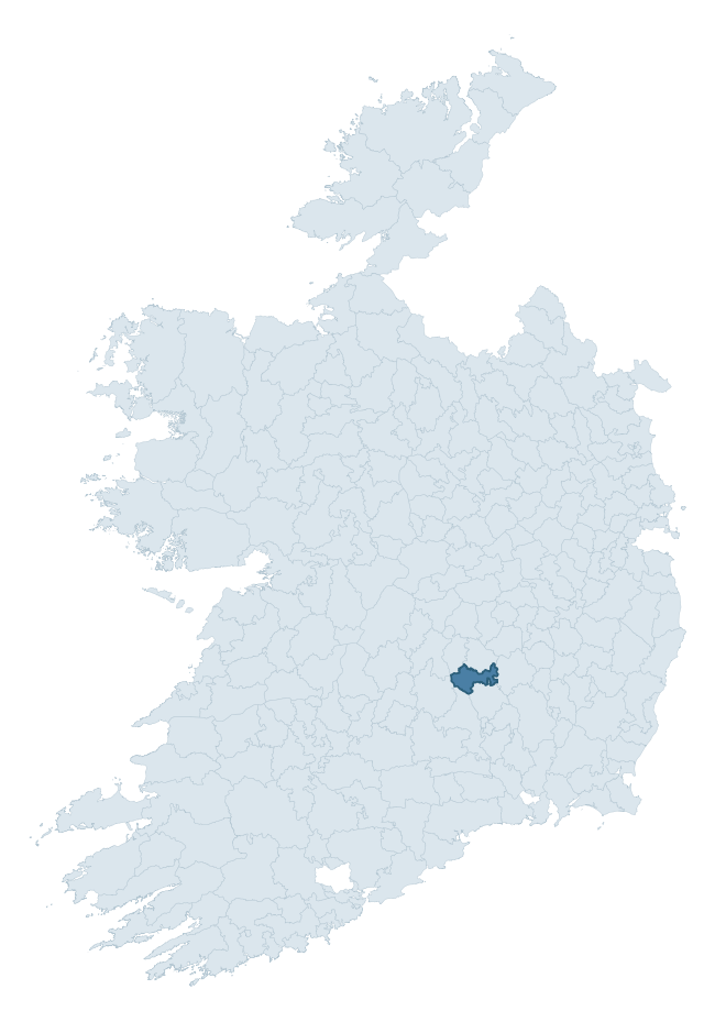
Where this barony sits in the Republic of Ireland
Geology and preservation
Bedrock geology shapes the landscape long before any settlement begins — controlling soil drainage, agricultural potential, the survival of upstanding monuments, and the preservation of buried archaeology. The figures below come from the Geological Survey Ireland 1:100,000 bedrock map.
The bedrock underlying Galmoy is predominantly limestone (57% of the barony by area), laid down during the Carboniferous period (100% by area, around 359 to 299 million years ago). Limestone is the most heritage-rich bedrock in Ireland. It supports fertile, well-drained soils that favoured dense Early Medieval settlement and Norman manorial agriculture, and it weathers into karst features — sinkholes, caves, swallow holes, and souterrains — that frequently carry archaeology. Where peat overlies limestone, organic preservation can be exceptional.
Rock type composition
Largest mapped unit: Ballyadams Formation (24% of the barony)
Placename evidence
Logainm records 20 heritage-diagnostic placenames for Galmoy, drawn from townland and civil-parish names across the barony. The dominant stratum is pre-Christian and Early Medieval defensive — ráth-, lios-, dún-, and caiseal-prefixed names that mark Iron Age and early historic settlement. The leading diagnostic roots are ráth- (11 — earthen ringfort), cill- (2 — church), and domhnach- (2 — very early church). This is below the ROI average of 30.7 heritage placenames per barony, suggesting either lighter survey coverage or a townland-naming tradition that draws more on generic landscape vocabulary. The presence of multiple heritage strata side by side indicates layered occupation of the landscape across successive prehistoric and historic periods. Logainm records 98 placenames for Galmoy (predominantly townland names). Of these, 20 (20%) carry one of the diagnostic Gaelic roots tracked above; the remainder draw on more generic landscape vocabulary that does not encode a heritage period.
Pre-Christian / Early Medieval Defensive
| Root | Count | Meaning |
|---|---|---|
| ráth- | 11 | earthen ringfort |
| lios- | 1 | ringfort or enclosure |
| caiseal- | 1 | stone ringfort |
Early Christian Ecclesiastical
| Root | Count | Meaning |
|---|---|---|
| cill- | 2 | church (early) |
| domhnach- | 2 | pre-Patrician or earliest Patrician church |
| tobar- | 1 | holy well |
| gráinseach- | 1 | monastic farm / grange |
Burial, Ritual, and Norse-Contact
| Root | Count | Meaning |
|---|---|---|
| feart- | 1 | grave mound |
Other baronies in Kilkenny
- Knocktopher
- Kells
- Fassadinin
- Gowran
- Kilculliheen
- Crannagh
- Shillelogher
- Ballycowan — Offaly
- Clandonagh — Laois
- Dundalk Upper — Louth
See all 280 baronies in the Republic of Ireland Heritage Tool.

Explore further
Grounding History: 10 Maps of Northern Ireland’s Past
If you’re interested in Irish heritage more widely, the companion report for Northern Ireland brings together the analysis of all 462 NI wards into one place through 10 high-quality maps — covering monument density, archaeological periods, placename heritage, terrain, wetland, and the historic landscape at first survey. Take a look.
About this profile
Click any section below to expand.
What is a barony?
A barony is a historic administrative unit in Ireland, broadly equivalent to an English hundred. The 280 baronies used here are from the OSi 2019 National Statutory Boundaries (generalised 20m), covering the 26 counties of the Republic of Ireland. Baronies derive from the Norman period, were formalised in the 17th century, and have not been redrawn for statistical purposes. They vary enormously in area, from compact urban baronies in Dublin to vast upland baronies in Connacht, and should not be compared by raw site count without accounting for area differences.
What counts as a site?
This profile combines three distinct heritage registers, each with its own definition of what constitutes a recordable site:
- Archaeological sites (NMS). The National Monuments Service Sites and Monuments Record (SMR) catalogues every known archaeological monument or site of archaeological interest in the Republic, from prehistoric burial mounds and ringforts to medieval churches and post-medieval defensive works. Inclusion does not require legal protection — only that the site has been identified, surveyed, and assessed as having archaeological value. A separate subset of these sites lies within a recorded protection zone, which gives them statutory protection under the National Monuments Acts.
- Listed buildings (NIAH). The National Inventory of Architectural Heritage records buildings of architectural, historical, archaeological, artistic, cultural, scientific, social, or technical interest. Each surveyed structure is appraised on a five-tier scale: International, National, Regional, Local, and Record-Only. The NIAH appraisal is informational rather than strictly statutory, but it underpins local-authority Record of Protected Structures (RPS) listings.
- Heritage placenames (Logainm). Logainm is the authoritative database of Irish placenames maintained by the Placenames Branch. This profile applies a heritage-diagnostic classifier to the Irish-language form of each townland name, flagging roots that signal defensive sites (ráth-, lios-, dún-, caiseal-, cathair-), ecclesiastical foundations (cill-, teampall-, domhnach-, mainistir-), prehistoric burial-ritual features (tuaim-, carn-, leaba-), or Norse-contact settlement (gall-). Townlands without one of these diagnostic roots are not flagged here — they may still carry historical significance, but that significance is not encoded in the name itself.
Editorial principles
The narrative sections of this profile follow several explicit principles:
- Evidential. Every claim about this barony’s heritage character is anchored in the underlying register data. Where a site count, a placename count, or a percentile rank is cited, it is computed from the source datasets at export time, not estimated.
- Comparative. Counts and metrics are reported alongside their percentile rank against the other 279 ROI baronies. A barony with 50 ringforts in absolute terms could be unusually high or unusually low depending on its size and regional context; percentile ranking removes that ambiguity.
- Transparent on limits. Where a register has known coverage gaps, survey biases, or data-quality issues that affect this barony’s figures, the profile flags them rather than presenting the numbers as definitive.
- No interpretation beyond what the data supports. The narrative does not speculate about historical events, social dynamics, or cultural meaning beyond what the recorded heritage and placename evidence directly attests.
Data caveats and limits
- NMS Sites and Monuments Record is the product of survey campaigns conducted at different intensities across different counties and decades. Some baronies have been surveyed more thoroughly than others, and absolute counts should be read in that light. Sites destroyed by development before survey are typically not represented; sites in heavily forested or upland terrain are sometimes under-recorded.
- NIAH coverage is broadly complete for the Republic of Ireland but the survey was conducted on a rolling county-by-county basis, and the most recent appraisal date varies. Buildings demolished or substantially altered after their original survey may still appear in the register; conversely, recent buildings of merit may not yet have been appraised.
- Logainm classification applies a deliberately conservative pattern-matching approach to the Irish-language townland forms. The classifier prioritises true positives over recall: a townland may carry a heritage signal that the classifier doesn’t recognise, particularly where the diagnostic root has been heavily anglicised or where the townland name draws on a less common term. The 60,000+ townland records and ~9,800 classified placenames give a substantial signal at barony scale, but individual townland names should be checked against Logainm directly for definitive interpretation.
- Period attribution. The chronological distribution reflects only those NMS sites that carry a recognised period attribution in the source data. Sites listed as “Unknown” period are excluded from the dated subset.
- Boundary changes. Some baronies have undergone minor boundary adjustments since their 19th-century definition; the OSi 2019 generalised boundaries used here are the current statutory definition and may differ slightly from historical maps in border areas.
- Bedrock geology is mapped at 1:100,000 scale, which means local variation within a barony — small pockets of different rock type, mineral veins, alluvium overlying bedrock — is generalised. The dominant-system and rocktype figures are area-weighted, so a barony reading “70% Carboniferous limestone” may still contain small but archaeologically important pockets of older or younger rock. Around 3% of GSI polygons do not match the lexicon and contribute no rocktype or system attribution.
Data sources
- National Monuments Service — Sites and Monuments Record (SMR) https://data.gov.ie/dataset/national-monuments-service-archaeological-survey-of-ireland
- National Inventory of Architectural Heritage (NIAH) https://data.gov.ie/dataset/national-inventory-of-architectural-heritage-niah-national-dataset
- Logainm — Placenames Database of Ireland https://www.logainm.ie/
- Ordnance Survey Ireland — National Statutory Barony Boundaries 2019 https://data-osi.opendata.arcgis.com/
- EURODEM — European Digital Elevation Model https://www.mapsforeurope.org/datasets/euro-dem
- ESA WorldCover https://esa-worldcover.org/en
- Geological Survey Ireland — 1:100,000 Bedrock Geology https://www.gsi.ie/en-ie/data-and-maps/Pages/Bedrock.aspx
Explore more: Search any of the 280 ROI baronies, browse by historical province, or read the methodology and data sources for the full Republic of Ireland Heritage Tool.