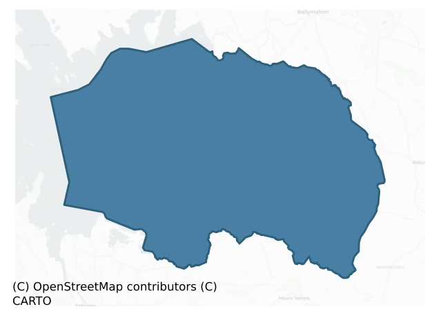
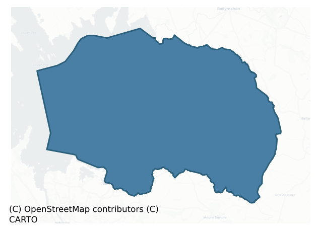
Kilkenny West is a barony of County Westmeath, in the historical province of Leinster (Irish: Cill Chainnigh Thiar), covering 152 km² of land. The barony records 260 NMS archaeological sites and 65 NIAH listed buildings, placing it at around the 43rd percentile among 280 ROI baronies for sites per km². This means it is in the lower half of all baronies for sites per km². Dated archaeological evidence runs from the Early Bronze Age through to the Post Medieval, spanning 6 of 9 archaeological periods, placing the barony in the 12th percentile among 280 ROI baronies for chronological depth. This means it is in the bottom fifth of all baronies for chronological depth. The largest dated subset of recorded sites dates to the Early Medieval. Logainm flags 29 placenames in the barony as carrying a recognised heritage root; the largest share — around 52% — are names associated with early Christian church and monastic foundations.
Heritage at a glance
Percentile rankings throughout this profile compare each barony only against the other 279 Republic of Ireland baronies.
The recorded heritage of Kilkenny West
The National Monuments Service Sites and Monuments Record (SMR) is the statutory inventory of archaeological sites for the Republic of Ireland, maintained by the Department of Tourism, Culture, Arts, Gaeltacht, Sport and Media. Sites recorded here include earthworks, ringforts, megalithic tombs, ecclesiastical remains, and post-medieval features; not every record is legally protected, but each is registered as a monument of archaeological interest.
The National Monuments Service records 260 archaeological sites in Kilkenny West, putting it at the 43rd percentile among 280 ROI baronies for sites per km². This means it is in the lower half of all baronies for sites per km². Protection coverage is near-universal — 257 sites (99%) fall within a recorded monument protection zone, indicating an extensively surveyed landscape. The dominant category is defensive sites — ringforts, enclosures, hillforts, and stone forts (152 sites, 58% of the record). Ringfort – rath is the most prevalent type, making up 30% of the barony's recorded sites (79 records) — well above the ROI average of 20% across all baronies where this type occurs. Ringfort – rath is an earthen ringfort enclosed by a bank and external ditch — the most common Early Medieval farmstead, broadly dated 500–1000 AD. Other significant types include Earthwork (13) and Ringfort – unclassified (13). Earthwork is an unclassified earthen structure with no diagnostic features that allow a more specific classification; Ringfort – unclassified is a circular Early Medieval settlement enclosure where surviving evidence does not allow distinction between earthen and stone forms. Across the barony's 152 km², this gives a recorded density of 1.71 sites per km².
Most common monument types
Hover or tap a monument type to see its definition.
| Type | Count |
|---|---|
| Ringfort – rath an earthen ringfort enclosed by a bank and external ditch — the most common Early Medieval farmstead, broadly dated 500–1000 AD | 79 |
| Earthwork an unclassified earthen structure with no diagnostic features that allow a more specific classification | 13 |
| Ringfort – unclassified a circular Early Medieval settlement enclosure where surviving evidence does not allow distinction between earthen and stone forms | 13 |
| Ecclesiastical enclosure a large enclosure surrounding an Early Medieval church or monastery and its associated activity areas | 11 |
| Castle – unclassified a castle whose form cannot be precisely classified, dating somewhere between the late 12th and 16th centuries | 11 |
| Church a building used for public Christian worship, of any date from c. 500 AD onwards | 10 |
| Cross-slab a stone slab inscribed with a cross, used as a grave-marker or memorial, dated pre-1200 AD | 10 |
| Graveyard a burial area associated with a church, in use from the medieval period onwards | 10 |
Chronological distribution
The dated archaeological record for Kilkenny West spans from the Early Bronze Age through to the Post Medieval, with activity attested across 6 of 9 archaeological periods. This is the 12th percentile across ROI baronies — a relatively narrow chronological band, with much of Irish prehistory not represented in the dated record. Every period from earliest to latest is represented in the record — an unbroken sequence of dated activity across the full chronological span. Activity concentrates most heavily in the Early Medieval (125 sites, 55% of dated material), with the Medieval forming a secondary peak (42 sites, 18%). A further 32 recorded sites (12% of the overall NMS register for the barony) carry no period attribution — appearing as 'Unknown' in the bar chart below. This typically reflects either records that pre-date the standardised period vocabulary or sites awaiting specialist dating review, rather than a genuine absence of chronological evidence.
Sample of recorded monuments
Show 25 sample monuments (of 260 total)
A representative sample of 25 recorded monuments drawn from the barony’s 260 total NMS entries. Sites within a recorded monument protection zone and rarer site types are prioritised so the list shows a meaningful cross-section rather than only the most common type. Each entry shows the official Sites and Monuments Record reference number and the description published by the National Monuments Service.
Religious house – Franciscan nuns (Poor Clares)
The Poor Clare convent is situated 105m SW of the shoreline of Lough Ree. The convent at Bethlehem was established in 1631 after the nuns were forced to flee from their Dublin house towards the end of the previous year.…
The Poor Clare convent is situated 105m SW of the shoreline of Lough Ree. The convent at Bethlehem was established in 1631 after the nuns were forced to flee from their Dublin house towards the end of the previous year. In 1682 Sir Henry Piers recorded that 'in a promontory that jetteth into the lake, distant from Athlone five miles, and to the north of it, was before the year 1641, a nunnery called Bethlem, the only one that I have heard of that was of late days in this kingdom, of the order of St. Clare, the mother abbess whereof was a lady of good extraction, the daughter of Sir Edmund Tuit' (Vallancey 1786, 81). The convent of Bethlehem was burnt by Lord Ranelagh in 1642 after which they fled to establish a new foundation (WM029-042101-) in the town of Athlone (Cal. S.P. Ire., 662-3). The burning of this convent was described in a petition sent to the Supreme Council in 1647 by the 'Mother Abbess and poor Sisters of St. Clare, in the Convent of Bethlehem in Athlone' (ibid.). The petitioner stated that 'the enemy burned their convent of Bethlehem and choicest ornaments at the beginning of these distempers, and ceased [seized] upon all their goods and provisions, and forced themselves to betake them into islands, woods, and bogs. After the first cessastion was proclaimed, they came together in the ruinous town of Athlone, their communion consisting of 24, where they continue till now upon the benevolence of the Supreme Council and friends, but they are very poor' (ib…
Religious house – Augustinian canons
Situated on the N side of Inchmore Island on Lough Ree. A monastery was reputedly founded here by St. Laobhán (Ó Riain 2011, 390-1). He was one of 47 children whose mother was Cuman daughter of Dallbhrónach, maternal…
Situated on the N side of Inchmore Island on Lough Ree. A monastery was reputedly founded here by St. Laobhán (Ó Riain 2011, 390-1). He was one of 47 children whose mother was Cuman daughter of Dallbhrónach, maternal aunt to Saint Brighid of Kildare, whose was womb had been blessed by St. Patrick (ibid.). His feastday fell on the 9th of August (ibid.). According to Ware a priory of Augustinian Canons was established on the island, probably some time before 1170 AD (Gwynn and Hadcock 1970, 179). In 1103 the Annals of the Four Masters recorded the death of 'The Lector Ua Connmhaigh, of the family of Inis-mor' (O'Donovan 1856, 973). After the dissolution of the monasteries the land of Inchmore was granted to Richard Barnwell (Gwynn and Hadcock 1970, 179). In 1641 the lands of Inchmore were in the joint possession of Lord Viscount Dillon, Gerald Dillon and John Dillon (NLI MS 723-4).
Monument depicted on the 1837 ed. OS 6-inch map and annotated as ‘Inchmore Church’. A narrow inlet, 60m to N is annotated as ‘Church Harbour’. Poorly preserved remains consist of a simple rectangular structure (Int. dims. 4.55m N-S x 9m E-W) comprising well built mortared walls (T 0.85m), with only the W gable upstanding and lower courses of the remaining walls surviving elsewhere. . A possible opening in N wall towards E end, but very uncertain. No dressed stones, windows or doorway visible. No surrounding earthworks visible.
Compiled by: Frank Coyne and Caimin O'Brien…
Cliff-edge fort
This monument is now located on the N side of the Tang River in the modern County of Longford because the course of the Tang River was straightened in recent times. Depicted as a semi-circular-shaped enclosure standing…
This monument is now located on the N side of the Tang River in the modern County of Longford because the course of the Tang River was straightened in recent times. Depicted as a semi-circular-shaped enclosure standing on the S bank of the Tang River which formed the enclosing element on the NE side of the monument. No surface remains visible. Slight traces of the semi-circular shaped earthwork appears to be visible on Digital Globe aerial photograph where it is visible as a line of trees on the S side of the monument. The old course of the Tang River is clearly visible on the Digital Globe aerial photograph.
Compiled by: Frank Coyne and Caimin O'Brien
Date of upload: 10 September 2018
Religious house – Carmelite friars
Carmelite friary founded c. 1291 by Robert Dillon, Lord of Drumrany (Gwynn & Hadcock 1970, 286). In 1540 the friary consisted of 'a small church with two small houses adjacent and a carucate of land which had come into…
Carmelite friary founded c. 1291 by Robert Dillon, Lord of Drumrany (Gwynn & Hadcock 1970, 286). In 1540 the friary consisted of 'a small church with two small houses adjacent and a carucate of land which had come into the king's hands through the dissolution by the prior and convent of the late house of Carmelites' (ibid., 286-7). In this year ‘Moryhyrtagh O Kenny, travelling serjeant or bailiff in the Annale, similiarly sworn, states that there is in Athnecrane [Ardnacrany] in co. Westmeath a small (parva) church with two small (exiguis) houses adjacent, and a carucate of land, which have come into the king’s hands through the dissolution by the prior and convent of the late house of Carmelite friar; value 26s. 8d.’ (White 1943, 283). In 1546 the lands of the friary were granted to Robert Dillon (Hadcock 1970, 287).
This site consists today of post-medieval graveyard (WM016-019001-) enclosed by a stone wall with entrance gate and stile on W side. The S wall of the graveyard incorporates the S wall of the Carmelite friary church with a seventeenth century graveslab (WM016-019002-) and a 17th century memorial stone (WM016-019004-) lying aginst the N face of this section of friary wall. The friary church wall forms part of the S boundary wall of the graveyard, a large part of this boundary wall formed the S wall of the medieval friary church building. There is no straight joint visible on the S graveyard boundary wall to indicate where the graveyard wall joined onto…
Children's burial ground
The children's burial ground marked on the OS 6-inch map as 'Relicnapastia' was located in the sub-triangular shaped field located immediately NW of Carrick Cross which was used as a mass rock (WM016-024—-) during…
The children's burial ground marked on the OS 6-inch map as 'Relicnapastia' was located in the sub-triangular shaped field located immediately NW of Carrick Cross which was used as a mass rock (WM016-024—-) during penal times. In 1837 the Ordnance Survey recorded that the Relicnapastia was 'a small field of triangular form field' (OSNB). Small D-shaped or sub-triangular shaped field (approx. dims. 57m E-W x 49m N-S) depicted on OS 6-inch map marked the site of a children's burial ground known as 'Relicnapastia' located immediately NW of Carrick Cross which was used as a mass rock (WM016-024—-) during penal times. This burial ground was surveyed and described in 1980 when it recorded that this site was 'Not marked as an antiquity by the OS. It was sited on a slight natural rise. The adjoining enclosure now destroyed was a burial ground although no burials have taken place here since the turn of the century' (SMR file). Described in 1979 as 'The site is a slight natural rise on the top of a high prominent hill of good pasture. Excellent views in all directions. There is no visible trace of an antiquity at the site of the cross [Carrick Cross] that was used as a mass rock (WM016-024—-) during penal times'. No surface remains visible of levelled burial ground and no evidence of any grave markers in area where burial ground was located. Faint cropmark of levelled enclosure visible on Digital Globe aerial photograph.
Compiled and revised by: Caimin O'Brien
Da…
Windmill
Described in 1980 as 'A circular stone tower built of rubble limestone 5.5m in diam. & approx. 7m high with walls 1m thick. There are wide doorways opposite each other in the NE & SW sides. There are the lines of two…
Described in 1980 as 'A circular stone tower built of rubble limestone 5.5m in diam. & approx. 7m high with walls 1m thick. There are wide doorways opposite each other in the NE & SW sides. There are the lines of two upper floors visible inside the tower, the wall is set slightly back to form a narrow ledge to support the floor. Part of the upper wall in the 2nd floor level has been broken away on the NE side. Probably the remains of a 17th C. or 18th C. windmill. Sited on a low rise with wide views in all directions' (SMR file 29/10/1980).
Described by the National Inventory of Architectural Heritage as a, 'Freestanding former windmill on circular plan, built c.1800. Now ruinous and out of use. Constructed of coursed rubble limestone. Square-headed openings to north face. Located in prominent position in the landscape close to summit of low, gently sloping hill' (www.buildingsofireland.ie).
Compiled and revised by: Caimin O'Brien
Date of revised upload: 23 July 2015
Bullaun stone
Situated on the E shoreline of Rinardoo Bay on Lough Ree overlooking Carnakilla Point 165m to W. Base of cross (WM022-017—-) 15m to SSE, church (WM022-014002-) and graveyard (WM022-014—-) with motte and bailey…
Situated on the E shoreline of Rinardoo Bay on Lough Ree overlooking Carnakilla Point 165m to W. Base of cross (WM022-017—-) 15m to SSE, church (WM022-014002-) and graveyard (WM022-014—-) with motte and bailey (WM022-015—) all built on site of Early Christian monastery (WM022-014001-) 60m to N. The stone is located in the area liable to flooding and is partially covered in water part of the year.
Described in 1977 as on top of 'a natural limestone boulder (Dims. 2.4m x 1.4m x H 0.75m) on the lake shore is a possible double bullaun. The longer depression has a definite worked appearance. Depressions measure 0.3m by 0.3m by 0.03m deep and 0.3m by 0.25m by 0.02m deep' (SMR file). There appears to be the partial remains of a third depression (diam. 0.28m)on the surface of the boulder.
Compiled by: Caimin O'Brien
Date of upload: 24 June 2010
Promontory fort – inland
Situated on a promontory jutting out into the S end of Ballaghkeeran Bay in Killinure Lough at SE end of Lough Ree. The Breensford River runs c. 90m to S which forms the townland boundary with Ballykeeran. Monument…
Situated on a promontory jutting out into the S end of Ballaghkeeran Bay in Killinure Lough at SE end of Lough Ree. The Breensford River runs c. 90m to S which forms the townland boundary with Ballykeeran. Monument described in 1976-1981 as an oval-shaped area (approx. dims. 130m N-S; 90m E-W) situated on a promontory which is separated from the mainland by an inner bank, an intervening fosse and an outer bank from NE-E-S-SW and defined by a steep scarp rising from the lakeshore from SW-W-N-NE. The inner bank (max. H 1m; Wth 2m) is almost reduced to a scarp and rises level with the interior. The intervening fosse (Wth 3-5m) is relatively wide. A low, wide outer bank (Wth 5-7m; H 0.3m) is visible outside the fosse from NE-SE. A modern drain has been cut through the fosse along the E side and similar drains cut through the outer bank at SE. A house site (WM022-041001-) is visible in the SE quadrant of the enclosure. The remainder of the interior is covered by lazy-beds running E-W. Reputed locally to be the site of a Viking longphort, however there is little surface evidence to suggest that it is Viking in date. The site was recorded and excavated by Mr. T. Fanning, University College Galway between 1980-84 (www.excavations.ie). An oak planked jetty (WM022-041003-) is located on the shoreline to the immediate W of the enclosure and a house site (WM022-041002-) is visible to the immediate NE. A possible burial mound (WM022-041004-), also reputed to be Viking in date, lies c….
Standing stone
Situated on a W-facing slope, in gently undulating pasture. Annotated 'Stone' on 1837 ed. OS Fair Plan map. Levelled monument described in 1983 as no surface remains visible. No surface remains visible today on Digital…
Situated on a W-facing slope, in gently undulating pasture. Annotated 'Stone' on 1837 ed. OS Fair Plan map. Levelled monument described in 1983 as no surface remains visible. No surface remains visible today on Digital Globe aerial photographs of any standing stone in area marked on 1837 ed. OS 6-inch map.
Compiled by Alison McQueen, Vera Rahilly and Caimin O’Brien.
Date of upload: 23 July 2019
Settlement deserted – medieval
Situated in low lying, gently undulating, wet pasture, Anglo-Norman motte and bailey castle (WM023-013001-) 190m to SSE. Not depicted on the 1837 OS 6-inch map or the revised 1913 ed. OS 25-inch map. Monument described…
Situated in low lying, gently undulating, wet pasture, Anglo-Norman motte and bailey castle (WM023-013001-) 190m to SSE. Not depicted on the 1837 OS 6-inch map or the revised 1913 ed. OS 25-inch map. Monument described in 1981 as an extensive system of ridges and depressions which may represent a medieval settlement. Some on the higher and drier ground may be archaeological whilst others on the low lying ground appear to be the remains of drainage features.
Compiled by Alison McQueen, Vera Rahilly and Caimin O’Brien.
Date of upload: 23 July 2019
Religious house – Fratres Cruciferi
A house for Fratres Cruciferi was founded at Kilkenny West, NE of Athlone, c.1200, apparently by Friar Thomas Dillon, grandson of Thomas Dillon who came to Ireland in 1185 (Hadcock 1964, 130). A church (WM023-025—-)…
A house for Fratres Cruciferi was founded at Kilkenny West, NE of Athlone, c.1200, apparently by Friar Thomas Dillon, grandson of Thomas Dillon who came to Ireland in 1185 (Hadcock 1964, 130). A church (WM023-025—-) and graveyard (WM023-025001-) with chapel (WM023-025003-) are located immediately to the N and Kilkenny Castle (WM023-023—-) is 175m to the NW. Holy well (WM023-024—-) dedicated to St. Canice 1100m to NE. According to Gwynn and Hadcock a monastery was founded here in the mid-sixth century by St. Canice (Gwynn and Hadcock 1970, 391). It has been mistakenly suggested that this was the priory or hospital of St. John the Baptist which was founded soon after the Conquest by the Tyrrells (Gwynn and Hadcock 1970, 213). In 1569 after the Dissolution of the Monasteries the Crown granted a 21 year lease to Gabriel Croftes of the ‘site of the hospital of S. John of Kylkenny, co. Westmeath, the lands of Kylkenny and Bryttas, and the tithes of Kylkenny, Walterstowne, Kylmackaron, Stonton, Kyllensaughen, Tullaghmore, Tullham, Ballynekell, Stacom, and of the burgage of Kylkenny’ (Nicholls 1994, 93). Three years later in 1569 the Crown granted Robert Dillon, chief justice of the Common Bench, the ‘site of the hospital of S. John the Baptist, of Kilkenny, (co. Westmeath), the lands of Kilkenny and Britas, and the tithes of Kilkenny, Walteristone, Kylmacarren, Stoughton alias Stonton, Killenfaughen, Tullaghmore, Tullan, Stacon and Ballenekell, possessions of the hospi…
Castle – motte
Situated on natural rise of ground with good views of the surrounding countryside. Drumraney church (WM023-040—-) and graveyard (WM023-040001-) located 300m to S with holy well (WM023-039—-) 215m to SE. …
Situated on natural rise of ground with good views of the surrounding countryside. Drumraney church (WM023-040—-) and graveyard (WM023-040001-) located 300m to S with holy well (WM023-039—-) 215m to SE. Anglo-Norman motte possibly constructed by Henry De Lion / Dillon c. 1185 who came to Ireland in this year as first gentleman and secretary to John, earl of Morton [later King John], who granted Henry MacCarron’s territory, called Corkoici, part of Annaly, now Longford, and a large part of Mac Geoghegan’s and O’Melaghlin’s territories, which he held with the service of 60 knights (Brydges 1817, 25-6). These granted lands became known as Dillion’s Country which during the reign of Henry VIII was divided into the barony of Kilkenny West and others. The Dillon’s constructed a castle and church (WM023-040—-) at Drumraney which located roughly in the centre of Dillon’s Country.
Situated on the landscaped estate of Drumraney House now levelled which was located immediately to SW as depicted on the first edition OS 6-inch map. The house was converted into a Constabulary Barracks as depicted on the current ed. OS 6-inch map. The motte may be the remains of Drumraney Castle depicted on the 1659 Down Survey map of Kilkenny West barony (NLI, MS 723-4). The castle is shown standing beside the medieval road depicted as the ‘Highway from Athlone to Dublin’ on the 1659 Down Survey map of Drumraney parish Ibid.). The terrier of the 1659 Down Survey map of Drumraney paris…
Barrow – unclassified
Situated on the summit of a hill with earthwork (WM023-044—-) 110m to S. Small poorly preserved irregular-shaped mound (overall diam. c. 18m NNE-SSW) of earth and stones which has been quarried away on the S (SMR…
Situated on the summit of a hill with earthwork (WM023-044—-) 110m to S. Small poorly preserved irregular-shaped mound (overall diam. c. 18m NNE-SSW) of earth and stones which has been quarried away on the S (SMR File 17/09/1971). The shape of the mound has been altered by the extensive damage caused by the quarrying of the mound. Not depicted as an antiquity on 1837 ed. OS 6-inch map. This mound marks the ordnance datum point for 401 ft. as depicted on the 1837 ed. OS 6-inch map. It is possible that the earthwork may have been modified or constructed by the Ordnance Survey when taking a datum point from this hilltop. The classification and antiquity of this monument is uncertain and its poor condition makes it difficult to be certain about its original appearance. It has been suggested that this earthwork may represent the remains of a poorly preserved bowl-barrow (SMR File 17/09/1971). However in profile the mound has the appearance of a stepped-barrow rather than a bowl-barrow.
Compiled by: Caimin O’Brien
Date of upload: 20 July 2015
Castle – ringwork
Situated on the W side of a high rise, in pasture, with good views to W, NW and S. The Down Survey map of Drumraney depicts a tower house type castle (WM023-070001-) in Bryanmore [Brinemore] townland on or close to site…
Situated on the W side of a high rise, in pasture, with good views to W, NW and S. The Down Survey map of Drumraney depicts a tower house type castle (WM023-070001-) in Bryanmore [Brinemore] townland on or close to site of ‘The Breen’ (NLI, MS 723-4). On this map the castle is depicted standing on lands belonging in 1640 to John Dillon who is listed as an 'Irish papist' (ibid.). Depicted on the 1837 OS six-inch map as a circular-shaped enclosure outlined by two concentric lines with two buildings in the centre of the enclosure. One of these building is annotated ‘Sterns Folly’ with a circular shaped earthwork or mound immediately depicted to the E of the building. The annotation ‘The Breen’ appears to refer to the circular-shaped enclosure. This earthwork may have been a circular shaped bawn or courtyard of the castle of Bryanmore (WM023-070001-), annotated as 'The Breen' on six inch OS maps.
Monument described in 1971 and 1979 as a roughly circular-shaped area enclosed by an earth and stone bank, an intervening fosse and an outer bank. The outer bank incorporates large stones which may be those referred to by O’Donovan (OSNB 1837) when he recorded that ‘there was originally a circle of large stones surrounding the fort'. The entrance to the interior is at SSE. A stone-faced rectangular depression in the NE quadrant appears to be a cellar or foundation of a building, which may be the remains of the tower house or Bryanmore Castle. A bank running N-S traverses the…
Exhibitionist figure (present location)
A male exhibitionist figure cemented into the gate pillar of Ballycloghduff House carved in relief on a rectangular-shaped cut stone (dims. 0.6m x 0.3m) which came from the site of a medieval castle (WM030-130—)…
A male exhibitionist figure cemented into the gate pillar of Ballycloghduff House carved in relief on a rectangular-shaped cut stone (dims. 0.6m x 0.3m) which came from the site of a medieval castle (WM030-130—) located 110m to the E of the present gateway. This carved stone was taken from the levelled castle site and inserted into gate pier by present landowners. A photograph taken by the landowner shows the figure carved in relief on a rectangular-shaped cut stone possibly a quoin or jamb stone from a window or doorway surround of the medieval castle. Figure was mistakenly identified as originally coming from the corn mill located 150m to the E (Weir 1980, 64-5). This figure was inserted into the gate pillar of Ballycloghduff House along with other stones from the levelled castle site by the present landowner. Ballycloghduff Castle is depicted on the 1659 Down Survey map where it is shown standing beside a medieval mill (WM030-131—-) (NLI, MS 723-4). The present corn mill appears to be standing on the site of the medieval mill depicted on the Down Survey map.
Described in 1973 as a carved figure 'built into a gate pier of Ballycloghduff House. The stone appears to be of limestone and was at one time painted over. The figure is cut in low relief and shows, head, arms, torso and legs. The feet are turned in towards each other. In the left hand the figure holds a key. The right hand is placed between the legs and may be holding the genitals' (SMR File 30/0…
Wall monument
Carmelite friary founded (WM016-019—-) c. 1291 by Robert Dillon, Lord of Drumrany (Gwynn & Hadcock 1970, 286). This site consists today of a relatively modern rectangular-shaped graveyard (WM016-019001-) with a…
Carmelite friary founded (WM016-019—-) c. 1291 by Robert Dillon, Lord of Drumrany (Gwynn & Hadcock 1970, 286). This site consists today of a relatively modern rectangular-shaped graveyard (WM016-019001-) with a seventeenth century graveslab (WM016-019002-) along with post-medieval memorial stones and the remains of a church (WM016-019—-) belonging to the Carmelite Friary. Late 17th century square-shaped wall monument (dims. 0.95m x 0.88m; T 0.14m) lying up against N face of S wall of friary church close to SE corner of graveyard. Wall monument located immediately W of 17th century graveslab (WM016-019002-). Memorial stone recorded by Marree Curran on the 8 April 2014 and listed Irish Historic Graves website at http://historicgraves.com/ardnacrany-north/wm-acny-0009/grave accessed 9 October 2014. Inscription on tablet reads as following:
Theobald Dillons Monument
was erected by his son Thomas
Dillon. the said Thomas his
Mother her was Julia Dillon Alias
Dalton who died 1st of
August in the year 1691 who
was eldest daughter of John
Dalton of Moyvaghly Esq
This Theobald Dillon is a branch of
the Earl of Roscommon.
Memorials inside graveyard have been recorded and photographed and are now listed on the Historic Graves website at http://historicgraves.com/graveyard/ardnacrany-north/wm-acny, accessed 9 October 2014. See attached pdf showing plan of graveyard, the above graveslab is shown as number 9, taken from Historic Graves website at the above address…
Chapel
Ivy-clad ruins of multi-period single cell chapel standing in SE quadrant of sub-rectangular shaped graveyard (WM023-025001-) with 19th century Church of Ireland church ruins standing on site of medieval parish church…
Ivy-clad ruins of multi-period single cell chapel standing in SE quadrant of sub-rectangular shaped graveyard (WM023-025001-) with 19th century Church of Ireland church ruins standing on site of medieval parish church (WM023-025—-). Holy well (WM023-024—-) 245m to NE, abbey site (WM023-026—-) 50m to SSE and castle (WM023-023—-) 135m to WNW. Present remains consist of a small rectangular chapel (int. dims. 3.8m N-S; 5.2m E-W; wall T 0.9m) with barrel-vaulted roof (H 4.43m) which is entered through a round-arched punch dressed stone doorway (Wth 0.9m; H 1.57m) with hood moulding above of 17th century date in centre of W wall. The chapel is lit by a single light window set into a cut-stone semi-circular arched window embrasure in centre of E wall. The window head consists of a reused window cill inserted to form the head of the present window opening. A small wall cupboard or aumbry (dims. 0.52m x 0.42m; D 0.41m) is located off centre to E in N wall of chapel. The vaulted ceiling has good evidence of wicker centring and there are three punch dressed corbels at the springing level of the vault in the N and S walls. A single light ogee-headed window in the centre of the W wall above the doorway is the only other window. The lower part of this window has been blocked by the insertion of a cut stone plaque (H 0.48m x Wth 0.36m) which reads ''WITHIN . THIS . CHAPEL . LIETH . THE . BODY. OF . TOO . SECULAR . PRIEST . FATHER . CHRISTY . DILON . AND . FATHER . PETER…
Building
The monastery on the island of Inchbofin [Inis Bó Finne), in Lough Ree, Co. Westmeath was founded by Moríog also known as St. Ríog/Ríoch or Doríog in the 5th century (Harbison 1970, 243; Ó Riain 2011, 497). Moríog was a…
The monastery on the island of Inchbofin [Inis Bó Finne), in Lough Ree, Co. Westmeath was founded by Moríog also known as St. Ríog/Ríoch or Doríog in the 5th century (Harbison 1970, 243; Ó Riain 2011, 497). Moríog was a nephew of St. Patrick and one of seven sons of Restitutus (Rhystud) of the Maca Baird (Lombards) and brother to Meal of Ardagh (Ó Riain 2011, 497). His feast day fell on the 1st of August.
It has been suggested that in the late medieval period the monastery was occupied by the Canons Regular of St. Augustine, and it was probably this order which made the additions to the abbey church at Inchbofin (De Paor 1962, 187). However no documentary evidence for the presence of Augustinians on this Island has been found to support this claim (Gwynn & Hadcock 1970, 37).
At the NE corner of this small island, are the ruins of a multi-period church known as Inchbofin [Inisbofin] "Abbey" (WM015-001—-; National Monument No. 213) and graveyard (WM015-001001-) standing in the E quadrant of a monastic enclosure or cashel (WM015-001003-) defined by a drystone wall with the remains of a second nave and chancel church (WM015-001002-) located 120m to the S of the abbey church. A small building attached to the cashel wall (WM015-001003-) 18m to the SSW of the abbey church (WM015-001—-) is indicated on the 1837 ed. OS 6-inch map, in 1912 this poorly preserved building was described as following; 'attached to the cashel (WM015-001003-) on the south is a small rectangula…
Inscribed stone
Fragment of a stone described by Robert Cochrane as, 'another curious stone shows parts of two grooves 3/8 inch [0.09m] wide and 5/16 inch [0.08m] deep. The portion remains of the grooves is 2" [0.05m] long, They may…
Fragment of a stone described by Robert Cochrane as, 'another curious stone shows parts of two grooves 3/8 inch [0.09m] wide and 5/16 inch [0.08m] deep. The portion remains of the grooves is 2" [0.05m] long, They may have been used for sharpening pointed tools' (Anon. 1913, 48).
This may be the same stone catalogued by Crawford in 1913 as slab (i) and described as a ‘fragment 11 in. [0.28m] by 6½ in. [0.15m], incised with the letters ..td, and below them . . r’ (Crawford 1913, 329). Listed by Macalister in 1949 as slab no. 875 and described as a fragmentary slab with 'the ends of two lines of writing' (Macalister 1949, 80).
See attached 1912 OPW drawing of stone with two incised lines (Anon. 1913, 47).
Compiled and revised by: Caimin O'Brien
Date of revised upload: 23 April 2021
Rock art (present location)
This stone stands in the garden of a house at the eastern extremity of the townland of Clogher. It has been described by O’Reilly (2010, 79-80) as follows: ‘In 1998 Jim Higgins reported a further rock art discovery from…
This stone stands in the garden of a house at the eastern extremity of the townland of Clogher. It has been described by O’Reilly (2010, 79-80) as follows: ‘In 1998 Jim Higgins reported a further rock art discovery from Corbrack townland, Tang. This stone, standing at approximately 1.7m in height and 1.69m in maximum width, is one of a pair of sandstone boulders that had been moved from their original position beside the road some years before. The decoration on the stone consists of thirty or more circular and oval cup-marks as well as at least two ringed cup-marks and a series of artificial grooves. About half way up the left-hand side of the stone is a particularly deep cup-mark measuring 13cm in diameter and approximately 8cm deep. This hollow has a ring pecked into the stone about 3cm from its edge enclosing the cup-mark The second of the two stones has no rock art discernible, although it is possible that some exists on the surfaces that are no longer visible since the stone was moved.’
Compiled by: Paul Walsh
Date of upload: 30 August 2013
Barrow – ring-barrow
Circular area (diam. 10m) enclosed by low earthen bank in low lying partially drained field immediately S of Noughaval graveyard (WM016-012001-) boundary wall. Outline of earthwork clearly visible on OSI 2005 aerial…
Circular area (diam. 10m) enclosed by low earthen bank in low lying partially drained field immediately S of Noughaval graveyard (WM016-012001-) boundary wall. Outline of earthwork clearly visible on OSI 2005 aerial photographs. Possibly represents the remains of a ring-barrow. A low linear earthwork in field to E of graveyard may represent the remains of an old trackway running from the graveyard towards Noughaval House to the E which is clearly visible on Bing Maps aerial photographs.
Compiled by: Caimin O'Brien
Date of upload: 2 October 2014
Font (present location)
St. Kenny's [St. Canice] holy well (WM023-024—) situated in a roughly-D-shaped grove of trees and bushes on flat poorly drained land with church (WM023-025—-) and graveyard (WM023-025001-) 240m to SW. Kilkenny…
St. Kenny's [St. Canice] holy well (WM023-024—) situated in a roughly-D-shaped grove of trees and bushes on flat poorly drained land with church (WM023-025—-) and graveyard (WM023-025001-) 240m to SW. Kilkenny Castle (WM023-023—-) 330m to WSW and site of levelled abbey (WM023-026—-) belonging to the Fratres Cruciferi / Crouched Friars 260m to SSW. The area around the well is covered in thorn bushes and trees making detailed examination of the site impossible. A large octagonal-shaped limestone baptismal font (ext. diam. 0.64m x H 0.3m) with chamfered panels (Wth 0.26m) and a flat rim (T 0.09m) lies on the ground immediately to the N of well. The circular basin of the font measures 0.46m in diameter and is 0.26m deep and has a central drain hole which was not visible at time of inspection due to presence of water and vegetation. Coins have been left in the basin as votive offerings associated with nearby holy well. The original location of the font is uncertain but it either came from the medieval church (WM023-025—-) or from the abbey site (WM023-026—-). The hexagonal shaped limestone base (Wth 0.55m x H 0.36m) of this font lies to the W of the well. The base of the font has 6 chamfered panels (Wth 0.26-0.21m) dressed in a similar fashion to the bowl of the font. The chamfered faces of the base are similar in size to the chamfered panels of the font. One side of the base has been left undressed and this face probably stood against the wall of the chur…
Font
Medieval baptismal font was probably taken from medieval church site (WM023-026—-) in the post-medieval period and moved down to St. Kenny's [St. Canice] holy well (WM023-024—) where it served as a possible…
Medieval baptismal font was probably taken from medieval church site (WM023-026—-) in the post-medieval period and moved down to St. Kenny's [St. Canice] holy well (WM023-024—) where it served as a possible penitential station. See WM023-024001- for description of medieval font.
Compiled by: Caimin O'Brien
Date of revised upload: 3 July 2015
Pier/Jetty
Situated on the W shoreline of a promontory jutting out into the S end of Ballaghkeeran Bay in Killinure Lough at SE end of Lough Ree. The Breensford River lies c. 50m to S, with possible promontory fort (WM022-041—-)…
Situated on the W shoreline of a promontory jutting out into the S end of Ballaghkeeran Bay in Killinure Lough at SE end of Lough Ree. The Breensford River lies c. 50m to S, with possible promontory fort (WM022-041—-) immediately to E. Monument described in 1981 as the remains of a possible jetty located on a scarp, which was revealed by a drop in the level of water on the lake. It is composed of four horizontal oak planks jutting out into the lough, bearing sapwood, black in colour and of obvious antiquity. The planks are embedded in a grey-red marl, which is obvious shoreline silt, and lie in a layer (T 0.1m) of charcoal and mixed habitation material.
Compiled by: Alison McQueen, Vera Rahilly and Caimin O’Brien
Date of upload: 17 July 2019
Ringfort – rath
Situated on elevated N-facing slope of rising ground. Ringfort (WM015-007—) 150m to S. A slightly raised circular-shaped area (approx. diam. 38m E-W) enclosed by a low bank of earth and stone with a shallow external…
Situated on elevated N-facing slope of rising ground. Ringfort (WM015-007—) 150m to S. A slightly raised circular-shaped area (approx. diam. 38m E-W) enclosed by a low bank of earth and stone with a shallow external fosse. The bank has been almost completely levelled at N, where the perimeter is intersected by a NW-SE field fence. The interior slopes gently from SW-NE. In the centre of the monument a mound of field clearance stones is visible, with a low bank extending to SW from the W end of this mound towards the ringfort bank.
See attached profile of monument surveyed and drawn by the ASI.
Compiled by: Frank Coyne and Caimin O'Brien
Date of upload: 5 September 2018
Listed buildings
The National Inventory of Architectural Heritage (NIAH) is a state survey appraising buildings of architectural, historical, archaeological, artistic, cultural, scientific, social, or technical interest. Each surveyed structure receives a rating from International (the highest, for buildings of European importance) through National, Regional, Local, and Record-Only.
The NIAH records 65 listed buildings in Kilkenny West (34th percentile across ROI baronies). The highest-graded structures include 2 of National significance. The Republic holds 937 National-graded buildings in total, so this barony accounts for around 0% of the national total. Construction dates concentrate most heavily in the Victorian (1830-1900) period. The most-recorded building type is house (22 examples, 34% of the listed stock).
Terrain and environment
Mean elevation across the barony is 55m — the 20th percentile among 280 ROI baronies for elevation. This means it is in the bottom third of all baronies for elevation. This is a relatively low-lying landscape by ROI standards. Elevation matters for heritage because higher-altitude baronies typically favour defensive monuments — ringforts and hilltop forts placed on prominent ground — while lowland baronies are more likely to carry the dense settlement and church networks of intensive agricultural landscapes. Mean slope is 2.3° — the 17th percentile among 280 ROI baronies for slope. This means it is in the bottom fifth of all baronies for slope. This is broadly flat terrain, the kind of landscape best suited to intensive agriculture. Slope is a key control on both land use and archaeological preservation: steep ground resists ploughing and tends to preserve earthworks intact, while gentle slopes favour intensive cultivation that damages or destroys surface archaeology over time. The Topographic Wetness Index averages 11.7, the 86th percentile among 280 ROI baronies for wetness. This means it is in the top fifth of all baronies for wetness. This is wet, slow-draining ground by ROI standards — the kind of landscape that may carry waterlogged archaeological sites of unusual preservation value. Drainage matters for heritage because poorly-drained ground preserves organic archaeology (wooden trackways, leather, textiles, and on rare occasions human remains) far better than free-draining soil; well-drained ground favours arable use but destroys organic material rapidly. The land-cover mosaic combines improved grassland (70%), open water (17%), and woodland (13%), giving a mixed agricultural and semi-natural landscape. In overall character, this is low-lying, gently-sloping terrain — characteristic of Ireland's central plain and coastal lowlands, with land use dominated by improved grassland.
Terrain measurements
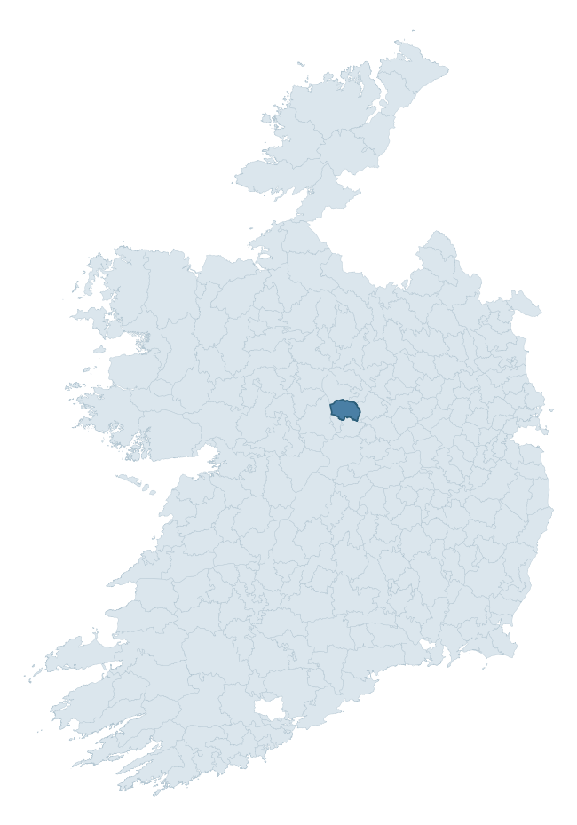
Where this barony sits in the Republic of Ireland
Geology and preservation
Bedrock geology shapes the landscape long before any settlement begins — controlling soil drainage, agricultural potential, the survival of upstanding monuments, and the preservation of buried archaeology. The figures below come from the Geological Survey Ireland 1:100,000 bedrock map.
The bedrock underlying Kilkenny West is predominantly limestone (97% of the barony by area), laid down during the Carboniferous period (100% by area, around 359 to 299 million years ago). Limestone is the most heritage-rich bedrock in Ireland. It supports fertile, well-drained soils that favoured dense Early Medieval settlement and Norman manorial agriculture, and it weathers into karst features — sinkholes, caves, swallow holes, and souterrains — that frequently carry archaeology. Where peat overlies limestone, organic preservation can be exceptional. The single largest mapped unit is the Lucan Formation (48% of the barony's bedrock). With only 2 distinct rock types mapped, the barony is geologically uniform compared to the rest of the Republic (8th percentile for diversity) — a single coherent bedrock landscape.
Rock type composition
Largest mapped unit: Lucan Formation (48% of the barony)
Placename evidence
Logainm records 29 heritage-diagnostic placenames for Kilkenny West, drawn from townland and civil-parish names across the barony. The dominant stratum is Early Christian ecclesiastical — cill-, teampall-, and domhnach-prefixed names that record the dense network of early church foundations established between the fifth and tenth centuries. The leading diagnostic roots are cill- (12 — church), lios- (9 — ringfort or enclosure), and dún- (3 — hilltop fort or promontory fort). This is broadly in line with the ROI average of 30.7 heritage placenames per barony. Logainm records 143 placenames for Kilkenny West (predominantly townland names). Of these, 29 (20%) carry one of the diagnostic Gaelic roots tracked above; the remainder draw on more generic landscape vocabulary that does not encode a heritage period.
Pre-Christian / Early Medieval Defensive
| Root | Count | Meaning |
|---|---|---|
| lios- | 9 | ringfort or enclosure |
| dún- | 3 | hilltop or promontory fort |
| ráth- | 2 | earthen ringfort |
Early Christian Ecclesiastical
| Root | Count | Meaning |
|---|---|---|
| cill- | 12 | church (early) |
| cillín- | 2 | unconsecrated burial ground |
| tobar- | 1 | holy well |
Other baronies in Westmeath
- Clonlonan
- Corkaree
- Rathconrath
- Moygoish
- Fore
- Fartullagh
- Athlone South
- Ardee — Louth
- Fore
- Ida — Wexford
See all 280 baronies in the Republic of Ireland Heritage Tool.

Explore further
Grounding History: 10 Maps of Northern Ireland’s Past
If you’re interested in Irish heritage more widely, the companion report for Northern Ireland brings together the analysis of all 462 NI wards into one place through 10 high-quality maps — covering monument density, archaeological periods, placename heritage, terrain, wetland, and the historic landscape at first survey. Take a look.
About this profile
Click any section below to expand.
What is a barony?
A barony is a historic administrative unit in Ireland, broadly equivalent to an English hundred. The 280 baronies used here are from the OSi 2019 National Statutory Boundaries (generalised 20m), covering the 26 counties of the Republic of Ireland. Baronies derive from the Norman period, were formalised in the 17th century, and have not been redrawn for statistical purposes. They vary enormously in area, from compact urban baronies in Dublin to vast upland baronies in Connacht, and should not be compared by raw site count without accounting for area differences.
What counts as a site?
This profile combines three distinct heritage registers, each with its own definition of what constitutes a recordable site:
- Archaeological sites (NMS). The National Monuments Service Sites and Monuments Record (SMR) catalogues every known archaeological monument or site of archaeological interest in the Republic, from prehistoric burial mounds and ringforts to medieval churches and post-medieval defensive works. Inclusion does not require legal protection — only that the site has been identified, surveyed, and assessed as having archaeological value. A separate subset of these sites lies within a recorded protection zone, which gives them statutory protection under the National Monuments Acts.
- Listed buildings (NIAH). The National Inventory of Architectural Heritage records buildings of architectural, historical, archaeological, artistic, cultural, scientific, social, or technical interest. Each surveyed structure is appraised on a five-tier scale: International, National, Regional, Local, and Record-Only. The NIAH appraisal is informational rather than strictly statutory, but it underpins local-authority Record of Protected Structures (RPS) listings.
- Heritage placenames (Logainm). Logainm is the authoritative database of Irish placenames maintained by the Placenames Branch. This profile applies a heritage-diagnostic classifier to the Irish-language form of each townland name, flagging roots that signal defensive sites (ráth-, lios-, dún-, caiseal-, cathair-), ecclesiastical foundations (cill-, teampall-, domhnach-, mainistir-), prehistoric burial-ritual features (tuaim-, carn-, leaba-), or Norse-contact settlement (gall-). Townlands without one of these diagnostic roots are not flagged here — they may still carry historical significance, but that significance is not encoded in the name itself.
Editorial principles
The narrative sections of this profile follow several explicit principles:
- Evidential. Every claim about this barony’s heritage character is anchored in the underlying register data. Where a site count, a placename count, or a percentile rank is cited, it is computed from the source datasets at export time, not estimated.
- Comparative. Counts and metrics are reported alongside their percentile rank against the other 279 ROI baronies. A barony with 50 ringforts in absolute terms could be unusually high or unusually low depending on its size and regional context; percentile ranking removes that ambiguity.
- Transparent on limits. Where a register has known coverage gaps, survey biases, or data-quality issues that affect this barony’s figures, the profile flags them rather than presenting the numbers as definitive.
- No interpretation beyond what the data supports. The narrative does not speculate about historical events, social dynamics, or cultural meaning beyond what the recorded heritage and placename evidence directly attests.
Data caveats and limits
- NMS Sites and Monuments Record is the product of survey campaigns conducted at different intensities across different counties and decades. Some baronies have been surveyed more thoroughly than others, and absolute counts should be read in that light. Sites destroyed by development before survey are typically not represented; sites in heavily forested or upland terrain are sometimes under-recorded.
- NIAH coverage is broadly complete for the Republic of Ireland but the survey was conducted on a rolling county-by-county basis, and the most recent appraisal date varies. Buildings demolished or substantially altered after their original survey may still appear in the register; conversely, recent buildings of merit may not yet have been appraised.
- Logainm classification applies a deliberately conservative pattern-matching approach to the Irish-language townland forms. The classifier prioritises true positives over recall: a townland may carry a heritage signal that the classifier doesn’t recognise, particularly where the diagnostic root has been heavily anglicised or where the townland name draws on a less common term. The 60,000+ townland records and ~9,800 classified placenames give a substantial signal at barony scale, but individual townland names should be checked against Logainm directly for definitive interpretation.
- Period attribution. The chronological distribution reflects only those NMS sites that carry a recognised period attribution in the source data. Sites listed as “Unknown” period are excluded from the dated subset.
- Boundary changes. Some baronies have undergone minor boundary adjustments since their 19th-century definition; the OSi 2019 generalised boundaries used here are the current statutory definition and may differ slightly from historical maps in border areas.
- Bedrock geology is mapped at 1:100,000 scale, which means local variation within a barony — small pockets of different rock type, mineral veins, alluvium overlying bedrock — is generalised. The dominant-system and rocktype figures are area-weighted, so a barony reading “70% Carboniferous limestone” may still contain small but archaeologically important pockets of older or younger rock. Around 3% of GSI polygons do not match the lexicon and contribute no rocktype or system attribution.
Data sources
- National Monuments Service — Sites and Monuments Record (SMR) https://data.gov.ie/dataset/national-monuments-service-archaeological-survey-of-ireland
- National Inventory of Architectural Heritage (NIAH) https://data.gov.ie/dataset/national-inventory-of-architectural-heritage-niah-national-dataset
- Logainm — Placenames Database of Ireland https://www.logainm.ie/
- Ordnance Survey Ireland — National Statutory Barony Boundaries 2019 https://data-osi.opendata.arcgis.com/
- EURODEM — European Digital Elevation Model https://www.mapsforeurope.org/datasets/euro-dem
- ESA WorldCover https://esa-worldcover.org/en
- Geological Survey Ireland — 1:100,000 Bedrock Geology https://www.gsi.ie/en-ie/data-and-maps/Pages/Bedrock.aspx
Explore more: Search any of the 280 ROI baronies, browse by historical province, or read the methodology and data sources for the full Republic of Ireland Heritage Tool.