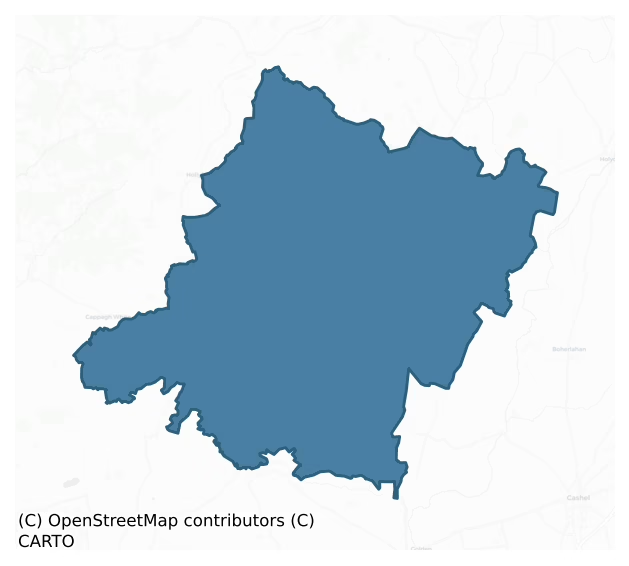
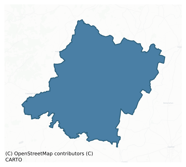
Kilnamanagh Lower is a barony of County Tipperary, in the historical province of Munster (Irish: Coill na Manach Íochtarach), covering 171 km² of land. The barony records 173 NMS archaeological sites and 58 NIAH listed buildings, placing it at around the 13th percentile among 280 ROI baronies for sites per km². This means it is in the bottom fifth of all baronies for sites per km². Dated archaeological evidence runs from the Neolithic through to the Modern, spanning 8 of 9 archaeological periods, placing the barony in the 80th percentile among 280 ROI baronies for chronological depth. This means it is in the top fifth of all baronies for chronological depth. The largest dated subset of recorded sites dates to the Iron Age. Logainm flags 17 placenames in the barony as carrying a recognised heritage root; the largest share — around 59% — are names associated with early Christian church and monastic foundations.
Heritage at a glance
Percentile rankings throughout this profile compare each barony only against the other 279 Republic of Ireland baronies.
The recorded heritage of Kilnamanagh Lower
The National Monuments Service Sites and Monuments Record (SMR) is the statutory inventory of archaeological sites for the Republic of Ireland, maintained by the Department of Tourism, Culture, Arts, Gaeltacht, Sport and Media. Sites recorded here include earthworks, ringforts, megalithic tombs, ecclesiastical remains, and post-medieval features; not every record is legally protected, but each is registered as a monument of archaeological interest.
The National Monuments Service records 173 archaeological sites in Kilnamanagh Lower, putting it at the 13th percentile among 280 ROI baronies for sites per km². This means it is in the bottom fifth of all baronies for sites per km². A sparse recorded total of this kind in Ireland often reflects survey priority rather than genuine absence of past activity. Protection coverage is near-universal — 172 sites (99%) fall within a recorded monument protection zone, indicating an extensively surveyed landscape. The dominant category is defensive sites — ringforts, enclosures, hillforts, and stone forts (97 sites, 56% of the record). The most diagnostically specific type is Ringfort – rath (21 records, 12% of the barony's NMS total) — compared to an ROI average of 20% across all baronies where this type occurs. Ringfort – rath is an earthen ringfort enclosed by a bank and external ditch — the most common Early Medieval farmstead, broadly dated 500–1000 AD. The broader 'Enclosure' classification — which catches unclassified ringforts and field enclosures — accounts for a further 59 records (34%) and reflects the difficulty of sub-classifying degraded earthworks from surface evidence alone. Across the barony's 171 km², this gives a recorded density of 1.01 sites per km².
Most common monument types
Hover or tap a monument type to see its definition.
| Type | Count |
|---|---|
| Enclosure a banked or ditched feature of uncertain type, used as a catch-all where the original function cannot be determined from surface evidence | 59 |
| Ringfort – rath an earthen ringfort enclosed by a bank and external ditch — the most common Early Medieval farmstead, broadly dated 500–1000 AD | 21 |
| Church a building used for public Christian worship, of any date from c. 500 AD onwards | 11 |
| Graveyard a burial area associated with a church, in use from the medieval period onwards | 8 |
| Castle – tower house a fortified residential tower of four or five storeys, mostly built by lords in the 15th and 16th centuries and often within a defended bawn | 5 |
| Castle – unclassified a castle whose form cannot be precisely classified, dating somewhere between the late 12th and 16th centuries | 4 |
| Moated site | 4 |
Chronological distribution
The dated archaeological record for Kilnamanagh Lower spans from the Neolithic through to the Modern, with activity attested across 8 of 9 archaeological periods. This is the 80th percentile across ROI baronies for chronological depth — an above-average span. Every period from earliest to latest is represented in the record — an unbroken sequence of dated activity across the full chronological span. Activity concentrates most heavily in the Iron Age (74 sites, 49% of dated material), with the Early Medieval forming a secondary peak (28 sites, 19%). A further 23 recorded sites (13% of the overall NMS register for the barony) carry no period attribution — appearing as 'Unknown' in the bar chart below. This typically reflects either records that pre-date the standardised period vocabulary or sites awaiting specialist dating review, rather than a genuine absence of chronological evidence.
Sample of recorded monuments
Show 25 sample monuments (of 173 total)
A representative sample of 25 recorded monuments drawn from the barony’s 173 total NMS entries. Sites within a recorded monument protection zone and rarer site types are prioritised so the list shows a meaningful cross-section rather than only the most common type. Each entry shows the official Sites and Monuments Record reference number and the description published by the National Monuments Service.
Weir – fish
On the bend of the Clodiagh River on flat pasture with good views in all directions. The bend in the river is now detached from the modern course of the Clodiagh River which has been straightened. There are no visible…
On the bend of the Clodiagh River on flat pasture with good views in all directions. The bend in the river is now detached from the modern course of the Clodiagh River which has been straightened. There are no visible remains of the eel weir mentioned in the Civil Survey (Simington 1934, vol. 2, 76). The detached river bend is overgrown and now appears as a natural pond or marshy area in field to the E of the river.
Compiled by: Jean Farrelly
Date of upload: 26 August 2011
Religious house – Knights Templars
On top of a low rise of ground in gently undulating countryside with a holy well (TS046-049—-) c. 220m to the E. Listed as Knights Templars foundation established before 1200 and granted to the Knights Hospitallers…
On top of a low rise of ground in gently undulating countryside with a holy well (TS046-049—-) c. 220m to the E. Listed as Knights Templars foundation established before 1200 and granted to the Knights Hospitallers after 1314 (Gwynn and Hadcock 1988, 329, 335). According to the OS Letters there was a local tradition that a monastery dedicated to St. John was built on the site, the last fragments of which were levelled by the parish minister around 1800 (O'Flanagan 1930, vol. 1, 102).There are no surface remains of a church earlier than the existing 19th-century C of I church which is located in the W end of the graveyard. An earlier church is marked on the 1st (1840) ed. OS 6-inch map further to the E of C of I church in the E end of the graveyard, near the boundary wall of the surviving graveyard. Several graves are now located in this area. There is a 17th-century O'Dwyer memorial plaque (TS046-048005-) in the N wall of the porch of the C of I church. A sheela-na-gig (TS046-048003-) was found in the western part of graveyard during a SES graveyard clean-up scheme in 1989.
Compiled by: Jean Farrelly
Date of upload: 26 August 2011
Earthwork
On top of a N-S ridge with good views in all directions, with Clogher Castle (TS46-038—-) c. 70m to the NW and Clogher Church (TS46-039001-) c. 200m to the SSW. There are faint traces of several low earthworks…
On top of a N-S ridge with good views in all directions, with Clogher Castle (TS46-038—-) c. 70m to the NW and Clogher Church (TS46-039001-) c. 200m to the SSW. There are faint traces of several low earthworks immediately to the S of Clogher Castle which may be part of the castle defences, however, the low earthworks do not form any clear discernible pattern. The earthworks include a possible enclosure (TS046-052001-) identifed on an aerial photograph (GSI S.585/4 8.4.1974).
Compiled by: Jean Farrelly
Date of upload: 26 August 2011
Water mill – unclassified
On flat floodplains of the Multeen River located to the S in an upland region. Only the lower courses of the S wall (wall T 0.7m; L 5m; H 1.3m) of the corn mill survive in the area marked on the 1903 OS 6-inch map along…
On flat floodplains of the Multeen River located to the S in an upland region. Only the lower courses of the S wall (wall T 0.7m; L 5m; H 1.3m) of the corn mill survive in the area marked on the 1903 OS 6-inch map along with possible mill pond and millrace which can be traced in the field immediately S of the wall. Possible retaining wall of either mill race or pond can be seen in field immediately S of surviving wall. Multeen river appears to have been diverted into silted up mill race further upstream down along the millrace to the S of the mill where it joined back up with the river at the bridge (TS051-026—-) over the Multeen River. Depicted as a corn mill on the 1840 ed. OS 6-inch map. Water mill mentioned in the Civil Survey of 1654-6 (Simington 1934, vol. 2, 83) and was described by Seymour (1917, 37-8) 'as consisting of the foundations of a more recent mill, while a considerable length of the old mill-race can be traced back along the slope of Rossacrow and parallel to the river'.
Compiled by: Jean Farrelly
Date of upload: 26 August 2011
Barrow – unclassified
In poorly drained grassland atop low rise of ground with good views in all directions. Overgrown monument consists of a raised circular area (approx. int. diam. 10m NE-SW; 12m E-W; overall diam. 20m N-S; 30m E-W)…
In poorly drained grassland atop low rise of ground with good views in all directions. Overgrown monument consists of a raised circular area (approx. int. diam. 10m NE-SW; 12m E-W; overall diam. 20m N-S; 30m E-W) enclosed by a bank with sunken interior. Rectangular trench (dims. 14m L x 4m Wth; D 0.7m) running E-W cut into SE quadrant of interior probably to accommodate construction of electricty pole recently erected on the monument. Interior impossible to examine due to dense cover of vegetation. Location and small size of interior as well as local placename 'The Mount' suggests a possible barrow classification. Present road intersects W side of mound on a NW-SE axis as indicated on first edition OS 6-inch map.
Compiled by: Jean Farrelly
Date of upload: 26 August 2011
Mound
On flat poorly drained grassland with good views in all directions. Hollow depression (diam. 30m N-S; D 0.4m) with low rise (diam. 13m N-S) in centre of hollow may represent the remains of a levelled mound. No monument…
On flat poorly drained grassland with good views in all directions. Hollow depression (diam. 30m N-S; D 0.4m) with low rise (diam. 13m N-S) in centre of hollow may represent the remains of a levelled mound. No monument is indicated in this area on the first (1840) ed. OS six inch map and indicated as a small mound with attached enclosure to E on the 1903 ed. OS 6-inch map.
Compiled by: Jean Farrelly
Date of upload: 26 August 2011
Castle – ringwork
In lush meadow. A natural mound has been modified to form a roughly circular area (dims. 13m E-W; 12m N-S) defined by scarp (Wth1.35m; H 0.45m) WSW-ENE and by a long, gentle scarp (Wth 30m; H 2.55m) ENE-WSW. Intervening…
In lush meadow. A natural mound has been modified to form a roughly circular area (dims. 13m E-W; 12m N-S) defined by scarp (Wth1.35m; H 0.45m) WSW-ENE and by a long, gentle scarp (Wth 30m; H 2.55m) ENE-WSW. Intervening fosse (basal Wth 1.6m; overall Wth 4.55m; Dth 0.65m) and outer bank (int. H 0.65m; ext. H 0.4m; Wth at top 2m; total Wth 4.6m) WSW-ENE. Fosse is open-ended and continues beyond scarp at WSW and ENE and doubles back around base of natural mound. Fosse (basal Wth 2.55m; overall 4.25m; Dth 0.1m) is best preserved WSW-NNE. An inner scarp (Wth 1.25m; H 1.1m) is on the inside of the fosse and an outer bank (Wth at top 2m; total Wth 4.9m; int. H 0.5m; ext. H 0.4m) is on the exterior. Inner scarp, fosse and outer bank are best preserved WSW-NNE and outer bank is levelled N-E. Gap (Wth 4.5m) in inner scarp at N. The area of the natural mound enclosed by the fosse and bank WSW-ESE is very steep and unlikely to have been inhabited.
Compiled by: Jean Farrelly
Date of upload: 07 July 2014
Building
Within a large enclosure (TS060-043001-). Cahill (1982) describes it as 'Extensive remains of a large stone and earthen enclosure. Foundations of stone church; also other buildings and internal subdivisions traceable.…
Within a large enclosure (TS060-043001-). Cahill (1982) describes it as 'Extensive remains of a large stone and earthen enclosure. Foundations of stone church; also other buildings and internal subdivisions traceable. Site completely overgrown'. There is no evidence to suggest that there was a church within the enclosure, Cahill's reference is confused with the church in Ballinamona townland (TS060-064003-). However, Cahill's description does suggest that a number of building foundations were apparent when the monument was visited in the early 1980s. According to local information some levelling took place at this monument subsequently. There are now no building foundations visible at ground level.
Compiled by: Jean Farrelly
Date of upload: 08 July 2014
Sheela-na-gig
A sheela-na-gig was found in 1989 during an SES graveyard clean up scheme in the E end of the graveyard (TS046-048004-) where a medieval church (TS046-048001-) was located on the 1st (1840) ed. OS 6-inch map. It is…
A sheela-na-gig was found in 1989 during an SES graveyard clean up scheme in the E end of the graveyard (TS046-048004-) where a medieval church (TS046-048001-) was located on the 1st (1840) ed. OS 6-inch map. It is described by Freitag (2004, 130) as a figure 'Carved on irregular slab [H 0.71m; Wth 0.35m]; head so damaged that no facial features survive; traces of a necklace at base of neck; ribs clearly indicated. Left arm behind left leg with fingers appearing from under thigh; right arm reaching down to vulva in front of body with hands gripping large slit-vulva. Squatting pose, legs widely splayed and bent at knees, feet turned outwards'. It is currently located in the GPA Bolton Library in Cashel where it is listed as TS061-025106—-.
Compiled by: Jean Farrelly
Date of upload: 26 August 2011
Wall monument
An O'Dwyer memorial plaque is located in the N wall of porch of C of I church which is located at the W end of a long rectangular graveyard (TS046-048002-) which contained a medieval church (TS046-048001-) in the E end.…
An O'Dwyer memorial plaque is located in the N wall of porch of C of I church which is located at the W end of a long rectangular graveyard (TS046-048002-) which contained a medieval church (TS046-048001-) in the E end. The plaque bears a latin inscription in Roman script which has been transcribed by Rev. St John Seymour (FitzGerald 1907-09, vol. 7, 669) as: ADJUVA ME DEUS GULIELM' DWYER FILI' JACENTIS HAEC FIERI FECIT SUPER CADAVERA PARENTU AC PRAEDECESSORU 2o DIE MENSIS SEPTERMBRIS Ao DM 1635 PLORATE QUIA STATUTU E OIBj HOIBj ' SEMEL MORI VIGILATE QUIA NESCITIS DIEM NEQUE HORAM ORATE QUIA SANCTA ET SALUBRIS E COGITATIO PRO DEFUNCTIS E ORARE REQUIESCANT 1 PAGE. It was translated by White (1892, 56) as, 'Judge Me O God, William Dwyer, son of him lying here, caused these to be placed over the corpses of his parents and his predecessors. The second day of the month of September, A.D. 1635. Weep, because it is appointed to man once to die, Watch for you know neither the day nor the hour, Pray , because it is a holy and a wholesome thought to pray for the dead, May they rest in peace, I.H.S. M.A.'.
Compiled by: Jean Farrelly
Date of upload: 26 August 2011
Castle – motte and bailey
On top of a natural hilloock in unudulating countryside with good extensive views in all directions. A church (TS046-026—-) lies c. 70m to the N. A low flat-topped mound (H 3m; top diam 6m N-S; base diam. 9m N-S) with…
On top of a natural hilloock in unudulating countryside with good extensive views in all directions. A church (TS046-026—-) lies c. 70m to the N. A low flat-topped mound (H 3m; top diam 6m N-S; base diam. 9m N-S) with rectangular bailey to the S defined by a wide flat-topped earth and stone bank (top Wth 3m; base Wth 6.5m; int. H 0.5m; ext. H 1.7m) with a possible entrance gap (Wth 4m) at the E. A low earthen bank runs onto the SE angle of the bailey which may be an earlier field boundary or access onto the monument. The mound has been quarried into at the NW sector while the interior of the bailey along the whole W side has been quarried out from N to S. It is depicted as a circular bailey on the OS 6-inch map, however, the quarry located in the W sector gives the appearnce of a rectangular bailey. A modern roadway intersects the perimeter of the monument at the N on an E-W axis. In the Civil Survey (1654-6) there is a reference to the 'street of Rathkienane', while Smyth (1985, 123) alludes to a reference to a castle and church which may have been depicted on the Down Survey maps for the area. The Strafford Survey of 1637 (NLI 16.1.17 (13)) depicts a castle at Rathkenan which may be a reference to the motte and bailey.
Compiled by: Jean Farrelly
Date of upload: 26 August 2011
Bullaun stone
On top of a natural hillock on a N-facing slope of rising ground in an upland area overlooking the Turraheen river valley to the N. A possible bullaun stone or stoup (bowl dims. 0.1m x 0.25m x 0.25m; stone dims. 0.34m x…
On top of a natural hillock on a N-facing slope of rising ground in an upland area overlooking the Turraheen river valley to the N. A possible bullaun stone or stoup (bowl dims. 0.1m x 0.25m x 0.25m; stone dims. 0.34m x 0.3m x 0.15m) sits on the W end of the S wall-footings of a church (TS046-002001-).
Compiled by: Jean Farrelly
Date of upload: 26 August 2011
Burnt mound
A limited excavation in 2000 was carried out adjacent to an enclosuse (TS060-004—-) (Hodkinson 2002, 322). It revealed a c. 0.1m thick deposit of burnt stone and charcoal, sandwiched between c. 0.3m of topsoil and the…
A limited excavation in 2000 was carried out adjacent to an enclosuse (TS060-004—-) (Hodkinson 2002, 322). It revealed a c. 0.1m thick deposit of burnt stone and charcoal, sandwiched between c. 0.3m of topsoil and the natural subsoil (ibid.). The deposit appears to measure 14-15m N-S by 7-8m E-W (ibid.). The deposit is in the lowest and dampest part of the field, and it is tentatively identified as material from a fulacht fiadh (ibid.).
Compiled by: Jean Farrelly
Date of upload: 15 July 2014
Fulacht fia
In pasture, on a W-facing slope. Remains of levelled, roughly oval mound (dims. 16m E-W; 12m N-S) of black soil and heat shattered stone. Mound is defined by a gentle scarp (Wth 4m; H 0.3m) SSE-NNE and is levelled out…
In pasture, on a W-facing slope. Remains of levelled, roughly oval mound (dims. 16m E-W; 12m N-S) of black soil and heat shattered stone. Mound is defined by a gentle scarp (Wth 4m; H 0.3m) SSE-NNE and is levelled out NNE-SSE. Livestock have worn down through sod in centre revealing abundant heat shattered stone.
Compiled by: Jean Farrelly
Date of upload: 26 August 2011
Graveslab
Lying in a recumbent postion in the E quadrant of Ballintemple graveyard (TS059-032001-), S of the church. According to the OS letters (O’Flanagan 1930, vol. 1, 95 (256)) the medieval church (TS059-032—-) was located…
Lying in a recumbent postion in the E quadrant of Ballintemple graveyard (TS059-032001-), S of the church. According to the OS letters (O’Flanagan 1930, vol. 1, 95 (256)) the medieval church (TS059-032—-) was located under the later C of I church, visible on the 1st (1840) ed. 6-inch OS map, but no longer visible above ground. A rectangular graveslab (L 1.91m; Wth 0.88m; D at least 0.12m) decorated with a raised cross with a large trefoil at each arm terminal. The arms emanate from a lozenge-shaped centre. There is a single knop (Wth 0.19m; H 0.09m) beneath the cross-head, surmounting the cross-shaft (Wth 0.09m) which rests on a stepped cross-base. There is a wide border (Wth 0.15m) with a latin inscription in raised Black Letter script which begins in the top dexter corner with 'HIC JACET….'. Based on style this graveslab appears to be of 16th or early 17th-century date.
Compiled by: Jean Farrelly
Date of upload: 11 December 2012
Ring-ditch
In pasture. A circular enclosure (diam. c. 10-12m) visible on satellite imagery (Google Earth satellite imagery, 20 January 2020), identified and reported by Jean-Charles Caillère. An enclosure (TS059-021—-) is…
In pasture. A circular enclosure (diam. c. 10-12m) visible on satellite imagery (Google Earth satellite imagery, 20 January 2020), identified and reported by Jean-Charles Caillère. An enclosure (TS059-021—-) is located c. 100m to the NW.
See attached:
TS059-195—-_03 Google Earth satellite imagery, 20 January 2020
Compiled by: Jean Farrelly
Date of upload: 2 February 2022
Barrow – ditch barrow
In pasture. A circular enclosure (overall diam. c. 9m), which appears to be defined by a fosse, visible on satellite imagery (Google Earth satellite imagery, 20 January 2020), identified and reported by Jean-Charles…
In pasture. A circular enclosure (overall diam. c. 9m), which appears to be defined by a fosse, visible on satellite imagery (Google Earth satellite imagery, 20 January 2020), identified and reported by Jean-Charles Caillère. There is an enclosure (TS060-005—-) c. 250m to the SSW, an enclosure (TS060-003—-) c. 300m to the NW and an enclosure (TS060-004—-) and burnt mound (TS060-131—-) c. 250-290m to the NNW respectively.
See attached:
TS060-152—-_01 Google Earth image (imagery date 20 January 2020)
Compiled by: Jean Farrelly
Date of upload: 7 January 2022
Field system
Just below heather covered hilltop on poorly drained E-facing slope with good extensive views from N through E to S. Field system identified on an aerial photograph (GSI 8.4.1974, R. 302/1). Traces of field system…
Just below heather covered hilltop on poorly drained E-facing slope with good extensive views from N through E to S. Field system identified on an aerial photograph (GSI 8.4.1974, R. 302/1). Traces of field system running off ringfort (TS045-022001-) visible at N, however, dense cover of vegetation made examination impossible.
Compiled by: Jean Farrelly
Date of upload: 26 August 2011
Children's burial ground
Depicted on the OS 6-inch map as Kyleturraheen and infants burial ground. Large D-shaped enclosure (TS046-002003-) which may have been a graveyard associated with the church (TS046-002001-) and then reused as a…
Depicted on the OS 6-inch map as Kyleturraheen and infants burial ground. Large D-shaped enclosure (TS046-002003-) which may have been a graveyard associated with the church (TS046-002001-) and then reused as a children's burial ground, the remains of which may be the low unmarked orthostats orientated on a N-S axis in the E sector of the enclosure.
Compiled by: Jean Farrelly
Date of upload: 26 August 2011
House – fortified house
On a low rise of ground on flat pasture with good views in all directions. Clogher Castle (TS046-038—-) lies 300m to the ESE and Clogher Church (TS046-039—-) lies 400m to the SSE. The poorly preserved remains of a…
On a low rise of ground on flat pasture with good views in all directions. Clogher Castle (TS046-038—-) lies 300m to the ESE and Clogher Church (TS046-039—-) lies 400m to the SSE. The poorly preserved remains of a three storey 17th-century fortified L-plan house constructed from roughly coursed limestone rubble with a base-batter. Only the NW end of the building survives with the partial remains of the NW (L 6.9m; overall L 8.6m; wall T 1m) and NE (L 4.3m) walls surviving with a two-storey garderobe tower (int. dims. 1.85m N-S; 1.55m E-W; wall T 0.6m) at the N angle. The ground floor is accessed from a destroyed doorway (Wth 1.4m) at the N end of the NW wall with a bar slot visible in the thickness of the NW wall. A slit ope window is visible in the NW wall, with a possible gun loop on either side of the window embrasure. All floors were wooden carried on floor joists. The garderobe tower was accessed from a narrow segmental-arched doorway in the N angle at first-floor level with an internal rebate for the door frame. There is a destroyed window in the NW wall with a possible destroyed oriel window at the E end of the NE wall. The latter feature appears to be corbelled out beyond the external face of the NE wall at first-floor level with the garderobe tower supporting the NW side of this feature. Only the NW embrasure of this feature survives making precise identification impossible. There was a possible lean-to roof over the garderobe. No cut stone survives in the win…
Barrow – mound barrow
At the NE end of NE-SW ridge in flat poorly drained countryside with good views in all directions. A poorly preserved, heavily overgrown round-topped mound (H 3m), the NE and SW sides of which have been quarried into.…
At the NE end of NE-SW ridge in flat poorly drained countryside with good views in all directions. A poorly preserved, heavily overgrown round-topped mound (H 3m), the NE and SW sides of which have been quarried into. It was difficult to examine due to the dense cover of bushes, however, there was no enclosing feature visible. A field boundary intersects the mound at N on an E-W axis, with a second field boundary running across the W edge of the mound on a N-S axis. It is not marked on the 1st (1840) ed. OS 6-inch map.
Compiled by: Jean Farrelly
Date of upload: 26 August 2011
Enclosure – large enclosure
On low poorly drained pasture in undulating countryside. A large circular area (diam. 85m NE-SW; 80m SE-NW) defined by a scarp (H 0.5m-1.7m) with slight traces of a bank (Wth 2.5m; ext. H 1.7m; int. H 0.3m) at the E…
On low poorly drained pasture in undulating countryside. A large circular area (diam. 85m NE-SW; 80m SE-NW) defined by a scarp (H 0.5m-1.7m) with slight traces of a bank (Wth 2.5m; ext. H 1.7m; int. H 0.3m) at the E only where a causewayed entrance (Wth 5.2m) is visible and an external fosse (Wth 3.5-5m; ext. D 0.5-1m) which is widened and deepened at the S where it acts as a field drain. The interior is very uneven, following the natural undulations of the hillock on which the monument is sited. The fosse and scarp are destroyed from NW to NNW where the fosse is filled in and the scarp has been removed.
Compiled by: Jean Farrelly
Date of upload: 26 August 2011
Enclosure – large enclosure
A large enclosure is depicted on the 1st (1840) ed. OS 6-inch map (diam. 107m N-S; 120 E-W) as being enclosed by a bank. A length of bank (c. 30m) is missing in the NNE sector and a well is depicted immediately outside…
A large enclosure is depicted on the 1st (1840) ed. OS 6-inch map (diam. 107m N-S; 120 E-W) as being enclosed by a bank. A length of bank (c. 30m) is missing in the NNE sector and a well is depicted immediately outside the bank in the NE sector. A townland boundary runs NE-SE through the centre of the enclosure. The enclosure E of the townland boundary is under forestry and not accessible. The W part of the enclosure is under grass and the outline of the fosse is visible on the OS Ortho imagery. Enclosure inassessible as it is located in a recent, densely planted, coniferous plantation.
Compiled by: Jean Farrelly
Date of revised upload: 10 June 2015
Children's burial ground
On a E-facing slope of rising ground in upland undulating region with good views in all directions. No surface remains visible of any monument in area marked on latest ed. OS 6-inch map. Indicated on the OS 6-inch map…
On a E-facing slope of rising ground in upland undulating region with good views in all directions. No surface remains visible of any monument in area marked on latest ed. OS 6-inch map. Indicated on the OS 6-inch map as a 'Killeen' with a dashed line delineating a roughly oval area (c. 25m N-S; c. 40m NE-SW). Possibly referred to in the Civil Survey where there is a reference to “ye heape of stones called Laghtnegarough” (Simington 1934, vol. 2, 84). There are several large flagstones scattered in the field to the N of the hill which may be the remains of the aforementioned heap of stones.
Compiled by: Jean Farrelly
Date of upload: 26 August 2011
Enclosure
In flat wet pasture in undulating countryside with good views in all directions. There is no visible trace at ground level of the enclosure indicated on the OS 6-inch maps, probably the result of levelling. On the 1st…
In flat wet pasture in undulating countryside with good views in all directions. There is no visible trace at ground level of the enclosure indicated on the OS 6-inch maps, probably the result of levelling. On the 1st (1840) ed. the monument is depicted as a roughly oval area (dims. c. 50m N-S; c. 65m E-W) with an inner and outer enclosing element, with the intervening area shaded. A limekiln is depicted in the NE quadrant, at the edge of the inner enclosing element. On the subsequent 1903 ed. OS 6-inch map it is depicted as a circular enclosure defined by a bank and outer fosse. Described Cahill (1975) as a large circular enclosure defined by a bank and a ditch and was levelled between 1975 and 2001.
Compiled by: Jean Farrelly
Date of revised upload: 10 June 2015
Listed buildings
The National Inventory of Architectural Heritage (NIAH) is a state survey appraising buildings of architectural, historical, archaeological, artistic, cultural, scientific, social, or technical interest. Each surveyed structure receives a rating from International (the highest, for buildings of European importance) through National, Regional, Local, and Record-Only.
The NIAH records 58 listed buildings in Kilnamanagh Lower (28th percentile across ROI baronies). The highest-graded structures include 2 of National significance. The Republic holds 937 National-graded buildings in total, so this barony accounts for around 0% of the national total. Construction dates concentrate most heavily in the Victorian (1830-1900) period. The most-recorded building type is house (20 examples, 34% of the listed stock).
Terrain and environment
Mean elevation across the barony is 151m — the 86th percentile among 280 ROI baronies for elevation. This means it is in the top fifth of all baronies for elevation. This is a relatively elevated landscape by ROI standards. Elevation matters for heritage because higher-altitude baronies typically favour defensive monuments — ringforts and hilltop forts placed on prominent ground — while lowland baronies are more likely to carry the dense settlement and church networks of intensive agricultural landscapes. The barony reaches 434m at its highest point — a vertical span of more than 282m within its boundary, indicating significant topographic diversity. Mean slope is 4.5° — the 69th percentile among 280 ROI baronies for slope. This means it is in the top third of all baronies for slope. Slope is a key control on both land use and archaeological preservation: steep ground resists ploughing and tends to preserve earthworks intact, while gentle slopes favour intensive cultivation that damages or destroys surface archaeology over time. The Topographic Wetness Index averages 10.4, the 33rd percentile among 280 ROI baronies for wetness. This means it is in the lower half of all baronies for wetness. Drainage matters for heritage because poorly-drained ground preserves organic archaeology (wooden trackways, leather, textiles, and on rare occasions human remains) far better than free-draining soil; well-drained ground favours arable use but destroys organic material rapidly. The land cover is dominated by improved grassland (72%) and woodland (26%). In overall character, this is elevated but relatively gentle terrain — typical of plateau country, with land use dominated by improved grassland.
Terrain measurements
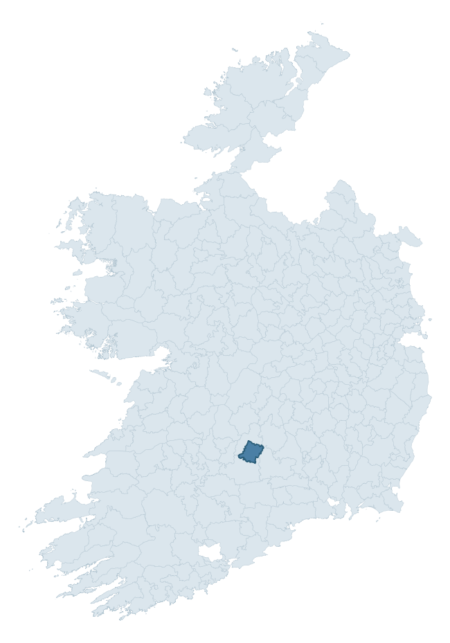
Where this barony sits in the Republic of Ireland
Geology and preservation
Bedrock geology shapes the landscape long before any settlement begins — controlling soil drainage, agricultural potential, the survival of upstanding monuments, and the preservation of buried archaeology. The figures below come from the Geological Survey Ireland 1:100,000 bedrock map.
The bedrock underlying Kilnamanagh Lower is predominantly sandstone, conglomerate (44% of the barony by area), with much of the rock dating to the Devonian period. A substantial secondary geology of limestone (30%) and greywack, siltstone and grit (15%) adds further variety to the underlying landscape. The single largest mapped unit is the Cappagh White Sandstone Formation (44% of the barony's bedrock).
Rock type composition
Largest mapped unit: Cappagh White Sandstone Formation (44% of the barony)
Placename evidence
Logainm records 17 heritage-diagnostic placenames for Kilnamanagh Lower, drawn from townland and civil-parish names across the barony. The dominant stratum is Early Christian ecclesiastical — cill-, teampall-, and domhnach-prefixed names that record the dense network of early church foundations established between the fifth and tenth centuries. The leading diagnostic roots are cill- (8 — church), ráth- (5 — earthen ringfort), and dún- (2 — hilltop fort or promontory fort). This is below the ROI average of 30.7 heritage placenames per barony, suggesting either lighter survey coverage or a townland-naming tradition that draws more on generic landscape vocabulary. Logainm records 125 placenames for Kilnamanagh Lower (predominantly townland names). Of these, 17 (14%) carry one of the diagnostic Gaelic roots tracked above; the remainder draw on more generic landscape vocabulary that does not encode a heritage period.
Pre-Christian / Early Medieval Defensive
| Root | Count | Meaning |
|---|---|---|
| ráth- | 5 | earthen ringfort |
| dún- | 2 | hilltop or promontory fort |
Early Christian Ecclesiastical
| Root | Count | Meaning |
|---|---|---|
| cill- | 8 | church (early) |
| teampall- | 2 | church (later medieval) |
Other baronies in Tipperary
- Ikerrin
- Iffa And Offa West
- Middlethird
- Clanwilliam
- Glenahiry
- Ormond Lower
- Iffa And Offa East
- Kenry — Limerick
- Upperthird
- North Liberties — Limerick
See all 280 baronies in the Republic of Ireland Heritage Tool.

Explore further
Grounding History: 10 Maps of Northern Ireland’s Past
If you’re interested in Irish heritage more widely, the companion report for Northern Ireland brings together the analysis of all 462 NI wards into one place through 10 high-quality maps — covering monument density, archaeological periods, placename heritage, terrain, wetland, and the historic landscape at first survey. Take a look.
About this profile
Click any section below to expand.
What is a barony?
A barony is a historic administrative unit in Ireland, broadly equivalent to an English hundred. The 280 baronies used here are from the OSi 2019 National Statutory Boundaries (generalised 20m), covering the 26 counties of the Republic of Ireland. Baronies derive from the Norman period, were formalised in the 17th century, and have not been redrawn for statistical purposes. They vary enormously in area, from compact urban baronies in Dublin to vast upland baronies in Connacht, and should not be compared by raw site count without accounting for area differences.
What counts as a site?
This profile combines three distinct heritage registers, each with its own definition of what constitutes a recordable site:
- Archaeological sites (NMS). The National Monuments Service Sites and Monuments Record (SMR) catalogues every known archaeological monument or site of archaeological interest in the Republic, from prehistoric burial mounds and ringforts to medieval churches and post-medieval defensive works. Inclusion does not require legal protection — only that the site has been identified, surveyed, and assessed as having archaeological value. A separate subset of these sites lies within a recorded protection zone, which gives them statutory protection under the National Monuments Acts.
- Listed buildings (NIAH). The National Inventory of Architectural Heritage records buildings of architectural, historical, archaeological, artistic, cultural, scientific, social, or technical interest. Each surveyed structure is appraised on a five-tier scale: International, National, Regional, Local, and Record-Only. The NIAH appraisal is informational rather than strictly statutory, but it underpins local-authority Record of Protected Structures (RPS) listings.
- Heritage placenames (Logainm). Logainm is the authoritative database of Irish placenames maintained by the Placenames Branch. This profile applies a heritage-diagnostic classifier to the Irish-language form of each townland name, flagging roots that signal defensive sites (ráth-, lios-, dún-, caiseal-, cathair-), ecclesiastical foundations (cill-, teampall-, domhnach-, mainistir-), prehistoric burial-ritual features (tuaim-, carn-, leaba-), or Norse-contact settlement (gall-). Townlands without one of these diagnostic roots are not flagged here — they may still carry historical significance, but that significance is not encoded in the name itself.
Editorial principles
The narrative sections of this profile follow several explicit principles:
- Evidential. Every claim about this barony’s heritage character is anchored in the underlying register data. Where a site count, a placename count, or a percentile rank is cited, it is computed from the source datasets at export time, not estimated.
- Comparative. Counts and metrics are reported alongside their percentile rank against the other 279 ROI baronies. A barony with 50 ringforts in absolute terms could be unusually high or unusually low depending on its size and regional context; percentile ranking removes that ambiguity.
- Transparent on limits. Where a register has known coverage gaps, survey biases, or data-quality issues that affect this barony’s figures, the profile flags them rather than presenting the numbers as definitive.
- No interpretation beyond what the data supports. The narrative does not speculate about historical events, social dynamics, or cultural meaning beyond what the recorded heritage and placename evidence directly attests.
Data caveats and limits
- NMS Sites and Monuments Record is the product of survey campaigns conducted at different intensities across different counties and decades. Some baronies have been surveyed more thoroughly than others, and absolute counts should be read in that light. Sites destroyed by development before survey are typically not represented; sites in heavily forested or upland terrain are sometimes under-recorded.
- NIAH coverage is broadly complete for the Republic of Ireland but the survey was conducted on a rolling county-by-county basis, and the most recent appraisal date varies. Buildings demolished or substantially altered after their original survey may still appear in the register; conversely, recent buildings of merit may not yet have been appraised.
- Logainm classification applies a deliberately conservative pattern-matching approach to the Irish-language townland forms. The classifier prioritises true positives over recall: a townland may carry a heritage signal that the classifier doesn’t recognise, particularly where the diagnostic root has been heavily anglicised or where the townland name draws on a less common term. The 60,000+ townland records and ~9,800 classified placenames give a substantial signal at barony scale, but individual townland names should be checked against Logainm directly for definitive interpretation.
- Period attribution. The chronological distribution reflects only those NMS sites that carry a recognised period attribution in the source data. Sites listed as “Unknown” period are excluded from the dated subset.
- Boundary changes. Some baronies have undergone minor boundary adjustments since their 19th-century definition; the OSi 2019 generalised boundaries used here are the current statutory definition and may differ slightly from historical maps in border areas.
- Bedrock geology is mapped at 1:100,000 scale, which means local variation within a barony — small pockets of different rock type, mineral veins, alluvium overlying bedrock — is generalised. The dominant-system and rocktype figures are area-weighted, so a barony reading “70% Carboniferous limestone” may still contain small but archaeologically important pockets of older or younger rock. Around 3% of GSI polygons do not match the lexicon and contribute no rocktype or system attribution.
Data sources
- National Monuments Service — Sites and Monuments Record (SMR) https://data.gov.ie/dataset/national-monuments-service-archaeological-survey-of-ireland
- National Inventory of Architectural Heritage (NIAH) https://data.gov.ie/dataset/national-inventory-of-architectural-heritage-niah-national-dataset
- Logainm — Placenames Database of Ireland https://www.logainm.ie/
- Ordnance Survey Ireland — National Statutory Barony Boundaries 2019 https://data-osi.opendata.arcgis.com/
- EURODEM — European Digital Elevation Model https://www.mapsforeurope.org/datasets/euro-dem
- ESA WorldCover https://esa-worldcover.org/en
- Geological Survey Ireland — 1:100,000 Bedrock Geology https://www.gsi.ie/en-ie/data-and-maps/Pages/Bedrock.aspx
Explore more: Search any of the 280 ROI baronies, browse by historical province, or read the methodology and data sources for the full Republic of Ireland Heritage Tool.