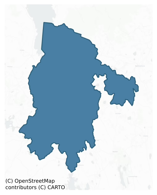
Leitrim is a barony of County Leitrim, in the historical province of Connacht (Irish: Liatroim), covering 250 km² of land. The barony records 551 NMS archaeological sites and 113 NIAH listed buildings, placing it at around the 61st percentile among 280 ROI baronies for sites per km². This means it is in the upper half of all baronies for sites per km². Dated archaeological evidence runs from the Neolithic through to the Modern, spanning 8 of 9 archaeological periods, placing the barony in the 68th percentile among 280 ROI baronies for chronological depth. This means it is in the top third of all baronies for chronological depth. The largest dated subset of recorded sites dates to the Early Medieval. Logainm flags 50 placenames in the barony as carrying a recognised heritage root; the largest share — around 52% — are names associated with pre-christian defensive.

Heritage at a glance
Percentile rankings throughout this profile compare each barony only against the other 279 Republic of Ireland baronies.
The recorded heritage of Leitrim
The National Monuments Service Sites and Monuments Record (SMR) is the statutory inventory of archaeological sites for the Republic of Ireland, maintained by the Department of Tourism, Culture, Arts, Gaeltacht, Sport and Media. Sites recorded here include earthworks, ringforts, megalithic tombs, ecclesiastical remains, and post-medieval features; not every record is legally protected, but each is registered as a monument of archaeological interest.
The National Monuments Service records 551 archaeological sites in Leitrim, putting it at the 61st percentile among 280 ROI baronies for sites per km². This means it is in the upper half of all baronies for sites per km². Protection coverage is near-universal — 531 sites (96%) fall within a recorded monument protection zone, indicating an extensively surveyed landscape. The dominant category is defensive sites — ringforts, enclosures, hillforts, and stone forts (407 sites, 74% of the record). Ringfort – rath is the most prevalent type, making up 55% of the barony's recorded sites (304 records) — well above the ROI average of 20% across all baronies where this type occurs. Ringfort – rath is an earthen ringfort enclosed by a bank and external ditch — the most common Early Medieval farmstead, broadly dated 500–1000 AD. Other significant types include Enclosure (38) and Crannog (34). Enclosure is a banked or ditched feature of uncertain type, used as a catch-all where the original function cannot be determined from surface evidence; Crannog is an artificial or partly artificial island built up on a lake or river bed, in use from the 6th to 17th centuries AD. Across the barony's 250 km², this gives a recorded density of 2.21 sites per km².
Most common monument types
Hover or tap a monument type to see its definition.
| Type | Count |
|---|---|
| Ringfort – rath an earthen ringfort enclosed by a bank and external ditch — the most common Early Medieval farmstead, broadly dated 500–1000 AD | 304 |
| Enclosure a banked or ditched feature of uncertain type, used as a catch-all where the original function cannot be determined from surface evidence | 38 |
| Crannog an artificial or partly artificial island built up on a lake or river bed, in use from the 6th to 17th centuries AD | 34 |
| Ringfort – cashel the stone-walled equivalent of the rath, found mainly in upland or western areas, broadly dated 500–1000 AD | 13 |
| Church a building used for public Christian worship, of any date from c. 500 AD onwards | 12 |
| Ringfort – unclassified a circular Early Medieval settlement enclosure where surviving evidence does not allow distinction between earthen and stone forms | 11 |
| Bridge a built structure spanning a river or ravine to allow crossing, dated medieval onwards | 8 |
Chronological distribution
The dated archaeological record for Leitrim spans from the Neolithic through to the Modern, with activity attested across 8 of 9 archaeological periods. Every period from earliest to latest is represented in the record — an unbroken sequence of dated activity across the full chronological span. Activity concentrates most heavily in the Early Medieval (208 sites, 60% of dated material), with the Iron Age forming a secondary peak (80 sites, 23%). A further 249 recorded sites (42% of the overall NMS register for the barony) carry no period attribution — appearing as 'Unknown' in the bar chart below. This typically reflects either records that pre-date the standardised period vocabulary or sites awaiting specialist dating review, rather than a genuine absence of chronological evidence.
Sample of recorded monuments
Show 25 sample monuments (of 551 total)
A representative sample of 25 recorded monuments drawn from the barony’s 551 total NMS entries. Sites within a recorded monument protection zone and rarer site types are prioritised so the list shows a meaningful cross-section rather than only the most common type. Each entry shows the official Sites and Monuments Record reference number and the description published by the National Monuments Service.
Megalithic tomb – wedge tomb
Situated on a slight rise in pasture in a broad E-W valley with the W end of Lough Scur c. 0.25km to the ENE. This is a rectangular structure (dims 7m E-W; c. 2.7m N-S) of which only the S and part of the W sides…
Situated on a slight rise in pasture in a broad E-W valley with the W end of Lough Scur c. 0.25km to the ENE. This is a rectangular structure (dims 7m E-W; c. 2.7m N-S) of which only the S and part of the W sides survive. It is composed of contiguous orthostats (max. dims 1.2m x 0.2m; H 0.5m) with some displaced stones (max. dims 1.5m x 1m) present. The stones are situated on a grass-covered mound (basal dims 17m E-W; 12.5m N-S; H 0.5m at E to 1m at N).
The above description is derived from 'The Archaeological Inventory of County Leitrim' compiled by Michael J. Moore (Dublin: Stationery Office, 2003). In certain instances the entries have been revised and updated in the light of recent research.
Date of upload: 23 September 2008
Watchtower
Situated on a rock outcrop pinnacle in mixed woodland about 10m from the S shore of Prison Island, which is in the central part of Lough Scur. This structure was reputedly built as a prison, probably by John Reynolds of…
Situated on a rock outcrop pinnacle in mixed woodland about 10m from the S shore of Prison Island, which is in the central part of Lough Scur. This structure was reputedly built as a prison, probably by John Reynolds of Castle John (LE024-050—), which is c. 150m to the S across the lake, in 1612 when he was the sheriff of Leitrim (Mac an Ghalloglaigh 1971, 236). It may have been regarded as a prison (Lewis 1837, vol. 2, 217) because of annalistic references to the taking or keeping of prisoners at Lough Scur. Both features are marked on the Down Survey (1656-8) barony and parish maps at Lough Skure (No. 42). However, this structure is more likely to have been built as a watchtower. It is a roofless, rectangular, three-storey structure (int. dims 5.3m NE-SW; 3.95m NW-SE; H c. 5m) built of randomly coursed limestone mortared masonry (Wth 1m) with dressed quoins and a rubble core but overgrown with ivy. There is a flat-arched doorway (Wth 1m; H 2.45m) at the first floor on the NE side, and there is a fireplace, four gun-loops or small lights (int. H 0.94m; int. Wth 0.52m; ext. H 0.37m; Wth 0.08m) and a small window at this floor. There are two gun-loops or lights in each wall at the ground floor and there are the remains of a fireplace, at least three gun-loops or lights and a small window at the second floor. The first floor is supported on corbels but access between the floors must have been by internal wooden ladder. (McDermott 2019, 118)
See the attached view from…
House – fortified house
it is located on a promontory, which was once an island known as Castle Island, near the S shore of Lough Scur in an area of scrub and rock outcrop. The house was built by John Reynolds, who was amongst one of the first…
it is located on a promontory, which was once an island known as Castle Island, near the S shore of Lough Scur in an area of scrub and rock outcrop. The house was built by John Reynolds, who was amongst one of the first of the Mac Raghnall to anglicise the name to Reynolds. He supported initiatives by the government to settle Leitrim, probably as a means of escaping the overlordship of O’Rourke. John Reynolds, or Seán na gCeann (of the heads), received a grant of over 2,000 acres as the manor of Lough Scur in 1621-2 (Mac an Ghalloglaigh 1971, 236, 253), and his son, Humphry, describes it in his will of 1660 as 20 cartrons or townlands, but the house is not mentioned (O’Connell 1960, 226). The house is depicted on the Down Survey (1656-8) barony and parish maps together with the watchtower (LE024-048—-) on Prison Island c. 150m to the NW. The house was a roofless ruin by 1797 (Grose 1792, vol. 2, 91-2) and has survived almost unchanged since, although with a dense cover of ivy.
The house is a rectangular, roofless, five-bay, three-storey house (int. dims 14m E-W; 6.25m N-S) surviving almost complete, except for the E gable. The house has rectangular windows from which no dressed stone survives, although some square hood-moulding fragments are visible. There is a destroyed doorway in the centre of the S wall, and a semi-circular newel stair tower with gun-loops projects from the centre of the N wall, but the stair does not survive. The remains of fireplaces can be identi…
Burial
Situated on low-lying ground on either side of the R209 Keshcarrigan to Fenagh road. Two small features described in italic lettering as 'Graves' are indicated only on the 1835 edition of the OS 6-inch map. There is no…
Situated on low-lying ground on either side of the R209 Keshcarrigan to Fenagh road. Two small features described in italic lettering as 'Graves' are indicated only on the 1835 edition of the OS 6-inch map. There is no other information, and no evidence of burials at the roadside.
The above description is derived from 'The Archaeological Inventory of County Leitrim' compiled by Michael J. Moore (Dublin: Stationery Office, 2003). In certain instances the entries have been revised and updated in the light of recent research.
Date of upload: 23 September 2008
Cairn – unclassified
Situated c. 80m from the W side of a N-S ravine. This is an overgrown circular rise (diam. c. 10m; H c. 0.5m) which may be the end of a slight ridge. It is overlain by an E-W field wall. Passage tomb (LE025-093001-) is…
Situated c. 80m from the W side of a N-S ravine. This is an overgrown circular rise (diam. c. 10m; H c. 0.5m) which may be the end of a slight ridge. It is overlain by an E-W field wall. Passage tomb (LE025-093001-) is c. 50m to the NE and the passage tomb (LE025-093002-) is c. 40m to the ENE. (Herity 1974, 277, Le 2)
The above description is derived from 'The Archaeological Inventory of County Leitrim' compiled by Michael J. Moore (Dublin: Stationery Office, 2003). In certain instances the entries have been revised and updated in the light of recent research.
Date of upload: 23 September 2008
Settlement deserted – medieval
In 1944 the ITA Survey recorded that the land surrounding Fenagh Abbey (LE025-096001-) on both sides of the road (Fenagh/Mohill) which is known as the 'Commons' was 'bristling with lichen-covered blocks of stone and…
In 1944 the ITA Survey recorded that the land surrounding Fenagh Abbey (LE025-096001-) on both sides of the road (Fenagh/Mohill) which is known as the 'Commons' was 'bristling with lichen-covered blocks of stone and partly concealed foundations' (Blaney 1944), which may be the remains of a deserted medieval settlement associated with the abbey. In 1969 Norman and St. Joseph identified in their aerial photographs traces of, 'faint earthworks of the ancient settlement' and outside the enclosure (LE025-096004-) a good deal of disturbed ground is visible, perhaps indicating considerable expansion and the settlement of monastic clients or craftsmen-apprentices' (Norman and St. Joseph 1969, 109-10).
Compiled by Caimin O'Brien
Date of upload/revision: 16 December 2011
This monument is subject to a preservation order made under the National Monuments Acts 1930 to 2014 (PO no. 3/1994).
Wall monument
The small roofless chapel or mausoleum (LE025-096012-) of the O’Duignans of Castlefore (LE024-053—-) abuts the W end of the S wall of the large church at Fenagh (LE025-096001-). The O'Duignan commemorative plaque…
The small roofless chapel or mausoleum (LE025-096012-) of the O’Duignans of Castlefore (LE024-053—-) abuts the W end of the S wall of the large church at Fenagh (LE025-096001-). The O'Duignan commemorative plaque dated 1671 in its moulded frame (Wth 0.75m; H 1.17m) with a Latin inscription is on the exterior of its S wall. The crucifixion is in relief, but some symbols of the Passion such as the ladder and the whip are in false relief as is the Latin inscription in roman capitals, which is now very worn. The inscription was recorded by John O’Donovan in the 1830s (Herity 2012, 401) as: TORNA O’DUGENAN, SACER / DOS ET RECTOR ME FIERE FE /CIT, ANNO 1671, SUPER / SERVITE ? FRATRIO ? / EUGENI: DUGENEN QUI / OBIJT: 28: XBRIS 1667 / SUCCESSORIBUS ET MARITE EJUS / UNIO MEG RENNELL.
Compiled by: Michael Moore
Date of upload: 6 July, 2017
Road – road/trackway
Situated towards the N and E edge of a plateau with rock outcrop. The large medieval church (LE025-096001-) and the rectangular graveyards are imposed on the curvilinear earthworks that cover an area of about 15 ha (c.…
Situated towards the N and E edge of a plateau with rock outcrop. The large medieval church (LE025-096001-) and the rectangular graveyards are imposed on the curvilinear earthworks that cover an area of about 15 ha (c. 60 acres) and are protected by a Preservation Order (PO no. 3/1994). The earthworks include a roadway which approaches the ecclesiastical enclosure (LE025-096004-) from the N (L c. 90m). The road appears to run directly to the W doorway of the church, and is probably late in date. It re-emerges from the S angle of the old graveyard and extends S (L c. 50m). Most of the earthworks are possibly early medieval in date and are best appreciated from the air (Norman and St Joseph 1969, 109-10).
This monument is subject to a preservation order made under the National Monuments Acts 1930 to 2014 (PO no. 3/1994).
Compiled by: Michael Moore
Date of upload: 6 July, 2017
Castle – tower house
Situated in the centre of Leitrim village c. 30m from the N bank of the Ballinamore and Ballyconnell canal, which at this point is a canalised stream, and c. 400m from its junction with the River Shannon. The castle,…
Situated in the centre of Leitrim village c. 30m from the N bank of the Ballinamore and Ballyconnell canal, which at this point is a canalised stream, and c. 400m from its junction with the River Shannon. The castle, undoubtedly a tower house, was originally a MacRaghnall stronghold with references in 1491 and 1499 (McDermott 2019, 116-18), but by 1540 it was in the hands of Brian Ballach O'Rourke (AFM), probably to intimidate the MacRaghnall and other families of Muintir Eolis and to harass his enemy of the moment, Mac Dermot of Moylurg. The castle was destroyed in 1580 by Brian of the Ramparts O'Rourke to prevent it falling to Sir Nicholas Malby. Sir Nicholas rebuilt and garrisoned it, but the castle was immediately besieged by O'Rourke and abandoned by its garrison shortly afterwards (AFM).
In January 1603, after the defeat of Kinsale, Donal Cam O'Sullivan Beare arrived at Leitrim castle with only thirty five from the thousand or so followers with whom he had started the long march from Dunboy, Co. Cork. Brian Óg O'Rourke, who was the last leader to remain in rebellion, was finally besieged at Leitrim castle. In April Brian Óg fled to Rosa-Iarla friary (GA041-047—-) near Lough Corrib, where he died in January 1604 (Mac an Ghalloglaigh 1971, 238). A length of mortared uncoursed limestone masonry (L 13m; H 2.8m; T 0.8m) survives with two small openings (dims 0.3m x 0.25m) which may be part of the bawn wall. Archaeological testing (04E0160) of an extensive area just to…
Promontory fort – inland
On a prominent flat-topped area of rock outcrop (max. H c. 20m) with an easy and natural approach from the S. Grass-covered oval platform (dims. 54m N-S; 24m E-W) defined by the natural slope which has dense vegetation…
On a prominent flat-topped area of rock outcrop (max. H c. 20m) with an easy and natural approach from the S. Grass-covered oval platform (dims. 54m N-S; 24m E-W) defined by the natural slope which has dense vegetation and an almost vertical drop at N. There is some stone spread on the slope which may have come from a collapsed wall on the perimeter. There is a ramp entrance (Wth c. 3m) at S, but there is no visible fosse.
The above description is derived from 'The Archaeological Inventory of County Leitrim' compiled by Michael J. Moore (Dublin: Stationery Office, 2003). In certain instances the entries have been revised and updated in the light of recent research.
Date of upload: 23 September 2008
Hilltop enclosure
Located on the summit plateau of Sheemore Hill. This is a grass-covered oval area (dims c. 180m NE-SW; c. 110m NW-SE) defined by a slight stone bank, best preserved at S (Wth 0.9m; H 0.55m) and visible intermittently…
Located on the summit plateau of Sheemore Hill. This is a grass-covered oval area (dims c. 180m NE-SW; c. 110m NW-SE) defined by a slight stone bank, best preserved at S (Wth 0.9m; H 0.55m) and visible intermittently around the perimeter of the plateau. It encloses the cairns (LE027-054001-; LE027-054002-; LE027-054003-) and appears to be overlain by the field system (LE027-054005-) and the associated enclosure (LE027-054004-).
The above description is derived from 'The Archaeological Inventory of County Leitrim' compiled by Michael J. Moore (Dublin: Stationery Office, 2003). In certain instances the entries have been revised and updated in the light of recent research.
Date of upload: 23 September 2008
Windmill
Situated on a flat-topped, grass-covered mound (diam. of top 10m; H 0.4-0.6m) at the S end of the N-S ridge of Mong Hill. It is described as a ‘Windmill Stump’ in italic lettering on the 1835 and 1911 editions of the OS…
Situated on a flat-topped, grass-covered mound (diam. of top 10m; H 0.4-0.6m) at the S end of the N-S ridge of Mong Hill. It is described as a ‘Windmill Stump’ in italic lettering on the 1835 and 1911 editions of the OS 6-inch map, so it was derelict by 1835. This is a circular feature (int. diam. 3.3m) defined by a masonry wall (Wth 0.9m) which does not survive beyond the foundation courses (H 0.4m) except at S (C 4m; H 2.6m). A gap (Wth 1m) at W may be a doorway.
The above description is derived from 'The Archaeological Inventory of County Leitrim' compiled by Michael J. Moore (Dublin: Stationery Office, 2003). In certain instances the entries have been revised and updated in the light of recent research.
Date of upload: 23 September 2008
Cave
Located towards the bottom of the NW-facing slope of the main Sheebeg Hill. A feature is described as a ‘Subterraneous Passage’ on the 1835 and 1911 editions of the OS 6-inch map. Local folklore as recorded in the…
Located towards the bottom of the NW-facing slope of the main Sheebeg Hill. A feature is described as a ‘Subterraneous Passage’ on the 1835 and 1911 editions of the OS 6-inch map. Local folklore as recorded in the Schools’ Manuscripts relates how after a fight with another giant in the area between Sheemore and Sheebeg Fionn Mac Cumhaill retired to a cave where he still rests. See this web-page accessed on 06/04/2017: http://www.duchas.ie/en/cbes/4649691/4647714 There is no cave in evidence now. Instead there is a cleft in rock outcrop with a natural spring.
Compiled by: Michael Moore
Date of upload: 6 April, 2017
Causeway
A causeway connects the crannog (LE028-028001-) with at SW shore of Keshcarrigan Lough. This is a path that appears to be a natural gravel ridge (L c. 30m) c 1m below the water level, with a wooden raft (dims c. 6m x c.…
A causeway connects the crannog (LE028-028001-) with at SW shore of Keshcarrigan Lough. This is a path that appears to be a natural gravel ridge (L c. 30m) c 1m below the water level, with a wooden raft (dims c. 6m x c. 1m) in its central area.
Compiled by: Michael Moore
Date of upload: 7 April, 2017
Earthwork
Located in pasture on top of a prominent drumlin. It is depicted faintly as a small circular feature (diam. c. 20m) on the 1835 edition of the OS 6-inch map and it is not known what was intended. No archaeological…
Located in pasture on top of a prominent drumlin. It is depicted faintly as a small circular feature (diam. c. 20m) on the 1835 edition of the OS 6-inch map and it is not known what was intended. No archaeological feature is visible at ground level close to where four field banks meet.
The above description is derived from 'The Archaeological Inventory of County Leitrim' compiled by Michael J. Moore (Dublin: Stationery Office, 2003). In certain instances the entries have been revised and updated in the light of recent research.
Date of revision: 10 April 2015
Fortification
Situated on the E bank of the river Shannon where it narrows passing through Carrick-on-Shannon. A fort of unknown form was built here in 1611, which survived into the 1650s at least when it had a complement of 20 men…
Situated on the E bank of the river Shannon where it narrows passing through Carrick-on-Shannon. A fort of unknown form was built here in 1611, which survived into the 1650s at least when it had a complement of 20 men (Kerrigan 1980-2, 140; McDermott 2019, 123). It is not known when the fort became defunct but its remains were preserved within the precinct of the Royal Irish Constabulary barracks into the early twentieth century. The surviving fragment is depicted and described as a 'Castle (in Ruins)' on the OS 25-inch plan (surveyed 1907), but it was not recorded on the subsequent revision of the 6-inch map. A fragment of the wall (Wth 1.4m; H 1.4m) amounting to about a quarter of a circular tower survives close to the bridge over the Shannon. Archaeological testing (02E0039) c. 25m NE of this remnant identified a wall (Wth 0.8m) running N-S that may relate to the fort (Quinn 2004).
The above description is derived from 'The Archaeological Inventory of County Leitrim' compiled by Michael J. Moore (Dublin: Stationery Office, 2003). In this instance the entry has been revised and updated in the light of recent research.
Revised by: Paul Walsh
Date of upload: 8 November 2012
Amended: 24 September, 2013, 14 October, 2019
Bullaun stone
Located at the top of a prominent drumlin with a N-S section of the River Shannon c. 300m top the W. This is a D-shaped bullaun stone (dims 0.8m x 0.5m; H 0.5m) with a single basin (diam. 0.32m; D 0.16m) worn down at…
Located at the top of a prominent drumlin with a N-S section of the River Shannon c. 300m top the W. This is a D-shaped bullaun stone (dims 0.8m x 0.5m; H 0.5m) with a single basin (diam. 0.32m; D 0.16m) worn down at one side which had been at a nearby house in 1977 (SMR file). It became incorporated into the road bank but was rediscovered in excavation (Delaney 2015, 2).
Compiled by: Michael Moore
Date of upload: 15 October, 2019
Amended: 10 January 2020
Gateway
The town was completely defended by a town wall which had bastions at the four corners and two demi-bastions at the centre of the long E and W walls, as recorded on a map of 1730 by Thomas Moland. The North Gate of…
The town was completely defended by a town wall which had bastions at the four corners and two demi-bastions at the centre of the long E and W walls, as recorded on a map of 1730 by Thomas Moland. The North Gate of Jamestown was destroyed by Patrick Sarsfield in 1689 when he retook the town from Col. Lloyd, but it was rebuilt c. 1780 by Hugh O'Beirne. Its arch was taken down after it was damaged in 1973. Two in-turned piers survive, creating a passageway (Wth 4.3-5.3m; L 2.8m), together with adjacent parts of the town wall. Archaeological monitoring (20E0504) by L. Cagney (2021) of groundworks associated with a water pipe through Jamestown in 2020 identified a metalled surface and kerbstones from a footpath just outside the N gateway, which are more likely to be associated with the rebuilding of the gate in 1780 than its original construction. The kerbstones were preserved in situ.
See the attached archival view taken from the S prior to the removal of the arch in 1973.
The above description is derived from 'The Archaeological Inventory of County Leitrim' compiled by Michael J. Moore (Dublin: Stationery Office, 2003). In certain instances the entries have been revised and updated in the light of recent research.
Compiled by: Michael Moore
Date of revised upload: 17 October 2019
Amended: 3 August 2021
Town defences
The town was completely defended by a town wall which had bastions at the four corners and two demi-bastions at the centre of the long E and W walls, as recorded on a map of 1730 by Thomas Moland. A length of town wall…
The town was completely defended by a town wall which had bastions at the four corners and two demi-bastions at the centre of the long E and W walls, as recorded on a map of 1730 by Thomas Moland. A length of town wall survives at the N end of the W side of the town (L 20m; ext. H 1.8-3m) but no distinguishing features are evident. A section of the town wall (L 7m; H 3m; T 1.2m) also survives at the S end of the W side of the town, which has no visible distinguishing features. The line of the wall can be traced as a break in slope to its N (L 23m) and S (L 18m). The North Gate of Jamestown (LE031-082001-) was destroyed by Patrick Sarsfield in 1689 when he retook the town from Col. Lloyd, but it was rebuilt c. 1780 by Hugh O'Beirne. Its arch was taken down after it was damaged in 1973. Two in-turned piers survive, creating a passageway (Wth 4.3-5.3m; L 2.8m), together with adjacent parts of the town wall. The base of the town wall on the W side has been found through excavation (01E1191) in at least one place (Ryan 2002, 2003). (Bradley and Dunne 1988, 23-6)
The above description is derived from 'The Archaeological Inventory of County Leitrim' compiled by Michael J. Moore (Dublin: Stationery Office, 2003). In certain instances the entries have been revised and updated in the light of recent research.
Compiled by: Michael Moore
Date of revised upload: 17 October 2019
Bastioned fort
Located on top of a drumlin overlooking Jamestown, which is c. 170m to the E at the nearest point. A fort with a wide view over the countryside and the town would be an essential part of the defences of Jamestown and…
Located on top of a drumlin overlooking Jamestown, which is c. 170m to the E at the nearest point. A fort with a wide view over the countryside and the town would be an essential part of the defences of Jamestown and might have been constructed at the outset in 1620, but the earliest secure reference to a garrison at Jamestown is in 1646 when it had a complement of a hundred men and their officers (Mahaffey 1901, 654). In September 1689 Col. Thomas Lloyd, on a raid from Sligo town, took Jamestown without a fight for King William as defending Jacobite troops had fled overnight. He left a colonel Russell in charge of a token force, which abandoned the town at Sarsfield’s approach the next month, but there was no fighting at Jamestown (Wauchope 1992, 76-81).
The fort is a rectangular earthen platform (dims 20m E-W; 17.5m N-S; H 0.6-1m) with slight banks at N (Wth 2.5m; int. H 0.3m; ext. H 0.7m) and S (Wth 4.3m; int. H 0.5m; ext. H 1.2m). There are rectangular bastions (dims of top 9.5-10.5m N-S; 5-7m E-W) offset in two directions at each angle. The bastions are defined by scarps (H 0.6-1.2m), and the fort is surrounded by a slight fosse indicated by lush vegetation forming a rectangular area (max. ext. dims 40m E-W; 36m N-S). The fort is cut by a N-S field bank towards the W edge, and it is grass-covered W of this feature but is generally overgrown to the E. (Bradley and Dunne 1988, 26-7)
The above description is derived from 'The Archaeological Inventory of County Leitri…
Religious house – Franciscan friars
Located within Jamestown on the floodplain of the River Shannon. A Franciscan friary dedicated to St Mary was established probably after 1645, and a meeting of Catholic bishops was held there in 1650. The Franciscans…
Located within Jamestown on the floodplain of the River Shannon. A Franciscan friary dedicated to St Mary was established probably after 1645, and a meeting of Catholic bishops was held there in 1650. The Franciscans held a last recorded chapter meeting here in 1658, but the community continued in the area into the 18th century and titular guardians were appointed down to 1860. Seven friars in the area were named in 1714 (MacNamee 1954, 231-4). There is no description of the buildings, and the site is sometimes thought to be the site of the parish church (LE031-82004-), but is more likely to have been at a different location. This is sometimes identified as the old national school as Franciscan lay brothers opened a school there in 1820 adjacent to the Roman Catholic chapel. (Mooney 1946 5-8, 21)
The above description is derived from 'The Archaeological Inventory of County Leitrim' compiled by Michael J. Moore (Dublin: Stationery Office, 2003). In certain instances the entries have been revised and updated in the light of recent research.
Compiled by: Michael Moore
Date of revised upload: 17 October 2019
Amended: 3 January, 2020
Enclosure – large enclosure
Located on the S-facing slope of a rise c. 250m from the NW bank of a SW-NE section of the River Shannon. It is depicted only on the 1945 revision of the OS 6-inch map as a D-shaped hachured feature. This is a…
Located on the S-facing slope of a rise c. 250m from the NW bank of a SW-NE section of the River Shannon. It is depicted only on the 1945 revision of the OS 6-inch map as a D-shaped hachured feature. This is a grass-covered D-shaped area (dims 72m N-S; 65m E-W) defined by a low scarp (H 0.2-0.4m), which is truncated by an E-W field bank at N. Neither a fosse nor an entrance is identified. There is a NW-SE field bank towards the perimeter at E.
The above description is derived from 'The Archaeological Inventory of County Leitrim' compiled by Michael J. Moore (Dublin: Stationery Office, 2003). In certain instances the entries have been revised and updated in the light of recent research.
Date of revised upload: 17 October 2019
House – 17th/18th century
Walter Jones is not amongst the original grantees of land in Leitrim in 1620 (Mac Cuarta 1999, 130-2) but he probably set about acquiring as much as possible in the succeeding decades. His second son, Theophilius Jones…
Walter Jones is not amongst the original grantees of land in Leitrim in 1620 (Mac Cuarta 1999, 130-2) but he probably set about acquiring as much as possible in the succeeding decades. His second son, Theophilius Jones (1666-1742) of Headfort, was one of the two MPs for Leitrim from 1692 until his death. Theophilus’ grandson, the Right Honourable Theophilus Jones, was MP for Leitrim 1761-8, 1776-83, 1790-97, and 1800, and continued to represent the county in the Westminster Parliament in 1801-02. His mother, Olivia Coote, was a co-heiress of the Coote estate centred at Coote Hall (RO007-015001-), but he seems to have lived at Headford. In 1753 his Leitrim estate had an estimated 10,000 acres. His son, Walter, continued to live at Headford but represented Coleraine in the Irish and Westminster parliaments 1798-1809 through a connection with the Marquis of Waterford, and he died in 1839 (Johnston-Liik 2002, vol. 4, 403-07). By the 1830s the family had moved to Drumard (Jones) near Lough Rinn (Lewis 1837, vol. 2, 376), and the Headford house might have been a ruin by then. Anthony Trollope wrote his first published novel ‘The MacDermots of Ballycloran’ (1847) while he was staying nearby at Drumsna between 1843 and 1845, and it is thought that he may have based the fictional castle at Ballycloran on Headfort House.
The remains consist of the E and W gables of a rectangular house (ext. dims 16.4m E-W; 9.4m N-S) of three storeys with an external render and the internal plast…
Moated site
Situated on the W-facing slope of a drumlin. This is a grass-covered rectangular area (int. dims 54m N-S; c. 26m E-W) defined by an overgrown earthen bank (at W: Wth of base 6.5m; int. H 0.5m; ext. H 2m) with an…
Situated on the W-facing slope of a drumlin. This is a grass-covered rectangular area (int. dims 54m N-S; c. 26m E-W) defined by an overgrown earthen bank (at W: Wth of base 6.5m; int. H 0.5m; ext. H 2m) with an external, flat-bottomed fosse (at W: Wth of top 5.5m; Wth of base 3m; ext. D 0.5m) at W, and by a scarp (H c. 1m) and fosse (Wth 4m) at N and E. It is defined by an E-W laneway at S. The interior is occupied by a derelict house, and there is a modern entrance at the E end of the S side. Rath (LE032-033—-) is c. 60m to the NNE.
The above description is derived from 'The Archaeological Inventory of County Leitrim' compiled by Michael J. Moore (Dublin: Stationery Office, 2003). In certain instances the entries have been revised and updated in the light of recent research.
Compiled by: Michael Moore
Date of upload: 23 September 2008
Amended: 5 December 2019
Ringfort – rath
Located in pasture on top of a rise. It is not marked on any edition of the OS 6-inch map but is visible clearly as a bivallate circular feature (int. diam. c. 50m; ext. diam. c. 80m N-S) defined by a wide inner and…
Located in pasture on top of a rise. It is not marked on any edition of the OS 6-inch map but is visible clearly as a bivallate circular feature (int. diam. c. 50m; ext. diam. c. 80m N-S) defined by a wide inner and narrow outer fosse features on aerial photographs (GSIAP: G 211-10). No feature was visible at ground level in pasture in 1991, and the area remains unplanted in a forest (Bing 2013).
The above description is derived from 'The Archaeological Inventory of County Leitrim' compiled by Michael J. Moore (Dublin: Stationery Office, 2003). In certain instances the entries have been revised and updated in the light of recent research.
Date of upload: 23 September 2008
Listed buildings
The National Inventory of Architectural Heritage (NIAH) is a state survey appraising buildings of architectural, historical, archaeological, artistic, cultural, scientific, social, or technical interest. Each surveyed structure receives a rating from International (the highest, for buildings of European importance) through National, Regional, Local, and Record-Only.
The NIAH records 113 listed buildings in Leitrim (56th percentile across ROI baronies). All recorded buildings carry Regional or lower grading; the barony does not contain any structures appraised as being of National or International architectural importance. Construction dates concentrate most heavily in the Victorian (1830-1900) period. The most-recorded building type is house (43 examples, 38% of the listed stock).
Terrain and environment
Mean elevation across the barony is 95m — the 57th percentile among 280 ROI baronies for elevation. This means it is in the upper half of all baronies for elevation. Elevation matters for heritage because higher-altitude baronies typically favour defensive monuments — ringforts and hilltop forts placed on prominent ground — while lowland baronies are more likely to carry the dense settlement and church networks of intensive agricultural landscapes. The barony reaches 324m at its highest point — a vertical span of more than 229m within its boundary, indicating significant topographic diversity. Mean slope is 3.2° — the 42nd percentile among 280 ROI baronies for slope. This means it is in the lower half of all baronies for slope. Slope is a key control on both land use and archaeological preservation: steep ground resists ploughing and tends to preserve earthworks intact, while gentle slopes favour intensive cultivation that damages or destroys surface archaeology over time. The Topographic Wetness Index averages 11.0, the 58th percentile among 280 ROI baronies for wetness. This means it is in the upper half of all baronies for wetness. Drainage matters for heritage because poorly-drained ground preserves organic archaeology (wooden trackways, leather, textiles, and on rare occasions human remains) far better than free-draining soil; well-drained ground favours arable use but destroys organic material rapidly. The land cover is dominated by improved grassland (65%) and woodland (30%).
Terrain measurements
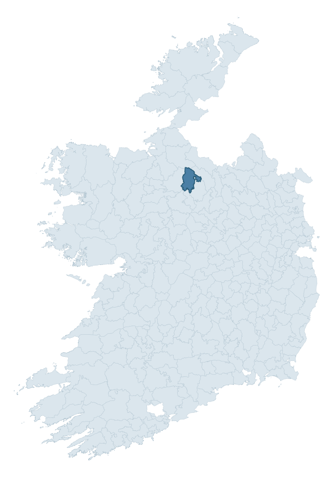
Where this barony sits in the Republic of Ireland
Geology and preservation
Bedrock geology shapes the landscape long before any settlement begins — controlling soil drainage, agricultural potential, the survival of upstanding monuments, and the preservation of buried archaeology. The figures below come from the Geological Survey Ireland 1:100,000 bedrock map.
The bedrock underlying Leitrim is predominantly limestone (53% of the barony by area), laid down during the Carboniferous period (95% by area, around 359 to 299 million years ago). Limestone is the most heritage-rich bedrock in Ireland. It supports fertile, well-drained soils that favoured dense Early Medieval settlement and Norman manorial agriculture, and it weathers into karst features — sinkholes, caves, swallow holes, and souterrains — that frequently carry archaeology. Where peat overlies limestone, organic preservation can be exceptional. A substantial secondary geology of black calcarenites and shales (18%) and shale (11%) adds further variety to the underlying landscape. The single largest mapped unit is the Bricklieve Limestone Formation (34% of the barony's bedrock). With 9 distinct rock types mapped, the barony sits in the top third of ROI baronies for geological diversity (86th percentile) — typically a sign of complex tectonic history or coastal mosaics of differing rock units.
Rock type composition
Largest mapped unit: Bricklieve Limestone Formation (34% of the barony)
Placename evidence
Logainm records 50 heritage-diagnostic placenames for Leitrim, drawn from townland and civil-parish names across the barony. The dominant stratum is pre-Christian and Early Medieval defensive — ráth-, lios-, dún-, and caiseal-prefixed names that mark Iron Age and early historic settlement. The leading diagnostic roots are lios- (23 — ringfort or enclosure), cill- (19 — church), and ráth- (2 — earthen ringfort). This is above the ROI average of 30.7 heritage placenames per barony. The presence of multiple heritage strata side by side indicates layered occupation of the landscape across successive prehistoric and historic periods. Logainm records 333 placenames for Leitrim (predominantly townland names). Of these, 50 (15%) carry one of the diagnostic Gaelic roots tracked above; the remainder draw on more generic landscape vocabulary that does not encode a heritage period.
Pre-Christian / Early Medieval Defensive
| Root | Count | Meaning |
|---|---|---|
| lios- | 23 | ringfort or enclosure |
| ráth- | 2 | earthen ringfort |
| caiseal- | 1 | stone ringfort |
Early Christian Ecclesiastical
| Root | Count | Meaning |
|---|---|---|
| cill- | 19 | church (early) |
| tobar- | 1 | holy well |
| gráinseach- | 1 | monastic farm / grange |
Burial, Ritual, and Norse-Contact
| Root | Count | Meaning |
|---|---|---|
| tuaim- | 1 | burial mound |
| carn- | 1 | cairn |
| uaimh- | 1 | cave / souterrain |
Other baronies in Leitrim
- Drumahaire
- Carrigallen
- Mohill
- Rosclogher
- Boyle — Roscommon
- Ballymoe — Galway
- Frenchpark — Roscommon
- Clare — Galway
- Costello — Mayo
- Clanmorris — Mayo
See all 280 baronies in the Republic of Ireland Heritage Tool.

Explore further
Grounding History: 10 Maps of Northern Ireland’s Past
If you’re interested in Irish heritage more widely, the companion report for Northern Ireland brings together the analysis of all 462 NI wards into one place through 10 high-quality maps — covering monument density, archaeological periods, placename heritage, terrain, wetland, and the historic landscape at first survey. Take a look.
About this profile
Click any section below to expand.
What is a barony?
A barony is a historic administrative unit in Ireland, broadly equivalent to an English hundred. The 280 baronies used here are from the OSi 2019 National Statutory Boundaries (generalised 20m), covering the 26 counties of the Republic of Ireland. Baronies derive from the Norman period, were formalised in the 17th century, and have not been redrawn for statistical purposes. They vary enormously in area, from compact urban baronies in Dublin to vast upland baronies in Connacht, and should not be compared by raw site count without accounting for area differences.
What counts as a site?
This profile combines three distinct heritage registers, each with its own definition of what constitutes a recordable site:
- Archaeological sites (NMS). The National Monuments Service Sites and Monuments Record (SMR) catalogues every known archaeological monument or site of archaeological interest in the Republic, from prehistoric burial mounds and ringforts to medieval churches and post-medieval defensive works. Inclusion does not require legal protection — only that the site has been identified, surveyed, and assessed as having archaeological value. A separate subset of these sites lies within a recorded protection zone, which gives them statutory protection under the National Monuments Acts.
- Listed buildings (NIAH). The National Inventory of Architectural Heritage records buildings of architectural, historical, archaeological, artistic, cultural, scientific, social, or technical interest. Each surveyed structure is appraised on a five-tier scale: International, National, Regional, Local, and Record-Only. The NIAH appraisal is informational rather than strictly statutory, but it underpins local-authority Record of Protected Structures (RPS) listings.
- Heritage placenames (Logainm). Logainm is the authoritative database of Irish placenames maintained by the Placenames Branch. This profile applies a heritage-diagnostic classifier to the Irish-language form of each townland name, flagging roots that signal defensive sites (ráth-, lios-, dún-, caiseal-, cathair-), ecclesiastical foundations (cill-, teampall-, domhnach-, mainistir-), prehistoric burial-ritual features (tuaim-, carn-, leaba-), or Norse-contact settlement (gall-). Townlands without one of these diagnostic roots are not flagged here — they may still carry historical significance, but that significance is not encoded in the name itself.
Editorial principles
The narrative sections of this profile follow several explicit principles:
- Evidential. Every claim about this barony’s heritage character is anchored in the underlying register data. Where a site count, a placename count, or a percentile rank is cited, it is computed from the source datasets at export time, not estimated.
- Comparative. Counts and metrics are reported alongside their percentile rank against the other 279 ROI baronies. A barony with 50 ringforts in absolute terms could be unusually high or unusually low depending on its size and regional context; percentile ranking removes that ambiguity.
- Transparent on limits. Where a register has known coverage gaps, survey biases, or data-quality issues that affect this barony’s figures, the profile flags them rather than presenting the numbers as definitive.
- No interpretation beyond what the data supports. The narrative does not speculate about historical events, social dynamics, or cultural meaning beyond what the recorded heritage and placename evidence directly attests.
Data caveats and limits
- NMS Sites and Monuments Record is the product of survey campaigns conducted at different intensities across different counties and decades. Some baronies have been surveyed more thoroughly than others, and absolute counts should be read in that light. Sites destroyed by development before survey are typically not represented; sites in heavily forested or upland terrain are sometimes under-recorded.
- NIAH coverage is broadly complete for the Republic of Ireland but the survey was conducted on a rolling county-by-county basis, and the most recent appraisal date varies. Buildings demolished or substantially altered after their original survey may still appear in the register; conversely, recent buildings of merit may not yet have been appraised.
- Logainm classification applies a deliberately conservative pattern-matching approach to the Irish-language townland forms. The classifier prioritises true positives over recall: a townland may carry a heritage signal that the classifier doesn’t recognise, particularly where the diagnostic root has been heavily anglicised or where the townland name draws on a less common term. The 60,000+ townland records and ~9,800 classified placenames give a substantial signal at barony scale, but individual townland names should be checked against Logainm directly for definitive interpretation.
- Period attribution. The chronological distribution reflects only those NMS sites that carry a recognised period attribution in the source data. Sites listed as “Unknown” period are excluded from the dated subset.
- Boundary changes. Some baronies have undergone minor boundary adjustments since their 19th-century definition; the OSi 2019 generalised boundaries used here are the current statutory definition and may differ slightly from historical maps in border areas.
- Bedrock geology is mapped at 1:100,000 scale, which means local variation within a barony — small pockets of different rock type, mineral veins, alluvium overlying bedrock — is generalised. The dominant-system and rocktype figures are area-weighted, so a barony reading “70% Carboniferous limestone” may still contain small but archaeologically important pockets of older or younger rock. Around 3% of GSI polygons do not match the lexicon and contribute no rocktype or system attribution.
Data sources
- National Monuments Service — Sites and Monuments Record (SMR) https://data.gov.ie/dataset/national-monuments-service-archaeological-survey-of-ireland
- National Inventory of Architectural Heritage (NIAH) https://data.gov.ie/dataset/national-inventory-of-architectural-heritage-niah-national-dataset
- Logainm — Placenames Database of Ireland https://www.logainm.ie/
- Ordnance Survey Ireland — National Statutory Barony Boundaries 2019 https://data-osi.opendata.arcgis.com/
- EURODEM — European Digital Elevation Model https://www.mapsforeurope.org/datasets/euro-dem
- ESA WorldCover https://esa-worldcover.org/en
- Geological Survey Ireland — 1:100,000 Bedrock Geology https://www.gsi.ie/en-ie/data-and-maps/Pages/Bedrock.aspx
Explore more: Search any of the 280 ROI baronies, browse by historical province, or read the methodology and data sources for the full Republic of Ireland Heritage Tool.