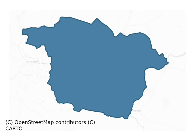
Moycarn is a barony of County Roscommon, in the historical province of Connacht (Irish: Maigh Charnáin), covering 114 km² of land. The barony records 152 NMS archaeological sites and 11 NIAH listed buildings, placing it at around the 24th percentile among 280 ROI baronies for sites per km². This means it is in the bottom third of all baronies for sites per km². Dated archaeological evidence runs from the Iron Age through to the Post Medieval, spanning 4 of 9 archaeological periods, placing the barony in the 2nd percentile among 280 ROI baronies for chronological depth. This means it is in the bottom tenth of all baronies for chronological depth. The largest dated subset of recorded sites dates to the Early Medieval.

Heritage at a glance
Percentile rankings throughout this profile compare each barony only against the other 279 Republic of Ireland baronies.
The recorded heritage of Moycarn
The National Monuments Service Sites and Monuments Record (SMR) is the statutory inventory of archaeological sites for the Republic of Ireland, maintained by the Department of Tourism, Culture, Arts, Gaeltacht, Sport and Media. Sites recorded here include earthworks, ringforts, megalithic tombs, ecclesiastical remains, and post-medieval features; not every record is legally protected, but each is registered as a monument of archaeological interest.
The National Monuments Service records 152 archaeological sites in Moycarn, putting it at the 24th percentile among 280 ROI baronies for sites per km². This means it is in the bottom third of all baronies for sites per km². Of these, 120 (79%) fall within a recorded monument protection zone. The record is dominated by defensive sites — ringforts, enclosures, hillforts, and stone forts (38 sites, 25% of the total), with ecclesiastical sites forming a substantial secondary presence (33 sites, 22%). Ringfort – rath is the most prevalent type, making up 12% of the barony's recorded sites (19 records) — below the ROI average of 20% across all baronies where this type occurs. Ringfort – rath is an earthen ringfort enclosed by a bank and external ditch — the most common Early Medieval farmstead, broadly dated 500–1000 AD. Other significant types include Cross-slab (12) and Structure – peatland (10). Cross-slab is a stone slab inscribed with a cross, used as a grave-marker or memorial, dated pre-1200 AD; Structure – peatland is a construction of unknown function, either extant or implied by archaeological evidence, of any date. Across the barony's 114 km², this gives a recorded density of 1.33 sites per km².
Most common monument types
Hover or tap a monument type to see its definition.
| Type | Count |
|---|---|
| Ringfort – rath an earthen ringfort enclosed by a bank and external ditch — the most common Early Medieval farmstead, broadly dated 500–1000 AD | 19 |
| Cross-slab a stone slab inscribed with a cross, used as a grave-marker or memorial, dated pre-1200 AD | 12 |
| Structure – peatland a construction of unknown function, either extant or implied by archaeological evidence, of any date | 10 |
| Children's burial ground an unconsecrated medieval and early-modern burial ground for unbaptised or stillborn children, often called a cillín or ceallúnach | 7 |
| Castle – unclassified a castle whose form cannot be precisely classified, dating somewhere between the late 12th and 16th centuries | 5 |
Chronological distribution
The dated archaeological record for Moycarn spans from the Iron Age through to the Post Medieval, with activity attested across 4 of 9 archaeological periods. This is the 2nd percentile across ROI baronies — a relatively narrow chronological band, with much of Irish prehistory not represented in the dated record. Every period from earliest to latest is represented in the record — an unbroken sequence of dated activity across the full chronological span. Activity concentrates most heavily in the Early Medieval (7 sites, 47% of dated material), with the Iron Age forming a secondary peak (5 sites, 33%). A further 12 recorded sites (44% of the overall NMS register for the barony) carry no period attribution — appearing as 'Unknown' in the bar chart below. This typically reflects either records that pre-date the standardised period vocabulary or sites awaiting specialist dating review, rather than a genuine absence of chronological evidence.
Sample of recorded monuments
Show 25 sample monuments (of 152 total)
A representative sample of 25 recorded monuments drawn from the barony’s 152 total NMS entries. Sites within a recorded monument protection zone and rarer site types are prioritised so the list shows a meaningful cross-section rather than only the most common type. Each entry shows the official Sites and Monuments Record reference number and the description published by the National Monuments Service.
Crannog
Marked as a small island (diam. c. 15m) close to the NW shore of the triangular S part (dims c. 250m NE-SW; c. 200m N-S) of Cranberry Lough on the 1837 and 1925 eds of the OS 6-inch map. It is now attached to the NW…
Marked as a small island (diam. c. 15m) close to the NW shore of the triangular S part (dims c. 250m NE-SW; c. 200m N-S) of Cranberry Lough on the 1837 and 1925 eds of the OS 6-inch map. It is now attached to the NW shore. The tip of the peninsula (diam. c. 20m) is lower than the rest and planted with some coniferous trees. It is overgrown with sallies while the lake to the S is becoming silted. There is no evidence of artificial construction, but it may well have a stone core and be a crannog.
Compiled by: Michael Moore
Date of revised upload: 23 November, 2015
Enclosure – large enclosure
Marked only on the 1837 ed. of the OS 6-inch map as a large embanked enclosure (ext. diam. c. 100m) and situated on a gentle S-facing slope. This is a circular area of mixed woodland defined by a scarp (Wth 2-5m; H…
Marked only on the 1837 ed. of the OS 6-inch map as a large embanked enclosure (ext. diam. c. 100m) and situated on a gentle S-facing slope. This is a circular area of mixed woodland defined by a scarp (Wth 2-5m; H 0.5-0.8m) SE-W-NW (diam. 83m NW-SE), which merges into the slope elsewhere where it is bordered by the edge of the wood. There is no evidence of a bank, fosse or original entrance.
Compiled by: Michael Moore
Date of upload: 24 August 2010
House – 16th/17th century
The castle of Tullagh had been lost to Irish rebels by Martin Lyle by 1596 (Cronin 1980, 117). A castle at Tullagh is not marked on the Strafford map of c. 1636, unless it is the castle also interpreted as now in…
The castle of Tullagh had been lost to Irish rebels by Martin Lyle by 1596 (Cronin 1980, 117). A castle at Tullagh is not marked on the Strafford map of c. 1636, unless it is the castle also interpreted as now in Liberty townland (RO054-019—-). The bishop of Meath owned 62 profitable acres at Tullogh in 1641 and the 1660s, but there is no mention of a castle or any other landowner (Simington 1949, 62). It is situated on a gently undulating landscape. This was a rectangular house (dims 17.6m N-S; 9m E-W) of two storeys and four bays with circular towers (ext. diam. 4m) that had gun-loops at the NW and SW angles and chimneys, each with two diamond-shaped stacks, in the N and S gables (Craig 1982, 131; Salter 1993, 45). The house was removed in the early 1990s after storm damage. Archaeological testing (07E1095) on the location produced no evidence of it (Wilkinson 2010).
Compiled by: Michael Moore
Date of upload: 24 August 2010
Sweathouse
At the bottom of a SW-facing slope c. 150m SE of Drumlaggagh church (RO056-004001-). It is built into the N corner of the structure locally regarded as the remains of a parish church (RO056-004003-) together with two…
At the bottom of a SW-facing slope c. 150m SE of Drumlaggagh church (RO056-004001-). It is built into the N corner of the structure locally regarded as the remains of a parish church (RO056-004003-) together with two house sites (RO056-004013-). The sweathouse is circular feature (int. dims 1.6m x 1.4m; max. H 0.7m)
Compiled by: Michael Moore
Date of upload: 24 August 2010
Field system
On a SW-facing slope. About 20m NW of the church (RO056-004001-) is a modern NE-SW field bank, and a field system covering about 3 acres (c. 1.2ha) survives to its NW. There are portions of two rectangular fields (dims…
On a SW-facing slope. About 20m NW of the church (RO056-004001-) is a modern NE-SW field bank, and a field system covering about 3 acres (c. 1.2ha) survives to its NW. There are portions of two rectangular fields (dims c. 30m x c. 30m) defined by earth and stone banks (Wth c. 3m; H 0.5-1m) associated with lazy beds. A house site (RO056-004014-) (ext. dims. 5.3m E-W; 4.3m N-S) is built on one of the field banks.
Compiled by: Michael Moore
Date of upload: 24 August 2010
Hut site
On a SW-facing slope. Within 20m of the church (RO056-004001-) are 5 possible hut-sites (ext. diam. 4-5m), defined by stone spreads (Wth c. 1-2m), sometimes with facing-stones evident, although they may be clearance…
On a SW-facing slope. Within 20m of the church (RO056-004001-) are 5 possible hut-sites (ext. diam. 4-5m), defined by stone spreads (Wth c. 1-2m), sometimes with facing-stones evident, although they may be clearance cairns.
Compiled by: Michael Moore
Date of upload: 24 August 2010
Watercourse
At the bottom of a SW-facing slope. About 90-130m S and SE of the church of the Arroauaisian nuns (RO056-004001-) and adjacent to a large building (RO056-004008-) at its visible E end is a mill-race which leads W and S…
At the bottom of a SW-facing slope. About 90-130m S and SE of the church of the Arroauaisian nuns (RO056-004001-) and adjacent to a large building (RO056-004008-) at its visible E end is a mill-race which leads W and S to a 19th century mill c. 500m to the S. The watercourse (Wth c. 2m; D c. 1m) is stone-faced in places. From the building at the E end it runs S (L c. 40m), WNW (L c. 100m) and SW (L c. 90m).
Compiled by: Michael Moore
Date of upload: 24 August 2010
Cross – Wayside cross
At the S side of an NW-SE public road in a flat-bottomed SW-NE valley which opens out to a bog at N. Called the Cross of Cairbre Crom by J. O'Donovan in the 1830s (O'Flanagan 1931, vol. 1, 24-5), it may have been a…
At the S side of an NW-SE public road in a flat-bottomed SW-NE valley which opens out to a bog at N. Called the Cross of Cairbre Crom by J. O'Donovan in the 1830s (O'Flanagan 1931, vol. 1, 24-5), it may have been a wayside cross beside a togher connecting Clonburren (RO056-007001-) with a higher ridge to the W at Faltia. A single limestone piece with an octagonal cross-section (dims 0.3m x 0.3m; L 0.8m) has an unserviceable circular tennon at one end. A further portion (RO056-007005-) is now at Clonburren church (RO056-007001-). (Crawford 1907, 217)
Compiled by: Michael Moore
Date of upload: 24 August 2010
Religious house nunnery – unclassified
On the summit of an esker within view of the monastery of Clonmacnoise, Co. Offaly (OF005-004—-) c. 4.5km to the ENE. A religious house of nuns was founded by Caoireach Dheargáin who died in AD 577-8 (AFM). Her…
On the summit of an esker within view of the monastery of Clonmacnoise, Co. Offaly (OF005-004—-) c. 4.5km to the ENE. A religious house of nuns was founded by Caoireach Dheargáin who died in AD 577-8 (AFM). Her importance can be gauged from the attempts to trace her ancestry variously to the Ceinéal Laoighre of Meath, the Dál nAraidhe of NE Ulster and the Oirghialla of Ulster, but no solid facts of her life are known (Ó Riain 2011, 151-2). Her foundation was known as Cluain-bairenn, and the names of seven other abbesses are known between AD 713 and 1066 (Gwynne and Hadcock 1970, 315). References cease in the 11th century, and its demise may be connected with the foundation of a nunnery (OF005-029—-) at Clonmacnoise before AD 1026. The church at Cloonburren is described as standing in 1641 when the Bishops of Meath and Clonfert jointly owned over 500 profitable acres there, but the land had reverted to the Bishop of Meath in the 1660s (Simington 1949, 64).
The conserved foundations of a rectangular structure (ext. dims at least 6.75m E-W; 6.65m N-S) defined by low walls (T 0.8m; H 0.6-0.7m) remain, of which only the W wall is original. It may be a mortuary enclosure but it is within a subrectangular graveyard (RO056-007001-) (dims c. 70m NE-SW; c. 60m NW-SE) defined by drystone walls. An almost complete cross-slab (RO056-007003-) and fragments of nine others are displayed in the graveyard, but four recorded slabs (Macalister 1912, fig. 2; 1945, vol. 2, 18-19, Nos 556-…
Architectural fragment
On the summit of an esker within view of Clonmacnoise, Co. Offaly (OF005-004—-) c. 4.5km to the ENE. At the conserved remains of a church structure (RO056-007002-) are fragments of dressed medieval masonry within the…
On the summit of an esker within view of Clonmacnoise, Co. Offaly (OF005-004—-) c. 4.5km to the ENE. At the conserved remains of a church structure (RO056-007002-) are fragments of dressed medieval masonry within the graveyard (RO056-007001-), including the head of a round-headed window.
Compiled by: Michael Moore
Date of upload: 24 August 2010
Cross (present location)
On the summit of an esker within view of Clonmacnoise, Co. Offaly (OF005-004—-) c. 4.5km to the ENE. A cross-base with moulded corners (dims of top 0.92m x 0.46m), which was moved from a position (RO056-006—-) at…
On the summit of an esker within view of Clonmacnoise, Co. Offaly (OF005-004—-) c. 4.5km to the ENE. A cross-base with moulded corners (dims of top 0.92m x 0.46m), which was moved from a position (RO056-006—-) at the roadside c. 80m to the SSW of the graveyard (RO056-007001-), now supports a fragment of cross (RO056-007003-) within the graveyard.
Compiled by: Michael Moore
Date of upload: 24 August 2010
Cross – Wayside cross (present location)
On the summit of an esker within view of Clonmacnoise, Co. Offaly (OF005-004—-) c. 4.5km to the ENE. A small fragment of the wayside cross (RO056-005—-), which is octagonal but has been damaged (dims. 0.3m x c.…
On the summit of an esker within view of Clonmacnoise, Co. Offaly (OF005-004—-) c. 4.5km to the ENE. A small fragment of the wayside cross (RO056-005—-), which is octagonal but has been damaged (dims. 0.3m x c. 0.3m; H 0.6m), was moved from its original position c. 400m to the W and is now in the graveyard (RO056-007001-).
Compiled by: Michael Moore
Date of upload: 24 August 2010
Castle – motte and bailey
At the NE end of the NE-SW esker known as Esker Riada. This territory was held by De Costentin until AD 1215 (Cal. doc. Ire., No. 590), but the motte was garrisoned by Aed Ua Conchobair in 1226 (Doran 2005, 368-70).…
At the NE end of the NE-SW esker known as Esker Riada. This territory was held by De Costentin until AD 1215 (Cal. doc. Ire., No. 590), but the motte was garrisoned by Aed Ua Conchobair in 1226 (Doran 2005, 368-70). This is a flat-topped, grass-covered gravel mound (diam. of top 12.7m E-W; 13.4m N-S; diam. of base 46m E-W; H 8m at W to 11.5m at E) with a slight fosse (at ENE: Wth of base 2m; D 0.4m) and outer bank or field bank (at ENE: Wth 2.8m; H 0.6m) at the base. The fosse is most pronounced (Wth of top c. 15m; Wth of base 2m; D 4.5m) at W where there is a subrectangular grass-covered bailey on the esker (dims 45m N-S; 24m E-W) defined by an earthen bank (Wth 11m; int. H 1.2-1.5m; ext. H 2.6-3m) and outer fosse (Wth of top 11.7m; Wth of base 3m; D 1.3m) at W with a scarp (H 3.7m) and an outer fosse (Wth of top 10.5m; Wth of base 3.5m; D 0.3m) at N and a scarp (H 3.8m) and fosse (Wth of top 8.6m; Wth of base 2m; D 1m) at S . There is a central E-W rib (Wth 7.5m; max. H 0.5m) in the bailey, which is probably the remains of a later field bank, but there is no evidence of an original entrance. Archaeological testing (07E0365) c. 60m to the NE produced no related material (Connell 2007). (Graham 1988b, 25)
See the attached aerial view taken from the SE.
Compiled by: Michael Moore
Date of upload: 18th October 2011
This monument is subject to a preservation order made under the National Monuments Acts 1930 to 2014 (PO no. 4/2007).
Graveslab
A small rectangular sandstone slab (Wth c. 0.43m; L c. 0.38m; T c. 0.07m) which is broken off at one end was found at the castle site (RO056-011001-) before 1955 and is now in NMI. It is incised with a cross that has…
A small rectangular sandstone slab (Wth c. 0.43m; L c. 0.38m; T c. 0.07m) which is broken off at one end was found at the castle site (RO056-011001-) before 1955 and is now in NMI. It is incised with a cross that has circular terminals, circles at the crux, and fluer-de-lis in the angles.
Compiled by: Michael Moore
Date of upload: 24 August 2010
Ritual site – holy tree/bush
Situated towards the bottom of a steep SW-facing, rush-covered slope. There is a holy bush with rags adjacent to the holy well (RO054-026001-). Kilbegly Church (RO054-027001-) is c. 260m to the NE.
Compiled by:…
Situated towards the bottom of a steep SW-facing, rush-covered slope. There is a holy bush with rags adjacent to the holy well (RO054-026001-). Kilbegly Church (RO054-027001-) is c. 260m to the NE.
Compiled by: Michael Moore
Date of upload: 24 August 2010
Burial
In October 2000 a single human bone, a right tibia, was recovered from the spoil heap of a drainage operation at the boundary of Cappaleitrim and Cloonburren. It was acquired by the National Museum of Ireland (2000:70),…
In October 2000 a single human bone, a right tibia, was recovered from the spoil heap of a drainage operation at the boundary of Cappaleitrim and Cloonburren. It was acquired by the National Museum of Ireland (2000:70), but no futher remains came to light. (Sikora and Cahill 2011, vol. 2, P 509, 7.176)
Compiled by: Michael Moore.
Date of Upload: 20 March, 2012.
Bridge
A bridge (RO056-018001-) of 17 arches was built c.1700 at a point where there had been a ford (RO056-018002-/OF013-037002-). In 1755 the Commissioners of Inland Navigation built an extra span on the E bank. In 1845…
A bridge (RO056-018001-) of 17 arches was built c.1700 at a point where there had been a ford (RO056-018002-/OF013-037002-). In 1755 the Commissioners of Inland Navigation built an extra span on the E bank. In 1845 Thomas Rhodes designed a cast iron swivel bridge to replace this span, which itself was replaced by a concrete span in 1883-4, (Barry 1985, ).
Compiled by: Michael Moore
Date of upload: 9 March 2012
Church
Situated on a gentle S-facing slope. This is the parish church of Moore in the Tuam diocese, possibly on the site of an earlier church. The church is a rectangular structure (int. dims at least 14m E-W; 5.3m N-S)…
Situated on a gentle S-facing slope. This is the parish church of Moore in the Tuam diocese, possibly on the site of an earlier church. The church is a rectangular structure (int. dims at least 14m E-W; 5.3m N-S) defined by cairn material, but only the N masonry wall survives (T 0.8m; H 3.6m) with a single robbed window embrasure. The church is situated towards the S edge of a large circular grass-covered ecclesiastical enclosure (RO054-024003-) (diam. 103m E-W; 96.5m N-S) defined by an earthen bank (Wth 4-6m; int. H 0.4m; ext. H 0.6-1.4m), which is best preserved NNW-NE (Wth 6.8m; int. H 0.5m; ext. H 1.8m) but missing E-S and morphed into a field bank elsewhere. An outer fosse survives NNW-NNE (Wth of top 8.8m; Wth of base 2.3m; D 0.5m) and SSW-WNW (Wth of top 3.5m; Wth of base 1.1m; D 0.3m). The interior has a number of radial banks (Wth 4m; H 0.4-0.6m), but a D-shaped graveyard (RO054-024002-) (dims c. 100m E-W; c. 40m N-S) is confined to the area N of a WNW-ESE road which traverses the enclosure N of the centre. The perimeter of the enclosure is clipped by a NE-SW field wall at SE. Archaeological testing (08E0307) c. 100m to the NW failed to produce any related material (Gleeson 2011).
Compiled by: Michael Moore
Date of upload: 20th June 2011
Ecclesiastical enclosure
On a gentle S-facing slope. The church of Moore (RO054-024001-) is situated towards the S edge of a large circular grass-covered enclosure (diam. 103m E-W; 96.5m N-S) defined by an earthen bank (Wth 4-6m; int. H 0.4m;…
On a gentle S-facing slope. The church of Moore (RO054-024001-) is situated towards the S edge of a large circular grass-covered enclosure (diam. 103m E-W; 96.5m N-S) defined by an earthen bank (Wth 4-6m; int. H 0.4m; ext. H 0.6-1.4m), which is best preserved NNW-NE (Wth 6.8m; int. H 0.5m; ext. H 1.8m) but missing E-S. An outer fosse survives NNW-NNE (Wth of top 8.8m; Wth of base 2.3m; D 0.5m) and SSW-WNW (Wth of top 3.5m; Wth of base 1.1m; D 0.3m). The interior has a number of radial banks (Wth 4m; H 0.4-0.6m), but a D-shaped graveyard (RO054-024002-) is confined to the area N of a WNW-ESE public road which bisects the enclosure.
Compiled by: Michael Moore
Date of upload: 24 August 2010
Church
During the middle ages this was probably a chapel-of ease to Moore parish church (RO054-024001-) in Tuam diocese, and it is situated on a hillock. The church may have an early origin. The holy well (RO054-026001-),…
During the middle ages this was probably a chapel-of ease to Moore parish church (RO054-024001-) in Tuam diocese, and it is situated on a hillock. The church may have an early origin. The holy well (RO054-026001-), church and townland were named after Beag Bile, a saint associated with Tullaghobegly church, Co. Donegal (DG025-024—-), who was also honoured here. The saint's feastday fell on the 1st November (Ó Riain 2011, 91-2), and while the well had a pattern in the 19th century (OS Name Books) the date is unknown.
The church is a rectangular masonry structure (int. dims 12.3m E-W; 4.9m N-S) with some large stones at the lower level suggesting two construction periods. Only the N, E, and the E end of the S walls survive (H 2m; T 0.7m), the rest being reduced to the foundations. There is a simple light towards the W end of the N wall, but no evidence of a doorway. The church is at the highest point of and towards the S edge of a subcircular ecclesiastical enclosure (RO054-027003-) (dims 108m N-S; 92m E-W) defined by an eroded earthen bank (Wth 4-6m; int. H 0.3-1.1m; ext. H 0.6-1.8m) reduced to a scarp (H 0.6m) SSW-W and with a fosse (Wth of top 5.6m; Wth of base 1.6m; int. D 1.8m; ext. D 0.6m) surviving at NE only. Two parallel banks 14m apart run E from the church to the enclosing bank which is surrounded by the wall of the graveyard (RO054-027002-) (dims c. 130m N-S; c. 95m E-W). Holy Well (RO054-026001-) is c. 260m to the SW. The original graveyard is depicted faint…
Ecclesiastical enclosure
The church of Kilbegly (RO054-027001-) is at the highest point of and towards the S of a subcircular enclosure (dims 108m N-S; 92m E-W) defined by an eroded earthen bank (Wth 4-6m; int. H 0.3-1.1m; ext. H 0.6-1.8m)…
The church of Kilbegly (RO054-027001-) is at the highest point of and towards the S of a subcircular enclosure (dims 108m N-S; 92m E-W) defined by an eroded earthen bank (Wth 4-6m; int. H 0.3-1.1m; ext. H 0.6-1.8m) reduced to a scarp (H 0.6m) SSW-W and with a fosse (Wth of top 5.6m; Wth of base 1.6m; int. D 1.8m; ext. D 0.6m) surviving at NE only. Two parallel banks 14m apart run E from the church to the enclosing bank which is surrounded by the wall of the graveyard (RO054-027002-). A geophysical survey undertaken in 2015 identified the ditch of the enclosure running outside of and roughly parallel with the graveyard wall at W, and a fallow area (Wth c. 30m) was left to protect it. Archaeological testing (18E0345) by Dominic Delaney & Associates W of the fallow area produced no related material (excavations.ie 2018:879).
Compiled by: Michael Moore
Date of upload: 24 August 2010
Amended: 20 October 2021
Enclosure
On a SW-facing slope. There is a rectangular grass-covered platform (dims c. 22m N-S; 18.5m E-W) defined by slight scarps attached to the E of the church (RO056-004001-).
Compiled by: Michael Moore
Date of upload:…
On a SW-facing slope. There is a rectangular grass-covered platform (dims c. 22m N-S; 18.5m E-W) defined by slight scarps attached to the E of the church (RO056-004001-).
Compiled by: Michael Moore
Date of upload: 24 August 2010
Cross
The cross-base (RO056-007007-) now in Cloonburren graveyard (RO056-007002-) was once located here at the T-junction of public roads, on the E side of the road going S from the junction. It was either on the ditch or on…
The cross-base (RO056-007007-) now in Cloonburren graveyard (RO056-007002-) was once located here at the T-junction of public roads, on the E side of the road going S from the junction. It was either on the ditch or on the roadside.
Compiled by: Michael Moore
Date of upload: 24 August 2010
Cross
Situated on the summit of an esker within view of Clonmacnoise, Co. Offaly (OF005-004—-) c. 4.5km to the ENE. A fragment of a cross (dims 0.3m x 0.15m; H 0.45m) with dog-tooth decoration on a side-panel and a…
Situated on the summit of an esker within view of Clonmacnoise, Co. Offaly (OF005-004—-) c. 4.5km to the ENE. A fragment of a cross (dims 0.3m x 0.15m; H 0.45m) with dog-tooth decoration on a side-panel and a secondary carving in low relief on the N face is set in a cross-base (RO056-007006-) within the graveyard (RO056-007001-). A third carving on the S face depicts a robed figure above a leaf design and was first recorded by Gary Dempsey.
See the attached image of the N face of the cross.
Compiled by: Michael Moore
Date of revised upload: 23 May 2016
Ringfort – rath
The name Rath na Sluagh – the rath of the crowds – was recorded by John O'Donovan in the 1830s for this monument (Herity 2010, 15). It is situated on a slight knoll. It is a circular grass and scrub-covered area (diam.…
The name Rath na Sluagh – the rath of the crowds – was recorded by John O'Donovan in the 1830s for this monument (Herity 2010, 15). It is situated on a slight knoll. It is a circular grass and scrub-covered area (diam. 45m E-W; 42.5m N-S) sloping down to the SE defined by an overgrown earthen bank (Wth 4-4.5m; int. H 0.1-0.4m; ext. H 1.3-1.5m) which is reduced to a scarp (H 1.5m) NNE-SSE. This is separated by a fosse (Wth of top 4.7-6.3m; Wth of base 2.2-3.2m; D 0.4-0.9m) from an overgrown outer bank (Wth 4-4.5m; ext. H 0.7-0.9m). There are traces of internal and external facing-stones on both banks. The entrance through the inner (Wth 4m) and outer (Wth 5m) banks and a causeway (Wth 8m) are at S.
Compiled by: Michael Moore
Date of upload: 24 August 2010
Listed buildings
The National Inventory of Architectural Heritage (NIAH) is a state survey appraising buildings of architectural, historical, archaeological, artistic, cultural, scientific, social, or technical interest. Each surveyed structure receives a rating from International (the highest, for buildings of European importance) through National, Regional, Local, and Record-Only.
The NIAH records only 11 listed buildings in Moycarn, the 2nd percentile across ROI baronies — a relatively thin architectural record. The highest-graded structures include 2 of National significance. The Republic holds 937 National-graded buildings in total, so this barony accounts for around 0% of the national total. Construction dates concentrate most heavily in the Victorian (1830-1900) period.
Terrain and environment
Mean elevation across the barony is 43m — the 12th percentile among 280 ROI baronies for elevation. This means it is in the bottom fifth of all baronies for elevation. This is a relatively low-lying landscape by ROI standards. Elevation matters for heritage because higher-altitude baronies typically favour defensive monuments — ringforts and hilltop forts placed on prominent ground — while lowland baronies are more likely to carry the dense settlement and church networks of intensive agricultural landscapes. Mean slope is 1.9° — the 3rd percentile among 280 ROI baronies for slope. This means it is in the bottom tenth of all baronies for slope. This is broadly flat terrain, the kind of landscape best suited to intensive agriculture. Slope is a key control on both land use and archaeological preservation: steep ground resists ploughing and tends to preserve earthworks intact, while gentle slopes favour intensive cultivation that damages or destroys surface archaeology over time. The Topographic Wetness Index averages 11.9, the 95th percentile among 280 ROI baronies for wetness. This means it is in the top tenth of all baronies for wetness. This is wet, slow-draining ground by ROI standards — the kind of landscape that may carry waterlogged archaeological sites of unusual preservation value. Drainage matters for heritage because poorly-drained ground preserves organic archaeology (wooden trackways, leather, textiles, and on rare occasions human remains) far better than free-draining soil; well-drained ground favours arable use but destroys organic material rapidly. The land cover is dominated by improved grassland (83%) and woodland (9%). In overall character, this is low-lying, gently-sloping terrain — characteristic of Ireland's central plain and coastal lowlands, with land use dominated by improved grassland.
Terrain measurements
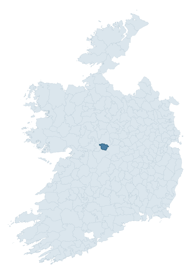
Where this barony sits in the Republic of Ireland
Geology and preservation
Bedrock geology shapes the landscape long before any settlement begins — controlling soil drainage, agricultural potential, the survival of upstanding monuments, and the preservation of buried archaeology. The figures below come from the Geological Survey Ireland 1:100,000 bedrock map.
The bedrock underlying Moycarn is predominantly limestone (90% of the barony by area), laid down during the Carboniferous period (100% by area, around 359 to 299 million years ago). Limestone is the most heritage-rich bedrock in Ireland. It supports fertile, well-drained soils that favoured dense Early Medieval settlement and Norman manorial agriculture, and it weathers into karst features — sinkholes, caves, swallow holes, and souterrains — that frequently carry archaeology. Where peat overlies limestone, organic preservation can be exceptional. The single largest mapped unit is the Waulsortian Limestones (55% of the barony's bedrock).
Rock type composition
Largest mapped unit: Waulsortian Limestones (55% of the barony)
Placename evidence
Logainm records 6 heritage-diagnostic placenames for Moycarn, a modest sample drawn predominantly from the townland record. The dominant stratum is pre-christian defensive. The most frequent diagnostic roots are caiseal- (3) and cill- (2). With a sample of this size the count should be treated as indicative rather than definitive.
Pre-Christian / Early Medieval Defensive
| Root | Count | Meaning |
|---|---|---|
| caiseal- | 3 | stone ringfort |
Early Christian Ecclesiastical
| Root | Count | Meaning |
|---|---|---|
| cill- | 2 | church (early) |
Burial, Ritual, and Norse-Contact
| Root | Count | Meaning |
|---|---|---|
| carn- | 1 | cairn |
Other baronies in Roscommon
- Frenchpark
- Costello
- Ballintober South
- Athlone South
- Boyle
- Athlone North
- Roscommon
- Frenchpark
- Kilmaine — Mayo
- Corran — Sligo
See all 280 baronies in the Republic of Ireland Heritage Tool.

Explore further
Grounding History: 10 Maps of Northern Ireland’s Past
If you’re interested in Irish heritage more widely, the companion report for Northern Ireland brings together the analysis of all 462 NI wards into one place through 10 high-quality maps — covering monument density, archaeological periods, placename heritage, terrain, wetland, and the historic landscape at first survey. Take a look.
About this profile
Click any section below to expand.
What is a barony?
A barony is a historic administrative unit in Ireland, broadly equivalent to an English hundred. The 280 baronies used here are from the OSi 2019 National Statutory Boundaries (generalised 20m), covering the 26 counties of the Republic of Ireland. Baronies derive from the Norman period, were formalised in the 17th century, and have not been redrawn for statistical purposes. They vary enormously in area, from compact urban baronies in Dublin to vast upland baronies in Connacht, and should not be compared by raw site count without accounting for area differences.
What counts as a site?
This profile combines three distinct heritage registers, each with its own definition of what constitutes a recordable site:
- Archaeological sites (NMS). The National Monuments Service Sites and Monuments Record (SMR) catalogues every known archaeological monument or site of archaeological interest in the Republic, from prehistoric burial mounds and ringforts to medieval churches and post-medieval defensive works. Inclusion does not require legal protection — only that the site has been identified, surveyed, and assessed as having archaeological value. A separate subset of these sites lies within a recorded protection zone, which gives them statutory protection under the National Monuments Acts.
- Listed buildings (NIAH). The National Inventory of Architectural Heritage records buildings of architectural, historical, archaeological, artistic, cultural, scientific, social, or technical interest. Each surveyed structure is appraised on a five-tier scale: International, National, Regional, Local, and Record-Only. The NIAH appraisal is informational rather than strictly statutory, but it underpins local-authority Record of Protected Structures (RPS) listings.
- Heritage placenames (Logainm). Logainm is the authoritative database of Irish placenames maintained by the Placenames Branch. This profile applies a heritage-diagnostic classifier to the Irish-language form of each townland name, flagging roots that signal defensive sites (ráth-, lios-, dún-, caiseal-, cathair-), ecclesiastical foundations (cill-, teampall-, domhnach-, mainistir-), prehistoric burial-ritual features (tuaim-, carn-, leaba-), or Norse-contact settlement (gall-). Townlands without one of these diagnostic roots are not flagged here — they may still carry historical significance, but that significance is not encoded in the name itself.
Editorial principles
The narrative sections of this profile follow several explicit principles:
- Evidential. Every claim about this barony’s heritage character is anchored in the underlying register data. Where a site count, a placename count, or a percentile rank is cited, it is computed from the source datasets at export time, not estimated.
- Comparative. Counts and metrics are reported alongside their percentile rank against the other 279 ROI baronies. A barony with 50 ringforts in absolute terms could be unusually high or unusually low depending on its size and regional context; percentile ranking removes that ambiguity.
- Transparent on limits. Where a register has known coverage gaps, survey biases, or data-quality issues that affect this barony’s figures, the profile flags them rather than presenting the numbers as definitive.
- No interpretation beyond what the data supports. The narrative does not speculate about historical events, social dynamics, or cultural meaning beyond what the recorded heritage and placename evidence directly attests.
Data caveats and limits
- NMS Sites and Monuments Record is the product of survey campaigns conducted at different intensities across different counties and decades. Some baronies have been surveyed more thoroughly than others, and absolute counts should be read in that light. Sites destroyed by development before survey are typically not represented; sites in heavily forested or upland terrain are sometimes under-recorded.
- NIAH coverage is broadly complete for the Republic of Ireland but the survey was conducted on a rolling county-by-county basis, and the most recent appraisal date varies. Buildings demolished or substantially altered after their original survey may still appear in the register; conversely, recent buildings of merit may not yet have been appraised.
- Logainm classification applies a deliberately conservative pattern-matching approach to the Irish-language townland forms. The classifier prioritises true positives over recall: a townland may carry a heritage signal that the classifier doesn’t recognise, particularly where the diagnostic root has been heavily anglicised or where the townland name draws on a less common term. The 60,000+ townland records and ~9,800 classified placenames give a substantial signal at barony scale, but individual townland names should be checked against Logainm directly for definitive interpretation.
- Period attribution. The chronological distribution reflects only those NMS sites that carry a recognised period attribution in the source data. Sites listed as “Unknown” period are excluded from the dated subset.
- Boundary changes. Some baronies have undergone minor boundary adjustments since their 19th-century definition; the OSi 2019 generalised boundaries used here are the current statutory definition and may differ slightly from historical maps in border areas.
- Bedrock geology is mapped at 1:100,000 scale, which means local variation within a barony — small pockets of different rock type, mineral veins, alluvium overlying bedrock — is generalised. The dominant-system and rocktype figures are area-weighted, so a barony reading “70% Carboniferous limestone” may still contain small but archaeologically important pockets of older or younger rock. Around 3% of GSI polygons do not match the lexicon and contribute no rocktype or system attribution.
Data sources
- National Monuments Service — Sites and Monuments Record (SMR) https://data.gov.ie/dataset/national-monuments-service-archaeological-survey-of-ireland
- National Inventory of Architectural Heritage (NIAH) https://data.gov.ie/dataset/national-inventory-of-architectural-heritage-niah-national-dataset
- Logainm — Placenames Database of Ireland https://www.logainm.ie/
- Ordnance Survey Ireland — National Statutory Barony Boundaries 2019 https://data-osi.opendata.arcgis.com/
- EURODEM — European Digital Elevation Model https://www.mapsforeurope.org/datasets/euro-dem
- ESA WorldCover https://esa-worldcover.org/en
- Geological Survey Ireland — 1:100,000 Bedrock Geology https://www.gsi.ie/en-ie/data-and-maps/Pages/Bedrock.aspx
Explore more: Search any of the 280 ROI baronies, browse by historical province, or read the methodology and data sources for the full Republic of Ireland Heritage Tool.