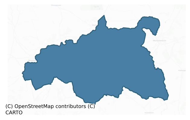
Portnahinch is a barony of County Laois, in the historical province of Leinster (Irish: Port na hInse), covering 145 km² of land. The barony records 152 NMS archaeological sites and 97 NIAH listed buildings, placing it at around the 15th percentile among 280 ROI baronies for sites per km². This means it is in the bottom fifth of all baronies for sites per km². Dated archaeological evidence runs from the Early Bronze Age through to the Modern, spanning 7 of 9 archaeological periods, placing the barony in the 39th percentile among 280 ROI baronies for chronological depth. This means it is in the lower half of all baronies for chronological depth. The largest dated subset of recorded sites dates to the Iron Age. Logainm flags 16 placenames in the barony as carrying a recognised heritage root; the largest share — around 69% — are names associated with early Christian church and monastic foundations.

Heritage at a glance
Percentile rankings throughout this profile compare each barony only against the other 279 Republic of Ireland baronies.
The recorded heritage of Portnahinch
The National Monuments Service Sites and Monuments Record (SMR) is the statutory inventory of archaeological sites for the Republic of Ireland, maintained by the Department of Tourism, Culture, Arts, Gaeltacht, Sport and Media. Sites recorded here include earthworks, ringforts, megalithic tombs, ecclesiastical remains, and post-medieval features; not every record is legally protected, but each is registered as a monument of archaeological interest.
The National Monuments Service records 152 archaeological sites in Portnahinch, putting it at the 15th percentile among 280 ROI baronies for sites per km². This means it is in the bottom fifth of all baronies for sites per km². A sparse recorded total of this kind in Ireland often reflects survey priority rather than genuine absence of past activity. Of these, 121 (80%) fall within a recorded monument protection zone. The record is dominated by defensive sites — ringforts, enclosures, hillforts, and stone forts (43 sites, 28% of the total), with ecclesiastical sites forming a substantial secondary presence (28 sites, 18%). The most diagnostically specific type is Church (12 records, 8% of the barony's NMS total) — compared to an ROI average of 4% across all baronies where this type occurs. Church is a building used for public Christian worship, of any date from c. 500 AD onwards. The broader 'Enclosure' classification — which catches unclassified ringforts and field enclosures — accounts for a further 24 records (16%) and reflects the difficulty of sub-classifying degraded earthworks from surface evidence alone. Across the barony's 145 km², this gives a recorded density of 1.05 sites per km².
Most common monument types
Hover or tap a monument type to see its definition.
| Type | Count |
|---|---|
| Enclosure a banked or ditched feature of uncertain type, used as a catch-all where the original function cannot be determined from surface evidence | 24 |
| Church a building used for public Christian worship, of any date from c. 500 AD onwards | 12 |
| Graveyard a burial area associated with a church, in use from the medieval period onwards | 10 |
| Fulacht fia a horseshoe-shaped Bronze Age burnt mound built around a sunken trough beside a water source, traditionally interpreted as a cooking site | 8 |
| Ringfort – rath an earthen ringfort enclosed by a bank and external ditch — the most common Early Medieval farmstead, broadly dated 500–1000 AD | 8 |
| Pit a circular or sub-circular cropmark, soil-mark or excavated cavity, of any date from prehistory onwards | 6 |
Chronological distribution
The dated archaeological record for Portnahinch spans from the Early Bronze Age through to the Modern, with activity attested across 7 of 9 archaeological periods. Every period from earliest to latest is represented in the record — an unbroken sequence of dated activity across the full chronological span. Activity concentrates most heavily in the Iron Age (32 sites, 30% of dated material), with the Early Bronze Age forming a secondary peak (15 sites, 14%). A further 47 recorded sites (31% of the overall NMS register for the barony) carry no period attribution — appearing as 'Unknown' in the bar chart below. This typically reflects either records that pre-date the standardised period vocabulary or sites awaiting specialist dating review, rather than a genuine absence of chronological evidence.
Sample of recorded monuments
Show 25 sample monuments (of 152 total)
A representative sample of 25 recorded monuments drawn from the barony’s 152 total NMS entries. Sites within a recorded monument protection zone and rarer site types are prioritised so the list shows a meaningful cross-section rather than only the most common type. Each entry shows the official Sites and Monuments Record reference number and the description published by the National Monuments Service.
Historic town
Town of Portarlington was previously known as the town of Cooletodderie as mentioned in 1571 Elizabethan land grant to Owen mac Hugh O'Dempsie and described as containing 80 acres, which lieth southwest from the River…
Town of Portarlington was previously known as the town of Cooletodderie as mentioned in 1571 Elizabethan land grant to Owen mac Hugh O'Dempsie and described as containing 80 acres, which lieth southwest from the River of the Barough, and abutteth upon the town and lands called Bracklone East' (O'Flanagan 1933, vol. 2, p. 51) The town is named after its founder Sir Henry Bennet, lord Arlington (Bradley et al. 1986, p. 42). In 1666 Charles II granted large tracts of O'Dempseys land which formed the manor of Portarlington and created the borough with a corporation, weekly market and two yearly fairs (Cal. State Papers, 1666-9, pp. 220-2). This new town may have been superimposed on an earlier settlement at Cooltedery mentioned in 1571. The town grew rapidly and formed its basic layout by 1678 when it is shown in a map now in the National Library of Ireland (Feehan 1983, p. 393). The town was laid out by George Rawdon and was fortified with a moat that enclosed the town and was surrounded on all sides by water. There is a market square in the centre of the town out of which the four main roads radiated out from the market square. Market House stood in the centre of the market square. The River Barrow enclosed three sides of the town from W through N to E and by a moat on the south side. The plan of the town shows triangular shaped bastions on the NE and NW angles of the town suggesting that the town was enclosed by a earthen fort with angle bastions similar to a star-shaped fo…
Castle – motte and bailey
Marked on the 1841 edition of the OS 6-inch map as a subcircular enclosure (diam. c. 40m NW-SE) enclosing two smaller enclosures at NW and SE; posibly a double motte and bailey. No surface remains.
Area adjacent to…
Marked on the 1841 edition of the OS 6-inch map as a subcircular enclosure (diam. c. 40m NW-SE) enclosing two smaller enclosures at NW and SE; posibly a double motte and bailey. No surface remains.
Area adjacent to motte was archaeologically tested bv Martin Byrne in 2003 under licence no. 03E1413
The above description is derived from the published 'Archaeological Inventory of County Laois' (Dublin Stationery Office, 1995) compiled by P. David Sweetman, Olive Alcock and Bernie Moran. In certain instances the entries have been revised and updated in the light of recent research.
Date of upload: 17 December 2007
Castle – Anglo-Norman masonry castle
Large Anglo-Norman fortress situated in low-lying ground close to the S bank of river Barrow. One of Leask's towered keeps (Leask 1941, 50-51) and the only one which has entensive outer defences extant (Leask 1936, Fig.…
Large Anglo-Norman fortress situated in low-lying ground close to the S bank of river Barrow. One of Leask's towered keeps (Leask 1941, 50-51) and the only one which has entensive outer defences extant (Leask 1936, Fig. 14). Probably built by the Earl Marshall in the first quarter of the thirteenth century. Its standing remains consist of a large keep with large circular angle towers, an inner ward with gateway and a large outer ward with D-shaped twin-towered gateway which was probably added at the end of thirteenth century. Earthworks of unknown date on all but the N side of the castle. (Leask 1936, 143-98; Leask 1941, 50-51, Fitzgerald 1904, 325-51). Church (LA005-007-) and graveyard (LA005-007001-) located 380m to the SE. Deserted medieval settlement (LA005-006003-) located in fields immediately S of Castle and NW of church.
In 1199 Maurice FitzPhilip gives to King John 400 marks, that he may have right according to judgement of the kings court touching Gessil (Geashill, Kings Co.) and Lega, whereof Gerald fitzMaurice FitzGerald (1st Baron of Offaly) deforces him, as is testified by charters which the King when Earl of Morton granted to Reginald de Boterell and William his brother (Cal. doc. Ire., 16). In 1203 upon the death of the 1st Baron of Offaly 'The King commands Meyler FitzHenry, Justiciary of Ireland, to casue to be delivered to William Marshall, Earl of Pembroke, or his messenger, the Castles of Lega and Geisil, with other lands of inheritance, whereof Ger…
Castle – tower house
Situated in flat countryside on slightly elevated site. A four-storey high tower house (max. dims 10m NE-SW, 11.80m NW-SE, wall T 2.35m) built of roughly coursed limestone. Punch-dressed limestone blocks with finely…
Situated in flat countryside on slightly elevated site. A four-storey high tower house (max. dims 10m NE-SW, 11.80m NW-SE, wall T 2.35m) built of roughly coursed limestone. Punch-dressed limestone blocks with finely dressed margins used as quoins and in windows and doorway indicating a late sixteenth or early seventeenth century date. There is a groin vault over second-floor level, other floors were of wood. Garderobes in NE angle, mural passage in SW wall, mural stairs in SW and SE walls. Sheela-na-gig (LA008-001002-) said to have come from here (JKAS 1904, Vol. IV, 205-15; JKAS 1920, Vol. IX, 262-3).
The above description is derived from the published 'Archaeological Inventory of County Laois' (Dublin Stationery Office, 1995) compiled by P. David Sweetman, Olive Alcock and Bernie Moran. In certain instances the entries have been revised and updated in the light of recent research.
Date of upload: 17 December 2007
Religious house – unclassified
Unclassified monastic establishment (Gwynn & Hadcock 1988, 369) also known as Triogue. Built of poorly coursed limestone rubble, remains consist of E gable of church (max. dims. 20.60m E-W, 5.50m N-S) with only the…
Unclassified monastic establishment (Gwynn & Hadcock 1988, 369) also known as Triogue. Built of poorly coursed limestone rubble, remains consist of E gable of church (max. dims. 20.60m E-W, 5.50m N-S) with only the foundation level of its other walls surviving. A barrel-vaulted building (max. dims. 7.30m N-S, 5.30m E-W) attached to S wall of nave. Simple slit ope with glazing-bar-holes visible in E gable, which apparently was 'trefoil headed' (JKAS 1904, Vol. IV, 194). Probably a late-medieval parish church (O'Hanlon and O'Leary 1907, vol. 1, 180; Vol II, 587; JKAS 1904, Vol IV, 194)
The above description is derived from the published 'Archaeological Inventory of County Laois' (Dublin Stationery Office, 1995) compiled by P. David Sweetman, Olive Alcock and Bernie Moran. In certain instances the entries have been revised and updated in the light of recent research.
Date of upload: 17 December 2007
Font (present location)
Now located in St John's church, moved from grounds of Emo Park demesne (LA009-006-) c. 1935. It may originally have been in Coolbanagher church (LA008-014001-). The font, which has an octagonal basin (max. int. diam.…
Now located in St John's church, moved from grounds of Emo Park demesne (LA009-006-) c. 1935. It may originally have been in Coolbanagher church (LA008-014001-). The font, which has an octagonal basin (max. int. diam. 0.57m, max. D 0.25m, T 0.1m) with a central drain-hole, is set on a modern base. Its eight panels are elaborately decorated with carvings in relief of angels or foliage designs and divided from each other by a twisted vine. Punch-dressing indicates a late medieval date (JKAS 1904, Vol. IV, 196-7; Roe 1947, 82-3). The panels contain angels carved in relief with a Bishops Head with open mouth from which a vine sprouts outwards, stylised vine leafs and bunches of grapes are found carved on several panels. This vine leaf motif coupled with the Bishop symbolises the church and the followers of the church which is linked to the scrament of Baptism where the person becomes a member of the church (symbol of the Bishop) and a follower of Christ (Vine leaf).
The above description is derived from the published 'Archaeological Inventory of County Laois' (Dublin Stationery Office, 1995) compiled by P. David Sweetman, Olive Alcock and Bernie Moran. In certain instances the entries have been revised and updated in the light of recent research.
Date of upload: 17 December 2007
Castle – hall-house
Located on flat elevated pasture with good views in all directions, the castle stands on the N side of a driveway leading up to a post-1700 house located 35m to the ENE. The medieval ruins of Coolbanagher church…
Located on flat elevated pasture with good views in all directions, the castle stands on the N side of a driveway leading up to a post-1700 house located 35m to the ENE. The medieval ruins of Coolbanagher church (LA008-014001-) are located 90m to the SW. On the 1837 ed. OS 6-inch map the castle is shown standing midway along the S boundary wall of a walled orchard. Today there are no upstanding remains of the S wall of the orchard but the N wall remains intact 50m to the N of the castle. The historic fabric of Coolbanagher Castle displays multi-phasing with evidence for at least three different building events, the floor levels of the castle were altered, wall fireplaces were inserted, narrow medieval windows were blocked up and tall brick lined windows were inserted into the S wall. An earlier site inspection of the castle (Wheeler 1969 SMR File) suggested that the castle was first built in the 13th century then modified in the 16th century with later 18th century insertions. In 1551, a 21 year lease was granted to Sir Ralph Bagenal which included the 'lands in Eyen [Eyne], Scrobo [Straboe], Syan [Shaen], the burgages of Raetyvyn [Ratheven] and a castle in decay and land in Cowlbaughell [Coolbanagher], parcel of the lordship of Irre, in Leix' (Nicholls 1994, 161). In the same year a second 21 year lease was granted to Ralph Bagenal which included the lands 'of Eyen (Eyne), Scrobo (Straboe), Sian (Shaen), Kilbanen, Kylenewarre (Ballydavis), Davidstown alias Ballydae…
House – medieval
No surface remains of house, which in any case was built 1810, except for traces of foundation. This was supposedly built on the site of an old house of the O'Dempsey's which according to Bence-Jones was remodelled in…
No surface remains of house, which in any case was built 1810, except for traces of foundation. This was supposedly built on the site of an old house of the O'Dempsey's which according to Bence-Jones was remodelled in the 19th century (Bence-Jones 1978, 28). Described the house as consisting of 2 principal fronts, one of them low and nearly 200 feet in length, with battlements and pointed doors and windows, the other front higher and with a square tower. Old arch opposite hall door, surviving from the O'Dempsey house. Could the square tower be the remains of O'Dempsey's medieval Castle?
Compiled by: Caimin O'Brien
Date of upload: 17 December 2007
Children's burial ground
Not marked on 1841 or 1888 eds OS 6-inch maps, but marked 'Childrens Burial Ground' (Disused) in plain script on 1909 edition Featureless area of scrub land (diam. c. 47m) with no obvious enclosing element.
The above…
Not marked on 1841 or 1888 eds OS 6-inch maps, but marked 'Childrens Burial Ground' (Disused) in plain script on 1909 edition Featureless area of scrub land (diam. c. 47m) with no obvious enclosing element.
The above description is derived from the published 'Archaeological Inventory of County Laois' (Dublin Stationery Office, 1995) compiled by P. David Sweetman, Olive Alcock and Bernie Moran. In certain instances the entries have been revised and updated in the light of recent research.
Date of upload: 17 December 2007
Moated site
No surface evidence remains. Not marked on current edition of the OS 6-inch map and unlikely to have been an antiquity. Marked as a rectangular enclosure on first edition of the OS 6-inch map. Classify as possible…
No surface evidence remains. Not marked on current edition of the OS 6-inch map and unlikely to have been an antiquity. Marked as a rectangular enclosure on first edition of the OS 6-inch map. Classify as possible moated site that was levelled between 1838 and 1888..
Compiled by: Caimin O'Brien
Date of upload: 17 December 2007
Ritual site – holy well
Recently renovated area around well reconstructed. Morrett church (LA009-021004-) lies c. 40m to SSE. Bullaun stone (LA029-021007-) stone located beside holy well.
The above description is derived from the published…
Recently renovated area around well reconstructed. Morrett church (LA009-021004-) lies c. 40m to SSE. Bullaun stone (LA029-021007-) stone located beside holy well.
The above description is derived from the published 'Archaeological Inventory of County Laois' (Dublin Stationery Office, 1995) compiled by P. David Sweetman, Olive Alcock and Bernie Moran. In certain instances the entries have been revised and updated in the light of recent research.
Date of upload: 17 December 2007
Water mill – horizontal-wheeled
Mill discovered in 1952 and investigated that year by Lucas and Danaher (Lucas 1953, 15-27). Understructure of the mill consisting of the dam, large wooden trough and the wheelhouse was uncovered. Site now levelled and…
Mill discovered in 1952 and investigated that year by Lucas and Danaher (Lucas 1953, 15-27). Understructure of the mill consisting of the dam, large wooden trough and the wheelhouse was uncovered. Site now levelled and covered over. No visible surface remains.
The above description is derived from the published 'Archaeological Inventory of County Laois' (Dublin Stationery Office, 1995) compiled by P. David Sweetman, Olive Alcock and Bernie Moran. In certain instances the entries have been revised and updated in the light of recent research.
Date of upload: 17 December 2007
Town defences
Town of Portarlington was previously known as the town of Cooletodderie as mentioned in 1571 Elizabethan land grant to Owen mac Hugh O'Dempsie and described as containing 80 acres, which lieth southwest from the River…
Town of Portarlington was previously known as the town of Cooletodderie as mentioned in 1571 Elizabethan land grant to Owen mac Hugh O'Dempsie and described as containing 80 acres, which lieth southwest from the River of the Barough, and abutteth upon the town and lands called Bracklone East' (O'Flanagan 1933, vol. 2, p. 51) The town is named after its founder Sir Henry Bennet, lord Arlington (Bradley 1986, p. 42). In 1666 Charles II granted large tracts of O'Dempseys land which formed the manor of Portarlington and created the borough with a corporation, weekly market and two yearly fairs (Cal. State Papers, 1666-9, pp. 220-2). This new town may have been superimposed on an earlier settlement at Cooltedery mentioned in 1571. The town grew rapidly and formed its basic layout by 1678 when it is shown in a map now in the Nat. Library of Ireland (Feehan 1983, p. 393). The town was laid out by George Rawdon and was fortified with a moat that enclosed the town and was surrounded on all sides by water. The River Barrow enclosed three sides of the town from W through N to E and by a moat on the south side. The plan of the town shows triangular shaped bastions on the NE and NW angles of the town suggesting that the town was enclosed by a earthen fort with two angle bastions on North side only and enclosed by a water-filled moat fed from the River Barrow on S side and defended by River Barrow on E and W sides. The four streets radiating out from the market square were called King S…
Market-house
Town of Portarlington was previously known as the town of Cooletodderie as mentioned in 1571 Elizabethan land grant to Owen mac Hugh O'Dempsie and described as containing 80 acres, which lieth southwest from the River…
Town of Portarlington was previously known as the town of Cooletodderie as mentioned in 1571 Elizabethan land grant to Owen mac Hugh O'Dempsie and described as containing 80 acres, which lieth southwest from the River of the Barough, and abutteth upon the town and lands called Bracklone East' (O'Flanagan 1933, vol. 2, p. 51) The town is named after its founder Sir Henry Bennet, lord Arlington (Bradley 1986, p. 42). In 1666 Charles II granted large tracts of O'Dempseys land which formed the manor of Portarlington and created the borough with a corporation, weekly market and two yearly fairs (Cal. State Papers, 1666-9, pp. 220-2). This new town may have been superimposed on an earlier settlement at Cooltedery mentioned in 1571. The town grew rapidly and formed its basic layout by 1678 when it is shown in a map now in the Nat. Library of Ireland (Feehan 1983, p. 393). The town was laid out by George Rawdon and was fortified with a moat that enclosed the town and was surrounded on all sides by water. There is a market square in the centre of the town out of which the four main roads radiated out from the market square. Market House stood in the centre of the market square. The four streets radiating out from the market square were called King Street running westwards towards the bridge over the Barrow River, Bennet street ran North from the square, James Stree ran out Eastwards and Queene Street that ran out southwards. Market house of three bay, two storeys high built c. 1740…
Castle – ringwork
Large Anglo-Norman fortress (LA005-006-) situated in low lying ground close to the S bank of river Barrow. In the nineteenth century the castle (LA005-006-) was described as 'the ruins of the central keep, surrounded by…
Large Anglo-Norman fortress (LA005-006-) situated in low lying ground close to the S bank of river Barrow. In the nineteenth century the castle (LA005-006-) was described as 'the ruins of the central keep, surrounded by a very extensive fortified bawn, whose walls on the north side are washed by the Barrow when it is in flood. Originally it was surrounded by a broad water-trench (Wth 10m). The remains of the gateway, containing the portcullis was a small castle in itself. The keep was an oblong building, having a large round tower at each angle (the northern one alone now stands), similar in construction to the Le Marshall Castle of Carlow (JKAS 1904, iv, pp. 344-5). This water filled fosse or trench may be the remains of an earlier ringwork which was built to accomodate a wooden castle and/or to fortify an early stone castle.
Compiled by: Caimin O'Brien
Date of upload: 17 December 2007
Cross-slab
The early Christian monastery of Coolbanagher is associated with Saint Lughach son of Lughaidh whose feastday occurred on the 6th of October (Ó Riain 2011, 407-8). This saint is also associated with Banagher Church, …
The early Christian monastery of Coolbanagher is associated with Saint Lughach son of Lughaidh whose feastday occurred on the 6th of October (Ó Riain 2011, 407-8). This saint is also associated with Banagher Church, Co. Fermanagh, Rattoo, Co. Kerry and Toomour, Co. Sligo (Ibid., 407). The twelfth century preface to the Martyrology of Tallaght allegedly records that in the ninth century Saint Aonghas of Tallaght went to Coolbanagher where he began the writing of the Martyrology which he completed in the monastery of Tallaght, Co. Dublin (Ibid., 79). The Early Christian church at Coolbanagher was also associated with Saint Sinche the ‘daughter of Annudh, of Cuil Bennchuir’ whose feastday was held on the 22nd of August (Fitzgerald 1904, 300). A roughly rectangular sandstone slab ( 0.61m x 0.30m; T 0.08m) with an incised 'Greek cross' (0.19m x 0.19m) with T-shaped terminals now on display attached to inner face of N wall of chancel off centre to E near NE angle of Coolbanagher Church (LA008-014001-).
Compiled by: Caimin O'Brien
Date of upload: 26 February 2014
Bullaun stone
Bullaun stone (L 1.1m x Wth 0.50m) with single hollow depression (diam. 0.25m ; D 0.11m) located beside holy well (LA009-021003-) dedicated to St Brigid.
Compiled by: Caimin O'Brien
Date of upload: 17 December 2007
Bawn
Situated atop rock outcrop with good views in all directions. Late sixteenth century rectangular tower house (LA009-021001-) known as Morrett Castle standing today four storeys high with attic. Tower house stood in the…
Situated atop rock outcrop with good views in all directions. Late sixteenth century rectangular tower house (LA009-021001-) known as Morrett Castle standing today four storeys high with attic. Tower house stood in the centre of a large square shaped bawn (approx int. dims. 49m N-S; 45m E-W) of which only the wall footings survives 19m to the N of the castle and 18m to the S of the castle. No visible remains of bawn wall to E or W of tower house. The 1838 edition of the OS 6-inch map shows the castle standing inside a small circular earthwork or low platform with the remains of an enclosing fosse depicted from E to S only. This circular platform with partial enclosing fosse may be a depiction of a small destroyed bawn with enclosing fosse. The 1906 edition of the OS 6-inch map depicts this earthwork as a rectangular platform which may suggest that this earthwork is the remains of a levelled bawn associated with Morret Castle. Today there are no surface remains of the fosse to the E and S of the castle.
Compiled by: Caimin O'Brien
Date of upload/revision: 08 December 2011
Cross-inscribed stone
Marked on 1841 edition of the OS 6-inch map as 'Foy Church (in Ruins)' but on 1910 edition as 'Site of'. Church (LA008-008-) located on top of the highest part of the graveyard (LA008-008001-). Simple incised cross-slab…
Marked on 1841 edition of the OS 6-inch map as 'Foy Church (in Ruins)' but on 1910 edition as 'Site of'. Church (LA008-008-) located on top of the highest part of the graveyard (LA008-008001-). Simple incised cross-slab in roadside ditch opposite entrance to graveyard (JKAS 1904, Vol. IV, 193).
Compiled by: Caimin O'Brien
Date of upload: 17 December 2007
Burnt pit
New monument discovered in 2003 during excavations of the M7 Heath-Mayfield motorway scheme by Jonathan Dempsey of Archaeological Consultancy Services Ltd under licence number 03E0735. This site was located in an area…
New monument discovered in 2003 during excavations of the M7 Heath-Mayfield motorway scheme by Jonathan Dempsey of Archaeological Consultancy Services Ltd under licence number 03E0735. This site was located in an area of deep fill and was protected and reburied and preserved in situ. Described as Jamestown A this site consisted of a burnt spread measuring 1.05m N-S by 0.55m by 0.04m deep (Bennett 2006, 283).
The site is described on the NRA database as 'The site is situated west of the Grand Canal, east of the Jamestown Road and north-west of Jamestown House. A small pond and a spring lie to the south-east. To the east of Jamestown or Ballyteigeduff 2, the land falls gently to the Grand Canal and, to the west, rises to the Jamestown Road. The prior land use was arable. A single feature was identified at Jamestown or Ballyteigeduff 2. Pit This truncated pit (1 m by 1 m by 0.1 m) had smooth sides that were convex in shape and sloped gradually to a flat base which sloped north-south. The fill of this pit was comprised of a friable black silty clay with frequent charcoal flecks, occasional fragments of charcoal and occasional sub-angular stone fragments up to 50 mm in length, some of which were heat-fractured and fire-reddened. Within this context, occasional lenses of stiff heavily oxidised orange-red silty clay were visible. No finds were recovered from this context' (http://archaeology.nra.ie/Home/ViewResult/64be0870-7c80-4441-ab3b-4ffdb2a22e93, accessed 21 January 2013)….
Ring-ditch
New monument uncovered during excavation by Ros O Maolduin under licence number 03E0633 in advance of the M7 Heath-Mayfield motorway scheme.
The excavation at site F at Cappakeel townland revealed a prehistoric…
New monument uncovered during excavation by Ros O Maolduin under licence number 03E0633 in advance of the M7 Heath-Mayfield motorway scheme.
The excavation at site F at Cappakeel townland revealed a prehistoric ring-ditch, a linear ditch (LA009-051) of medieval date and a series of charcoal production pits (LA009-052). The ring-ditch was relatively small, with an internal diameter of 3.5m. It showed no evidence of any entrance but was disturbed on the NW side by a linear medieval ditch (Bennett 2006, 289).
Compiled by: Caimin O'Brien
Date of upload: 17 December 2007
Enclosure – large enclosure
Cropmark of large circular-shaped enclosure (approx. diam. 72m) visible on Google earth aerial imagery. The cropmark of two smaller enclosures (LA008-067-/068-) are visible 30m to NE.
See attached image taken from…
Cropmark of large circular-shaped enclosure (approx. diam. 72m) visible on Google earth aerial imagery. The cropmark of two smaller enclosures (LA008-067-/068-) are visible 30m to NE.
See attached image taken from Google Earth aerial photographs taken 02/07/2018
Compiled by: Caimin O'Brien based on details provided by Jean-Charles Caillère
Date of upload: 09 September 2019
Excavation – report final
The final report of archaeological monitoring carried out for Rosecourt, Portarlington Water Rehabilitation Scheme, County Laois on behalf of Ward and Burke Construction Ltd., under licence number 18E0001. An early…
The final report of archaeological monitoring carried out for Rosecourt, Portarlington Water Rehabilitation Scheme, County Laois on behalf of Ward and Burke Construction Ltd., under licence number 18E0001. An early modern stone arch (L 1.60m) associated with a sewage pipe was uncovered on French Church Street and was preserved in situ. A fragment of the base of a bowl was found within rubble backfill at approximately 1.6m below the current road surface (ITM 653978 712620). The underside is stamped ‘Portarlington School’ and ‘Diligentia Vincit’ within a circular wreath. There can be no doubt that the bowl fragment is associated with the boarding school phase of Arlington House, dating to c. 1846-1912.
Compiled by: Margaret Keane
Uploaded on: 29 March 2021
Earthwork
Situated in tillage beside small quarry. Cropmark of semi-circular-shaped earthwork (diam. c. 48m) visible on Google Earth orthoimage taken 19/07/2021.
See attached Google Earth orthophoto
Compiled by: Caimin…
Situated in tillage beside small quarry. Cropmark of semi-circular-shaped earthwork (diam. c. 48m) visible on Google Earth orthoimage taken 19/07/2021.
See attached Google Earth orthophoto
Compiled by: Caimin O'Brien based on details provided by Jean-Charles Caillère
Date of upload: 16 May 2022
Enclosure
In a low-lying boggy area. Marked on the 1910 edition of the OS 6-inch map as a circular enclosure (max. diam. c. 20m). No visible surface remains.
The above description is derived from the published 'Archaeological…
In a low-lying boggy area. Marked on the 1910 edition of the OS 6-inch map as a circular enclosure (max. diam. c. 20m). No visible surface remains.
The above description is derived from the published 'Archaeological Inventory of County Laois' (Dublin Stationery Office, 1995) compiled by P. David Sweetman, Olive Alcock and Bernie Moran. In certain instances the entries have been revised and updated in the light of recent research.
Date of upload: 17 December 2007
Listed buildings
The National Inventory of Architectural Heritage (NIAH) is a state survey appraising buildings of architectural, historical, archaeological, artistic, cultural, scientific, social, or technical interest. Each surveyed structure receives a rating from International (the highest, for buildings of European importance) through National, Regional, Local, and Record-Only.
The NIAH records 97 listed buildings in Portnahinch (48th percentile across ROI baronies). Among these, 5 are graded National — buildings of interest to the whole of Ireland rather than only its region. The Republic holds 937 National-graded buildings in total, so this barony accounts for around 1% of the national total. Construction dates concentrate most heavily in the Victorian (1830-1900) period. The most-recorded building type is house (27 examples, 28% of the listed stock).
Terrain and environment
Mean elevation across the barony is 76m — the 37th percentile among 280 ROI baronies for elevation. This means it is in the lower half of all baronies for elevation. Elevation matters for heritage because higher-altitude baronies typically favour defensive monuments — ringforts and hilltop forts placed on prominent ground — while lowland baronies are more likely to carry the dense settlement and church networks of intensive agricultural landscapes. Mean slope is 2.2° — the 14th percentile among 280 ROI baronies for slope. This means it is in the bottom fifth of all baronies for slope. This is broadly flat terrain, the kind of landscape best suited to intensive agriculture. Slope is a key control on both land use and archaeological preservation: steep ground resists ploughing and tends to preserve earthworks intact, while gentle slopes favour intensive cultivation that damages or destroys surface archaeology over time. The Topographic Wetness Index averages 11.8, the 90th percentile among 280 ROI baronies for wetness. This means it is in the top tenth of all baronies for wetness. This is wet, slow-draining ground by ROI standards — the kind of landscape that may carry waterlogged archaeological sites of unusual preservation value. Drainage matters for heritage because poorly-drained ground preserves organic archaeology (wooden trackways, leather, textiles, and on rare occasions human remains) far better than free-draining soil; well-drained ground favours arable use but destroys organic material rapidly. The land-cover mosaic combines improved grassland (58%), arable farmland (23%), and woodland (16%), giving a mixed agricultural and semi-natural landscape.
Terrain measurements
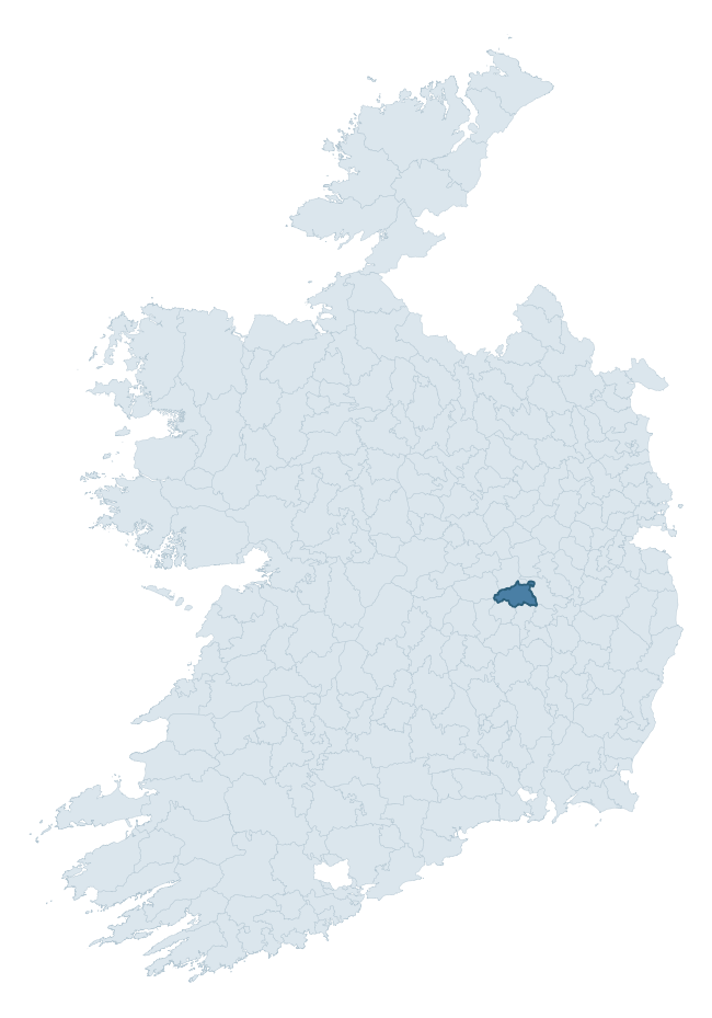
Where this barony sits in the Republic of Ireland
Geology and preservation
Bedrock geology shapes the landscape long before any settlement begins — controlling soil drainage, agricultural potential, the survival of upstanding monuments, and the preservation of buried archaeology. The figures below come from the Geological Survey Ireland 1:100,000 bedrock map.
The bedrock underlying Portnahinch is predominantly limestone (100% of the barony by area), laid down during the Carboniferous period (100% by area, around 359 to 299 million years ago). Limestone is the most heritage-rich bedrock in Ireland. It supports fertile, well-drained soils that favoured dense Early Medieval settlement and Norman manorial agriculture, and it weathers into karst features — sinkholes, caves, swallow holes, and souterrains — that frequently carry archaeology. Where peat overlies limestone, organic preservation can be exceptional. The single largest mapped unit is the Lucan Formation (33% of the barony's bedrock). With only 1 distinct rock type mapped, the barony is geologically uniform compared to the rest of the Republic (2nd percentile for diversity) — a single coherent bedrock landscape.
Largest mapped unit: Lucan Formation (33% of the barony)
Placename evidence
Logainm records 16 heritage-diagnostic placenames for Portnahinch, drawn from townland and civil-parish names across the barony. The dominant stratum is Early Christian ecclesiastical — cill-, teampall-, and domhnach-prefixed names that record the dense network of early church foundations established between the fifth and tenth centuries. The leading diagnostic roots are cill- (10 — church), ráth- (3 — earthen ringfort), and cillín- (1 — killeen). This is below the ROI average of 30.7 heritage placenames per barony, suggesting either lighter survey coverage or a townland-naming tradition that draws more on generic landscape vocabulary. The presence of multiple heritage strata side by side indicates layered occupation of the landscape across successive prehistoric and historic periods. Logainm records 72 placenames for Portnahinch (predominantly townland names). Of these, 16 (22%) carry one of the diagnostic Gaelic roots tracked above; the remainder draw on more generic landscape vocabulary that does not encode a heritage period.
Pre-Christian / Early Medieval Defensive
| Root | Count | Meaning |
|---|---|---|
| ráth- | 3 | earthen ringfort |
Early Christian Ecclesiastical
| Root | Count | Meaning |
|---|---|---|
| cill- | 10 | church (early) |
| cillín- | 1 | unconsecrated burial ground |
Burial, Ritual, and Norse-Contact
| Root | Count | Meaning |
|---|---|---|
| carn- | 1 | cairn |
| leacht- | 1 | grave monument |
Other baronies in Laois
- Cullenagh
- Maryborough East
- Slievemargy
- Maryborough West
- Ballyadams
- Upperwoods
- Clandonagh
- Fassadinin — Kilkenny
- Arklow — Wicklow
- Ballycowan — Offaly
See all 280 baronies in the Republic of Ireland Heritage Tool.

Explore further
Grounding History: 10 Maps of Northern Ireland’s Past
If you’re interested in Irish heritage more widely, the companion report for Northern Ireland brings together the analysis of all 462 NI wards into one place through 10 high-quality maps — covering monument density, archaeological periods, placename heritage, terrain, wetland, and the historic landscape at first survey. Take a look.
About this profile
Click any section below to expand.
What is a barony?
A barony is a historic administrative unit in Ireland, broadly equivalent to an English hundred. The 280 baronies used here are from the OSi 2019 National Statutory Boundaries (generalised 20m), covering the 26 counties of the Republic of Ireland. Baronies derive from the Norman period, were formalised in the 17th century, and have not been redrawn for statistical purposes. They vary enormously in area, from compact urban baronies in Dublin to vast upland baronies in Connacht, and should not be compared by raw site count without accounting for area differences.
What counts as a site?
This profile combines three distinct heritage registers, each with its own definition of what constitutes a recordable site:
- Archaeological sites (NMS). The National Monuments Service Sites and Monuments Record (SMR) catalogues every known archaeological monument or site of archaeological interest in the Republic, from prehistoric burial mounds and ringforts to medieval churches and post-medieval defensive works. Inclusion does not require legal protection — only that the site has been identified, surveyed, and assessed as having archaeological value. A separate subset of these sites lies within a recorded protection zone, which gives them statutory protection under the National Monuments Acts.
- Listed buildings (NIAH). The National Inventory of Architectural Heritage records buildings of architectural, historical, archaeological, artistic, cultural, scientific, social, or technical interest. Each surveyed structure is appraised on a five-tier scale: International, National, Regional, Local, and Record-Only. The NIAH appraisal is informational rather than strictly statutory, but it underpins local-authority Record of Protected Structures (RPS) listings.
- Heritage placenames (Logainm). Logainm is the authoritative database of Irish placenames maintained by the Placenames Branch. This profile applies a heritage-diagnostic classifier to the Irish-language form of each townland name, flagging roots that signal defensive sites (ráth-, lios-, dún-, caiseal-, cathair-), ecclesiastical foundations (cill-, teampall-, domhnach-, mainistir-), prehistoric burial-ritual features (tuaim-, carn-, leaba-), or Norse-contact settlement (gall-). Townlands without one of these diagnostic roots are not flagged here — they may still carry historical significance, but that significance is not encoded in the name itself.
Editorial principles
The narrative sections of this profile follow several explicit principles:
- Evidential. Every claim about this barony’s heritage character is anchored in the underlying register data. Where a site count, a placename count, or a percentile rank is cited, it is computed from the source datasets at export time, not estimated.
- Comparative. Counts and metrics are reported alongside their percentile rank against the other 279 ROI baronies. A barony with 50 ringforts in absolute terms could be unusually high or unusually low depending on its size and regional context; percentile ranking removes that ambiguity.
- Transparent on limits. Where a register has known coverage gaps, survey biases, or data-quality issues that affect this barony’s figures, the profile flags them rather than presenting the numbers as definitive.
- No interpretation beyond what the data supports. The narrative does not speculate about historical events, social dynamics, or cultural meaning beyond what the recorded heritage and placename evidence directly attests.
Data caveats and limits
- NMS Sites and Monuments Record is the product of survey campaigns conducted at different intensities across different counties and decades. Some baronies have been surveyed more thoroughly than others, and absolute counts should be read in that light. Sites destroyed by development before survey are typically not represented; sites in heavily forested or upland terrain are sometimes under-recorded.
- NIAH coverage is broadly complete for the Republic of Ireland but the survey was conducted on a rolling county-by-county basis, and the most recent appraisal date varies. Buildings demolished or substantially altered after their original survey may still appear in the register; conversely, recent buildings of merit may not yet have been appraised.
- Logainm classification applies a deliberately conservative pattern-matching approach to the Irish-language townland forms. The classifier prioritises true positives over recall: a townland may carry a heritage signal that the classifier doesn’t recognise, particularly where the diagnostic root has been heavily anglicised or where the townland name draws on a less common term. The 60,000+ townland records and ~9,800 classified placenames give a substantial signal at barony scale, but individual townland names should be checked against Logainm directly for definitive interpretation.
- Period attribution. The chronological distribution reflects only those NMS sites that carry a recognised period attribution in the source data. Sites listed as “Unknown” period are excluded from the dated subset.
- Boundary changes. Some baronies have undergone minor boundary adjustments since their 19th-century definition; the OSi 2019 generalised boundaries used here are the current statutory definition and may differ slightly from historical maps in border areas.
- Bedrock geology is mapped at 1:100,000 scale, which means local variation within a barony — small pockets of different rock type, mineral veins, alluvium overlying bedrock — is generalised. The dominant-system and rocktype figures are area-weighted, so a barony reading “70% Carboniferous limestone” may still contain small but archaeologically important pockets of older or younger rock. Around 3% of GSI polygons do not match the lexicon and contribute no rocktype or system attribution.
Data sources
- National Monuments Service — Sites and Monuments Record (SMR) https://data.gov.ie/dataset/national-monuments-service-archaeological-survey-of-ireland
- National Inventory of Architectural Heritage (NIAH) https://data.gov.ie/dataset/national-inventory-of-architectural-heritage-niah-national-dataset
- Logainm — Placenames Database of Ireland https://www.logainm.ie/
- Ordnance Survey Ireland — National Statutory Barony Boundaries 2019 https://data-osi.opendata.arcgis.com/
- EURODEM — European Digital Elevation Model https://www.mapsforeurope.org/datasets/euro-dem
- ESA WorldCover https://esa-worldcover.org/en
- Geological Survey Ireland — 1:100,000 Bedrock Geology https://www.gsi.ie/en-ie/data-and-maps/Pages/Bedrock.aspx
Explore more: Search any of the 280 ROI baronies, browse by historical province, or read the methodology and data sources for the full Republic of Ireland Heritage Tool.