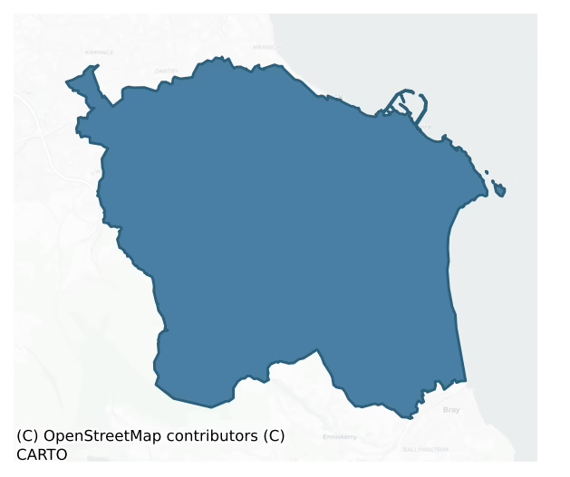
Rathdown is a barony of County Dublin, in the historical province of Leinster (Irish: Ráth an Dúin), covering 127 km² of land. The barony records 422 NMS archaeological sites and 517 NIAH listed buildings, placing it at around the 87th percentile among 280 ROI baronies for sites per km². This means it is in the top fifth of all baronies for sites per km². Dated archaeological evidence runs from the Mesolithic through to the Modern, spanning 9 of 9 archaeological periods, placing the barony in the 95th percentile among 280 ROI baronies for chronological depth. This means it is in the top tenth of all baronies for chronological depth. The largest dated subset of recorded sites dates to the Iron Age. Logainm flags 33 placenames in the barony as carrying a recognised heritage root; the largest share — around 67% — are names associated with early Christian church and monastic foundations.
Heritage at a glance
Percentile rankings throughout this profile compare each barony only against the other 279 Republic of Ireland baronies.
The recorded heritage of Rathdown
The National Monuments Service Sites and Monuments Record (SMR) is the statutory inventory of archaeological sites for the Republic of Ireland, maintained by the Department of Tourism, Culture, Arts, Gaeltacht, Sport and Media. Sites recorded here include earthworks, ringforts, megalithic tombs, ecclesiastical remains, and post-medieval features; not every record is legally protected, but each is registered as a monument of archaeological interest.
The National Monuments Service records 422 archaeological sites in Rathdown, putting it at the 87th percentile among 280 ROI baronies for sites per km². This means it is in the top fifth of all baronies for sites per km². Protection coverage is near-universal — 402 sites (95%) fall within a recorded monument protection zone, indicating an extensively surveyed landscape. The record is dominated by defensive sites — ringforts, enclosures, hillforts, and stone forts (106 sites, 25% of the total), with ecclesiastical sites forming a substantial secondary presence (101 sites, 24%). The most diagnostically specific type is Graveslab (36 records, 9% of the barony's NMS total) — compared to an ROI average of 4% across all baronies where this type occurs. Graveslab is a recumbent grave-marking slab, dated 1200–1700 AD. The broader 'Enclosure' classification — which catches unclassified ringforts and field enclosures — accounts for a further 44 records (10%) and reflects the difficulty of sub-classifying degraded earthworks from surface evidence alone. Across the barony's 127 km², this gives a recorded density of 3.32 sites per km².
Most common monument types
Hover or tap a monument type to see its definition.
| Type | Count |
|---|---|
| Enclosure a banked or ditched feature of uncertain type, used as a catch-all where the original function cannot be determined from surface evidence | 44 |
| Graveslab a recumbent grave-marking slab, dated 1200–1700 AD | 36 |
| Church a building used for public Christian worship, of any date from c. 500 AD onwards | 20 |
| Graveyard a burial area associated with a church, in use from the medieval period onwards | 17 |
| Castle – tower house a fortified residential tower of four or five storeys, mostly built by lords in the 15th and 16th centuries and often within a defended bawn | 15 |
| Fulacht fia a horseshoe-shaped Bronze Age burnt mound built around a sunken trough beside a water source, traditionally interpreted as a cooking site | 14 |
| Castle – unclassified a castle whose form cannot be precisely classified, dating somewhere between the late 12th and 16th centuries | 13 |
Chronological distribution
The dated archaeological record for Rathdown spans from the Mesolithic through to the Modern, with activity attested across 9 of 9 archaeological periods. This places Rathdown in the top 5% of ROI baronies for chronological depth — few baronies record evidence across as many distinct archaeological periods. Every period from earliest to latest is represented in the record — an unbroken sequence of dated activity across the full chronological span. Activity concentrates most heavily in the Iron Age (55 sites, 32% of dated material), with the Early Medieval forming a secondary peak (48 sites, 28%). A further 74 recorded sites (30% of the overall NMS register for the barony) carry no period attribution — appearing as 'Unknown' in the bar chart below. This typically reflects either records that pre-date the standardised period vocabulary or sites awaiting specialist dating review, rather than a genuine absence of chronological evidence.
Sample of recorded monuments
Show 25 sample monuments (of 422 total)
A representative sample of 25 recorded monuments drawn from the barony’s 422 total NMS entries. Sites within a recorded monument protection zone and rarer site types are prioritised so the list shows a meaningful cross-section rather than only the most common type. Each entry shows the official Sites and Monuments Record reference number and the description published by the National Monuments Service.
Bridge
The present bridge at Milltown occupies the site of an earlier bridge that spanned the river Dodder. It is shown on the Down Survey (1655-6) map.This earlier was replaced by one of granite in relatively recent past. …
The present bridge at Milltown occupies the site of an earlier bridge that spanned the river Dodder. It is shown on the Down Survey (1655-6) map.This earlier was replaced by one of granite in relatively recent past. This bridge spans the River Dodder from the present Milltown Bridge. Both the central pier and its two abutments are founded on rock. Built of rubble masonry, randomly coursed with well cut ashlar blocks. The arches are round with a cut-water on the S side. Along the parapet is a barrel-vaulted machiolation type step out. The parapets were repaired in the mid 18th century and further repairs undertaken in 1973 (Ball 1903, 2, 110-111; O'Keefe & Simington 1991, 211-214).
Compiled by Geraldine Stout
House – fortified house
Situated at the foot of the Dublin Mountains SE of Rathfarnham village. Built in the late 16th century by the Loftus family and re-modelled in the 18th-century when in the hands of Speaker Connolly, the Hoadleys and the…
Situated at the foot of the Dublin Mountains SE of Rathfarnham village. Built in the late 16th century by the Loftus family and re-modelled in the 18th-century when in the hands of Speaker Connolly, the Hoadleys and the Earls of Ely (Ball 1903, 117-130). In the 20th-century it was extended and refurbished with a kitchen wing, a Bowe window and a colonnaded front portico added. The original 16th-century castle was a large semi-fortified house of enlarged tower house type. It has a rectangular plan with a very thick central spine and four flanker towers (int. dims. L 20.3m, Wth 10.4m). A vaulted passage was exposed during excavation in the early '90s , which tapers towards the SW flanker (Carroll 1993, 33). Built of calp limestone which has been plastered over the building rises to three storeys which are offset at each level. The walls are battered. Originally entered at the W end where there is a great stone arch visible in the facade. The site of a dumb waiter shaft adjacent to the W entrance may have been the site of the original stairwell. Ground floor was vaulted. It contains an original fireplace opening. The second floor also contains an original stone built fireplace with early brickwork. These bricks have been compared to examples from Hampton Court Palace. Traces of stone mullioned windows have been exposed during plaster removal throughout the building. The present roof structure incorporated early oak trusses mainly in the N roof where rough adze marks are visib…
Castle – Anglo-Norman masonry castle
Situated on top of an E facing ridge overlooking the river Slang. Dundrum Castle is a late 16th-17th century tower house (DU022-023001-) which incorporates part of a 12th-14th-century castle exposed during excavations…
Situated on top of an E facing ridge overlooking the river Slang. Dundrum Castle is a late 16th-17th century tower house (DU022-023001-) which incorporates part of a 12th-14th-century castle exposed during excavations in 1988-91 (O'Brien 1987, 14; O' Brien 1989, 136-137). Built by Sir John de Clahull c. 1187, the earliest feature exposed is a section of fosse (Wth 7m, D 1.40m) that enclosed the top of the ridge. Finds included Leinster cooking ware, a buckle and a socketed arrowhead. Associated with this moat was a triple-slotted drawbridge with an entrance to a gatehouse extending from the drawbridge to part of the outer wall of the early castle (Wth 2m). Part of a stone-lined watercourse runs under the base of the wall and the shaft of a garderobe was revealed within the wall. (Newman Johnson 2014)
Compiled by: Geraldine Stout
Updated by: Paul Walsh
Revised date of upload: 16 April 2015
Cross-slab (present location)
This graveslab is at present located in the chapel of the College of St. Columba. It came originally from Kilmashogue Mountain. It has a circular head and shaft (L 0.69m, Wth 0.26m, T 0.07m), the head bears a Greek…
This graveslab is at present located in the chapel of the College of St. Columba. It came originally from Kilmashogue Mountain. It has a circular head and shaft (L 0.69m, Wth 0.26m, T 0.07m), the head bears a Greek double-line cross in a circle, with a raised line around the edge. The lower shaft is decorated except for the base, which may have been placed in the ground or in a base (Ó hÉailidhe and Prendergast 1977, 141-42, Fig. 29).
Compiled by: Geraldine Stout
Date of upload: 18 November 2013
Ford
According to Rob Goodbody (pers coms) there was a ford at Milltown which served as the river crossing prior to the 19th century.
Charnel house
Situated in a flat urban site to the NE of the junction of Carrickbrennan Road and Mounttown Road Upper.
The W gable of the medieval church (DU023-012001-) of Carrickbrennan is incorporated into the 17th century…
Situated in a flat urban site to the NE of the junction of Carrickbrennan Road and Mounttown Road Upper.
The W gable of the medieval church (DU023-012001-) of Carrickbrennan is incorporated into the 17th century charnel-house (Turner 1983, 28-29).
After the dissolution of St. Mary's, the church and tithes were given to Sir John Travers. In 1668 Sir Edward Corker re-built the church for the parish, and further works took place in the 19th century (Turner 1983, 28-29).
The Charnel house is located within the walled graveyard (DU023-013002-) which contains 18th and 19th century memorials.
Compiled by: Geraldine Stout and Padraig Clancy
Revised upload on: 22 May 2018
Gatehouse
Situated to the SE of the junction of Monkstown Avenue and Mounttown Road Upper the site is located in grassland on the road edge. The gate-house is in the NW corner of the bawn wall (DU023-014003-) enclosure. It has a…
Situated to the SE of the junction of Monkstown Avenue and Mounttown Road Upper the site is located in grassland on the road edge. The gate-house is in the NW corner of the bawn wall (DU023-014003-) enclosure. It has a base batter. The masonry of the bawn wall on the N side of the gate-house displays a series of building phases. It has aroundexternal arch and a pointedinternal arch with wicker centred vault . There is one chamber with a parapet level above it. This chamber is lit by a single light, cusped, ogee-headed, window in the S and a plain loop in the W wall. A lintelled doorway below a pointed arch survives in the NW corner and this provided access to the upper battlements with a projecting turret in the NW angle. There are stepped crenellations. An entrance off the passageway leads into what survives of an E wing. This was lit by rectangular opes. There are some brick-faced insertions. External stairs are present in the SE corner.
The site was associated with the Cistercian grange of St Mary's Abbey. After the dissolution in the sixteenth century the lands at Monkstown were given to Sir John Travers, Master of the Ordnance of Ireland. Walter Cheevers had it in 1641, then Ludlow Cromwell, Master of the House, who is said to have repaired the castle and laid out the gardens (Ball 1906, I, 1-12). A drawing by Beranger dated 1766 shows two towers placed either end of a courtyard flanked by a multi-chimneyed mansion on the one side and a show wall on the other (Harbis…
House – 16th century
In the Dublin RMP (1998) this record was listed as 'dwelling possible' and refers to the house annotated 'Kill Abbey' on the historic OSi maps to the W of Kill of the Grange church (DU023-015001-) and graveyard…
In the Dublin RMP (1998) this record was listed as 'dwelling possible' and refers to the house annotated 'Kill Abbey' on the historic OSi maps to the W of Kill of the Grange church (DU023-015001-) and graveyard (DU023-015002-). The house was described in 1896 as; 'the “Abbey" a picturesque and venerable residence of the Espinasse family dating from the sixteenth century' (Wakeman 1896, 407). According to Ball (1902, 47, 50), 'the house called Kill Abbey, which, though it has lost its original characteristics, bears the date 1595 [DU023-015011-], and is surrounded by yew trees of extreme age. The house known as Kill Abbey was, doubtless, built in 1595, the date it bears, by George Ussher, a merchant of Dublin, to whom was leased, in 1592, by the Chapter of the Cathedral [Christchurch]'. The house was described in 1869 as; 'Within a few yards of the gate of the church-yard stands Kill Abbey, the residence of Richard Espinasse, Esq., J.P. one of the oldest houses perhaps in Ireland, for according to the date over the entrance door it was erected or repaired in the year 1595, Queen Elizabeth's reign, the house is of peculiar construction, consisting of a group of pointed gables, each of them terminating with a finial or pinnacle of a granite ball; most of the doors and windows are lancet-shaped, which give the building an ecclesiastical appearance. The vaults under Kill Abbey are very extensive' (Gaskin 1869, 201).
Kill Abbey (NIAH reg. No. 60230126) was described by…
Font (present location)
The Church of Ireland at Deansgrange is the location of a stone font which came originally from Kill of the Grange (Healy 1975, 1-19).
Compiled by: Geraldine Stout and Padraig Clancy
Uploaded on: 22 May 2018
Midden
Excavations in the interior of the promontory fort (DU023-029001-) at Dalkey Island in the mid-1950s revealed evidence for two large shell middens. The animal bone content included a high proportion of pig remains.…
Excavations in the interior of the promontory fort (DU023-029001-) at Dalkey Island in the mid-1950s revealed evidence for two large shell middens. The animal bone content included a high proportion of pig remains. Amongst the associated finds were polished stone axes, potsherds and limpet scoops (Liversage 1968, 62-3, 96-98, 103-4, 119-120, 132, 136, 172-4)
Compiled by: Geraldine Stout and Padraig Clancy
Revised upload on: 28 July 2018
Architectural fragment
Situated on the N slope of Three Rock Mountain on the S side Kilgobbin Lane, near Stepaside Village. A rectangular church (DU025-016001-) with a porch at the W end of the N wall. Attached to the inner face of the W wall…
Situated on the N slope of Three Rock Mountain on the S side Kilgobbin Lane, near Stepaside Village. A rectangular church (DU025-016001-) with a porch at the W end of the N wall. Attached to the inner face of the W wall of the church porch are seven architectural fragments (DU025-016008-/009-/010-) from the medieval church.
Compiled by: Geraldine Stout and Padraig Clancy
Revised by: Caimin O'Brien
Date of revised upload: 8 May 2023
Inn
Situated to the NE of Kilgobbin Road. An Inn which according to Goodbody (1993, 72-75) was on the site of Oltown House. It was built in the 1690's and was known as the White House.
Compiled by: Geraldine Stout and…
Situated to the NE of Kilgobbin Road. An Inn which according to Goodbody (1993, 72-75) was on the site of Oltown House. It was built in the 1690's and was known as the White House.
Compiled by: Geraldine Stout and Padraig Clancy
Revised upload on: 8 July 2018
Megalithic tomb – passage tomb
Situated on the summit of Two Rock Mountain. This is a roughly circular flat-topped cairn (diam.27m; H 3m). There are two inclined kerbstones on the N side, c. 3m apart. According to the ITA Survey (1945) there were…
Situated on the summit of Two Rock Mountain. This is a roughly circular flat-topped cairn (diam.27m; H 3m). There are two inclined kerbstones on the N side, c. 3m apart. According to the ITA Survey (1945) there were indications of a passage extending NW-SE axis. This is not apparent today (Price 1940, 124; Herity 1974, 209, 257).
Compiled by: Geraldine Stout and Padraig Clancy
Revised upload on: 8 July 2018
Stone circle
Situated on the lower S slopes of Two Rock Mountain. A stone circle comprised of a circular area defined by seven orthostats (H c. 1m) and ten more stones only partially exposed. This site was first identified by Healy…
Situated on the lower S slopes of Two Rock Mountain. A stone circle comprised of a circular area defined by seven orthostats (H c. 1m) and ten more stones only partially exposed. This site was first identified by Healy in 1967 (1975, 1-19). Unfortunately it was planted with trees in 1972 leaving no visible remains at ground level.
Compiled by: Geraldine Stout and Padraig Clancy
Uploaded on: 28 July 2018
Barrow – unclassified
Situated on the upper crest of a hill above the old chapel in Glencullen village. A barrow comprising of a circular round-topped mound (diam.25m; H 3.2m) defined by an inner fosse (Wth 5m; H 0.5m) and external bank (Wth…
Situated on the upper crest of a hill above the old chapel in Glencullen village. A barrow comprising of a circular round-topped mound (diam.25m; H 3.2m) defined by an inner fosse (Wth 5m; H 0.5m) and external bank (Wth 2.5m; H 0.5m). The site is damaged in the S where its bank has been truncated by a field boundary extending E-W. There is a single standing stone (DU025-047002-) to the NE of the bowl-barrow (Healy 1975, 1-19; Turner 1983, 14).
Compiled by: Geraldine Stout and Padraig Clancy
Revised upload on: 28 July 2018
Moated site
Excavations revealed the remains of a northern enclosure of possible moated site which was described in the Draft Conservation Plan of Carrickmines Castle as follows; 'The northern The defences of Carrickmines Castle…
Excavations revealed the remains of a northern enclosure of possible moated site which was described in the Draft Conservation Plan of Carrickmines Castle as follows; 'The northern The defences of Carrickmines Castle (DU026-005001-) consist of three earth and stone ditches. The earliest is the northern enclosure, possibly a moated site defended by a broad ditch and containing at least one substantial stone building. Another enclosure was later added to the south-west which had two probable entrances – a causeway or bridge on the south side, and a causeway on the east side. The south-east enclosure [DU026-005002-] was added last and was defended by three sets of defences (i.e. trivallate) with the innermost and central ditch cut into bedrock, and sections of the defences revetted in granite. The south-eastern enclosure had the foundations of a rectangular structure which has been suggested as a gate tower' (Bolton 2015, 27-8).
See attached plan showing location of the north enclosure No. 1 which has been interpreted as a possible moated site, courtesy Jason Bolton 2015, 27.
Bolton, J. 2015 Draft Carrickmines Castle Conservation Plan 2015-2025. DLR Co. Co., County Hall, Marine Road, Dún Laoghaire, County Dublin.
Compiled by: Geraldine Stout and Padraig Clancy
Revised by: Caimin O'Brien
Date of revised upload: 30 December 2022
Water mill – horizontal-wheeled
Description not available.
Hillfort
A large broad, oval area (dims. 140m N-S; 120m E-W) around the top of the hill at Rathmichael is enclosed by a low, wide earth and stone bank with a narrow V-shaped fosse (Wth 1.6m; D 0.4m). The bank is defaced W-N-E…
A large broad, oval area (dims. 140m N-S; 120m E-W) around the top of the hill at Rathmichael is enclosed by a low, wide earth and stone bank with a narrow V-shaped fosse (Wth 1.6m; D 0.4m). The bank is defaced W-N-E being best preserved in the SW and S (Wth 3.3m; H 0.6m) where it joins a modern field boundary. It has an external stone facing made up of shattered stone fragments, which are strewn over the hilltop. A univallate ringfort (DU026-048002-) lies within the interior. (Anon 1900, 187; Healy 1975, 1-19; Turner 1983, 95)
Compiled by: Geraldine Stout and Padraig Clancy.
Revised upload on: 15 April 2018.
Round tower
The tower lies on the E slopes of Carrickgollogan. The butt of a round tower lies to the SW of the church (DU026-050001-). It is built of coursed quartz and sandstone blocks (diam. 5.4m x wall T 1m x H 1.5m)(Wakeman…
The tower lies on the E slopes of Carrickgollogan. The butt of a round tower lies to the SW of the church (DU026-050001-). It is built of coursed quartz and sandstone blocks (diam. 5.4m x wall T 1m x H 1.5m)(Wakeman 1890-1, 701, Barrow 1979, 60).
Compiled by: Geraldine Stout and Padraig Clancy.
Revised upload on: 15 April 2018.
Souterrain
The site lies on the E slopes of Carrickgollogan. The OS Letters (1837) refer to an underground passage to the NW of Rathmichael Church (DU026-050001-) (O'Flanagan 1927, 40). It is described as having stone sides and…
The site lies on the E slopes of Carrickgollogan. The OS Letters (1837) refer to an underground passage to the NW of Rathmichael Church (DU026-050001-) (O'Flanagan 1927, 40). It is described as having stone sides and being covered with large flagstones. O'Brien (1988) has suggested a location c. 30m NW of the church where a wide trench (now covered) can be traced for a distance (L 7m) extending towards the cashel wall.
Compiled by: Geraldine Stout and Padraig Clancy.
Revised upload on: 15 April 2018.
Holed stone
Rathmichael church ruins stands on the E slopes of Carrickgollogan. Lying against the internal face of the E wall Rathmichael church (DU026-050001-) there is a holed granite slab (L 1.45m x Wth 0.8m x T 0.2m). This…
Rathmichael church ruins stands on the E slopes of Carrickgollogan. Lying against the internal face of the E wall Rathmichael church (DU026-050001-) there is a holed granite slab (L 1.45m x Wth 0.8m x T 0.2m). This stone was unearthed at the turn of the century.
To see a 3D model of this stone visit https://skfb.ly/oHrsz
Compiled by: Geraldine Stout and Padraig Clancy
Revised by: Caimin O'Brien
Date of revised upload: 17 May 2023
Gateway
The site lies on the E slopes of Carrickgollogan. The entrance is marked by two large blocks believed by Petrie to be part of an arched gateway similar to that at Glendalough (Turner 1985, 53).
Compiled by: Geraldine…
The site lies on the E slopes of Carrickgollogan. The entrance is marked by two large blocks believed by Petrie to be part of an arched gateway similar to that at Glendalough (Turner 1985, 53).
Compiled by: Geraldine Stout and Padraig Clancy.
Revised upload on: 15 April 2018.
Ring-ditch
The ring-ditch is located in an area of tillage that falls S to the Bray River with views of the coastline and the Sugarloaf Mountain. The ring-ditch (diam c. 15m) is visible as a cropmark on an aerial photograph taken…
The ring-ditch is located in an area of tillage that falls S to the Bray River with views of the coastline and the Sugarloaf Mountain. The ring-ditch (diam c. 15m) is visible as a cropmark on an aerial photograph taken in 1970 (CUCAP, BDP 23). It is not visible at ground level.
Compiled by: Geraldine Stout and Padraig Clancy.
Revised upload on: 21 April 2018.
Mill – fulling
The site was located south of the Brides Glen Road, on the south bank of the stream and east of the M50. The 1837 OS 6-inch map indicates the 'site of tuckmill'. It is not shown on the 1937 OS 6-inch map but the house…
The site was located south of the Brides Glen Road, on the south bank of the stream and east of the M50. The 1837 OS 6-inch map indicates the 'site of tuckmill'. It is not shown on the 1937 OS 6-inch map but the house name Mullinastill House at a distance to the E indicates the former presence of a mill.
Compiled by: Geraldine Stout and Padraig Clancy.
Revised upload on: 21 April 2018.
Enclosure
A field system radiates from a subcircular enclosure in a natural level platform on the N slopes of Kilmashogue mountain. This impressive enclosure (int. diam. c. 60m) is defined by a drystone-built wall (Wth 2m; H 1m).…
A field system radiates from a subcircular enclosure in a natural level platform on the N slopes of Kilmashogue mountain. This impressive enclosure (int. diam. c. 60m) is defined by a drystone-built wall (Wth 2m; H 1m). The interior has uneven stony areas. Aerial photographic coverage of the site indicates a central internal enclosure (OS Flight 9, 2271). There is an opening in the NW. Field walls radiate from the enclosure at the NE, SSE, SSW and W and across the main field system running NW-SE (Cooney 1985, 28-30).
Compiled by: Geraldine Stout and Padraig Clancy
Revised upload on: 28 July 2018
Listed buildings
The National Inventory of Architectural Heritage (NIAH) is a state survey appraising buildings of architectural, historical, archaeological, artistic, cultural, scientific, social, or technical interest. Each surveyed structure receives a rating from International (the highest, for buildings of European importance) through National, Regional, Local, and Record-Only.
The National Inventory of Architectural Heritage records 517 listed buildings in Rathdown, placing it in the top 5% of ROI baronies for listed-building density. Among these, 9 are graded National — buildings of interest to the whole of Ireland rather than only its region. The Republic holds 937 National-graded buildings in total, so this barony accounts for around 1% of the national total. Construction dates concentrate most heavily in the Victorian (1830-1900) period. The most-recorded building type is house (213 examples, 41% of the listed stock).
Terrain and environment
Mean elevation across the barony is 253m — the 99th percentile among 280 ROI baronies for elevation. This means it is in the top tenth of all baronies for elevation. This is a relatively elevated landscape by ROI standards. Elevation matters for heritage because higher-altitude baronies typically favour defensive monuments — ringforts and hilltop forts placed on prominent ground — while lowland baronies are more likely to carry the dense settlement and church networks of intensive agricultural landscapes. The barony reaches 749m at its highest point — a vertical span of more than 495m within its boundary, indicating significant topographic diversity. Mean slope is 8.9° — the 95th percentile among 280 ROI baronies for slope. This means it is in the top tenth of all baronies for slope. This is consistently steep terrain by ROI standards, the kind of landscape that tends to preserve upstanding archaeological features well. Slope is a key control on both land use and archaeological preservation: steep ground resists ploughing and tends to preserve earthworks intact, while gentle slopes favour intensive cultivation that damages or destroys surface archaeology over time. The Topographic Wetness Index averages 8.9, the 3rd percentile among 280 ROI baronies for wetness. This means it is in the bottom tenth of all baronies for wetness. This is well-drained ground by ROI standards — typical of upland or steeply-sloping country that sheds water rapidly. Drainage matters for heritage because poorly-drained ground preserves organic archaeology (wooden trackways, leather, textiles, and on rare occasions human remains) far better than free-draining soil; well-drained ground favours arable use but destroys organic material rapidly. Urban land covers 5% of the barony (the 90th percentile among 280 ROI baronies for urban cover. This means it is in the top tenth of all baronies for urban cover). Heavy urban coverage compresses heritage analysis: many archaeological features have been buried or destroyed by development, but the surviving record is concentrated in protected city-centre cores, and the NIAH listed-buildings count is typically high. The land-cover mosaic combines improved grassland (56%), woodland (36%), and urban land (5%), giving a mixed agricultural and semi-natural landscape. In overall character, this is an upland landscape of steep, elevated terrain, with land use dominated by improved grassland.
Terrain measurements
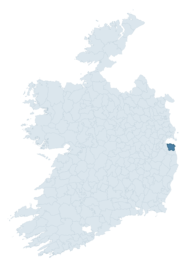
Where this barony sits in the Republic of Ireland
Geology and preservation
Bedrock geology shapes the landscape long before any settlement begins — controlling soil drainage, agricultural potential, the survival of upstanding monuments, and the preservation of buried archaeology. The figures below come from the Geological Survey Ireland 1:100,000 bedrock map.
The bedrock underlying Rathdown is predominantly granite (76% of the barony by area), laid down during the Caledonian period (76% by area, during the Caledonian orogeny (around 490–390 million years ago)). Granite weathers slowly and produces thin, acidic, often poorly-drained soils that historically limited arable agriculture but favoured pastoralism, upland settlement, and the construction of stone monuments. Granite-dominated landscapes typically carry fewer ringforts but a higher density of megalithic tombs, standing stones, and stone circles, which survive well against the resistant bedrock. The single largest mapped unit is the Type 3 muscovite porphyritic (Northern and Upper Liffey Valley Plutons) (26% of the barony's bedrock).
Rock type composition
Largest mapped unit: Type 3 muscovite porphyritic (Northern and Upper Liffey Valley Plutons) (27% of the barony)
Placename evidence
Logainm records 33 heritage-diagnostic placenames for Rathdown, drawn from townland and civil-parish names across the barony. The dominant stratum is Early Christian ecclesiastical — cill-, teampall-, and domhnach-prefixed names that record the dense network of early church foundations established between the fifth and tenth centuries. The leading diagnostic roots are cill- (16 — church), ráth- (8 — earthen ringfort), and dún- (3 — hilltop fort or promontory fort). This is broadly in line with the ROI average of 30.7 heritage placenames per barony. The presence of multiple heritage strata side by side indicates layered occupation of the landscape across successive prehistoric and historic periods. Logainm records 151 placenames for Rathdown (predominantly townland names). Of these, 33 (22%) carry one of the diagnostic Gaelic roots tracked above; the remainder draw on more generic landscape vocabulary that does not encode a heritage period.
Pre-Christian / Early Medieval Defensive
| Root | Count | Meaning |
|---|---|---|
| ráth- | 8 | earthen ringfort |
| dún- | 3 | hilltop or promontory fort |
Early Christian Ecclesiastical
| Root | Count | Meaning |
|---|---|---|
| cill- | 16 | church (early) |
| teampall- | 3 | church (later medieval) |
| gráinseach- | 3 | monastic farm / grange |
Burial, Ritual, and Norse-Contact
| Root | Count | Meaning |
|---|---|---|
| gall- | 2 | foreigner — Norse settlement marker |
Other baronies in Dublin
- Balrothery West
- Newcastle
- Dublin
- Balrothery East
- Coolock
- Castleknock
- Nethercross
- Kilkenny West — Westmeath
- Castleknock
- Upperwoods — Laois
See all 280 baronies in the Republic of Ireland Heritage Tool.

Explore further
Grounding History: 10 Maps of Northern Ireland’s Past
If you’re interested in Irish heritage more widely, the companion report for Northern Ireland brings together the analysis of all 462 NI wards into one place through 10 high-quality maps — covering monument density, archaeological periods, placename heritage, terrain, wetland, and the historic landscape at first survey. Take a look.
About this profile
Click any section below to expand.
What is a barony?
A barony is a historic administrative unit in Ireland, broadly equivalent to an English hundred. The 280 baronies used here are from the OSi 2019 National Statutory Boundaries (generalised 20m), covering the 26 counties of the Republic of Ireland. Baronies derive from the Norman period, were formalised in the 17th century, and have not been redrawn for statistical purposes. They vary enormously in area, from compact urban baronies in Dublin to vast upland baronies in Connacht, and should not be compared by raw site count without accounting for area differences.
What counts as a site?
This profile combines three distinct heritage registers, each with its own definition of what constitutes a recordable site:
- Archaeological sites (NMS). The National Monuments Service Sites and Monuments Record (SMR) catalogues every known archaeological monument or site of archaeological interest in the Republic, from prehistoric burial mounds and ringforts to medieval churches and post-medieval defensive works. Inclusion does not require legal protection — only that the site has been identified, surveyed, and assessed as having archaeological value. A separate subset of these sites lies within a recorded protection zone, which gives them statutory protection under the National Monuments Acts.
- Listed buildings (NIAH). The National Inventory of Architectural Heritage records buildings of architectural, historical, archaeological, artistic, cultural, scientific, social, or technical interest. Each surveyed structure is appraised on a five-tier scale: International, National, Regional, Local, and Record-Only. The NIAH appraisal is informational rather than strictly statutory, but it underpins local-authority Record of Protected Structures (RPS) listings.
- Heritage placenames (Logainm). Logainm is the authoritative database of Irish placenames maintained by the Placenames Branch. This profile applies a heritage-diagnostic classifier to the Irish-language form of each townland name, flagging roots that signal defensive sites (ráth-, lios-, dún-, caiseal-, cathair-), ecclesiastical foundations (cill-, teampall-, domhnach-, mainistir-), prehistoric burial-ritual features (tuaim-, carn-, leaba-), or Norse-contact settlement (gall-). Townlands without one of these diagnostic roots are not flagged here — they may still carry historical significance, but that significance is not encoded in the name itself.
Editorial principles
The narrative sections of this profile follow several explicit principles:
- Evidential. Every claim about this barony’s heritage character is anchored in the underlying register data. Where a site count, a placename count, or a percentile rank is cited, it is computed from the source datasets at export time, not estimated.
- Comparative. Counts and metrics are reported alongside their percentile rank against the other 279 ROI baronies. A barony with 50 ringforts in absolute terms could be unusually high or unusually low depending on its size and regional context; percentile ranking removes that ambiguity.
- Transparent on limits. Where a register has known coverage gaps, survey biases, or data-quality issues that affect this barony’s figures, the profile flags them rather than presenting the numbers as definitive.
- No interpretation beyond what the data supports. The narrative does not speculate about historical events, social dynamics, or cultural meaning beyond what the recorded heritage and placename evidence directly attests.
Data caveats and limits
- NMS Sites and Monuments Record is the product of survey campaigns conducted at different intensities across different counties and decades. Some baronies have been surveyed more thoroughly than others, and absolute counts should be read in that light. Sites destroyed by development before survey are typically not represented; sites in heavily forested or upland terrain are sometimes under-recorded.
- NIAH coverage is broadly complete for the Republic of Ireland but the survey was conducted on a rolling county-by-county basis, and the most recent appraisal date varies. Buildings demolished or substantially altered after their original survey may still appear in the register; conversely, recent buildings of merit may not yet have been appraised.
- Logainm classification applies a deliberately conservative pattern-matching approach to the Irish-language townland forms. The classifier prioritises true positives over recall: a townland may carry a heritage signal that the classifier doesn’t recognise, particularly where the diagnostic root has been heavily anglicised or where the townland name draws on a less common term. The 60,000+ townland records and ~9,800 classified placenames give a substantial signal at barony scale, but individual townland names should be checked against Logainm directly for definitive interpretation.
- Period attribution. The chronological distribution reflects only those NMS sites that carry a recognised period attribution in the source data. Sites listed as “Unknown” period are excluded from the dated subset.
- Boundary changes. Some baronies have undergone minor boundary adjustments since their 19th-century definition; the OSi 2019 generalised boundaries used here are the current statutory definition and may differ slightly from historical maps in border areas.
- Bedrock geology is mapped at 1:100,000 scale, which means local variation within a barony — small pockets of different rock type, mineral veins, alluvium overlying bedrock — is generalised. The dominant-system and rocktype figures are area-weighted, so a barony reading “70% Carboniferous limestone” may still contain small but archaeologically important pockets of older or younger rock. Around 3% of GSI polygons do not match the lexicon and contribute no rocktype or system attribution.
Data sources
- National Monuments Service — Sites and Monuments Record (SMR) https://data.gov.ie/dataset/national-monuments-service-archaeological-survey-of-ireland
- National Inventory of Architectural Heritage (NIAH) https://data.gov.ie/dataset/national-inventory-of-architectural-heritage-niah-national-dataset
- Logainm — Placenames Database of Ireland https://www.logainm.ie/
- Ordnance Survey Ireland — National Statutory Barony Boundaries 2019 https://data-osi.opendata.arcgis.com/
- EURODEM — European Digital Elevation Model https://www.mapsforeurope.org/datasets/euro-dem
- ESA WorldCover https://esa-worldcover.org/en
- Geological Survey Ireland — 1:100,000 Bedrock Geology https://www.gsi.ie/en-ie/data-and-maps/Pages/Bedrock.aspx
Explore more: Search any of the 280 ROI baronies, browse by historical province, or read the methodology and data sources for the full Republic of Ireland Heritage Tool.