Rathdown is a barony of County Wicklow, in the historical province of Leinster (Irish: Ráth an Dúin), covering 134 km² of land. The barony records 245 NMS archaeological sites and 539 NIAH listed buildings, placing it at around the 47th percentile among 280 ROI baronies for sites per km². This means it is in the lower half of all baronies for sites per km². Dated archaeological evidence runs from the Mesolithic through to the Modern, spanning 9 of 9 archaeological periods, placing the barony in the 98th percentile among 280 ROI baronies for chronological depth. This means it is in the top tenth of all baronies for chronological depth. The largest dated subset of recorded sites dates to the Iron Age. Logainm flags 25 placenames in the barony as carrying a recognised heritage root; the largest share — around 88% — are names associated with early Christian church and monastic foundations.

Heritage at a glance
Percentile rankings throughout this profile compare each barony only against the other 279 Republic of Ireland baronies.
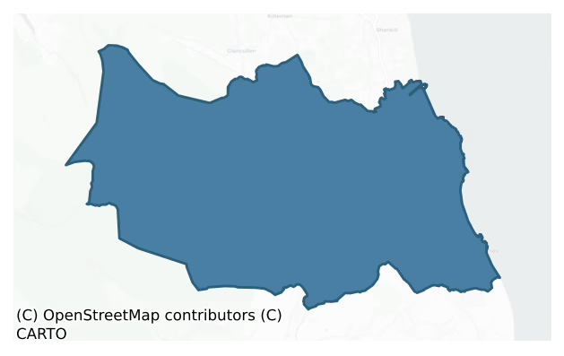
The recorded heritage of Rathdown
The National Monuments Service Sites and Monuments Record (SMR) is the statutory inventory of archaeological sites for the Republic of Ireland, maintained by the Department of Tourism, Culture, Arts, Gaeltacht, Sport and Media. Sites recorded here include earthworks, ringforts, megalithic tombs, ecclesiastical remains, and post-medieval features; not every record is legally protected, but each is registered as a monument of archaeological interest.
The National Monuments Service records 245 archaeological sites in Rathdown, putting it at the 47th percentile among 280 ROI baronies for sites per km². This means it is in the lower half of all baronies for sites per km². Of these, 205 (84%) fall within a recorded monument protection zone. The record is dominated by defensive sites — ringforts, enclosures, hillforts, and stone forts (69 sites, 28% of the total), with ecclesiastical sites forming a substantial secondary presence (50 sites, 20%). The most diagnostically specific type is Fulacht fia (21 records, 9% of the barony's NMS total) — compared to an ROI average of 6% across all baronies where this type occurs. Fulacht fia is a horseshoe-shaped Bronze Age burnt mound built around a sunken trough beside a water source, traditionally interpreted as a cooking site. The broader 'Enclosure' classification — which catches unclassified ringforts and field enclosures — accounts for a further 34 records (14%) and reflects the difficulty of sub-classifying degraded earthworks from surface evidence alone. Across the barony's 134 km², this gives a recorded density of 1.83 sites per km².
Most common monument types
Hover or tap a monument type to see its definition.
| Type | Count |
|---|---|
| Enclosure a banked or ditched feature of uncertain type, used as a catch-all where the original function cannot be determined from surface evidence | 34 |
| Fulacht fia a horseshoe-shaped Bronze Age burnt mound built around a sunken trough beside a water source, traditionally interpreted as a cooking site | 21 |
| Ringfort – rath an earthen ringfort enclosed by a bank and external ditch — the most common Early Medieval farmstead, broadly dated 500–1000 AD | 16 |
| Church a building used for public Christian worship, of any date from c. 500 AD onwards | 15 |
| Graveyard a burial area associated with a church, in use from the medieval period onwards | 12 |
| Excavation – miscellaneous | 11 |
| Cross-slab a stone slab inscribed with a cross, used as a grave-marker or memorial, dated pre-1200 AD | 6 |
Chronological distribution
The dated archaeological record for Rathdown spans from the Mesolithic through to the Modern, with activity attested across 9 of 9 archaeological periods. This places Rathdown in the top 2% of ROI baronies for chronological depth — few baronies record evidence across as many distinct archaeological periods. Every period from earliest to latest is represented in the record — an unbroken sequence of dated activity across the full chronological span. Activity concentrates most heavily in the Iron Age (55 sites, 32% of dated material), with the Early Medieval forming a secondary peak (48 sites, 28%). A further 74 recorded sites (30% of the overall NMS register for the barony) carry no period attribution — appearing as 'Unknown' in the bar chart below. This typically reflects either records that pre-date the standardised period vocabulary or sites awaiting specialist dating review, rather than a genuine absence of chronological evidence.
Sample of recorded monuments
Show 25 sample monuments (of 245 total)
A representative sample of 25 recorded monuments drawn from the barony’s 245 total NMS entries. Sites within a recorded monument protection zone and rarer site types are prioritised so the list shows a meaningful cross-section rather than only the most common type. Each entry shows the official Sites and Monuments Record reference number and the description published by the National Monuments Service.
Mass-rock
Situated near the summit of a NW-SE ridge, one mile NE of Glencree. Two large rocks one of which displays a very weathered incised Greek cross with T-shaped terminals and the letters IHS'. (Information Kenneth Clear)…
Situated near the summit of a NW-SE ridge, one mile NE of Glencree. Two large rocks one of which displays a very weathered incised Greek cross with T-shaped terminals and the letters IHS'. (Information Kenneth Clear) According to O' Donovan (O'Flanagan 1928, 5) it was locally known as 'Castle Toole'.
The above description is derived from the published 'Archaeological Inventory of County Wicklow' (Dublin: Stationery Office, 1997). In certain instances the entries have been revised and updated in the light of recent research.
Date of upload/revision: 17 December 2008
Historic town
The town of Bray is situated on the Dargle River and is divided into Little Bray to the N and Great Bray to the S. The manor of Bray was granted to Walter de Ridelesford before 1176 and was resigned to the Crown in…
The town of Bray is situated on the Dargle River and is divided into Little Bray to the N and Great Bray to the S. The manor of Bray was granted to Walter de Ridelesford before 1176 and was resigned to the Crown in 1280. The first reference to a burgage is c. 1225 when de Ridelesford granted a burgage 'opposite my castle beyond the river' to St Mary's Abbey, Dublin. A mill stood below the castle (WI004-001003-) and a number of Roman burials were discovered near the seafront (WI004-004—-). (Scott 1913; Davies 1986, 22; Bradley and King 1989, 12-17).
The above description is derived from the published 'Archaeological Inventory of County Wicklow' (Dublin: Stationery Office, 1997). In certain instances the entries have been revised and updated in the light of recent research.
Date of upload/revision: 17 December 2008
Castle – motte
Situated in gently undulating terrain. Oval steep-sided hillock (dims. c. 220m NW-SE; 170m NE-SW) of glacial gravel, with a level summit at the SE end (dims. c. 50m E-W; 40m N-S). It is now planted with conifers.…
Situated in gently undulating terrain. Oval steep-sided hillock (dims. c. 220m NW-SE; 170m NE-SW) of glacial gravel, with a level summit at the SE end (dims. c. 50m E-W; 40m N-S). It is now planted with conifers. Possibly part of the medieval borough of Mulsoe's Court (WI007-018—-). (GSIAP, 0 172-3)
The above description is derived from the published 'Archaeological Inventory of County Wicklow' (Dublin: Stationery Office, 1997). In certain instances the entries have been revised and updated in the light of recent research.
Date of upload/revision: 17 December 2008
Megalithic tomb – unclassified
Situated on a gentle E/NE-facing slope, on the SW side of the Glencullen River valley. A small chamber formed by two parallel slabs supporting a split boulder capstone (L 1.7m; Wth 0.7m at W – 0.61m at E; max. H 0.77m).…
Situated on a gentle E/NE-facing slope, on the SW side of the Glencullen River valley. A small chamber formed by two parallel slabs supporting a split boulder capstone (L 1.7m; Wth 0.7m at W – 0.61m at E; max. H 0.77m). The chamber is open at the W side but a displaced slab at the E end may have been a backs tone. It stands in the centre of a roughly circular cairn (diam. 7m; max. H 0.5m) which is slightly flattened along the W side. The OS Letters (O'Flanagan 1928, 7) state that the chamber stood at the centre of a 'small circular enclosure, unbroken, and consisting of twelve large stones, some laid flat but deep in the ground, others set on edge' – possibly a kerb. There are several boulders piled around the chamber some of which may have formed part of this feature.
The above description is derived from the published 'Archaeological Inventory of County Wicklow' (Dublin: Stationery Office, 1997). In certain instances the entries have been revised and updated in the light of recent research.
Date of upload/revision: 17 December 2008
This monument is subject to a preservation order made under the National Monuments Acts 1930 to 2014 (PO no. 144/1940).
Megalithic tomb – portal tomb
Situated on the SE-facing lower slopes of Knockree Hill, and incorporated into the townland and field boundary. The chamber (dims. 1.3m x 1.3m) faces uphill to the NW and consists of two tall portal stones, two…
Situated on the SE-facing lower slopes of Knockree Hill, and incorporated into the townland and field boundary. The chamber (dims. 1.3m x 1.3m) faces uphill to the NW and consists of two tall portal stones, two sidestones and a broken doorstone which leans to the SE and rests on the backstone. The roofstone is displaced and rests against the N sidestone. A large block of stone lies between the portal-stones and may not be an original feature. Two low stones are set in front of the E portal-stone. (Powell 1941, 9-23; Price 1934, 36)
The above description is derived from the published 'Archaeological Inventory of County Wicklow' (Dublin: Stationery Office, 1997). In certain instances the entries have been revised and updated in the light of recent research.
Date of upload/revision: 17 December 2008
This monument is subject to a preservation order made under the National Monuments Acts 1930 to 2014 (PO no. 121/1940).
Barrow – bowl-barrow
Situated on a gentle E-facing slope. Subcircular mound (dims. 12.5m N-S; 11m E-W; H 1.5m) with a fosse (Wth 5m at W – 2.5m at E; D 1m) and an external bank (Wth 2.5m but up to 4m at E; H. 0.2-0.95m) (max. dims. 24m N-S;…
Situated on a gentle E-facing slope. Subcircular mound (dims. 12.5m N-S; 11m E-W; H 1.5m) with a fosse (Wth 5m at W – 2.5m at E; D 1m) and an external bank (Wth 2.5m but up to 4m at E; H. 0.2-0.95m) (max. dims. 24m N-S; 25.5m E-W). The site has been truncated by a laneway and by a field boundary on NNE side. Shown on the 1838 OS 6-inch map as a small enclosure.
The above description is derived from the published 'Archaeological Inventory of County Wicklow' (Dublin: Stationery Office, 1997). In certain instances the entries have been revised and updated in the light of recent research.
Date of upload/revision: 2 October 2012
Revised by: Claire Breen
Cist
Situated on a gentle NW-facing slope in grassland. Polygonal cist with an inverted encrusted urn containing the cremation of a child. Not visible at ground level. (Price 1939, 157-9; Kavanagh 1973, 569, fig. 37; Waddell…
Situated on a gentle NW-facing slope in grassland. Polygonal cist with an inverted encrusted urn containing the cremation of a child. Not visible at ground level. (Price 1939, 157-9; Kavanagh 1973, 569, fig. 37; Waddell 1990, 159)
The above description is derived from the published 'Archaeological Inventory of County Wicklow' (Dublin: Stationery Office, 1997). In certain instances the entries have been revised and updated in the light of recent research.
Date of upload/revision: 17 December 2008
House – early medieval
Situated on the lower eastern slopes of the Great Sugar Loaf mountain. A souterrain (WI007-066002-) and possible hut sites excavated by Lucas (1970, 166) during which potsherds and worked flint pebbles were found, and…
Situated on the lower eastern slopes of the Great Sugar Loaf mountain. A souterrain (WI007-066002-) and possible hut sites excavated by Lucas (1970, 166) during which potsherds and worked flint pebbles were found, and which subsequently produced a whetstone, quernstone, and spindle whorl (NMI 1970-164-7). The opening of the souterrain is still visible.
The above description is derived from the published 'Archaeological Inventory of County Wicklow' (Dublin: Stationery Office, 1997). In certain instances the entries have been revised and updated in the light of recent research.
Date of upload/revision: 17 December 2008
House – fortified house
Situated in the NE angle of a natural platform forming the summit of a slight knoll overlooking the steep sides of a stream valley to the E. Castle, 17th century house (WI008-041—-) and bawn (WI008-002001-)…
Situated in the NE angle of a natural platform forming the summit of a slight knoll overlooking the steep sides of a stream valley to the E. Castle, 17th century house (WI008-041—-) and bawn (WI008-002001-) described in the Ordnance Survey letters of 1838/40 as following; ‘Old Court Castle occupies a bold and handsome situation on the brink of a little river in the townland of Old Court. It is a square tower about 70 feet (21.3m) high, 54 feet [16.45m] long and 20 [6m] broad, with all its sides perfect to the top. It has several square and two gothic arched windows or loop holes. The ascent within is by wooden ladders and partly by the original spiral stone stairs. The entrance was through a door on the west side near the N.W. angle, and apparently through a house (WI008-041—-) which projected from this angle westward 54 feet [16.45m] in length by 20 [6m] in breadth; the foundation only traceable at present. The remains of two small round towers mark the gate entrance to the house, lying about 20 yards [18.2m] south of the castle. That on the right as you enter is 12 feet [3.65m] in diameter and five [1.5m] in height, the wall 2 feet [0.6m] thick, and having a breach 7 feet [2.13m] wide on the west side. Ten or twelve feet [3-3.65m] of the other remains to the height of about ten feet [3m], having a pointed arched doorway 7 feet [2.13m] high and two feet 6 inches [0.76m] wide’ (O’Flanagan 1928, 28-9). The castle was described described in 1905 as 'a restored…
Cross – High cross (present location)
Situated on the edge of a small stream in Oldcourt Demesne; said to have been found in a nearby roadside hedge in the eighteenth century (Ó hÉalidhe 1988, 98). A tall semi-pyramidal block of granite (H 1.13m; 0.78m x…
Situated on the edge of a small stream in Oldcourt Demesne; said to have been found in a nearby roadside hedge in the eighteenth century (Ó hÉalidhe 1988, 98). A tall semi-pyramidal block of granite (H 1.13m; 0.78m x 0.72m at base) with centrally placed mortice. The lower two-thirds of the E, W and S faces are framed by roll-moulding and are divided into two panels by a horizontal bar, while the upper third comprises a separately framed panel. The N face is undecorated. The lower panels all contain figure sculpture although some are badly eroded. The upper panels may have been sculpted originally. Recognisable scenes include St Michael Weighing Souls and Daniel in the Lions' Den (E face); The Fall of Adam and Eve (W face); a hunting scene and two rearing animals (S face). (Harbison 1992, 158-9; Mason 2010, 26-29). This monument is subject to a preservation order made under the National Monuments Acts 1930 to 2014 (PO no. 143/1940).
See attached photographs provided by Chris Corlett
The above description is derived from the published 'Archaeological Inventory of County Wicklow' (Dublin: Stationery Office, 1997), no. 990. In this instance the record has been updated in the light of recent research.
Date of upload: 29 November 2012
Revised by: Claire Breen
Designed landscape – tree-ring
Situated on a gentle NW-facing slope. Circular enclosure (diam. 18m) defined by an earth and stone bank (Wth c. 3m; H 0.8m). No trace of entrance, fosse or internal features. Possibly a tree-ring. Archaeological…
Situated on a gentle NW-facing slope. Circular enclosure (diam. 18m) defined by an earth and stone bank (Wth c. 3m; H 0.8m). No trace of entrance, fosse or internal features. Possibly a tree-ring. Archaeological monitoring of top soil removal in 2004 (Excavation Licence 04E1201) carried out immediately to the E of this monument did not reveal anything of archaeological significance (Cryerhall 2007, 477-8).
The above description is derived from the published 'Archaeological Inventory of County Wicklow' (Dublin: Stationery Office, 1997). In certain instances the entries have been revised and updated in the light of recent research.
Date of revision: 11 January 2013
Revised by: Claire Breen
Designed landscape – formal garden
To the south of Kilruddery house (WI008-006001-) is a 'Late C17 and early C18 formal garden (WI008-006002-) on a grand scale, one of the very few surviving layouts of this kind in Ireland. Long double canal…
To the south of Kilruddery house (WI008-006001-) is a 'Late C17 and early C18 formal garden (WI008-006002-) on a grand scale, one of the very few surviving layouts of this kind in Ireland. Long double canal (WI008-006003-); alleys with hedges; miniature amphitheatre of grass banks.' (Bence-Jones 1978, 171)
Compiled by: Claire Breen
Date of upload: 01 February 2013
Designed landscape – ornamental canal
To the south of Kilruddery house (WI008-006001-) is a 'Late C17 and early C18 formal garden (WI008-006002-) on a grand scale, one of the very few surviving layouts of this kind in Ireland. Long double canal…
To the south of Kilruddery house (WI008-006001-) is a 'Late C17 and early C18 formal garden (WI008-006002-) on a grand scale, one of the very few surviving layouts of this kind in Ireland. Long double canal (WI008-006003-); alleys with hedges; miniature amphitheatre of grass banks.' (Bence-Jones 1978, 171)
Compiled by: Claire Breen
Date of upload: 01 February 2013
Settlement deserted – medieval
Situated to the N of the site of Rathdown Castle (WI008-011—-). Cropmarks indicating a deserted medieval village are visible on aerial photographs (CUCAP, BDP025/026; GSIAP 061/62/63). There are several large square…
Situated to the N of the site of Rathdown Castle (WI008-011—-). Cropmarks indicating a deserted medieval village are visible on aerial photographs (CUCAP, BDP025/026; GSIAP 061/62/63). There are several large square fields with traces of other features visible on these aerial photographs. These earthworks appear to represent the medieval village of Rathdown.
In 1827 the deserted settlement of Rathdown was described as following; ‘Wild and deserted as the whole of this district, from the Windgate road to the beach, now appears, with scarcely a comfortable residence (none at all now) and no arborical vegetation, it was once the site of the village of Rathdown, and surrounded by baronial and ecclesiastical edifices. The castle [WI008-011—-], St. Crispin’s Cell [WI008-012001-], and the parish church, were within short distances of each other and of the village. Upon the final deletion of the village, Col. Farrar the proprietor, razed the tomb stones, disinterred the bones in the church yard and recommitted all the earth again in one large pit dug for the purpose, after which he erased the church itself’ (Wright 1827, 20).
In 1838 the Ordnance Survey recorded the presence of earthworks belonging to levelled buildings in the field to the N of the castle. The OS described these seetlement earthworks as following; 'The ground on the north of this place still retains various traces of buildings or enclosures (WI008-011002-), but whether they belonged to the Rath (WI00…
Building
The OS Letters (O'Flanagan 1928, 16) describe two buildings at in the S half of 'Kilmurry Green', one of which is possibly the church (WI008-013—-). They are described as follows: 'the one on the south running from…
The OS Letters (O'Flanagan 1928, 16) describe two buildings at in the S half of 'Kilmurry Green', one of which is possibly the church (WI008-013—-). They are described as follows: 'the one on the south running from N.W. to S.E. 42 feet long and 12 broad; four stones on the South E. mark the foundation of the gable. Immediately north of this last site may be seen another running N & S, 30 feet long by 12 wide, two stones pointing out its northern gable.' (iO'Flanagan 1928, 16). One structure was noted when inspected in 1990 (SMR file).
Compiled by: Claire Breen
Date of upload: 05 February 2013
Hillfort
The summit of a steep hill (max. diams. 550m N-S; 650m E-W; area c. 28.2 hectares), now largely covered in forestry, is enclosed by an earth and stone bank (Wth 4m; max. H 1m), best preserved at the E (GSIAP O.62/63).…
The summit of a steep hill (max. diams. 550m N-S; 650m E-W; area c. 28.2 hectares), now largely covered in forestry, is enclosed by an earth and stone bank (Wth 4m; max. H 1m), best preserved at the E (GSIAP O.62/63).
The hillfort was recently described in the Atlas of Hillforts of Britain and Ireland as following; 'Partial contour fort surrounding the domed summit of steep hilltop. This prominent hilltop sits at the E edge of the Wicklow mountains overlooking Greystones town and the Wicklow coastline. Coolagad is positioned 2.8km to the NE of Downshill hillfort (Atlas No.0720). The univallate site forms a complete circuit and has a total footprint of 28.2ha. There are no recorded entrance features. No evidence for any internal features on the surface. Ramparts survive best at the E. The majority of the interior is under mature forestry. This hillfort is not depicted in any historic mapping. The enclosing elements follow the natural contours of the hill at the N and W. At the NE, the bank runs down slope and continues to the E across a gentle slope rather than utilizing the steeper slope uphill. The hilltop itself is prominent and sits at the E edge of the Wicklow mountains overlooking Greystones town and the Wicklow coastline. Boundary between Coolagad and Kindlestown Upper townland runs E-W through the center of the hillfort' (http://hillforts.arch.ox.ac.uk/records/IR0719.html). Described in 2019 (O'Driscoll et. al. 2019, 91) as a 'Class 1 Hillfort'.
See atta…
Castle – hall-house
National Monument in state ownership No. 323. Situated in a low-lying area in gently undulating terrain. A rectangular two-storey hall (dims. 21m E-W; 9.8m N-S), of roughly coursed limestone and felsitic rubble, of…
National Monument in state ownership No. 323. Situated in a low-lying area in gently undulating terrain. A rectangular two-storey hall (dims. 21m E-W; 9.8m N-S), of roughly coursed limestone and felsitic rubble, of which only the N wall remains largely intact. It has a barrel-vaulted ground floor, above which the surviving N wall is stepped inward to support the first floor independently of the vault. There are towers at the NW and NE angles which project (L 0.6m) from the N wall; that at the NE has collapsed but the stairwell leading from the ground floor to an intramural passage at first floor level in the N wall is still visible. There is a chamber in the NW tower at this level, with a cross-loop in the W wall, two garderobe chutes in the N face, and a third immediately beneath the squinch between the chamber and the N wall of the hall. There are four internal rounded opes in the N wall on the first floor which narrow to simple rectangular windows on the outside. The remains of a wall-walk with drain-holes and string course is to be seen at the top of the N wall. The hall is probably of early fourteenth-century date and it stands at the E end of a rectangular ditched enclosure (dims. c. 52m E-W; c. 18m N-S internally). The fosse (Wth 4m) extends 29m to the W beyond the hall and turns S to the adjacent field boundary. There is no indication of an entrance.
Excavations carried out in 2001 (Excavation Licence 01E0844) 'revealed the remains of habitation in the medieval p…
House – 17th century
Situated on the summit of a slight knoll overlooking the steep sides of a stream valley to the E. Castle (WI008-002001-), bawn (WI008-002002-) and 17th century house described in the Ordnance Survey letters of 1838/40…
Situated on the summit of a slight knoll overlooking the steep sides of a stream valley to the E. Castle (WI008-002001-), bawn (WI008-002002-) and 17th century house described in the Ordnance Survey letters of 1838/40 as following; ‘Old Court Castle (WI008-002001-) occupies a bold and handsome situation on the brink of a little river in the townland of Old Court. It is a square tower about 70 feet (21.3m) high, 54 feet [16.45m] long and 20 [6m] broad, with all its sides perfect to the top. It has several square and two gothic arched windows or loop holes. The ascent within is by wooden ladders and partly by the original spiral stone stairs. The entrance was through a door on the west side near the N.W. angle, and apparently through a house which projected from this angle westward 54 feet [16.45m] in length by 20 [6m] in breadth; the foundation only traceable at present. The remains of two small round towers mark the gate entrance to the house, lying about 20 yards [18.2m] south of the castle. That on the right as you enter is 12 feet [3.65m] in diameter and five [1.5m] in height, the wall 2 feet [0.6m] thick, and having a breach 7 feet [2.13m] wide on the west side. Ten or twelve feet [3-3.65m] of the other remains to the height of about ten feet [3m], having a pointed arched doorway 7 feet [2.13m] high and two feet 6 inches [0.76m] wide’ (O’Flanagan 1928, 28-9).
Present remains consist of a 17th-century house (Wth 7.85m) evidenced by a high-pitched gable visible…
Cross – High cross
The remains of a granite high cross are situated to the N of the church at Delgany (WI013-004001-). They consist of the lower portion of the cross-shaft with rectangular section and chamfered edges (H 1.87m; 0.47m x…
The remains of a granite high cross are situated to the N of the church at Delgany (WI013-004001-). They consist of the lower portion of the cross-shaft with rectangular section and chamfered edges (H 1.87m; 0.47m x 0.3m). The W, S and E faces have the remains of rebated panels and six (indecipherable) lines of script survive on the S face (Harbison 1992, 61).
The above description is derived from the published 'Archaeological Inventory of County Wicklow' (Dublin: Stationery Office, 1997). In certain instances the entries have been revised and updated in the light of recent research.
Date of upload: 07 February 2013
Burial mound
A low mound (dims. 3.5m x 2.5m; H 0.1m), known locally as the 'Bishop's Grave', lies in the W sector of the ecclesiastical enclosure (WI007-002—-). (SMR file)
Compiled by: Claire Breen
Date of upload: 31 January…
A low mound (dims. 3.5m x 2.5m; H 0.1m), known locally as the 'Bishop's Grave', lies in the W sector of the ecclesiastical enclosure (WI007-002—-). (SMR file)
Compiled by: Claire Breen
Date of upload: 31 January 2013
Moated site
Situated on a very gentle E-facing slope overlooking the sea to the E. The masonry castle of Rathdown (WI008-011—–) was enclosed by a square shaped enclosure or moated site (dims. 43m x 43m) that was bisected by a…
Situated on a very gentle E-facing slope overlooking the sea to the E. The masonry castle of Rathdown (WI008-011—–) was enclosed by a square shaped enclosure or moated site (dims. 43m x 43m) that was bisected by a road or laneway running E-W as depicted on the 1838 ed. OS 6-inch map. The cropmark of the N half of this square-shaped enclosure is clearly visible on aerial photographs taken on the 16/07/1970 (CUCAP, BDP025/026). The cropmark indicates that this earthwork was defined by a fosse (Wth 6m; D 0.8m) with a well-defined entrance causeway (Wth 7m) midway along the N side. A laneway cuts diagonally across the S portion of the site but the continuation of the fosse and the SW angle of the site can be clearly made out on the photograph with a castle site (WI008-011—-) just S of the lane. The cropmark of a second outer fosse (Wth 3m) can be seen 14m to the N of the inner fosse with a corresponding entrance gap (Wth 7m) at N. This outer enclosing element continues on the S side of the laneway where it joins a narrow stream gully at the SW. This outer enclosing feature on the S side of the road is depicted on the 1838 ed. OS 6-inch map. These earthworks represented the defended bailey or courtyard of the masonry castle of Rathdown. There is a possibility that the earthwork pre-dated the stone castle and represented the remains of a earlier earth and timber castle dating from the late 12th or early 13th century. It has been suggested that this enclosure is c…
Field system
A field system (WI012-007004-) was noted in 1989 attached to the SW and SE sides of ringfort (WI012-007—-) (SMR file).
Compiled by: Claire Breen
Date of upload: 06 February 2013
Burnt mound
A spread of charcoal-stained clay with high concentrations of heat-cracked stone (12m by 3m; max. D 0.25m) was excavated here in 2001 as part of a monitoring programme on the N11 road improvement scheme (Excavation…
A spread of charcoal-stained clay with high concentrations of heat-cracked stone (12m by 3m; max. D 0.25m) was excavated here in 2001 as part of a monitoring programme on the N11 road improvement scheme (Excavation Licence 01E1076). A gully and a pit underlay the spread. The full extent of the monument was not excavated as part of it lies outside the road take. (Mossop 2003, 425)
Compiled by: Claire Breen
Date of upload: 23 January 2013
Ring-ditch
A ring-ditch (ext. diam. 5m; max. Wth of ditch 0.78m; max. D of ditch 0.4m) was partially excavated here in 2000 prior to the construction of the golf course (Excavation Licence 00E0691). 'The central area inside the…
A ring-ditch (ext. diam. 5m; max. Wth of ditch 0.78m; max. D of ditch 0.4m) was partially excavated here in 2000 prior to the construction of the golf course (Excavation Licence 00E0691). 'The central area inside the ring-ditch, which was not excavated, was slightly domed in profile. Five small pits (one of which was just off centre) visible within this area were probably funerary pits.' (Deevy 2002, 363). A possible structure was uncovered 4m to the NE of the ring ditch and four small pits filled with burnt bone were uncovered in the vicinity. (Deevy 2002, 362-3).
Compiled by: Claire Breen
Date of upload: 24 January 2013
Enclosure
Situated on a gentle SE-facing slope. Oval enclosure (dims. c. 35m x 30m) visible as cropmark on aerial photographs (GSIAP, O 173-4, 99-100). Not visible at ground level.
The above description is derived from the…
Situated on a gentle SE-facing slope. Oval enclosure (dims. c. 35m x 30m) visible as cropmark on aerial photographs (GSIAP, O 173-4, 99-100). Not visible at ground level.
The above description is derived from the published 'Archaeological Inventory of County Wicklow' (Dublin: Stationery Office, 1997). In certain instances the entries have been revised and updated in the light of recent research.
Date of upload/revision: 17 December 2008
Listed buildings
The National Inventory of Architectural Heritage (NIAH) is a state survey appraising buildings of architectural, historical, archaeological, artistic, cultural, scientific, social, or technical interest. Each surveyed structure receives a rating from International (the highest, for buildings of European importance) through National, Regional, Local, and Record-Only.
The National Inventory of Architectural Heritage records 539 listed buildings in Rathdown, placing it in the top 4% of ROI baronies for listed-building density. This includes 1 structure of International significance and 3 of National significance — buildings of the highest architectural and historic interest. The Republic holds 13 International-graded and 937 National-graded buildings in total, so this barony accounts for around 0% of the highest-tier national stock. Construction dates concentrate most heavily in the Victorian (1830-1900) period. The most-recorded building type is house (430 examples, 80% of the listed stock).
Terrain and environment
Mean elevation across the barony is 253m — the 99th percentile among 280 ROI baronies for elevation. This means it is in the top tenth of all baronies for elevation. This is a relatively elevated landscape by ROI standards. Elevation matters for heritage because higher-altitude baronies typically favour defensive monuments — ringforts and hilltop forts placed on prominent ground — while lowland baronies are more likely to carry the dense settlement and church networks of intensive agricultural landscapes. The barony reaches 749m at its highest point — a vertical span of more than 495m within its boundary, indicating significant topographic diversity. Mean slope is 8.9° — the 95th percentile among 280 ROI baronies for slope. This means it is in the top tenth of all baronies for slope. This is consistently steep terrain by ROI standards, the kind of landscape that tends to preserve upstanding archaeological features well. Slope is a key control on both land use and archaeological preservation: steep ground resists ploughing and tends to preserve earthworks intact, while gentle slopes favour intensive cultivation that damages or destroys surface archaeology over time. The Topographic Wetness Index averages 8.9, the 4th percentile among 280 ROI baronies for wetness. This means it is in the bottom tenth of all baronies for wetness. This is well-drained ground by ROI standards — typical of upland or steeply-sloping country that sheds water rapidly. Drainage matters for heritage because poorly-drained ground preserves organic archaeology (wooden trackways, leather, textiles, and on rare occasions human remains) far better than free-draining soil; well-drained ground favours arable use but destroys organic material rapidly. Urban land covers 5% of the barony (the 91st percentile among 280 ROI baronies for urban cover. This means it is in the top tenth of all baronies for urban cover). Heavy urban coverage compresses heritage analysis: many archaeological features have been buried or destroyed by development, but the surviving record is concentrated in protected city-centre cores, and the NIAH listed-buildings count is typically high. The land-cover mosaic combines improved grassland (56%), woodland (36%), and urban land (5%), giving a mixed agricultural and semi-natural landscape. In overall character, this is an upland landscape of steep, elevated terrain, with land use dominated by improved grassland.
Terrain measurements
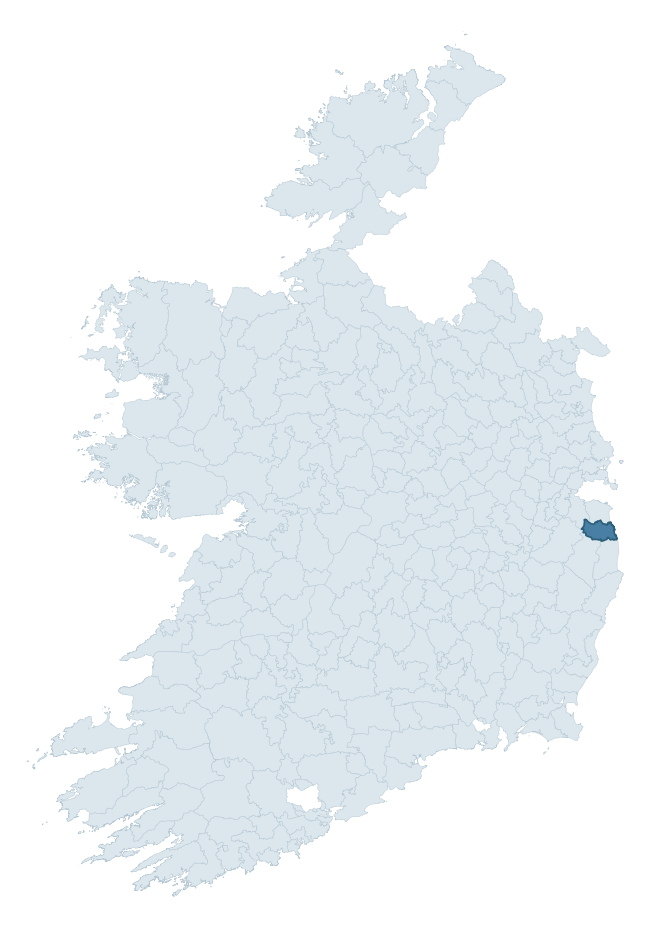
Where this barony sits in the Republic of Ireland
Geology and preservation
Bedrock geology shapes the landscape long before any settlement begins — controlling soil drainage, agricultural potential, the survival of upstanding monuments, and the preservation of buried archaeology. The figures below come from the Geological Survey Ireland 1:100,000 bedrock map.
The bedrock underlying Rathdown is predominantly granite (35% of the barony by area), with much of the rock dating to the Cambrian period. Granite weathers slowly and produces thin, acidic, often poorly-drained soils that historically limited arable agriculture but favoured pastoralism, upland settlement, and the construction of stone monuments. Granite-dominated landscapes typically carry fewer ringforts but a higher density of megalithic tombs, standing stones, and stone circles, which survive well against the resistant bedrock. A substantial secondary geology of greywacke and quartzite (33%) and slate (22%) adds further variety to the underlying landscape. The single largest mapped unit is the Bray Head Formation (33% of the barony's bedrock).
Rock type composition
Largest mapped unit: Bray Head Formation (33% of the barony)
Placename evidence
Logainm records 25 heritage-diagnostic placenames for Rathdown, drawn from townland and civil-parish names across the barony. The dominant stratum is Early Christian ecclesiastical — cill-, teampall-, and domhnach-prefixed names that record the dense network of early church foundations established between the fifth and tenth centuries. The leading diagnostic roots are cill- (18 — church), ráth- (2 — earthen ringfort), and teampall- (2 — church). This is broadly in line with the ROI average of 30.7 heritage placenames per barony. The presence of multiple heritage strata side by side indicates layered occupation of the landscape across successive prehistoric and historic periods. Logainm records 107 placenames for Rathdown (predominantly townland names). Of these, 25 (23%) carry one of the diagnostic Gaelic roots tracked above; the remainder draw on more generic landscape vocabulary that does not encode a heritage period.
Pre-Christian / Early Medieval Defensive
| Root | Count | Meaning |
|---|---|---|
| ráth- | 2 | earthen ringfort |
Early Christian Ecclesiastical
| Root | Count | Meaning |
|---|---|---|
| cill- | 18 | church (early) |
| teampall- | 2 | church (later medieval) |
| domhnach- | 1 | pre-Patrician or earliest Patrician church |
| mainistir- | 1 | monastery |
Burial, Ritual, and Norse-Contact
| Root | Count | Meaning |
|---|---|---|
| uaimh- | 1 | cave / souterrain |
Other baronies in Wicklow
- Talbotstown Upper
- Talbotstown Lower
- Arklow
- Ballinacor North
- Newcastle
- Shillelagh
- Ballinacor South
- Scarawalsh — Wexford
- Ballinacor North
- St. Mullin's Lower — Carlow
See all 280 baronies in the Republic of Ireland Heritage Tool.

Explore further
Grounding History: 10 Maps of Northern Ireland’s Past
If you’re interested in Irish heritage more widely, the companion report for Northern Ireland brings together the analysis of all 462 NI wards into one place through 10 high-quality maps — covering monument density, archaeological periods, placename heritage, terrain, wetland, and the historic landscape at first survey. Take a look.
About this profile
Click any section below to expand.
What is a barony?
A barony is a historic administrative unit in Ireland, broadly equivalent to an English hundred. The 280 baronies used here are from the OSi 2019 National Statutory Boundaries (generalised 20m), covering the 26 counties of the Republic of Ireland. Baronies derive from the Norman period, were formalised in the 17th century, and have not been redrawn for statistical purposes. They vary enormously in area, from compact urban baronies in Dublin to vast upland baronies in Connacht, and should not be compared by raw site count without accounting for area differences.
What counts as a site?
This profile combines three distinct heritage registers, each with its own definition of what constitutes a recordable site:
- Archaeological sites (NMS). The National Monuments Service Sites and Monuments Record (SMR) catalogues every known archaeological monument or site of archaeological interest in the Republic, from prehistoric burial mounds and ringforts to medieval churches and post-medieval defensive works. Inclusion does not require legal protection — only that the site has been identified, surveyed, and assessed as having archaeological value. A separate subset of these sites lies within a recorded protection zone, which gives them statutory protection under the National Monuments Acts.
- Listed buildings (NIAH). The National Inventory of Architectural Heritage records buildings of architectural, historical, archaeological, artistic, cultural, scientific, social, or technical interest. Each surveyed structure is appraised on a five-tier scale: International, National, Regional, Local, and Record-Only. The NIAH appraisal is informational rather than strictly statutory, but it underpins local-authority Record of Protected Structures (RPS) listings.
- Heritage placenames (Logainm). Logainm is the authoritative database of Irish placenames maintained by the Placenames Branch. This profile applies a heritage-diagnostic classifier to the Irish-language form of each townland name, flagging roots that signal defensive sites (ráth-, lios-, dún-, caiseal-, cathair-), ecclesiastical foundations (cill-, teampall-, domhnach-, mainistir-), prehistoric burial-ritual features (tuaim-, carn-, leaba-), or Norse-contact settlement (gall-). Townlands without one of these diagnostic roots are not flagged here — they may still carry historical significance, but that significance is not encoded in the name itself.
Editorial principles
The narrative sections of this profile follow several explicit principles:
- Evidential. Every claim about this barony’s heritage character is anchored in the underlying register data. Where a site count, a placename count, or a percentile rank is cited, it is computed from the source datasets at export time, not estimated.
- Comparative. Counts and metrics are reported alongside their percentile rank against the other 279 ROI baronies. A barony with 50 ringforts in absolute terms could be unusually high or unusually low depending on its size and regional context; percentile ranking removes that ambiguity.
- Transparent on limits. Where a register has known coverage gaps, survey biases, or data-quality issues that affect this barony’s figures, the profile flags them rather than presenting the numbers as definitive.
- No interpretation beyond what the data supports. The narrative does not speculate about historical events, social dynamics, or cultural meaning beyond what the recorded heritage and placename evidence directly attests.
Data caveats and limits
- NMS Sites and Monuments Record is the product of survey campaigns conducted at different intensities across different counties and decades. Some baronies have been surveyed more thoroughly than others, and absolute counts should be read in that light. Sites destroyed by development before survey are typically not represented; sites in heavily forested or upland terrain are sometimes under-recorded.
- NIAH coverage is broadly complete for the Republic of Ireland but the survey was conducted on a rolling county-by-county basis, and the most recent appraisal date varies. Buildings demolished or substantially altered after their original survey may still appear in the register; conversely, recent buildings of merit may not yet have been appraised.
- Logainm classification applies a deliberately conservative pattern-matching approach to the Irish-language townland forms. The classifier prioritises true positives over recall: a townland may carry a heritage signal that the classifier doesn’t recognise, particularly where the diagnostic root has been heavily anglicised or where the townland name draws on a less common term. The 60,000+ townland records and ~9,800 classified placenames give a substantial signal at barony scale, but individual townland names should be checked against Logainm directly for definitive interpretation.
- Period attribution. The chronological distribution reflects only those NMS sites that carry a recognised period attribution in the source data. Sites listed as “Unknown” period are excluded from the dated subset.
- Boundary changes. Some baronies have undergone minor boundary adjustments since their 19th-century definition; the OSi 2019 generalised boundaries used here are the current statutory definition and may differ slightly from historical maps in border areas.
- Bedrock geology is mapped at 1:100,000 scale, which means local variation within a barony — small pockets of different rock type, mineral veins, alluvium overlying bedrock — is generalised. The dominant-system and rocktype figures are area-weighted, so a barony reading “70% Carboniferous limestone” may still contain small but archaeologically important pockets of older or younger rock. Around 3% of GSI polygons do not match the lexicon and contribute no rocktype or system attribution.
Data sources
- National Monuments Service — Sites and Monuments Record (SMR) https://data.gov.ie/dataset/national-monuments-service-archaeological-survey-of-ireland
- National Inventory of Architectural Heritage (NIAH) https://data.gov.ie/dataset/national-inventory-of-architectural-heritage-niah-national-dataset
- Logainm — Placenames Database of Ireland https://www.logainm.ie/
- Ordnance Survey Ireland — National Statutory Barony Boundaries 2019 https://data-osi.opendata.arcgis.com/
- EURODEM — European Digital Elevation Model https://www.mapsforeurope.org/datasets/euro-dem
- ESA WorldCover https://esa-worldcover.org/en
- Geological Survey Ireland — 1:100,000 Bedrock Geology https://www.gsi.ie/en-ie/data-and-maps/Pages/Bedrock.aspx
Explore more: Search any of the 280 ROI baronies, browse by historical province, or read the methodology and data sources for the full Republic of Ireland Heritage Tool.