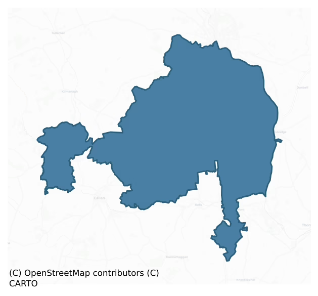
Shillelogher is a barony of County Kilkenny, in the historical province of Leinster (Irish: Síol Fhaolchair), covering 151 km² of land. The barony records 625 NMS archaeological sites and 388 NIAH listed buildings, placing it at around the 94th percentile among 280 ROI baronies for sites per km². This means it is in the top tenth of all baronies for sites per km². Dated archaeological evidence runs from the Neolithic through to the Modern, spanning 8 of 9 archaeological periods, placing the barony in the 67th percentile among 280 ROI baronies for chronological depth. This means it is in the top third of all baronies for chronological depth. The largest dated subset of recorded sites dates to the Iron Age. Logainm flags 30 placenames in the barony as carrying a recognised heritage root; the largest share — around 47% — are names associated with pre-christian defensive.
Heritage at a glance
Percentile rankings throughout this profile compare each barony only against the other 279 Republic of Ireland baronies.
The recorded heritage of Shillelogher
The National Monuments Service Sites and Monuments Record (SMR) is the statutory inventory of archaeological sites for the Republic of Ireland, maintained by the Department of Tourism, Culture, Arts, Gaeltacht, Sport and Media. Sites recorded here include earthworks, ringforts, megalithic tombs, ecclesiastical remains, and post-medieval features; not every record is legally protected, but each is registered as a monument of archaeological interest.
The National Monuments Service records 625 archaeological sites in Shillelogher, putting it at the 94th percentile among 280 ROI baronies for sites per km². This means it is in the top tenth of all baronies for sites per km². Protection coverage is near-universal — 592 sites (95%) fall within a recorded monument protection zone, indicating an extensively surveyed landscape. The record is dominated by defensive sites — ringforts, enclosures, hillforts, and stone forts (159 sites, 25% of the total), with ecclesiastical sites forming a substantial secondary presence (141 sites, 23%). The most diagnostically specific type is Graveslab (71 records, 11% of the barony's NMS total) — compared to an ROI average of 4% across all baronies where this type occurs. Graveslab is a recumbent grave-marking slab, dated 1200–1700 AD. The broader 'Enclosure' classification — which catches unclassified ringforts and field enclosures — accounts for a further 121 records (19%) and reflects the difficulty of sub-classifying degraded earthworks from surface evidence alone. Across the barony's 151 km², this gives a recorded density of 4.15 sites per km².
Most common monument types
Hover or tap a monument type to see its definition.
| Type | Count |
|---|---|
| Enclosure a banked or ditched feature of uncertain type, used as a catch-all where the original function cannot be determined from surface evidence | 121 |
| Graveslab a recumbent grave-marking slab, dated 1200–1700 AD | 71 |
| Church a building used for public Christian worship, of any date from c. 500 AD onwards | 26 |
| Graveyard a burial area associated with a church, in use from the medieval period onwards | 22 |
| Ring-ditch a circular ditch under 20m across, often the ploughed-out remains of a barrow, ring-barrow or roundhouse | 21 |
Chronological distribution
The dated archaeological record for Shillelogher spans from the Neolithic through to the Modern, with activity attested across 8 of 9 archaeological periods. Every period from earliest to latest is represented in the record — an unbroken sequence of dated activity across the full chronological span. Activity concentrates most heavily in the Iron Age (162 sites, 40% of dated material), with the Medieval forming a secondary peak (132 sites, 32%). A further 216 recorded sites (35% of the overall NMS register for the barony) carry no period attribution — appearing as 'Unknown' in the bar chart below. This typically reflects either records that pre-date the standardised period vocabulary or sites awaiting specialist dating review, rather than a genuine absence of chronological evidence.
Sample of recorded monuments
Show 25 sample monuments (of 625 total)
A representative sample of 25 recorded monuments drawn from the barony’s 625 total NMS entries. Sites within a recorded monument protection zone and rarer site types are prioritised so the list shows a meaningful cross-section rather than only the most common type. Each entry shows the official Sites and Monuments Record reference number and the description published by the National Monuments Service.
Hermitage
There is a tradition that St Rioc, also known as Rioch or Rock, lived here as a hermit in the 5th century and that his followers founded a church at this location (O'Carroll 1974, 57). The precise location of this…
There is a tradition that St Rioc, also known as Rioch or Rock, lived here as a hermit in the 5th century and that his followers founded a church at this location (O'Carroll 1974, 57). The precise location of this hermitage is unknown within the general area of St Rioc's church (KK019-025001-), graveyard (KK019-025002-) and holy well (KK019-025003-).
Compiled by: Jean Farrelly
Date of upload: 28 September 2020
Stone sculpture
In St Rioc’s graveyard (KK019-025002-), Kilkenny City there is a limestone figure sculpture representing the Trinity, consisting of the seated figure of God the Father, seated with the right hand raised, probably in the…
In St Rioc’s graveyard (KK019-025002-), Kilkenny City there is a limestone figure sculpture representing the Trinity, consisting of the seated figure of God the Father, seated with the right hand raised, probably in the gesture of benediction, though the fingers are broken off, and the left hand under and supporting the sinister arm of the cross. God the Son is carved on the cross which is between the knees of the Father and the Holy Spirit, in the form of a dove, is carved above the arms of the cross. The top of the sculpture, including the head of God the Father, is missing, with the break running from the top sinister side to just above the arm of the cross on the dexter side. It is possible that this is the Trinity sculpture which was illustrated in c. 1812 by George Millar and located to St Patrick’s graveyard (KK019-026172-), which lies c. 900m to the ESE, but which has not been found there (Roe 1979, 128, 145-6). The sculpture is similar to the limestone Trinity (KK026-010032-) in Callan, Co. Kilkenny which has been dated to the first half of the 16th century (Roe 1979, 110). A 15th-century alabaster sculpture of the Trinity has also been found in the Black Abbey church of the Dominican friary (KK019-026021-), c. 600m to the N (Roe 1972, 33-6; Hunt and Harbison 1976, 310-21).
Compiled by: Jean Farrelly
Date of upload: 30 September 2020
Historic town
The Archaeological Survey of Ireland (ASI) is in the process of providing information on all monuments on The Historic Environment Viewer (HEV). Currently the information for this record has not been uploaded. To…
The Archaeological Survey of Ireland (ASI) is in the process of providing information on all monuments on The Historic Environment Viewer (HEV). Currently the information for this record has not been uploaded. To access available information for research purposes please make an appointment in advance with the Archive Unit (open Fridays 10.00 am – 5.00 pm), Department of Culture, Heritage and the Gaeltacht, The Custom House, Dublin 1 D01W6XO or email nmarchive@chg.gov.ie.
Decoy pond
Indicated as 'Old Decoy' on the 1st (1839) ed. OS 6-inch map with a stream around the perimeter from NW-E-SE and it is indicated as an octagonal field on the 1899-1900 revised edition. The decoy (dims. c. 240m N-S; c.…
Indicated as 'Old Decoy' on the 1st (1839) ed. OS 6-inch map with a stream around the perimeter from NW-E-SE and it is indicated as an octagonal field on the 1899-1900 revised edition. The decoy (dims. c. 240m N-S; c. 290m E-W), originally a pond with arm-like projections (pipes) covered with nets into which wild birds are lured and then caught. The decoy would have been part of a demesne landscape, though the associated demesne no longer survives. The Munster River flows roughly E-W c. 350m to the N before turning S where it flows c. 600m to the E. A house indicated on both editions of the 6-inch OS map, c. 150m to the N, may have been the demesne house. The octagonal field boundaries and all the field boundaries which radiated from this on the revised 6-inch OS map have been removed and the field reclaimed. A rectangular tree plantation (dims. c. 260m NE-SW; c. 130m NW-SW) currently occupies the N portion of the former decoy.
Compiled by: Jean Farrelly
Date of upload: 24 May 2021
Settlement cluster
In a river valley, E of a meandering stream called the Craosóg (O’Kelly 1969, 192) and S of a church (KK022-027001-) and graveyard (KK022-027002-). According to Carrigan (1905, vol. 3, 321), the ‘field to the south of…
In a river valley, E of a meandering stream called the Craosóg (O’Kelly 1969, 192) and S of a church (KK022-027001-) and graveyard (KK022-027002-). According to Carrigan (1905, vol. 3, 321), the ‘field to the south of the churchyard is called “the Old Street,” and hence must be the site of some ancient village’. O’Kelly (ibid.), also mentions, ‘The Sean-bhaile, Old street, and Old court are fields lying south of the churchyard denoting a hamlet formerly’. Neither Carrigan or O’Kelly mention the Callan-Kilkenny road which runs NE-SW c. 40m S of the graveyard and it is unclear whether the fields referred extend S of this road. There is no visible trace of a settlement on satellite imagery (Google Earth and Digitalglobe, viewed 25 May 2021).
Compiled by: Jean Farrelly
Date of upload: 25 May 2021
Earthwork
Under the heading, ‘Ancient Monastery’, Carrigan (1905, vol. 3, 440) notes that, ‘Tradition points to a field of Mr. Daniel Maher’s in Killaloe, close to the old churchyard [KK022-018002-], as the site of an ancient…
Under the heading, ‘Ancient Monastery’, Carrigan (1905, vol. 3, 440) notes that, ‘Tradition points to a field of Mr. Daniel Maher’s in Killaloe, close to the old churchyard [KK022-018002-], as the site of an ancient monastery. This field was known as Paurk-Philop, or Philip’s Field, till 1839, when the Ordnance Survey Commissioners gave it the new name of Awrdhawns, because they found the surface of the field, to the extent of two acres, covered over with little hillocks and mounds, the remains of the early monastic establishment that stood here. The south side of Paurk-Philip is washed by a stream, on the north bank of which may of the stones used in the ancient foundation may be seen; one of these formed the semi-circular cap of a small cut-stone windows. The people preserve no tradition whatever about this monastery. The field at the opposite side of the stream is called Mocha-na-mo (Macha-na-mbo), the Yard of the Cows’. Carrigan’s description tallies with a field 200m SW of the graveyard which has clearly defined earthworks and a stream running NW-SE along the S side of the field, visible on the 1st (1839) ed. OS 6-inch map, though since re-aligned and now dry.
See attached:
KK022-045—-_01 Satellite imagery (Digitalglobe, viewed 27 May 2021)
KK022-045—-_02 Satellite imagery (Digitalglobe, viewed 27 May 2021)
Compiled by: Jean Farrelly
Date of upload: 27 May 2021
Standing stone
The OS Letters (1839) describe, 'In the Townland of Knockaliagain, i.e., the Hill of the Standing Stone, is a large rock reclining against a wall or ditch, measuring seven and a half feet [2.27m] in height over ground,…
The OS Letters (1839) describe, 'In the Townland of Knockaliagain, i.e., the Hill of the Standing Stone, is a large rock reclining against a wall or ditch, measuring seven and a half feet [2.27m] in height over ground, two feet ten inches [0.87m] in breadth at bottom, one and a half feet [0.45m] at top and one foot [0.3m] in thickness' (O'Flanagan 1930, vol. 1, 267 (90)). O'Kelly (1969, 179) describes it as, 'The liagán, an uncarved and uninscribed land-stone column'.
Compiled by: Jean Farrelly
Date of upload: 1 June 2021
Ritual site – holy tree/bush
The OS Letters (1839) refer to a bullaun stone (KK023-009001-) known as St. Patrick's Knee on the W side of the Kilkenny – Kells road and c. 300m SE of a standing stone (KK023-008—-). Shearman (1876-8, 200) notes that…
The OS Letters (1839) refer to a bullaun stone (KK023-009001-) known as St. Patrick's Knee on the W side of the Kilkenny – Kells road and c. 300m SE of a standing stone (KK023-008—-). Shearman (1876-8, 200) notes that an, 'old hawthorn bush over-shadows the Glun Padraig [Patrick's Knee]; on its branches hang the usual ex votis of shreds torn from the garments of the visitors and devotees' (ibid.). Carrigan (1905, vol. 3, 393) quotes the OS Letters' description of the bullaun and adds that the bullaun stone is shaded by, 'a large, old sccach [bush], which the people call "Patrick's Bush," and which they still hold in veneration through reverence of our National Apostle. Its branches are plentifully hung with the usual ex voto offerings, such as pieces of cloth, linen, &c.'. Carrigan (ibid., 392-3) also refers to a church (KK023-009003-)and graveyard (KK023-009004-) which according to tradition were located adjacent to the bullaun stone and holy tree.
Compiled by: Jean Farrelly
Date of upload: 1 June 2021
Barn
On the brow of an E-facing slope with good views from E-SSE. A tower house (KK023-084—-), ‘Annamult Castle’, is visible c. 100m to the N. On the 1st (1839) ed. OS 6-inch map a rectangular area, indicated as a small…
On the brow of an E-facing slope with good views from E-SSE. A tower house (KK023-084—-), ‘Annamult Castle’, is visible c. 100m to the N. On the 1st (1839) ed. OS 6-inch map a rectangular area, indicated as a small field, is annotated, ‘Friars Barn’ and on the 1947 revision it is indicated as a large building, with most of the N wall missing, annotated, ‘Friars’ Barn (in Ruins)’. According to Carrigan (1905, vol. 3, 373), the barn and ancillary buildings, ‘formed the monastic “Grange of Hanumolt,” which the Abbot of Graiguenamanagh was forced to surrender to the Commissioners of Henry VIII at the suppression of the Religious Houses’ in 1540.
A long rectangular building (ext. dims. 33.6m E-W x 18.8m N-S) constructed of roughly coursed limestone rubble and mortar. Much of the external facing has been robbed, as have the quoins at the NE and SE angles. The ruinous ivy-clad remains consist of the W gable standing almost to full height, a length of the E end of the N wall (L 9m; H 1.2m), the S wall (H 2m) and the E gable (H 1.8m). A series of neatly executed, square apertures (int. dims. 0.23m x 0.2m; H above ext. ground level 1.2m), lintelled at head and base, are the only surviving features. These apertures, c. 1.2m apart, run through the thickness of the wall and occur in horizontal rows, with eight in the W gable, five in the E gable and nine in the S wall. The apertures may have functioned as putlog holes during the construction phase, however, since they appear to cont…
Castle – motte
On level ground in gently undulating terrain, under grass. View impeded to E and W by rising ground, elsewhere fair to good, though impeded by hedgerow and by forestry to S. The northern section of a meandering stream,…
On level ground in gently undulating terrain, under grass. View impeded to E and W by rising ground, elsewhere fair to good, though impeded by hedgerow and by forestry to S. The northern section of a meandering stream, visible on the 1st (1839) ed. OS 6-inch map, and which is immediately N and W of the monument, was subsequently straightened. The former medieval parish church of Tullaghanbrogue (KK023-030001-) (Carrigan 1905, vol. 3, 385-6), is located c. 200m to the W and there are numerous earthworks (KK023-031001-) immediately E of the mound, including a small moated site (KK023-031004-) and a large enclosure (KK023-031005-). Orpen (1909, 333) associates this mound with the manor of Tullaghanbrogue, and states that, ‘William de St. Leger also held the manor of Tullaghanbrogue, with which the St. Legers were connected up to Cromwellian times. What I take to be the Norman earthwork here, however, belongs rather to the bretage that to the mote type’. He goes on to say that this, and similar manors in the central part of Ossory, were probably the latest part settled by the Anglo-Normans (ibid.). The Down Survey (1655-6) barony map of Sheelogher, ‘Sheelelogher’ (Hibernia Regnum, courtesy of Trinity College Dublin), indicates what appears to be a ruined castle (KK023-093—-) to the E of a medieval church (KK023-030001-) in Tullohaune townland which equates with the modern townland of Grove. The castle, which is not visible at ground level, probably occupied this castle mound…
Cross – Churchyard cross
In Grange graveyard (KK023-036002-), associated with the medieval church (KK023-036001-). The limestone cross-base has been reused as a quoin stone in the NW angle of the RC church which was erected in the graveyard in…
In Grange graveyard (KK023-036002-), associated with the medieval church (KK023-036001-). The limestone cross-base has been reused as a quoin stone in the NW angle of the RC church which was erected in the graveyard in 1826. Described by Hogan (1880-83, vol. 2, 41-2) as, ‘part of the base of a memorial cross – a block of lime-stone, about two feet [0.6m] square – and worked into the masonry as a quoin in the north-west angle of the present parish church. It stands about six feet [c. 1.8m] from the ground; two squares or faces of it are exposed, one uninscribed, the other bears an inscription, cut in relief. The following is a fac-simile of a rubbing taken by myself from the stone for the use of the present paper :- ….RICH ….. COMERFORD DE BALLIBVR EQVITIS ET DOMINAE MARIA PVRCELL VXORIS EIVS QVI HANC CRVCEM IN HONOREM ALMAE CEVCIS DNI NRI FIERI FECERVNT 20 IVLII [Pray for the souls of] Richard Comerford, of Ballybur [Knight], and of Mrs. Mary Purcell, his wife, who [both] had this cross erected in honour of the Holy Cross of our Lord, 20 July.” The left corner of the stone is broken off, and hence the word before Richard and the latter syllable of that name are absent; the words “pray, &c.,” within the brackets in the translation, are most probably the lost ones. The year of the erection is not on the stone, and, singular enough, the space for it was sunk down as if to show that this date was designedly obliterated; but an inscription on the tomb of this same Richard – to…
Midden
A midden, consisting of a number of oyster shells in the topsoil, was exposed as part of the archaeological investigations on the Cork-Dublin gas pipeline (1981-2) (Sleeman 1983, 365-6).
Compiled by: Jean…
A midden, consisting of a number of oyster shells in the topsoil, was exposed as part of the archaeological investigations on the Cork-Dublin gas pipeline (1981-2) (Sleeman 1983, 365-6).
Compiled by: Jean Farrelly
Date of upload: 11 August 2021
Hut site
Within the W quadrant of an enclosure (KK023-048001-). A small circular cropmark, probably a hut site, identified on aerial photographs (CUCAP AYK062, 9 July 1969; BDI039, 14 July 1970; BGG011 and BGG012, 16 July…
Within the W quadrant of an enclosure (KK023-048001-). A small circular cropmark, probably a hut site, identified on aerial photographs (CUCAP AYK062, 9 July 1969; BDI039, 14 July 1970; BGG011 and BGG012, 16 July 1971).
KK023-048002-_01 aerial photograph (CUCAP AYK062, 9 July 1969)
KK023-048002-_02 aerial photograph (CUCAP BDI039, 14 July 1970)
KK023-048002-_03 aerial photograph (CUCAP BGG012, 16 July 1971)
Compiled by: Jean Farrelly
Date of upload: 17 August 2021
Burnt spread
Located c. 60m N of a NW-SE flowing stream. Identified as a, 'spread of charcoal and burnt clay, probably part of a fulacht fiadh' during the construction of the Cork-Dublin gas pipeline (Sleeman 1983,…
Located c. 60m N of a NW-SE flowing stream. Identified as a, 'spread of charcoal and burnt clay, probably part of a fulacht fiadh' during the construction of the Cork-Dublin gas pipeline (Sleeman 1983, 365-6).
Compiled by: Jean Farrelly
Date of upload: 17 August 2021
Dovecote
Located immediately NE of a large enclosure (KK023-058001-) and 25m SW of another enclosure (KK023-057—-). Orpen (1909, 320-21) provides an extent of lands, ‘of Joan, Countess of Gloucester and Hertford, taken in…
Located immediately NE of a large enclosure (KK023-058001-) and 25m SW of another enclosure (KK023-057—-). Orpen (1909, 320-21) provides an extent of lands, ‘of Joan, Countess of Gloucester and Hertford, taken in 1307, the jurors say that there are within the manor of Dunfert “Within the enclosure one hall, one chamber, one dairy, one grange, one bretage beyond the gate, and other wooden houses”. They also mention “a dovecote,” perhaps at the same spot’.
A circular dovecote (diam. c. 7m), only the N section of walling survives (H 5.5m) and this is corbelled towards the top. There are remnants of pigeon holes internally, starting c. 0.6m above ground level and running in vertical lines c. 0.3m apart. They have narrow entrances but are wider inside and they are divided from each other by thin stone flags which act as lintels. The exterior was harled. Two bricks were noted in the fabric, possibly indicating a date around the 16th/17th century for the structure.
Compiled by: Jean Farrelly
Date of upload: 18 August 2021
Designed landscape – folly
Centrally placed within a ringwork (KK023-080—-) with good views in all directions. Indicated as 'Turret (in ruins)' on OS 6-inch map (1947 revised edition). A late 18th/19th-century, two-storey octagonal structure…
Centrally placed within a ringwork (KK023-080—-) with good views in all directions. Indicated as 'Turret (in ruins)' on OS 6-inch map (1947 revised edition). A late 18th/19th-century, two-storey octagonal structure (int. diam. 5.5m; wall T 0.6m) constructed of limestone rubble with brick employed around the window reveal, first-floor fireplace and chimney. There is a ground-floor entrance at N with fenestration comprising ten round-headed windows; five on each floor. Additional features include first-floor timbers in situ and a rectangular aumbrey in the NW wall. Visible on aerial photograph (GB89.P.16) surmounting the earlier ringwork.
See attached:
KK023-080001-_01 Folly from the ESE (26 October 1994)
Compiled by: Mary Tunney
Date of upload: 25 January 2012
Water mill – unclassified
A mill is indicated roughly at this location on the Down Survey (1655-6) barony map of Sheelogher/‘Sheelelogher’ (Hibernia Regnum, courtesy of Trinity College Dublin). Carrigan (1905, vol. 3, 487) noted that in 1794,…
A mill is indicated roughly at this location on the Down Survey (1655-6) barony map of Sheelogher/‘Sheelelogher’ (Hibernia Regnum, courtesy of Trinity College Dublin). Carrigan (1905, vol. 3, 487) noted that in 1794, 'the tourist Holmes observed at Bennetsbrige, "near the river a small ancient building, now part of a mill". There is a watermill on the W bank of the River Nore indicated as 'Flour Mill' on the 1st (1839) ed. OS 6-inch map which may be on the location of the Down Survey mill. It is shown as a 'Corn Mill' on the 1899-1902 revision of the OS 6-inch map. The building is currently used to produce and sell locally made pottery.
See attached:
KK024-033—-_01 extract from the Down Survey (1655-6) barony map of Sheelogher/‘Sheelelogher’ (Hibernia Regnum, courtesy of Trinity College Dublin)
Compiled by: Jean Farrelly
Date of upload: 27 September 2021
Cross
Associated with the medieval church of Newtown Earley (KK027-012001-) and uncovered during a clean-up of graveyard in 1985-7 (KK027-012009-) (Harte 1987, 408-17). Currently lying within the church.
A three-armed cross…
Associated with the medieval church of Newtown Earley (KK027-012001-) and uncovered during a clean-up of graveyard in 1985-7 (KK027-012009-) (Harte 1987, 408-17). Currently lying within the church.
A three-armed cross (surviving upper portion of head and shaft H 0.75m; Wth 0.50m; lower portion of shaft H 0.7m) with fleur-de-lys terminals and a hollow lozenge at the centre of the cross-head. The top fleur-de-lys is missing and the cross-shaft is broken horizontally across the shaft. It has a mason’s mark of a flower. (Harte 1987, 415-16, no. 27).
Reference:
Harte, R. 1987 Tombstones at Newtown Earley. Old Kilkenny Review 39, 408-17.
See attached photograph:
KK027-012003-_01
Compiled by: Jean Farrelly
Date of upload: 26 April 2023
Mound
A mound at this location is mentioned in OPW Correspondence Files (1956). Possibly located in a former strip of woodland which ran immediately S of the Newtown to Kells road. There is nothing indicated on the 1st (1839)…
A mound at this location is mentioned in OPW Correspondence Files (1956). Possibly located in a former strip of woodland which ran immediately S of the Newtown to Kells road. There is nothing indicated on the 1st (1839) ed. OS 6-inch map or the subsequent 1948 revision.
Compiled by: Jean Farrelly
Date of upload: 27 March 2023
Ringfort – unclassified
The Kings River flows E-W c. 150m to the S. A roughly oval enclosure (dims. c. 57m NE-SW; c. 48m NW-SE) indicated on the 1st (1839) ed. OS 6-inch map and subsequent revisions. There are trees growing around the…
The Kings River flows E-W c. 150m to the S. A roughly oval enclosure (dims. c. 57m NE-SW; c. 48m NW-SE) indicated on the 1st (1839) ed. OS 6-inch map and subsequent revisions. There are trees growing around the perimeter.
Compiled by: Jean Farrelly
Date of upload: 27 March 2023
Barrow – ring-barrow
On top of a natural sand hill. Described by Prendergast in 1954 as consisting of, ‘a central raised platform surrounded by one fosse and outer bank, all dug into and piled up on what is apparently a natural gravel…
On top of a natural sand hill. Described by Prendergast in 1954 as consisting of, ‘a central raised platform surrounded by one fosse and outer bank, all dug into and piled up on what is apparently a natural gravel mound. The fosse is interrupted in three places where an undug strip affords an entrance to the central area’. An accompanying sketch shows three entrances, at the NE, SE and W and gives the internal diameter as 37 yards [c. 34m] (NMI Correspondence Files, 17 May 1954). The bank, which was, ‘said to have been low, only 2 or 3 feet [0.6-0.9m] high’, was levelled in October 1954 (OPW Correspondence Files, 18 October 1954). Gibbons (1990, 6) speculated that this might have been a henge. Certainly three causewayed entrances to the interior, if they are all original, is unusual. However, given the size of the monument, and with an external bank and internal fosse, it is more likely to be a ring-barrow.
Compiled by: Jean Farrelly
Date of upload: 27 March 2023
House – fortified house
On a spur of high ground at the E end of a low ridge, N of the Kings River. The site commands good views of the countryside to W, NW and S.
Carrigan (1905, vol. 3, 330) identified this as the location of the early…
On a spur of high ground at the E end of a low ridge, N of the Kings River. The site commands good views of the countryside to W, NW and S.
Carrigan (1905, vol. 3, 330) identified this as the location of the early 14th-century castle of the D’Erleys, mentioned in the Red Book of Ossory c. 1300 and 1320 respectively as, ‘Curia de Erleyestoun’ and the ‘Castrum Erleye’. In 1367 John D’Erley joined the army of Edward, the Black Prince, the eldest son of Edward III in Spain where he was taken prisoner (Walsh 1958, 43). The ransom for his release was so costly that the family were forced to sell the Manor of Earleston (ibid.). Thus, towards the end of the 14th century, the Sweetmans succeeded the D’Erleys in both their property of Earlstown, and the title of Baron of Erley (Carrigan 1905, vol. 3, 330).
The Register of Kells Priory mentions that in 1478, John Sweetman was chief lord of all the Barony of Erley (ibid.). Carrigan is confident that this is the same John Sweetman who, in the Pat. Rolls, is mentioned as, ‘son and heir of Nicholas Sweetman of Castellyse [i.e. Castellyfe, or Castle Eve] in the Co. Kilkenny, gent.’, who received a royal pardon for treasons etc. in 1482 (ibid.). In 1543, James Sweetman was Sheriff of Co. Kilkenny and in 1549, ‘James Sweteman, of Castelliff’ receives a pardon (ibid. 331). He was succeeded by William Sweetman, who was the largest freeholder in the Barony of Kells c. 1560 and was the Sheriff of Co. Kilkenny in 1564 (ibid.). He was succeede…
Designed landscape feature
On the summit of Gallows Hill. Indicated on the 1st (1839) ed. OS 6-inch map as a circular enclosure (diam. c. 30m). This was inspected by the National Museum of Ireland in November 1975 and described as a small…
On the summit of Gallows Hill. Indicated on the 1st (1839) ed. OS 6-inch map as a circular enclosure (diam. c. 30m). This was inspected by the National Museum of Ireland in November 1975 and described as a small barrow-like mound which proved to be a fairly modern (landscaping) feature (Ryan 1975-6). The small mound had been raised on the site of a cemetery of extended, unaccompanied single burials (KK019-034—-) of unknown date (ibid.). Disarticulated bones (KK019-105001-) derived from the surrounding graves were incorporated in the material of the mound (ibid.). Other burials (KK019-034—-) had been found in the sand pit c. 130m to the E in 1969.
Compiled by: Jean Farrelly
Date of upload: 19 October 2020
Market-house
Site of the 'old' tholsel, presently occupied by the Allied Irish Bank building (NIAH 12001017), which was itself converted, and probably originally extended, in 1921 from the early 19th-century Victoria Hotel…
Site of the 'old' tholsel, presently occupied by the Allied Irish Bank building (NIAH 12001017), which was itself converted, and probably originally extended, in 1921 from the early 19th-century Victoria Hotel establishment (Farrelly et al. 1993, 38-9; Bradley 2000, 15, 20). This tholsel, or Market House, is first referred to as a 'Stallage house' in the 1307 extent of the estate of the deceased Joan of Acre, Countess of Gloucester (Sweetman 1886, 187) and in 1383 it was the venue for the town hundred court (McNeill 1931, 67). A stone tholsel had been completed by 1507 and a 'great chamber' and stone gate were added to it before 1517 (McNeill 1931, 132, 138-9). A new tholsel was built in 1578 150m to its N on the E side of High Street, elements of which are incorporated into the present largely 18th-century tholsel building (KK019-026061-).The 'old Tholsel' continued to function under Corporation ownership for about a century and was eventually knocked c. 1795 (Hogan 1884, 270-4). John Rocque's 1758 survey of Kilkenny depicts it prior to its removal as part of a solid block of buildings between Pudding Lane and High Street. Rocque also shows the rear (W) plot of the old tholsel occupied by a building in the E and a walled garden/yard extending to a building range that flanks the town wall to the W. According to John Hogan a section of the old Tholsel was still visible in the back (W) wall of the Victoria Hotel in the late 19th century (Hogan 1880, 242). This, however, was…
Enclosure
In pasture, c. 400m W of the River Nore. A large oval enclosure (dims. c. 60m N-S; c. 50m E-W) is depicted on the 1st (1839-40) OS 6-inch map, with trees in the interior. The enclosure is indicated as a tree-ring on the…
In pasture, c. 400m W of the River Nore. A large oval enclosure (dims. c. 60m N-S; c. 50m E-W) is depicted on the 1st (1839-40) OS 6-inch map, with trees in the interior. The enclosure is indicated as a tree-ring on the 1945-6 revision. A farm trackway is shown skirting past the NW quadrant of the enclosure and a field boundary runs NW-SE up to the SE quadrant and on the 1945-6 revision this field boundary appears incorporated into the E side, giving it a straight-sided appearance. The enclosure lies c. 190m SW of a farm yard associated with Kilfera House which lies c. 460m to the NE. St Fiachra’s church (KK020-050001-) and graveyard (KK020-050002-) lie c.290m to the E and Sheastown medieval church (KK024-001001-) and graveyard (KK024-001002-) lie across the townland boundary, c. 530m to the SE.
It is described by Carrigan (1905, vol. 3, 221-2) as, ‘About 80 perches [400m] west of Feechra’s Church-yard, and in the same townland of Kilferagh, there is an enclosed area forming a perfect circle, 65 yds. [c. 60m] in diameter. At first sight it appears to be surrounded by nothing more than a very thick rampart of earth, 5 or 6 ft. [c. 1.5-1.8m] high; but, on closer examination the centre of the rampart will be found to consist of a most solidly built wall, or caiseal, of well-laid stones and mortar, 5 ft. [c. 1.5m] thick, and faced all round, on both its sides, with heaped-up earth. The entrance to the enclosure is in the east side, through an arch of the same age as the caise…
Listed buildings
The National Inventory of Architectural Heritage (NIAH) is a state survey appraising buildings of architectural, historical, archaeological, artistic, cultural, scientific, social, or technical interest. Each surveyed structure receives a rating from International (the highest, for buildings of European importance) through National, Regional, Local, and Record-Only.
The National Inventory of Architectural Heritage records 388 listed buildings in Shillelogher, placing it in the top 8% of ROI baronies for listed-building density. Among these, 12 are graded National — buildings of interest to the whole of Ireland rather than only its region. The Republic holds 937 National-graded buildings in total, so this barony accounts for around 1% of the national total. Construction dates concentrate most heavily in the Late Georgian (1800-1830) period. The most-recorded building type is house (232 examples, 60% of the listed stock).
Terrain and environment
Mean elevation across the barony is 72m — the 33rd percentile among 280 ROI baronies for elevation. This means it is in the lower half of all baronies for elevation. Elevation matters for heritage because higher-altitude baronies typically favour defensive monuments — ringforts and hilltop forts placed on prominent ground — while lowland baronies are more likely to carry the dense settlement and church networks of intensive agricultural landscapes. Mean slope is 2.2° — the 14th percentile among 280 ROI baronies for slope. This means it is in the bottom fifth of all baronies for slope. This is broadly flat terrain, the kind of landscape best suited to intensive agriculture. Slope is a key control on both land use and archaeological preservation: steep ground resists ploughing and tends to preserve earthworks intact, while gentle slopes favour intensive cultivation that damages or destroys surface archaeology over time. The Topographic Wetness Index averages 11.7, the 84th percentile among 280 ROI baronies for wetness. This means it is in the top fifth of all baronies for wetness. This is wet, slow-draining ground by ROI standards — the kind of landscape that may carry waterlogged archaeological sites of unusual preservation value. Drainage matters for heritage because poorly-drained ground preserves organic archaeology (wooden trackways, leather, textiles, and on rare occasions human remains) far better than free-draining soil; well-drained ground favours arable use but destroys organic material rapidly. The land-cover mosaic combines improved grassland (71%), arable farmland (16%), and woodland (10%), giving a mixed agricultural and semi-natural landscape.
Terrain measurements
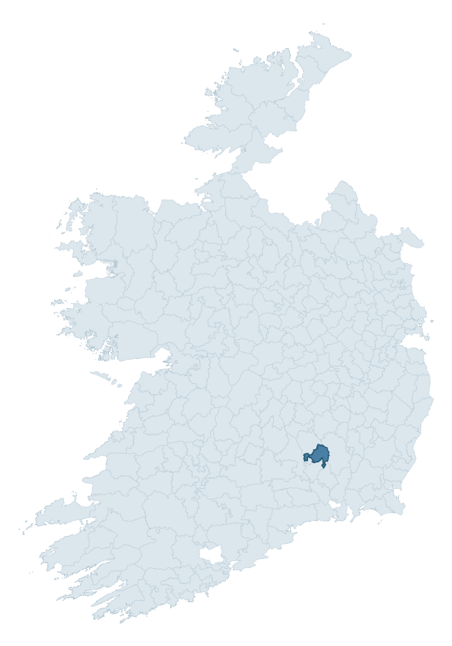
Where this barony sits in the Republic of Ireland
Geology and preservation
Bedrock geology shapes the landscape long before any settlement begins — controlling soil drainage, agricultural potential, the survival of upstanding monuments, and the preservation of buried archaeology. The figures below come from the Geological Survey Ireland 1:100,000 bedrock map.
The bedrock underlying Shillelogher is predominantly limestone (73% of the barony by area), laid down during the Carboniferous period (100% by area, around 359 to 299 million years ago). Limestone is the most heritage-rich bedrock in Ireland. It supports fertile, well-drained soils that favoured dense Early Medieval settlement and Norman manorial agriculture, and it weathers into karst features — sinkholes, caves, swallow holes, and souterrains — that frequently carry archaeology. Where peat overlies limestone, organic preservation can be exceptional. The single largest mapped unit is the Ballyadams Formation (39% of the barony's bedrock).
Rock type composition
Largest mapped unit: Ballyadams Formation (39% of the barony)
Placename evidence
Logainm records 30 heritage-diagnostic placenames for Shillelogher, drawn from townland and civil-parish names across the barony. The dominant stratum is pre-Christian and Early Medieval defensive — ráth-, lios-, dún-, and caiseal-prefixed names that mark Iron Age and early historic settlement. The leading diagnostic roots are ráth- (11 — earthen ringfort), cill- (7 — church), and gráinseach- (4 — grange). This is broadly in line with the ROI average of 30.7 heritage placenames per barony. The presence of multiple heritage strata side by side indicates layered occupation of the landscape across successive prehistoric and historic periods. Logainm records 162 placenames for Shillelogher (predominantly townland names). Of these, 30 (19%) carry one of the diagnostic Gaelic roots tracked above; the remainder draw on more generic landscape vocabulary that does not encode a heritage period.
Pre-Christian / Early Medieval Defensive
| Root | Count | Meaning |
|---|---|---|
| ráth- | 11 | earthen ringfort |
| lios- | 1 | ringfort or enclosure |
| dún- | 1 | hilltop or promontory fort |
| caiseal- | 1 | stone ringfort |
Early Christian Ecclesiastical
| Root | Count | Meaning |
|---|---|---|
| cill- | 7 | church (early) |
| gráinseach- | 4 | monastic farm / grange |
| teampall- | 2 | church (later medieval) |
| domhnach- | 1 | pre-Patrician or earliest Patrician church |
Burial, Ritual, and Norse-Contact
| Root | Count | Meaning |
|---|---|---|
| feart- | 2 | grave mound |
| gall- | 1 | foreigner — Norse settlement marker |
Other baronies in Kilkenny
- Galmoy
- Kells
- Callan
- Crannagh
- Fassadinin
- Kilculliheen
- Gowran
- Navan Upper — Meath
- Callan
- Naas North — Kildare
See all 280 baronies in the Republic of Ireland Heritage Tool.

Explore further
Grounding History: 10 Maps of Northern Ireland’s Past
If you’re interested in Irish heritage more widely, the companion report for Northern Ireland brings together the analysis of all 462 NI wards into one place through 10 high-quality maps — covering monument density, archaeological periods, placename heritage, terrain, wetland, and the historic landscape at first survey. Take a look.
About this profile
Click any section below to expand.
What is a barony?
A barony is a historic administrative unit in Ireland, broadly equivalent to an English hundred. The 280 baronies used here are from the OSi 2019 National Statutory Boundaries (generalised 20m), covering the 26 counties of the Republic of Ireland. Baronies derive from the Norman period, were formalised in the 17th century, and have not been redrawn for statistical purposes. They vary enormously in area, from compact urban baronies in Dublin to vast upland baronies in Connacht, and should not be compared by raw site count without accounting for area differences.
What counts as a site?
This profile combines three distinct heritage registers, each with its own definition of what constitutes a recordable site:
- Archaeological sites (NMS). The National Monuments Service Sites and Monuments Record (SMR) catalogues every known archaeological monument or site of archaeological interest in the Republic, from prehistoric burial mounds and ringforts to medieval churches and post-medieval defensive works. Inclusion does not require legal protection — only that the site has been identified, surveyed, and assessed as having archaeological value. A separate subset of these sites lies within a recorded protection zone, which gives them statutory protection under the National Monuments Acts.
- Listed buildings (NIAH). The National Inventory of Architectural Heritage records buildings of architectural, historical, archaeological, artistic, cultural, scientific, social, or technical interest. Each surveyed structure is appraised on a five-tier scale: International, National, Regional, Local, and Record-Only. The NIAH appraisal is informational rather than strictly statutory, but it underpins local-authority Record of Protected Structures (RPS) listings.
- Heritage placenames (Logainm). Logainm is the authoritative database of Irish placenames maintained by the Placenames Branch. This profile applies a heritage-diagnostic classifier to the Irish-language form of each townland name, flagging roots that signal defensive sites (ráth-, lios-, dún-, caiseal-, cathair-), ecclesiastical foundations (cill-, teampall-, domhnach-, mainistir-), prehistoric burial-ritual features (tuaim-, carn-, leaba-), or Norse-contact settlement (gall-). Townlands without one of these diagnostic roots are not flagged here — they may still carry historical significance, but that significance is not encoded in the name itself.
Editorial principles
The narrative sections of this profile follow several explicit principles:
- Evidential. Every claim about this barony’s heritage character is anchored in the underlying register data. Where a site count, a placename count, or a percentile rank is cited, it is computed from the source datasets at export time, not estimated.
- Comparative. Counts and metrics are reported alongside their percentile rank against the other 279 ROI baronies. A barony with 50 ringforts in absolute terms could be unusually high or unusually low depending on its size and regional context; percentile ranking removes that ambiguity.
- Transparent on limits. Where a register has known coverage gaps, survey biases, or data-quality issues that affect this barony’s figures, the profile flags them rather than presenting the numbers as definitive.
- No interpretation beyond what the data supports. The narrative does not speculate about historical events, social dynamics, or cultural meaning beyond what the recorded heritage and placename evidence directly attests.
Data caveats and limits
- NMS Sites and Monuments Record is the product of survey campaigns conducted at different intensities across different counties and decades. Some baronies have been surveyed more thoroughly than others, and absolute counts should be read in that light. Sites destroyed by development before survey are typically not represented; sites in heavily forested or upland terrain are sometimes under-recorded.
- NIAH coverage is broadly complete for the Republic of Ireland but the survey was conducted on a rolling county-by-county basis, and the most recent appraisal date varies. Buildings demolished or substantially altered after their original survey may still appear in the register; conversely, recent buildings of merit may not yet have been appraised.
- Logainm classification applies a deliberately conservative pattern-matching approach to the Irish-language townland forms. The classifier prioritises true positives over recall: a townland may carry a heritage signal that the classifier doesn’t recognise, particularly where the diagnostic root has been heavily anglicised or where the townland name draws on a less common term. The 60,000+ townland records and ~9,800 classified placenames give a substantial signal at barony scale, but individual townland names should be checked against Logainm directly for definitive interpretation.
- Period attribution. The chronological distribution reflects only those NMS sites that carry a recognised period attribution in the source data. Sites listed as “Unknown” period are excluded from the dated subset.
- Boundary changes. Some baronies have undergone minor boundary adjustments since their 19th-century definition; the OSi 2019 generalised boundaries used here are the current statutory definition and may differ slightly from historical maps in border areas.
- Bedrock geology is mapped at 1:100,000 scale, which means local variation within a barony — small pockets of different rock type, mineral veins, alluvium overlying bedrock — is generalised. The dominant-system and rocktype figures are area-weighted, so a barony reading “70% Carboniferous limestone” may still contain small but archaeologically important pockets of older or younger rock. Around 3% of GSI polygons do not match the lexicon and contribute no rocktype or system attribution.
Data sources
- National Monuments Service — Sites and Monuments Record (SMR) https://data.gov.ie/dataset/national-monuments-service-archaeological-survey-of-ireland
- National Inventory of Architectural Heritage (NIAH) https://data.gov.ie/dataset/national-inventory-of-architectural-heritage-niah-national-dataset
- Logainm — Placenames Database of Ireland https://www.logainm.ie/
- Ordnance Survey Ireland — National Statutory Barony Boundaries 2019 https://data-osi.opendata.arcgis.com/
- EURODEM — European Digital Elevation Model https://www.mapsforeurope.org/datasets/euro-dem
- ESA WorldCover https://esa-worldcover.org/en
- Geological Survey Ireland — 1:100,000 Bedrock Geology https://www.gsi.ie/en-ie/data-and-maps/Pages/Bedrock.aspx
Explore more: Search any of the 280 ROI baronies, browse by historical province, or read the methodology and data sources for the full Republic of Ireland Heritage Tool.