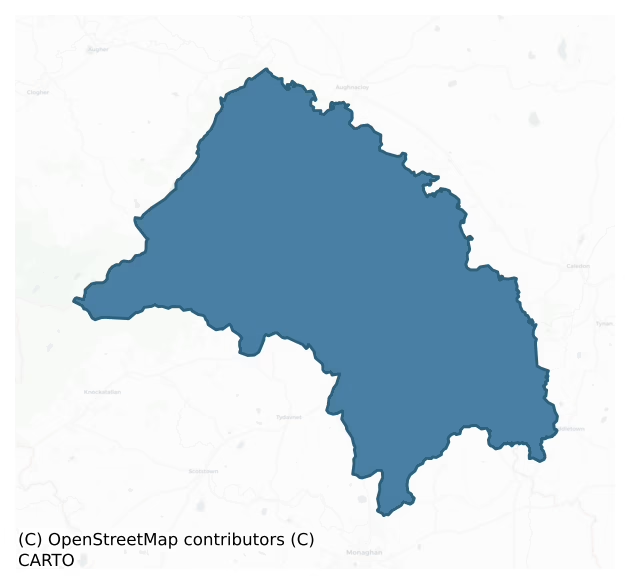
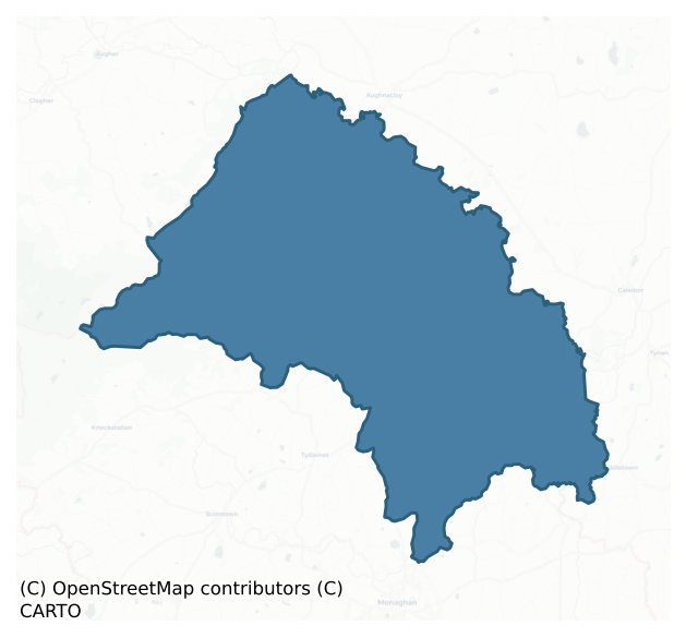
Trough is a barony of County Monaghan, in the historical province of Ulster (Irish: An Triúcha), covering 151 km² of land. The barony records 136 NMS archaeological sites and 146 NIAH listed buildings, placing it at around the 8th percentile among 280 ROI baronies for sites per km². This means it is in the bottom tenth of all baronies for sites per km². Dated archaeological evidence runs from the Early Bronze Age through to the Post Medieval, spanning 6 of 9 archaeological periods, placing the barony in the 9th percentile among 280 ROI baronies for chronological depth. This means it is in the bottom tenth of all baronies for chronological depth. The largest dated subset of recorded sites dates to the Early Medieval. Logainm flags 60 placenames in the barony as carrying a recognised heritage root; the largest share — around 57% — are names associated with early Christian church and monastic foundations.
Heritage at a glance
Percentile rankings throughout this profile compare each barony only against the other 279 Republic of Ireland baronies.
The recorded heritage of Trough
The National Monuments Service Sites and Monuments Record (SMR) is the statutory inventory of archaeological sites for the Republic of Ireland, maintained by the Department of Tourism, Culture, Arts, Gaeltacht, Sport and Media. Sites recorded here include earthworks, ringforts, megalithic tombs, ecclesiastical remains, and post-medieval features; not every record is legally protected, but each is registered as a monument of archaeological interest.
The National Monuments Service records 136 archaeological sites in Trough, putting it at the 8th percentile among 280 ROI baronies for sites per km². This means it is in the bottom tenth of all baronies for sites per km². A sparse recorded total of this kind in Ireland often reflects survey priority rather than genuine absence of past activity. Protection coverage is near-universal — 127 sites (93%) fall within a recorded monument protection zone, indicating an extensively surveyed landscape. The dominant category is defensive sites — ringforts, enclosures, hillforts, and stone forts (84 sites, 62% of the record). Ringfort – rath is the most prevalent type, making up 54% of the barony's recorded sites (73 records) — well above the ROI average of 20% across all baronies where this type occurs. Ringfort – rath is an earthen ringfort enclosed by a bank and external ditch — the most common Early Medieval farmstead, broadly dated 500–1000 AD. Other significant types include Enclosure (6) and Graveslab (5). Enclosure is a banked or ditched feature of uncertain type, used as a catch-all where the original function cannot be determined from surface evidence; Graveslab is a recumbent grave-marking slab, dated 1200–1700 AD. Across the barony's 151 km², this gives a recorded density of 0.90 sites per km².
Most common monument types
Hover or tap a monument type to see its definition.
| Type | Count |
|---|---|
| Ringfort – rath an earthen ringfort enclosed by a bank and external ditch — the most common Early Medieval farmstead, broadly dated 500–1000 AD | 73 |
| Enclosure a banked or ditched feature of uncertain type, used as a catch-all where the original function cannot be determined from surface evidence | 6 |
| Graveslab a recumbent grave-marking slab, dated 1200–1700 AD | 5 |
| Fulacht fia a horseshoe-shaped Bronze Age burnt mound built around a sunken trough beside a water source, traditionally interpreted as a cooking site | 5 |
| Crannog an artificial or partly artificial island built up on a lake or river bed, in use from the 6th to 17th centuries AD | 4 |
Chronological distribution
The dated archaeological record for Trough spans from the Early Bronze Age through to the Post Medieval, with activity attested across 6 of 9 archaeological periods. This is the 9th percentile across ROI baronies — a relatively narrow chronological band, with much of Irish prehistory not represented in the dated record. Every period from earliest to latest is represented in the record — an unbroken sequence of dated activity across the full chronological span. Activity concentrates most heavily in the Early Medieval (67 sites, 58% of dated material), with the Iron Age forming a secondary peak (36 sites, 31%). A further 21 recorded sites (15% of the overall NMS register for the barony) carry no period attribution — appearing as 'Unknown' in the bar chart below. This typically reflects either records that pre-date the standardised period vocabulary or sites awaiting specialist dating review, rather than a genuine absence of chronological evidence.
Sample of recorded monuments
Show 25 sample monuments (of 136 total)
A representative sample of 25 recorded monuments drawn from the barony’s 136 total NMS entries. Sites within a recorded monument protection zone and rarer site types are prioritised so the list shows a meaningful cross-section rather than only the most common type. Each entry shows the official Sites and Monuments Record reference number and the description published by the National Monuments Service.
Ritual site – holy/saint's stone
Situated in a low-lying area in the bend of a NW-SE stream or drain as it turns NE and c. 20m from the stream. This is a rock which according to local information is known as St. Patrick's stone. A natural mark on the…
Situated in a low-lying area in the bend of a NW-SE stream or drain as it turns NE and c. 20m from the stream. This is a rock which according to local information is known as St. Patrick's stone. A natural mark on the stone is said to be the imprint of the saint's foot.
Date of upload: 14 April 2011
Burial ground
Situated in a slight col. Described by Oliver Davies as a small square enclosure that was known locally as the graveyard field where bones had been found (ITA Survey 1940). There was no evidence of any structure and its…
Situated in a slight col. Described by Oliver Davies as a small square enclosure that was known locally as the graveyard field where bones had been found (ITA Survey 1940). There was no evidence of any structure and its precise location is not known. (Leslie 1929, 290)
The above description is derived from the published 'Archaeological Inventory of County Monaghan' (Dublin: Stationery Office, 1986). In certain instances the entries have been revised and updated in the light of recent research.
Date of upload: 17 July 2007
Ritual site – holy well
Situated at the base of a NE-facing rock-face (H c. 2m), which is on the SW bank of a small stream. The well is across the road to the NE of the graveyard (MO003-018003-) and is accessible by a path down from the road…
Situated at the base of a NE-facing rock-face (H c. 2m), which is on the SW bank of a small stream. The well is across the road to the NE of the graveyard (MO003-018003-) and is accessible by a path down from the road to a rock outcrop platform. The well (D 0.3m) is in a D-shaped recess (dims 0.8m WNW-ESE; 0.5m NNE-SSW; H 0.5m) and it overflows across the platform to the stream. There is no evidence of veneration now but in the folk memory there was a two day pattern held at the well around August 30 until the well was closed in 1836 (see this web-page accessed on 28/10/2016: http://www.duchas.ie/en/cbes/4742067/4732198
Compiled by: Michael Moore
Date of revised upload: 7 November, 2016
Ringfort – unclassified
Located on the S-facing slope W of a small NE-SW drumlin ridge. A circular earthwork is depicted on McCrea’s map of County Monaghan (1793) at Billis. A subrectangular field (dims c. 35m NW-SE; c. 30m NE-SW) defined by…
Located on the S-facing slope W of a small NE-SW drumlin ridge. A circular earthwork is depicted on McCrea’s map of County Monaghan (1793) at Billis. A subrectangular field (dims c. 35m NW-SE; c. 30m NE-SW) defined by curving field banks on all sides except NW-NE is depicted on the 1907 edition. These field banks are still extant.
The above description is derived from the published 'Archaeological Inventory of County Monaghan' (Dublin: Stationery Office, 1986). In certain instances the entries have been revised and updated in the light of recent research.
Date of revision: 29 August 2017
Burial mound
Situated on an E-facing slope. This feature is known locally as a 'Caldragh', which signifies a burial ground, or a 'Mound'. It is an oval grass-covered mound (dims 38.5m E-W; 28m N-S) with traces of bank around the…
Situated on an E-facing slope. This feature is known locally as a 'Caldragh', which signifies a burial ground, or a 'Mound'. It is an oval grass-covered mound (dims 38.5m E-W; 28m N-S) with traces of bank around the base. A rabbit burrow on the mound produced charcoal, thirty-six pieces of slag and part of possible crucible (Monaghan County Museum file).
The above description is derived from the published 'Archaeological Inventory of County Monaghan' (Dublin: Stationery Office, 1986). In certain instances the entries have been revised and updated in the light of recent research.
Date of revision: 29 August 2017
Cist
There is a local report of a cist containing a small pot that was uncovered during building operations in Emyvale during 1959 (Irish News 09/03/2015), but the pot was thrown away subsequently (Monaghan County Museum…
There is a local report of a cist containing a small pot that was uncovered during building operations in Emyvale during 1959 (Irish News 09/03/2015), but the pot was thrown away subsequently (Monaghan County Museum file). The location where the cist was found is not known precisely.
Updated by: Michael Moore
Revised date of upload: 29 August 2017
Armorial plaque
The Hamilton coat of arms and the date 1698 are carved on a plaque set on the outside wall of a farm building.
Date of upload: 14 April 2011
Designed landscape – tree-ring
Situated at the S end of a small N-S ridge, on the E-facing slope. It is in a loop of the SW-NE Blackwater River that curves around it from SW (c. 70m distant)-E-NE (c. 140m distant). This southern end of the townland…
Situated at the S end of a small N-S ridge, on the E-facing slope. It is in a loop of the SW-NE Blackwater River that curves around it from SW (c. 70m distant)-E-NE (c. 140m distant). This southern end of the townland probably was an island at one time with the river taking the direct route NW of the monument. A large oval wood is depicted as on the 1834 edition of the OS 6-inch map and it had become a field by the 1907 edition. This is an oval grass-covered area (dims c. 95m NE-SW; c. 70m NW-SE) defined by a field bank and hedge. It was probably a landscape feature created by the Bessmount estate, and Bessmount House is c. 700m to the SSE on the other side of the river. It is matched by the enclosure at Lisnanore (MO009-029—-) c. 700m to the E. Rath (MO009-027—-) is c. 50m to the NNW.
The above description is derived from the published 'Archaeological Inventory of County Monaghan' (Dublin: Stationery Office, 1986). In certain instances the entries have been revised and updated in the light of recent research.
Date of revision: 13 December 2017
Bastioned fort
After a rebellion the land of Brian Óg Mac Mahon, amounting to three Ballybetaghs or villages, was forfeited, and in 1609 it was granted to Sir Thomas Ridgeway as the manor of Upper Trough. This became the core of the…
After a rebellion the land of Brian Óg Mac Mahon, amounting to three Ballybetaghs or villages, was forfeited, and in 1609 it was granted to Sir Thomas Ridgeway as the manor of Upper Trough. This became the core of the Glaslough estate, consisting of almost all of Donagh parish, which was owned by the Countess of Carlisle in 1640, probably as mortgage security (Shirley 1879, 135). In 1661 John Leslie, who had been successively bishop of the Scottish Isles and Raphoe, was appointed Bishop of Clogher, and he had acquired Glaslough by 1665 (ibid. 140-5). The core of the estate has remained in the Leslie family down to the present.
Ridgeway was not remiss in developing his property. In 1611 it was reported by Lord Carew, a special Commissioner reporting on the Plantation of Ulster, that Sir Thomas had built a bastioned fort at Glaslough, within which was ‘a little English house’ (Hunter 1975, 81). Although Ridgeway’s plans might have been ambitious, it is a moot point as to how much was actually completed in 1611 rather than planned. The location was probably on the E-W ridge of Glaslough, but perhaps no more than the English house had been constructed. In 1720 it is recorded in a letter that ‘the brick house has fallen down’ and this may have been Ridgeway’s ‘English house’. It was replaced by a seven bay three storey and attic house in a Queen Anne style with the double bays at either end stepped slightly forward (Shirley 1879, 146). This is the house that is described as C…
Sheela-na-gig
There is a record of what might be a sheela-na-gig from Errigal Trough graveyard (MO003-01803-) that was moved to the Ulster Museum (ITA Survey 1943), but this cannot be confirmed (Freitag 2004).
Compiled by:…
There is a record of what might be a sheela-na-gig from Errigal Trough graveyard (MO003-01803-) that was moved to the Ulster Museum (ITA Survey 1943), but this cannot be confirmed (Freitag 2004).
Compiled by: Michael Moore
Date of revision: 7 November 2016
Cupmarked stone
Located c. 8m E of the burial enclosure on the site of the parish church of Donagh (MO007-007001-) is a stone (dims 0.51m x 0.13-0.16m; H 0.23-0.26m) set up as a headstone with a single cup-mark (diam. 0.1m; D 2.5cm) on…
Located c. 8m E of the burial enclosure on the site of the parish church of Donagh (MO007-007001-) is a stone (dims 0.51m x 0.13-0.16m; H 0.23-0.26m) set up as a headstone with a single cup-mark (diam. 0.1m; D 2.5cm) on its E face.
Compiled by: Michael Moore
See the attached image
Date of upload: 8 November, 2016
Inscribed stone
Placed high on the outer face of the S wall of the nave of Glaslough Church of Ireland church (MO007-014001-) is a stone with the date 1670 in false relief. It is accompanied by the statement ‘And Rebu / ilt in 1763’ on…
Placed high on the outer face of the S wall of the nave of Glaslough Church of Ireland church (MO007-014001-) is a stone with the date 1670 in false relief. It is accompanied by the statement ‘And Rebu / ilt in 1763’ on a separate stone produced in the same style.
See the attached image
Compiled by: Michael Moore
Date of upload: 09/11/2016
Font
Outside the doorway of the Church of Ireland church of St Salvator (MO007-017001-) is an eight-sided sandstone cylinder (dims 0.45m x 0.45m; H 0.43m) with a circular, flat-bottomed basin (diam. 0.3m; D 0.24m) that has…
Outside the doorway of the Church of Ireland church of St Salvator (MO007-017001-) is an eight-sided sandstone cylinder (dims 0.45m x 0.45m; H 0.43m) with a circular, flat-bottomed basin (diam. 0.3m; D 0.24m) that has is a drain-hole through a side-wall. Covering two of the facets is a raised inscription: I know that my Redeemer liveth.
See the attached image
Compiled by: Michael Moore
Date of upload; 9 November, 2016
Enclosure – large enclosure
Situated on a low hillock in a loop of the River Cor with the stream running W-E c. 160-180m to the S and turning N c. 125m from the monument at the closest point. A slightly raised and probably domed grass-covered area…
Situated on a low hillock in a loop of the River Cor with the stream running W-E c. 160-180m to the S and turning N c. 125m from the monument at the closest point. A slightly raised and probably domed grass-covered area (diam. c. 75m E-W; c. c. 65m N-S), perhaps with a fosse at the perimeter especially E-S-W is visible on Google Earth (07/02/2019). It is traversed by an E-W field bank with trees at the points where it crosses the perimeter. It may have been a tree-ring. It was first reported in 2018 by Susan Curran from a LiDAR image, and was also noted by Jean Charles Caillère.
Compiled by: Michael Moore
Date of upload: 11 March 2020
Amended: 13 May, 2020
Architectural fragment
Two corbels decorated with carved heads were moved from Errigal Trough graveyard (MO003-018003-) to Favor Royal, Co. Tyrone (ITA Survey 1943).
Compiled by: Michael Moore
Date of revision: 7 November, 2016
Architectural fragment
Two corbels decorated with carved heads were moved from Errigal Trough graveyard (MO003-018003-) to Favor Royal, Co. Tyrone (ITA Survey 1943).
Compiled by: Michael Moore
Date of revision: 7 November 2016
Headstone
Situated in the SE corner of Donagh graveyard (MO007-007004-) and just W of the graveslab of Philemy McKenna (MO007-007007-) is a cross-shaped headstone (H 0.8m; span 0.52m) with a rectangular cross-section (dims of…
Situated in the SE corner of Donagh graveyard (MO007-007004-) and just W of the graveslab of Philemy McKenna (MO007-007007-) is a cross-shaped headstone (H 0.8m; span 0.52m) with a rectangular cross-section (dims of base 0.21m x 0.13m) leaning to the E. The legend in false relief reads: 1666 / ART O / CONALLEN / HIS CROSS / AND B / VRIAL / PLACE (Shirley 1879, 295; McCarney 1957, 198)
Compiled by: Michael Moore
Date of revised upload: 8 November 2016
Headstone
Located outside the W wall of the tower of Glaslough Church of Ireland church of Salvator, this was found under a pew in the church in 1838. The headstone (dims 0.46m x 0.1-0.16m; H 0.76) has an incised inscription in…
Located outside the W wall of the tower of Glaslough Church of Ireland church of Salvator, this was found under a pew in the church in 1838. The headstone (dims 0.46m x 0.1-0.16m; H 0.76) has an incised inscription in roman capitals with dots between the words. It has been read (Shirley 1879, 297) as: HERE . LYETH / THE . BODY . / OF . JOHN . C / ONELL . W / HO . WAS . B / ORNE . THE . 4 / OF . MAY . / 1671 . / AND . DYED . / THE . 16 . OF . / MARCH . FOLLOWING. King (1895) reads the end of the inscription as: …AND . DYED . / THE . 16 . OF . / MARCH OF / 1710 WINO
Compiled by: Michael Moore
Date of upload: 9 November, 2016
Church
Situated on an E-W rise in a low-lying position, and in the loop of a small stream that runs W-E outside the graveyard at S and returns SE-NE on the NE side of a subrectangular graveyard (dims c. 80m N-S; c. 40-45m E-W)…
Situated on an E-W rise in a low-lying position, and in the loop of a small stream that runs W-E outside the graveyard at S and returns SE-NE on the NE side of a subrectangular graveyard (dims c. 80m N-S; c. 40-45m E-W) defined by masonry walls. The medieval parish church of Errigal Trough was dedicated to St Meallán, an associate of St Fursa, a seventh century county saint from Co. Down, However, little is known of Meallán except that his pattern is recorded as October 26 (Ó Riain 2011, 451-2). The names of some of the clergy are known from 1441 and in Spottiswold’s Visitation of 1622 the church is described as ruinous (Leslie 1929, 195-7). It was rebuilt and continued in use for Protestant worship until 1824 when the new Church of Ireland church of St Muadain was opened c. 150m to the SE (Shirley 1879, 290-3; McKenna 1920, 1, 207-35).
The remains of the medieval parish church consist of the W gable (L 8.3m; T 1.3m) with a central doorway (Wth 1.05m), but its round arch and the wall above it are rebuilt. The E gable (surviving L 7.85m; T 0.7m) has a large pointed opening (Wth 1.6m) but the dressed stones are robbed. The church has an external length of 22m. Most of the headstones in the graveyard, dating almost exclusively to the 18th century and dominated by those of McKenna, have been recorded (Taylor 1892-1900; Mulligan et al. 1987), while a more recent survey by Irish Graveyard Surveys is displayed at the entrance on the W side. The graveslab of Prior Tullius Ken…
House – 17th century
Situated on the E-facing slope of the spine of a NE-SW drumlin ridge. Oliver Anketill, a grandson of Christopher Anketill, of Shaftsbury, Dorsetshire, came to Ireland in the middle of the seventeenth century and began…
Situated on the E-facing slope of the spine of a NE-SW drumlin ridge. Oliver Anketill, a grandson of Christopher Anketill, of Shaftsbury, Dorsetshire, came to Ireland in the middle of the seventeenth century and began to acquire land in north Monaghan, probably through direct purchase or the purchase of the interests of Undertakers and soldiers. He died in 1666 and his memorial (MO009-060011-) is in Monaghan town. In 1667 3300 acres in seventy townlands in the barony of Errigal Trough were confirmed to his son, Mathew. Derrynashallog, which had been owned by a Gareth Rooney in 1640 became the centre of the estate known as Anketill’s Grave (Grove). Mathew died in 1688 and his memorial (MO007-014006-) is in Glaslough but his son Oliver, who was sheriff of Monaghan in 1710 and an MP for Monaghan town in 1759-60, is thought have built a house at Derrynashallog. Oliver died in 1760, and the house was pulled down in 1781 by his grandson Mathew when the family moved to a new Anketell Grove, in Gortmoney c. 1.5km to the S. (Shirley 1879, 154-60)
Taylor and Skinners’ map (1778) of the roads of Ireland (Andrews 1969, 267) depicts Anketill Grove as a ruin at Derrynashallog, although McCrea’s map of the Barony of Trough (1793) shows it as a roofed house. The 1834 edition of the OS 6-inch map does not indicate the location of the house, but it does portray a designed landscape at Derrynashallog with an avenue rising up the slope from the NE and the direction of Emy Lough. A geophysica…
Church
Located on top of a broad hill. The medieval parish church of Donagh is listed as Dunagh in the ecclesiastical taxation (1302-06) of Pope Nicholas IV (Shirley 1879, 289), and the names of some of the clergy are known…
Located on top of a broad hill. The medieval parish church of Donagh is listed as Dunagh in the ecclesiastical taxation (1302-06) of Pope Nicholas IV (Shirley 1879, 289), and the names of some of the clergy are known from 1451 (Leslie 1929, 293-300). It is sometimes confused (McKenna 1920, 267-80) with the church of Domhnach maighe dá Chlaoine – the church between the bogs – at Donagh, Co. Fermanagh (Ó Maolagain and Ó Gallachobhair 1955 141). The church of was described as ruinous in 1622 but by the end of the century the parochial centre for Protestant worship had been moved to Glaslough (MO007-014001-), c. 2km to the ENE.
There is no evidence of the medieval church although it is probably partly incorporated in the walls of the double mortuary enclosure (ext. dims 13.7m E-W; 7.55m N0S) of the Johnston family that has masonry walls (Wth 0.6-0.7m; max. H 2.8m). There are entrances to both chambers in the N wall, and there is an inscribed stone (Wth 0.6m; H 0.33m) dated 176? on the outside of the W wall. The earliest graveslab within is the central of five against the W wall of the W chamber commemorating Baptist Johnston dated 1710.
In 1939 the presence of a possible broken out window in the E wall and another towards the E end of the S wall was noted. A cut stone fragment from a doorway together with a stone mullion (H 1.14m) from a glazed window were also recorded (Paterson et al. 1939, 26). The doorway arch (dims 0.91m x 0.26m x 0.2m) along with a stone corbel (dims…
Church
Situated on a shelf of an E-facing overlooking Glaslough Lake, which is c. 70m to the E. The medieval parish church of Donagh (MO007-007001-) was derelict by 1622 (Leslie 1929, 170-2) but by 1670 the parish centre for…
Situated on a shelf of an E-facing overlooking Glaslough Lake, which is c. 70m to the E. The medieval parish church of Donagh (MO007-007001-) was derelict by 1622 (Leslie 1929, 170-2) but by 1670 the parish centre for Protestant worship had been moved to Glaslough, c. 2km to the ENE where the church of St Salvator (Saviour) was built. This was rebuilt in 1763, and the four bay nave with bluntly pointed windows which survives today is from this building. A chancel in a gothic style was added in 1874 over the Leslie vault (Shirley 1879, 296). The church is within a subrectangular graveyard (dims c. 40m WNW-ESE; c. 40m NNE-SSW) that was enclosed with a wall in 1742. All the headstones have been recorded (McMahon and Cowan 1978), including that of John Connell dated 1671 outside the W wall of the church tower.
A datestone with 1670 carved in false relief is placed high on the S wall of the nave accompanied by the statement ‘And Rebu / ilt in 1763’ on a separate stone produced in the same style. Only the tower (ext. dims 6.25m N-S; c. 6.25m E-W) built with small stones in contrast to the quarried stone of the nave dates from the seventeenth century. The tower, supported by buttresses, is at the W end of the church and has five stages, but the topmost is probably not original. The pointed doorway at the ground floor on the S is also probably not original. There is a large round-headed window, now filled with three-light wooden tracery on the W wall of the first floor, and ther…
House – 17th century
Situated in a slight N-S valley with drumlins rising to the E and W. According to Shirley (1879, 160-1) Robert Maxwell, who had been chaplain to Henry Carew, first Viscount Faulkland and Lord Deputy of Ireland 1622-29…
Situated in a slight N-S valley with drumlins rising to the E and W. According to Shirley (1879, 160-1) Robert Maxwell, who had been chaplain to Henry Carew, first Viscount Faulkland and Lord Deputy of Ireland 1622-29 was the ancestor of Maxwell families at College Hall and Fellows Hall in Tynan parish, Co. Armagh and at Falkland in Donagh parish, Co. Monaghan. The land at Falkland, which had been called Drumnaghmore, was acquired under lease from the Glaslough estate early in the reign of Charles II and was bought back by Glaslough in 1871. William Maxwell, High Sherriff of Monaghan, was murdered by one of his own followers at Faulkland in 1691. The house was probably built in the late seventeenth century, but it seems to have been abandoned after 1780 when the Maxwells moved to Bath. It is depicted as a house owned by R. D. Maxwell on the 1783 Taylor and Skinner map of the Roads of Ireland (Andrews 1969, 267) and some walls of the house still survive.
A stone head (MO009-077—-) attached to the external front wall of a derelict farmhouse on the E side of Monaghan town is believed to have originated here (pers. comm. Shirley Clerkin, Monaghan Heritage Officer).
Date of revision: 14 December 2017
Graveyard
Situated on an E-W rise in a low-lying position, and in the loop of a small stream that runs W-E outside the graveyard at S and returns SE-NE on the NE side of the subrectangular graveyard (dims c. 80m N-S; c. 40-45m…
Situated on an E-W rise in a low-lying position, and in the loop of a small stream that runs W-E outside the graveyard at S and returns SE-NE on the NE side of the subrectangular graveyard (dims c. 80m N-S; c. 40-45m E-W) defined by masonry walls. The parish church of Errigal Trough (MO003-018002-) is within the graveyard. Most of the headstones, dating almost exclusively to the 18th century and dominated by those of McKenna, have been recorded (Taylor 1892-1900; Mulligan et al. 1987), while a more recent survey by Irish Graveyard Surveys is displayed at the entrance on the W side. Two corbels with carved heads from the graveyard were moved to Favor Royal, Co. Tyrone (ITA 1943), but the graveslab of Prior Tullius Kena (MO003-018007-) dated 1698 is no longer visible in the graveyard.
Compiled by: Michael Moore
Date of revision: 7 November, 2016
Ringfort – rath
Situated at the crest of an E-facing slope of a N-S drumlin ridge, with higher ground c. 250m to the NW and c. 150m to the SW. It is depicted as a circular enclosure (diam. c. 30m) described as a ‘fort’ in gothic…
Situated at the crest of an E-facing slope of a N-S drumlin ridge, with higher ground c. 250m to the NW and c. 150m to the SW. It is depicted as a circular enclosure (diam. c. 30m) described as a ‘fort’ in gothic lettering on the 1834 edition of the OS 6-inch map, and as a hachured enclosure on the 1907 edition. It was described in 1967 as an oval grass-covered area (dims 39m NE-SW; 26m NW-SE) defined by a scarp (at SW: Wth 3.7m; H 0.7m: at NW: Wth 6m; H 1.8m), with a fosse (Wth of top 7m; Wth of base 1.7m; ext. D 0.3m) across the ridge S-W. The original entrance was not identified. It appears to have been removed or eroded away before 1995 (OSAP).
The above description is derived from the published 'Archaeological Inventory of County Monaghan' (Dublin: Stationery Office, 1986). In certain instances the entries have been revised and updated in the light of recent research.
Date of revision: 29 August 2017
Listed buildings
The National Inventory of Architectural Heritage (NIAH) is a state survey appraising buildings of architectural, historical, archaeological, artistic, cultural, scientific, social, or technical interest. Each surveyed structure receives a rating from International (the highest, for buildings of European importance) through National, Regional, Local, and Record-Only.
The NIAH records 146 listed buildings in Trough (67th percentile across ROI baronies). The highest-graded structure include 1 of National significance. The Republic holds 937 National-graded buildings in total, so this barony accounts for around 0% of the national total. Construction dates concentrate most heavily in the Victorian (1830-1900) period.
Terrain and environment
Mean elevation across the barony is 92m — the 53rd percentile among 280 ROI baronies for elevation. This means it is in the upper half of all baronies for elevation. Elevation matters for heritage because higher-altitude baronies typically favour defensive monuments — ringforts and hilltop forts placed on prominent ground — while lowland baronies are more likely to carry the dense settlement and church networks of intensive agricultural landscapes. The barony reaches 350m at its highest point — a vertical span of more than 257m within its boundary, indicating significant topographic diversity. Mean slope is 5.7° — the 80th percentile among 280 ROI baronies for slope. This means it is in the top fifth of all baronies for slope. This is consistently steep terrain by ROI standards, the kind of landscape that tends to preserve upstanding archaeological features well. Slope is a key control on both land use and archaeological preservation: steep ground resists ploughing and tends to preserve earthworks intact, while gentle slopes favour intensive cultivation that damages or destroys surface archaeology over time. The Topographic Wetness Index averages 9.8, the 16th percentile among 280 ROI baronies for wetness. This means it is in the bottom fifth of all baronies for wetness. This is well-drained ground by ROI standards — typical of upland or steeply-sloping country that sheds water rapidly. Drainage matters for heritage because poorly-drained ground preserves organic archaeology (wooden trackways, leather, textiles, and on rare occasions human remains) far better than free-draining soil; well-drained ground favours arable use but destroys organic material rapidly. The land cover is dominated by improved grassland (76%) and woodland (21%). In overall character, this is steeply-sloping terrain at modest elevation, with land use dominated by improved grassland.
Terrain measurements
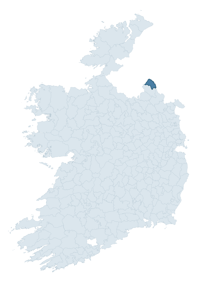
Where this barony sits in the Republic of Ireland
Geology and preservation
Bedrock geology shapes the landscape long before any settlement begins — controlling soil drainage, agricultural potential, the survival of upstanding monuments, and the preservation of buried archaeology. The figures below come from the Geological Survey Ireland 1:100,000 bedrock map.
The bedrock underlying Trough is predominantly limestone (75% of the barony by area), laid down during the Carboniferous period (100% by area, around 359 to 299 million years ago). Limestone is the most heritage-rich bedrock in Ireland. It supports fertile, well-drained soils that favoured dense Early Medieval settlement and Norman manorial agriculture, and it weathers into karst features — sinkholes, caves, swallow holes, and souterrains — that frequently carry archaeology. Where peat overlies limestone, organic preservation can be exceptional. A substantial secondary geology of shale (16%) adds further variety to the underlying landscape. The single largest mapped unit is the Maydown Limestone Formation (67% of the barony's bedrock).
Rock type composition
Largest mapped unit: Maydown Limestone Formation (67% of the barony)
Placename evidence
Logainm records 60 heritage-diagnostic placenames for Trough, drawn from townland and civil-parish names across the barony. The dominant stratum is Early Christian ecclesiastical — cill-, teampall-, and domhnach-prefixed names that record the dense network of early church foundations established between the fifth and tenth centuries. The leading diagnostic roots are cill- (30 — church), lios- (9 — ringfort or enclosure), and ráth- (6 — earthen ringfort). This is above the ROI average of 30.7 heritage placenames per barony. The presence of multiple heritage strata side by side indicates layered occupation of the landscape across successive prehistoric and historic periods. Logainm records 270 placenames for Trough (predominantly townland names). Of these, 60 (22%) carry one of the diagnostic Gaelic roots tracked above; the remainder draw on more generic landscape vocabulary that does not encode a heritage period.
Pre-Christian / Early Medieval Defensive
| Root | Count | Meaning |
|---|---|---|
| lios- | 9 | ringfort or enclosure |
| ráth- | 6 | earthen ringfort |
| dún- | 4 | hilltop or promontory fort |
Early Christian Ecclesiastical
| Root | Count | Meaning |
|---|---|---|
| cill- | 30 | church (early) |
| domhnach- | 3 | pre-Patrician or earliest Patrician church |
| díseart- | 1 | hermitage |
Burial, Ritual, and Norse-Contact
| Root | Count | Meaning |
|---|---|---|
| leacht- | 4 | grave monument |
| carn- | 3 | cairn |
Other baronies in Monaghan
- Farney
- Cremorne
- Dartree
- Monaghan
- Tirhugh — Donegal
- Clanmahon — Cavan
- Clankee — Cavan
- Inishowen West — Donegal
- Cremorne
- Inishowen East — Donegal
See all 280 baronies in the Republic of Ireland Heritage Tool.

Explore further
Grounding History: 10 Maps of Northern Ireland’s Past
If you’re interested in Irish heritage more widely, the companion report for Northern Ireland brings together the analysis of all 462 NI wards into one place through 10 high-quality maps — covering monument density, archaeological periods, placename heritage, terrain, wetland, and the historic landscape at first survey. Take a look.
About this profile
Click any section below to expand.
What is a barony?
A barony is a historic administrative unit in Ireland, broadly equivalent to an English hundred. The 280 baronies used here are from the OSi 2019 National Statutory Boundaries (generalised 20m), covering the 26 counties of the Republic of Ireland. Baronies derive from the Norman period, were formalised in the 17th century, and have not been redrawn for statistical purposes. They vary enormously in area, from compact urban baronies in Dublin to vast upland baronies in Connacht, and should not be compared by raw site count without accounting for area differences.
What counts as a site?
This profile combines three distinct heritage registers, each with its own definition of what constitutes a recordable site:
- Archaeological sites (NMS). The National Monuments Service Sites and Monuments Record (SMR) catalogues every known archaeological monument or site of archaeological interest in the Republic, from prehistoric burial mounds and ringforts to medieval churches and post-medieval defensive works. Inclusion does not require legal protection — only that the site has been identified, surveyed, and assessed as having archaeological value. A separate subset of these sites lies within a recorded protection zone, which gives them statutory protection under the National Monuments Acts.
- Listed buildings (NIAH). The National Inventory of Architectural Heritage records buildings of architectural, historical, archaeological, artistic, cultural, scientific, social, or technical interest. Each surveyed structure is appraised on a five-tier scale: International, National, Regional, Local, and Record-Only. The NIAH appraisal is informational rather than strictly statutory, but it underpins local-authority Record of Protected Structures (RPS) listings.
- Heritage placenames (Logainm). Logainm is the authoritative database of Irish placenames maintained by the Placenames Branch. This profile applies a heritage-diagnostic classifier to the Irish-language form of each townland name, flagging roots that signal defensive sites (ráth-, lios-, dún-, caiseal-, cathair-), ecclesiastical foundations (cill-, teampall-, domhnach-, mainistir-), prehistoric burial-ritual features (tuaim-, carn-, leaba-), or Norse-contact settlement (gall-). Townlands without one of these diagnostic roots are not flagged here — they may still carry historical significance, but that significance is not encoded in the name itself.
Editorial principles
The narrative sections of this profile follow several explicit principles:
- Evidential. Every claim about this barony’s heritage character is anchored in the underlying register data. Where a site count, a placename count, or a percentile rank is cited, it is computed from the source datasets at export time, not estimated.
- Comparative. Counts and metrics are reported alongside their percentile rank against the other 279 ROI baronies. A barony with 50 ringforts in absolute terms could be unusually high or unusually low depending on its size and regional context; percentile ranking removes that ambiguity.
- Transparent on limits. Where a register has known coverage gaps, survey biases, or data-quality issues that affect this barony’s figures, the profile flags them rather than presenting the numbers as definitive.
- No interpretation beyond what the data supports. The narrative does not speculate about historical events, social dynamics, or cultural meaning beyond what the recorded heritage and placename evidence directly attests.
Data caveats and limits
- NMS Sites and Monuments Record is the product of survey campaigns conducted at different intensities across different counties and decades. Some baronies have been surveyed more thoroughly than others, and absolute counts should be read in that light. Sites destroyed by development before survey are typically not represented; sites in heavily forested or upland terrain are sometimes under-recorded.
- NIAH coverage is broadly complete for the Republic of Ireland but the survey was conducted on a rolling county-by-county basis, and the most recent appraisal date varies. Buildings demolished or substantially altered after their original survey may still appear in the register; conversely, recent buildings of merit may not yet have been appraised.
- Logainm classification applies a deliberately conservative pattern-matching approach to the Irish-language townland forms. The classifier prioritises true positives over recall: a townland may carry a heritage signal that the classifier doesn’t recognise, particularly where the diagnostic root has been heavily anglicised or where the townland name draws on a less common term. The 60,000+ townland records and ~9,800 classified placenames give a substantial signal at barony scale, but individual townland names should be checked against Logainm directly for definitive interpretation.
- Period attribution. The chronological distribution reflects only those NMS sites that carry a recognised period attribution in the source data. Sites listed as “Unknown” period are excluded from the dated subset.
- Boundary changes. Some baronies have undergone minor boundary adjustments since their 19th-century definition; the OSi 2019 generalised boundaries used here are the current statutory definition and may differ slightly from historical maps in border areas.
- Bedrock geology is mapped at 1:100,000 scale, which means local variation within a barony — small pockets of different rock type, mineral veins, alluvium overlying bedrock — is generalised. The dominant-system and rocktype figures are area-weighted, so a barony reading “70% Carboniferous limestone” may still contain small but archaeologically important pockets of older or younger rock. Around 3% of GSI polygons do not match the lexicon and contribute no rocktype or system attribution.
Data sources
- National Monuments Service — Sites and Monuments Record (SMR) https://data.gov.ie/dataset/national-monuments-service-archaeological-survey-of-ireland
- National Inventory of Architectural Heritage (NIAH) https://data.gov.ie/dataset/national-inventory-of-architectural-heritage-niah-national-dataset
- Logainm — Placenames Database of Ireland https://www.logainm.ie/
- Ordnance Survey Ireland — National Statutory Barony Boundaries 2019 https://data-osi.opendata.arcgis.com/
- EURODEM — European Digital Elevation Model https://www.mapsforeurope.org/datasets/euro-dem
- ESA WorldCover https://esa-worldcover.org/en
- Geological Survey Ireland — 1:100,000 Bedrock Geology https://www.gsi.ie/en-ie/data-and-maps/Pages/Bedrock.aspx
Explore more: Search any of the 280 ROI baronies, browse by historical province, or read the methodology and data sources for the full Republic of Ireland Heritage Tool.