KILLINCHY covers 226.4 km² in Northern Ireland. With 272 historic sites and 15 scheduled monuments on record, the ward sits at the 98th percentile across all 462 NI wards for combined archaeological heritage. It also records 104 listed buildings (HED Historic Buildings Record), the 93rd percentile for listed-building density across NI wards. Per 1,000 residents, this works out at 106.1 recorded sites — the 99th percentile across NI wards (a measure of heritage density relative to current population). Dated archaeological evidence runs from the Mesolithic through to the Modern period, spanning 7 archaeological periods, placing the ward in the 79th percentile NI-wide for chronological depth.
Heritage at a glance
Percentile rankings throughout this profile compare each ward only against the other 461 Northern Ireland wards.
Population context
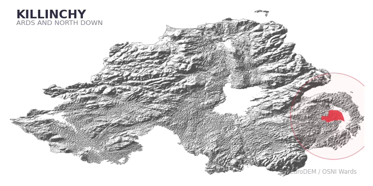
The recorded heritage of KILLINCHY
Of the 272 historic sites recorded, the most common are Cleared Slipway (19, 7% of historic sites), Ford (17), and Intertidal Wall (16). For Cleared Slipways, this is the 80th percentile across NI wards that record this type. For Fords, this is the 0th percentile across NI wards that record this type. Across the ward's 226.4 km², this gives a recorded density of 1.73 sites per km² (all heritage types combined). Scheduled monuments are distributed across approximately 0.06° of latitude and 0.11° of longitude within the ward, indicating dispersed rather than clustered placement.
Most common monument types
| Type | Count | Description |
|---|---|---|
| Cleared Slipway | 19 | — |
| Ford | 17 | — |
| Intertidal Wall | 16 | — |
Chronological distribution
Note: 19% of historic site records carry an ‘Unknown’ period attribution. The chronological breakdown above reflects only the dated subset.
Terrain and environment
A mean elevation of 20m places this ward among the lowest-lying in NI (11th percentile), reaching 81m at the highest point. The terrain is broadly flat, with a mean slope of 2.9° (15th percentile across NI). Drainage is poor across much of the ward — the Topographic Wetness Index of 11.7 sits in the 96th NI percentile, reflecting low-lying or impeded-drainage ground prone to waterlogging. The land-cover mosaic combines improved grassland (42%), open water (41%), and woodland (8%), giving a mixed agricultural and semi-natural landscape. In overall character, this is low-lying, gently-sloping terrain — characteristic of NI's lowland basins and coastal plains, with land use dominated by improved grassland.
Terrain measurements
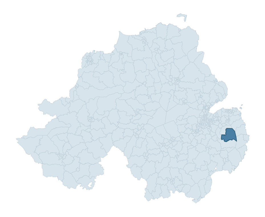
Where this ward sits in NI
Geology and preservation
The dominant bedrock formed during the Palaeozoic era (Silurian period). Ancient sedimentary or metamorphic rock dating to before the age of dinosaurs; the resulting landscape has been long-stable enough to host every period of human activity. Bedrock composition is uniform (complexity index 0.19), with a single dominant geological unit underlying most of the ward. A uniform geology narrows the natural lithic-resource base available to past inhabitants.
Placename evidence
The combined OSNI, Logainm NI, and GeoNames sources record 51 placenames for this ward. Diagnostic heritage strata identified within these are: 3 pre-Christian defensive (rath-, dún-, lios-, caiseal-), 7 ecclesiastical (cill-, teampall-, mainistir-, díseart-), and 2 Norse coastal (fjord-derived names, Viking-age trading sites). Note: Irish-language (name_ga) forms are recorded for roughly half of NI placenames in the combined sources, so anglicised forms whose Irish original could belong to multiple categories may be misclassified.
Placename categories
Scheduled monuments in KILLINCHY
Scheduled monuments are sites legally protected under the Historic Monuments and Archaeological Objects (Northern Ireland) Order 1995, designated by the Historic Environment Division (HED).
| Monument | Type | Period |
|---|---|---|
| Tide Mill | Tide Mill | Unknown |
| Harbour | Harbour | Unknown |
| Oyster Midden | Oyster Midden | Unknown |
| Raised Rath | Raised Rath | Early Medieval |
| Raised rath or motte: Curly's Fort | Raised Rath Or Motte: Curly'S Fort | Early Medieval |
| Tower-house and bawn: Mahee Castle (area adjacent to the state care monument) | Tower-House And Bawn: Mahee Castle (Area Adjacent To The State Care Monument) | Post-Medieval |
| Nendrum monastic site (area surrounding the state care monument) | Nendrum Monastic Site (Area Surrounding The State Care Monument) | Early Medieval |
| Stone Fishtrap | Stone Fishtrap | Unknown |
Recorded historic sites
| Name | Period | Type |
|---|---|---|
| 2 PORTIONS OF QUAY WORKS AND SLIPWAY | Unknown | Industrial |
| A.P. FEATURE | Unknown | Unknown |
| A.P. FEATURE | Unknown | Unknown |
| A.P. FEATURE | Unknown | Unknown |
| A.P. SITE | Unknown | Unknown |
| A.P. SITE | Unknown | Unknown |
| A.P. SITE | Unknown | Unknown |
| A.P. SITE | Unknown | Unknown |
| A.P. SITE – rath? | Early Medieval | Defence |
| A.P. SITE LINEAR CLEARANCE | Unknown | Unknown |
Listed buildings in KILLINCHY
| Address / Name | Grade | Period |
|---|---|---|
| 135 Whiterock Bay Killinakin Killinchy village Newtownards Co Down BT23 6QA | B2 | 1920 – 1939 |
| Castle Espie House, 72 Ballydrain Road, Castle Espie, Comber, Co. Down BT23 5ST | B1 | 1860 – 1879 |
| Drumreagh Bridge, Moss Road, Drumreagh, Ballygowan, Newtownards Co. Down BT23 6LE | B2 | 1800 – 1819 |
| Killinchy C of I Parish Church Church Hill Killinchy Newtownards Co Down BT23 6PP | B2 | 1820 – 1839 |
| Ard View 31 Ardview Road Killinchy [near Killinchy village] Newtownards Co Down BT23 6TG | B+ | 1720 – 1739 |
| Dry Closet Ard View 31 Ardview Road Killinchy Newtownards Co Down BT23 6TG | B2 | 1720 – 1739 |
| Hill Farm 29 Whiterock Road Killinchy Newtownards Co Down BT23 6PT | B2 | 1840 – 1859 |
| Ashville 49 Killyleagh Road Carrigullian Killinchy Co Down BT23 6TD | B1 | 1840 – 1859 |
| Holly Park 37 Holly Park Road Ballymacreelly Killinchy Newtownards Co Down BT23 6SN | B1 | 1780 – 1799 |
| Dry Closet, Holly Park 37 Holly Park Road Ballymacreelly Killinchy Newtownards Co Down BT23 6SN | B2 | 1820 – 1839 |
Discover more in Ards and North Down
- Clandeboye
- Holywood
- Warren
- Ballyholme
- Cultra
- Donaghadee
- Scrabo
- Kells — Mid and East Antrim
- Knock — Belfast
- Killyclogher — Fermanagh and Omagh
See all 462 wards in the Northern Ireland Heritage Tool.

Want a deeper view?
Grounding History: 10 Maps of Northern Ireland’s Past
A spatial history report bringing together analysis of all 462 wards into one place through 10 high-quality maps — covering monument density, archaeological periods, placename heritage, terrain, wetland, and the historic landscape at first survey.
About this profile
What is a ward?
A ward is the smallest electoral and statistical geography used by the Northern Ireland Statistics and Research Agency (NISRA). The boundaries used here are the 2014 NISRA / OSNI Wards (462 across Northern Ireland), each typically covering 1-700 km² and a population of a few thousand. Wards do not align with parishes, townlands, or any historic administrative unit — they are a modern statistical convenience, used here only as a fixed spatial frame within which to summarise heritage records.
What counts as a site?
Three distinct heritage record types are reported separately, not combined: (1) Historic Sites — entries in the Northern Ireland Sites and Monuments Record (NISMR), the inventory of recorded archaeological sites and findspots, dated from prehistoric to early-modern; (2) Scheduled Monuments — sites legally protected under the Historic Monuments and Archaeological Objects (NI) Order 1995 and maintained by the Historic Environment Division (HED); (3) Listed Buildings — buildings of architectural or historic interest protected under the Planning Act (NI) 2011 and graded A, B+, B1, B2, or Record-Only by HED. A site appearing in more than one register is counted in each register independently.
Editorial principles
These ward profiles describe evidence, not history. They report what is recorded, not what occurred. Where the data is ambiguous, we say so. We do not infer historical processes — population movements, settlement expansion, periods of decline — from patterns in the record. Absence of evidence is not evidence of absence: in Northern Ireland, where antiquarian survey was uneven and modern excavation is geographically biased, a gap in the record almost always reflects the limits of recording rather than a genuine historical absence. We mark such gaps explicitly where they appear in the data.
Limits of coverage and known caveats
Several caveats apply to every ward profile: (1) NISMR coverage is uneven across NI — some areas (notably parts of the south-east and the Belfast urban fringe) have been more intensively surveyed than others, so a low recorded site count does not reliably indicate a low past density of activity; (2) period attributions in NISMR are often 'Unknown', and chronological breakdowns reported here reflect only the dated subset; (3) placename classification depends on the Irish-language form (name_ga), which is recorded for approximately 50% of NI placenames in the combined sources, so ecclesiastical and pre-Christian counts may be understated where anglicised forms remain unparsed; (4) terrain percentile ranks compare each ward only to the other 461 NI wards; they are not absolute thresholds. For absence-dominant land cover categories (wetland, water, cropland), percentile ranks are suppressed below 1% raw value, since the ranking of zero-value wards is not meaningful.
Data sources (11)
- Northern Ireland Sites and Monuments Record (NISMR) https://www.communities-ni.gov.uk/articles/nismr-public-mapviewer
- HED Scheduled Monuments Dataset https://www.opendatani.gov.uk/@historic-environment-division/scheduled-monuments-northern-ireland
- HED Historic Buildings Record https://www.communities-ni.gov.uk/topics/historic-environment/listed-buildings
- OSNI OS Open Names (Northern Ireland) https://www.opendatani.gov.uk/@ordnance-survey-of-northern-ireland/osni-open-data—50k-gazetteer
- Logainm — Placenames Database of Ireland https://www.logainm.ie/
- GeoNames https://www.geonames.org/
- Census 2021 (Northern Ireland) https://www.nisra.gov.uk/statistics/2021-census
- OSNI Open Data — Largescale Boundaries https://www.opendatani.gov.uk/@ordnance-survey-of-northern-ireland/osni-open-data-largescale-boundaries-wards-2012
- Copernicus GLO-30 DEM https://spacedata.copernicus.eu/collections/copernicus-digital-elevation-model
- ESA WorldCover https://esa-worldcover.org/
- GSNI 1:250,000 Geology https://www.bgs.ac.uk/geological-data/maps/