As I have developed this blog and write about the various ancient sites around Ireland, I have naturally developed a series of maps. These cover various different formats ranging from historical fantasy reconstructions, to data visualisations, and bespoke historical graphics of ancient Ireland. All images are subject to copyright. You may share these images for non-commercial use with attribution. For commercial use, please contact me.
For anyone interested in purchasing high definition versions of these maps please check out my page on Etsy where I’m slowly adding these maps to my profile: https://www.etsy.com/shop/MappingIreland
Interactive Maps of Historical Sites in Ireland
I’ve created a series of interactive maps which each show the distribution and background on historical sites across the whole of Ireland. Each is embedded within individual posts which provide analysis and background on the specific topic. See the links below for each one:
As a data scientist by trade, I cannot help but apply some of that knowledge here to my love for ancient Irish history. Thankfully there are many online, freely available datasets which have been produced in Northern Ireland and the Republic. These extensively map historical monuments ranging from megalithic tombs, to castles and stone circles. Below are the links to these sources:
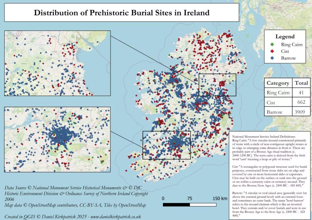
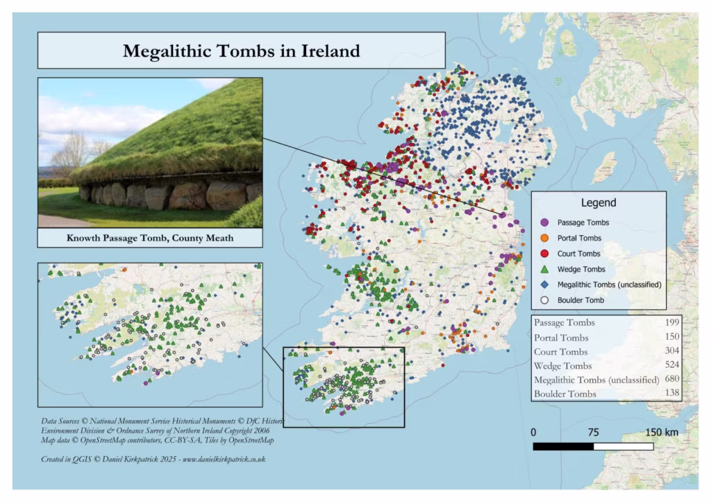
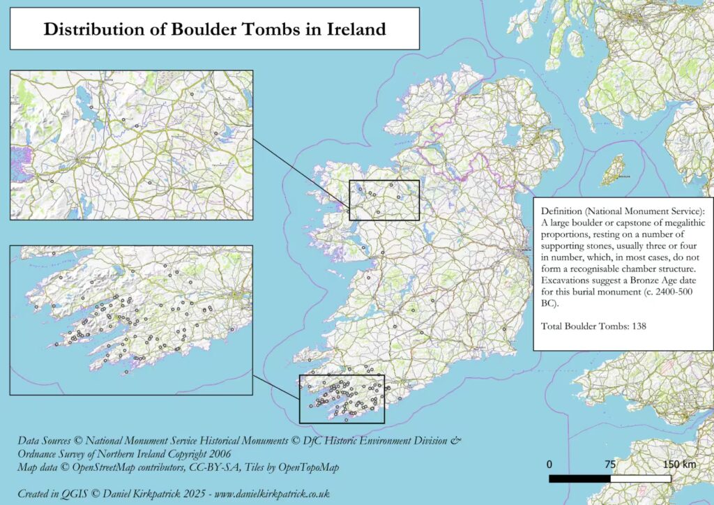
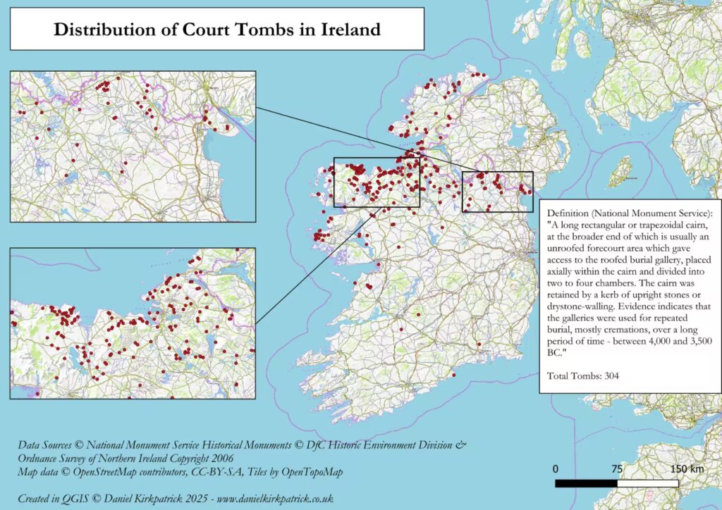
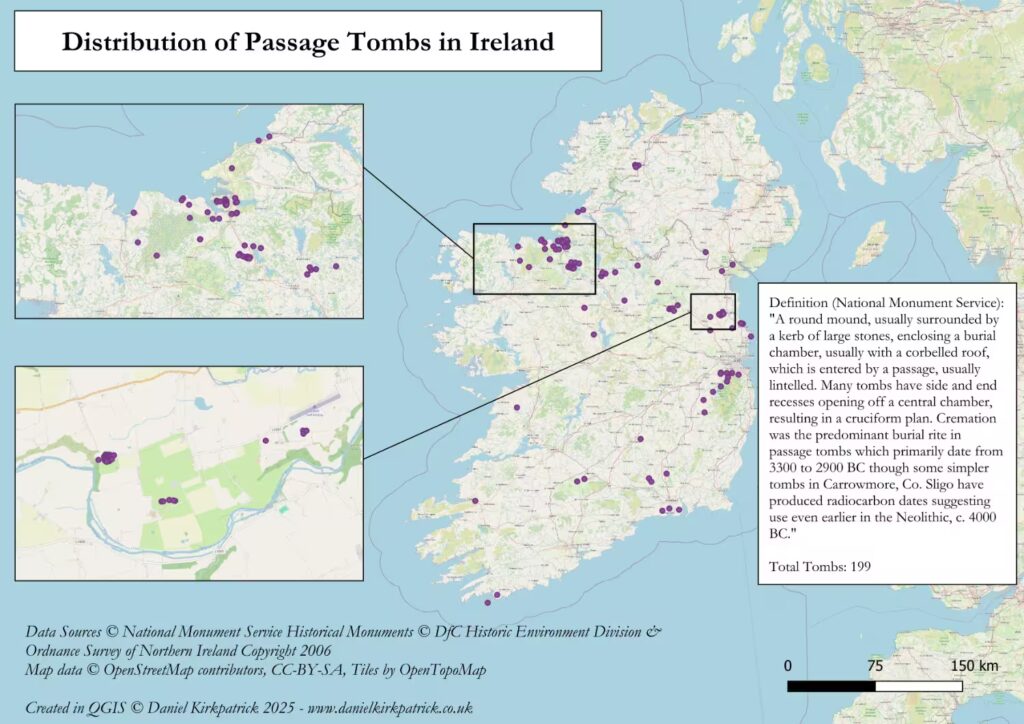
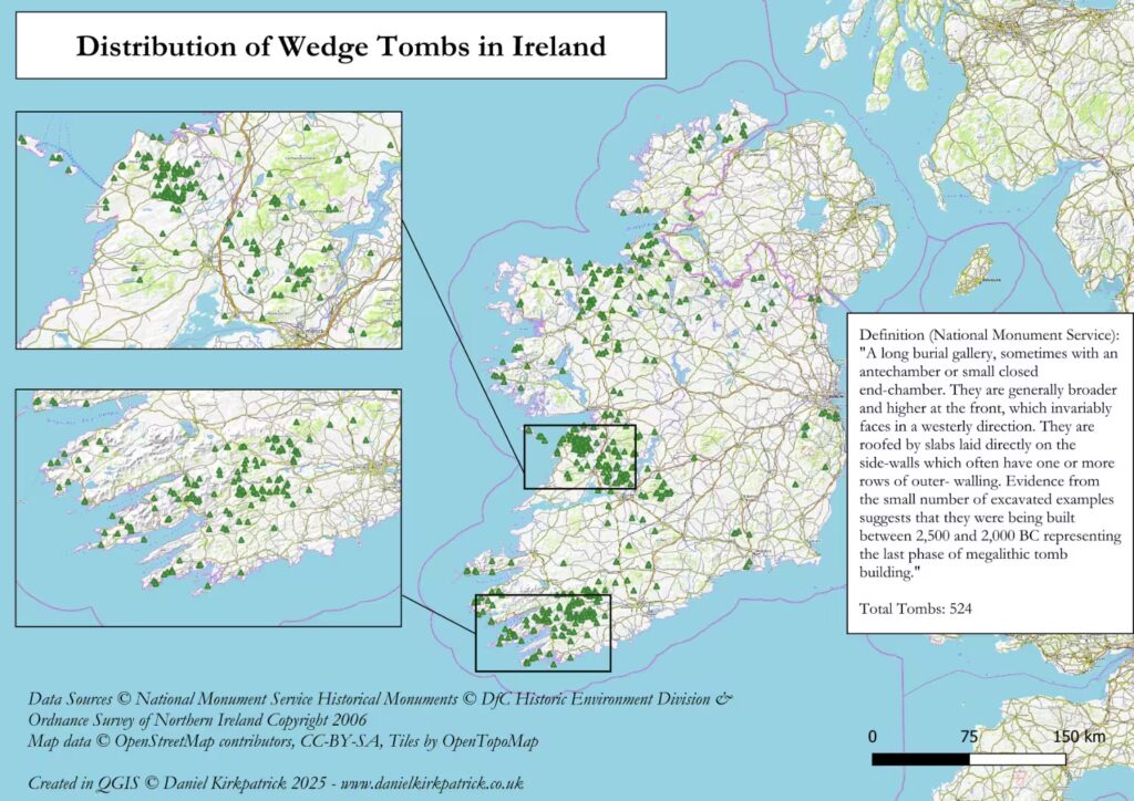
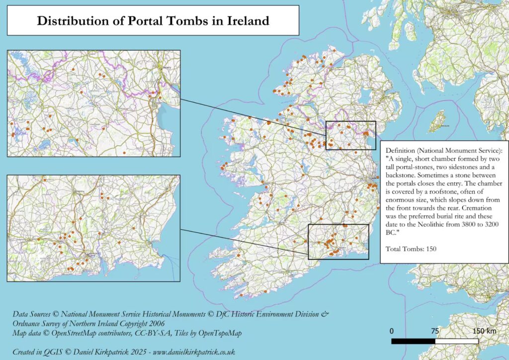
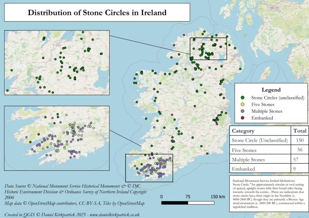
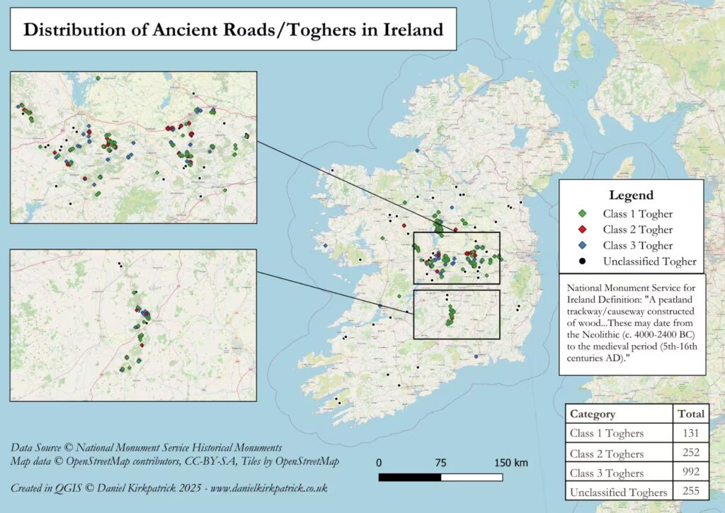
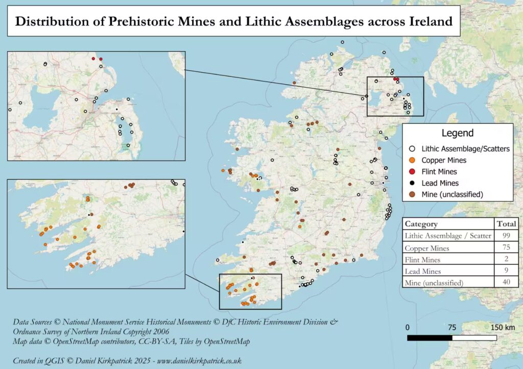
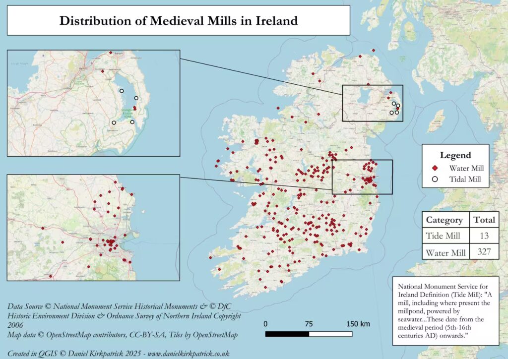
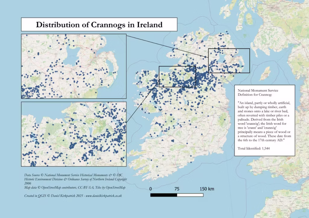
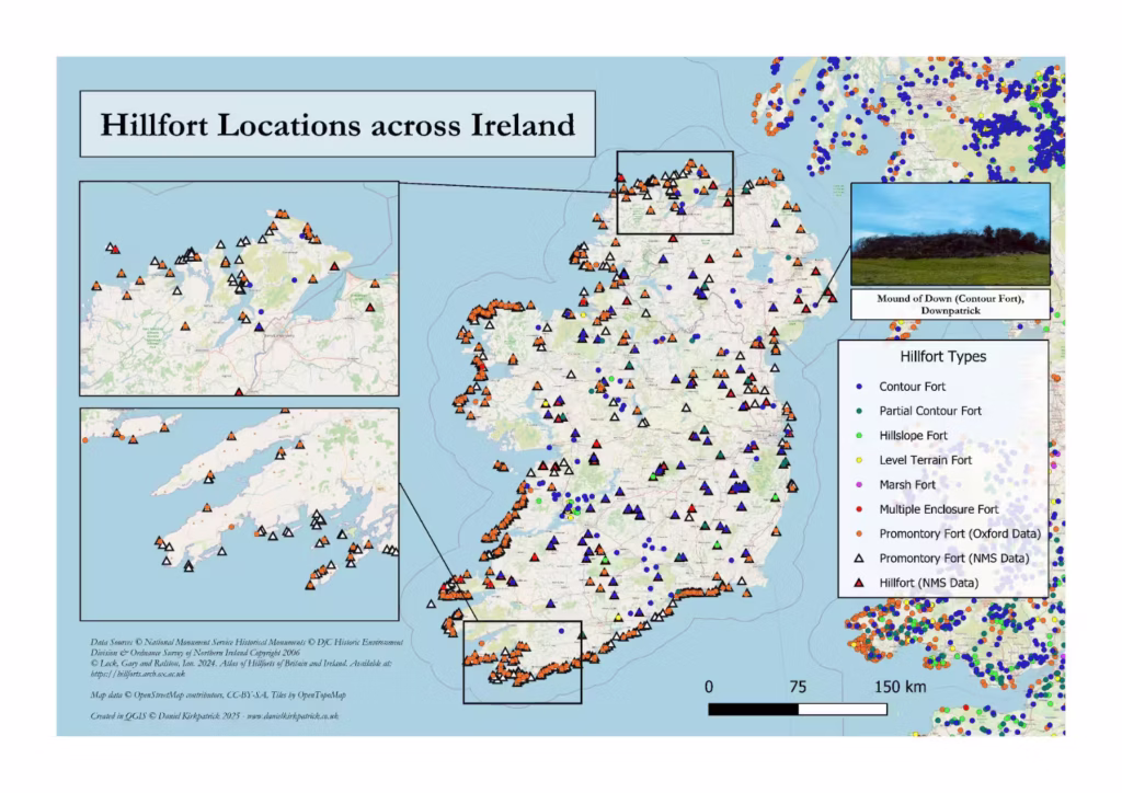
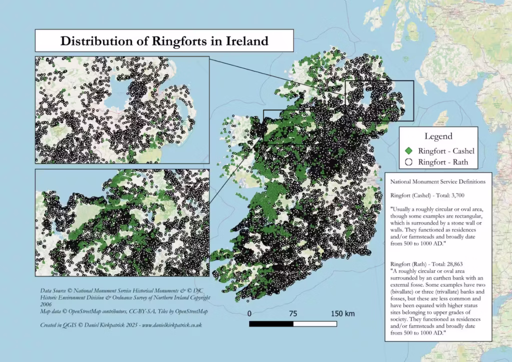
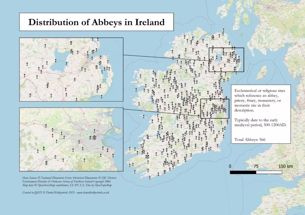
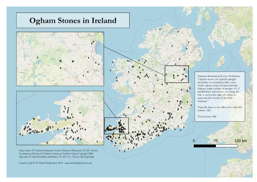
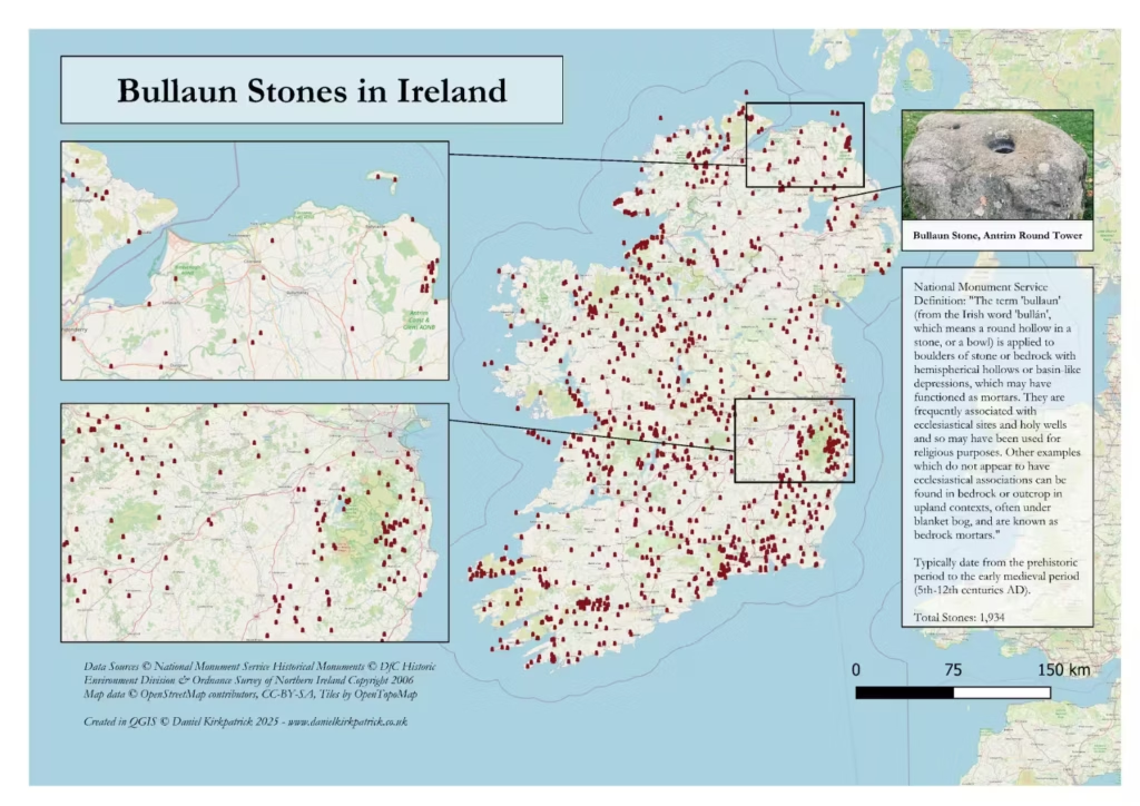
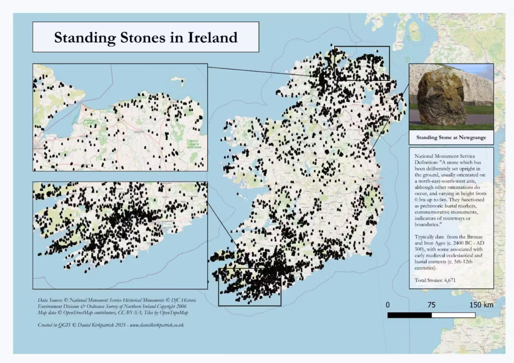
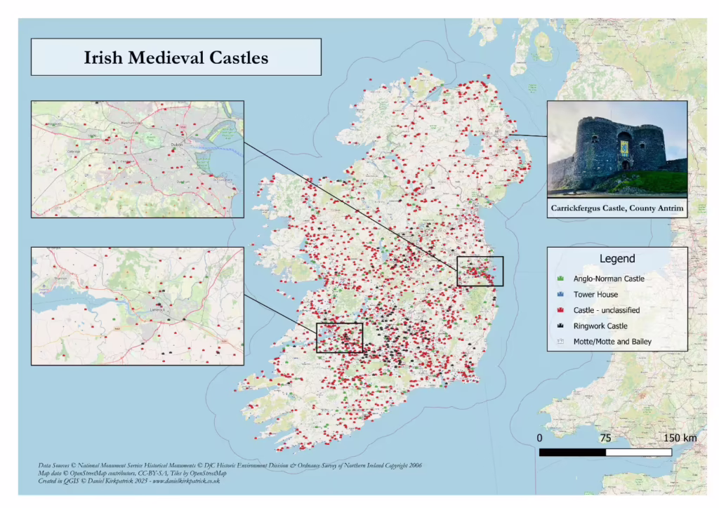
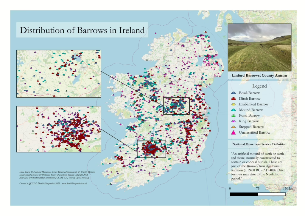
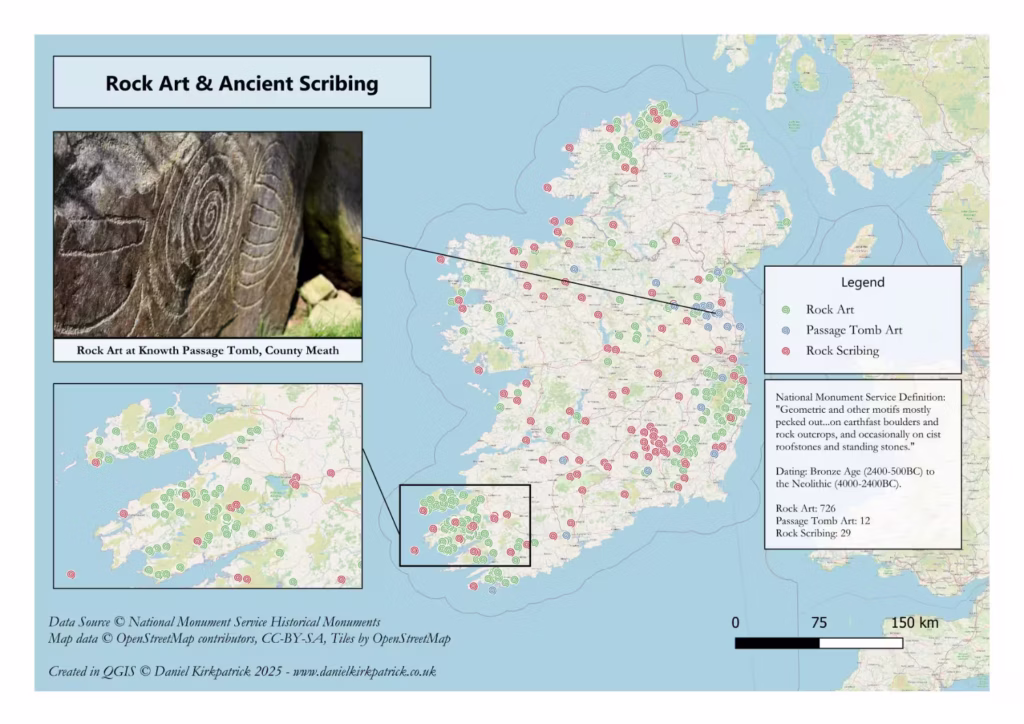
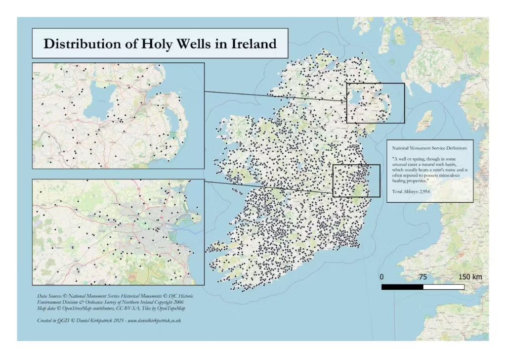
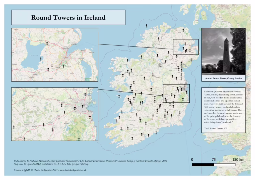
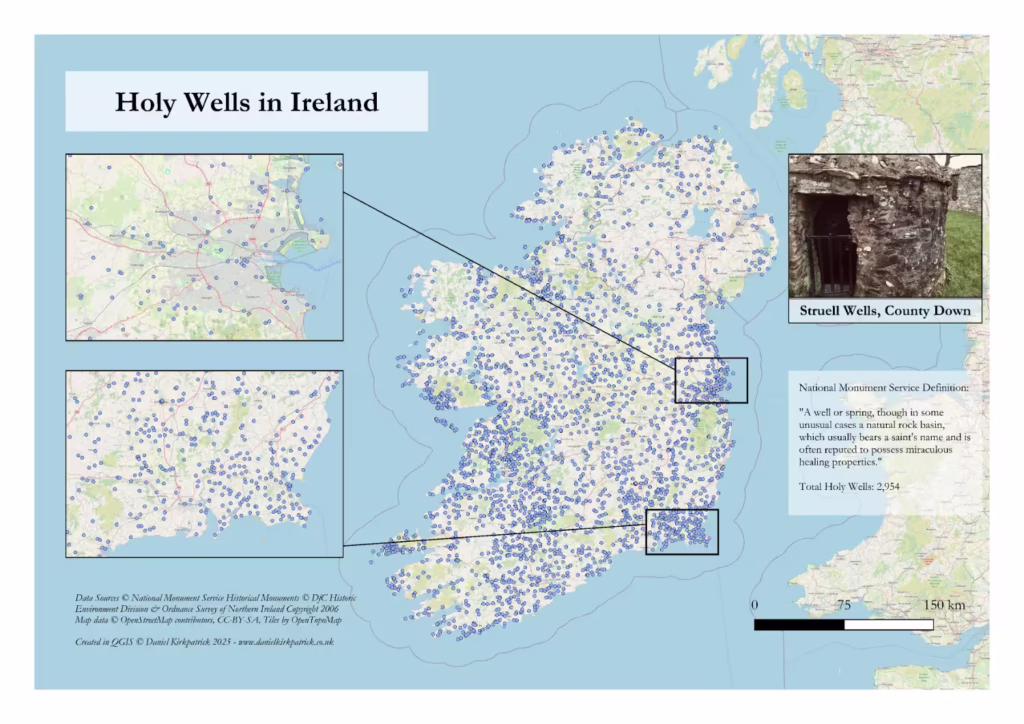
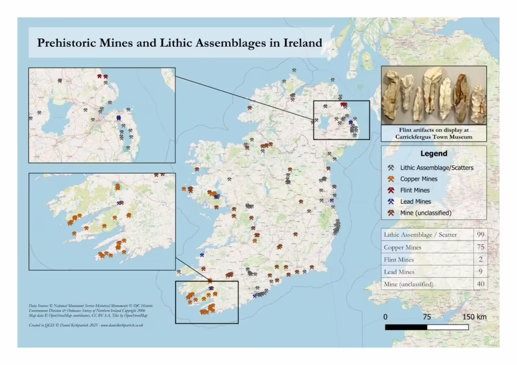
Prehistoric burials sites across IrelandAll megalithic tombs and sites across IrelandBoulder Tombs across IrelandCourt Tombs across IrelandPassage tombs across IrelandWedge Tombs across IrelandPortal Tombs across IrelandMap showing the distribution of Stone Circle sites across Ireland based on data from the DfC and NMSAncient roads or toghers across IrelandPrehistoric Mines across IrelandMedieval Mills across IrelandMap showing the distribution of Crannogs across the whole of Ireland typically dating to the Iron Age onwardsMap of Hillfort locations across Ireland based on Oxford University ResearchMap showing the distribution of Ringforts across Ireland Map showing the distribution of medieval abbeys across Ireland produced by Daniel KirkpatrickMap showing the distribution of ogham stones across Ireland based on archaeological data created by Daniel KirkpatrickMap showing the distribution of bullaun stones across Ireland based on archaeological data created by Daniel KirkpatrickMap showing the distribution of standing stones across Ireland based on archaeological data created by Daniel KirkpatrickMap showing location of all medieval castles in IrelandDistribution of all barrows across the whole of Ireland. Created by Daniel KirkpatrickMap showing the distribution of all recorded rock art and rock scribing locations across Ireland produced by Daniel Kirkpatrick using Government historical datasetsMap showing the distribution of Holy Wells across Ireland created by Daniel KirkpatrickMap showing distribution of round towers in IrelandMap of all Holy Wells in IrelandMap of prehistoric mines across Ireland
Regional Maps of Ancient Sites across Ireland
You can see the static maps below, or select these links to see the interactive maps for each. These allow you to zoom in and see all associated descriptive detail which is useful for anyone visiting or research these areas.
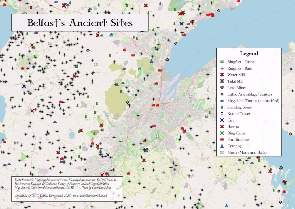
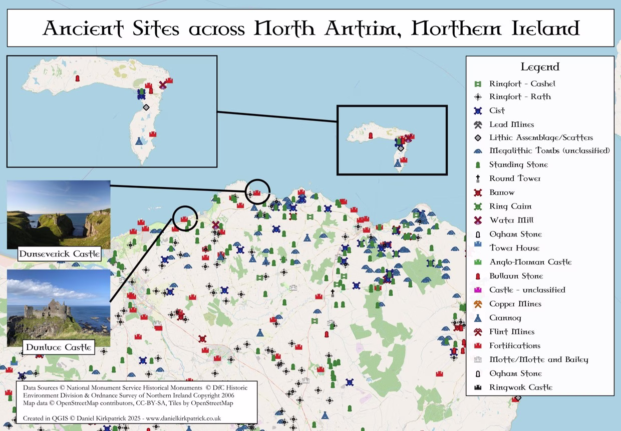
Ancient Historical Sites across Belfast mapped from Department for Communities data by Daniel KirkpatrickHistorical sites mapped across north Antrim in Northern Ireland using data from the Department for Communities by Daniel Kirkpatrick
Historical Maps of Ireland
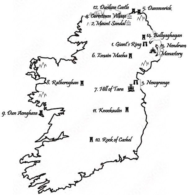
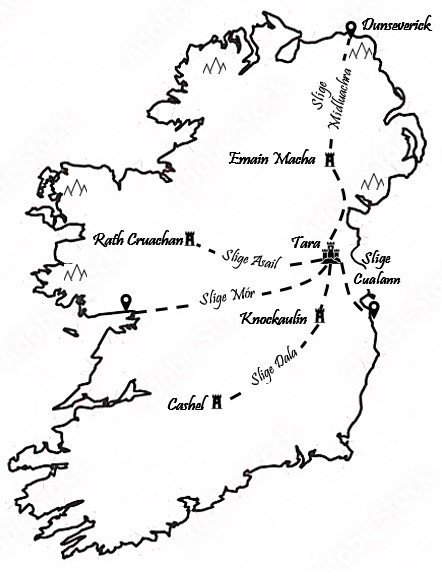
Black and white map of Ancient Historical Sites across IrelandMap of Ireland’s ancient highways
Irish Historical Reconstruction Maps
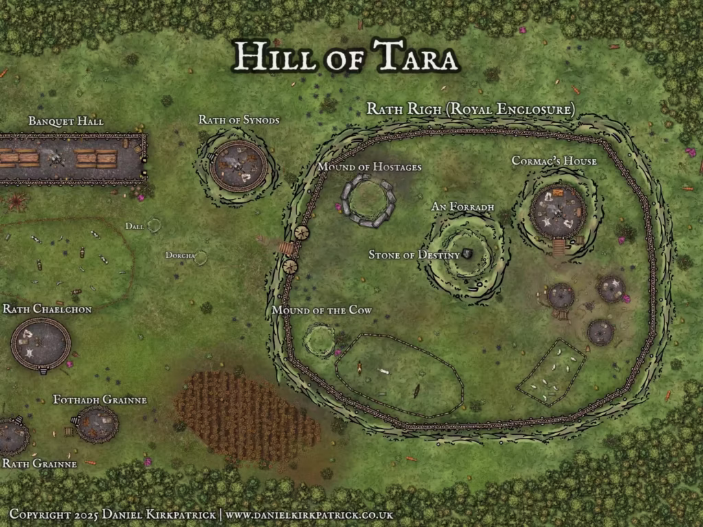
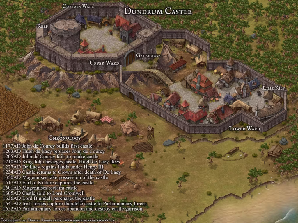
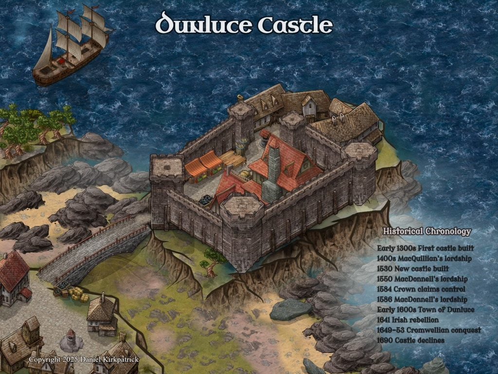
As I research different historical sites, I will review the archaeological evacuation reports in detail to understand the layout and design. Using these – with some creative license – I have begun reconstructing some of the sites as I imagine them. These maps should be viewed as historical fantasy. Personally they are my favourite. If you’ve any ideas for new ones to develop, please do get in contact.
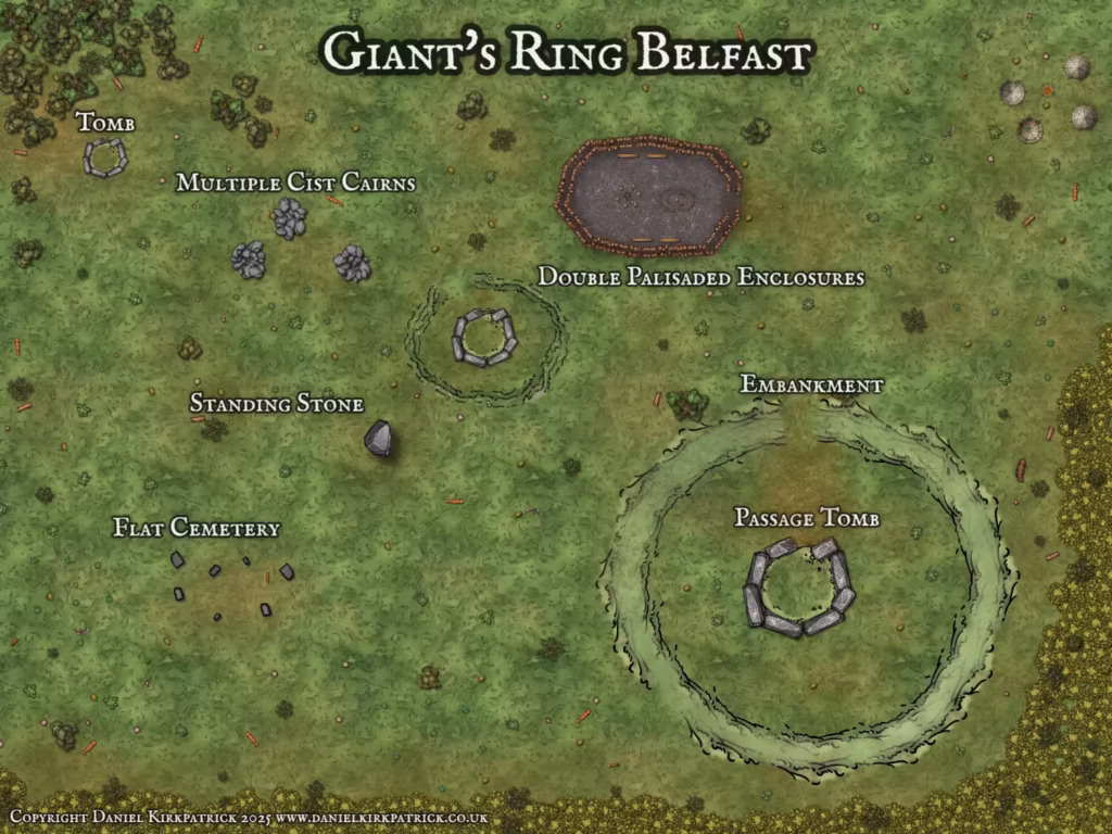
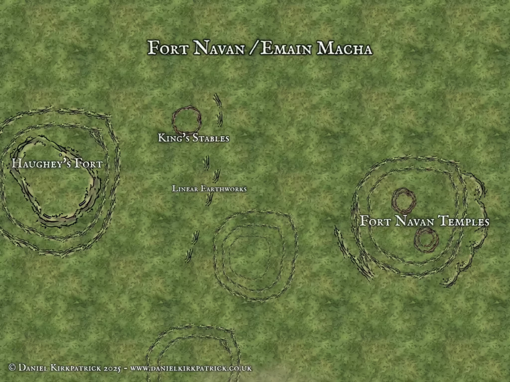
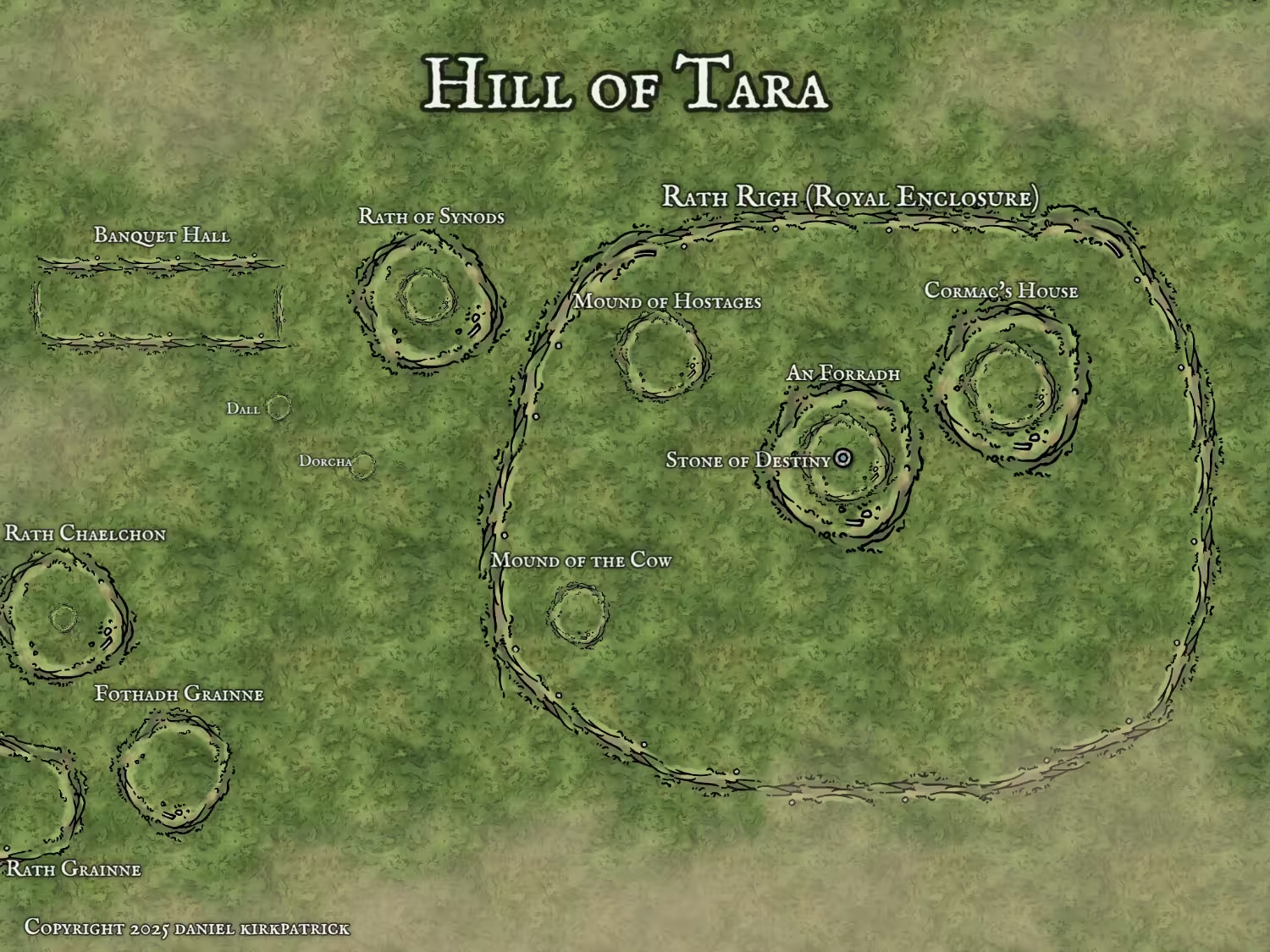
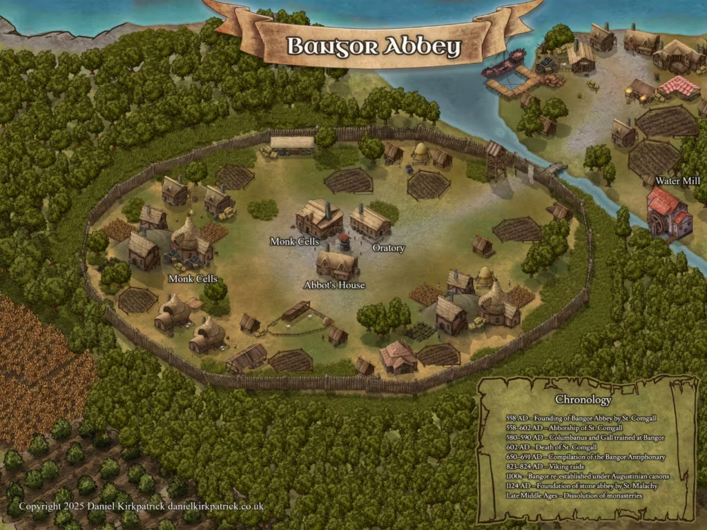
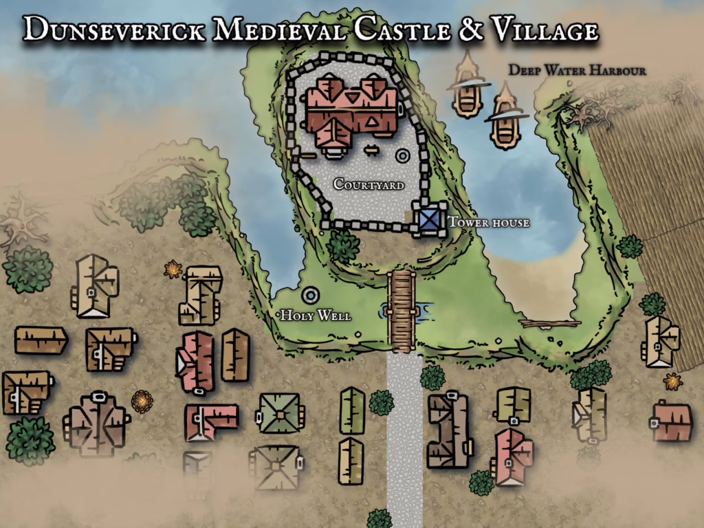
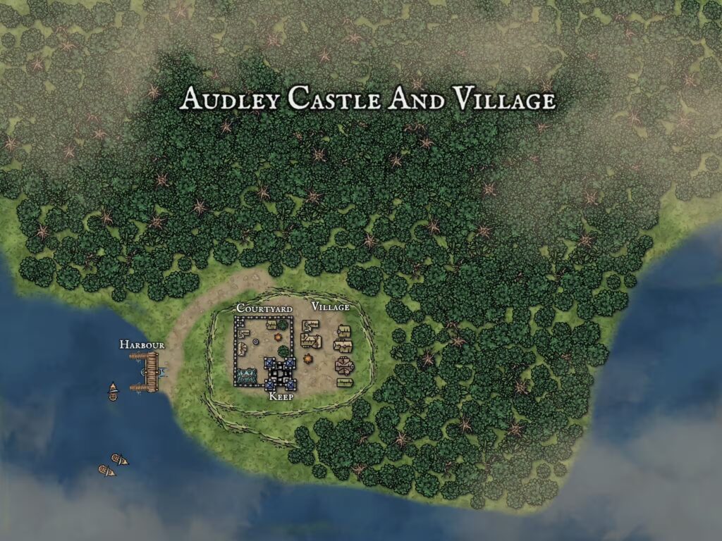
Hill of Tara, Ireland, reconstruction of the Iron Age site based on archaeological site data created by Daniel KirkpatrickHistorical reconstruction of Dundrum Castle in County Down, Northern Ireland created by Daniel KirkpatrickReconstruction of Dunluce Castle in the 1600s before its decline. Created by Daniel KirkpatrickSite map of the Giant’s Rung, Ballynahatty in Belfast, Northern Ireland, based on archaeological surveys. Created by Daniel KirkpatrickSite map of Fort Navan, Emain Macha, in Northern Ireland, based on archaeological surveys. Created by Daniel KirkpatrickHistorical Fantasy map of the Hill of Tara site created by Daniel KirkpatrickMap reconstruction of the medieval Christian Abbey in Bangor, County Down, Northern Ireland, created by Daniel KirkpatrickHistorical fantasy map of Dunseverick Castle in Ireland showing medieval layout and designHistorical Fantasy map of Audley Castle and Medieval Village in Northern Ireland
Other historical maps
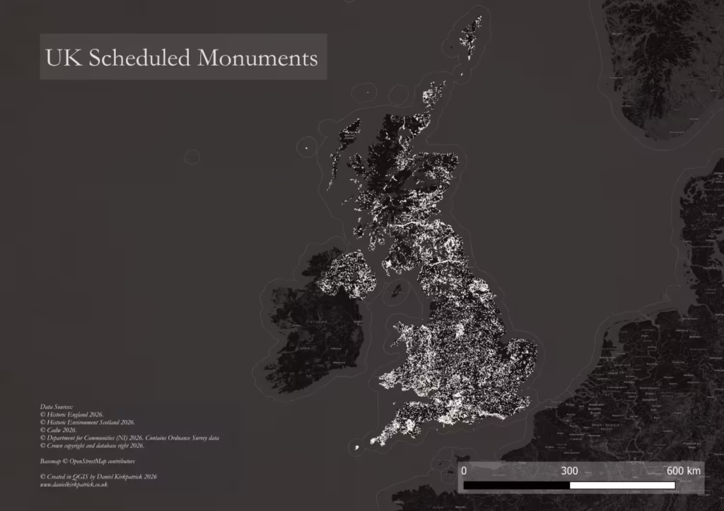
Map showing location of all scheduled monuments in the UK
Thanks for viewing my maps. If you’d like to read about any of the historical or mythological background for any of these, please feel free to browse my other pages:
To provide the best experiences, we use technologies like cookies to store and/or access device information. Consenting to these technologies will allow us to process data such as browsing behaviour or unique IDs on this site. Not consenting or withdrawing consent, may adversely affect certain features and functions.
Functional
Always active
The technical storage or access is strictly necessary for the legitimate purpose of enabling the use of a specific service explicitly requested by the subscriber or user, or for the sole purpose of carrying out the transmission of a communication over an electronic communications network.
Preferences
The technical storage or access is necessary for the legitimate purpose of storing preferences that are not requested by the subscriber or user.
Statistics
The technical storage or access that is used exclusively for statistical purposes.The technical storage or access that is used exclusively for anonymous statistical purposes. Without a subpoena, voluntary compliance on the part of your Internet Service Provider, or additional records from a third party, information stored or retrieved for this purpose alone cannot usually be used to identify you.
Marketing
The technical storage or access is required to create user profiles to send advertising, or to track the user on a website or across several websites for similar marketing purposes.