The north coastline of Northern Ireland is world famous for it’s stunning beauty, with iconic beaches and natural geography. From the Giant’s Causeway to the sandy golf courses, it’s a well-travelled route for good reason. However, it is much richer than most realise, with a treasure trove of interesting historical sites dating back into the Mesolithic period. Some are better known than others, like the striking Dunluce Castle perched on the cliffs, but much has either disappeared, or is simply hidden in plain sight. For that reason, I’ve created an interactive map of historical sites of North Antrim to aid all would-be visitors, travelers, or researchers. This map notes all recorded historical sites of note in the region with the description as provided by the Department for Communities in Northern Ireland.
Please feel free to use the map to investigate the area. Below I also provide some commentary and analysis based on my own research, but would genuinely welcome the views of others via my contact page or on social media. But if you’re interested in other maps and areas, please check out my maps page which is regularly updated with new projects and regions as I develop them.
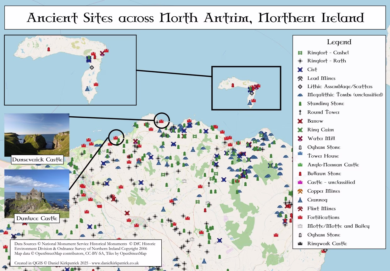
Interactive Map: Historic Sites in North Antrim, Northern Ireland
This interactive map was created in QGIS using data from the Department for Communities NI datasets. Copyright for the data and basemaps attribution is as follows:
Data Sources: © DfC Historic Environment Division & Ordnance Survey of Northern Ireland Copyright 2006
Map data: © OpenStreetMap contributors, CC-BY-SA, Tiles by OpenStreetMap
Key Historical Sites of North Antrim
When looking at a map like this, there’s always a danger to be overwhelmed. In some ways, I hope you are. The scale of this history is overwhelming. It is right to let it wash over you, to give it time to truly sink in.
However, I don’t want to leave you in your historical stasis for long. For there are truly wonderful historical stories to tell, and many of which I’ve spent far too long investigating covering the historical sites of North Antrim. So I’ve structured the rest of this post to provide brief overviews of some of the key sites as I see them, ones I’ve researched elsewhere to signpost you if interested in exploring further.
I’ve structured this according to the historical time-periods. Though, it’s worth noting that nearly all of these sites spanned multiple historical periods (e.g. Dunseverick spans early Bronze Age up to the late Medieval). Hopefully this can help provide some further context for the vast historical sites you now have at your fingertips.
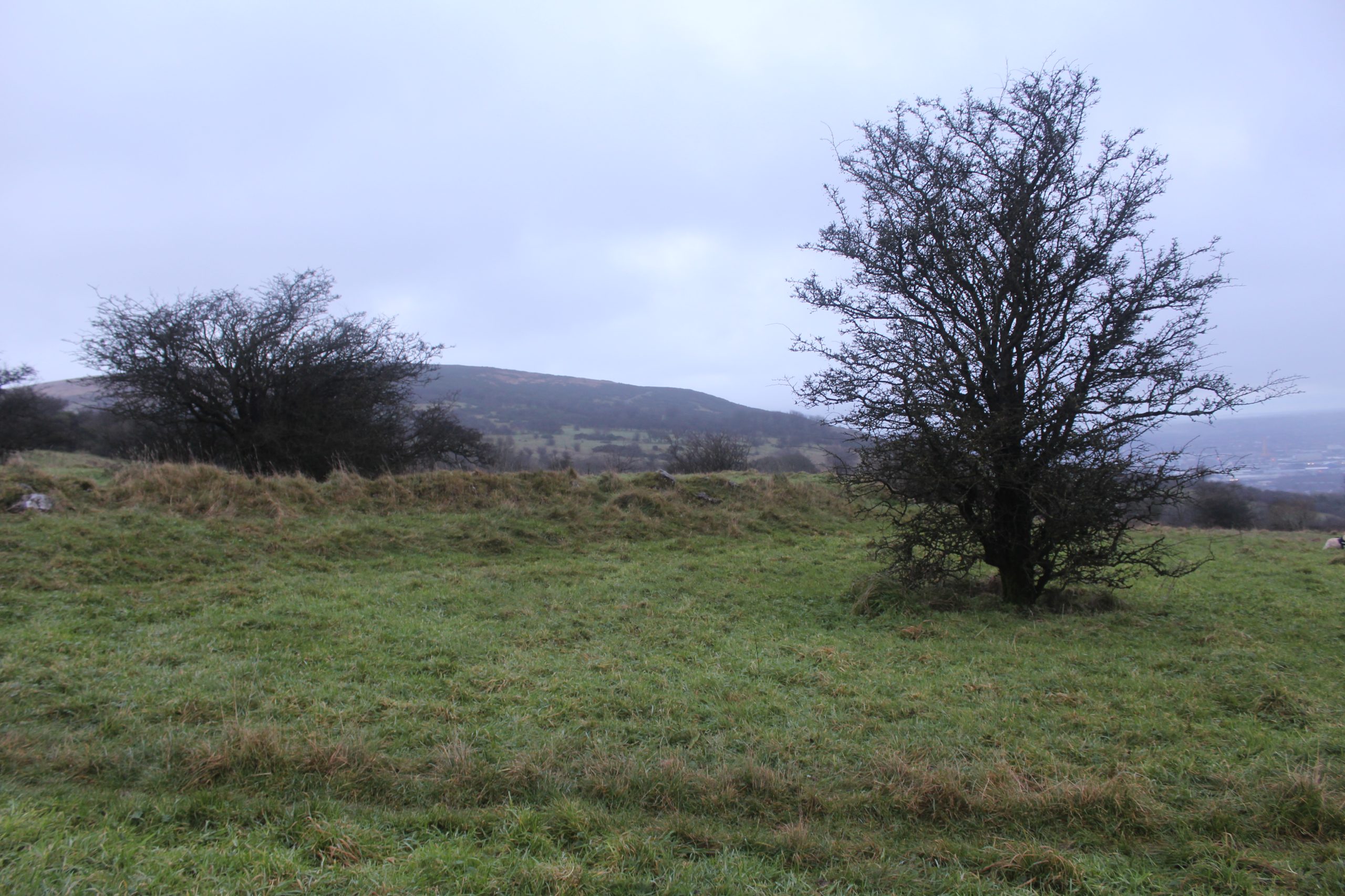
Mesolithic Age – Mountsandel Fort
I have a personal connection to this region having grown up nearby, and will always be drawn to its incredible depth. But I am not alone, for so too have my ancestors for 1,000s of years.
Perched above the River Bann near Coleraine, Mountsandel Fort is one of the most significant archaeological sites in Ireland—not for its later earthwork, but for what lay beneath it. Excavations in the 1970s revealed traces of human occupation dating back nearly 10,000 years, making Mountsandel the earliest known settlement in Ireland.
Archaeologist Peter Woodman’s excavations uncovered post-holes from circular huts, hearths, and large quantities of flint tools, showing that Mesolithic hunter-gatherers had established a semi-permanent camp here around 7900–7600 BC. The site’s position overlooking the river was ideal: the Bann provided fish, particularly salmon, while the surrounding forests offered hazelnuts, wild game, and raw materials for tool-making.
Mountsandel’s discovery reshaped understanding of Ireland’s early prehistory. Before its excavation, Mesolithic life on the island was thought to be temporary and mobile, based on small, shifting camps. The evidence from Mountsandel showed a more organised and sustainable pattern of settlement, suggesting that people were already deeply familiar with their landscape and capable of long-term adaptation within it.
You can see here for more on the significance and discoveries at Mountsandel Fort.
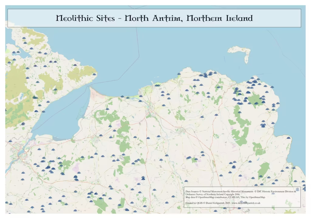
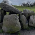
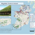
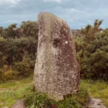
Neolithic Age – The Megaliths
Irish megaliths are rightly regarded as some of the most impressive across the world. The passage tomb of Newgrange in County Meath is a World Heritage site for good reason. But what is less well known, is the sheer number of these doted across the rest of the island. North Antrim is no exception.
As you can see from the map above, I’ve filtered only to the megalithic sites recorded in the region. There are obvious clusters around Ballintoy and Ballycastle which have well documented evidence of neolithic communities. I’d love to make claims based on the geography as we see it today around why this is, but – besides it being coastal – we need to be careful due to how different Ireland would have looked over 4,000 years ago. Sea-levels, climate, vegetation, amongst other things, have all changed.
However, for those eager to learn more, I’ve a more detailed map of megaliths and their distribution across Ireland, alongside another interactive map. You can also see the distributions of passage, court, portal, and wedge tombs across Ireland with my tentative views on these. Similarly, if you want to learn more about the various types and how they differ, you can check out my guide to megalithic monuments (or sign-up to my newsletter for a more comprehensive handbook on these).
Bronze Age – Corrstown Village
The Bronze Age in Ireland, roughly spanning 2500 to 300 BC, saw major changes in materials, society and settlement. New metal-tools, expanding farming, and more long-term habitation all combined to reshape life across the island.
The village at Corrstown Bronze Age Village (near Portrush, County Londonderry) fits into this era as a remarkable example of large-scale Bronze Age community organisation. Archaeologists uncovered 74 round-house platforms laid out in rows, connected by a cobbled roadway and metalled paths. Radiocarbon dating places the main occupation around 1550–1150 BC, during the Middle to Late Bronze Age period.
What makes the site significant is how it challenges earlier assumptions about Bronze Age settlement in Ireland. Instead of small, isolated farmsteads, Corrstown shows evidence of a cohesive village, planning, craft production and links to wider networks. The volume of pottery, lithics and moulds found underlines a community engaged in craft, trade and domestic life at scale.
See here to read more about my research on Corrstown Village and why it matters today.
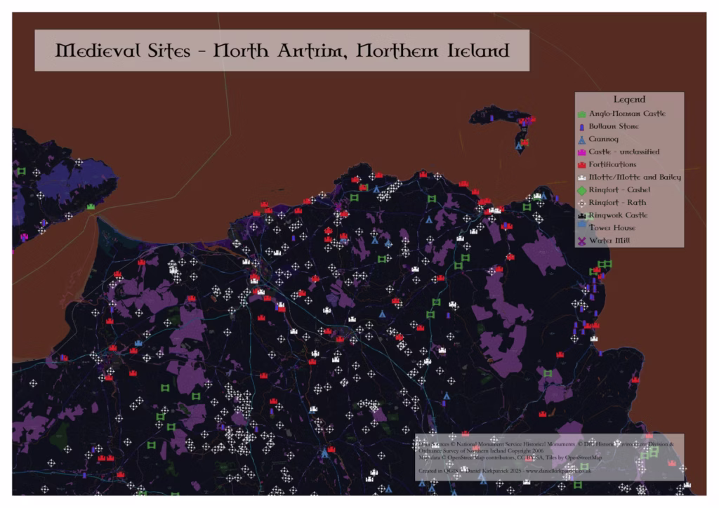
Early Medieval Age – Dunseverick Castle
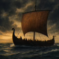
As Christianity began to spread across Ireland in the early medieval period, the island’s political and cultural landscape was undergoing profound change. Small túatha (kingdoms) consolidated into larger dynastic territories, while maritime connections with Scotland grew increasingly important. Across the North Channel, Gaelic settlers and missionaries carried both faith and warfare between the two shores, giving rise to the transmarine kingdom of Dál Riata—a realm that bridged north-eastern Ireland and western Scotland.
Dunseverick Castle stood at the heart of this shifting world. Perched on a rugged headland along the north Antrim coast, it commanded a strategic view across the channel and served as one of Dál Riata’s key coastal strongholds. Historical tradition holds that the site was linked to early Christian figures, including Saint Patrick, who is said to have visited and baptised a local chieftain here in the 5th century AD. Its position at the northern terminus of the ancient Slí Mídluachra—the royal road connecting the sacred centre of Tara to the sea—further emphasises its enduring significance as a point of both political and spiritual power.
During this period, Dunseverick functioned as more than a fortress. It was a centre of royal authority, religious influence, and maritime connection, embodying the close ties between Ireland and Scotland that defined the early medieval North Atlantic world.
For more on the significance and evolving history of Dunseverick Castle you read on here.
Mid-Late Medieval Age – Dunluce Castle
The medieval period in Ireland saw a transformation of defence, lordship and settlement—stone castles replaced wooden forts, and the rise of Gaelic and Anglo-Norman elites reshaped landscapes of power. Fortifications became not only military strongholds but residences and symbols of lordship.
Dunluce Castle sits prominently within this medieval context. Perched on a basalt outcrop above the Antrim coast, its strategic location made it ideal for both defence and projection of power. From the 13th century onwards it emerged as a seat of the Anglo-Normans and later Gaelic lords of the Route.
By the early 16th century the surrounding area had been refortified and expanded by the MacQuillan clan and later the powerful MacDonnell dynasty. Under their stewardship it evolved from a coastal fortress into a richly appointed residence—its stone walls, towers and domestic buildings illustrating the shift from purely military architecture to one of noble dwelling and status.
Read on here for more on how Dunluce Castle reflected much of the politics of this Medieval era.
YOU MAY ALSO LIKE
![Dun Ailinne Excavation Photograph. Hamish Forbes. Notebook East Area 1975 Book 3 Hamish Forbes Field Notes. Text [Type]. Digital Repository of Ireland (2024) [Publisher]. https://doi.org/10.7486/DRI.ns06j259](https://www.danielkirkpatrick.co.uk/wp-content/uploads/2024/09/Dun-Ailinne-Exacation-Photograph-120x120.jpg) Dun Ailinne: Exploring Leinster’s Ancient Royal Hillfort
Dun Ailinne: Exploring Leinster’s Ancient Royal Hillfort
 Ballyaghagan Cashel: Belfast Hills Stone Ringfort Guide
 The Giant’s Ring Belfast: Neolithic Henge and Passage Tomb
 Megalithic Sites of Ireland: Maps and Distribution Analysis
 Standing Stones in Ireland: Locations, Analysis and Interactive Map
 Bangor Abbey: History & Legacy of the Medieval Monastic Site
 Iron Age Trade in Ireland: Networks, Imports, and Economic Life
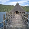 Buildings in Iron Age Ireland: Roundhouses, Ringforts & Crannógs