129 historic sites22 scheduled monuments49 listed buildings7 archaeological periods
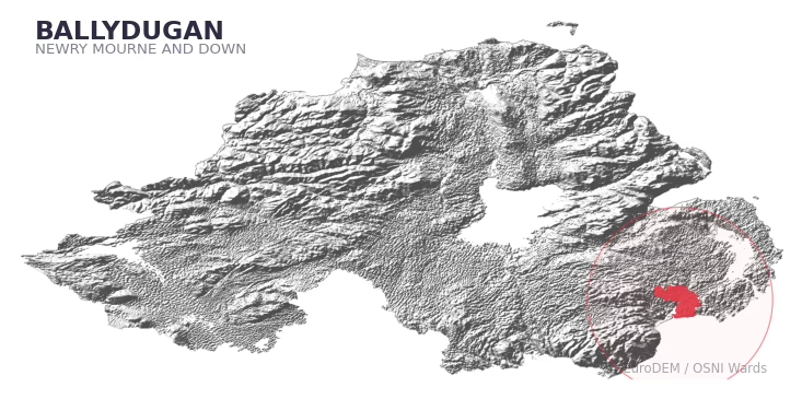
BALLYDUGAN covers 245.9 km² in Northern Ireland. With 129 historic sites and 22 scheduled monuments on record, the ward sits at the 92nd percentile across all 462 NI wards for combined archaeological heritage. It also records 49 listed buildings (HED Historic Buildings Record), the 77th percentile for listed-building density across NI wards. Per 1,000 residents, this works out at 53.1 recorded sites — the 92nd percentile across NI wards (a measure of heritage density relative to current population). Dated archaeological evidence runs from the Mesolithic through to the Modern period, spanning 7 archaeological periods, placing the ward in the 79th percentile NI-wide for chronological depth.
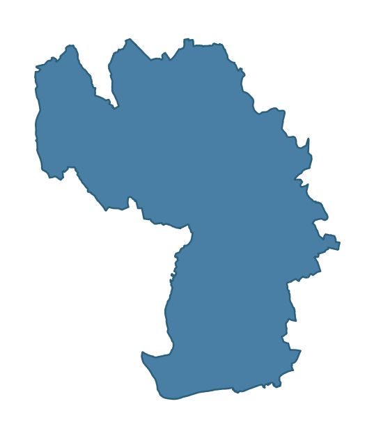
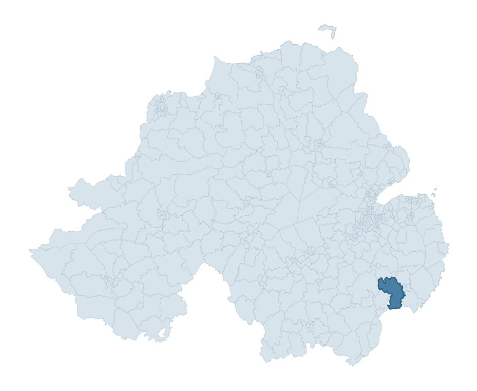
BALLYDUGAN boundary detailBALLYDUGAN in regional context
Heritage at a glance
Percentile rankings throughout this profile compare each ward only against the other 461 Northern Ireland wards.
129
Historic sites
92nd percentile
22
Scheduled monuments
97th percentile
49
Listed buildings
77th percentile
0.81
Sites per km²
Population context
15
Persons per km²
13th percentile
53.1
Sites per 1,000 residents
92nd percentile
3,764
Total residents (2021)
The recorded heritage of BALLYDUGAN
Of the 129 historic sites recorded, the most common are Enclosure (10, 8% of historic sites), Rath (8), and Raised Rath (5). For Enclosures, this is the 69th percentile among NI wards that record this type. For Raths, this is the 58th percentile among NI wards that record this type. Across the ward's 245.9 km², this gives a recorded density of 0.81 sites per km² (all heritage types combined). Scheduled monuments are distributed across approximately 0.10° of latitude and 0.12° of longitude within the ward, indicating dispersed rather than clustered placement.
Most common monument types
Type
Count
Description
Enclosure
10
—
Rath
8
—
Raised Rath
5
—
Chronological distribution
Mesolithic
5
Middle Late Bronze Age
1
Iron Age
30
Early Medieval
47
Medieval
8
Post Medieval
7
Modern
7
Unknown
24
Note: 19% of historic site records carry an ‘Unknown’ period attribution. The chronological breakdown above reflects only the dated subset.
Terrain and environment
Mean elevation of 40m sits around the NI median (31th percentile), with a maximum of 164m giving the ward meaningful vertical relief. Mean slope is 5.0° (69th percentile across NI), giving moderately undulating terrain. The Topographic Wetness Index of 10.2 (35th NI percentile) indicates moderate drainage, balanced between upland shedding and lowland accumulation. The land-cover mosaic combines improved grassland (72%), woodland (14%), and arable farmland (11%), giving a mixed agricultural and semi-natural landscape.
Terrain measurements
Mean elevation39.6 m 31st pct
Max elevation163.6 m 66th pct
Mean slope5° 70th pct
Wetness index (TWI)10.15 36th pct
Grassland72.2% 67th pct
Woodland14.5% 39th pct
Cropland10.7% 93rd pct
Urban land1.5% 16th pct
Where this ward sits in NI
Elevation
31st
Slope
70th
Drainage
36th
Grassland
67th
Woodland
39th
Geology and preservation
The dominant bedrock formed during the Palaeozoic era (Silurian period). Ancient sedimentary or metamorphic rock dating to before the age of dinosaurs; the resulting landscape has been long-stable enough to host every period of human activity. Bedrock composition is uniform (complexity index 0.00), with a single dominant geological unit underlying most of the ward. A uniform geology narrows the natural lithic-resource base available to past inhabitants.
Bedrock eraPalaeozoic
Bedrock periodSilurian
Surface depositsTill
Peat coverage0.0%
Bedrock complexity0.00
Placename evidence
The combined OSNI, Logainm NI, and GeoNames sources record 62 placenames for this ward. Diagnostic heritage strata identified within these are: 3 pre-Christian defensive (rath-, dún-, lios-, caiseal-) and 1 ecclesiastical (cill-, teampall-, mainistir-, díseart-). Note: Irish-language (name_ga) forms are recorded for roughly half of NI placenames in the combined sources, so anglicised forms whose Irish original could belong to multiple categories may be misclassified.
Scheduled monuments are sites legally protected under the Historic Monuments and Archaeological Objects (Northern Ireland) Order 1995, designated by the Historic Environment Division (HED).
Monument
Type
Period
Rath: Blackwood's Fort
Rath: Blackwood'S Fort
Early Medieval
Couterscarp Rath
Couterscarp Rath
Early Medieval
Mound: Piper's Fort
Mound: Piper'S Fort
Unknown
Bawn
Bawn
Post-Medieval
Standing Stone
Standing Stone
Early Bronze Age
Rath and Motte
Rath And Motte
Early Medieval
Rectangular enclosure and souterrain
Rectangular Enclosure And Souterrain
Iron Age
Rath and tower-house
Rath And Tower-House
Early Medieval
Enclosure
Enclosure
Iron Age
Rath
Rath
Early Medieval
Raised Rath
Raised Rath
Early Medieval
Motte and bailey
Motte And Bailey
Medieval
Raised Rath
Raised Rath
Early Medieval
Raised rath and motte: Lismahon
Raised Rath And Motte: Lismahon
Early Medieval
Church site and graveyard 'Parkaneety'
Church Site And Graveyard 'Parkaneety'
Unknown
Rath and tower house (area surrounding the state care monument)
Rath And Tower House (Area Surrounding The State Care Monument)
Early Medieval
Trench system WWI
Trench System Wwi
Modern
Crannog
Crannog
Iron Age
Trench System and Grenade Bunker DHP 326
Trench System And Grenade Bunker Dhp 326
Modern
PILLBOX
Pillbox
Modern
PILLBOX
Pillbox
Modern
PILLBOX
Pillbox
Modern
Recorded historic sites
Name
Period
Type
A.P. SITE
Unknown
Unknown
A.P. SITE – 2 enclosures/ mounds
Unknown
Unknown
A.P. SITE – RATH
Early Medieval
Defence
A.P. SITE – circular bivallate enclosure
Iron Age
Defence
A.P. SITE – circular cropmark
Unknown
Unknown
A.P. SITE – circular enclosure
Iron Age
Unknown
A.P. SITE – circular enclosure
Iron Age
Unknown
A.P. SITE – cropmark
Unknown
Unknown
A.P. SITE – cropmark
Unknown
Unknown
A.P. SITE – cropmark
Unknown
Unknown
A.P. SITE – double-ditched cropmark
Unknown
Defence
A.P. SITE – large enclosure
Iron Age
Unknown
A.P. SITE – oval enclosure
Iron Age
Unknown
AP Cropmark
Unknown
Unknown
AP Cropmark – Possible enclosure
Iron Age
Unknown
AP Cropmark – Possible enclosure (rath?)
Iron Age
Defence
AP Cropmark – Possible enclosure (rath?)
Iron Age
Defence
AP Cropmark – Possible sub-oval enclosure
Iron Age
Unknown
AP Cropmarks – 3x ring ditches
Unknown
Defence
AP sub-rectangular enclosure
Iron Age
Unknown
BAWN: BALLYDUGAN BAWN
Post-Medieval
Defence
BULLAUN
Early Medieval
Unknown
CASHEL: THE CASHEL
Early Medieval
Defence
CASTLE: BONECASTLE
Unknown
Defence
CHURCH & GRAVEYARD (site of): KILLYWOOLPA
Unknown
Ritual/Funerary
CHURCH & GRAVEYARD: Capella de Villa Rili
Medieval
Ritual/Funerary
CHURCH & GRAVEYARD: SHANKILL
Unknown
Ritual/Funerary
CHURCH; GRAVEYARD; HOLY WELL: KILLYGLINNE or PARKANEETY GRAVEYARD or ST.PATRICK'S WELL
Early Medieval
Ritual/Funerary
CIST with BRONZE AGE CREMATION BURIAL
Mesolithic
Ritual/Funerary
COUNTERSCARP RATH
Early Medieval
Defence
COUNTERSCARP RATH
Early Medieval
Defence
COUNTERSCARP RATH: BLACKWOOD'S FORT
Early Medieval
Defence
COUNTERSCARP RATH: GARDENHILL FORT
Early Medieval
Defence
COUNTERSCARP RATH: RAY'S FORT
Early Medieval
Defence
CRANNOG (submerged)
Early Medieval
Defence
CRANNOG: LOUGH FAUGHAN CRANNOG or LOUGH FALCON
Early Medieval
Defence
CRANNOG?
Early Medieval
Defence
CRANNOG?: MCCRORY'S CASTLE
Early Medieval
Defence
Circular cropmark – Possible enclosure
Iron Age
Unknown
EARTHWORK
Unknown
Defence
ENCLOSURE
Iron Age
Unknown
ENCLOSURE
Iron Age
Unknown
ENCLOSURE
Iron Age
Unknown
ENCLOSURE
Iron Age
Unknown
ENCLOSURE
Iron Age
Unknown
ENCLOSURE
Iron Age
Unknown
ENCLOSURE
Iron Age
Unknown
ENCLOSURE
Iron Age
Unknown
ENCLOSURE
Iron Age
Unknown
ENCLOSURE
Iron Age
Unknown
ENCLOSURE – rath?
Iron Age
Defence
ENCLOSURE – rath? or tree ring?
Iron Age
Defence
ENCLOSURE – tree ring?
Iron Age
Unknown
ENCLOSURE – tree ring?
Iron Age
Unknown
ENCLOSURE, poss. BARROW with MULTIPLE CIST BURIALS: LISNASHIMMER
Mesolithic
Ritual/Funerary
ENCLOSURE: FORT ELIZABETH
Iron Age
Defence
ENCLOSURE: PIPER'S FORT
Iron Age
Defence
FINDSPOT of C16TH COIN HOARD
Post-Medieval
Unknown
FISH TRAP
Unknown
Agriculture
FORTIFICATION
Medieval
Defence
FORTIFICATION: MACCOURTNEY'S CASTLE
Unknown
Defence
GRAVEYARD
Unknown
Ritual/Funerary
GRAVEYARD: KILLYCLOUGH
Unknown
Ritual/Funerary
HOLY WELL, CHURCH & ABBEY (site of): ST. FINNAN'S WELL; ST.FINNAN'S CHURCH; TEMPLEMAGEERAGH
Medieval
Ritual/Funerary
HOLY WELL: TOBERDONEY
Early Medieval
Ritual/Funerary
HOLY WELL: TUBBERDONEY
Early Medieval
Ritual/Funerary
Historic Settlement Ballykinler
Post-Medieval
Domestic
Historic Settlement Seaforde
Post-Medieval
Transport
Historic Settlement: Loughinisland
Post-Medieval
Domestic
ISLAND
Unknown
Unknown
Large irregular enclosure/ field system
Middle-Late Bronze Age
Agriculture
Linear earthwork (possibly comprising a ditch and a trackway)
Iron Age
Defence
MASS ROCK
Post-Medieval
Unknown
MEDIEVAL CHURCH & GRAVEYARD (unlocated): ST. MARY MAGDALENE
Medieval
Ritual/Funerary
MEDIEVAL CHURCH: BALIDUGAN (unlocated)
Medieval
Religious
MODERN CHURCH on PRE-NORMAN SITE: STAGHREEL
Medieval
Religious
MOTTE & BAILEY
Medieval
Defence
MOTTE on RATH; reused as BAILEY: CASTLESKREEN MOTTE
Early Medieval
Defence
MOUND
Unknown
Unknown
NON-ANTIQUITY
Unknown
Unknown
NON-ANTIQUITY – Landscaping Feature
Modern
Unknown
NON-ANTIQUITY – quarry
Modern
Industrial
PASSAGE TOMB: ANNADORN DOLMEN
Mesolithic
Ritual/Funerary
PENAL SITE: ALTAR HOLLOW
Post-Medieval
Unknown
PLATFORM RATH
Early Medieval
Defence
PLATFORM RATH WITH REMAINS OF TOWER-HOUSE
Early Medieval
Defence
PLATFORM? RATH
Early Medieval
Defence
QUADRILATERAL ENCLOSURE
Iron Age
Unknown
RAISED RATH
Early Medieval
Defence
RAISED RATH
Early Medieval
Defence
RAISED RATH
Early Medieval
Defence
RAISED RATH
Early Medieval
Defence
RAISED RATH
Early Medieval
Defence
RAISED RATH reused as MOTTE: LISMAHON
Early Medieval
Defence
RATH
Early Medieval
Defence
RATH
Early Medieval
Defence
RATH
Early Medieval
Defence
RATH
Early Medieval
Defence
RATH
Early Medieval
Defence
RATH
Early Medieval
Defence
RATH
Early Medieval
Defence
RATH
Early Medieval
Defence
RATH & SOUTERRAIN
Early Medieval
Defence
RATH & TOWER-HOUSE: CASTLESKREEN TOWER HOUSE
Early Medieval
Defence
RATH REUSED AS TREE RING
Early Medieval
Defence
RATH: CUSACK'S FORT
Early Medieval
Defence
RATH: FARRANFAD FORT
Early Medieval
Defence
RATH: PLUNKET'S FORT
Early Medieval
Defence
RECTANGULAR ENCLOSURE
Iron Age
Unknown
RECTANGULAR ENCLOSURE & possible SOUTERRAIN
Early Medieval
Defence
SETTLEMENT SITE
Unknown
Domestic
SOUTERRAIN
Early Medieval
Defence
SOUTERRAIN
Early Medieval
Defence
SOUTERRAIN
Early Medieval
Defence
SOUTERRAIN
Early Medieval
Defence
SOUTERRAIN, ?RATH & RECTILINEAR ENCLOSURE
Early Medieval
Defence
STANDING STONE
Mesolithic
Ritual/Funerary
STANDING STONE
Mesolithic
Ritual/Funerary
STONE BUILT TOMB (unlocated)
Unknown
Ritual/Funerary
THREE CHURCHES IN MULTIPERIOD GRAVEYARD: LOUGHINSILAND CHURCHES, ST. MacCARTAN'S CHAPEL
Medieval
Ritual/Funerary
TREE RING
Unknown
Unknown
TRENCH SYSTEM (WW1)- DHP 307
Modern
Unknown
TWO CRANNOGS (destroyed, 1814): INISLOCHACULIN
Early Medieval
Defence
WELL (unlocated)
Unknown
Unknown
WW1 TRENCH SYSTEM; GRENADE BUNKER(WW2)-DHP 326
Modern
Defence
WWII PILLBOX – DHP no. 68
Modern
Defence
WWII PILLBOX – DHP no. 69
Modern
Defence
WWII PILLBOX – DHP no. 83
Modern
Defence
c12TH MOUND; possibly MOTTE on earlier OCCUPATION SITE: PIPER'S FORT
Early Medieval
Defence
Listed buildings in BALLYDUGAN
Address / Name
Grade
Period
Lower Farm courtyard
off Demesne Road
Seaforde Demense
near Seaforde
Downpatrick
Co Down
BT30 8PF
B2
1840 – 1859
Stable Yard
Seaforde House
Newcastle Road
Seaforde Demense
near Seaforde
Downpatrick
Co Down
BT30 8PG
Grounding History: 10 Maps of Northern Ireland’s Past
A spatial history report bringing together analysis of all 462 wards into one place through 10 high-quality maps — covering monument density, archaeological periods, placename heritage, terrain, wetland, and the historic landscape at first survey.
A ward is the smallest electoral and statistical geography used by the Northern Ireland Statistics and Research Agency (NISRA). The boundaries used here are the 2014 NISRA / OSNI Wards (462 across Northern Ireland), each typically covering 1-700 km² and a population of a few thousand. Wards do not align with parishes, townlands, or any historic administrative unit — they are a modern statistical convenience, used here only as a fixed spatial frame within which to summarise heritage records.
What counts as a site?
Three distinct heritage record types are reported separately, not combined: (1) Historic Sites — entries in the Northern Ireland Sites and Monuments Record (NISMR), the inventory of recorded archaeological sites and findspots, dated from prehistoric to early-modern; (2) Scheduled Monuments — sites legally protected under the Historic Monuments and Archaeological Objects (NI) Order 1995 and maintained by the Historic Environment Division (HED); (3) Listed Buildings — buildings of architectural or historic interest protected under the Planning Act (NI) 2011 and graded A, B+, B1, B2, or Record-Only by HED. A site appearing in more than one register is counted in each register independently.
Editorial principles
These ward profiles describe evidence, not history. They report what is recorded, not what occurred. Where the data is ambiguous, we say so. We do not infer historical processes — population movements, settlement expansion, periods of decline — from patterns in the record. Absence of evidence is not evidence of absence: in Northern Ireland, where antiquarian survey was uneven and modern excavation is geographically biased, a gap in the record almost always reflects the limits of recording rather than a genuine historical absence. We mark such gaps explicitly where they appear in the data.
Limits of coverage and known caveats
Several caveats apply to every ward profile: (1) NISMR coverage is uneven across NI — some areas (notably parts of the south-east and the Belfast urban fringe) have been more intensively surveyed than others, so a low recorded site count does not reliably indicate a low past density of activity; (2) period attributions in NISMR are often 'Unknown', and chronological breakdowns reported here reflect only the dated subset; (3) placename classification depends on the Irish-language form (name_ga), which is recorded for approximately 50% of NI placenames in the combined sources, so ecclesiastical and pre-Christian counts may be understated where anglicised forms remain unparsed; (4) terrain percentile ranks compare each ward only to the other 461 NI wards; they are not absolute thresholds. For absence-dominant land cover categories (wetland, water, cropland), percentile ranks are suppressed below 1% raw value, since the ranking of zero-value wards is not meaningful.
Data sources (11)
Northern Ireland Sites and Monuments Record (NISMR)
Spotted an error? This dataset is updated continuously.
Email contact@danielkirkpatrick.co.uk with corrections, missing records, or suggestions for improvement.
Manage Consent
To provide the best experiences, we use technologies like cookies to store and/or access device information. Consenting to these technologies will allow us to process data such as browsing behaviour or unique IDs on this site. Not consenting or withdrawing consent, may adversely affect certain features and functions.
Functional
Always active
The technical storage or access is strictly necessary for the legitimate purpose of enabling the use of a specific service explicitly requested by the subscriber or user, or for the sole purpose of carrying out the transmission of a communication over an electronic communications network.
Preferences
The technical storage or access is necessary for the legitimate purpose of storing preferences that are not requested by the subscriber or user.
Statistics
The technical storage or access that is used exclusively for statistical purposes.The technical storage or access that is used exclusively for anonymous statistical purposes. Without a subpoena, voluntary compliance on the part of your Internet Service Provider, or additional records from a third party, information stored or retrieved for this purpose alone cannot usually be used to identify you.
Marketing
The technical storage or access is required to create user profiles to send advertising, or to track the user on a website or across several websites for similar marketing purposes.