What is the Northern Ireland Heritage Tool?
The Northern Ireland Heritage Tool is an interactive research resource designed to help explore the historic landscape of Northern Ireland through its electoral wards. Rather than focusing on individual monuments in isolation, the tool allows users to examine how archaeology, settlement history, landscape, and placenames combine within a defined local area.
Search for a ward’s heritage profile:
Loading data…
Browse by council
11 councils across Northern Ireland
Loading councils…

Grounding History: 10 Maps of Northern Ireland’s Past
A spatial history report bringing together analysis of all 462 wards into one place through 10 high-quality maps — covering monument density, archaeological periods, placename heritage, terrain, wetland, and the historic landscape at first survey.
About this tool
Click any section below to expand.
What is the Northern Ireland Heritage Tool?
The Northern Ireland Heritage Tool is an interactive research resource designed to help explore the historic landscape of Northern Ireland through its 462 electoral wards. Rather than focusing on individual monuments in isolation, the tool allows users to examine how archaeology, settlement history, landscape, and placenames combine within a defined local area. Each ward profile draws together evidence from the Northern Ireland Sites and Monuments Record, the Historic Environment Division’s scheduled monuments and listed buildings registers, OS Open Names placename data, and terrain and land-cover layers into one analytical view. The tool is intended for local residents researching the history of their area, genealogists placing family history in a spatial context, students and researchers using the data as a starting point for landscape analysis, and anyone with an interest in Northern Ireland’s historical geography.
How to use this tool
Using the Northern Ireland Heritage Tool is straightforward and requires no specialist knowledge.
Begin by entering at least two characters into the search box above. The search function will suggest ward names — Parkgate, Aldergrove, Derrygonnelly — as you type. Once you select a ward, you’ll be taken straight to its full heritage profile page.
You can also click Explore by map to see all 462 wards plotted on an interactive map. Click any polygon to open a popup with the ward’s name and a link to its full profile. If you’d rather browse by area, the Browse by council section above lists all 11 NI councils with their ward counts and a link to each council’s aggregated heritage profile.
Each ward profile presents an overview of recorded archaeological and architectural heritage, the dominant monument types and chronological periods, terrain and land-cover characteristics, and placename heritage. Because the tool operates at ward level, it encourages exploration of everyday historic landscapes as well as the famous monuments.
Methodology behind the tool
This tool was built out of a desire to better understand Northern Ireland’s heritage spatially. The sheer volume of recorded sites and the span of history involved can be overwhelming. This tool helps structure this data in a way that is hopefully meaningful for researchers, hobbyists, and anyone with an interest in history.
The tool presents heritage data for all 462 NI electoral wards, drawn from a bespoke spatial pipeline. Each ward’s record was built by spatially joining three statutory heritage registers — the Sites and Monuments Record, Scheduled Monument Zones, and Listed Buildings — to ward boundary polygons using point-in-polygon assignment. Heritage density figures (sites per km²) exclude listed buildings and are calculated against the full ward area derived from the OSNI ward boundary dataset.
Period classification for Historic Sites follows a multi-pass lexicon applied to the NISMR site-type vocabulary, with the Roman period excluded from Northern Ireland records (the island lay outside the Roman Empire and any “Roman” labels in source data are folded into the chronologically-adjacent Iron Age bucket). Placename heritage classifications use a custom classifier applied to the OS Open Names dataset, categorising toponyms by linguistic tradition (Pre-Christian Gaelic, Early Christian, Norse, Norman, Plantation). Terrain data is derived from the Copernicus GLO-30 Digital Elevation Model and ESA WorldCover 2021 land-cover product, aggregated to ward level. Where a data field shows a dash or is absent, the underlying record did not contain sufficient information to compute the metric reliably.
What is a ward?
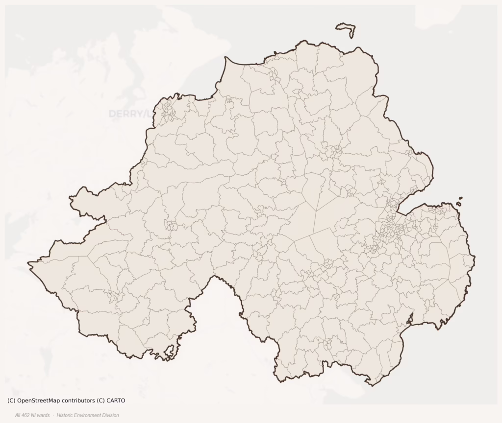
Electoral wards are the smallest geographical unit used for local government elections in Northern Ireland. There are 462 wards in total, grouped into the 11 council areas created by the 2014 Local Government Reform. Wards typically contain between 1,500 and 5,000 residents and were drawn to balance population, community identity, and physical geography.
For this tool, wards serve as the unit of spatial analysis because they aggregate the townland-level evidence into manageable, locally-meaningful areas while still being small enough to retain local character. The full ward boundary polygons used here are the NISRA Census 2021 electoral ward polygons.
Data coverage
This tool covers the 462 electoral wards of Northern Ireland — the six counties of Antrim, Armagh, Derry, Down, Fermanagh, and Tyrone. The 26 counties of the Republic of Ireland are covered by the sibling Republic of Ireland Heritage Tool on this same site, which works at barony level rather than ward level. The two tools use different statutory data sources on different boundary units, which makes direct head-to-head counts of sites or listed buildings unsafe to compare without caveats. Terrain layers, however, are directly comparable across the two tools.
What counts as a site?
This tool combines three distinct heritage registers, each with its own definition of what constitutes a recordable site:
- Historic Sites (NISMR). The Northern Ireland Sites and Monuments Record catalogues every known archaeological monument or site of archaeological interest in Northern Ireland — from prehistoric burial mounds and ringforts to medieval churches and post-medieval industrial works. Maintained by the Historic Environment Division (HED), Department for Communities NI.
- Scheduled Monuments. A subset of archaeological sites given statutory protection under the Historic Monuments and Archaeological Objects (NI) Order 1995. Scheduling provides the highest level of legal protection for monuments of national importance.
- Listed Buildings. Buildings of special architectural or historic interest, recorded by HED on a four-tier scale from Grade A through Grade B+, Grade B1, and Grade B2. The list includes churches, country houses, vernacular farmhouses, industrial buildings, and a wide range of other historic structures.
Editorial principles
The narrative sections on each ward and council profile follow several explicit principles:
- Evidential. Every claim about a ward’s heritage character is anchored in the underlying register data. Where a count, share, or comparative ranking is cited, it is computed from the source datasets at export time.
- Comparative. Counts are reported alongside their rank among NI wards or councils so the reader can see whether a figure is unusual.
- Transparent on limits. Coverage gaps and survey biases are flagged where they meaningfully affect the figures rather than hidden.
- No interpretation beyond what the data supports. The narrative does not speculate about historical events or social dynamics beyond what the recorded heritage and placename evidence directly attests.
Data caveats and limits
- NISMR Sites and Monuments Record is the product of survey campaigns at different intensities across counties and decades. Some wards have been surveyed more thoroughly than others, and absolute counts should be read in that light. Sites destroyed by development before survey are typically not represented; sites in heavily forested or upland terrain are sometimes under-recorded.
- Scheduled Monument coverage reflects statutory decisions about which sites warrant the highest level of protection. A ward with few scheduled monuments may still hold a rich archaeological record — scheduling status is not a comprehensive measure of significance.
- Listed Buildings coverage is broadly complete but was assembled over multiple decades. Recently built or recently demolished structures may not be reflected, and some buildings have been re-graded over time.
- Placename classification applies a conservative pattern-matching approach to the OS Open Names dataset. A townland may carry a heritage signal the classifier doesn’t recognise, particularly where the modern anglicised name has lost the original linguistic form.
- Period attribution. The chronological distribution reflects only NISMR sites with a recognised period attribution in the source data; sites without a clear date are excluded from canonical period totals.
- Boundary changes. Wards have undergone boundary adjustments at successive reviews. The 2014 Local Government Reform ward boundaries used here are the current statutory definition and may differ from historical maps in border areas.
Data sources
- Northern Ireland Sites and Monuments Record (NISMR) communities-ni.gov.uk — Historic Environment Digital Datasets
- HED Scheduled Monument Zones communities-ni.gov.uk — Scheduled Historic Monuments
- HED Listed Buildings communities-ni.gov.uk — Buildings Database
- Northern Ireland ward boundaries
- OS Open Names
- Logainm — Placenames Database of Ireland logainm.ie
- Copernicus GLO-30 Digital Elevation Model
- ESA WorldCover 2021
Copyright and attribution
Heritage data. The Northern Ireland Sites and Monuments Record, HED Scheduled Monument Zones, and HED Listed Buildings data are © Crown Copyright and database right, Historic Environment Division, Department for Communities, Northern Ireland. Used under the terms of the Open Government Licence v3.0 (nationalarchives.gov.uk/doc/open-government-licence). No warranty is given as to the accuracy or completeness of the data.
Boundary data. Ward boundary data is © Crown Copyright and database right, NISRA / OSNI 2021. Contains public sector information licensed under the Open Government Licence v3.0.
Terrain and satellite data. Copernicus GLO-30 DEM is made freely available under the Copernicus DEM licence. ESA WorldCover is © European Space Agency, made available under the Creative Commons Attribution 4.0 International Licence (CC BY 4.0).
Placename data. OS Open Names is © Crown Copyright and database right 2024, published by Ordnance Survey and Ordnance Survey of Northern Ireland under the Open Government Licence v3.0.
Tool and analysis. The data pipeline, spatial analysis, period classification, placename heritage classification, ward-level aggregation, written summaries, and this web tool are © Daniel Kirkpatrick 2026. All rights reserved. The derived dataset is an original analytical work and may not be reproduced, redistributed, or used to train machine learning models without prior written permission.
Spotted an error or have a suggestion? Email contact@danielkirkpatrick.co.uk — corrections and improvements are very welcome.
How to cite this tool
If you reference any data, figures, or narrative from this tool in academic, journalistic, or genealogical writing, the suggested citation is:
Kirkpatrick, D. (2026). Ward Heritage Profile: Northern Ireland Ward Heritage Project. www.danielkirkpatrick.co.uk/northern-ireland-heritage-tool
For per-ward or per-council citations, append the specific profile name and URL — for example:
Kirkpatrick, D. (2026). Parkgate Ward Heritage Profile. www.danielkirkpatrick.co.uk/wards/parkgate-heritage-profile
The underlying source datasets (NISMR, HED, OS Open Names, Copernicus, ESA WorldCover) should be cited separately where their figures are quoted directly — links and licence terms for each are listed under Data sources above.