145 historic sites11 scheduled monuments42 listed buildings8 archaeological periods
DERRYBOY covers 224.4 km² in Northern Ireland. With 145 historic sites and 11 scheduled monuments on record, the ward sits at the 91st percentile across all 462 NI wards for combined archaeological heritage. It also records 42 listed buildings (HED Historic Buildings Record), the 72nd percentile for listed-building density across NI wards. Per 1,000 residents, this works out at 49.6 recorded sites — the 90th percentile across NI wards (a measure of heritage density relative to current population). Dated archaeological evidence runs from the Mesolithic through to the Modern period, spanning 8 archaeological periods, placing the ward in the 90th percentile NI-wide for chronological depth.
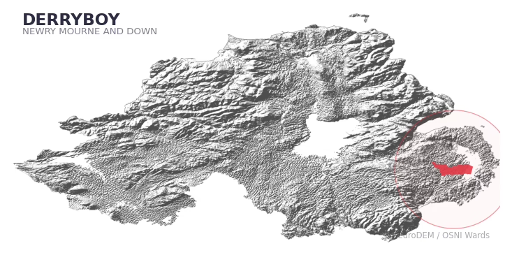
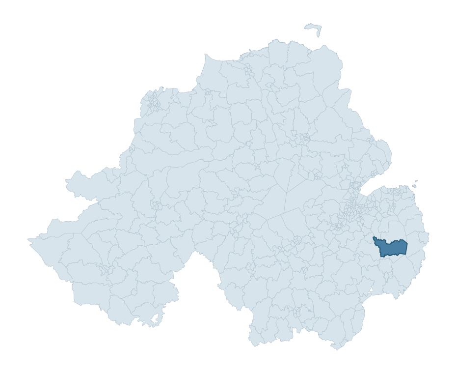
DERRYBOY boundary detailDERRYBOY in regional context
Heritage at a glance
Percentile rankings throughout this profile compare each ward only against the other 461 Northern Ireland wards.
145
Historic sites
95th percentile
11
Scheduled monuments
86th percentile
42
Listed buildings
72nd percentile
0.88
Sites per km²
Population context
18
Persons per km²
17th percentile
49.6
Sites per 1,000 residents
90th percentile
3,993
Total residents (2021)
The recorded heritage of DERRYBOY
Of the 145 historic sites recorded, the most common are Enclosure (14, 10% of historic sites), Cleared Slipway (11), and Rath (7). For Enclosures, this is the 81st percentile across NI wards that record this type. For Cleared Slipways, this is the 40th percentile among NI wards that record this type. Across the ward's 224.4 km², this gives a recorded density of 0.88 sites per km² (all heritage types combined). Scheduled monuments are distributed across approximately 0.05° of latitude and 0.15° of longitude within the ward, indicating dispersed rather than clustered placement.
Most common monument types
Type
Count
Description
Enclosure
14
—
Cleared Slipway
11
—
Rath
7
—
Chronological distribution
Mesolithic
5
Neolithic
2
Early Bronze Age
1
Iron Age
18
Early Medieval
28
Medieval
9
Post Medieval
48
Modern
4
Unknown
30
Note: 21% of historic site records carry an ‘Unknown’ period attribution. The chronological breakdown above reflects only the dated subset.
Terrain and environment
Mean elevation of 29m sits around the NI median (22th percentile), reaching 94m at the highest point. Mean slope is 3.8° (42th percentile across NI), giving moderately undulating terrain. Drainage is poor across much of the ward — the Topographic Wetness Index of 11.0 sits in the 81th NI percentile, reflecting low-lying or impeded-drainage ground prone to waterlogging. The land-cover mosaic combines improved grassland (60%), open water (23%), and woodland (10%), giving a mixed agricultural and semi-natural landscape.
Terrain measurements
Mean elevation28.7 m 23rd pct
Max elevation94.2 m 40th pct
Mean slope3.8° 42nd pct
Wetness index (TWI)11.00 81st pct
Grassland60.5% 55th pct
Woodland9.9% 18th pct
Cropland5.1% 80th pct
Urban land1.0% 8th pct
Where this ward sits in NI
Elevation
23rd
Slope
42nd
Drainage
81st
Grassland
55th
Woodland
18th
Geology and preservation
The dominant bedrock formed during the Palaeozoic era (Silurian period). Ancient sedimentary or metamorphic rock dating to before the age of dinosaurs; the resulting landscape has been long-stable enough to host every period of human activity. Bedrock composition is uniform (complexity index 0.00), with a single dominant geological unit underlying most of the ward. A uniform geology narrows the natural lithic-resource base available to past inhabitants.
Bedrock eraPalaeozoic
Bedrock periodSilurian
Surface depositsTill
Peat coverage0.0%
Bedrock complexity0.00
Placename evidence
The combined OSNI, Logainm NI, and GeoNames sources record 43 placenames for this ward. Diagnostic heritage strata identified within these are: 3 pre-Christian defensive (rath-, dún-, lios-, caiseal-) and 4 ecclesiastical (cill-, teampall-, mainistir-, díseart-). Note: Irish-language (name_ga) forms are recorded for roughly half of NI placenames in the combined sources, so anglicised forms whose Irish original could belong to multiple categories may be misclassified.
Scheduled monuments are sites legally protected under the Historic Monuments and Archaeological Objects (Northern Ireland) Order 1995, designated by the Historic Environment Division (HED).
Monument
Type
Period
Raised rath
Raised Rath
Early Medieval
Crannog in the Clea Lakes
Crannog In The Clea Lakes
Iron Age
Crannog in the Clea Lakes
Crannog In The Clea Lakes
Iron Age
Motte and bailey
Motte And Bailey
Medieval
Standing stone
Standing Stone
Early Bronze Age
Rath
Rath
Early Medieval
Tower-house: Ringhaddy Castle
Tower-House: Ringhaddy Castle
Unknown
Ringhaddy Church (area surrounding the state care monument)
Ringhaddy Church (Area Surrounding The State Care Monument)
Unknown
Chimney stack 'Shrigley Mill Chimney'
Chimney Stack 'Shrigley Mill Chimney'
Unknown
ECCLESIASTICAL SITE
Ecclesiastical Site
Unknown
RATH
Rath
Early Medieval
Recorded historic sites
Name
Period
Type
A.P. SITE
Unknown
Unknown
A.P. SITE
Unknown
Unknown
A.P. SITE
Post-Medieval
Unknown
A.P. SITE
Unknown
Unknown
A.P. SITE
Unknown
Unknown
A.P. SITE
Unknown
Unknown
A.P. SITE – RATH?
Early Medieval
Defence
A.P. SITE – circular cropmark
Unknown
Unknown
A.P. SITE CROPMARKS
Unknown
Unknown
A.P. SITE CROPMARKS
Unknown
Unknown
A.P. SITE LINEAR FEATURE
Unknown
Unknown
A.P. SITE LINEAR FEATURE
Unknown
Unknown
A.P. SITE LINEAR FEATURE
Unknown
Unknown
A.P. SITE LINEAR FEATURE
Unknown
Unknown
A.P. SITE NATURAL SPIT
Unknown
Industrial
A.P. SITE NATURAL SPIT
Unknown
Industrial
A.P. SITE: CLEAR CHANNEL
Unknown
Unknown
A.P. SITE: UNCERTAIN
Unknown
Unknown
A.P. SITE: VEHICLE TRACKS
Modern
Unknown
A.P.SITE NON-ANTIQUITY
Unknown
Unknown
ANIMAL SHELTER
Post-Medieval
Unknown
ARCHAEOLOGICALLY SENSITIVE AREA AROUND THE CASTLE
Unknown
Defence
BATTLE SITE, 1689
Mesolithic
Unknown
BIVALLATE RATH
Early Medieval
Defence
BIVALLATE RATH
Early Medieval
Defence
BURIAL GROUND
Post-Medieval
Ritual/Funerary
BURIAL in STONE LINED GRAVE
Early Medieval
Ritual/Funerary
Building
Unknown
Domestic
CASHEL
Early Medieval
Defence
CASHEL
Early Medieval
Defence
CASTLE, possibly Tower-House
Medieval
Defence
CAUSEWAY
Post-Medieval
Transport
CHURCH & ENCLOSURE: RINGHADDY CHURCH
Medieval
Religious
CHURCH & GRAVEYARD: KILLARESY CHURCH
Medieval
Ritual/Funerary
CHURCH (in ruins)
Medieval
Religious
CHURCH (site of)
Medieval
Religious
CLEARED SLIPWAY
Unknown
Unknown
CLEARED SLIPWAY
Post-Medieval
Unknown
CLEARED SLIPWAY
Unknown
Unknown
CLEARED SLIPWAY
Post-Medieval
Unknown
CLEARED SLIPWAY
Post-Medieval
Unknown
CLEARED SLIPWAY
Post-Medieval
Unknown
CLEARED SLIPWAY
Post-Medieval
Unknown
CLEARED SLIPWAY
Post-Medieval
Unknown
CLEARED SLIPWAY
Post-Medieval
Unknown
CLEARED SLIPWAY
Post-Medieval
Unknown
CLEARED SLIPWAY
Post-Medieval
Unknown
CLEARED SLIPWAY AND FLINTS
Mesolithic
Unknown
CRANNOG
Early Medieval
Defence
CRANNOG
Early Medieval
Defence
CRANNOG
Early Medieval
Defence
CRANNOG
Early Medieval
Defence
CRANNOG: DUMB LOUGH
Early Medieval
Defence
Duck Hide
Post-Medieval
Unknown
ENCLOSURE
Iron Age
Unknown
ENCLOSURE
Iron Age
Unknown
ENCLOSURE
Iron Age
Unknown
ENCLOSURE
Iron Age
Unknown
ENCLOSURE
Iron Age
Unknown
ENCLOSURE
Iron Age
Unknown
ENCLOSURE
Iron Age
Unknown
ENCLOSURE
Iron Age
Unknown
ENCLOSURE
Iron Age
Unknown
ENCLOSURE
Iron Age
Unknown
ENCLOSURE
Iron Age
Unknown
ENCLOSURE
Iron Age
Unknown
ENCLOSURE
Iron Age
Unknown
ENCLOSURE
Iron Age
Unknown
ENCLOSURE – rath?
Iron Age
Defence
ENCLOSURE -rath?
Iron Age
Defence
ENCLOSURE: CURLEY'S FORT
Iron Age
Defence
Enclosure
Iron Age
Unknown
FIELD BOUNDARY EXTENSION
Post-Medieval
Agriculture
FIELD BOUNDARY EXTENSION
Post-Medieval
Agriculture
FIELD BOUNDARY EXTENSION
Post-Medieval
Agriculture
FIELD BOUNDARY EXTENSION
Post-Medieval
Agriculture
FIELD BOUNDARY EXTENSION
Post-Medieval
Agriculture
FIELD BOUNDARY EXTENSION
Post-Medieval
Agriculture
FIELD BOUNDARY EXTENSION: MODERN FENCE
Modern
Agriculture
FOLLY
Post-Medieval
Unknown
FORD
Post-Medieval
Transport
FORD AND INTERTIDAL WALL
Post-Medieval
Transport
Findspot – unlocated
Neolithic
Unknown
Findspot of one stone axe – unlocated
Unknown
Unknown
Findspots – unlocated
Neolithic
Unknown
GRAVEYARD
Unknown
Ritual/Funerary
HARD
Post-Medieval
Unknown
HOLY WELL: SUNDAY WELL
Early Medieval
Ritual/Funerary
Historic Settlement
Post-Medieval
Domestic
Historic Settlement Darragh Cross
Post-Medieval
Domestic
Historic Settlement Shrigley
Post-Medieval
Domestic
INTERTIDAL WALL
Post-Medieval
Unknown
Inscribed Stone/ Dressed stone on foreshore
Unknown
Unknown
KILLOWEN MEDIEVAL CHURCH (ruined) and GRAVEYARD; with 2 CROSS-CARVED STONES
Early Medieval
Ritual/Funerary
KILLYBANN GRAVEYARD
Medieval
Ritual/Funerary
LANDING PLACE
Post-Medieval
Transport
MESOLITHIC OCCUPATION SITE
Mesolithic
Unknown
MILL CHIMNEY – IHR 03065
Modern
Agriculture
MOTTE & BAILEY
Medieval
Defence
MOUND – raised rath?: THE FORT
Early Medieval
Defence
Mill
Post-Medieval
Agriculture
Modern Fence
Modern
Unknown
NATURAL FORD
Unknown
Transport
NON-ANTIQUITY
Unknown
Unknown
NON-ANTIQUITY
Unknown
Unknown
PLATFORM RATH
Early Medieval
Defence
PLATFORM RATH
Early Medieval
Defence
PRE-NORMAN & MEDIEVAL CHURCH & GRAVEYARD (unlocated): KILDUNCY
Early Medieval
Ritual/Funerary
Placename suggests Viking Influence
Early Medieval
Unknown
QUAY (Remains of)
Post-Medieval
Transport
RAISED RATH
Early Medieval
Defence
RAISED RATH
Mesolithic
Defence
RATH
Early Medieval
Defence
RATH
Early Medieval
Defence
RATH
Early Medieval
Defence
RATH
Early Medieval
Defence
RATH
Early Medieval
Defence
RATH
Early Medieval
Defence
RATH
Early Medieval
Defence
RATH & WINDMILL – IHR 03062
Early Medieval
Defence
RATH: THE FORT
Early Medieval
Defence
RECLAMATION BANKS
Post-Medieval
Commercial
RUINED CLEARED SLIPWAY
Post-Medieval
Unknown
SHORE REVETMENT SEA DEFENCE
Post-Medieval
Unknown
SLIPWAY
Post-Medieval
Unknown
SLIPWAY
Post-Medieval
Unknown
SLIPWAY
Unknown
Unknown
SLIPWAY, STONE STRUCTURE AND UPRIGHT STONE MARKERS
Post-Medieval
Domestic
STANDING STONE
Early Bronze Age
Ritual/Funerary
STANDING STONE
Mesolithic
Ritual/Funerary
STONE FARM JETTY AND CLEARED SLIPWAY
Post-Medieval
Agriculture
STONE FISH TRAP
Medieval
Agriculture
STONE QUAY
Post-Medieval
Transport
STONE QUAY
Post-Medieval
Transport
STONE QUAY
Post-Medieval
Transport
STONE QUAY
Post-Medieval
Transport
STONE QUAY
Post-Medieval
Transport
STONE QUAY AND CLEARED SLIPWAY
Post-Medieval
Transport
STONE QUAY AND CLEARED SLIPWAY
Post-Medieval
Transport
STONE QUAY AND CLEARED SLIPWAY
Post-Medieval
Transport
STONE SLIPWAY
Post-Medieval
Unknown
STONE TONGUE-SHAPED QUAY
Post-Medieval
Transport
STONE: GIANT'S STONE
Unknown
Unknown
TIDAL POND
Unknown
Unknown
TOWER-HOUSE: RINGHADDY CASTLE
Medieval
Defence
Listed buildings in DERRYBOY
Address / Name
Grade
Period
John Martin Monument
Clay Road
Shrigley
Tullyveery (Td.)
Killyleagh
Co. Down
BT30 9PN
B1
1860 – 1879
Raffrey Presbyterian Church
Manse Road
Raffrey
Crossgar
Co. Down
BT30 9LY
B2
1840 – 1859
42 Quarterland Road
Rathgorman
Killinchy
Co. Down
BT23 6TX
B2
1820 – 1839
Moor Hall (with gates and outbuildings)
96 Killyleagh Road
Ballybredagh
Killinchy
Co. Down
BT23 6TR
B2
1760 – 1779
93 Derryboy Road
Ballygoskin
Crossgar
Co. Down
BT30 9LW
B2
1820 – 1839
38 Ballygoskin Road
Ballygoskin
Crossgar
Co. Down
BT30 9LW
Record Only
1820 – 1839
Archway and adjacent buildings at 'The Fort'
171 Clay Road
Ballygoskin
Killyleagh
Co. Down
BT30 9PN
Record Only
1820 – 1839
Tullyverry House
7 Ardigon Road
Tullyveery
Killyleagh
Co. Down
BT30 9TA
B1
1820 – 1839
Outbuildings at Tullyveery House
7 Ardigon Road
Tullyveery
Killyleagh
Co. Down
BT30 9TA
B2
1840 – 1859
Outbuildings at Tullyveery House (calf house, cottage)
7 Ardigon Road
Tullyveery
Killyleagh
Co. Down
BT30 9TA
B2
1860 – 1879
The Hill
32 Jericho Road
Ardigon
Killyleagh
Co. Down
BT30 9TF
B2
1840 – 1859
Maymore House
97 Comber Road
Moymore
Killyleagh
Co. Down
BT30 9PG
B2
1840 – 1859
Toye House
1 Kirkland Road
Toy and Kirkland
Killyleagh
Co. Down
BT30 9PQ
B1
1760 – 1779
Ballymacarron House
69 Ringdufferin Road
Ballymacarron
Killyleagh
Co. Down
BT30 9PH
Record Only
1840 – 1859
Ardigon House
51 Ardigon Road
Ardigon
Killyleagh
Co. Down
BT30 9TA
B1
1840 – 1859
Ringdufferin House
35 Ringdufferin Road
Ringdufferin
Killyleagh
Co. Down
BT30 9PH
B+
1780 – 1799
Outbuildings at Ringdufferin House
35 Ringdufferin Road
Ringdufferin
Killyleagh
Co. Down
BT30 9PH
B1
1780 – 1799
34 Derryboy Road
Killinchy
Co. Down
B1
1820 – 1839
RIVERDALE HOUSE
Braeside Gardens
CORPORATION
KILLYLEAGH
Downpatrick
CO.DOWN
BT33 9QE
B1
—
KILLOWEN CHURCH RUINS,
KILLOWEN GRAVEYARD
KILLYLEAGH
Downpatrick
CO.DOWN
Record Only
Pre 1600
48 Killyleagh Street
Crossgar
Co Down
BT30 9QD
B2
1860 – 1879
50 Killyleagh Street
Crossgar
Co Down
BT30 9QD
B2
1860 – 1879
32 Quarterland Road
Quarterland
Killinchy
Co. Down
BT23 6TX
Record Only
1820 – 1839
1-3 Tullyveery Road
Tullyveery
Killyleagh
Co. Down
BT30 9TD
Record Only
1900 – 1919
5 Sunday Well Road
Ardigon
Crossgar
Co. Down
BT30 9TG
Grounding History: 10 Maps of Northern Ireland’s Past
A spatial history report bringing together analysis of all 462 wards into one place through 10 high-quality maps — covering monument density, archaeological periods, placename heritage, terrain, wetland, and the historic landscape at first survey.
A ward is the smallest electoral and statistical geography used by the Northern Ireland Statistics and Research Agency (NISRA). The boundaries used here are the 2014 NISRA / OSNI Wards (462 across Northern Ireland), each typically covering 1-700 km² and a population of a few thousand. Wards do not align with parishes, townlands, or any historic administrative unit — they are a modern statistical convenience, used here only as a fixed spatial frame within which to summarise heritage records.
What counts as a site?
Three distinct heritage record types are reported separately, not combined: (1) Historic Sites — entries in the Northern Ireland Sites and Monuments Record (NISMR), the inventory of recorded archaeological sites and findspots, dated from prehistoric to early-modern; (2) Scheduled Monuments — sites legally protected under the Historic Monuments and Archaeological Objects (NI) Order 1995 and maintained by the Historic Environment Division (HED); (3) Listed Buildings — buildings of architectural or historic interest protected under the Planning Act (NI) 2011 and graded A, B+, B1, B2, or Record-Only by HED. A site appearing in more than one register is counted in each register independently.
Editorial principles
These ward profiles describe evidence, not history. They report what is recorded, not what occurred. Where the data is ambiguous, we say so. We do not infer historical processes — population movements, settlement expansion, periods of decline — from patterns in the record. Absence of evidence is not evidence of absence: in Northern Ireland, where antiquarian survey was uneven and modern excavation is geographically biased, a gap in the record almost always reflects the limits of recording rather than a genuine historical absence. We mark such gaps explicitly where they appear in the data.
Limits of coverage and known caveats
Several caveats apply to every ward profile: (1) NISMR coverage is uneven across NI — some areas (notably parts of the south-east and the Belfast urban fringe) have been more intensively surveyed than others, so a low recorded site count does not reliably indicate a low past density of activity; (2) period attributions in NISMR are often 'Unknown', and chronological breakdowns reported here reflect only the dated subset; (3) placename classification depends on the Irish-language form (name_ga), which is recorded for approximately 50% of NI placenames in the combined sources, so ecclesiastical and pre-Christian counts may be understated where anglicised forms remain unparsed; (4) terrain percentile ranks compare each ward only to the other 461 NI wards; they are not absolute thresholds. For absence-dominant land cover categories (wetland, water, cropland), percentile ranks are suppressed below 1% raw value, since the ranking of zero-value wards is not meaningful.
Data sources (11)
Northern Ireland Sites and Monuments Record (NISMR)
Spotted an error? This dataset is updated continuously.
Email contact@danielkirkpatrick.co.uk with corrections, missing records, or suggestions for improvement.
Manage Consent
To provide the best experiences, we use technologies like cookies to store and/or access device information. Consenting to these technologies will allow us to process data such as browsing behaviour or unique IDs on this site. Not consenting or withdrawing consent, may adversely affect certain features and functions.
Functional
Always active
The technical storage or access is strictly necessary for the legitimate purpose of enabling the use of a specific service explicitly requested by the subscriber or user, or for the sole purpose of carrying out the transmission of a communication over an electronic communications network.
Preferences
The technical storage or access is necessary for the legitimate purpose of storing preferences that are not requested by the subscriber or user.
Statistics
The technical storage or access that is used exclusively for statistical purposes.The technical storage or access that is used exclusively for anonymous statistical purposes. Without a subpoena, voluntary compliance on the part of your Internet Service Provider, or additional records from a third party, information stored or retrieved for this purpose alone cannot usually be used to identify you.
Marketing
The technical storage or access is required to create user profiles to send advertising, or to track the user on a website or across several websites for similar marketing purposes.