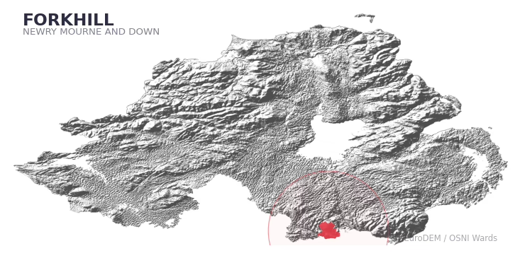
FORKHILL covers 164.4 km² in Northern Ireland. With 53 historic sites and 17 scheduled monuments on record, the ward sits at the 82nd percentile across all 462 NI wards for combined archaeological heritage. It also records 67 listed buildings (HED Historic Buildings Record), the 85th percentile for listed-building density across NI wards. Per 1,000 residents, this works out at 32.8 recorded sites — the 78th percentile across NI wards (a measure of heritage density relative to current population). Dated archaeological evidence runs from the Mesolithic through to the Post-Medieval period, spanning 5 archaeological periods, around the NI median for chronological depth.

Heritage at a glance
Percentile rankings throughout this profile compare each ward only against the other 461 Northern Ireland wards.
Population context
The recorded heritage of FORKHILL
Of the 53 historic sites recorded, the most common are Rath (7, 13% of historic sites), Enclosure (7), and Rath & Souterrain (2). For Raths, this is the 52nd percentile among NI wards that record this type. For Enclosures, this is the 60th percentile among NI wards that record this type. Across the ward's 164.4 km², this gives a recorded density of 0.83 sites per km² (all heritage types combined). Scheduled monuments are distributed across approximately 0.08° of latitude and 0.10° of longitude within the ward, indicating dispersed rather than clustered placement.
Most common monument types
| Type | Count | Description |
|---|---|---|
| Rath | 7 | — |
| Enclosure | 7 | — |
| Rath & Souterrain | 2 | — |
Chronological distribution
Terrain and environment
With a mean elevation of 158m, this ward sits above the NI median (89th percentile), but the ward reaches 573m at its highest point — a vertical span of more than 414m within its boundary, indicating significant topographic diversity. The terrain is consistently steep, with a mean slope of 8.2° (97th percentile across NI); localised maximum slopes reach 23°, typical of stream-cut valleys, escarpments, or bluffs within the wider landscape. The ward is well-drained, with a Topographic Wetness Index of 9.3 (4th NI percentile) — characteristic of upland or steeply-sloping ground that sheds water rapidly. The land cover is dominated by improved grassland (80%) and woodland (18%). In overall character, this is an upland landscape of steep, elevated terrain, with land use dominated by improved grassland.
Terrain measurements
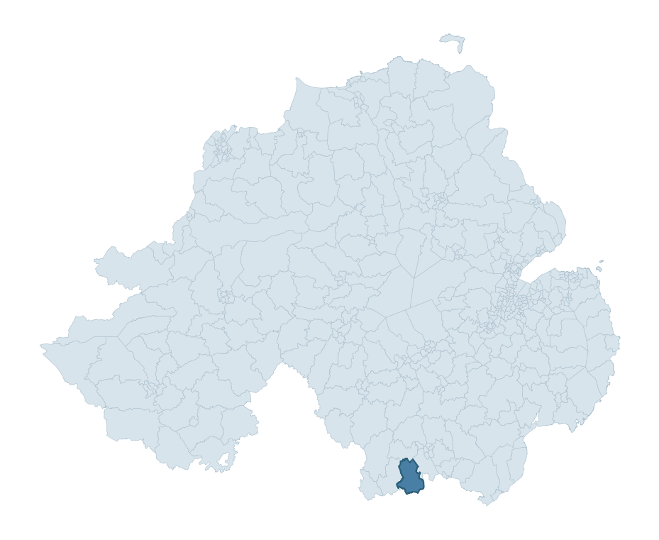
Where this ward sits in NI
Geology and preservation
The dominant bedrock formed during the Cainozoic era (Palaeogene period). Relatively young rock formed in the last 66 million years. In Ulster, Cainozoic basalt — the lava that created the Antrim Plateau and Giant's Causeway — dominates much of the eastern landscape. Peat covers 6% of the ward — a minor share, but where it occurs it can preserve organic finds in good condition. Bedrock composition is moderately varied (complexity index 0.65), with two or three geological units present within the ward boundary.
Placename evidence
The combined OSNI, Logainm NI, and GeoNames sources record 43 placenames for this ward. Of those, 3 fall into the ecclesiastical category (cill-, teampall-, mainistir-, díseart-) — the only diagnostic heritage stratum identified beyond the generic Gaelic landscape substrate. Note: Irish-language (name_ga) forms are recorded for roughly half of NI placenames in the combined sources, so anglicised forms whose Irish original could belong to multiple categories may be misclassified.
Placename categories
Scheduled monuments in FORKHILL
Scheduled monuments are sites legally protected under the Historic Monuments and Archaeological Objects (Northern Ireland) Order 1995, designated by the Historic Environment Division (HED).
| Monument | Type | Period |
|---|---|---|
| Portal tomb: the Oul'Grave | Portal Tomb: The Oul'Grave | Neolithic |
| Hilltop Enclosure: Carrickinaffrin | Hilltop Enclosure: Carrickinaffrin | Iron Age |
| Standing Stone: the Long stone | Standing Stone: The Long Stone | Early Bronze Age |
| Rath | Rath | Early Medieval |
| Rath | Rath | Early Medieval |
| Ecclesiastical site and bullaun (area surrounding the state care monument): Kilnasaggart | Ecclesiastical Site And Bullaun (Area Surrounding The State Care Monument): Kilnasaggart | Unknown |
| Cashel and Souterrain | Cashel And Souterrain | Iron Age |
| Rath | Rath | Early Medieval |
Recorded historic sites
| Name | Period | Type |
|---|---|---|
| BATTLE SITE: MOYRY PASS, 1600 | Post-Medieval | Unknown |
| Battlefield | Unknown | Commemorative |
| CAIRN (unlocated) | Mesolithic | Ritual/Funerary |
| CAIRN?: CAIRNAN HILL (placename evidence only) | Mesolithic | Ritual/Funerary |
| CASHEL | Early Medieval | Defence |
| CASHEL & SOUTERRAIN: LISSACASHEL | Early Medieval | Defence |
| CASHEL reused as KILLEEN: THE SHANKILL | Early Medieval | Defence |
| CASTLE & BAWN: MOYRY or MOIRY CASTLE | Medieval | Defence |
| CHURCH SITE & CROSS-CARVED BOULDER: THE SHANKILL | Unknown | Religious |
| COURT TOMB: NORTH CAIRN | Mesolithic | Ritual/Funerary |
Listed buildings in FORKHILL
| Address / Name | Grade | Period |
|---|---|---|
| Stable block and attached former mill Killevy Castle Ballintemple Road Meigh Killeavy NEWRY Co. Armagh BT35 8LQ | B2 | 1820 – 1839 |
| Gate Lodge to Hawthorn Hill Drumintee Road Killevy Newry Co Armagh BT35 8DE | B2 | 1840 – 1859 |
| Hawthorn Hill Wood Road Killevy Co Armagh BT35 8DE | Record Only | 1920 – 1939 |
| Outbuildings Hawthorn Hill Wood Road Killevy Co Armagh BT35 8DE | B2 | 1800 – 1819 |
| Forkhill Parish Church Church Road Forkhill Newry Co. Armagh BT35 9SX | B2 | 1760 – 1779 |
| 19 Foughilletra Road Jonesborough Newry Co Armagh BT35 8RH | B1 | 1840 – 1859 |
| Parochial House 40 Jonesborough Village Newry Co. Armagh BT35 8HP | Record Only | 1880 – 1899 |
| 17 Jonesborough Village Jonesborough Newry Co Armagh BT35 8HP | Record Only | 1800 – 1819 |
| Jonesborough House Jonesborough Newry Co Armagh BT35 8HR | B1 | 1760 – 1779 |
| St Patrick's R.C Church New Line Drumintee Newry Co Armagh BT35 8TA | B2 | 1860 – 1879 |
Discover more in Newry, Mourne and Down
- Kilkeel
- Whitecross
- Saintfield
- Kilmore
- Lecale
- Cathedral
- Derryboy
- Finaghy — Belfast
- Foyle Springs — Derry City and Strabane
- Falls Park — Belfast
See all 462 wards in the Northern Ireland Heritage Tool.

Want a deeper view?
Grounding History: 10 Maps of Northern Ireland’s Past
A spatial history report bringing together analysis of all 462 wards into one place through 10 high-quality maps — covering monument density, archaeological periods, placename heritage, terrain, wetland, and the historic landscape at first survey.
About this profile
What is a ward?
A ward is the smallest electoral and statistical geography used by the Northern Ireland Statistics and Research Agency (NISRA). The boundaries used here are the 2014 NISRA / OSNI Wards (462 across Northern Ireland), each typically covering 1-700 km² and a population of a few thousand. Wards do not align with parishes, townlands, or any historic administrative unit — they are a modern statistical convenience, used here only as a fixed spatial frame within which to summarise heritage records.
What counts as a site?
Three distinct heritage record types are reported separately, not combined: (1) Historic Sites — entries in the Northern Ireland Sites and Monuments Record (NISMR), the inventory of recorded archaeological sites and findspots, dated from prehistoric to early-modern; (2) Scheduled Monuments — sites legally protected under the Historic Monuments and Archaeological Objects (NI) Order 1995 and maintained by the Historic Environment Division (HED); (3) Listed Buildings — buildings of architectural or historic interest protected under the Planning Act (NI) 2011 and graded A, B+, B1, B2, or Record-Only by HED. A site appearing in more than one register is counted in each register independently.
Editorial principles
These ward profiles describe evidence, not history. They report what is recorded, not what occurred. Where the data is ambiguous, we say so. We do not infer historical processes — population movements, settlement expansion, periods of decline — from patterns in the record. Absence of evidence is not evidence of absence: in Northern Ireland, where antiquarian survey was uneven and modern excavation is geographically biased, a gap in the record almost always reflects the limits of recording rather than a genuine historical absence. We mark such gaps explicitly where they appear in the data.
Limits of coverage and known caveats
Several caveats apply to every ward profile: (1) NISMR coverage is uneven across NI — some areas (notably parts of the south-east and the Belfast urban fringe) have been more intensively surveyed than others, so a low recorded site count does not reliably indicate a low past density of activity; (2) period attributions in NISMR are often 'Unknown', and chronological breakdowns reported here reflect only the dated subset; (3) placename classification depends on the Irish-language form (name_ga), which is recorded for approximately 50% of NI placenames in the combined sources, so ecclesiastical and pre-Christian counts may be understated where anglicised forms remain unparsed; (4) terrain percentile ranks compare each ward only to the other 461 NI wards; they are not absolute thresholds. For absence-dominant land cover categories (wetland, water, cropland), percentile ranks are suppressed below 1% raw value, since the ranking of zero-value wards is not meaningful.
Data sources (11)
- Northern Ireland Sites and Monuments Record (NISMR) https://www.communities-ni.gov.uk/articles/nismr-public-mapviewer
- HED Scheduled Monuments Dataset https://www.opendatani.gov.uk/@historic-environment-division/scheduled-monuments-northern-ireland
- HED Historic Buildings Record https://www.communities-ni.gov.uk/topics/historic-environment/listed-buildings
- OSNI OS Open Names (Northern Ireland) https://www.opendatani.gov.uk/@ordnance-survey-of-northern-ireland/osni-open-data—50k-gazetteer
- Logainm — Placenames Database of Ireland https://www.logainm.ie/
- GeoNames https://www.geonames.org/
- Census 2021 (Northern Ireland) https://www.nisra.gov.uk/statistics/2021-census
- OSNI Open Data — Largescale Boundaries https://www.opendatani.gov.uk/@ordnance-survey-of-northern-ireland/osni-open-data-largescale-boundaries-wards-2012
- Copernicus GLO-30 DEM https://spacedata.copernicus.eu/collections/copernicus-digital-elevation-model
- ESA WorldCover https://esa-worldcover.org/
- GSNI 1:250,000 Geology https://www.bgs.ac.uk/geological-data/maps/