MULLAGHBANE covers 162.8 km² in Northern Ireland. With 33 historic sites and 8 scheduled monuments on record, the ward sits at the 52nd percentile across all 462 NI wards for combined archaeological heritage. It also records 18 listed buildings (HED Historic Buildings Record), the 47th percentile for listed-building density across NI wards. Per 1,000 residents, this works out at 13.3 recorded sites — the 51st percentile across NI wards (a measure of heritage density relative to current population). Dated archaeological evidence runs from the Mesolithic through to the Modern period, spanning 6 archaeological periods, around the NI median for chronological depth.

Heritage at a glance
Percentile rankings throughout this profile compare each ward only against the other 461 Northern Ireland wards.
Population context
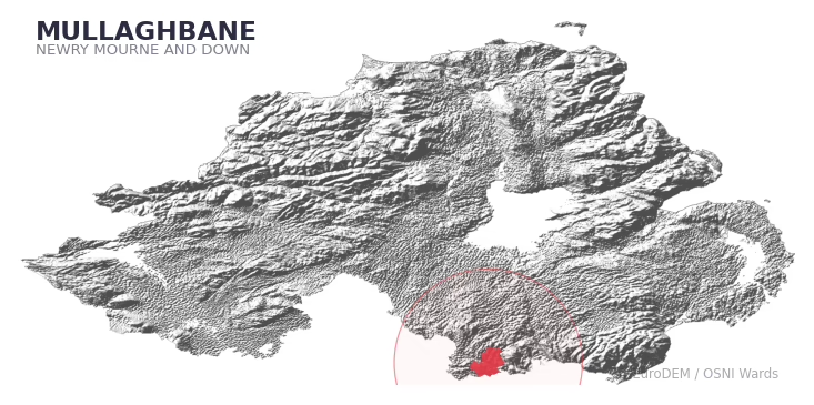
The recorded heritage of MULLAGHBANE
Of the 33 historic sites recorded, the most common are Counterscarp Rath (2, 6% of historic sites), Enclosure (1), and Platform Rath (1). For Counterscarp Raths, this is the 33rd percentile among NI wards that record this type. For Enclosures, this is the 0th percentile across NI wards that record this type. Across the ward's 162.8 km², this gives a recorded density of 0.36 sites per km² (all heritage types combined). Scheduled monuments are distributed across approximately 0.07° of latitude and 0.05° of longitude within the ward, indicating dispersed rather than clustered placement.
Most common monument types
| Type | Count | Description |
|---|---|---|
| Counterscarp Rath | 2 | — |
| Enclosure | 1 | — |
| Platform Rath | 1 | — |
Chronological distribution
Terrain and environment
With a mean elevation of 123m, this ward sits above the NI median (81th percentile), with a maximum of 288m giving the ward meaningful vertical relief. The terrain is consistently steep, with a mean slope of 6.1° (90th percentile across NI); localised maximum slopes reach 16°, typical of stream-cut valleys, escarpments, or bluffs within the wider landscape. The ward is well-drained, with a Topographic Wetness Index of 9.7 (13th NI percentile) — characteristic of upland or steeply-sloping ground that sheds water rapidly. The land cover is dominated by improved grassland (84%) and woodland (13%). In overall character, this is an upland landscape of steep, elevated terrain, with land use dominated by improved grassland.
Terrain measurements
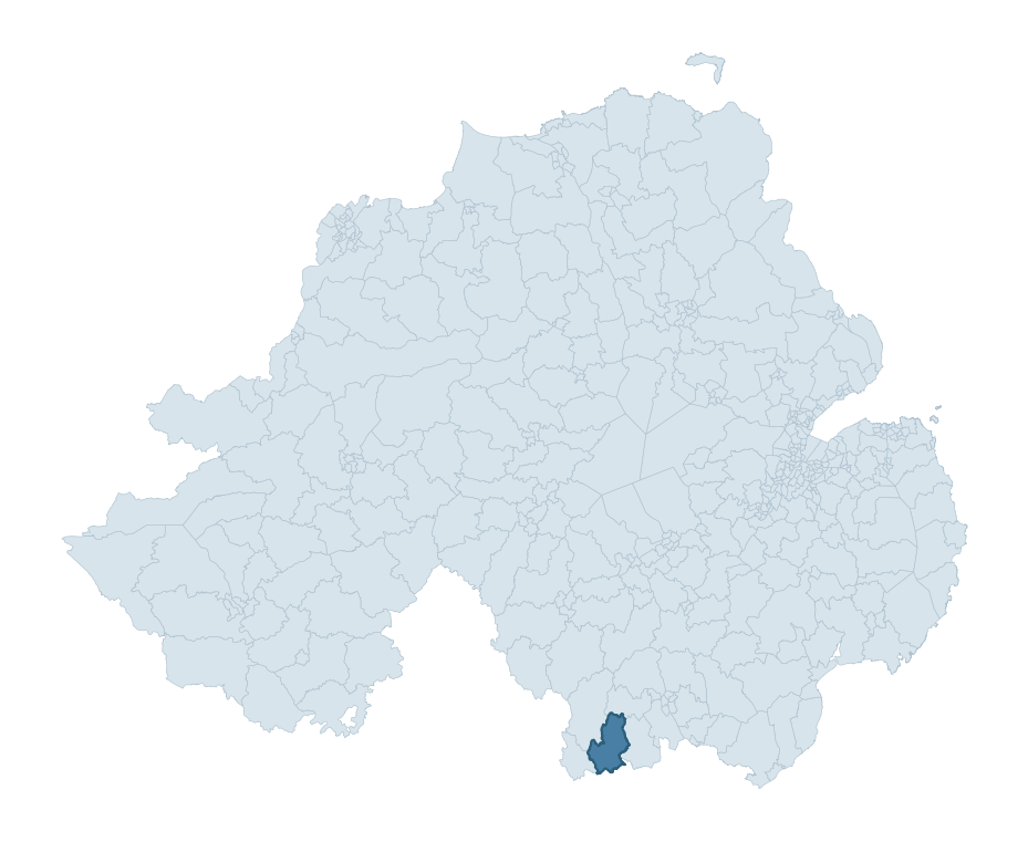
Where this ward sits in NI
Geology and preservation
The dominant bedrock formed during the Palaeozoic era (Silurian period). Ancient sedimentary or metamorphic rock dating to before the age of dinosaurs; the resulting landscape has been long-stable enough to host every period of human activity. Peat covers 4% of the ward — a minor share, but where it occurs it can preserve organic finds in good condition. Bedrock composition is moderately varied (complexity index 0.65), with two or three geological units present within the ward boundary.
Placename evidence
The combined OSNI, Logainm NI, and GeoNames sources record 40 placenames for this ward. Diagnostic heritage strata identified within these are: 1 pre-Christian defensive (rath-, dún-, lios-, caiseal-) and 1 ecclesiastical (cill-, teampall-, mainistir-, díseart-). Note: Irish-language (name_ga) forms are recorded for roughly half of NI placenames in the combined sources, so anglicised forms whose Irish original could belong to multiple categories may be misclassified.
Placename categories
Scheduled monuments in MULLAGHBANE
Scheduled monuments are sites legally protected under the Historic Monuments and Archaeological Objects (Northern Ireland) Order 1995, designated by the Historic Environment Division (HED).
| Monument | Type | Period |
|---|---|---|
| Cashel | Cashel | Early Medieval |
| Rectangular earthwork: the Relig | Rectangular Earthwork: The Relig | Unknown |
| Graveyard Enclosure: Kilnacrue | Graveyard Enclosure: Kilnacrue | Iron Age |
| Cashel: Mc Partland's Forth | Cashel: Mc Partland'S Forth | Early Medieval |
| Rath | Rath | Early Medieval |
| Megalithic Tomb: Giant's Grave | Megalithic Tomb: Giant'S Grave | Neolithic |
| Rath | Rath | Early Medieval |
| Crannog | Crannog | Iron Age |
Recorded historic sites
| Name | Period | Type |
|---|---|---|
| A.P. SITE – circular enclosure | Iron Age | Unknown |
| CASHEL | Early Medieval | Defence |
| CASHEL & possible SOUTERRAIN | Early Medieval | Defence |
| CASHEL? | Early Medieval | Defence |
| CASHEL? (placename evidence only) | Early Medieval | Defence |
| CHURCH SITE; GRAVEYARD: KILNACRUE or SHANKILL | Unknown | Ritual/Funerary |
| COUNTERSCARP RATH | Early Medieval | Defence |
| COUNTERSCARP RATH | Early Medieval | Defence |
| CRANNOG in GLASDRUMMAN LOUGH | Early Medieval | Defence |
| Cairn | Mesolithic | Ritual/Funerary |
Listed buildings in MULLAGHBANE
| Address / Name | Grade | Period |
|---|---|---|
| CREGGAN CHURCH, CREGGAN Newry CO.ARMAGH | B+ | — |
| SEXTON'S DWELLING AND SCHOOLHOUSE AT CREGGAN CHURCH, CREGGAN Newry CO.ARMAGH | B1 | — |
| ST. BRIGID'S R C CHURCH GLASDRUMMAN Newry CO.ARMAGH | B+ | — |
| SILVER BRIDGE HOUSE 3 DRUMALT ROAD SILVERBRIDGE UMMERACAM SOUTH CROSSMAGLEN CO.ARMAGH | B1 | — |
| SILVER BRIDGE UMMERACAM SOUTH CROSSMAGLEN CO.ARMAGH | B2 | — |
| THE ALTS 4 LURGANCULLENBOY ROAD CREGGAN Newry CO.ARMAGH | B2 | — |
| House at Redmond's Cross (Mullaghbawn Folk Museum) Cowan Road Tullymacreeve Camlough Co. Armagh BT35 9TJ | B2 | 1820 – 1839 |
| Mounthill House, 16 Leeter Rd Newry, Co. Down BT35 9EW | D1 Record Only | — |
| 41 Carricknagavna Road, Camlough, Co.Armagh BT35 7PZ | D1 Record Only | — |
| Cottage 1, 10 Drumhalt Road, Camlough, Co.Armagh BT35 9QL | D1 Record Only | — |
Discover more in Newry, Mourne and Down
- Ballynahinch
- Newtownhamilton
- Quoile
- Kilkeel
- Derryboy
- Crossmaglen
- St. Patrick's
- Maine — Mid and East Antrim
- Mountsandel — Causeway Coast and Glens
- Moygashel — Mid Ulster
See all 462 wards in the Northern Ireland Heritage Tool.

Want a deeper view?
Grounding History: 10 Maps of Northern Ireland’s Past
A spatial history report bringing together analysis of all 462 wards into one place through 10 high-quality maps — covering monument density, archaeological periods, placename heritage, terrain, wetland, and the historic landscape at first survey.
About this profile
What is a ward?
A ward is the smallest electoral and statistical geography used by the Northern Ireland Statistics and Research Agency (NISRA). The boundaries used here are the 2014 NISRA / OSNI Wards (462 across Northern Ireland), each typically covering 1-700 km² and a population of a few thousand. Wards do not align with parishes, townlands, or any historic administrative unit — they are a modern statistical convenience, used here only as a fixed spatial frame within which to summarise heritage records.
What counts as a site?
Three distinct heritage record types are reported separately, not combined: (1) Historic Sites — entries in the Northern Ireland Sites and Monuments Record (NISMR), the inventory of recorded archaeological sites and findspots, dated from prehistoric to early-modern; (2) Scheduled Monuments — sites legally protected under the Historic Monuments and Archaeological Objects (NI) Order 1995 and maintained by the Historic Environment Division (HED); (3) Listed Buildings — buildings of architectural or historic interest protected under the Planning Act (NI) 2011 and graded A, B+, B1, B2, or Record-Only by HED. A site appearing in more than one register is counted in each register independently.
Editorial principles
These ward profiles describe evidence, not history. They report what is recorded, not what occurred. Where the data is ambiguous, we say so. We do not infer historical processes — population movements, settlement expansion, periods of decline — from patterns in the record. Absence of evidence is not evidence of absence: in Northern Ireland, where antiquarian survey was uneven and modern excavation is geographically biased, a gap in the record almost always reflects the limits of recording rather than a genuine historical absence. We mark such gaps explicitly where they appear in the data.
Limits of coverage and known caveats
Several caveats apply to every ward profile: (1) NISMR coverage is uneven across NI — some areas (notably parts of the south-east and the Belfast urban fringe) have been more intensively surveyed than others, so a low recorded site count does not reliably indicate a low past density of activity; (2) period attributions in NISMR are often 'Unknown', and chronological breakdowns reported here reflect only the dated subset; (3) placename classification depends on the Irish-language form (name_ga), which is recorded for approximately 50% of NI placenames in the combined sources, so ecclesiastical and pre-Christian counts may be understated where anglicised forms remain unparsed; (4) terrain percentile ranks compare each ward only to the other 461 NI wards; they are not absolute thresholds. For absence-dominant land cover categories (wetland, water, cropland), percentile ranks are suppressed below 1% raw value, since the ranking of zero-value wards is not meaningful.
Data sources (11)
- Northern Ireland Sites and Monuments Record (NISMR) https://www.communities-ni.gov.uk/articles/nismr-public-mapviewer
- HED Scheduled Monuments Dataset https://www.opendatani.gov.uk/@historic-environment-division/scheduled-monuments-northern-ireland
- HED Historic Buildings Record https://www.communities-ni.gov.uk/topics/historic-environment/listed-buildings
- OSNI OS Open Names (Northern Ireland) https://www.opendatani.gov.uk/@ordnance-survey-of-northern-ireland/osni-open-data—50k-gazetteer
- Logainm — Placenames Database of Ireland https://www.logainm.ie/
- GeoNames https://www.geonames.org/
- Census 2021 (Northern Ireland) https://www.nisra.gov.uk/statistics/2021-census
- OSNI Open Data — Largescale Boundaries https://www.opendatani.gov.uk/@ordnance-survey-of-northern-ireland/osni-open-data-largescale-boundaries-wards-2012
- Copernicus GLO-30 DEM https://spacedata.copernicus.eu/collections/copernicus-digital-elevation-model
- ESA WorldCover https://esa-worldcover.org/
- GSNI 1:250,000 Geology https://www.bgs.ac.uk/geological-data/maps/