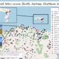
As a resident of Belfast myself, I like to think I know its history well. Indeed I prided myself on the point, that is until I created this map. Not only does it show the scale and breadth of history, it reveals just how hidden much of it remains. So the interactive map of historical sites in Greater Belfast below seeks to address exactly that – making them visible and accessible. I also have provided several examples and summary of key the trends.
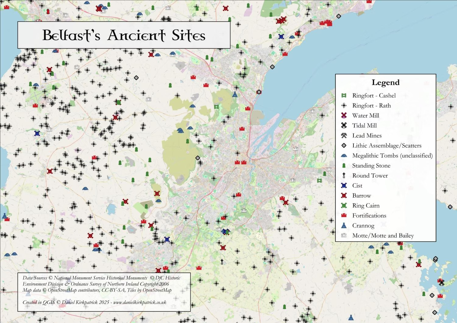
Interactive Map of Historical Sites in Belfast
Interactive Map of Belfast Historical Sites
Click to view all recorded historical locations across Greater Belfast.
This interactive map was created in QGIS using data from the Department for Communities NI datasets. Copyright for the data and basemaps attribution is as follows:
Data Sources: © DfC Historic Environment Division & Ordnance Survey of Northern Ireland Copyright 2006
Map data: © OpenStreetMap contributors, CC-BY-SA, Tiles by OpenStreetMap
The map itself was created by myself using QGIS alongside PowerQuery. Some of the icons I created myself, but the majority are standard ones available in QGIS.
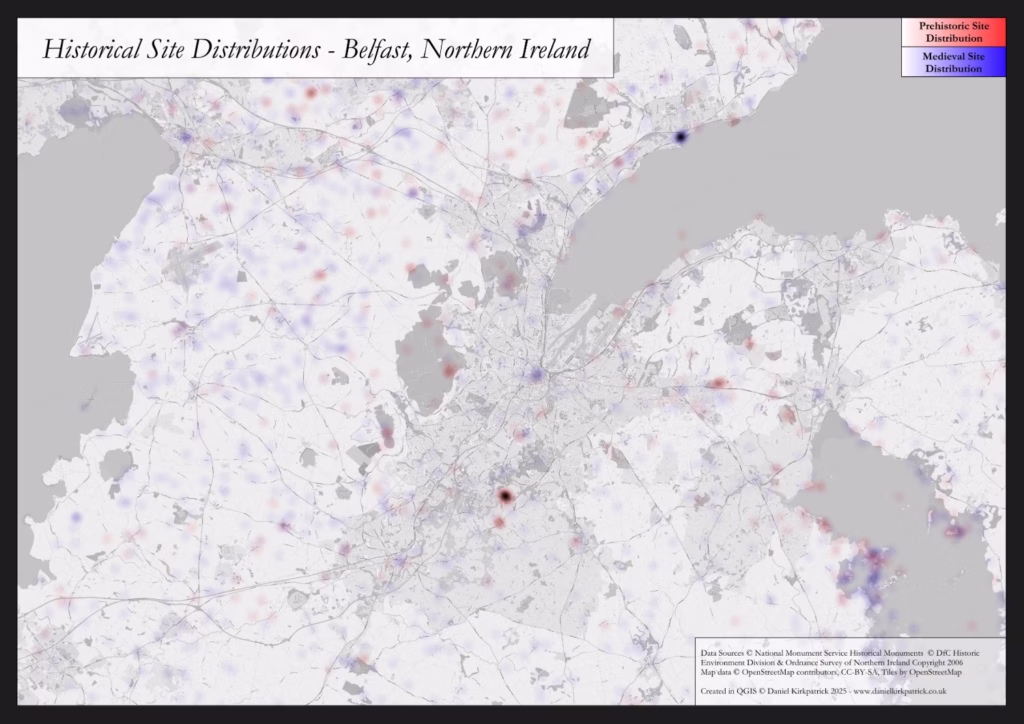
Distributions and Frequency of Sites in Belfast
Of the 100s of sites mapped here, there are two interesting clusters which are worth pausing on. The first is for medieval sites which are overwhelmingly concentrated in and around the town of Carrickfergus. Not only is there the famous Norman castle, but also the medieval town walls (much of which still survive today), alongside various ecclesiastical sites. The castle itself is known for having remained an active military frontier fortification for 100s of years, right up to the 19th century (albeit having suffered several defeats). It was a key foothold of Anglo-Norman authority, connecting inland trade across a network of fortified towns, like Coleraine and Antrim, with the eastern seaboard. This is discussed in more detail below. But beyond these obvious medieval sites, there are 100s of others.
The sea of blue below (coded for sites dating to between 500-1700), you can see a wide range of coverage. Most of these are simple settlements – ringforts of either stone or earthen design. The region between the Belfast hills and the shores of Lough Neagh are literally covered in them. Indeed, this is one of the areas in Ireland with the highest concentration of ringforts. The fertile lands and strategic position which remain relevant today, were key factors throughout their long history.
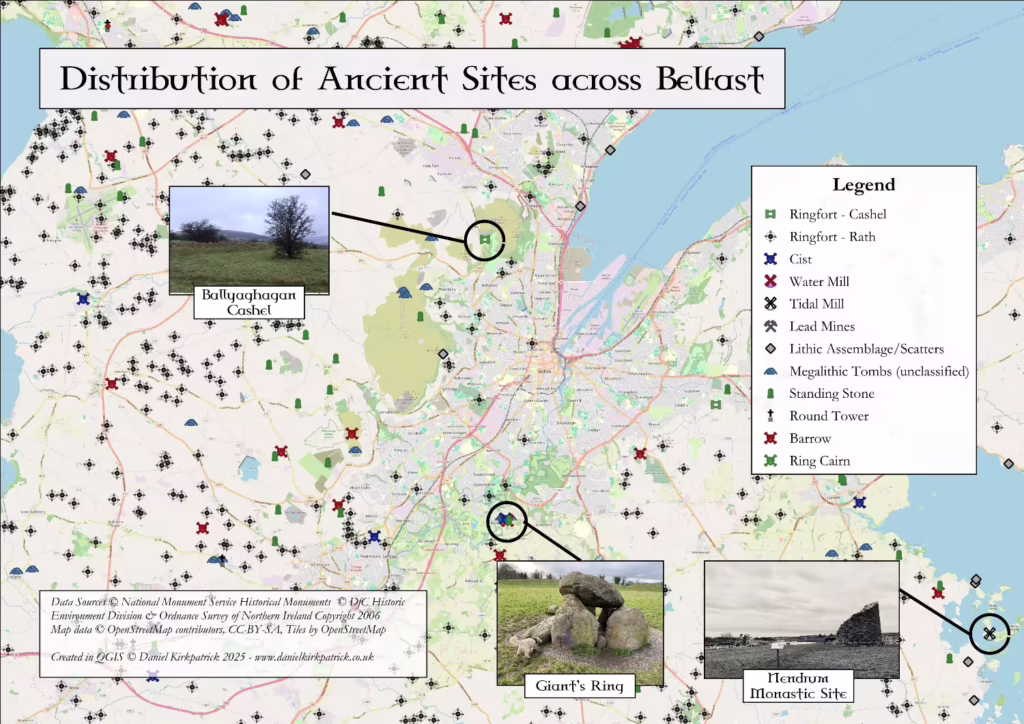
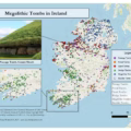
The other obvious cluster dates much, much earlier, to the neolithic period and centred around the iconic henge – the Giant’s Ring. This is quite typical of significant megalithic sites, where there’s often a series of monuments in close proximity ranging from cairns and cists, to tombs and henges. But to give a little more context to these, I’ve walked through example sites from each key historical period below.
Neolithic – Giant’s Ring
The Neolithic period in Ireland (c. 4000–2500 BC) marked a fundamental shift in human society: people moved from hunter-gathering into farming, built permanent settlements, cleared large areas of woodland, and created some of the largest communal monuments the island has ever seen. This was an era of collective effort, monumentality and new social structures.
The Giant’s Ring near Belfast is a striking example of that transformation. Dating to around 2700 BC, this vast circular enclosure—approximately 200 metres in diameter—surrounds a passage tomb and is one of the finest surviving henge monuments in Ireland. The size of the earth bank, the effort required to build it, and the presence of the central tomb together suggest it was a major ceremonial or ritual site.
Its significance today lies in what it tells us about Neolithic communities. They were capable of organising large-scale work, had shared belief systems grounded in ancestor veneration or ritual, and chose sites that had meaning within the landscape. The Giant’s Ring also serves as a tangible link between modern Belfast and thousands of years of human history, reminding us that this place was deeply meaningful long before the city existed. Visitors to the site can walk around its bank and stand where people once gathered for ceremony, offering a direct connection to Ireland’s deep past.
Read on here to learn more about the Giant’s Ring, including its archaeology and suspected uses.

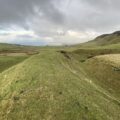
Bronze Age – Divis Homestead
The Bronze Age in Ireland, spanning roughly from 2500 to 500 BC, marked a turning point in how people lived, farmed, and organised their communities. Metalworking flourished, with bronze tools and weapons replacing earlier stone ones, and settlement patterns shifted toward more permanent homes and enclosed farmsteads. Across the island, people built roundhouses, cultivated the land, and developed thriving local economies linked by trade in copper, tin, and gold.
The Bronze Age homestead on Divis Mountain, overlooking Belfast, offers a remarkable glimpse into this world. Excavations have revealed the foundations of roundhouses and evidence of agricultural activity, showing that the uplands were not empty wilderness but part of a lived and worked landscape. Its elevated position provided both security and a commanding view across the Lagan Valley, linking it visually and economically to the wider Bronze Age networks of Ulster.
Sites like this illustrate the adaptability and resilience of early farming communities, who made use of even the higher slopes for cultivation and herding. The remains on Divis stand as a quiet testament to a time when Ireland’s landscape was being shaped by human hands and communities were establishing the roots of settled life that would endure for millennia.
Iron Age – Ballyaghagan Cashel
The early medieval period in Ireland roughly dates from AD 400 to 1100. During this period, society became increasingly organised into small kingdoms and túatha, Christianity spread across the island, and the Irish landscape filled with ringforts, monasteries, and stone enclosures. These structures reflect a world where farming, faith, and kinship defined daily life, and where the boundaries of power were often marked in stone.
Ballyaghagan Cashel, nestled in the Belfast Hills, is one such example. A cashel is a circular stone fort, typically serving as a defended farmstead for a prosperous family or local lord. Constructed from dry stone walls, these sites provided shelter for people, livestock, and food stores, while also symbolising status and ownership. Ballyaghagan’s elevated position gave it sweeping views over the surrounding countryside, offering both protection and a clear demonstration of control over valuable farmland.
What makes Ballyaghagan particularly significant is how it bridges past and present. It represents the rhythms of early medieval rural life—self-sufficiency, defence, and community—while occupying a landscape shaped by human activity since the Neolithic. As the most frequent type of historical site within this period, it is clearly worth understanding what these were and why they were built.
You can read more on the ring of cashels surrounding Belfast here.
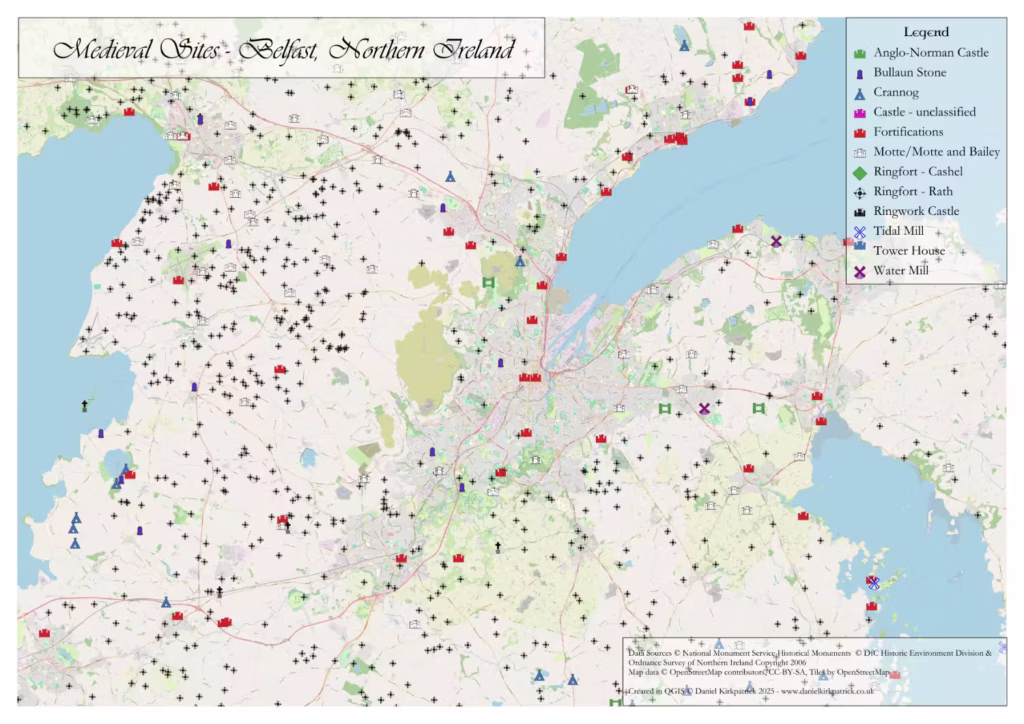
Medieval – Carrickfergus Castle
The medieval period in Ireland typically dates to between the 12th and 16th centuries. Besides being a time of knights and nobles, in Ireland it was marked by Norman conquest beginning with Norman invasion in 1169. However Ireland was not an easy place to conquer, and so it wasn’t long before the invaders began building new fortifications across the landscape, replacing earlier earthen and wooden defences. And soon castles became not only military strongholds, but also administrative centres that projected authority and controlled trade, especially along key coastal routes.
Carrickfergus Castle is one of the best-preserved examples of this transformation. Built by the Anglo-Norman knight John de Courcy around 1177, it served as a strategic foothold for the Normans in Ulster. Its commanding position allowed control of maritime traffic through the lough, linking it to broader networks of power that extended across the Irish Sea. Over the centuries, the castle witnessed sieges, invasions, and political struggles, reflecting the turbulent dynamics of medieval Ireland.
See here to learn more about history of this fascinating and brilliantly preserved castle.
For those interested in other regions and analysis, please see my heritage lookup tool which covers all wards across Northern Ireland.
YOU MAY ALSO LIKE
 North Antrim Historical Sites: Interactive Map
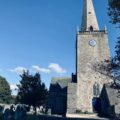 Bangor Abbey: History & Legacy of the Medieval Monastic Site
 Manannán Mac Lir: Irish God of the Sea — Myth, Power & Legacy
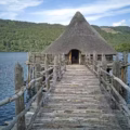 Buildings in Iron Age Ireland: Roundhouses, Ringforts & Crannógs
 Iron Age Food and Drink: History and significance of diet in ancient Ireland
 Barrows of Ireland: Mapping Ireland’s Prehistoric Burial Mounds
 Megalithic Sites of Ireland: An Interactive Map & Guide
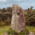 Standing Stones in Ireland: Locations, Analysis and Interactive Map