
If you were to ask anyone to name a megalithic monument, almost all will point to Stonehenge. And understandably so. But as impressive as it is, there are literally hundreds of other stone circles in Ireland alone. Many are bigger. Many are much more striking settings. Reducing megalithic history to a single site misses the wonder and magnitude of the vast array of monuments which remain. This post goes some way to help, providing an interactive map of stone circles in Ireland, alongside giving an explanation – with examples – of what they likely were built for.
So let’s begin with the map.
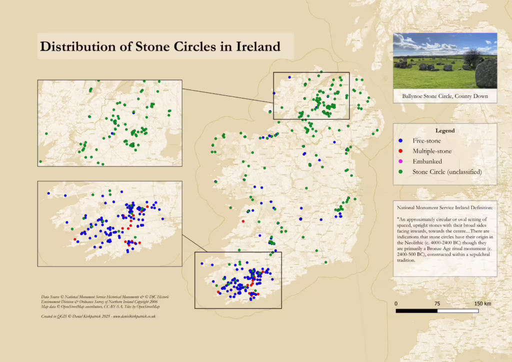
Interactive Map of Stone Circle Locations in Ireland
Interactive Map of Stone Circles
Click to view all recorded Stone Circle locations across Ireland.
This interactive map was created in ArcGIS Online using data from both Government datasets. The data was originally cleaned in Excel using PowerQuery and then in QGIS. It includes all stone circle locations recorded by either government using filters for classification and description. Copyright for the data and basemaps attribution is as follows:
Data Sources
© National Monument Service Historical Monuments
© DfC Historic Environment Division & Ordnance Survey of Northern Ireland Copyright 2006
Map data
© OpenStreetMap contributors, CC-BY-SA, Tiles by OpenStreetMap
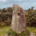
What is a Stone Circle?
The National Monument Service for Ireland provides a particularly comprehensive definition which is worth quoting at length:
“An approximately circular or oval setting of spaced, upright stones with their broad sides facing inwards, towards the centre. The Cork/Kerry series…is characterised by an uneven number of non-contiguous orthostats which decrease in height from the entrance stones to the recumbent stone opposite the entrance. By contrast the Ulster series is defined by low orthostats rarely exceeding 0.5m in height, which often occur in groups and are associated with long stone rows. There are indications that stone circles have their origin in the Neolithic (c. 4000-2400 BC) though they are primarily a Bronze Age ritual monument (c. 2400-500 BC), constructed within a sepulchral tradition.”
To put it simply, they are what the name suggests. But they vary in terms of the number of stones, the size of stones, the stone material itself, and the positioning of the stones both in relation to each other, but also the choice of site. Each of these factors all have significance with regional variations (e.g. the size distinction noted in the definition).
Now we know roughly what they are, it brings us to the next question of where can we find them.
Where are the Stone Circles?
I’ll summarise the key distributions, but I’d recommend just playing around with the interactive map. It’s the best way to fully appreciate the distributions and you’re likely to discover many things I have missed. But, for what it’s worth, here is my attempt.
Let’s start with the clusters, the first being at Cullaun. This actually reveals a slight issue with the data, for it appears to be a huge cluster, when in fact it is just false positives whereby a series of standing stones (173 in Timoney Hills and 48 in Cullaun) all refer to a neighbouring stone circle in their site description. This is interesting itself, as it reflects the close association between stone circles and other monument types. Often they were built nearby other features, or indeed vice-versa.
The two clusters which are correct (see in the image above rather than the interactive map), are around the Sperrins in Counties Tyrone and Derry, and then the south west cluster in Counties Cork and Kerry. I recently visited one of the sites in the Sperrins at Beaghmore) and was blown away by the 7 stone circles , never mind the cairns and other stone alignments. Many were small in size, but their sheer number was incredible. It’s also interesting that the design of these circles varies with 5 stones being clearly preferred in the south west compared with the rest of the island.
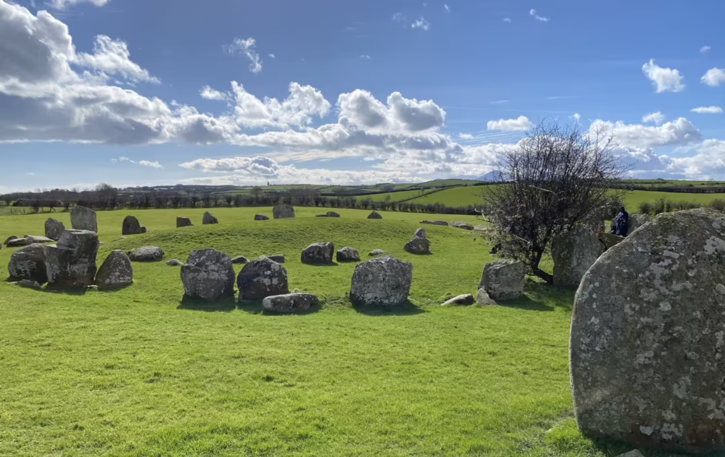
Ballynoe Stone Circle, County Down
The Ballynoe stone circle is fantastic example of the complexity surrounding these monuments. Firstly is the change over time, for often what we physically see today is but a snapshot of what they would have looked like throughout history. Stones are often removed and features added or changed. Ballynoe is over 33m wide with stones ranging up to 2m high. It is thought that it would have once been surrounded by a ditch with a further 2 entrance stones at its edge.
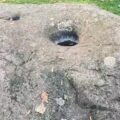
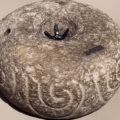
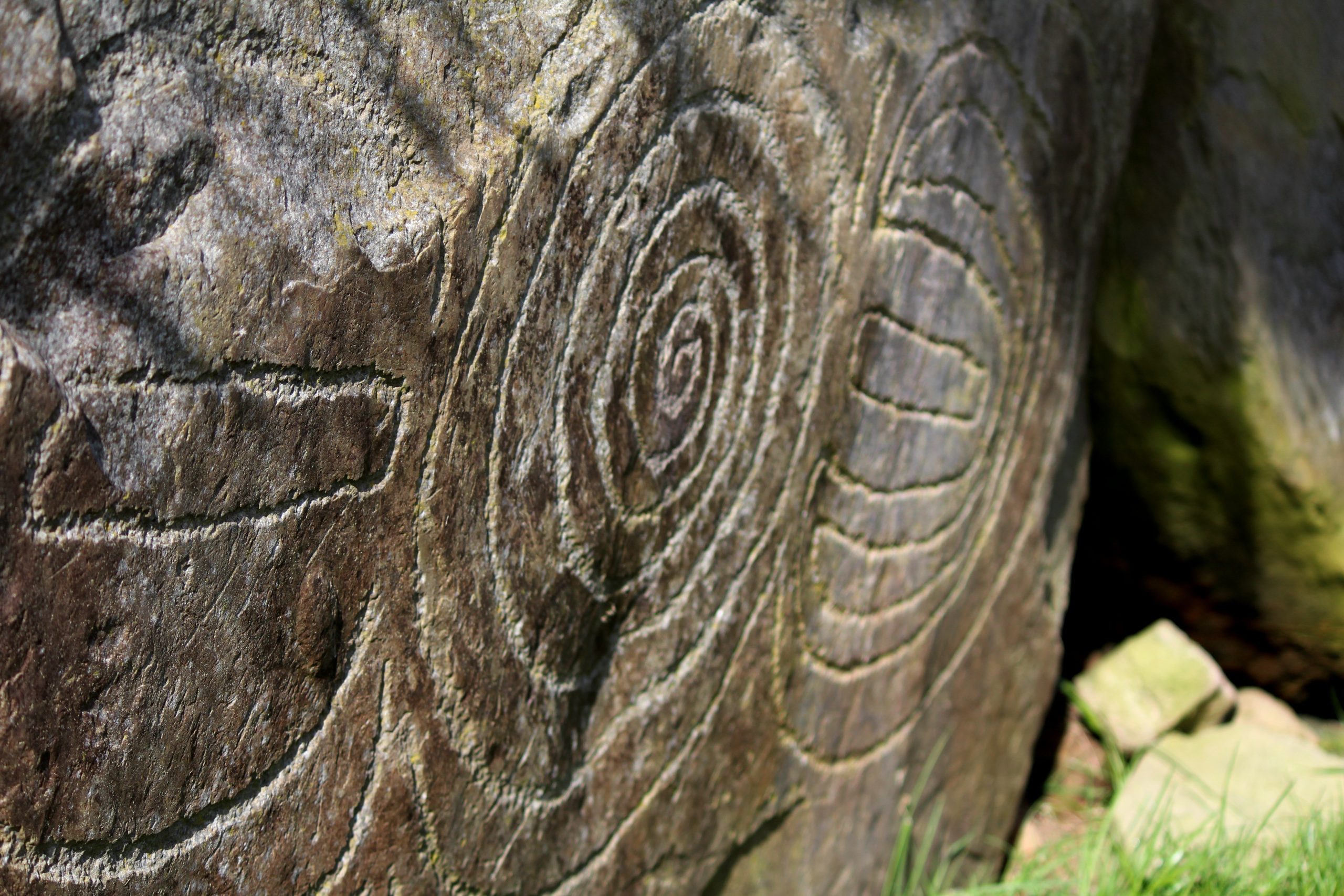
Yet when features were added or removed is difficult to tell. Indeed, one of the things we do know is that the site shows signs of use over an extremely long period of time. For instance, the inner circle had once a cairn (man-made pile of stones) which had been covered over with a stone-edged mound of earth. Underneath the burnt remains were discovered in a stone grave called a cist. There was also another stone burial with two human remains and prehistoric pottery.
It is therefore clear the site held ritual and funerary significance. The presence of multiple ‘phases’ of development indicate it was used over a long period of time. These findings are, of course, not unique. Across the many other stone circles noted above, we can see similar patterns. Stone circles are, therefore, a wonderful example of just how complex ancient history can be. But they are truly only one part of a much grander puzzle.
Data Caveats and Considerations
The data on stone circles should be caveated with a few common quality issues. First is the coverage, whereby a lot of sites have been destroyed or lost to history. This is a common challenge for any archaeological sites. Then there is the data consistency as I’ve joined data from Northern Ireland with that in the Republic. While the National Monument Service data has a specific classification for stone circles, the data for Northern Ireland is more inconsistent. To account for this, the interactive map used very broad filters so you’ll find a lot of false positives. To check, just select the individual data point and you’ll be able to see more details. They will all reference a stone circle in either their classification or description.
Frequently Asked Questions: Stone Circles in Ireland
Estimates suggest there are at least 291 stone circles recorded across the island, though this map shows many other possible sites.
While most date to the Bronze Age (2,400-500BC), several date back further though these are the minority.
They held a ritual importance given their solar/lunar alignments. But they also likely formed a key gathering place more generally linked to the celtic calendar which is also based on celestial events.
YOU MAY ALSO LIKE
 Manannán Mac Lir: Irish God of the Sea — Myth, Power & Legacy
 Buildings in Iron Age Ireland: Roundhouses, Ringforts & Crannógs
 Barrows of Ireland: Mapping Ireland’s Prehistoric Burial Mounds
 Standing Stones in Ireland: Locations, Analysis and Interactive Map
 Bullaun Stones of Ireland: Mapping the Sacred Basins
 Iron Age Food and Drink: History and significance of diet in ancient Ireland
 Viking Settlements in Ireland: From Raids to Norse Towns
 Rock Art in Ireland: Prehistoric Carvings, Meaning & Sites