293 historic sites45 scheduled monuments38 listed buildings7 archaeological periods
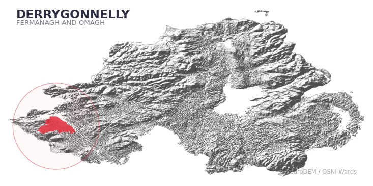
DERRYGONNELLY covers 474.3 km² in Northern Ireland. With 293 historic sites and 45 scheduled monuments on record, the ward sits at the 98th percentile across all 462 NI wards for combined archaeological heritage. It also records 38 listed buildings (HED Historic Buildings Record), the 68th percentile for listed-building density across NI wards. Per 1,000 residents, this works out at 133.6 recorded sites — the 100th percentile across NI wards (a measure of heritage density relative to current population). Dated archaeological evidence runs from the Mesolithic through to the Modern period, spanning 7 archaeological periods, placing the ward in the 79th percentile NI-wide for chronological depth.
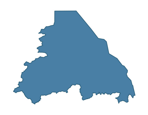
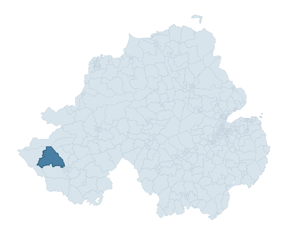
DERRYGONNELLY boundary detailDERRYGONNELLY in regional context
Heritage at a glance
Percentile rankings throughout this profile compare each ward only against the other 461 Northern Ireland wards.
293
Historic sites
99th percentile
45
Scheduled monuments
99th percentile
38
Listed buildings
68th percentile
0.79
Sites per km²
Population context
6
Persons per km²
2nd percentile
133.6
Sites per 1,000 residents
100th percentile
2,815
Total residents (2021)
The recorded heritage of DERRYGONNELLY
Of the 293 historic sites recorded, the most common are Rath (77, 26% of historic sites), Burnt Mound (58), and Non-Antiquity (11). For Raths, this is placing the ward in the top 1% nationally for this type. For Burnt Mounds, this is the 89th percentile across NI wards that record this type. Across the ward's 474.3 km², this gives a recorded density of 0.79 sites per km² (all heritage types combined). Scheduled monuments are distributed across approximately 0.10° of latitude and 0.21° of longitude within the ward, indicating dispersed rather than clustered placement.
Most common monument types
Type
Count
Description
Rath
77
—
Burnt Mound
58
—
Non-antiquity
11
—
Chronological distribution
Mesolithic
72
Middle Late Bronze Age
21
Iron Age
12
Early Medieval
121
Medieval
3
Post Medieval
15
Modern
4
Unknown
45
Terrain and environment
With a mean elevation of 122m, this ward sits above the NI median (80th percentile), but the ward reaches 372m at its highest point — a vertical span of more than 250m within its boundary, indicating significant topographic diversity. The terrain is consistently steep, with a mean slope of 6.2° (90th percentile across NI); localised maximum slopes reach 17°, typical of stream-cut valleys, escarpments, or bluffs within the wider landscape. The Topographic Wetness Index of 10.0 (28th NI percentile) indicates moderate drainage, balanced between upland shedding and lowland accumulation. The land-cover mosaic combines improved grassland (56%), woodland (28%), and open water (16%), giving a mixed agricultural and semi-natural landscape. In overall character, this is an upland landscape of steep, elevated terrain, with land use dominated by improved grassland.
Terrain measurements
Mean elevation121.6 m 81st pct
Max elevation371.9 m 88th pct
Mean slope6.2° 91st pct
Wetness index (TWI)10.03 28th pct
Grassland55.9% 51st pct
Woodland27.5% 77th pct
Where this ward sits in NI
Elevation
81st
Slope
91st
Drainage
28th
Grassland
51st
Woodland
77th
Geology and preservation
The dominant bedrock formed during the Palaeozoic era (Carboniferous period). Ancient sedimentary or metamorphic rock dating to before the age of dinosaurs; the resulting landscape has been long-stable enough to host every period of human activity. Bedrock composition is varied (complexity index 0.77, on a 0-1 Simpson-style scale), with multiple geological units within the ward boundary. Geologically diverse wards historically offered a wider range of stone types for building, toolmaking, and quarrying — a relevant factor when interpreting the material culture of nearby sites.
Bedrock eraPalaeozoic
Bedrock periodCarboniferous
Peat coverage0.0%
Bedrock complexity0.77
Placename evidence
The combined OSNI, Logainm NI, and GeoNames sources record 198 placenames for this ward. Diagnostic heritage strata identified within these are: 4 pre-Christian defensive (rath-, dún-, lios-, caiseal-), 21 ecclesiastical (cill-, teampall-, mainistir-, díseart-), and 1 Plantation-era (17th c English/Scots settlement names). Note: Irish-language (name_ga) forms are recorded for roughly half of NI placenames in the combined sources, so anglicised forms whose Irish original could belong to multiple categories may be misclassified.
Scheduled monuments are sites legally protected under the Historic Monuments and Archaeological Objects (Northern Ireland) Order 1995, designated by the Historic Environment Division (HED).
Monument
Type
Period
Rath
Rath
Early Medieval
Rath
Rath
Early Medieval
Rath
Rath
Early Medieval
Court Tomb
Court Tomb
Neolithic
Abbey(Traditional site)
Abbey(Traditional Site)
Medieval
Crannogs in Bunnahone Lough (3)
Crannogs In Bunnahone Lough (3)
Unknown
Court tomb: Giant's Grave
Court Tomb: Giant'S Grave
Neolithic
Penannular enclosure
Penannular Enclosure
Iron Age
Standing stone
Standing Stone
Early Bronze Age
Rath
Rath
Early Medieval
Rath
Rath
Early Medieval
Rath
Rath
Early Medieval
Rath
Rath
Early Medieval
Rath
Rath
Early Medieval
Cave with rock scribings: 'Lettered Cave'
Cave With Rock Scribings: 'Lettered Cave'
Unknown
Henge
Henge
Neolithic
Rath
Rath
Early Medieval
Rath
Rath
Early Medieval
Bivallate Rath
Bivallate Rath
Iron Age
Rath with annexe
Rath With Annexe
Early Medieval
Crannog
Crannog
Iron Age
Carrick church and graveyard
Carrick Church And Graveyard
Unknown
Counterscarp Rath
Counterscarp Rath
Early Medieval
Rath
Rath
Early Medieval
Rath
Rath
Early Medieval
Rath
Rath
Early Medieval
Rath
Rath
Early Medieval
Rath Pair
Rath Pair
Early Medieval
Court tomb: Giants Grave
Court Tomb: Giants Grave
Neolithic
Rath
Rath
Early Medieval
Rath
Rath
Early Medieval
Rath
Rath
Early Medieval
Crannog in Ross Lough
Crannog In Ross Lough
Iron Age
Carrick Lough Crannog
Carrick Lough Crannog
Iron Age
Castle: 'Tullykelter Castle'
Castle: 'Tullykelter Castle'
Unknown
Avenue and Gardens of Monea Castle
Avenue And Gardens Of Monea Castle
Unknown
17th Century Church
17Th Century Church
Early Medieval
Area of 5.8 acres, including former enclosure of monastic site. Enclosure: unconsecrated graveyard
Area Of 5.8 Acres, Including Former Enclosure Of Monastic Site. Enclosure: Unconsecrated Graveyard
Iron Age
CIST BURIAL
Cist Burial
Early Bronze Age
STANDING STONES/MEGALITH
Standing Stones/Megalith
Early Bronze Age
BARROW
Barrow
Early Bronze Age
PROMONTORY FORT
Promontory Fort
Iron Age
Burial Ground/Enclosure
Burial Ground/Enclosure
Iron Age
Dunbar Manor Plantation Castle
Dunbar Manor Plantation Castle
Unknown
Barrow: Most of Inis
Barrow: Most Of Inis
Early Bronze Age
Recorded historic sites
Name
Period
Type
A.P. SITE
Unknown
Unknown
A.P. SITE
Unknown
Unknown
A.P. SITE – 3 cropmarks
Unknown
Unknown
A.P. SITE – 4 cropmarks
Unknown
Unknown
A.P. SITE – NON-ANTIQUITY
Unknown
Unknown
A.P. SITE – circular cropmark
Unknown
Unknown
A.P. SITE – circular cropmark
Unknown
Unknown
A.P. SITE – circular cropmark
Unknown
Unknown
A.P. SITE – circular cropmark
Unknown
Unknown
A.P. SITE – circular cropmark
Unknown
Unknown
A.P. SITE – circular cropmark
Unknown
Unknown
A.P. SITE – circular cropmark
Unknown
Unknown
A.P. SITE – circular cropmark
Unknown
Unknown
A.P. SITE – circular enclosure
Iron Age
Unknown
A.P. SITE – field system & 2 enclosures
Middle-Late Bronze Age
Agriculture
A.P. SITE – penannular cropmark
Unknown
Unknown
BARROW or possibly HENGIFORM ENCLOSURE
Mesolithic
Ritual/Funerary
BARROW: MOAT OF INIS
Mesolithic
Ritual/Funerary
BIER STONE
Unknown
Unknown
BIVALLATE RATH
Early Medieval
Defence
BIVALLATE RATH
Early Medieval
Defence
BOOLEY HUT: GIANTS GRAVEYARD
Unknown
Ritual/Funerary
BURIAL GROUND/ ENCLOSURE
Early Medieval
Ritual/Funerary
BURNT MOUND
Mesolithic
Agriculture
BURNT MOUND
Mesolithic
Agriculture
BURNT MOUND
Mesolithic
Agriculture
BURNT MOUND
Mesolithic
Agriculture
BURNT MOUND
Mesolithic
Agriculture
BURNT MOUND
Mesolithic
Agriculture
BURNT MOUND
Mesolithic
Agriculture
BURNT MOUND
Mesolithic
Agriculture
BURNT MOUND
Mesolithic
Agriculture
BURNT MOUND
Mesolithic
Agriculture
BURNT MOUND
Mesolithic
Agriculture
BURNT MOUND
Mesolithic
Agriculture
BURNT MOUND
Mesolithic
Agriculture
BURNT MOUND
Mesolithic
Agriculture
BURNT MOUND
Mesolithic
Agriculture
BURNT MOUND
Mesolithic
Agriculture
BURNT MOUND
Mesolithic
Agriculture
BURNT MOUND
Mesolithic
Agriculture
BURNT MOUND
Mesolithic
Agriculture
BURNT MOUND
Mesolithic
Agriculture
BURNT MOUND
Mesolithic
Agriculture
BURNT MOUND
Mesolithic
Agriculture
BURNT MOUND
Mesolithic
Agriculture
BURNT MOUND
Mesolithic
Agriculture
BURNT MOUND
Mesolithic
Agriculture
BURNT MOUND
Mesolithic
Agriculture
BURNT MOUND
Mesolithic
Agriculture
BURNT MOUND
Mesolithic
Agriculture
BURNT MOUND
Mesolithic
Agriculture
BURNT MOUND
Mesolithic
Agriculture
BURNT MOUND
Mesolithic
Agriculture
BURNT MOUND
Mesolithic
Agriculture
BURNT MOUND
Mesolithic
Agriculture
BURNT MOUND
Mesolithic
Agriculture
BURNT MOUND
Mesolithic
Agriculture
BURNT MOUND
Mesolithic
Agriculture
BURNT MOUND
Mesolithic
Agriculture
BURNT MOUND
Mesolithic
Agriculture
BURNT MOUND
Mesolithic
Agriculture
BURNT MOUND
Mesolithic
Agriculture
BURNT MOUND
Mesolithic
Agriculture
BURNT MOUND
Middle-Late Bronze Age
Agriculture
BURNT MOUND
Middle-Late Bronze Age
Agriculture
BURNT MOUND
Middle-Late Bronze Age
Agriculture
BURNT MOUND
Middle-Late Bronze Age
Agriculture
BURNT MOUND
Middle-Late Bronze Age
Agriculture
BURNT MOUND
Middle-Late Bronze Age
Agriculture
BURNT MOUND
Middle-Late Bronze Age
Agriculture
BURNT MOUND
Middle-Late Bronze Age
Agriculture
BURNT MOUND
Middle-Late Bronze Age
Agriculture
BURNT MOUND
Middle-Late Bronze Age
Agriculture
BURNT MOUND
Middle-Late Bronze Age
Agriculture
BURNT MOUND
Middle-Late Bronze Age
Agriculture
BURNT MOUND
Middle-Late Bronze Age
Agriculture
BURNT MOUND
Middle-Late Bronze Age
Agriculture
BURNT MOUND
Middle-Late Bronze Age
Agriculture
BURNT MOUND
Middle-Late Bronze Age
Agriculture
BURNT MOUND
Middle-Late Bronze Age
Agriculture
BURNT MOUND (possible)
Mesolithic
Agriculture
BURNT MOUND (possible)
Mesolithic
Agriculture
BURNT MOUND / FULACHT FIADH
Mesolithic
Agriculture
BURNT MOUND / FULACHT FIADH
Mesolithic
Agriculture
BURNT MOUND / FULACHT FIADH
Mesolithic
Agriculture
BURNT MOUND / FULACHT FIADH
Middle-Late Bronze Age
Agriculture
BURNT MOUND MATERIAL
Middle-Late Bronze Age
Agriculture
BURNT MOUNDS (2)
Mesolithic
Agriculture
BURNT MOUNDS (2)
Mesolithic
Agriculture
BURNT MOUNDS (2) / FULACHTA FIADH
Mesolithic
Agriculture
BURNT MOUNDS (3)
Mesolithic
Agriculture
BURNT MOUNDS (4) (possible)
Middle-Late Bronze Age
Agriculture
BURNT MOUNDS (5)
Mesolithic
Agriculture
BURNT MOUNDS (7) / FULACHTA FIADH
Mesolithic
Agriculture
Burial
Unknown
Ritual/Funerary
C17TH CASTLE & BAWN: MONEA CASTLE
Post-Medieval
Defence
C17TH CHURCH
Post-Medieval
Religious
C17TH HOUSE & BAWN (unlocated)
Post-Medieval
Defence
C17TH HOUSE & BAWN (unlocated)
Post-Medieval
Defence
C17TH SETTLEMENT: CHURCHILL
Post-Medieval
Religious
CAIRN: LAGHTMACDONNELL or LAGHTA VIC DONAL
Mesolithic
Ritual/Funerary
CARRICK LOUGH CRANNOG
Early Medieval
Defence
CASHEL
Early Medieval
Defence
CASTLE, BAWN & VILLAGE SITE: TULLY CASTLE
Post-Medieval
Defence
CASTLE: TULLYMARGY CASTLE
Post-Medieval
Defence
CAVE WITH ROCK SCRIBINGS: LETTERED CAVE
Post-Medieval
Unknown
CAVES (unlocated)
Unknown
Unknown
CHILDREN'S BURIAL GROUND (possible)
Unknown
Ritual/Funerary
CHURCH & GRAVEYARD: CARRICK or AGHAMORE CHURCH
Medieval
Ritual/Funerary
CHURCH SITE (unlocated): INISH COIMHETA or CUSTODARIA INSULA OF VITA COMGALLI
Early Medieval
Religious
CIST BURIAL AND CREMATION PIT
Mesolithic
Ritual/Funerary
COFFIN STONE: CARRICK LEAM or WILLIAM'S ROCK
Unknown
Unknown
COUNTERSCARP RATH
Early Medieval
Defence
COUNTERSCARP RATH
Early Medieval
Defence
COUNTERSCARP RATH
Early Medieval
Defence
COUNTERSCARP RATH
Early Medieval
Defence
COUNTERSCARP RATH
Early Medieval
Defence
COUNTERSCARP RATH
Early Medieval
Defence
COUNTERSCARP RATH
Early Medieval
Defence
COUNTERSCARP RATH
Early Medieval
Defence
COUNTERSCARP RATH
Early Medieval
Defence
COURT TOMB
Mesolithic
Ritual/Funerary
COURT TOMB: GIANT'S GRAVE
Mesolithic
Ritual/Funerary
COURT TOMB: GIANT'S GRAVE
Mesolithic
Ritual/Funerary
CRANNOG
Early Medieval
Defence
CRANNOG
Early Medieval
Defence
CRANNOG IN BUNNAHONE LOUGH
Early Medieval
Defence
CRANNOG IN BUNNAHONE LOUGH
Early Medieval
Defence
CRANNOG IN ROSS LOUGH
Early Medieval
Defence
CRANNOG in DRUMSKIMLY LOUGH
Early Medieval
Defence
CRANNOG: MAGUIRE CRANNOG
Early Medieval
Defence
CRANNOG: THE MIRACLES (unlocated)
Early Medieval
Defence
CRANNOG?
Early Medieval
Defence
Crannog or Causeway?
Iron Age
Defence
DECORATED CAVE: GILLIES' CAVE (unlocated)
Unknown
Unknown
DRY-STONE STRUCTURE, possibly SWEAT HOUSE
Unknown
Domestic
DRY-STONE STRUCTURE, possibly SWEAT HOUSE
Unknown
Domestic
EARTHWORKS, possibly modern
Modern
Defence
ENCLOSURE
Iron Age
Unknown
ENCLOSURE
Iron Age
Unknown
ENCLOSURE
Iron Age
Unknown
ENCLOSURE
Iron Age
Unknown
ENCLOSURE
Iron Age
Unknown
ENCLOSURE
Iron Age
Unknown
ENCLOSURE
Iron Age
Unknown
ENCLOSURE
Iron Age
Unknown
ENCLOSURE
Iron Age
Unknown
ENCLOSURE
Iron Age
Unknown
FORTIFICATION?
Post-Medieval
Defence
FORTIFIED HOUSE: TULLYKELTER CASTLE
Post-Medieval
Defence
GRAVEYARD & TOWER: CHURCH HILL
Post-Medieval
Ritual/Funerary
HENGE
Mesolithic
Ritual/Funerary
HISTORIC SETTLEMENT: DERRYGONNELLY
Post-Medieval
Domestic
HOLY WELL
Early Medieval
Ritual/Funerary
HOLY WELL & BULLAUN: TOBER ST FEBER or ST. FEBER'S WELL
Grounding History: 10 Maps of Northern Ireland’s Past
A spatial history report bringing together analysis of all 462 wards into one place through 10 high-quality maps — covering monument density, archaeological periods, placename heritage, terrain, wetland, and the historic landscape at first survey.
A ward is the smallest electoral and statistical geography used by the Northern Ireland Statistics and Research Agency (NISRA). The boundaries used here are the 2014 NISRA / OSNI Wards (462 across Northern Ireland), each typically covering 1-700 km² and a population of a few thousand. Wards do not align with parishes, townlands, or any historic administrative unit — they are a modern statistical convenience, used here only as a fixed spatial frame within which to summarise heritage records.
What counts as a site?
Three distinct heritage record types are reported separately, not combined: (1) Historic Sites — entries in the Northern Ireland Sites and Monuments Record (NISMR), the inventory of recorded archaeological sites and findspots, dated from prehistoric to early-modern; (2) Scheduled Monuments — sites legally protected under the Historic Monuments and Archaeological Objects (NI) Order 1995 and maintained by the Historic Environment Division (HED); (3) Listed Buildings — buildings of architectural or historic interest protected under the Planning Act (NI) 2011 and graded A, B+, B1, B2, or Record-Only by HED. A site appearing in more than one register is counted in each register independently.
Editorial principles
These ward profiles describe evidence, not history. They report what is recorded, not what occurred. Where the data is ambiguous, we say so. We do not infer historical processes — population movements, settlement expansion, periods of decline — from patterns in the record. Absence of evidence is not evidence of absence: in Northern Ireland, where antiquarian survey was uneven and modern excavation is geographically biased, a gap in the record almost always reflects the limits of recording rather than a genuine historical absence. We mark such gaps explicitly where they appear in the data.
Limits of coverage and known caveats
Several caveats apply to every ward profile: (1) NISMR coverage is uneven across NI — some areas (notably parts of the south-east and the Belfast urban fringe) have been more intensively surveyed than others, so a low recorded site count does not reliably indicate a low past density of activity; (2) period attributions in NISMR are often 'Unknown', and chronological breakdowns reported here reflect only the dated subset; (3) placename classification depends on the Irish-language form (name_ga), which is recorded for approximately 50% of NI placenames in the combined sources, so ecclesiastical and pre-Christian counts may be understated where anglicised forms remain unparsed; (4) terrain percentile ranks compare each ward only to the other 461 NI wards; they are not absolute thresholds. For absence-dominant land cover categories (wetland, water, cropland), percentile ranks are suppressed below 1% raw value, since the ranking of zero-value wards is not meaningful.
Data sources (11)
Northern Ireland Sites and Monuments Record (NISMR)
Spotted an error? This dataset is updated continuously.
Email contact@danielkirkpatrick.co.uk with corrections, missing records, or suggestions for improvement.
Manage Consent
To provide the best experiences, we use technologies like cookies to store and/or access device information. Consenting to these technologies will allow us to process data such as browsing behaviour or unique IDs on this site. Not consenting or withdrawing consent, may adversely affect certain features and functions.
Functional
Always active
The technical storage or access is strictly necessary for the legitimate purpose of enabling the use of a specific service explicitly requested by the subscriber or user, or for the sole purpose of carrying out the transmission of a communication over an electronic communications network.
Preferences
The technical storage or access is necessary for the legitimate purpose of storing preferences that are not requested by the subscriber or user.
Statistics
The technical storage or access that is used exclusively for statistical purposes.The technical storage or access that is used exclusively for anonymous statistical purposes. Without a subpoena, voluntary compliance on the part of your Internet Service Provider, or additional records from a third party, information stored or retrieved for this purpose alone cannot usually be used to identify you.
Marketing
The technical storage or access is required to create user profiles to send advertising, or to track the user on a website or across several websites for similar marketing purposes.