200 historic sites20 scheduled monuments26 listed buildings8 archaeological periods
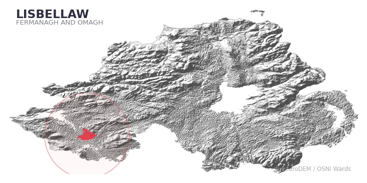
LISBELLAW covers 153.4 km² in Northern Ireland. With 200 historic sites and 20 scheduled monuments on record, the ward sits at the 96th percentile across all 462 NI wards for combined archaeological heritage. It also records 26 listed buildings (HED Historic Buildings Record), the 57th percentile for listed-building density across NI wards. Per 1,000 residents, this works out at 80.7 recorded sites — the 97th percentile across NI wards (a measure of heritage density relative to current population). Dated archaeological evidence runs from the Mesolithic through to the Modern period, spanning 8 archaeological periods, placing the ward in the 90th percentile NI-wide for chronological depth.
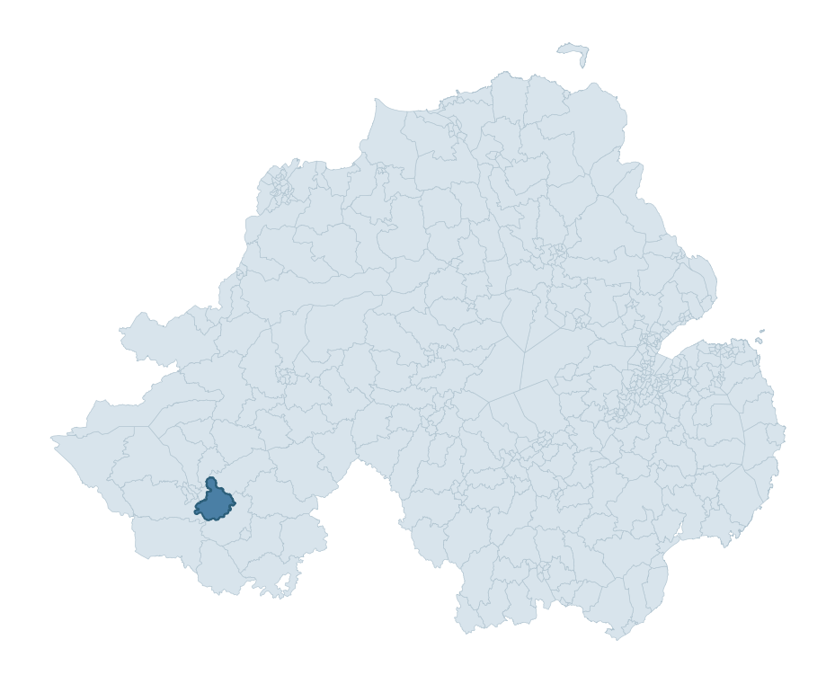
LISBELLAW boundary detailLISBELLAW in regional context
Heritage at a glance
Percentile rankings throughout this profile compare each ward only against the other 461 Northern Ireland wards.
200
Historic sites
97th percentile
20
Scheduled monuments
96th percentile
26
Listed buildings
57th percentile
1.60
Sites per km²
Population context
20
Persons per km²
19th percentile
80.7
Sites per 1,000 residents
97th percentile
3,049
Total residents (2021)
The recorded heritage of LISBELLAW
Of the 200 historic sites recorded, the most common are Burnt Mound (78, 39% of historic sites), Rath (19), and Tree Ring (10). For Burnt Mounds, this is the 94th percentile across NI wards that record this type. For Raths, this is the 85th percentile across NI wards that record this type. Across the ward's 153.4 km², this gives a recorded density of 1.60 sites per km² (all heritage types combined). Scheduled monuments are distributed across approximately 0.08° of latitude and 0.10° of longitude within the ward, indicating dispersed rather than clustered placement.
Most common monument types
Type
Count
Description
Burnt Mound
78
—
Rath
19
—
Tree Ring
10
—
Chronological distribution
Mesolithic
46
Early Bronze Age
2
Middle Late Bronze Age
65
Iron Age
7
Early Medieval
56
Medieval
1
Post Medieval
5
Modern
13
Unknown
5
Terrain and environment
Mean elevation of 86m sits around the NI median (66th percentile), with a maximum of 215m giving the ward meaningful vertical relief. The terrain is consistently steep, with a mean slope of 5.4° (80th percentile across NI). The Topographic Wetness Index of 9.9 (22th NI percentile) indicates moderate drainage, balanced between upland shedding and lowland accumulation. The land cover is dominated by improved grassland (80%) and woodland (13%). In overall character, this is steeply-sloping terrain at modest elevation, with land use dominated by improved grassland.
Terrain measurements
Mean elevation86.5 m 66th pct
Max elevation214.6 m 76th pct
Mean slope5.4° 80th pct
Wetness index (TWI)9.91 22nd pct
Grassland80.4% 82nd pct
Woodland13.2% 35th pct
Urban land1.3% 12th pct
Where this ward sits in NI
Elevation
66th
Slope
80th
Drainage
22nd
Grassland
82nd
Woodland
35th
Geology and preservation
The dominant bedrock formed during the Palaeozoic era (Carboniferous period). Ancient sedimentary or metamorphic rock dating to before the age of dinosaurs; the resulting landscape has been long-stable enough to host every period of human activity. Bedrock composition is varied (complexity index 0.78, on a 0-1 Simpson-style scale), with multiple geological units within the ward boundary. Geologically diverse wards historically offered a wider range of stone types for building, toolmaking, and quarrying — a relevant factor when interpreting the material culture of nearby sites.
Bedrock eraPalaeozoic
Bedrock periodCarboniferous
Peat coverage0.0%
Bedrock complexity0.78
Placename evidence
The combined OSNI, Logainm NI, and GeoNames sources record 82 placenames for this ward. Diagnostic heritage strata identified within these are: 5 pre-Christian defensive (rath-, dún-, lios-, caiseal-), 15 ecclesiastical (cill-, teampall-, mainistir-, díseart-), and 1 Anglo-Norman (12th-14th c medieval planted names). Note: Irish-language (name_ga) forms are recorded for roughly half of NI placenames in the combined sources, so anglicised forms whose Irish original could belong to multiple categories may be misclassified.
Scheduled monuments are sites legally protected under the Historic Monuments and Archaeological Objects (Northern Ireland) Order 1995, designated by the Historic Environment Division (HED).
Monument
Type
Period
Derrybrusk church
Derrybrusk Church
Unknown
Court tomb: Druid's Circle
Court Tomb: Druid'S Circle
Neolithic
Wedge Tomb: Druid's Alter and Giants Grave
Wedge Tomb: Druid'S Alter And Giants Grave
Neolithic
Standing Stone
Standing Stone
Early Bronze Age
Prehistoric ritual landscape
Prehistoric Ritual Landscape
Unknown
Possible megalithic tomb
Possible Megalithic Tomb
Neolithic
Church and graveyard, cross-shaft and base
Church And Graveyard, Cross-Shaft And Base
Unknown
Platform Rath
Platform Rath
Early Medieval
Platform rath
Platform Rath
Early Medieval
Burnt mound/cooking place
Burnt Mound/Cooking Place
Middle-Late Bronze Age
Church (site of) and carved stones in graveyard
Church (Site Of) And Carved Stones In Graveyard
Unknown
Cairn
Cairn
Early Bronze Age
Ecclesiastical Site
Ecclesiastical Site
Unknown
Rath
Rath
Early Medieval
Court Tomb
Court Tomb
Neolithic
Standing stone alignments
Standing Stone Alignments
Early Bronze Age
Standing stone
Standing Stone
Early Bronze Age
CAIRN KERB ('STONE CIRCLE')
Cairn Kerb ('Stone Circle')
Early Bronze Age
Mound-crannog
Mound-Crannog
Iron Age
LONG CAIRN
Long Cairn
Neolithic
Recorded historic sites
Name
Period
Type
BAWN: THARLEGH BAWN
Post-Medieval
Defence
BURNT MOUND
Middle-Late Bronze Age
Agriculture
BURNT MOUND
Middle-Late Bronze Age
Agriculture
BURNT MOUND
Mesolithic
Agriculture
BURNT MOUND
Mesolithic
Agriculture
BURNT MOUND
Mesolithic
Agriculture
BURNT MOUND
Mesolithic
Agriculture
BURNT MOUND
Middle-Late Bronze Age
Agriculture
BURNT MOUND
Mesolithic
Agriculture
BURNT MOUND
Mesolithic
Agriculture
BURNT MOUND
Mesolithic
Agriculture
BURNT MOUND
Mesolithic
Agriculture
BURNT MOUND
Mesolithic
Agriculture
BURNT MOUND
Mesolithic
Agriculture
BURNT MOUND
Mesolithic
Agriculture
BURNT MOUND
Middle-Late Bronze Age
Agriculture
BURNT MOUND
Mesolithic
Agriculture
BURNT MOUND
Mesolithic
Agriculture
BURNT MOUND
Mesolithic
Agriculture
BURNT MOUND
Mesolithic
Agriculture
BURNT MOUND
Mesolithic
Agriculture
BURNT MOUND
Mesolithic
Agriculture
BURNT MOUND
Mesolithic
Agriculture
BURNT MOUND
Early Medieval
Agriculture
BURNT MOUND
Middle-Late Bronze Age
Agriculture
BURNT MOUND
Middle-Late Bronze Age
Agriculture
BURNT MOUND
Middle-Late Bronze Age
Agriculture
BURNT MOUND
Middle-Late Bronze Age
Agriculture
BURNT MOUND
Middle-Late Bronze Age
Agriculture
BURNT MOUND
Middle-Late Bronze Age
Agriculture
BURNT MOUND
Middle-Late Bronze Age
Agriculture
BURNT MOUND
Middle-Late Bronze Age
Agriculture
BURNT MOUND
Middle-Late Bronze Age
Agriculture
BURNT MOUND
Middle-Late Bronze Age
Agriculture
BURNT MOUND
Middle-Late Bronze Age
Agriculture
BURNT MOUND
Middle-Late Bronze Age
Agriculture
BURNT MOUND
Middle-Late Bronze Age
Agriculture
BURNT MOUND
Middle-Late Bronze Age
Agriculture
BURNT MOUND
Middle-Late Bronze Age
Agriculture
BURNT MOUND
Middle-Late Bronze Age
Agriculture
BURNT MOUND
Middle-Late Bronze Age
Agriculture
BURNT MOUND
Middle-Late Bronze Age
Agriculture
BURNT MOUND
Middle-Late Bronze Age
Agriculture
BURNT MOUND
Middle-Late Bronze Age
Agriculture
BURNT MOUND
Middle-Late Bronze Age
Agriculture
BURNT MOUND
Middle-Late Bronze Age
Agriculture
BURNT MOUND
Middle-Late Bronze Age
Agriculture
BURNT MOUND
Middle-Late Bronze Age
Agriculture
BURNT MOUND
Middle-Late Bronze Age
Agriculture
BURNT MOUND
Middle-Late Bronze Age
Agriculture
BURNT MOUND
Middle-Late Bronze Age
Agriculture
BURNT MOUND
Middle-Late Bronze Age
Agriculture
BURNT MOUND
Middle-Late Bronze Age
Agriculture
BURNT MOUND
Middle-Late Bronze Age
Agriculture
BURNT MOUND
Middle-Late Bronze Age
Agriculture
BURNT MOUND
Middle-Late Bronze Age
Agriculture
BURNT MOUND
Middle-Late Bronze Age
Agriculture
BURNT MOUND
Middle-Late Bronze Age
Agriculture
BURNT MOUND
Middle-Late Bronze Age
Agriculture
BURNT MOUND
Middle-Late Bronze Age
Agriculture
BURNT MOUND
Middle-Late Bronze Age
Agriculture
BURNT MOUND
Middle-Late Bronze Age
Agriculture
BURNT MOUND
Middle-Late Bronze Age
Agriculture
BURNT MOUND
Middle-Late Bronze Age
Agriculture
BURNT MOUND
Middle-Late Bronze Age
Agriculture
BURNT MOUND
Middle-Late Bronze Age
Agriculture
BURNT MOUND
Middle-Late Bronze Age
Agriculture
BURNT MOUND
Middle-Late Bronze Age
Agriculture
BURNT MOUND
Middle-Late Bronze Age
Agriculture
BURNT MOUND
Middle-Late Bronze Age
Agriculture
BURNT MOUND
Middle-Late Bronze Age
Agriculture
BURNT MOUND
Middle-Late Bronze Age
Agriculture
BURNT MOUND
Middle-Late Bronze Age
Agriculture
BURNT MOUND
Middle-Late Bronze Age
Agriculture
BURNT MOUND
Middle-Late Bronze Age
Agriculture
BURNT MOUND
Middle-Late Bronze Age
Agriculture
BURNT MOUND
Middle-Late Bronze Age
Agriculture
BURNT MOUND
Middle-Late Bronze Age
Agriculture
BURNT MOUND
Middle-Late Bronze Age
Agriculture
BURNT MOUND (possible)
Middle-Late Bronze Age
Agriculture
BURNT MOUND – FULACHT FIADH
Mesolithic
Agriculture
BURNT MOUND / FULACHT FIADH
Mesolithic
Agriculture
BURNT MOUND / FULACHT FIADH
Mesolithic
Agriculture
BURNT MOUND / FULACHT FIADH
Post-Medieval
Agriculture
BURNT MOUND MATERIAL
Middle-Late Bronze Age
Agriculture
BURNT MOUND MATERIAL
Middle-Late Bronze Age
Agriculture
BURNT MOUND MATERIAL
Middle-Late Bronze Age
Agriculture
BURNT MOUND MATERIAL
Middle-Late Bronze Age
Agriculture
BURNT MOUNDS (3)
Mesolithic
Agriculture
CAIRN
Mesolithic
Ritual/Funerary
CAIRN
Mesolithic
Ritual/Funerary
CAIRN
Mesolithic
Ritual/Funerary
CAIRN KERB: CLOGHCOR STONE CIRCLE
Mesolithic
Ritual/Funerary
CAIRN; ORTHOSTAT; possibly COURT TOMB
Mesolithic
Ritual/Funerary
CAIRN?: CARN
Early Bronze Age
Ritual/Funerary
CRANNOG
Early Medieval
Defence
CRANNOG
Early Medieval
Defence
CRANNOG
Early Medieval
Defence
CRANNOG
Early Medieval
Defence
CRANNOG
Early Medieval
Defence
CRANNOG
Early Medieval
Defence
CRANNOG
Early Medieval
Defence
CRANNOG in Lough Acrussel
Early Medieval
Defence
CRANNOG?
Early Medieval
Defence
DUAL COURT TOMB: DRUIDS' CIRCLE
Mesolithic
Ritual/Funerary
ENCLOSURE
Iron Age
Unknown
ENCLOSURE
Iron Age
Unknown
ENCLOSURE
Iron Age
Unknown
ENCLOSURE
Modern
Unknown
ENCLOSURE – GRAVEYARD?: THE RELIG
Modern
Ritual/Funerary
ENCLOSURE – Platform Rath? or Tree Ring?
Iron Age
Defence
ENCLOSURE – Tree Ring? or Platform Rath?
Iron Age
Defence
ENCLOSURES (2)
Unknown
Unknown
Early Christian MONASTERY; Medieval CHURCH (SITE OF); CARVED STONE IN GRAVEYARD: ST. SINELLS
Early Medieval
Ritual/Funerary
Enclosure
Mesolithic
Unknown
GRAVEYARD
Unknown
Ritual/Funerary
HOLY WELL: ST PATRICK'S WELL
Early Medieval
Ritual/Funerary
HOLY WELL: TOBERNASOOL
Early Medieval
Ritual/Funerary
HOLY WELL: TOBERNASOOL
Early Medieval
Ritual/Funerary
HOLY WELL: TOBERPATRICK
Early Medieval
Ritual/Funerary
HOLY WELL: TUBBERFARIS or FERGUS' WELL
Early Medieval
Ritual/Funerary
Historic Settlement Lisbellaw
Post-Medieval
Domestic
Historic Settlement Tamlaght
Post-Medieval
Domestic
ISLAND, possibly CRANNOG
Early Medieval
Defence
LANDSCAPE FEATURE
Modern
Unknown
LONG CAIRN
Mesolithic
Ritual/Funerary
MEDIEVAL CHURCH & GRAVEYARD: DERRYBRUSK CHURCH
Medieval
Ritual/Funerary
MEGALITHIC TOMB
Mesolithic
Ritual/Funerary
MEGALITHIC TOMB
Mesolithic
Ritual/Funerary
MOUND
Unknown
Unknown
MOUND; possibly CRANNOG
Early Medieval
Defence
MULTI-PERIOD CHURCH SITE; MONASTIC SITE; MEDIEVAL CHURCH; GRAVEYARD; CROSS-SHAFT; BASE etc.
Early Medieval
Ritual/Funerary
MULTIPERIOD CHURCH SITE; GRAVEYARD (E.Christian-Post Med.) with CROSS-CARVED STONE; FINIAL STONE; BULLAUN: TAMLAGHT
Early Medieval
Ritual/Funerary
NON-ANTIQUITY
Unknown
Unknown
PENAL CHURCH
Post-Medieval
Religious
PLATFORM RATH
Early Medieval
Defence
PLATFORM RATH
Early Medieval
Defence
PLATFORM RATH
Early Medieval
Defence
PLATFORM RATH
Early Medieval
Defence
PLATFORM RATH
Early Medieval
Defence
PLATFORM RATH
Early Medieval
Defence
PLATFORM RATH
Early Medieval
Defence
PLATFORM RATH
Early Medieval
Defence
PLATFORM RATH
Early Medieval
Defence
PLATFORM RATH: LISREAGH FORT
Early Medieval
Defence
POSSIBLE MEGALITHIC TOMB
Mesolithic
Ritual/Funerary
RATH
Early Medieval
Defence
RATH
Early Medieval
Defence
RATH
Early Medieval
Defence
RATH
Early Medieval
Defence
RATH
Early Medieval
Defence
RATH
Early Medieval
Defence
RATH
Early Medieval
Defence
RATH
Early Medieval
Defence
RATH
Early Medieval
Defence
RATH
Early Medieval
Defence
RATH
Early Medieval
Defence
RATH
Early Medieval
Defence
RATH
Early Medieval
Defence
RATH
Early Medieval
Defence
RATH
Early Medieval
Defence
RATH
Early Medieval
Defence
RATH
Early Medieval
Defence
RATH
Early Medieval
Defence
RATH
Early Medieval
Defence
RATH & TREE PLANTATION
Early Medieval
Defence
RATH & possible SOUTERRAIN
Early Medieval
Defence
RATH reused as TREE RING
Early Medieval
Defence
RATH reused as TREE RING: CLOVERHILL RATH
Early Medieval
Defence
RATH: DRUMGRIAR FORT
Early Medieval
Defence
RATH: FORT HILL
Early Medieval
Defence
RATH?
Early Medieval
Defence
SQUARE ENCLOSURE
Iron Age
Unknown
STANDING STONE
Mesolithic
Ritual/Funerary
STANDING STONE
Mesolithic
Ritual/Funerary
STANDING STONE
Mesolithic
Ritual/Funerary
STANDING STONE (removed)
Mesolithic
Ritual/Funerary
STANDING STONE; possibly MEGALITHIC TOMB
Mesolithic
Ritual/Funerary
STONE CIRCLE & ALIGNMENT
Mesolithic
Ritual/Funerary
STONE CIRCLE & TWO ALIGNMENTS
Mesolithic
Ritual/Funerary
Standing Stone (removed – not precisely located)
Early Bronze Age
Ritual/Funerary
THREE CONCENTRIC STONE CIRCLES & ALIGNMENT
Mesolithic
Ritual/Funerary
THREE STONE ALIGNMENTS
Mesolithic
Ritual/Funerary
TREE RING
Modern
Unknown
TREE RING
Unknown
Unknown
TREE RING
Modern
Unknown
TREE RING
Modern
Unknown
TREE RING
Modern
Unknown
TREE RING
Modern
Unknown
TREE RING
Modern
Unknown
TREE RING
Modern
Unknown
TREE RING
Modern
Unknown
TREE RING
Modern
Unknown
TREE SQUARE
Modern
Unknown
TWO BURNT MOUNDS/ COOKING PLACES (Fulachta Fiadh)
Middle-Late Bronze Age
Agriculture
TWO POSSIBLE STONE CIRCLES
Mesolithic
Ritual/Funerary
WEDGE TOMB
Mesolithic
Ritual/Funerary
WEDGE TOMB: GIANT'S GRAVE
Mesolithic
Ritual/Funerary
WEDGE TOMB: THE DRUID'S ALTAR & GIANT'S GRAVE
Mesolithic
Ritual/Funerary
large oval enclosure
Iron Age
Unknown
Listed buildings in LISBELLAW
Address / Name
Grade
Period
PARISH CHURCH
MULLYBRITT
LISBELLAW
Enniskillen
CO.FERMANAGH
B
—
43 MAIN ST.
LISBELLAW
Enniskillen
CO.FERMANAGH
B2
—
THE WILD DUCK INN
LISBELLAW
Enniskillen
CO.FERMANAGH
B
—
ST. MARY'S RC CHURCH
MULLYBRITT
LISBELLAW
Enniskillen
CO.FERMANAGH
Grounding History: 10 Maps of Northern Ireland’s Past
A spatial history report bringing together analysis of all 462 wards into one place through 10 high-quality maps — covering monument density, archaeological periods, placename heritage, terrain, wetland, and the historic landscape at first survey.
A ward is the smallest electoral and statistical geography used by the Northern Ireland Statistics and Research Agency (NISRA). The boundaries used here are the 2014 NISRA / OSNI Wards (462 across Northern Ireland), each typically covering 1-700 km² and a population of a few thousand. Wards do not align with parishes, townlands, or any historic administrative unit — they are a modern statistical convenience, used here only as a fixed spatial frame within which to summarise heritage records.
What counts as a site?
Three distinct heritage record types are reported separately, not combined: (1) Historic Sites — entries in the Northern Ireland Sites and Monuments Record (NISMR), the inventory of recorded archaeological sites and findspots, dated from prehistoric to early-modern; (2) Scheduled Monuments — sites legally protected under the Historic Monuments and Archaeological Objects (NI) Order 1995 and maintained by the Historic Environment Division (HED); (3) Listed Buildings — buildings of architectural or historic interest protected under the Planning Act (NI) 2011 and graded A, B+, B1, B2, or Record-Only by HED. A site appearing in more than one register is counted in each register independently.
Editorial principles
These ward profiles describe evidence, not history. They report what is recorded, not what occurred. Where the data is ambiguous, we say so. We do not infer historical processes — population movements, settlement expansion, periods of decline — from patterns in the record. Absence of evidence is not evidence of absence: in Northern Ireland, where antiquarian survey was uneven and modern excavation is geographically biased, a gap in the record almost always reflects the limits of recording rather than a genuine historical absence. We mark such gaps explicitly where they appear in the data.
Limits of coverage and known caveats
Several caveats apply to every ward profile: (1) NISMR coverage is uneven across NI — some areas (notably parts of the south-east and the Belfast urban fringe) have been more intensively surveyed than others, so a low recorded site count does not reliably indicate a low past density of activity; (2) period attributions in NISMR are often 'Unknown', and chronological breakdowns reported here reflect only the dated subset; (3) placename classification depends on the Irish-language form (name_ga), which is recorded for approximately 50% of NI placenames in the combined sources, so ecclesiastical and pre-Christian counts may be understated where anglicised forms remain unparsed; (4) terrain percentile ranks compare each ward only to the other 461 NI wards; they are not absolute thresholds. For absence-dominant land cover categories (wetland, water, cropland), percentile ranks are suppressed below 1% raw value, since the ranking of zero-value wards is not meaningful.
Data sources (11)
Northern Ireland Sites and Monuments Record (NISMR)
Spotted an error? This dataset is updated continuously.
Email contact@danielkirkpatrick.co.uk with corrections, missing records, or suggestions for improvement.
Manage Consent
To provide the best experiences, we use technologies like cookies to store and/or access device information. Consenting to these technologies will allow us to process data such as browsing behaviour or unique IDs on this site. Not consenting or withdrawing consent, may adversely affect certain features and functions.
Functional
Always active
The technical storage or access is strictly necessary for the legitimate purpose of enabling the use of a specific service explicitly requested by the subscriber or user, or for the sole purpose of carrying out the transmission of a communication over an electronic communications network.
Preferences
The technical storage or access is necessary for the legitimate purpose of storing preferences that are not requested by the subscriber or user.
Statistics
The technical storage or access that is used exclusively for statistical purposes.The technical storage or access that is used exclusively for anonymous statistical purposes. Without a subpoena, voluntary compliance on the part of your Internet Service Provider, or additional records from a third party, information stored or retrieved for this purpose alone cannot usually be used to identify you.
Marketing
The technical storage or access is required to create user profiles to send advertising, or to track the user on a website or across several websites for similar marketing purposes.