98 historic sites16 scheduled monuments72 listed buildings6 archaeological periods
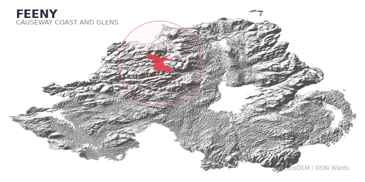
FEENY covers 301.5 km² in Northern Ireland. With 98 historic sites and 16 scheduled monuments on record, the ward sits at the 90th percentile across all 462 NI wards for combined archaeological heritage. It also records 72 listed buildings (HED Historic Buildings Record), the 87th percentile for listed-building density across NI wards. Per 1,000 residents, this works out at 51.6 recorded sites — the 91st percentile across NI wards (a measure of heritage density relative to current population). Dated archaeological evidence runs from the Mesolithic through to the Post-Medieval period, spanning 6 archaeological periods, around the NI median for chronological depth.
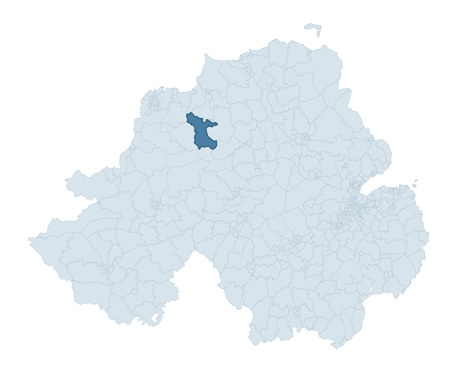
FEENY boundary detailFEENY in regional context
Heritage at a glance
Percentile rankings throughout this profile compare each ward only against the other 461 Northern Ireland wards.
98
Historic sites
89th percentile
16
Scheduled monuments
93rd percentile
72
Listed buildings
87th percentile
0.62
Sites per km²
Population context
12
Persons per km²
8th percentile
51.6
Sites per 1,000 residents
91st percentile
3,607
Total residents (2021)
The recorded heritage of FEENY
Of the 98 historic sites recorded, the most common are Standing Stone (10, 10% of historic sites), Enclosure (6), and Cairn (O.S. Memoir Site, Unlocated) (5). For Standing Stones, this is the 86th percentile across NI wards that record this type. For Enclosures, this is the 53rd percentile among NI wards that record this type. Across the ward's 301.5 km², this gives a recorded density of 0.62 sites per km² (all heritage types combined). Scheduled monuments are distributed across approximately 0.06° of latitude and 0.11° of longitude within the ward, indicating dispersed rather than clustered placement.
Most common monument types
Type
Count
Description
Standing Stone
10
—
Enclosure
6
—
Cairn (o.s. Memoir Site, Unlocated)
5
—
Chronological distribution
Mesolithic
46
Early Bronze Age
2
Iron Age
13
Early Medieval
23
Medieval
1
Post Medieval
3
Unknown
10
Terrain and environment
A mean elevation of 231m places this ward in the top 2% of NI wards by altitude, but the ward reaches 627m at its highest point — a vertical span of more than 395m within its boundary, indicating significant topographic diversity. The terrain is consistently steep, with a mean slope of 6.6° (92th percentile across NI). The ward is well-drained, with a Topographic Wetness Index of 9.5 (8th NI percentile) — characteristic of upland or steeply-sloping ground that sheds water rapidly. The land cover is dominated by improved grassland (86%) and woodland (12%). In overall character, this is an upland landscape of steep, elevated terrain, with land use dominated by improved grassland.
Terrain measurements
Mean elevation231.2 m 99th pct
Max elevation626.6 m 98th pct
Mean slope6.6° 93rd pct
Wetness index (TWI)9.49 8th pct
Grassland85.7% 93rd pct
Woodland12.5% 31st pct
Urban land1.1% 9th pct
Where this ward sits in NI
Elevation
99th
Slope
93rd
Drainage
8th
Grassland
93rd
Woodland
31st
Geology and preservation
The dominant bedrock formed during the Neoproterozoic era (Carboniferous period). Late Pre-Cambrian rock laid down before the Cambrian explosion of life — a stable, long-eroded basement geology. Peat covers 30% of the ward. Peat-bound ground preserves organic archaeological material that would not survive on aerated mineral soils. Bedrock composition is moderately varied (complexity index 0.60), with two or three geological units present within the ward boundary.
Bedrock eraNeoproterozoic
Bedrock periodCarboniferous
Surface depositsGlacial Sand And Gravel
Peat coverage29.7%
Bedrock complexity0.60
Placename evidence
The combined OSNI, Logainm NI, and GeoNames sources record 40 placenames for this ward. Diagnostic heritage strata identified within these are: 2 pre-Christian defensive (rath-, dún-, lios-, caiseal-), 4 ecclesiastical (cill-, teampall-, mainistir-, díseart-), and 1 Plantation-era (17th c English/Scots settlement names). Note: Irish-language (name_ga) forms are recorded for roughly half of NI placenames in the combined sources, so anglicised forms whose Irish original could belong to multiple categories may be misclassified.
Scheduled monuments are sites legally protected under the Historic Monuments and Archaeological Objects (Northern Ireland) Order 1995, designated by the Historic Environment Division (HED).
BURIAL MOUND?: LISNAGORP (O.S. memoir site, unlocated)
Early Bronze Age
Ritual/Funerary
BURIALS (O.S. memoir site, unlocated)
Mesolithic
Ritual/Funerary
CAIRN
Mesolithic
Ritual/Funerary
CAIRN (O.S. memoir site, unlocated)
Mesolithic
Ritual/Funerary
CAIRN (O.S. memoir site, unlocated)
Mesolithic
Ritual/Funerary
CAIRN (O.S. memoir site, unlocated)
Mesolithic
Ritual/Funerary
CAIRN (O.S. memoir site, unlocated)
Mesolithic
Ritual/Funerary
CAIRN (O.S. memoir site, unlocated)
Mesolithic
Ritual/Funerary
CAIRN COMPLEX (O.S. memoir site, unlocated)
Mesolithic
Ritual/Funerary
CASHEL
Early Medieval
Defence
CHURCH SITE: TEMPLEMOYLE
Early Medieval
Ritual/Funerary
CIST BURIAL (unlocated)
Mesolithic
Ritual/Funerary
CIST BURIAL? (O.S. memoir site, unlocated)
Mesolithic
Ritual/Funerary
CROSS (O.S. memoir site, unlocated)
Unknown
Unknown
CROSS, FONT & WELL (O.S. memoir site)
Unknown
Unknown
CROSS-CARVED STONE (O.S. memoir site, unlocated)
Unknown
Ritual/Funerary
DUNGIVEN CASTLE (PART OF WALLS)
Post-Medieval
Defence
EARLY MONASTIC SITE; AUGUSTINIAN PRIORY; CHURCH; MANOR-HOUSE; TOWER-HOUSE; BAWN: DUNGIVEN PRIORY; OLD CHURCH; DUNGIVEN CHURCH; ST PATRICK'S ALTAR & BED
Early Medieval
Religious
ENCLOSURE
Iron Age
Unknown
ENCLOSURE
Iron Age
Unknown
ENCLOSURE
Iron Age
Unknown
ENCLOSURE
Iron Age
Unknown
ENCLOSURE
Iron Age
Unknown
ENCLOSURE
Iron Age
Unknown
ENCLOSURE (O.S. memoir site, unlocated)
Early Medieval
Unknown
ENCLOSURE (O.S. memoir site, unlocated)
Iron Age
Unknown
ENCLOSURE & 2 BURIALS
Iron Age
Ritual/Funerary
ENCLOSURE & MOUND: THE DOON
Iron Age
Unknown
ENCLOSURE (O.S. memoir site, unlocated)
Iron Age
Unknown
ENCLOSURE – CASHEL?
Early Medieval
Defence
ENCLOSURE: LUISNAHEGUIRTH or THE PRIEST'S FORT (O.S. memoir site, unlocated)
Iron Age
Defence
ENCLOSURE: LISS-CHACHA-NA-THOUYA or FORT OF THE MOURNFUL BATTLES
Iron Age
Defence
ENCLOSURE?: DOON
Iron Age
Unknown
FINDSPOT of STONE AXE
Mesolithic
Unknown
FINDSPOT of STONE AXE
Mesolithic
Unknown
FINDSPOT of STONE AXE
Mesolithic
Unknown
FIVE STONE CIRCLES & ALIGNMENTS
Mesolithic
Ritual/Funerary
HISTORIC SETTLEMENT: DUNGIVEN
Early Medieval
Defence
HOLY WELL: TOBERPATRICK
Early Medieval
Ritual/Funerary
Historic Settlement Feeny
Post-Medieval
Domestic
MEGALITHIC TOMB
Mesolithic
Ritual/Funerary
MEGALITHIC TOMB
Mesolithic
Ritual/Funerary
MEGALITHIC TOMB (O.S. memoir site, unlocated)
Mesolithic
Ritual/Funerary
MEGALITHIC TOMB (O.S. memoir site, unlocated)
Mesolithic
Ritual/Funerary
MEGALITHIC TOMB (O.S. memoir site, unlocated)
Mesolithic
Ritual/Funerary
MEGALITHIC TOMB (O.S. memoir site, unlocated)
Mesolithic
Ritual/Funerary
MEGALITHIC TOMB (O.S. memoir site, unlocated)
Mesolithic
Ritual/Funerary
MEGALITHIC TOMB (unlocated)
Mesolithic
Ritual/Funerary
MEGALITHIC TOMB – WEDGE TOMB?
Mesolithic
Ritual/Funerary
MEGALITHIC TOMB? (O.S. memoir site)
Mesolithic
Ritual/Funerary
MILL
Post-Medieval
Agriculture
MOUND
Unknown
Unknown
Multi-period site: Bronze Age ring barrow and funerary structure; Medieval charcoal production pits
Early Bronze Age
Ritual/Funerary
PAVED ROAD & WELL: TUBBERNACUSH (well) (O.S. memoir site, unlocated)
Unknown
Transport
Pits
Unknown
Industrial
RATH
Early Medieval
Defence
RATH (O.S. memoir site)
Early Medieval
Defence
RATH (O.S. memoir site, unlocated)
Early Medieval
Defence
RATH (O.S. memoir site, unlocated)
Early Medieval
Defence
RATH (O.S. memoir site, unlocated)
Early Medieval
Defence
RATH and CLACHAN
Early Medieval
Defence
RATH, reused as TREE RING: LISARD
Early Medieval
Defence
RATH: CAUGH FORT
Early Medieval
Defence
RATH: DICK'S FORT
Early Medieval
Defence
RATH: KNOCKNAGIN FORT
Early Medieval
Defence
RATH: RALLAGH FORT
Early Medieval
Defence
RATH: TANDRAGEE FORT
Early Medieval
Defence
RATH? (O.S. memoir site, unlocated)
Early Medieval
Defence
SETTLEMENT SITE (O.S. memoir site, unlocated)
Unknown
Domestic
SOUTERRAIN (O.S. memoir site, unlocated)
Early Medieval
Defence
SOUTERRAIN (O.S. memoir site, unlocated)
Early Medieval
Defence
STANDING STONE
Mesolithic
Ritual/Funerary
STANDING STONE
Mesolithic
Ritual/Funerary
STANDING STONE
Mesolithic
Ritual/Funerary
STANDING STONE
Mesolithic
Ritual/Funerary
STANDING STONE
Mesolithic
Ritual/Funerary
STANDING STONE
Mesolithic
Ritual/Funerary
STANDING STONE
Mesolithic
Ritual/Funerary
STANDING STONE
Mesolithic
Ritual/Funerary
STANDING STONE
Mesolithic
Ritual/Funerary
STANDING STONE
Mesolithic
Ritual/Funerary
STANDING STONE (unlocated)
Mesolithic
Ritual/Funerary
STANDING STONE (O.S. memoir site, unlocated)
Mesolithic
Ritual/Funerary
STANDING STONE (O.S. memoir site, unlocated)
Mesolithic
Ritual/Funerary
STANDING STONE (unlocated)
Mesolithic
Ritual/Funerary
STANDING STONE?: FIN STONE
Mesolithic
Ritual/Funerary
STONE CIRCLE/ REMAINS OF MEGALITH
Mesolithic
Ritual/Funerary
SWEAT HOUSE
Unknown
Domestic
TWO STANDING STONES (O.S. memoir site, unlocated)
Mesolithic
Ritual/Funerary
TWO STANDING STONES; possibly remains of MEGALITHIC TOMB
Mesolithic
Ritual/Funerary
URN BURIAL
Mesolithic
Ritual/Funerary
URN BURIAL (O.S. memoir site, unlocated)
Mesolithic
Ritual/Funerary
URN BURIAL (O.S. memoir site, unlocated)
Mesolithic
Ritual/Funerary
VILLAGE: OLD DUNGIVEN
Medieval
Defence
VITRIFIED FORT: GRIEN MOUNT or GREEN MOUNT
Unknown
Defence
Listed buildings in FEENY
Address / Name
Grade
Period
Knockan Bridge
Killunaght Road
Dungiven
Co Londonderry
B1
1780 – 1799
Carnanbane Bridge
Carnanbane Road
Dungiven
Co Londonderry
B2
1860 – 1879
Derrychier Bridge
Derrychier Road
Derrychier
Dungiven
Co Londonderry
B2
1860 – 1879
Fincarn Bridge
Altimure Road
Fincarn
Feeny
Co Londonderry
B2
1860 – 1879
Owenbeg Bridge
Foreglen Road
Dungiven
Co Londonderry
B2
1780 – 1799
Church of St. Peter and St. Paul.
Foreglen Road
Dungiven
Co Londonderry
BT47 4PL
Record Only
1920 – 1939
The Old Rectory
Glenshane Road
Dungiven
Co Londonderry
BT47
B+
1800 – 1819
Banagher Church of Ireland
Feeny Road
Rallagh
Dungiven
Co Londonderry
B+
1780 – 1799
Ashpark House
712 Glenshane Road
Feeny
Co Londonderry
BT47 4TG
B+
1780 – 1799
714 Glenshane Road
Feeny
Co Londonderry
BT47 4TG
B1
1780 – 1799
Knockan House
9 Killunaght Road
Dungiven
Co Londonderry
BT47 4TU
B+
1780 – 1799
Outbuildings
Knockan House
9 Killunaght Road
Dungiven
Co Londonderry
BT47 4TU
B2
1720 – 1739
Drumcovit House
704 Feeny Road
Feeny
Co Londonderry
BT47 4SU
B+
1780 – 1799
PAROCHIAL HALL
MAIN ST.
FEENY
CO.LONDONDERRY
Record Only
1860 – 1879
St Joseph’s R.C. Church
Glenedra Road
Fincarn
Feeny
Co Londonderry
BT47 4TW
B2
1880 – 1899
48 Glenedra Road
Feeny
Co Londonderry
BT47 4TP
Record Only
1840 – 1859
Aughlish Bridge
Glenedra Road
Aughlish
Feeny
Co Londonderry
B1
1880 – 1899
Water pump
128 Glenedra Road
Feeny
Co Londonderry
BT47 4TP
B2
1880 – 1899
St Patrick’s R.C. Church
Glenshane Road
Dungiven
Co Londonderry
BT47 4RT
B2
1880 – 1899
Dungiven Castle
Main Street
Dungiven
Co Londonderry
BT47 4LF
B1
1820 – 1839
113 Main Street
Dungiven
Co Londonderry
BT47 4LF
Record Only
1980 – 1999
7 Lower Main Street
Dungiven
Co Londonderry
BT47 4LD
B2
1840 – 1859
9 Lower Main Street
Dungiven
Co Londonderry
BT47 4LD
B2
1860 – 1879
11 Lower Main Street
Dungiven
Co Londonderry
BT47 4LD
B2
1860 – 1879
15 Lower Main Street
Dungiven
Co Londonderry
BT47 4LD
B2
1860 – 1879
Old Graveyard.
Church of St. Peter and St. Paul.
Foreglen Road
Dungiven
Co Londonderry
Record Only
1820 – 1839
Former Flax Mill
Altmover Road
Dungiven
Co Londonderry
BT47 4QD
Record Only
1800 – 1819
121 Muldonagh Road
Claudy
Co Londonderry
BT47 4EJ
Record Only
1820 – 1839
119 Muldonagh Road
Claudy
Co Londonderry
BT47 4EJ
Record Only
1820 – 1839
14 Munolahug Road
Dungiven
Co Londonderry
BT47 4PX
Record Only
1840 – 1859
Mission Hall
23 Altmover Road
Dungiven
Co Londonderry
BT47 4QD
Record Only
1840 – 1859
The Old Rectory – Outbuildings
Glenshane Road
Dungiven
Co Londonderry
Record Only
1800 – 1819
Outbuildings
704 Glenshane Road
Feeny
Co Londonderry
BT47 4TG
Record Only
1780 – 1799
Grotto Hall
Former Stables
Glenedra Road
Fincarn
Feeny
Co Londonderry
Record Only
1880 – 1899
Aughlish House
136 Glenedra Road
Feeny
Co Londonderry
BT47 4TP
Record Only
1780 – 1799
154 Glenedra Road
Feeny
Co Londonderry
BT47 4TP
Record Only
1880 – 1899
General’s Bridge
Glenshane Road
Feeny
Co Londonderry
Record Only
1780 – 1799
Former Flax Mill
Glenedra Road
Rincarn
Feeny
Co Londonderry
Record Only
1860 – 1879
Former Flax Mill
Glenedra Road
Fincarn
Feeny
Co Londonderry
Record Only
1860 – 1879
Former Mill
Derrychier Road
Derrychier
Dungiven
Co Londonderry
Record Only
1800 – 1819
Poston’s Mill
Altinure Road
Gallany
Dungiven
Co Londonderry
Record Only
1800 – 1819
Poston’s Mill
Altinure Road
Gallany
Dungiven
Co Londonderry
Record Only
1800 – 1819
Glenedra Bridge
Glenedra Road
Glenedra
Feeny
Co Londonderry
Record Only
1860 – 1879
Ubbernagapple Bridge
Glenedra Road
Glenedra
Feeny
Co Londonderry
Record Only
1800 – 1819
Stone Circles
Rallagh Road
Aughlish
Feeny
Co Londonderry
Record Only
Pre 1600
Tandragee Fort
Glenedra Road
Drumcovit
Feeny
Co Londonderry
Record Only
Pre 1600
Tullygowan Bridge
Glenedra Road
Fincarn
Feeny
Co Londonderry
Record Only
1860 – 1879
Templemoyle Old Church site
Banagher Road
Templemoyle
Dungiven
Co Londonderry
Record Only
Pre 1600
Standing Stones
Glenshane Road
Derrychier
Dungiven
Co Londonderry
Record Only
Pre 1600
Bridge
Feeny Road
Drumcovit
Feeny
Co Londonderry
Record Only
1860 – 1879
Former Flax Mill
Feeny Road
Knockan TD
Feeny
Co Londonderry
Record Only
1780 – 1799
Finglen Lodge
Glenedra Road
Feeny
Co Londonderry
Record Only
1880 – 1899
Former Filter House
Banagher Glen
Dungiven
Co Londonderry
Record Only
1920 – 1939
Vacant Cottage
721 Feeny Road
Feeny
Co Londonderry
Record Only
1800 – 1819
Former Teacher’s House
4 Rallagh Road
Dungiven
Co Londonderry
BT47 4TT
Record Only
1860 – 1879
Stone circle
Banagher Road
Feeny
Co Londonderryn
Record Only
Pre 1600
Sweathouse
Altinure Road
Ballydonegan
Claudy
Co Londonderry
Record Only
Pre 1600
Standing Stone
Altimure Road
Gallany
Co Londonderry
Record Only
Pre 1600
Standing Stone
Altimure Road
Fincarn TD
Feeny
Co Londonderry
Record Only
Pre 1600
Standing Stone
Glenedra Road
Drumcovit TD
Feeny
Co Londonderry
Record Only
Pre 1600
Former Bawn Wall
Dungiven Castle
Dungiven
Co Londonderry
Record Only
1650 – 1699
Manse
807 Glenshane Road
Dungiven
Co Londonderry
BT47 4HW
Record Only
1880 – 1899
Dungiven High School
822 Glenshane Road
Dungiven
Co Londonderry
BT47 4PQ
Record Only
1960 – 1979
Priory Plantation House ( Remains of)
Dungiven Priory
Priory Lane
Dungiven
Co Londonderry
BT47 4PF
Record Only
Pre 1600
Cooey na Gall Monument
Dungiven Priory
Priory Lane
Dungiven
Londonderry
BT47 4PF
Record Only
Pre 1600
Graveyard
Dungiven Priory
Priory Lane
Dungiven
Co Londonderry
BT47 4PF
Record Only
Pre 1600
Ballaun/Font
Graveyard
Priory Lane
Dungiven
Co Londonderry
BT47 4PF
Record Only
Pre 1600
Standing Stone
Priory Lane
Dungiven
Co Londonderry
BT47 4PF
Record Only
Pre 1600
Turmeel Bridge
Magheramore Road
Dungiven
Co Londonderry
Record Only
1860 – 1879
Guildhall
2 New Street
Dungiven
Co Londonderry
BT47 4LJ
Record Only
1840 – 1859
844 Glenshane Road
Dungiven
Co Londonderry
BT47 4PQ
Grounding History: 10 Maps of Northern Ireland’s Past
A spatial history report bringing together analysis of all 462 wards into one place through 10 high-quality maps — covering monument density, archaeological periods, placename heritage, terrain, wetland, and the historic landscape at first survey.
A ward is the smallest electoral and statistical geography used by the Northern Ireland Statistics and Research Agency (NISRA). The boundaries used here are the 2014 NISRA / OSNI Wards (462 across Northern Ireland), each typically covering 1-700 km² and a population of a few thousand. Wards do not align with parishes, townlands, or any historic administrative unit — they are a modern statistical convenience, used here only as a fixed spatial frame within which to summarise heritage records.
What counts as a site?
Three distinct heritage record types are reported separately, not combined: (1) Historic Sites — entries in the Northern Ireland Sites and Monuments Record (NISMR), the inventory of recorded archaeological sites and findspots, dated from prehistoric to early-modern; (2) Scheduled Monuments — sites legally protected under the Historic Monuments and Archaeological Objects (NI) Order 1995 and maintained by the Historic Environment Division (HED); (3) Listed Buildings — buildings of architectural or historic interest protected under the Planning Act (NI) 2011 and graded A, B+, B1, B2, or Record-Only by HED. A site appearing in more than one register is counted in each register independently.
Editorial principles
These ward profiles describe evidence, not history. They report what is recorded, not what occurred. Where the data is ambiguous, we say so. We do not infer historical processes — population movements, settlement expansion, periods of decline — from patterns in the record. Absence of evidence is not evidence of absence: in Northern Ireland, where antiquarian survey was uneven and modern excavation is geographically biased, a gap in the record almost always reflects the limits of recording rather than a genuine historical absence. We mark such gaps explicitly where they appear in the data.
Limits of coverage and known caveats
Several caveats apply to every ward profile: (1) NISMR coverage is uneven across NI — some areas (notably parts of the south-east and the Belfast urban fringe) have been more intensively surveyed than others, so a low recorded site count does not reliably indicate a low past density of activity; (2) period attributions in NISMR are often 'Unknown', and chronological breakdowns reported here reflect only the dated subset; (3) placename classification depends on the Irish-language form (name_ga), which is recorded for approximately 50% of NI placenames in the combined sources, so ecclesiastical and pre-Christian counts may be understated where anglicised forms remain unparsed; (4) terrain percentile ranks compare each ward only to the other 461 NI wards; they are not absolute thresholds. For absence-dominant land cover categories (wetland, water, cropland), percentile ranks are suppressed below 1% raw value, since the ranking of zero-value wards is not meaningful.
Data sources (11)
Northern Ireland Sites and Monuments Record (NISMR)
Spotted an error? This dataset is updated continuously.
Email contact@danielkirkpatrick.co.uk with corrections, missing records, or suggestions for improvement.
Manage Consent
To provide the best experiences, we use technologies like cookies to store and/or access device information. Consenting to these technologies will allow us to process data such as browsing behaviour or unique IDs on this site. Not consenting or withdrawing consent, may adversely affect certain features and functions.
Functional
Always active
The technical storage or access is strictly necessary for the legitimate purpose of enabling the use of a specific service explicitly requested by the subscriber or user, or for the sole purpose of carrying out the transmission of a communication over an electronic communications network.
Preferences
The technical storage or access is necessary for the legitimate purpose of storing preferences that are not requested by the subscriber or user.
Statistics
The technical storage or access that is used exclusively for statistical purposes.The technical storage or access that is used exclusively for anonymous statistical purposes. Without a subpoena, voluntary compliance on the part of your Internet Service Provider, or additional records from a third party, information stored or retrieved for this purpose alone cannot usually be used to identify you.
Marketing
The technical storage or access is required to create user profiles to send advertising, or to track the user on a website or across several websites for similar marketing purposes.