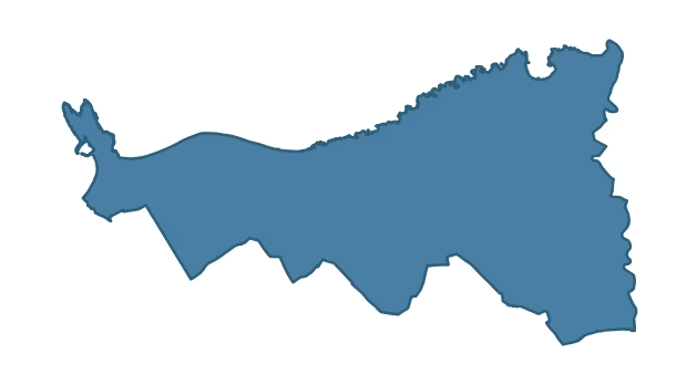
PORTRUSH and DUNLUCE covers 63.4 km² in Northern Ireland. With 66 historic sites and 7 scheduled monuments on record, the ward sits at the 87th percentile across all 462 NI wards for combined archaeological heritage. It also records 97 listed buildings (HED Historic Buildings Record), the 92nd percentile for listed-building density across NI wards. Per 1,000 residents, this works out at 63.6 recorded sites — the 95th percentile across NI wards (a measure of heritage density relative to current population). Dated archaeological evidence runs from the Mesolithic through to the Modern period, spanning 7 archaeological periods, placing the ward in the 79th percentile NI-wide for chronological depth.

Heritage at a glance
Percentile rankings throughout this profile compare each ward only against the other 461 Northern Ireland wards.
Population context
The recorded heritage of PORTRUSH and DUNLUCE
Of the 66 historic sites recorded, the most common are Souterrain (3, 5% of historic sites), Standing Stone (3), and Standing Stone (O.S. Memoir Site: Unlocated) (3). For Souterrains, this is the 34th percentile among NI wards that record this type. For Standing Stones, this is the 35th percentile among NI wards that record this type. Across the ward's 63.4 km², this gives a recorded density of 2.68 sites per km² (all heritage types combined). Scheduled monuments are distributed across approximately 0.04° of latitude and 0.09° of longitude within the ward, indicating dispersed rather than clustered placement.
Most common monument types
| Type | Count | Description |
|---|---|---|
| Souterrain | 3 | — |
| Standing Stone | 3 | — |
| Standing Stone (o.s. Memoir Site: Unlocated) | 3 | — |
Chronological distribution
Terrain and environment
Mean elevation of 49m sits around the NI median (38th percentile), reaching 125m at the highest point. Mean slope is 4.0° (47th percentile across NI), giving moderately undulating terrain. The Topographic Wetness Index of 10.6 (61th NI percentile) indicates moderate drainage, balanced between upland shedding and lowland accumulation. The land-cover mosaic combines improved grassland (79%), urban land (7%), and woodland (7%), giving a mixed agricultural and semi-natural landscape.
Terrain measurements
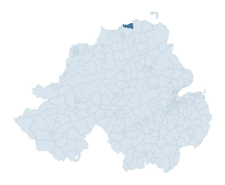
Where this ward sits in NI
Geology and preservation
The dominant bedrock formed during the Cainozoic era (Palaeogene period). Relatively young rock formed in the last 66 million years. In Ulster, Cainozoic basalt — the lava that created the Antrim Plateau and Giant's Causeway — dominates much of the eastern landscape. Bedrock composition is moderately varied (complexity index 0.44), with two or three geological units present within the ward boundary.
Placename evidence
The combined OSNI, Logainm NI, and GeoNames sources record 49 placenames for this ward. Diagnostic heritage strata identified within these are: 5 pre-Christian defensive (rath-, dún-, lios-, caiseal-), 1 Norse coastal (fjord-derived names, Viking-age trading sites), and 3 Plantation-era (17th c English/Scots settlement names). Note: Irish-language (name_ga) forms are recorded for roughly half of NI placenames in the combined sources, so anglicised forms whose Irish original could belong to multiple categories may be misclassified.
Placename categories
Scheduled monuments in PORTRUSH and DUNLUCE
Scheduled monuments are sites legally protected under the Historic Monuments and Archaeological Objects (Northern Ireland) Order 1995, designated by the Historic Environment Division (HED).
| Monument | Type | Period |
|---|---|---|
| Standing stone | Standing Stone | Early Bronze Age |
| Church and graveyard | Church And Graveyard | Unknown |
| Two Earthworks | Two Earthworks | Unknown |
| Two Earthworks | Two Earthworks | Unknown |
| Ice House | Ice House | Post-Medieval |
| Dunluce Castle and historic Settlement Complex | Dunluce Castle And Historic Settlement Complex | Unknown |
| Standing stone and mound | Standing Stone And Mound | Early Bronze Age |
Recorded historic sites
| Name | Period | Type |
|---|---|---|
| A pit and ditch | Mesolithic | Defence |
| A.P. SITE – possible barrow | Early Bronze Age | Ritual/Funerary |
| A.P. SITE – possible enclosure | Iron Age | Unknown |
| A.P. SITE: CROPMARK OF POSSIBLE ENCLOSURE | Iron Age | Unknown |
| A.P. SITE: FIELD BOUNDARY? | Unknown | Agriculture |
| A.P. SITE: possibly natural | Unknown | Unknown |
| Ballytober Historic Settlement | Post-Medieval | Domestic |
| C18TH HOUSE on site of C17TH CASTLE | Post-Medieval | Defence |
| CASTLE (destroyed): FLOWER HILL HOUSE | Post-Medieval | Defence |
| CASTLE (unlocated; O.S. memoir site) CASTLE AN TEENIE | Medieval | Defence |
Listed buildings in PORTRUSH and DUNLUCE
| Address / Name | Grade | Period |
|---|---|---|
| 1 Old Coastguard Cottages Portballintrae Bushmills Co. Antrim BT57 8RF | B1 | 1860 – 1879 |
| 3 Old Coastguard Cottages Portballintrae Bushmills Co. Antrim BT57 8RF | B1 | 1860 – 1879 |
| Town Hall Kerr Street Portrush Co. Antrim BT56 8DX | B+ | 1860 – 1879 |
| 30 Kerr Street Portrush Co. Antrim BT56 8DG | B2 | 1860 – 1879 |
| Holy Trinity Parish Church 62 Main Street Portrush Co. Antrim BT56 8BN See General Comments | B1 | 1840 – 1859 |
| Northern Bank 60 Main Street Portrush Co. Antrim BT56 8BL | B+ | 1880 – 1899 |
| Presbyterian Manse Main Street Portrush Co. Antrim BT56 8BN | B2 | 1840 – 1859 |
| Dr. Adam Clarke Memorial Methodist Church Causeway Street Portrush Co. Antrim BT56 8AE | B1 | 1880 – 1899 |
| St Patrick's RC Church Causeway Street Portrush Co Antrim BT56 8JE | B2 | 1840 – 1859 |
| Dunluce Presbyterian Church 17 Priestland Road Bushmills Co. Antrim BT57 8QP | B1 | 1840 – 1859 |
Discover more in Causeway Coast and Glens
- University
- Hopefield
- Garvagh
- Feeny
- Portstewart
- Loughguile And Stranocum
- Dundooan
- Parkgate — Antrim and Newtownabbey
- Pomeroy — Mid Ulster
- Portglenone — Mid and East Antrim
See all 462 wards in the Northern Ireland Heritage Tool.

Want a deeper view?
Grounding History: 10 Maps of Northern Ireland’s Past
A spatial history report bringing together analysis of all 462 wards into one place through 10 high-quality maps — covering monument density, archaeological periods, placename heritage, terrain, wetland, and the historic landscape at first survey.
About this profile
What is a ward?
A ward is the smallest electoral and statistical geography used by the Northern Ireland Statistics and Research Agency (NISRA). The boundaries used here are the 2014 NISRA / OSNI Wards (462 across Northern Ireland), each typically covering 1-700 km² and a population of a few thousand. Wards do not align with parishes, townlands, or any historic administrative unit — they are a modern statistical convenience, used here only as a fixed spatial frame within which to summarise heritage records.
What counts as a site?
Three distinct heritage record types are reported separately, not combined: (1) Historic Sites — entries in the Northern Ireland Sites and Monuments Record (NISMR), the inventory of recorded archaeological sites and findspots, dated from prehistoric to early-modern; (2) Scheduled Monuments — sites legally protected under the Historic Monuments and Archaeological Objects (NI) Order 1995 and maintained by the Historic Environment Division (HED); (3) Listed Buildings — buildings of architectural or historic interest protected under the Planning Act (NI) 2011 and graded A, B+, B1, B2, or Record-Only by HED. A site appearing in more than one register is counted in each register independently.
Editorial principles
These ward profiles describe evidence, not history. They report what is recorded, not what occurred. Where the data is ambiguous, we say so. We do not infer historical processes — population movements, settlement expansion, periods of decline — from patterns in the record. Absence of evidence is not evidence of absence: in Northern Ireland, where antiquarian survey was uneven and modern excavation is geographically biased, a gap in the record almost always reflects the limits of recording rather than a genuine historical absence. We mark such gaps explicitly where they appear in the data.
Limits of coverage and known caveats
Several caveats apply to every ward profile: (1) NISMR coverage is uneven across NI — some areas (notably parts of the south-east and the Belfast urban fringe) have been more intensively surveyed than others, so a low recorded site count does not reliably indicate a low past density of activity; (2) period attributions in NISMR are often 'Unknown', and chronological breakdowns reported here reflect only the dated subset; (3) placename classification depends on the Irish-language form (name_ga), which is recorded for approximately 50% of NI placenames in the combined sources, so ecclesiastical and pre-Christian counts may be understated where anglicised forms remain unparsed; (4) terrain percentile ranks compare each ward only to the other 461 NI wards; they are not absolute thresholds. For absence-dominant land cover categories (wetland, water, cropland), percentile ranks are suppressed below 1% raw value, since the ranking of zero-value wards is not meaningful.
Data sources (11)
- Northern Ireland Sites and Monuments Record (NISMR) https://www.communities-ni.gov.uk/articles/nismr-public-mapviewer
- HED Scheduled Monuments Dataset https://www.opendatani.gov.uk/@historic-environment-division/scheduled-monuments-northern-ireland
- HED Historic Buildings Record https://www.communities-ni.gov.uk/topics/historic-environment/listed-buildings
- OSNI OS Open Names (Northern Ireland) https://www.opendatani.gov.uk/@ordnance-survey-of-northern-ireland/osni-open-data—50k-gazetteer
- Logainm — Placenames Database of Ireland https://www.logainm.ie/
- GeoNames https://www.geonames.org/
- Census 2021 (Northern Ireland) https://www.nisra.gov.uk/statistics/2021-census
- OSNI Open Data — Largescale Boundaries https://www.opendatani.gov.uk/@ordnance-survey-of-northern-ireland/osni-open-data-largescale-boundaries-wards-2012
- Copernicus GLO-30 DEM https://spacedata.copernicus.eu/collections/copernicus-digital-elevation-model
- ESA WorldCover https://esa-worldcover.org/
- GSNI 1:250,000 Geology https://www.bgs.ac.uk/geological-data/maps/