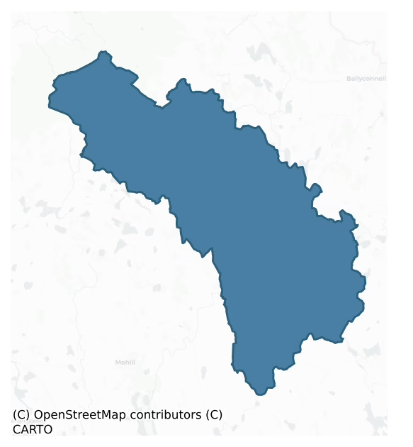
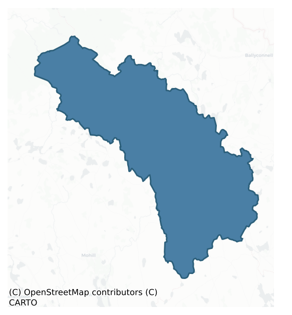
Carrigallen is a barony of County Leitrim, in the historical province of Connacht (Irish: Carraig Álainn), covering 257 km² of land. The barony records 228 NMS archaeological sites and 61 NIAH listed buildings, placing it at around the 7th percentile among 280 ROI baronies for sites per km². This means it is in the bottom tenth of all baronies for sites per km². Dated archaeological evidence runs from the Neolithic through to the Post Medieval, spanning 7 of 9 archaeological periods, placing the barony in the 47th percentile among 280 ROI baronies for chronological depth. This means it is in the lower half of all baronies for chronological depth. The largest dated subset of recorded sites dates to the Early Medieval. Logainm flags 34 placenames in the barony as carrying a recognised heritage root; the largest share — around 65% — are names associated with early Christian church and monastic foundations.
Heritage at a glance
Percentile rankings throughout this profile compare each barony only against the other 279 Republic of Ireland baronies.
The recorded heritage of Carrigallen
The National Monuments Service Sites and Monuments Record (SMR) is the statutory inventory of archaeological sites for the Republic of Ireland, maintained by the Department of Tourism, Culture, Arts, Gaeltacht, Sport and Media. Sites recorded here include earthworks, ringforts, megalithic tombs, ecclesiastical remains, and post-medieval features; not every record is legally protected, but each is registered as a monument of archaeological interest.
The National Monuments Service records 228 archaeological sites in Carrigallen, putting it at the 7th percentile among 280 ROI baronies for sites per km². This means it is in the bottom tenth of all baronies for sites per km². A sparse recorded total of this kind in Ireland often reflects survey priority rather than genuine absence of past activity. Protection coverage is near-universal — 224 sites (98%) fall within a recorded monument protection zone, indicating an extensively surveyed landscape. The dominant category is defensive sites — ringforts, enclosures, hillforts, and stone forts (142 sites, 62% of the record). Ringfort – rath is the most prevalent type, making up 42% of the barony's recorded sites (96 records) — well above the ROI average of 20% across all baronies where this type occurs. Ringfort – rath is an earthen ringfort enclosed by a bank and external ditch — the most common Early Medieval farmstead, broadly dated 500–1000 AD. Other significant types include Crannog (28) and Enclosure (8). Crannog is an artificial or partly artificial island built up on a lake or river bed, in use from the 6th to 17th centuries AD; Enclosure is a banked or ditched feature of uncertain type, used as a catch-all where the original function cannot be determined from surface evidence. Across the barony's 257 km², this gives a recorded density of 0.89 sites per km².
Most common monument types
Hover or tap a monument type to see its definition.
| Type | Count |
|---|---|
| Ringfort – rath an earthen ringfort enclosed by a bank and external ditch — the most common Early Medieval farmstead, broadly dated 500–1000 AD | 96 |
| Crannog an artificial or partly artificial island built up on a lake or river bed, in use from the 6th to 17th centuries AD | 28 |
| Enclosure a banked or ditched feature of uncertain type, used as a catch-all where the original function cannot be determined from surface evidence | 8 |
| Ritual site – holy well a well or spring traditionally associated with a saint, often credited with healing properties; many trace earlier ritual origins but devotion is documented from the medieval period onwards | 7 |
| Church a building used for public Christian worship, of any date from c. 500 AD onwards | 7 |
| Graveyard a burial area associated with a church, in use from the medieval period onwards | 6 |
| Standing stone a deliberately set upright stone, used variously as a Bronze/Iron Age burial marker, route marker or commemorative monument | 5 |
Chronological distribution
The dated archaeological record for Carrigallen spans from the Neolithic through to the Post Medieval, with activity attested across 7 of 9 archaeological periods. Every period from earliest to latest is represented in the record — an unbroken sequence of dated activity across the full chronological span. Activity concentrates most heavily in the Early Medieval (133 sites, 68% of dated material), with the Iron Age forming a secondary peak (30 sites, 15%). A further 31 recorded sites (14% of the overall NMS register for the barony) carry no period attribution — appearing as 'Unknown' in the bar chart below. This typically reflects either records that pre-date the standardised period vocabulary or sites awaiting specialist dating review, rather than a genuine absence of chronological evidence.
Sample of recorded monuments
Show 25 sample monuments (of 228 total)
A representative sample of 25 recorded monuments drawn from the barony’s 228 total NMS entries. Sites within a recorded monument protection zone and rarer site types are prioritised so the list shows a meaningful cross-section rather than only the most common type. Each entry shows the official Sites and Monuments Record reference number and the description published by the National Monuments Service.
Cliff-edge fort
Situated at the outer edge of a shelf of rock outcrop on a S-facing slope. This is a grass-covered D-shaped area (int. dims 33.5m E-W; 21.5m N-S) defined by a cliff at S (H c. 8m), by an earthen bank (Wth 5-7m; int. H…
Situated at the outer edge of a shelf of rock outcrop on a S-facing slope. This is a grass-covered D-shaped area (int. dims 33.5m E-W; 21.5m N-S) defined by a cliff at S (H c. 8m), by an earthen bank (Wth 5-7m; int. H 0.4m at N to 1.2m at E; ext. H 0.3m at N to 1.8m at E) NW-N-SE and a partly rock-cut fosse SW-N-SE that is most massive at W (Wth of top 12.5m; Wth of base 2.2m; int. D 2.2m; ext. D 2.4m) and E (Wth of top 9.5m; Wth of base 3.5m; int. D 1.8m; ext. D 2.2m), but is very slight at N (Wth of top 10m; Wth of base 4.5m; int. D 0.3m; ext. D 0.2m). The entrance (Wth 5m) is at N. St Patrick's holy well (LE022-015—-) is c. 15m to the SE, across a NE-SW public road. John O’Donovan writing in the 1830s identified Cromlin with the location of the pagan idol known as Crom Cruach. The image was reputedly destroyed by St Patrick, after which he conducted baptisms at the well (Herity 2012, 397-8). The source, the Tripartite Life, is unreliable, and Dalton (1921-4, 33-36) places the location of Crom Cruach in a hilltop enclosure (CV013-022—-) in Co. Cavan, which seems more reasonable.
The above description is derived from 'The Archaeological Inventory of County Leitrim' compiled by Michael J. Moore (Dublin: Stationery Office, 2003). In certain instances the entries have been revised and updated in the light of recent research.
Compiled by: Michael Moore
Date of revised upload: 26 January 2017
Earthwork
Located in pasture on top of a low rise between drumlins to the N and S. It is indicated as a D-shaped area truncated by a railway line at S only on the revised 1944 edition of the OS 6-inch map, and described in 1944…
Located in pasture on top of a low rise between drumlins to the N and S. It is indicated as a D-shaped area truncated by a railway line at S only on the revised 1944 edition of the OS 6-inch map, and described in 1944 as a D-shaped platform (dims c. 35m E-W; c. 20m N-S) with the remnant of a bank on the W side (OSFM). No archaeological feature is visible at ground level, but was probably a rath.
The above description is derived from 'The Archaeological Inventory of County Leitrim' compiled by Michael J. Moore (Dublin: Stationery Office, 2003). In certain instances the entries have been revised and updated in the light of recent research.
Date of upload: 23 September 2008
Megalithic tomb – court tomb
Located in pasture with some scrub on undulating low-lying ground within Ballinamore golf club. A mound (dims 35m NW-SE; c. 15m NE-SW; H 1m-1.5m) has the remains of a court with entrance jambstones at either end. There…
Located in pasture with some scrub on undulating low-lying ground within Ballinamore golf club. A mound (dims 35m NW-SE; c. 15m NE-SW; H 1m-1.5m) has the remains of a court with entrance jambstones at either end. There was also evidence of chambers at the NW end and at the centre of the cairn. The NW end of the cairn was damaged in 1999. (de Valera and Ó Nualláin 1972, 71-2)
The above description is derived from 'The Archaeological Inventory of County Leitrim' compiled by Michael J. Moore (Dublin: Stationery Office, 2003). In certain instances the entries have been revised and updated in the light of recent research.
Date of upload: 23 September 2008
See linked document with details from Ruaidhrí de Valera and Seán Ó Nualláin, Survey of the Megalithic Tombs of Ireland. Volume III. Counties Galway, Roscommon, Leitrim, Longford, Westmeath, Laoighis, Offaly, Kildare, Cavan. (Dublin: Stationery Office, 1972).
Hilltop enclosure
Located on top of a drumlin with wide views over Lough Gardice NE-SW, although the view is more restricted in other directions. This is a circular grass and rush-covered area (int. diam. 88.8m E-W; 87.5m N-S) defined by…
Located on top of a drumlin with wide views over Lough Gardice NE-SW, although the view is more restricted in other directions. This is a circular grass and rush-covered area (int. diam. 88.8m E-W; 87.5m N-S) defined by a hedge-covered earthen bank (at E: Wth 4m; int. H 0.6m-0.9m; ext. H 1.6m-1.8m) and an outer drain (at E: Wth of base 1m; ext. D 0.6m-0.8m) NE-S-NNW, but the perimeter is reduced to a scarp (H 0.2m) elsewhere. There is a modern entrance (Wth 5.5m) at SE.
The above description is derived from 'The Archaeological Inventory of County Leitrim' compiled by Michael J. Moore (Dublin: Stationery Office, 2003). In certain instances the entries have been revised and updated in the light of recent research.
Date of upload: 23 September 2008
Moated site
Situated at the bottom of a S-facing slope c. 50m from the N shore of what was an oval bay (dims c. 600m NW-SE; c. 450m NE-SW) opening at SE into the W end of Gardice Lough before the Ballinamore and Ballyconnell canal…
Situated at the bottom of a S-facing slope c. 50m from the N shore of what was an oval bay (dims c. 600m NW-SE; c. 450m NE-SW) opening at SE into the W end of Gardice Lough before the Ballinamore and Ballyconnell canal lowered the general levels of the lake and altered its shore. This is a grass-covered subrectangular area (int. dims 30.5m NW-SE; 27m NE-SW) defined by a scrub-covered earthen bank (Wth 3.5m; int. H 0.4m; ext. H 2m) and outer fosse or moat (Wth of top 5.5m; max. D 1m) at NW, a fosse or moat (Wth of top 5.5m; D 0.3-0.5m) at SE, a bank (Wth 3m; int. H 0.5m; ext. H 0.3m) at NE and a scarp (H 0.5-1m) at SW, but the NE and SW sides may have been truncated.
The above description is derived from 'The Archaeological Inventory of County Leitrim' compiled by Michael J. Moore (Dublin: Stationery Office, 2003). In certain instances the entries have been revised and updated in the light of recent research.
Date of upload: 23 September 2008
Stone sculpture
Two corbels with carved heads from the medieval church are probably in their original position high on the outer face of the W gable of the present Church of Ireland church of Drumreilly. The carved head of a bishop and…
Two corbels with carved heads from the medieval church are probably in their original position high on the outer face of the W gable of the present Church of Ireland church of Drumreilly. The carved head of a bishop and a grotesque mouth-pulling carved head are built into the outer face of the E gable.
Compiled by: Michael Moore
Date of upload: 6 July, 2017
Graveslab
There is a tapering graveslab (Wth 0.47m at W to 0.53m at E; L 1.63m plus) with a legend carved in false relief in the graveyard, N of the E end of Drumrielly church (LE025-057001-). The legend is in English and carved…
There is a tapering graveslab (Wth 0.47m at W to 0.53m at E; L 1.63m plus) with a legend carved in false relief in the graveyard, N of the E end of Drumrielly church (LE025-057001-). The legend is in English and carved in roman capitals, but it is illegible. However, it could be seventeenth century in date.
Compiled by: Michael Moore
Date of upload: 6 July, 2017
Cross
The base of a finial cross, and a window mullion with part of the head of a two-light ogee-headed window of fifteenth century date (LE025-058005-) are kept in the present Church of Ireland church of…
The base of a finial cross, and a window mullion with part of the head of a two-light ogee-headed window of fifteenth century date (LE025-058005-) are kept in the present Church of Ireland church of Drumreilly.
Compiled by: Michael Moore
Date of upload: 6 July, 2017
Hospital
A hospital, which may have been a guest-house for poor travellers, at Drumerbalaid (Drumreilly) was described in 1479 as so poorly funded that it could not be maintained alone and should be united with the rectory…
A hospital, which may have been a guest-house for poor travellers, at Drumerbalaid (Drumreilly) was described in 1479 as so poorly funded that it could not be maintained alone and should be united with the rectory (Gwynn and Hadcock 1970, 350, 382; Earley and Boyle 1999, 110). The location of the hospital is unknown and it might be anywhere within the parish, although probably close to the parish church (LE025-058001-).
Compiled by: Michael Moore
Date of upload: 6 July, 2017
Building
In 1942 the ITA Survey recorded that 'around the church ruins are signs of other buildings having once stood here also but nothing of any definite shape or form is visible' (SMR File). No trace of such structures can…
In 1942 the ITA Survey recorded that 'around the church ruins are signs of other buildings having once stood here also but nothing of any definite shape or form is visible' (SMR File). No trace of such structures can be identified now.
Date of upload/revision : 16 December 2011
Castle – unclassified
Situated in woodland towards the NW corner of the heart-shaped Cherry Island (dims c. 280m N-S; 250m E-W), formerly known as Hog Island or Inis na dTorc, in Garadice Lough, formerly called Lough Finvoy. In 1257 Con,…
Situated in woodland towards the NW corner of the heart-shaped Cherry Island (dims c. 280m N-S; 250m E-W), formerly known as Hog Island or Inis na dTorc, in Garadice Lough, formerly called Lough Finvoy. In 1257 Con, the son of Tiernan O'Rourke gave the island, described as fortified, to O'Conor (AFM), but It is thought to have been an O’Rourke castle until they transferred their centre to Drumahaire (LE014-009—-) and north Leitrim after 1418, in which year Owen, the son of Tiernan Mór O’Rourke, was drowned while returning from a visit to his dying father at Inis-na-dTorc (AFM). By the seventeenth century the island and castle was said to have belonged to Myles ‘the Slasher’ O’Reilly, whose principal stronghold as at Crane Island (LE026-006—-) at the SE edge of the lake.
The surviving structure is unlikely to date from the thirteenth century. It is a rectangular building (int. dims 19.55m E-W; 8.05m N-S) with the W wall surviving (H 2.7m; T 1.2-1.3m) best, although without the corners, while the other walls are reduced to the foundation courses. The walls are featureless, apart from some putlog holes in the W wall, and not even an entrance can be identified. It is situated within a D-shaped enclosure (dims 31m N-S; 26m E-W) defined by a stone spread with the straight E side 4m from the castle, but an entrance cannot be identified. A cairn (diam. c. 15m; H 1.5-2.5m) containing a kiln (diam. 2.1m; D 0.95m) which opens to the W is overlying the enclosure wall at W and S…
Kiln
A cairn (diam. c. 15m; H 1.5-2.5m) containing a kiln (diam. 2.1m; D 0.95m) which opens to the W is overlying the enclosure wall which surrounds the castle (LE025-061001-).
Compiled by: Michael Moore
Date of…
A cairn (diam. c. 15m; H 1.5-2.5m) containing a kiln (diam. 2.1m; D 0.95m) which opens to the W is overlying the enclosure wall which surrounds the castle (LE025-061001-).
Compiled by: Michael Moore
Date of upload: 6 July, 2017
Castle – ringwork
This enclosure is situated in mixed woodland in a low-lying position on the S bank of a WNW-ESE section of the Ballinamore and Ballyconnell canal, which cuts off a loop of the Woodford River to the N and which truncates…
This enclosure is situated in mixed woodland in a low-lying position on the S bank of a WNW-ESE section of the Ballinamore and Ballyconnell canal, which cuts off a loop of the Woodford River to the N and which truncates this monument on the N side. The river and the canal connect Ballymagauran Lough to the E with Gardice Lough to the W. This is identified as Tuam Seanchaidh or Tomonaghan, an early centre of the O'Rourke's in south Leitrim which may have continued in use up to the 15th century (Dalton 1921-4, 26, 31-3). In 1386 Aine, the wife of Tiernan O’Rourke, Lord of Breifne, died at Tuaim Seanchaidh (AFM). As a medieval centre of the O’Rourkes’ and for morphological reasons the earthwork can be considered as a possible ringwork castle. However, a stone castle (LE026-001002-) may have been built c. 100m to the SE, at a location later occupied by a house (M’Parlan 1802, 93).
This is a grass-covered D-shaped area (int. dims 36m WNW-ESE; 25m NNE-SSW) defined by an earthen bank (Wth of base 6.m; int. H 0.6-1m; ext. H 0.8-1m) with trees that is separated by a berm (Wth 0.5-1m) from an outer rock-cut fosse (Wth 7m; int. D 1.3-2m; ext. D 0.5-1.6m) E-S-WSW, and by the canal elsewhere. There is an entrance (Wth 4.8m) and causeway (Wth 7m) at SW, but the bank and fosse do not continue W of this feature. Before the canal truncated it, the enclosure would include all the loop created by the river (dim. c. 120m N-S).
The above description is derived from 'The Archaeological I…
Megalithic tomb – unclassified
Located towards the bottom of a steep S-facing slope, with the headwaters of a small SE-NW stream c. 40m to the S. It is depicted as a small hachured feature and described as a ‘Giant’s Grave’ only on the 1907 edition…
Located towards the bottom of a steep S-facing slope, with the headwaters of a small SE-NW stream c. 40m to the S. It is depicted as a small hachured feature and described as a ‘Giant’s Grave’ only on the 1907 edition of the OS 6-inch map. This is an overgrown cairn (dims 12m N-S; 7m E-W; H 1m) with three upright stones protruding from it 2m inside the W edge. The stones area contiguous and from the S these are (dims 0.75m x 0.15m; H 0.3m; 0.5m x 0.25m; H 0.45m; 0.55m x 0.35m; H 0.95m). (de Valera and Ó Nualláin 1972, 85-6)
The above description is derived from 'The Archaeological Inventory of County Leitrim' compiled by Michael J. Moore (Dublin: Stationery Office, 2003). In certain instances the entries have been revised and updated in the light of recent research.
Compiled by: Michael Moore
Date of revised upload: 10 October 2019
Barrow – stepped barrow
Situated on a rise towards the bottom of the SE-facing slope of a drumlin. This is a raised, circular, and overgrown earthen platform (diam. 29m E-W; H 1.2-1.4m) planted with deciduous trees. It is defined by a fosse…
Situated on a rise towards the bottom of the SE-facing slope of a drumlin. This is a raised, circular, and overgrown earthen platform (diam. 29m E-W; H 1.2-1.4m) planted with deciduous trees. It is defined by a fosse (Wth of top 5.5-8.6m; Wth of base 3m at W to 6m at E; ext. D 0.3m at W) which has silted up to the top of an outer bank (at W: Wth of base 10m; Wth of top 3.5m; ext. H 1.7m) almost everywhere, reducing the bank to an outer scarp (at E: Wth 6.3m; H 1.5m) (max. ext. diam. 58m E-W). There is no identifiable entrance feature. It could be a platform rath, but the wide outer bank suggests it is more likely to be a platform barrow.
The above description is derived from 'The Archaeological Inventory of County Leitrim' compiled by Michael J. Moore (Dublin: Stationery Office, 2003). In certain instances the entries have been revised and updated in the light of recent research.
Compiled by: Michael Moore
Date of revised upload: 14 October 2019
Standing stone – pair
Located at the outer edge of a shelf towards the bottom of the NE-facing slope of a drumlin. Two stone uprights, roughly aligned N-S, are placed 0.35m apart. The N stone (dims 0.4m x 0.35m; H 1.5m) is oriented NE-SW and…
Located at the outer edge of a shelf towards the bottom of the NE-facing slope of a drumlin. Two stone uprights, roughly aligned N-S, are placed 0.35m apart. The N stone (dims 0.4m x 0.35m; H 1.5m) is oriented NE-SW and the S stone (dims 0.6m x 0.45m; H 1.35m) is oriented NNE-SSW. It was reputed to be the burial place of a king who died in combat with another at the hill called Mullach an Dá Rí – the hill of the two kings as recorded by John O’Donovan in the 1830s (Herity 2012, 398; Borlase 1897, vol. 1, 195).
The above description is derived from 'The Archaeological Inventory of County Leitrim' compiled by Michael J. Moore (Dublin: Stationery Office, 2003). In certain instances the entries have been revised and updated in the light of recent research.
Compiled by: Michael Moore
Date of revised upload: 14 October 2019
House – 16th/17th century
Situated on rock outcrop in an undulating landscape. Shane Oge O'Rourke received a grant of 1800 acres as the manor of Clooncoric in 1629 (Cal. pat. rolls Ire., Chas. I, 511), and he or his descendants may have built a…
Situated on rock outcrop in an undulating landscape. Shane Oge O'Rourke received a grant of 1800 acres as the manor of Clooncoric in 1629 (Cal. pat. rolls Ire., Chas. I, 511), and he or his descendants may have built a house here in the 17th century, although he was at least the fourth generation of the family resident here (Burke 1884, 762) in a territory known as Magh Anaighe (McDermott 2019, 121). A building was added in the 18th century, but all the structures were removed c. 1920. No archaeological or architectural feature is visible at ground level. (McParlan 1802, 91; Lewis 1837, vol. 1, 279; Williams 1996)
The above description is derived from 'The Archaeological Inventory of County Leitrim' compiled by Michael J. Moore (Dublin: Stationery Office, 2003). In certain instances the entries have been revised and updated in the light of recent research.
Compiled by: Michael Moore
Date of revised upload: 16 October 2019
Amended: 3 January 2020
Souterrain
Within a quarry in an area of rock outcrop. A souterrain consisting of a passage (L 3.6m; Wth 0.5m; H 0.45m) leading to a circular chamber (diam. 1.3m; H 1.2m) was discovered in 1958 (National Museum of Ireland file).…
Within a quarry in an area of rock outcrop. A souterrain consisting of a passage (L 3.6m; Wth 0.5m; H 0.45m) leading to a circular chamber (diam. 1.3m; H 1.2m) was discovered in 1958 (National Museum of Ireland file). It is no longer visible at ground level in a large disused quarry.
The above description is derived from 'The Archaeological Inventory of County Leitrim' compiled by Michael J. Moore (Dublin: Stationery Office, 2003). In certain instances the entries have been revised and updated in the light of recent research.
Compiled by: Michael Moore
Date of revised upload: 14 October 2019
Mound
Located on a rise on a NE-facing slope. A hachured subrectangular feature (dims c. 20m NE-SW: c. 10m NW-SE) is depicted only on the 1907 edition of the OS 6-inch map. It is now within a large abandoned quarry and no…
Located on a rise on a NE-facing slope. A hachured subrectangular feature (dims c. 20m NE-SW: c. 10m NW-SE) is depicted only on the 1907 edition of the OS 6-inch map. It is now within a large abandoned quarry and no archaeological feature is visible.
Compiled by: Michael Moore
Date of revised upload : 14 October 2019
Kiln – corn-drying
Located towards the bottom of the SE-facing slope of a drumlin. Excavated in 1964 by A. B. Ó Ríordáin of the National Museum of Ireland, it consisted of a stone-lined pit (diam. of top 2.3m; diam. of base 1.15m; D 1.5m)…
Located towards the bottom of the SE-facing slope of a drumlin. Excavated in 1964 by A. B. Ó Ríordáin of the National Museum of Ireland, it consisted of a stone-lined pit (diam. of top 2.3m; diam. of base 1.15m; D 1.5m) with a stone floor and a flue (Wth 0..28m; H 0.3m; L 2m plus) at floor level on the E side. The monument is now back-filled. (NMI file)
The above description is derived from 'The Archaeological Inventory of County Leitrim' compiled by Michael J. Moore (Dublin: Stationery Office, 2003). In certain instances the entries have been revised and updated in the light of recent research.
Compiled by: Michael Moore
Date of upload: 23 September 2008
Date of upload: 9 December 2019
Field system
Situated on rock outcrop on an E-facing slope with the headwaters of a small N-S stream c. 50m to the NE. It is depicted as a circular hachured feature (diam. c. 50m) only on the 1907 edition of the OS 6-inch map.…
Situated on rock outcrop on an E-facing slope with the headwaters of a small N-S stream c. 50m to the NE. It is depicted as a circular hachured feature (diam. c. 50m) only on the 1907 edition of the OS 6-inch map. Because of the rock outcrop base this is the only area in the vicinity where a relict field system survives, covering less than 1 hectare. The fields (dims c. 10m x c. 15m to c. 30m) are defined by grass-covered stone spreads (Wth c. 2-3m; H 0.2-0.4m) with fairly large stones. The W edge of the area is provided by a wider spread (Wth c. 7m; H 1-1.4m) that might be the result of ancient damage. A lane (Wth 2-3m) with relict walls on either side sweeps from the SW edge E and N to the top of a steep N-facing slope. There are no house sites within the system, and there is no evidence of spade cultivation.
The above description is derived from 'The Archaeological Inventory of County Leitrim' compiled by Michael J. Moore (Dublin: Stationery Office, 2003). In certain instances the entries have been revised and updated in the light of recent research.
Compiled by: Michael Moore
Date of revision: 9 December 2019
Ritual site – holy tree/bush
St Patrick's holy well is situated in a natural amphitheatre (LE021-006002-) defined by an earthen bank planted with deciduous trees on the perimeter W-N-E, which is on the NE bank of a N-S stream. The circular holy…
St Patrick's holy well is situated in a natural amphitheatre (LE021-006002-) defined by an earthen bank planted with deciduous trees on the perimeter W-N-E, which is on the NE bank of a N-S stream. The circular holy well is under the rag-tree (LE021-006003-).
Compiled by: Michael Moore
Date of upload: 14 December, 2016
Well
St Patrick's holy well is situated in a natural amphitheatre (LE021-006002-) defined by an earthen bank planted with deciduous trees on the perimeter W-N-E, which is on the NE bank of a N-S stream. The circular holy…
St Patrick's holy well is situated in a natural amphitheatre (LE021-006002-) defined by an earthen bank planted with deciduous trees on the perimeter W-N-E, which is on the NE bank of a N-S stream. The circular holy well (LE021-006001-) is under the rag-tree (LE021-006003-), but a defunct rectangular well (dims 1.1m x 0.9m) is E of the present well.
Compiled by: Michael Moore
Date of upload: 14 December, 2016
Mass-rock (present location)
Situated on a level landscape at the edge of the carpark of Drumeela Roman Catholic church. A sandstone block (dims of top 1.3m x 0.6m; H 1.05m) is set up on its narrow base and supported by low walls to the E and W. It…
Situated on a level landscape at the edge of the carpark of Drumeela Roman Catholic church. A sandstone block (dims of top 1.3m x 0.6m; H 1.05m) is set up on its narrow base and supported by low walls to the E and W. It had been moved from the bottom of a W-facing slope in Annagh townland c. 300m to E (LE030-050—-) where it had lain prone.
The above description is derived from 'The Archaeological Inventory of County Leitrim' compiled by Michael J. Moore (Dublin: Stationery Office, 2003). In certain instances the entries have been revised and updated in the light of recent research.
Compiled by: Michael Moore
Date of revised upload: 14 October 2019
Ringfort – rath
Situated on top of a prominent drumlin. This monument is not marked on any edition of the OS 6-inch map. A circular feature is visible as n aerial photographs (GSIAP: H 133-2). This is a grass-covered circular platform…
Situated on top of a prominent drumlin. This monument is not marked on any edition of the OS 6-inch map. A circular feature is visible as n aerial photographs (GSIAP: H 133-2). This is a grass-covered circular platform (diam. 25m) defined by a scarp (H 0.4m), with a field bank and outer ditch on the perimeter SW-N.
The above description is derived from 'The Archaeological Inventory of County Leitrim' compiled by Michael J. Moore (Dublin: Stationery Office, 2003). In certain instances the entries have been revised and updated in the light of recent research.
Date of upload: 23 September 2008
Listed buildings
The National Inventory of Architectural Heritage (NIAH) is a state survey appraising buildings of architectural, historical, archaeological, artistic, cultural, scientific, social, or technical interest. Each surveyed structure receives a rating from International (the highest, for buildings of European importance) through National, Regional, Local, and Record-Only.
The NIAH records 61 listed buildings in Carrigallen (31st percentile across ROI baronies). All recorded buildings carry Regional or lower grading; the barony does not contain any structures appraised as being of National or International architectural importance. Construction dates concentrate most heavily in the Victorian (1830-1900) period. The most-recorded building type is house (14 examples, 23% of the listed stock).
Terrain and environment
Mean elevation across the barony is 104m — the 61st percentile among 280 ROI baronies for elevation. This means it is in the upper half of all baronies for elevation. Elevation matters for heritage because higher-altitude baronies typically favour defensive monuments — ringforts and hilltop forts placed on prominent ground — while lowland baronies are more likely to carry the dense settlement and church networks of intensive agricultural landscapes. The barony reaches 530m at its highest point — a vertical span of more than 426m within its boundary, indicating significant topographic diversity. Mean slope is 5.4° — the 78th percentile among 280 ROI baronies for slope. This means it is in the top third of all baronies for slope. This is consistently steep terrain by ROI standards, the kind of landscape that tends to preserve upstanding archaeological features well. Slope is a key control on both land use and archaeological preservation: steep ground resists ploughing and tends to preserve earthworks intact, while gentle slopes favour intensive cultivation that damages or destroys surface archaeology over time. The Topographic Wetness Index averages 9.9, the 21st percentile among 280 ROI baronies for wetness. This means it is in the bottom third of all baronies for wetness. This is well-drained ground by ROI standards — typical of upland or steeply-sloping country that sheds water rapidly. Drainage matters for heritage because poorly-drained ground preserves organic archaeology (wooden trackways, leather, textiles, and on rare occasions human remains) far better than free-draining soil; well-drained ground favours arable use but destroys organic material rapidly. The land cover is dominated by improved grassland (65%) and woodland (31%). In overall character, this is steeply-sloping terrain at modest elevation, with land use dominated by improved grassland.
Terrain measurements
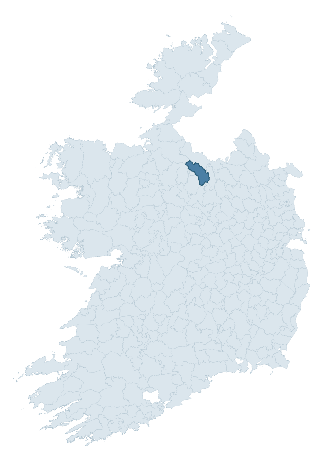
Where this barony sits in the Republic of Ireland
Geology and preservation
Bedrock geology shapes the landscape long before any settlement begins — controlling soil drainage, agricultural potential, the survival of upstanding monuments, and the preservation of buried archaeology. The figures below come from the Geological Survey Ireland 1:100,000 bedrock map.
The bedrock underlying Carrigallen is predominantly shale (30% of the barony by area), laid down during the Carboniferous period (77% by area, around 359 to 299 million years ago). Shale weathers to thin, acidic, frequently waterlogged soils, historically marginal for arable but suited to upland pasture and bog development. Shale-dominated baronies often carry sparse ringfort records and a higher representation of bog-preserved archaeology. A substantial secondary geology of limestone (28%) and greywacke (22%) adds further variety to the underlying landscape. With 11 distinct rock types mapped, the barony sits in the top third of ROI baronies for geological diversity (95th percentile) — typically a sign of complex tectonic history or coastal mosaics of differing rock units.
Rock type composition
Largest mapped unit: Drumgesh Shale Formation (24% of the barony)
Placename evidence
Logainm records 34 heritage-diagnostic placenames for Carrigallen, drawn from townland and civil-parish names across the barony. The dominant stratum is Early Christian ecclesiastical — cill-, teampall-, and domhnach-prefixed names that record the dense network of early church foundations established between the fifth and tenth centuries. The leading diagnostic roots are cill- (22 — church), lios- (6 — ringfort or enclosure), and tuaim- (3 — burial mound). This is broadly in line with the ROI average of 30.7 heritage placenames per barony. The presence of multiple heritage strata side by side indicates layered occupation of the landscape across successive prehistoric and historic periods. Logainm records 233 placenames for Carrigallen (predominantly townland names). Of these, 34 (15%) carry one of the diagnostic Gaelic roots tracked above; the remainder draw on more generic landscape vocabulary that does not encode a heritage period.
Pre-Christian / Early Medieval Defensive
| Root | Count | Meaning |
|---|---|---|
| lios- | 6 | ringfort or enclosure |
| ráth- | 1 | earthen ringfort |
| dún- | 1 | hilltop or promontory fort |
| caiseal- | 1 | stone ringfort |
Early Christian Ecclesiastical
| Root | Count | Meaning |
|---|---|---|
| cill- | 22 | church (early) |
Burial, Ritual, and Norse-Contact
| Root | Count | Meaning |
|---|---|---|
| tuaim- | 3 | burial mound |
| gall- | 1 | foreigner — Norse settlement marker |
Other baronies in Leitrim
About this profile
Click any section below to expand.
What is a barony?
A barony is a historic administrative unit in Ireland, broadly equivalent to an English hundred. The 280 baronies used here are from the OSi 2019 National Statutory Boundaries (generalised 20m), covering the 26 counties of the Republic of Ireland. Baronies derive from the Norman period, were formalised in the 17th century, and have not been redrawn for statistical purposes. They vary enormously in area, from compact urban baronies in Dublin to vast upland baronies in Connacht, and should not be compared by raw site count without accounting for area differences.
What counts as a site?
This profile combines three distinct heritage registers, each with its own definition of what constitutes a recordable site:
- Archaeological sites (NMS). The National Monuments Service Sites and Monuments Record (SMR) catalogues every known archaeological monument or site of archaeological interest in the Republic, from prehistoric burial mounds and ringforts to medieval churches and post-medieval defensive works. Inclusion does not require legal protection — only that the site has been identified, surveyed, and assessed as having archaeological value. A separate subset of these sites lies within a recorded protection zone, which gives them statutory protection under the National Monuments Acts.
- Listed buildings (NIAH). The National Inventory of Architectural Heritage records buildings of architectural, historical, archaeological, artistic, cultural, scientific, social, or technical interest. Each surveyed structure is appraised on a five-tier scale: International, National, Regional, Local, and Record-Only. The NIAH appraisal is informational rather than strictly statutory, but it underpins local-authority Record of Protected Structures (RPS) listings.
- Heritage placenames (Logainm). Logainm is the authoritative database of Irish placenames maintained by the Placenames Branch. This profile applies a heritage-diagnostic classifier to the Irish-language form of each townland name, flagging roots that signal defensive sites (ráth-, lios-, dún-, caiseal-, cathair-), ecclesiastical foundations (cill-, teampall-, domhnach-, mainistir-), prehistoric burial-ritual features (tuaim-, carn-, leaba-), or Norse-contact settlement (gall-). Townlands without one of these diagnostic roots are not flagged here — they may still carry historical significance, but that significance is not encoded in the name itself.
Editorial principles
The narrative sections of this profile follow several explicit principles:
- Evidential. Every claim about this barony’s heritage character is anchored in the underlying register data. Where a site count, a placename count, or a percentile rank is cited, it is computed from the source datasets at export time, not estimated.
- Comparative. Counts and metrics are reported alongside their percentile rank against the other 279 ROI baronies. A barony with 50 ringforts in absolute terms could be unusually high or unusually low depending on its size and regional context; percentile ranking removes that ambiguity.
- Transparent on limits. Where a register has known coverage gaps, survey biases, or data-quality issues that affect this barony’s figures, the profile flags them rather than presenting the numbers as definitive.
- No interpretation beyond what the data supports. The narrative does not speculate about historical events, social dynamics, or cultural meaning beyond what the recorded heritage and placename evidence directly attests.
Data caveats and limits
- NMS Sites and Monuments Record is the product of survey campaigns conducted at different intensities across different counties and decades. Some baronies have been surveyed more thoroughly than others, and absolute counts should be read in that light. Sites destroyed by development before survey are typically not represented; sites in heavily forested or upland terrain are sometimes under-recorded.
- NIAH coverage is broadly complete for the Republic of Ireland but the survey was conducted on a rolling county-by-county basis, and the most recent appraisal date varies. Buildings demolished or substantially altered after their original survey may still appear in the register; conversely, recent buildings of merit may not yet have been appraised.
- Logainm classification applies a deliberately conservative pattern-matching approach to the Irish-language townland forms. The classifier prioritises true positives over recall: a townland may carry a heritage signal that the classifier doesn’t recognise, particularly where the diagnostic root has been heavily anglicised or where the townland name draws on a less common term. The 60,000+ townland records and ~9,800 classified placenames give a substantial signal at barony scale, but individual townland names should be checked against Logainm directly for definitive interpretation.
- Period attribution. The chronological distribution reflects only those NMS sites that carry a recognised period attribution in the source data. Sites listed as “Unknown” period are excluded from the dated subset.
- Boundary changes. Some baronies have undergone minor boundary adjustments since their 19th-century definition; the OSi 2019 generalised boundaries used here are the current statutory definition and may differ slightly from historical maps in border areas.
- Bedrock geology is mapped at 1:100,000 scale, which means local variation within a barony — small pockets of different rock type, mineral veins, alluvium overlying bedrock — is generalised. The dominant-system and rocktype figures are area-weighted, so a barony reading “70% Carboniferous limestone” may still contain small but archaeologically important pockets of older or younger rock. Around 3% of GSI polygons do not match the lexicon and contribute no rocktype or system attribution.
Data sources
- National Monuments Service — Sites and Monuments Record (SMR) https://data.gov.ie/dataset/national-monuments-service-archaeological-survey-of-ireland
- National Inventory of Architectural Heritage (NIAH) https://data.gov.ie/dataset/national-inventory-of-architectural-heritage-niah-national-dataset
- Logainm — Placenames Database of Ireland https://www.logainm.ie/
- Ordnance Survey Ireland — National Statutory Barony Boundaries 2019 https://data-osi.opendata.arcgis.com/
- EURODEM — European Digital Elevation Model https://www.mapsforeurope.org/datasets/euro-dem
- ESA WorldCover https://esa-worldcover.org/en
- Geological Survey Ireland — 1:100,000 Bedrock Geology https://www.gsi.ie/en-ie/data-and-maps/Pages/Bedrock.aspx
Explore more: Search any of the 280 ROI baronies, browse by historical province, or read the methodology and data sources for the full Republic of Ireland Heritage Tool.