
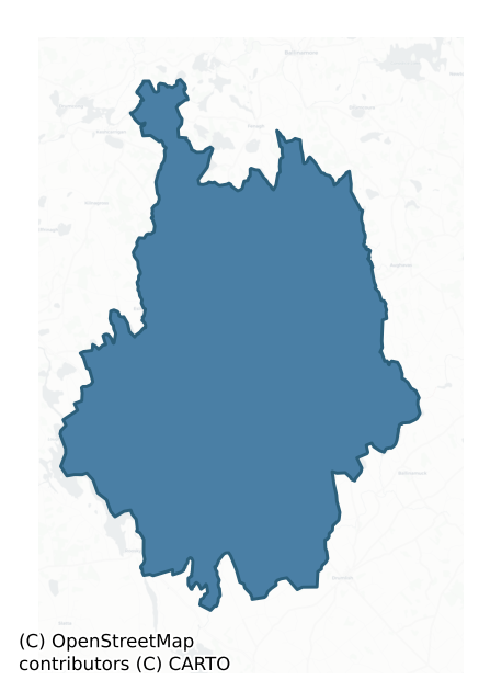
Mohill is a barony of County Leitrim, in the historical province of Connacht (Irish: Maothail), covering 259 km² of land. The barony records 251 NMS archaeological sites and 104 NIAH listed buildings, placing it at around the 12th percentile among 280 ROI baronies for sites per km². This means it is in the bottom fifth of all baronies for sites per km². Dated archaeological evidence runs from the Neolithic through to the Modern, spanning 8 of 9 archaeological periods, placing the barony in the 84th percentile among 280 ROI baronies for chronological depth. This means it is in the top fifth of all baronies for chronological depth. The largest dated subset of recorded sites dates to the Early Medieval. Logainm flags 36 placenames in the barony as carrying a recognised heritage root; the largest share — around 39% — are names associated with early Christian church and monastic foundations.
Heritage at a glance
Percentile rankings throughout this profile compare each barony only against the other 279 Republic of Ireland baronies.
The recorded heritage of Mohill
The National Monuments Service Sites and Monuments Record (SMR) is the statutory inventory of archaeological sites for the Republic of Ireland, maintained by the Department of Tourism, Culture, Arts, Gaeltacht, Sport and Media. Sites recorded here include earthworks, ringforts, megalithic tombs, ecclesiastical remains, and post-medieval features; not every record is legally protected, but each is registered as a monument of archaeological interest.
The National Monuments Service records 251 archaeological sites in Mohill, putting it at the 12th percentile among 280 ROI baronies for sites per km². This means it is in the bottom fifth of all baronies for sites per km². A sparse recorded total of this kind in Ireland often reflects survey priority rather than genuine absence of past activity. Of these, 220 (88%) fall within a recorded monument protection zone. The dominant category is defensive sites — ringforts, enclosures, hillforts, and stone forts (120 sites, 48% of the record). Ringfort – rath is the most prevalent type, making up 26% of the barony's recorded sites (66 records) — well above the ROI average of 20% across all baronies where this type occurs. Ringfort – rath is an earthen ringfort enclosed by a bank and external ditch — the most common Early Medieval farmstead, broadly dated 500–1000 AD. Other significant types include Crannog (29) and Burnt mound (20). Crannog is an artificial or partly artificial island built up on a lake or river bed, in use from the 6th to 17th centuries AD; Burnt mound is a heap of fire-cracked stone, ash and charcoal, with no surviving trough, dated Bronze Age to early medieval. Across the barony's 259 km², this gives a recorded density of 0.97 sites per km².
Most common monument types
Hover or tap a monument type to see its definition.
| Type | Count |
|---|---|
| Ringfort – rath an earthen ringfort enclosed by a bank and external ditch — the most common Early Medieval farmstead, broadly dated 500–1000 AD | 66 |
| Crannog an artificial or partly artificial island built up on a lake or river bed, in use from the 6th to 17th centuries AD | 29 |
| Burnt mound a heap of fire-cracked stone, ash and charcoal, with no surviving trough, dated Bronze Age to early medieval | 20 |
| Fulacht fia a horseshoe-shaped Bronze Age burnt mound built around a sunken trough beside a water source, traditionally interpreted as a cooking site | 10 |
| Ritual site – holy well a well or spring traditionally associated with a saint, often credited with healing properties; many trace earlier ritual origins but devotion is documented from the medieval period onwards | 9 |
| Ringfort – unclassified a circular Early Medieval settlement enclosure where surviving evidence does not allow distinction between earthen and stone forms | 9 |
| Enclosure a banked or ditched feature of uncertain type, used as a catch-all where the original function cannot be determined from surface evidence | 7 |
Chronological distribution
The dated archaeological record for Mohill spans from the Neolithic through to the Modern, with activity attested across 8 of 9 archaeological periods. This is the 84th percentile across ROI baronies for chronological depth — an above-average span. Every period from earliest to latest is represented in the record — an unbroken sequence of dated activity across the full chronological span. Activity concentrates most heavily in the Early Medieval (99 sites, 47% of dated material), with the Iron Age forming a secondary peak (38 sites, 18%). A further 41 recorded sites (16% of the overall NMS register for the barony) carry no period attribution — appearing as 'Unknown' in the bar chart below. This typically reflects either records that pre-date the standardised period vocabulary or sites awaiting specialist dating review, rather than a genuine absence of chronological evidence.
Sample of recorded monuments
Show 25 sample monuments (of 251 total)
A representative sample of 25 recorded monuments drawn from the barony’s 251 total NMS entries. Sites within a recorded monument protection zone and rarer site types are prioritised so the list shows a meaningful cross-section rather than only the most common type. Each entry shows the official Sites and Monuments Record reference number and the description published by the National Monuments Service.
Memorial stone
Located in mixed woodland at the bottom of an E-facing slope, and just beside Tober Patrick holy well (LE028-065001-). It is described in gothic lettering on the 1835 and 1911 editions of the OS 6-inch maps as a…
Located in mixed woodland at the bottom of an E-facing slope, and just beside Tober Patrick holy well (LE028-065001-). It is described in gothic lettering on the 1835 and 1911 editions of the OS 6-inch maps as a ‘Standing Stone’. It is not a prehistoric antiquity but a small stone (Wth 0.38m; H. 0.6m; T 0.07m) set in the ground and bears an inscription which is now illegible apart from the date ‘1775’. The inscription was recorded in the 1830s (OSNB No. 84, 14) as ‘Pray for Mark Meuly by whom this cross was erected in honour of St. Patrick, 1775.’ It is recorded in the 1930s Schools’ Manuscripts as: ‘IHS Pray for the soul of Mark Meale by whom this stone was erected in honour to Saint Patrick 1775.’ For the Schools Manuscripts see this web-page accessed on 12/04/2017: http://www.duchas.ie/en/cbes/4658426/4654168
Compiled by: Michael Moore
Date of upload: 13 April, 2017
Burial ground
Situated in a low-lying position in a farmyard. It is depicted as a rectangular area (dims c. 15m E-W; c. 15m N-S) described as a burial ground on the 1835 and 1911 editions of the OS 6-inch map. This is a…
Situated in a low-lying position in a farmyard. It is depicted as a rectangular area (dims c. 15m E-W; c. 15m N-S) described as a burial ground on the 1835 and 1911 editions of the OS 6-inch map. This is a subrectangular area (dims 18m N-S; 8m E-W) defined by wire fences and drystone walls. Three small limestone upright slabs are the only grave-markers. It is known as Tooma after the townland to the SW, the name of which – Tuama – means a mound or burial place. Local folklore records that a church was intended here by St Patrick, but when he departed for Fenagh a local merchant persuaded the builders to relocate the church to Cloone. See this web-page accessed on 18/04/2017 for the Schools Manuscripts: http://www.duchas.ie/en/cbes/4658433/4655116/4660900
The above description is derived from 'The Archaeological Inventory of County Leitrim' compiled by Michael J. Moore (Dublin: Stationery Office, 2003). In certain instances the entries have been revised and updated in the light of recent research.
Date of upload: 23 September 2008
Stoup (present location)
Outside the Roman Catholic church of St Mary at Eslin, which was built in 1844, are two stone stoups. One is a rounded bowl (ext. diam. 0.4m; int. diam. 0.35m; H 0.15m; D 0.09m) on a pedestal. The other is a circular…
Outside the Roman Catholic church of St Mary at Eslin, which was built in 1844, are two stone stoups. One is a rounded bowl (ext. diam. 0.4m; int. diam. 0.35m; H 0.15m; D 0.09m) on a pedestal. The other is a circular bowl (int. diam. 0.43m; D 0.15m) set into the ground outside the church door.
The original find-spot is not known with certainty but they may have come from an earlier Roman Catholic church at Cavan, represented on the 1835 edition of the OS 6-inch map c. 400m to the SE, on the E side of the public road, the site of which is still extant.
Compiled by: Michael Moore
Date of upload: 29 March 2019
Amended: 5 December 2019
House – 17th century
Located within Mohill town, on the E bank of a N-S stream that runs into Lough Rinn c. 2.5km to the S at the nearest point. Henry Crofton (d. 1643) had been accumulating land in south Leitrim from the 1610s, including…
Located within Mohill town, on the E bank of a N-S stream that runs into Lough Rinn c. 2.5km to the S at the nearest point. Henry Crofton (d. 1643) had been accumulating land in south Leitrim from the 1610s, including the land of the Augustinian priory (LE032-068001-) that he acquired from Thomas Ashe. He received a grant of 600 acres in 1621 with the rectory of Mohill and consolidated his holding as the manor of Mohill (MacCuarta 2001, 314, fn 36). He was one of only four English or Scottish undertakers to have taken up residence in Leitrim by 1622 (MacCuarta 1999, 130-1). Other branches of the Crofton family were based at the Mote, Co. Roscommon, and in Co. Longford. Sir Morgan Crofton (1733-1802) became the first Baron of Mohill in 1802.
Only part of a bawn wall (L 46m) extending NE from the base of a circular corner-tower (ext. diam. 5m; H 3.3m) remain of what was a 17th-century house and bawn. An 18th-century five-bay, two-storey building, owned by the Crofton family (Turley 1944, file no. 146) had become a police station by 1837, but the family had moved to Clooncahir just outside the town by then (Lewis 1837, vol. 2, 376). The castle later became a school, but the tower of the bawn was reduced to its present height only in 1977 (Oates 1977). Archaeological testing (98E0201) on the other side of the stream, c. 60m NW of the surviving tower produced no related material (Halpin 2000), and further testing (07E0110) on Castle Street had the same result (Moore 2009). Qu…
Bawn
Located within Mohill town, on the E bank of a N-S stream that runs into Lough Rinn c. 2.5km to the S at the nearest point. Henry Crofton (d. 1643) was one of only four English or Scottish undertakers to have taken up…
Located within Mohill town, on the E bank of a N-S stream that runs into Lough Rinn c. 2.5km to the S at the nearest point. Henry Crofton (d. 1643) was one of only four English or Scottish undertakers to have taken up residence in Leitrim by 1622 (MacCuarta 1999, 130-1). Only part of a bawn wall (L 46m) extending NE from the base of a circular corner-tower (ext. diam. 5m; H 3.3m) remain of what was a 17th-century house and bawn. An 18th-century five-bay, two-storey building, owned by the Crofton family (Turley 1944, file no. 146) had become a police station by 1837, but the family had moved to Clooncahir just outside the town by then (Lewis 1837, vol. 2, 376). The castle later became a school, but the tower of the bawn was reduced to its present height (H 3.35m) only in 1977 (Oates 1977).
Archaeological testing (19E0054) on the site of an extension to the library on Castle St. identified the base of another circular tower (ext. diam. c. 5m) from the bawn which is c. 25m NW of the surviving tower. It was excavated under the same licence and is only one course high. An excavated NW-SE wall SE of the tower is from a later structure and is likely to be from the large post-medieval house depicted on the 1835 edition of the OS 6-inch map. From the excavated tower the bawn wall is likely to have run N, following the line of Crooked Lane before turning SE to the site of the original house. The bawn would therefore have been a polygonal area (dims c. 75m NW-SE; c. 30-60m NE-SW)….
Religious house – Augustinian canons
Augustinians: Situated on a slight E-facing slope within Mohill town, with a small N-S stream that flows down to Lough Rinn just to the E. A monastery was founded by St. Manchan in the 6th or 7th century (Anon. 1940,…
Augustinians: Situated on a slight E-facing slope within Mohill town, with a small N-S stream that flows down to Lough Rinn just to the E. A monastery was founded by St. Manchan in the 6th or 7th century (Anon. 1940, 43; Mac Namee 1954, 723), of which nothing survives (Pinkman 1942, 34-46). Manchan was a contemporary of St Cailin of Fenagh (LE025-096001-) and according to the Book of Fenagh would succeed Cailin at that monastery. His feast is on the 14th February, the day before the feast of St. Bearach (Barry) of Termonbarry (RO024-016001-) (Ó Riain 2011, 430). A shrine of St. Manchan was covered in gold on the orders of the High King Ruaraí O’Conor in 1166 (AFM), but it is likely that St. Manchan of Lemanaghan (OF015-004003-) is the saint (Anon 1940, 43), and that house-shaped shrine (Graves 1874) is still extant.
The Augustinian rule was introduced into the Mohill monastery early in the 12th century when the church was dedicated to the Blessed Virgin, and it is described as a parish church in 1470 (Mac Namee 1954, 724) and the head of the rectory of Muinter Eolais with seven churches (Scully 2019, 137). At the dissolution it was said to have held seven cartrons (townlands), and in 1590 the precinct contained a church, two stone buildings and a cemetery (Gwynn and Hadcock 1970, 187). In 1620 Henry Crofton acquired the rectory and 600 acres (MacCuarta 1999, 130), but he added a chapel and a tomb for himself (Logan 1971, 227-8). The foundations of a rectangular buildin…
Tomb – unclassified
Situated on a slight E-facing slope within Mohill town, with a small N-S stream that flows down to Lough Rinn just to the E. In 1620 Henry Crofton acquired the rectory and the medieval parish church of Mohill, which…
Situated on a slight E-facing slope within Mohill town, with a small N-S stream that flows down to Lough Rinn just to the E. In 1620 Henry Crofton acquired the rectory and the medieval parish church of Mohill, which were on the site of St. Manchan’s monastery (LE032-068001-) along with 600 acres (MacCuarta 1999, 130), but he added a chapel (ME032-068002-) and a tomb for himself (Logan 1971, 327-8). The sites of these are within the graveyard around the present Church of Ireland church which was built c. 1815 (Lewis 1837, vol. 2, 376). The nature of the tomb is not known but it was probably a subterranean vault and it has not been identified.
Compiled by: Michael Moore
Date of upload: 7 December 2011
Amended: 6 December, 2019
Ford
Situated on the N-S Cloone River. A ford on the river is marked on a map of 1750 in NLI (14 A 16) at this point. No trace of this could be found.
Compiled by Caimin O'Brien
Date of upload: 18 October…
Situated on the N-S Cloone River. A ford on the river is marked on a map of 1750 in NLI (14 A 16) at this point. No trace of this could be found.
Compiled by Caimin O'Brien
Date of upload: 18 October 2010
Amended: 9 December, 2019
Rock scribing – folk art
Located on the S-facing slope of a drumlin. A limestone upright (H 1m; Wth 0.9m; T 0.5m) has, among other less well-defined carvings, an engraving of a cross, a chalice and possibly a crosier.
The above description…
Located on the S-facing slope of a drumlin. A limestone upright (H 1m; Wth 0.9m; T 0.5m) has, among other less well-defined carvings, an engraving of a cross, a chalice and possibly a crosier.
The above description is derived from 'The Archaeological Inventory of County Leitrim' compiled by Michael J. Moore (Dublin: Stationery Office, 2003). In certain instances the entries have been revised and updated in the light of recent research.
Compiled by: Michael Moore
Date of upload: 23 September 2008
Amended; 9 December, 2019
Cairn – clearance cairn
Located in a coniferous forest on Inchiquin or Rabbit Island in Lough Bofin on the River Shannon, which is now joined to the mainland at N. A ‘mound’ is depicted only on the 1835 edition of the OS 6-inch map, and it is…
Located in a coniferous forest on Inchiquin or Rabbit Island in Lough Bofin on the River Shannon, which is now joined to the mainland at N. A ‘mound’ is depicted only on the 1835 edition of the OS 6-inch map, and it is described as ‘a mound of stones gathered by workmen …’ (OS Name Book No. 83). This is a circular stone mound (diam. 11.5m; H 1.25m) composed of large boulders (dims up to 1m), but no structural features are visible.
The above description is derived from 'The Archaeological Inventory of County Leitrim' compiled by Michael J. Moore (Dublin: Stationery Office, 2003). In certain instances the entries have been revised and updated in the light of recent research.
Compiled by: Michael Moore
Date of upload: 23 September 2008
Amended: 6 January 2020
House – fortified house
Situated in pasture on a gentle S-facing slope c. 40m from the shore of Lough Bofin, which is on the River Shannon. Built by the Scottish family of Nesbitt c. 1640, it was captured, and probably burnt, during the…
Situated in pasture on a gentle S-facing slope c. 40m from the shore of Lough Bofin, which is on the River Shannon. Built by the Scottish family of Nesbitt c. 1640, it was captured, and probably burnt, during the Confederate wars. It might have been abandoned then as the Nesbitts made Derrycarne, about 3km to the NW on the River Shannon, their home until the last of the family died without heirs in 1854. The ruins as depicted by Francis Grose c. 1820 consist of two separate walls, each probably a gable of a two-storey house with an attic. Each wall has a large chimney stack, and one has a corner-turret supported on corbels in the Scottish style (Stalley 1991, 155-7). The remains have been removed, and no feature is visible at ground level in pasture.
The above description is derived from 'The Archaeological Inventory of County Leitrim' compiled by Michael J. Moore (Dublin: Stationery Office, 2003). In certain instances the entries have been revised and updated in the light of recent research.
Compiled by: Michael Moore
Date of upload: 23 September 2008
Amended; 6 January 2020
Metalworking site
The Nesbitts of Derrycarne had Iron works in Annaghduff parish before 1830 (Flanagan 1972, 415) but the date of commencement is not known. The work might have been located at Dromod and an old furnace is indicated on…
The Nesbitts of Derrycarne had Iron works in Annaghduff parish before 1830 (Flanagan 1972, 415) but the date of commencement is not known. The work might have been located at Dromod and an old furnace is indicated on the 1835 edition of the OS 6-inch map in Furnace or Bleankinnew townland, just N of the village.
Compiled by: Michael Moore
Date of upload: 6 January 2020
Kiln – lime
Situated on the lower reaches of the N-S Cloone River, also known as the Lurga River before it enters Lough Rinn. An estate map (Wogan 1750, 22) depicts a ruined lime-kiln close to the river on its W bank between Lough…
Situated on the lower reaches of the N-S Cloone River, also known as the Lurga River before it enters Lough Rinn. An estate map (Wogan 1750, 22) depicts a ruined lime-kiln close to the river on its W bank between Lough Errew and Lough Rinn. The river is now a narrow channel, and the precise location cannot be identified.
Compiled by Michael Moore
Date of upload: 18 October 2010
Amended: 7 January 2020
Ogham stone
A Silurian grit stone (L 1m) with a square cross-section (dims 0.26m x 0.16m to 0.30m x 0.19m) which had been marking a grave just outside the E gable of the church (LE037-004001-) (MacNeill 1909) is now set upright…
A Silurian grit stone (L 1m) with a square cross-section (dims 0.26m x 0.16m to 0.30m x 0.19m) which had been marking a grave just outside the E gable of the church (LE037-004001-) (MacNeill 1909) is now set upright inside the wall of the old graveyard at N. It has an ogham inscription on two angles, one of which is badly damaged. The inscription has been read as: G (A)T (T)…QENUVEN… by MacNeill (1909) and by Macalister (1945, vol. 1, 3-4), and originally could have read 'GATTAGNI MAQI MUCOI QENUVENDI'.
See the attached view of the stone.
The above description is derived from 'The Archaeological Inventory of County Leitrim' compiled by Michael J. Moore (Dublin: Stationery Office, 2003). In certain instances the entries have been revised and updated in the light of recent research.
Compiled by: Michael Moore
Date of upload: 23 September 2008
Amended: 7 January 2020
House – 17th/18th century
Situated in a low-lying landscape c. 100m W of the N-S River Rinn. Part of the W gable (surviving L 4.4m; T 1.6m; H c. 6m) of a two storey house survives with the ground-floor fireplace Wth c. 1.45m; D 1.35m) and what…
Situated in a low-lying landscape c. 100m W of the N-S River Rinn. Part of the W gable (surviving L 4.4m; T 1.6m; H c. 6m) of a two storey house survives with the ground-floor fireplace Wth c. 1.45m; D 1.35m) and what might have been an oven beside it. Two flues combine with the flues of two fireplaces at the first floor. Traditionally the building is associated with Boyle Abbey, Co. Roscommon (Blaney 1944, file no. 129), and it may have been the Police Barracks that was here in 1835 (OS 6-inch map. It is not possible to date it closely, but it may be seventeenth-century in date.
The above description is derived from 'The Archaeological Inventory of County Leitrim' compiled by Michael J. Moore (Dublin: Stationery Office, 2003). In certain instances the entries have been revised and updated in the light of recent research.
Compiled by: Michael Moore
Date of upload: 23 September 2008
Amended: 7 January 2020
Cross – Wayside cross
Situated on top of a drumlin and c. just SW of a road from Cloone to Ballinamuck, Co. Longfort. A sandstone slab (dims 0.34 x 0.12m; H 0.78m) aligned N-S has a latin cross (H 0.34m; span 0.2m) in false relief with…
Situated on top of a drumlin and c. just SW of a road from Cloone to Ballinamuck, Co. Longfort. A sandstone slab (dims 0.34 x 0.12m; H 0.78m) aligned N-S has a latin cross (H 0.34m; span 0.2m) in false relief with expanded terminals on its E face. The arms of the cross are deeply cut (Wth 5cm; D 1.5cm), and field stones are gathered around the base of the slab. It may be 17th or 18th-century in date. It is also thought to have been a mass-rock (IFC: Schools’ Collection, vol. 0222, 523-4, 569; Ó Cléirigh and Kelleher 1991, 134).
See the attached view _1
The above description is derived from 'The Archaeological Inventory of County Leitrim' compiled by Michael J. Moore (Dublin: Stationery Office, 2003). In certain instances the entries have been revised and updated in the light of recent research.
Compiled by: Michael Moore
Date of upload: 23 September 2008
Date of upload: 7 January 2020
Cist
Located towards the S end of a low N-S ridge. A stone-lined cist (dims c. 0.9m x c. 0.6m; D c. 0.4m) containing a bowl food vessel with a cremation was discovered in 1934 during the removal of a cairn (LE033-049001-)…
Located towards the S end of a low N-S ridge. A stone-lined cist (dims c. 0.9m x c. 0.6m; D c. 0.4m) containing a bowl food vessel with a cremation was discovered in 1934 during the removal of a cairn (LE033-049001-) (NMI file). The cist was preserved in situ, but it is not visible now at ground level. There is a detailed account of the discovery in the Schools Manuscripts from Drumeen school (IFC: Schools Collection, vol. 0220, 183-4). (Waddell 1970, 122; Waddell 1990, 105-6; Ó Ríordáin & Waddell 1993, 118)
Compiled by: Michael Moore
Date of upload: 17 May, 2017
Amended: 9 December, 2019
Mass-rock
Situated on a level landscape and at the edge of mound (LE036-043001-) within a farmyard. A spread of stones (dims c. 2m x 1.5m) includes a larger stone (dims 0.8m x 0.4m x 0.5m) which is locally known as a mass-rock…
Situated on a level landscape and at the edge of mound (LE036-043001-) within a farmyard. A spread of stones (dims c. 2m x 1.5m) includes a larger stone (dims 0.8m x 0.4m x 0.5m) which is locally known as a mass-rock (IFC: Schools’ Collection, vol. 0222, 523-4; Ó Cléirigh and Kelleher 1991, 134).
The above description is derived from 'The Archaeological Inventory of County Leitrim' compiled by Michael J. Moore (Dublin: Stationery Office, 2003). In certain instances the entries have been revised and updated in the light of recent research.
Compiled by: Michael Moore
Date of upload: 23 September 2008
Amended: 7 January 2020
Stone sculpture
An upright headstone (Wth 0.62-0.72m; H 1.5m; T 0.15m) in the graveyard attached to the site of the early church (LE033-006001-), has three carvings of animals on the E side executed in false relief. On top is a lion…
An upright headstone (Wth 0.62-0.72m; H 1.5m; T 0.15m) in the graveyard attached to the site of the early church (LE033-006001-), has three carvings of animals on the E side executed in false relief. On top is a lion rampant over a panel with a lion rampart holding a shield but the support on the left side has been truncated by the straight edge of the stone. This is over a panel with a hound that is slightly truncated on the left side. The carving is in the style of the Dobhar Chú stone (LE003-008004-) from Conwall burial ground in the north of the county, and like that stone is probably 18th century in date.
Compiled by: Michael Moore
Date of upload: 6 December, 2019
Cross – High cross (present location)
The transom or cross-arm of the high cross of Cloone was at the head of a grave in the graveyard attached to the site of the early monastery (LE033-006001-), but it was moved to the small graveyard of St. Mary’s when…
The transom or cross-arm of the high cross of Cloone was at the head of a grave in the graveyard attached to the site of the early monastery (LE033-006001-), but it was moved to the small graveyard of St. Mary’s when that graveyard was conserved in the early 1990s. It is a sandstone (dims 0.24m x 0.2m; L 0.77m) with the hollowed angles at the crux of a typical high cross. There is a double moulding around the edges and single figures on each side. One is a bishop with vestments and holding a crozier; the other is probably Christ performing a blessing as he appears to be fully clothed with hands extended from the elbows, palms forward. One end panel has an intricate interlace but while the opposite panel is less clear it is probably of the same design. (Kelly 1993, 158-61)
See the attached image of Christ performing a blessing
Compiled by: Michael Moore
Date of upload: 6 December, 2019
Cross-inscribed pillar
There are four cross-inscribed stones in the graveyard at the site of the early church and close to the cross-base. This pillar (dims 0.25m x 0.1m; H 1.27m) has a cross (H 0.17m; span 0.1m) inscribed at the top of the W…
There are four cross-inscribed stones in the graveyard at the site of the early church and close to the cross-base. This pillar (dims 0.25m x 0.1m; H 1.27m) has a cross (H 0.17m; span 0.1m) inscribed at the top of the W side with the initials PC beneath. (Herity et al. 1997, 104, 002)
Compiled by: Michael Moore
Date of upload: 6 December, 2019
Burnt spread
Located on a fairly level landscape c. 180m NW of Lough Sallagh, and discovered during July 2018 in archaeological monitoring of forestry trenching (pers. comm. Richard Crumlish). A spread of burnt stone (dims 2.4m N-S;…
Located on a fairly level landscape c. 180m NW of Lough Sallagh, and discovered during July 2018 in archaeological monitoring of forestry trenching (pers. comm. Richard Crumlish). A spread of burnt stone (dims 2.4m N-S; 1m E-W) was identified at a depth of 0.15m, and 0.8m to the N at 0.7m below the surface a smaller spread (dims 1.15m x 0.5m) of burnt stone was identified. Both spreads are probably more extensive and the area will be excluded from tree-planting.
Compiled by: Michael Moore
Date of upload: 12 July, 2018
Pit circle
Situated towards the bottom of a SE-facing slope. Archaeological monitoring (03E1761) over a wide area W and N of Lough Errew identified numerous archaeological features that could be preserved in situ, including this…
Situated towards the bottom of a SE-facing slope. Archaeological monitoring (03E1761) over a wide area W and N of Lough Errew identified numerous archaeological features that could be preserved in situ, including this possible pit-circle. It is an arc (diam. c 12m E-W; 11m N-S) of five pits (diam. 0.6-2.5m) that are filled with layers of black / grey silty clays with some burnt stone and charcoal inclusions. Some pits show evidence of being re-cut, and the pits were partly covered by stone cobbling (dims 10m E-W; 4m N-S) that overlay the E part of the potential circle. The interior was also traversed by a N-S drain (Wth 0.65m; D 0.25m) but the monument is preserved in situ. (Read 2004, 9-11, No. 11)
Compiled by: Michael Moore
Date of upload: 8 January 2020
Souterrain
Located on a level landscape c. 80m from the NE shore of Lough Errew and c. 140m NNW of rath (LE036-003—-). Archaeological monitoring (03E1761) over a wide area W and N of Lough Errew identified numerous…
Located on a level landscape c. 80m from the NE shore of Lough Errew and c. 140m NNW of rath (LE036-003—-). Archaeological monitoring (03E1761) over a wide area W and N of Lough Errew identified numerous archaeological features that could be preserved in situ, including this possible souterrain. A lintelled passage or covered drain (L 7.2m E-W) with a large lintel over an opening (Wth 0.7m) at its E end came to light. It was not opened and is preserved in situ. (Read 2004, 11, No. 17)
Compiled by: Michael Moore
Date of upload: 8 January 2020
Ringfort – rath
Situated towards the top of the S-facing slope of a drumlin. It is not depicted on any OS map, but a circular enclosure (diam. c. 25m) is visible on aerial photographs (OSAP: 4/1025-6). It is not visible at ground level…
Situated towards the top of the S-facing slope of a drumlin. It is not depicted on any OS map, but a circular enclosure (diam. c. 25m) is visible on aerial photographs (OSAP: 4/1025-6). It is not visible at ground level in pasture and does not appear on other aerial images.
The above description is derived from 'The Archaeological Inventory of County Leitrim' compiled by Michael J. Moore (Dublin: Stationery Office, 2003). In certain instances the entries have been revised and updated in the light of recent research.
Compiled by: Michael Moore
Date of upload: 23 September 2008
Amended; 5 December, 2019
Listed buildings
The National Inventory of Architectural Heritage (NIAH) is a state survey appraising buildings of architectural, historical, archaeological, artistic, cultural, scientific, social, or technical interest. Each surveyed structure receives a rating from International (the highest, for buildings of European importance) through National, Regional, Local, and Record-Only.
The NIAH records 104 listed buildings in Mohill (51st percentile across ROI baronies). All recorded buildings carry Regional or lower grading; the barony does not contain any structures appraised as being of National or International architectural importance. Construction dates concentrate most heavily in the Victorian (1830-1900) period. The most-recorded building type is house (29 examples, 28% of the listed stock).
Terrain and environment
Mean elevation across the barony is 62m — the 24th percentile among 280 ROI baronies for elevation. This means it is in the bottom third of all baronies for elevation. This is a relatively low-lying landscape by ROI standards. Elevation matters for heritage because higher-altitude baronies typically favour defensive monuments — ringforts and hilltop forts placed on prominent ground — while lowland baronies are more likely to carry the dense settlement and church networks of intensive agricultural landscapes. Mean slope is 3.7° — the 52nd percentile among 280 ROI baronies for slope. This means it is in the upper half of all baronies for slope. Slope is a key control on both land use and archaeological preservation: steep ground resists ploughing and tends to preserve earthworks intact, while gentle slopes favour intensive cultivation that damages or destroys surface archaeology over time. The Topographic Wetness Index averages 10.8, the 50th percentile among 280 ROI baronies for wetness. This means it is in the upper half of all baronies for wetness. Drainage matters for heritage because poorly-drained ground preserves organic archaeology (wooden trackways, leather, textiles, and on rare occasions human remains) far better than free-draining soil; well-drained ground favours arable use but destroys organic material rapidly. The land cover is dominated by improved grassland (72%) and woodland (24%).
Terrain measurements
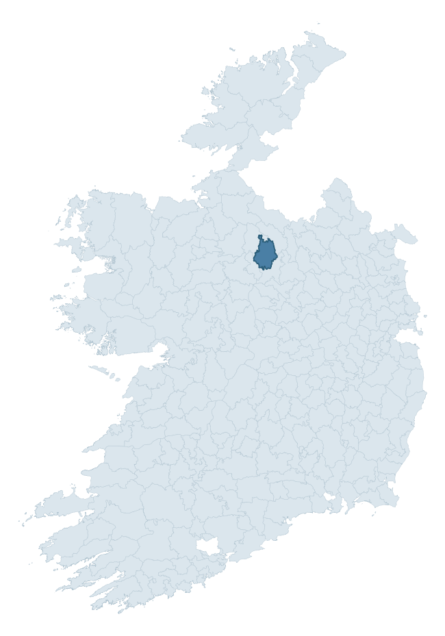
Where this barony sits in the Republic of Ireland
Geology and preservation
Bedrock geology shapes the landscape long before any settlement begins — controlling soil drainage, agricultural potential, the survival of upstanding monuments, and the preservation of buried archaeology. The figures below come from the Geological Survey Ireland 1:100,000 bedrock map.
The bedrock underlying Mohill is predominantly limestone (39% of the barony by area), laid down during the Carboniferous period (90% by area, around 359 to 299 million years ago). Limestone is the most heritage-rich bedrock in Ireland. It supports fertile, well-drained soils that favoured dense Early Medieval settlement and Norman manorial agriculture, and it weathers into karst features — sinkholes, caves, swallow holes, and souterrains — that frequently carry archaeology. Where peat overlies limestone, organic preservation can be exceptional. A substantial secondary geology of conglomerate & sandstone (17%) and limestone, sandstone, shale (14%) adds further variety to the underlying landscape. With 8 distinct rock types mapped, the barony sits in the top third of ROI baronies for geological diversity (84th percentile) — typically a sign of complex tectonic history or coastal mosaics of differing rock units.
Rock type composition
Largest mapped unit: Ballysteen Formation (21% of the barony)
Placename evidence
Logainm records 36 heritage-diagnostic placenames for Mohill, drawn from townland and civil-parish names across the barony. The dominant stratum is Early Christian ecclesiastical — cill-, teampall-, and domhnach-prefixed names that record the dense network of early church foundations established between the fifth and tenth centuries. The leading diagnostic roots are cill- (12 — church), ráth- (5 — earthen ringfort), and lios- (5 — ringfort or enclosure). This is broadly in line with the ROI average of 30.7 heritage placenames per barony. The presence of multiple heritage strata side by side indicates layered occupation of the landscape across successive prehistoric and historic periods. Logainm records 251 placenames for Mohill (predominantly townland names). Of these, 36 (14%) carry one of the diagnostic Gaelic roots tracked above; the remainder draw on more generic landscape vocabulary that does not encode a heritage period.
Pre-Christian / Early Medieval Defensive
| Root | Count | Meaning |
|---|---|---|
| ráth- | 5 | earthen ringfort |
| lios- | 5 | ringfort or enclosure |
| dún- | 2 | hilltop or promontory fort |
| caiseal- | 1 | stone ringfort |
Early Christian Ecclesiastical
| Root | Count | Meaning |
|---|---|---|
| cill- | 12 | church (early) |
| cillín- | 2 | unconsecrated burial ground |
Burial, Ritual, and Norse-Contact
| Root | Count | Meaning |
|---|---|---|
| carn- | 4 | cairn |
| tuaim- | 2 | burial mound |
| dumha- | 1 | mound |
| leaba- | 1 | megalithic tomb |
| leacht- | 1 | grave monument |
| gall- | 1 | foreigner — Norse settlement marker |
Other baronies in Leitrim
About this profile
Click any section below to expand.
What is a barony?
A barony is a historic administrative unit in Ireland, broadly equivalent to an English hundred. The 280 baronies used here are from the OSi 2019 National Statutory Boundaries (generalised 20m), covering the 26 counties of the Republic of Ireland. Baronies derive from the Norman period, were formalised in the 17th century, and have not been redrawn for statistical purposes. They vary enormously in area, from compact urban baronies in Dublin to vast upland baronies in Connacht, and should not be compared by raw site count without accounting for area differences.
What counts as a site?
This profile combines three distinct heritage registers, each with its own definition of what constitutes a recordable site:
- Archaeological sites (NMS). The National Monuments Service Sites and Monuments Record (SMR) catalogues every known archaeological monument or site of archaeological interest in the Republic, from prehistoric burial mounds and ringforts to medieval churches and post-medieval defensive works. Inclusion does not require legal protection — only that the site has been identified, surveyed, and assessed as having archaeological value. A separate subset of these sites lies within a recorded protection zone, which gives them statutory protection under the National Monuments Acts.
- Listed buildings (NIAH). The National Inventory of Architectural Heritage records buildings of architectural, historical, archaeological, artistic, cultural, scientific, social, or technical interest. Each surveyed structure is appraised on a five-tier scale: International, National, Regional, Local, and Record-Only. The NIAH appraisal is informational rather than strictly statutory, but it underpins local-authority Record of Protected Structures (RPS) listings.
- Heritage placenames (Logainm). Logainm is the authoritative database of Irish placenames maintained by the Placenames Branch. This profile applies a heritage-diagnostic classifier to the Irish-language form of each townland name, flagging roots that signal defensive sites (ráth-, lios-, dún-, caiseal-, cathair-), ecclesiastical foundations (cill-, teampall-, domhnach-, mainistir-), prehistoric burial-ritual features (tuaim-, carn-, leaba-), or Norse-contact settlement (gall-). Townlands without one of these diagnostic roots are not flagged here — they may still carry historical significance, but that significance is not encoded in the name itself.
Editorial principles
The narrative sections of this profile follow several explicit principles:
- Evidential. Every claim about this barony’s heritage character is anchored in the underlying register data. Where a site count, a placename count, or a percentile rank is cited, it is computed from the source datasets at export time, not estimated.
- Comparative. Counts and metrics are reported alongside their percentile rank against the other 279 ROI baronies. A barony with 50 ringforts in absolute terms could be unusually high or unusually low depending on its size and regional context; percentile ranking removes that ambiguity.
- Transparent on limits. Where a register has known coverage gaps, survey biases, or data-quality issues that affect this barony’s figures, the profile flags them rather than presenting the numbers as definitive.
- No interpretation beyond what the data supports. The narrative does not speculate about historical events, social dynamics, or cultural meaning beyond what the recorded heritage and placename evidence directly attests.
Data caveats and limits
- NMS Sites and Monuments Record is the product of survey campaigns conducted at different intensities across different counties and decades. Some baronies have been surveyed more thoroughly than others, and absolute counts should be read in that light. Sites destroyed by development before survey are typically not represented; sites in heavily forested or upland terrain are sometimes under-recorded.
- NIAH coverage is broadly complete for the Republic of Ireland but the survey was conducted on a rolling county-by-county basis, and the most recent appraisal date varies. Buildings demolished or substantially altered after their original survey may still appear in the register; conversely, recent buildings of merit may not yet have been appraised.
- Logainm classification applies a deliberately conservative pattern-matching approach to the Irish-language townland forms. The classifier prioritises true positives over recall: a townland may carry a heritage signal that the classifier doesn’t recognise, particularly where the diagnostic root has been heavily anglicised or where the townland name draws on a less common term. The 60,000+ townland records and ~9,800 classified placenames give a substantial signal at barony scale, but individual townland names should be checked against Logainm directly for definitive interpretation.
- Period attribution. The chronological distribution reflects only those NMS sites that carry a recognised period attribution in the source data. Sites listed as “Unknown” period are excluded from the dated subset.
- Boundary changes. Some baronies have undergone minor boundary adjustments since their 19th-century definition; the OSi 2019 generalised boundaries used here are the current statutory definition and may differ slightly from historical maps in border areas.
- Bedrock geology is mapped at 1:100,000 scale, which means local variation within a barony — small pockets of different rock type, mineral veins, alluvium overlying bedrock — is generalised. The dominant-system and rocktype figures are area-weighted, so a barony reading “70% Carboniferous limestone” may still contain small but archaeologically important pockets of older or younger rock. Around 3% of GSI polygons do not match the lexicon and contribute no rocktype or system attribution.
Data sources
- National Monuments Service — Sites and Monuments Record (SMR) https://data.gov.ie/dataset/national-monuments-service-archaeological-survey-of-ireland
- National Inventory of Architectural Heritage (NIAH) https://data.gov.ie/dataset/national-inventory-of-architectural-heritage-niah-national-dataset
- Logainm — Placenames Database of Ireland https://www.logainm.ie/
- Ordnance Survey Ireland — National Statutory Barony Boundaries 2019 https://data-osi.opendata.arcgis.com/
- EURODEM — European Digital Elevation Model https://www.mapsforeurope.org/datasets/euro-dem
- ESA WorldCover https://esa-worldcover.org/en
- Geological Survey Ireland — 1:100,000 Bedrock Geology https://www.gsi.ie/en-ie/data-and-maps/Pages/Bedrock.aspx
Explore more: Search any of the 280 ROI baronies, browse by historical province, or read the methodology and data sources for the full Republic of Ireland Heritage Tool.