98 historic sites15 scheduled monuments66 listed buildings8 archaeological periods
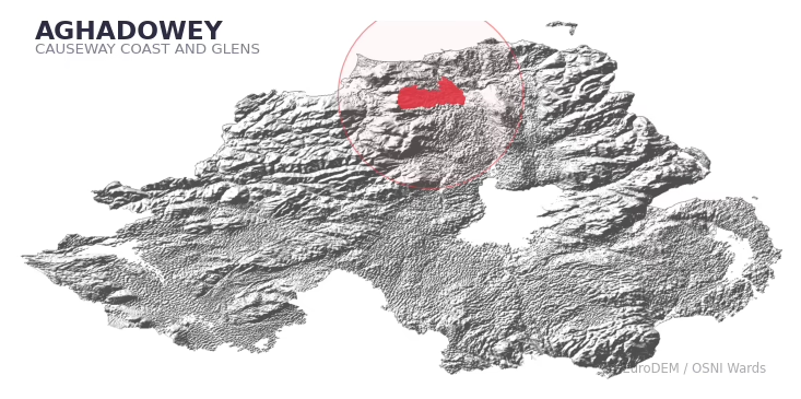
AGHADOWEY covers 360.8 km² in Northern Ireland. With 98 historic sites and 15 scheduled monuments on record, the ward sits at the 89th percentile across all 462 NI wards for combined archaeological heritage. It also records 66 listed buildings (HED Historic Buildings Record), the 85th percentile for listed-building density across NI wards. Per 1,000 residents, this works out at 51.9 recorded sites — the 91st percentile across NI wards (a measure of heritage density relative to current population). Dated archaeological evidence runs from the Mesolithic through to the Modern period, spanning 8 archaeological periods, placing the ward in the 90th percentile NI-wide for chronological depth.
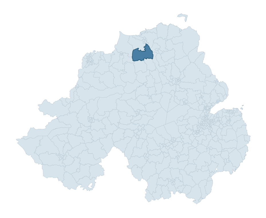
AGHADOWEY boundary detailAGHADOWEY in regional context
Heritage at a glance
Percentile rankings throughout this profile compare each ward only against the other 461 Northern Ireland wards.
98
Historic sites
89th percentile
15
Scheduled monuments
92nd percentile
66
Listed buildings
85th percentile
0.50
Sites per km²
Population context
10
Persons per km²
5th percentile
51.9
Sites per 1,000 residents
91st percentile
3,447
Total residents (2021)
The recorded heritage of AGHADOWEY
Of the 98 historic sites recorded, the most common are Enclosure (O.S. Memoir Site, Unlocated) (7, 7% of historic sites), Enclosure (6), and Souterrain (O.S. Memoir Site, Unlocated) (5). For Enclosure (O.S. Memoir Site, Unlocated)s, this is the 33rd percentile among NI wards that record this type. For Enclosures, this is the 53rd percentile among NI wards that record this type. Across the ward's 360.8 km², this gives a recorded density of 0.50 sites per km² (all heritage types combined). Scheduled monuments are distributed across approximately 0.09° of latitude and 0.20° of longitude within the ward, indicating dispersed rather than clustered placement.
Most common monument types
Type
Count
Description
Enclosure (o.s. Memoir Site, Unlocated)
7
—
Enclosure
6
—
Souterrain (o.s. Memoir Site, Unlocated)
5
—
Chronological distribution
Mesolithic
20
Early Bronze Age
5
Middle Late Bronze Age
2
Iron Age
22
Early Medieval
23
Medieval
3
Post Medieval
5
Modern
3
Unknown
15
Terrain and environment
With a mean elevation of 105m, this ward sits above the NI median (75th percentile), but the ward reaches 371m at its highest point — a vertical span of more than 265m within its boundary, indicating significant topographic diversity. Mean slope is 3.7° (39th percentile across NI), giving moderately undulating terrain. The Topographic Wetness Index of 10.7 (66th NI percentile) indicates moderate drainage, balanced between upland shedding and lowland accumulation. The land cover is dominated by improved grassland (72%) and woodland (23%). In overall character, this is elevated but relatively gentle terrain — typical of plateau country, with land use dominated by improved grassland.
Terrain measurements
Mean elevation105.3 m 75th pct
Max elevation370.5 m 88th pct
Mean slope3.7° 40th pct
Wetness index (TWI)10.73 67th pct
Grassland72.5% 68th pct
Woodland23.4% 68th pct
Cropland2.6% 65th pct
Where this ward sits in NI
Elevation
75th
Slope
40th
Drainage
67th
Grassland
68th
Woodland
68th
Geology and preservation
The dominant bedrock formed during the Cainozoic era (Palaeogene period). Relatively young rock formed in the last 66 million years. In Ulster, Cainozoic basalt — the lava that created the Antrim Plateau and Giant's Causeway — dominates much of the eastern landscape. Peat covers 39% of the ward — a substantial share of the surface, characteristic of upland blanket-bog or poorly-drained ground. Where archaeological features lie beneath peat, they are typically far better preserved than on aerated mineral soils: organic materials such as wood, leather, and even textiles can survive thousands of years sealed within waterlogged peat. Bedrock composition is uniform (complexity index 0.35), with a single dominant geological unit underlying most of the ward. A uniform geology narrows the natural lithic-resource base available to past inhabitants.
Bedrock eraCainozoic
Bedrock periodPalaeogene
Surface depositsPeat
Peat coverage38.6%
Bedrock complexity0.35
Placename evidence
The combined OSNI, Logainm NI, and GeoNames sources record 117 placenames for this ward. Diagnostic heritage strata identified within these are: 4 pre-Christian defensive (rath-, dún-, lios-, caiseal-), 6 ecclesiastical (cill-, teampall-, mainistir-, díseart-), and 1 Plantation-era (17th c English/Scots settlement names). Note: Irish-language (name_ga) forms are recorded for roughly half of NI placenames in the combined sources, so anglicised forms whose Irish original could belong to multiple categories may be misclassified.
Scheduled monuments are sites legally protected under the Historic Monuments and Archaeological Objects (Northern Ireland) Order 1995, designated by the Historic Environment Division (HED).
Monument
Type
Period
Agivey Church, holestone and font
Agivey Church, Holestone And Font
Unknown
Sweat House
Sweat House
Unknown
Rath
Rath
Early Medieval
Graveyard
Graveyard
Unknown
Sweat House
Sweat House
Unknown
Rath
Rath
Early Medieval
Cross and Bullaun
Cross And Bullaun
Unknown
Plantation Village Site: Agivey
Plantation Village Site: Agivey
Unknown
Barrow
Barrow
Early Bronze Age
Large enclosure: Cashel
Large Enclosure: Cashel
Iron Age
Burial Mound 'Tappatowsie'
Burial Mound 'Tappatowsie'
Early Bronze Age
Portal tomb, 'The Grey Stone'.
Portal Tomb, 'The Grey Stone'.
Neolithic
TURRET TRAINER
Turret Trainer
Roman
LINK TRAINER
Link Trainer
Unknown
BOMBING TRAINER
Bombing Trainer
Unknown
Recorded historic sites
Name
Period
Type
A.P. SITE – circular cropmark
Unknown
Unknown
A.P. SITE – circular cropmark
Unknown
Unknown
A.P. SITE – circular cropmark
Unknown
Unknown
A.P. SITE – circular enclosure
Iron Age
Unknown
A.P. SITE – oval cropmark
Unknown
Unknown
Agivey Historic Settlement
Post-Medieval
Domestic
BARROW
Early Bronze Age
Ritual/Funerary
BATTLE SITE, 1641
Post-Medieval
Unknown
BAWN & TOWER HOUSE: AGHADOWEY CASTLE
Medieval
Defence
BURIAL
Mesolithic
Ritual/Funerary
BURIAL GROUND
Unknown
Ritual/Funerary
Bombing Teacher: DHR 0075:036
Modern
Unknown
Bronze Age occupation
Early Bronze Age
Unknown
Bronze Age settlement and ring ditch
Early Bronze Age
Defence
Burnt Mound
Middle-Late Bronze Age
Agriculture
Burnt Mounds
Middle-Late Bronze Age
Agriculture
CAIRN: RORY'S CAIRN
Early Bronze Age
Ritual/Funerary
CASTLE (O.S. Memoir site, unlocated)
Post-Medieval
Defence
CHAIR-SHAPED ROCK: PRIEST'S CHAIR (removed)
Unknown
Unknown
CHURCH: GREENALLY (this may be the same as Agivey old church, 12:3)
Unknown
Religious
CHURCH; GRAVEYARD HOLE-STONE; FONT: AGIVEY CHURCH or CHAPEL OF AGHADOWEY
Unknown
Ritual/Funerary
CIST BURIAL (O.S. memoir site, unlocated)
Mesolithic
Ritual/Funerary
COUNTERSCARP RATH
Early Medieval
Defence
ENCLOSURE
Iron Age
Unknown
ENCLOSURE
Iron Age
Unknown
ENCLOSURE
Iron Age
Unknown
ENCLOSURE
Iron Age
Unknown
ENCLOSURE
Iron Age
Unknown
ENCLOSURE
Iron Age
Unknown
ENCLOSURE (O.S. memoir site, unlocated)
Iron Age
Unknown
ENCLOSURE (O.S. memoir site, unlocated)
Iron Age
Unknown
ENCLOSURE (O.S. memoir site, unlocated)
Iron Age
Unknown
ENCLOSURE (O.S. memoir site, unlocated)
Iron Age
Unknown
ENCLOSURE (O.S. memoir site, unlocated)
Iron Age
Unknown
ENCLOSURE (O.S. memoir site, unlocated)
Iron Age
Unknown
ENCLOSURE (O.S. memoir site, unlocated)
Iron Age
Unknown
ENCLOSURE (O.S. memoir site, unlocated)
Iron Age
Unknown
ENCLOSURE (unlocated)
Iron Age
Unknown
ENCLOSURE (unlocated)
Iron Age
Unknown
ENCLOSURE: CULCROW FORT
Iron Age
Defence
ENCLOSURE: GLENKEEN FORT
Iron Age
Defence
ENCLOSURE: ROOKIN FORT
Iron Age
Defence
FINDSPOT of BOG BODY, WOODEN FIGURE & BRONZE AXE/PALSTAVE from bog (unlocated)
Unknown
Unknown
FINDSPOT of CARVED STONE (now in Ulster Museum)
Medieval
Ritual/Funerary
FINDSPOT of VIKING SWORD HANDLE
Early Medieval
Unknown
GRAVEYARD
Unknown
Ritual/Funerary
GRAVEYARD & SOUTERRAIN: NICHOLL'S GROUND
Early Medieval
Ritual/Funerary
HOLY WELL: PRIEST'S WELL
Early Medieval
Ritual/Funerary
HOLY WELL: TOBAR GOURA
Early Medieval
Ritual/Funerary
HOLY WELL: TOBERTEEFRIM
Early Medieval
Ritual/Funerary
LARGE ENCLOSURE & BURIAL GROUND (O.S. memoir site, unlocated)
Iron Age
Ritual/Funerary
LARGE ENCLOSURE: CASHEL
Iron Age
Defence
Link Trainer: DHR 0075:037
Modern
Unknown
MEGALITHIC TOMB
Mesolithic
Ritual/Funerary
MEGALITHIC TOMB: GRAFFOG'S GRAVE (O.S. memoir site, unlocated)
Mesolithic
Ritual/Funerary
MILITARY ENTRENCHMENT
Post-Medieval
Unknown
MOUND (O.S. memoir site, unlocated)
Unknown
Unknown
MOUND with URN BURIAL
Mesolithic
Ritual/Funerary
MOUND: TAPPATOWSIE
Mesolithic
Unknown
MULTIPERIOD CHURCH & GRAVEYARD: AGHADOWEY
Early Medieval
Ritual/Funerary
MULTIPERIOD MONASTERY; CHURCH; GRAVEYARD with CROSS; BULLAUN
Early Medieval
Ritual/Funerary
Mesolithic occupation site
Mesolithic
Unknown
PAVED ROAD: CAT'S CAUSEWAY (O.S. memoir site, unlocated)
Unknown
Transport
PLANTATION VILLAGE SITE; HOUSE; BAWN; MILL: AGIVEY or AGIVEY BAWN or IRONMONGERS' BUILDINGS
Post-Medieval
Defence
PLATFORM RATH
Early Medieval
Defence
PORTAL TOMB: GREY STONE
Mesolithic
Ritual/Funerary
RATH
Early Medieval
Defence
RATH
Early Medieval
Defence
RATH
Early Medieval
Defence
RATH
Early Medieval
Defence
RATH
Early Medieval
Defence
RATH (O.S. memoir site, unlocated)
Early Medieval
Defence
RATH & SOUTERRAIN
Early Medieval
Defence
SOUTERRAIN (O.S. memoir site, unlocated)
Early Medieval
Defence
SOUTERRAIN (O.S. memoir site, unlocated)
Early Medieval
Defence
SOUTERRAIN (O.S. memoir site, unlocated)
Early Medieval
Defence
SOUTERRAIN (O.S. memoir site, unlocated)
Early Medieval
Defence
SOUTERRAIN (O.S. memoir site, unlocated)
Early Medieval
Defence
SOUTERRAIN (O.S. memoir site, unlocated)
Early Medieval
Defence
SOUTERRAIN: CAVE HILL (O.S. memoir site, unlocated)
Early Medieval
Defence
STANDING STONE
Mesolithic
Ritual/Funerary
STANDING STONE
Mesolithic
Ritual/Funerary
STANDING STONE (UNLOCATED)
Mesolithic
Ritual/Funerary
STANDING STONES (O.S. memoir site, unlocated)
Mesolithic
Ritual/Funerary
STONE CIRCLE
Mesolithic
Ritual/Funerary
SWEAT HOUSE
Unknown
Domestic
SWEAT HOUSE
Unknown
Domestic
Segment Ring Ditch and Cremation Pit
Early Bronze Age
Ritual/Funerary
TIMBER TRACKWAY through bog (O.S. memoir site, unlocated)
Mesolithic
Transport
TOWER-HOUSE & BAWN: CASTLE ROE (destroyed)
Medieval
Defence
TRACKWAY (O.S. memoir site, unlocated)
Mesolithic
Transport
Turret Instructional Building: DHR 00075:038
Modern
Domestic
URN BURIAL
Mesolithic
Ritual/Funerary
URN BURIAL (O.S. memoir site, unlocated)
Mesolithic
Ritual/Funerary
URN BURIALS
Mesolithic
Ritual/Funerary
URN BURIALS, possibly URN FIELD (O.S. memoir site, unlocated)
Mesolithic
Ritual/Funerary
possibly MASS ROCK: PRIEST'S ROCK
Unknown
Unknown
this is Ldy 012:009!
Mesolithic
Unknown
Listed buildings in AGHADOWEY
Address / Name
Grade
Period
Aghadowey Presbyterian Church
Ardreagh Road
Coleraine
Co. Londonderry
BT51 4DN
B2
1820 – 1839
Our Lady of the Assumption
31 Cullycapple Road
Coleraine
Co. Londonderry
BT51 4AR
Grounding History: 10 Maps of Northern Ireland’s Past
A spatial history report bringing together analysis of all 462 wards into one place through 10 high-quality maps — covering monument density, archaeological periods, placename heritage, terrain, wetland, and the historic landscape at first survey.
A ward is the smallest electoral and statistical geography used by the Northern Ireland Statistics and Research Agency (NISRA). The boundaries used here are the 2014 NISRA / OSNI Wards (462 across Northern Ireland), each typically covering 1-700 km² and a population of a few thousand. Wards do not align with parishes, townlands, or any historic administrative unit — they are a modern statistical convenience, used here only as a fixed spatial frame within which to summarise heritage records.
What counts as a site?
Three distinct heritage record types are reported separately, not combined: (1) Historic Sites — entries in the Northern Ireland Sites and Monuments Record (NISMR), the inventory of recorded archaeological sites and findspots, dated from prehistoric to early-modern; (2) Scheduled Monuments — sites legally protected under the Historic Monuments and Archaeological Objects (NI) Order 1995 and maintained by the Historic Environment Division (HED); (3) Listed Buildings — buildings of architectural or historic interest protected under the Planning Act (NI) 2011 and graded A, B+, B1, B2, or Record-Only by HED. A site appearing in more than one register is counted in each register independently.
Editorial principles
These ward profiles describe evidence, not history. They report what is recorded, not what occurred. Where the data is ambiguous, we say so. We do not infer historical processes — population movements, settlement expansion, periods of decline — from patterns in the record. Absence of evidence is not evidence of absence: in Northern Ireland, where antiquarian survey was uneven and modern excavation is geographically biased, a gap in the record almost always reflects the limits of recording rather than a genuine historical absence. We mark such gaps explicitly where they appear in the data.
Limits of coverage and known caveats
Several caveats apply to every ward profile: (1) NISMR coverage is uneven across NI — some areas (notably parts of the south-east and the Belfast urban fringe) have been more intensively surveyed than others, so a low recorded site count does not reliably indicate a low past density of activity; (2) period attributions in NISMR are often 'Unknown', and chronological breakdowns reported here reflect only the dated subset; (3) placename classification depends on the Irish-language form (name_ga), which is recorded for approximately 50% of NI placenames in the combined sources, so ecclesiastical and pre-Christian counts may be understated where anglicised forms remain unparsed; (4) terrain percentile ranks compare each ward only to the other 461 NI wards; they are not absolute thresholds. For absence-dominant land cover categories (wetland, water, cropland), percentile ranks are suppressed below 1% raw value, since the ranking of zero-value wards is not meaningful.
Data sources (11)
Northern Ireland Sites and Monuments Record (NISMR)
Spotted an error? This dataset is updated continuously.
Email contact@danielkirkpatrick.co.uk with corrections, missing records, or suggestions for improvement.
Manage Consent
To provide the best experiences, we use technologies like cookies to store and/or access device information. Consenting to these technologies will allow us to process data such as browsing behaviour or unique IDs on this site. Not consenting or withdrawing consent, may adversely affect certain features and functions.
Functional
Always active
The technical storage or access is strictly necessary for the legitimate purpose of enabling the use of a specific service explicitly requested by the subscriber or user, or for the sole purpose of carrying out the transmission of a communication over an electronic communications network.
Preferences
The technical storage or access is necessary for the legitimate purpose of storing preferences that are not requested by the subscriber or user.
Statistics
The technical storage or access that is used exclusively for statistical purposes.The technical storage or access that is used exclusively for anonymous statistical purposes. Without a subpoena, voluntary compliance on the part of your Internet Service Provider, or additional records from a third party, information stored or retrieved for this purpose alone cannot usually be used to identify you.
Marketing
The technical storage or access is required to create user profiles to send advertising, or to track the user on a website or across several websites for similar marketing purposes.