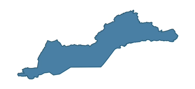
BELLEEK and BOA covers 580.6 km² in Northern Ireland. With 137 historic sites and 19 scheduled monuments on record, the ward sits at the 90th percentile across all 462 NI wards for combined archaeological heritage. It also records 31 listed buildings (HED Historic Buildings Record), the 62nd percentile for listed-building density across NI wards. Per 1,000 residents, this works out at 60.0 recorded sites — the 94th percentile across NI wards (a measure of heritage density relative to current population). Dated archaeological evidence runs from the Mesolithic through to the Modern period, spanning 7 archaeological periods, placing the ward in the 79th percentile NI-wide for chronological depth.
Heritage at a glance
Percentile rankings throughout this profile compare each ward only against the other 461 Northern Ireland wards.
Population context
The recorded heritage of BELLEEK and BOA
Of the 137 historic sites recorded, the most common are Rath (19, 14% of historic sites), Tree Ring (13), and A.P. Site – Circular Cropmark (9). For Raths, this is the 85th percentile across NI wards that record this type. For Tree Rings, this is the 91st percentile across NI wards that record this type. Across the ward's 580.6 km², this gives a recorded density of 0.32 sites per km² (all heritage types combined). Scheduled monuments are distributed across approximately 0.13° of latitude and 0.42° of longitude within the ward, indicating dispersed rather than clustered placement.
Most common monument types
| Type | Count | Description |
|---|---|---|
| Rath | 19 | — |
| Tree Ring | 13 | — |
| A.p. Site – Circular Cropmark | 9 | — |
Chronological distribution
Note: 26% of historic site records carry an ‘Unknown’ period attribution. The chronological breakdown above reflects only the dated subset.
Terrain and environment
With a mean elevation of 95m, this ward sits above the NI median (70th percentile), but the ward reaches 334m at its highest point — a vertical span of more than 239m within its boundary, indicating significant topographic diversity. Mean slope is 4.5° (58th percentile across NI), giving moderately undulating terrain. The Topographic Wetness Index of 10.6 (58th NI percentile) indicates moderate drainage, balanced between upland shedding and lowland accumulation. The land-cover mosaic combines improved grassland (57%), woodland (24%), and open water (18%), giving a mixed agricultural and semi-natural landscape.
Terrain measurements
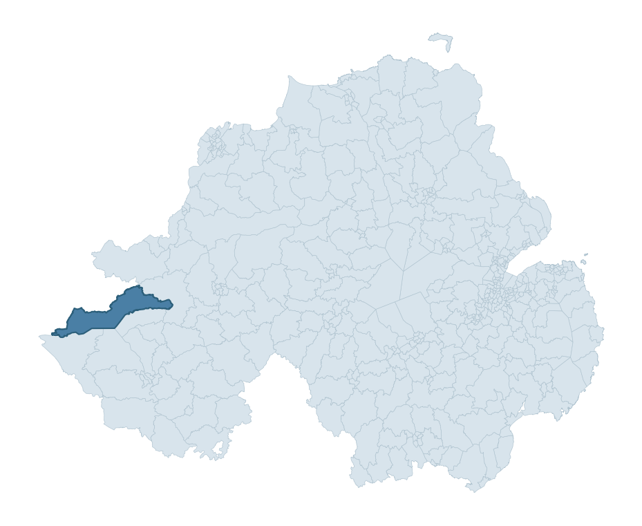
Where this ward sits in NI
Geology and preservation
The dominant bedrock formed during the Palaeozoic era (Carboniferous period). Ancient sedimentary or metamorphic rock dating to before the age of dinosaurs; the resulting landscape has been long-stable enough to host every period of human activity. Bedrock composition is moderately varied (complexity index 0.52), with two or three geological units present within the ward boundary.
Placename evidence
The combined OSNI, Logainm NI, and GeoNames sources record 221 placenames for this ward. Diagnostic heritage strata identified within these are: 2 pre-Christian defensive (rath-, dún-, lios-, caiseal-) and 21 ecclesiastical (cill-, teampall-, mainistir-, díseart-). Note: Irish-language (name_ga) forms are recorded for roughly half of NI placenames in the combined sources, so anglicised forms whose Irish original could belong to multiple categories may be misclassified.
Placename categories
Scheduled monuments in BELLEEK and BOA
Scheduled monuments are sites legally protected under the Historic Monuments and Archaeological Objects (Northern Ireland) Order 1995, designated by the Historic Environment Division (HED).
| Monument | Type | Period |
|---|---|---|
| Court Tomb: Giant's Grave | Court Tomb: Giant'S Grave | Neolithic |
| Stone Circle | Stone Circle | Early Bronze Age |
| Bivallate Rath | Bivallate Rath | Iron Age |
| Counterscarp Rath | Counterscarp Rath | Early Medieval |
| Counterscarp Rath | Counterscarp Rath | Early Medieval |
| Bivallate Rath | Bivallate Rath | Iron Age |
| Ring Barrow | Ring Barrow | Early Bronze Age |
| Bivallate Rath | Bivallate Rath | Iron Age |
Recorded historic sites
| Name | Period | Type |
|---|---|---|
| A.P. SITE – 16 small cropmarks | Unknown | Unknown |
| A.P. SITE – 2 cropmarks | Unknown | Unknown |
| A.P. SITE – circular cropmark | Unknown | Unknown |
| A.P. SITE – circular cropmark | Unknown | Unknown |
| A.P. SITE – circular cropmark | Unknown | Unknown |
| A.P. SITE – circular cropmark | Unknown | Unknown |
| A.P. SITE – circular cropmark | Unknown | Unknown |
| A.P. SITE – circular cropmark | Unknown | Unknown |
| A.P. SITE – circular cropmark | Unknown | Unknown |
| A.P. SITE – circular cropmark | Unknown | Unknown |
Listed buildings in BELLEEK and BOA
| Address / Name | Grade | Period |
|---|---|---|
| Farmhouse Movarran Road Kesh Co Fermanagh BT93 1FA | B2 | 1880 – 1899 |
| Bannagh Lodge 106 Pettigo Road Kesh Co Fermanagh | B | — |
| THE WATERFOOT LETTER Kesh CO.FERMANAGH | B | — |
| 8 DERRYNACRANNOG ROAD BELLEEK CO.FERMANAGH | B1 | — |
| 7 Derrynacrannog Road Ballaghgee Roscor Belleek Co. Fermanagh BT93 3FN | B1 | 1820 – 1839 |
| Loughlan’s 154 Boa Island Road Keenaghan Belleek Co. Fermanagh BT93 3ES | B1 | 1820 – 1839 |
| BANNAGH BRIDGE BANNAGH BEG CO.FERMANAGH | B2 | — |
| FORMER CLONELLY COUNTY PRIMARY SCHOOL 116 PETTIGOE ROAD CLONELLY CO.FERMANAGH | Record Only | — |
| MEMORIAL PLAQUE HIGH ST. PETTIGOE CO.FERMANAGH | B1 | — |
| DRUMKEERAN PARISH CHURCH TUBBRID Kesh CO.FERMANAGH | B | — |
Discover more in Fermanagh and Omagh
- Brookeborough
- Tempo
- Sixmilecross
- Maguiresbridge
- Donagh
- Gortrush
- Derrygonnelly
- Ballyrobert — Antrim and Newtownabbey
- Ballyclare East — Antrim and Newtownabbey
- Ballycrochan — Ards and North Down
See all 462 wards in the Northern Ireland Heritage Tool.

Want a deeper view?
Grounding History: 10 Maps of Northern Ireland’s Past
A spatial history report bringing together analysis of all 462 wards into one place through 10 high-quality maps — covering monument density, archaeological periods, placename heritage, terrain, wetland, and the historic landscape at first survey.
About this profile
What is a ward?
A ward is the smallest electoral and statistical geography used by the Northern Ireland Statistics and Research Agency (NISRA). The boundaries used here are the 2014 NISRA / OSNI Wards (462 across Northern Ireland), each typically covering 1-700 km² and a population of a few thousand. Wards do not align with parishes, townlands, or any historic administrative unit — they are a modern statistical convenience, used here only as a fixed spatial frame within which to summarise heritage records.
What counts as a site?
Three distinct heritage record types are reported separately, not combined: (1) Historic Sites — entries in the Northern Ireland Sites and Monuments Record (NISMR), the inventory of recorded archaeological sites and findspots, dated from prehistoric to early-modern; (2) Scheduled Monuments — sites legally protected under the Historic Monuments and Archaeological Objects (NI) Order 1995 and maintained by the Historic Environment Division (HED); (3) Listed Buildings — buildings of architectural or historic interest protected under the Planning Act (NI) 2011 and graded A, B+, B1, B2, or Record-Only by HED. A site appearing in more than one register is counted in each register independently.
Editorial principles
These ward profiles describe evidence, not history. They report what is recorded, not what occurred. Where the data is ambiguous, we say so. We do not infer historical processes — population movements, settlement expansion, periods of decline — from patterns in the record. Absence of evidence is not evidence of absence: in Northern Ireland, where antiquarian survey was uneven and modern excavation is geographically biased, a gap in the record almost always reflects the limits of recording rather than a genuine historical absence. We mark such gaps explicitly where they appear in the data.
Limits of coverage and known caveats
Several caveats apply to every ward profile: (1) NISMR coverage is uneven across NI — some areas (notably parts of the south-east and the Belfast urban fringe) have been more intensively surveyed than others, so a low recorded site count does not reliably indicate a low past density of activity; (2) period attributions in NISMR are often 'Unknown', and chronological breakdowns reported here reflect only the dated subset; (3) placename classification depends on the Irish-language form (name_ga), which is recorded for approximately 50% of NI placenames in the combined sources, so ecclesiastical and pre-Christian counts may be understated where anglicised forms remain unparsed; (4) terrain percentile ranks compare each ward only to the other 461 NI wards; they are not absolute thresholds. For absence-dominant land cover categories (wetland, water, cropland), percentile ranks are suppressed below 1% raw value, since the ranking of zero-value wards is not meaningful.
Data sources (11)
- Northern Ireland Sites and Monuments Record (NISMR) https://www.communities-ni.gov.uk/articles/nismr-public-mapviewer
- HED Scheduled Monuments Dataset https://www.opendatani.gov.uk/@historic-environment-division/scheduled-monuments-northern-ireland
- HED Historic Buildings Record https://www.communities-ni.gov.uk/topics/historic-environment/listed-buildings
- OSNI OS Open Names (Northern Ireland) https://www.opendatani.gov.uk/@ordnance-survey-of-northern-ireland/osni-open-data—50k-gazetteer
- Logainm — Placenames Database of Ireland https://www.logainm.ie/
- GeoNames https://www.geonames.org/
- Census 2021 (Northern Ireland) https://www.nisra.gov.uk/statistics/2021-census
- OSNI Open Data — Largescale Boundaries https://www.opendatani.gov.uk/@ordnance-survey-of-northern-ireland/osni-open-data-largescale-boundaries-wards-2012
- Copernicus GLO-30 DEM https://spacedata.copernicus.eu/collections/copernicus-digital-elevation-model
- ESA WorldCover https://esa-worldcover.org/
- GSNI 1:250,000 Geology https://www.bgs.ac.uk/geological-data/maps/