79 historic sites11 scheduled monuments76 listed buildings6 archaeological periods
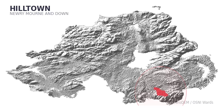
HILLTOWN covers 246.4 km² in Northern Ireland. With 79 historic sites and 11 scheduled monuments on record, the ward sits at the 87th percentile across all 462 NI wards for combined archaeological heritage. It also records 76 listed buildings (HED Historic Buildings Record), the 88th percentile for listed-building density across NI wards. Per 1,000 residents, this works out at 32.3 recorded sites — the 78th percentile across NI wards (a measure of heritage density relative to current population). Dated archaeological evidence runs from the Mesolithic through to the Post-Medieval period, spanning 6 archaeological periods, around the NI median for chronological depth.
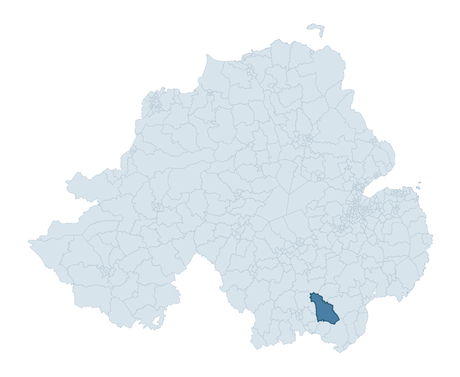
HILLTOWN boundary detailHILLTOWN in regional context
Heritage at a glance
Percentile rankings throughout this profile compare each ward only against the other 461 Northern Ireland wards.
79
Historic sites
82nd percentile
11
Scheduled monuments
86th percentile
76
Listed buildings
88th percentile
0.67
Sites per km²
Population context
21
Persons per km²
21st percentile
32.3
Sites per 1,000 residents
78th percentile
5,134
Total residents (2021)
The recorded heritage of HILLTOWN
Of the 79 historic sites recorded, the most common are Enclosure (23, 29% of historic sites), Rath (9), and Standing Stone (3). For Enclosures, this is the 92nd percentile across NI wards that record this type. For Raths, this is the 65th percentile among NI wards that record this type. Across the ward's 246.4 km², this gives a recorded density of 0.67 sites per km² (all heritage types combined). Scheduled monuments are distributed across approximately 0.09° of latitude and 0.12° of longitude within the ward, indicating dispersed rather than clustered placement.
Most common monument types
Type
Count
Description
Enclosure
23
—
Rath
9
—
Standing Stone
3
—
Chronological distribution
Mesolithic
11
Early Bronze Age
1
Iron Age
30
Early Medieval
25
Medieval
1
Post Medieval
2
Unknown
9
Terrain and environment
A mean elevation of 177m places this ward in the top 7% of NI wards by altitude, but the ward reaches 633m at its highest point — a vertical span of more than 456m within its boundary, indicating significant topographic diversity. The terrain is consistently steep, with a mean slope of 6.7° (92th percentile across NI); localised maximum slopes reach 18°, typical of stream-cut valleys, escarpments, or bluffs within the wider landscape. The ward is well-drained, with a Topographic Wetness Index of 9.6 (9th NI percentile) — characteristic of upland or steeply-sloping ground that sheds water rapidly. Land cover is overwhelmingly improved grassland (90%), with virtually no other category exceeding 5%. In overall character, this is an upland landscape of steep, elevated terrain, with land use dominated by improved grassland.
Terrain measurements
Mean elevation176.8 m 93rd pct
Max elevation632.8 m 98th pct
Mean slope6.7° 93rd pct
Wetness index (TWI)9.59 10th pct
Grassland90.3% 99th pct
Woodland3.4% 1st pct
Cropland4.4% 78th pct
Urban land1.8% 22nd pct
Where this ward sits in NI
Elevation
93rd
Slope
93rd
Drainage
10th
Grassland
99th
Woodland
1st
Geology and preservation
The dominant bedrock formed during the Palaeozoic era (Silurian period). Ancient sedimentary or metamorphic rock dating to before the age of dinosaurs; the resulting landscape has been long-stable enough to host every period of human activity. Bedrock composition is varied (complexity index 0.98, on a 0-1 Simpson-style scale), with multiple geological units within the ward boundary. Geologically diverse wards historically offered a wider range of stone types for building, toolmaking, and quarrying — a relevant factor when interpreting the material culture of nearby sites.
Bedrock eraPalaeozoic
Bedrock periodSilurian
Surface depositsTill
Peat coverage0.0%
Bedrock complexity0.98
Placename evidence
The combined OSNI, Logainm NI, and GeoNames sources record 42 placenames for this ward. Diagnostic heritage strata identified within these are: 2 pre-Christian defensive (rath-, dún-, lios-, caiseal-) and 1 ecclesiastical (cill-, teampall-, mainistir-, díseart-). Note: Irish-language (name_ga) forms are recorded for roughly half of NI placenames in the combined sources, so anglicised forms whose Irish original could belong to multiple categories may be misclassified.
Scheduled monuments are sites legally protected under the Historic Monuments and Archaeological Objects (Northern Ireland) Order 1995, designated by the Historic Environment Division (HED).
Monument
Type
Period
Church site, graveyard and enclosure
Church Site, Graveyard And Enclosure
Iron Age
Standing Stone
Standing Stone
Early Bronze Age
Rath: Lisnabrean
Rath: Lisnabrean
Early Medieval
Rath and Souterrains
Rath And Souterrains
Iron Age
Ring Barrows (2) and Standing Stones
Ring Barrows (2) And Standing Stones
Early Bronze Age
Motte
Motte
Medieval
Enclosure, possible mill site
Enclosure, Possible Mill Site
Iron Age
Counterscarp Rath
Counterscarp Rath
Early Medieval
Graveyard and site of medieval church
Graveyard And Site Of Medieval Church
Medieval
Rath
Rath
Early Medieval
Rath
Rath
Early Medieval
Recorded historic sites
Name
Period
Type
A.P. SITE – 3 BOOLEY HUTS
Unknown
Unknown
A.P. SITE – ENCLOSURE
Iron Age
Unknown
A.P. SITE – RATH?
Early Medieval
Defence
A.P. SITE – circular cropmark
Unknown
Unknown
A.P. SITE – enclosure
Iron Age
Unknown
A.P. SITE – field boundaries
Unknown
Unknown
A.P. SITE – large enclosure
Iron Age
Unknown
A.P. SITE – mound (field clearance cairn?)
Early Bronze Age
Ritual/Funerary
A.P. SITE – oval cropmark
Unknown
Unknown
A.P. SITE – rectangular cropmark
Unknown
Unknown
AP Cropmark – Enclosure
Iron Age
Unknown
AP Cropmark – penannular enclosure
Iron Age
Unknown
BIVALLATE RATH
Early Medieval
Defence
BIVALLATE RATH: LISNABREAN
Early Medieval
Defence
BOOLEY HUTS
Unknown
Unknown
BRONZE AGE RING BARROW with cremation burials & 5 STANDING STONES: MURPHY'S FORT
Mesolithic
Ritual/Funerary
CAIRN
Mesolithic
Ritual/Funerary
CAIRN
Mesolithic
Ritual/Funerary
CAIRN
Mesolithic
Ritual/Funerary
CAIRN? (unlocated)
Mesolithic
Ritual/Funerary
CASHEL
Early Medieval
Defence
CHURCH (site of) & GRAVEYARD
Medieval
Ritual/Funerary
CHURCH (site of); GRAVEYARD; ENCLOSURE; HOLY WELL: TOBERDONEY
Iron Age
Ritual/Funerary
COUNTERSCARP RATH
Early Medieval
Defence
COUNTERSCARP RATH: BALLYVALLY RATH
Early Medieval
Defence
CROSS-CARVED BOULDER
Post-Medieval
Unknown
ENCLOSURE
Iron Age
Unknown
ENCLOSURE
Iron Age
Unknown
ENCLOSURE
Iron Age
Unknown
ENCLOSURE
Iron Age
Unknown
ENCLOSURE
Iron Age
Unknown
ENCLOSURE
Iron Age
Unknown
ENCLOSURE
Iron Age
Unknown
ENCLOSURE
Iron Age
Unknown
ENCLOSURE
Iron Age
Unknown
ENCLOSURE
Iron Age
Unknown
ENCLOSURE
Iron Age
Unknown
ENCLOSURE
Iron Age
Unknown
ENCLOSURE
Iron Age
Unknown
ENCLOSURE
Iron Age
Unknown
ENCLOSURE
Iron Age
Unknown
ENCLOSURE
Iron Age
Unknown
ENCLOSURE
Iron Age
Unknown
ENCLOSURE
Iron Age
Unknown
ENCLOSURE
Iron Age
Unknown
ENCLOSURE
Iron Age
Unknown
ENCLOSURE
Iron Age
Unknown
ENCLOSURE
Iron Age
Unknown
ENCLOSURE
Iron Age
Unknown
ENCLOSURE: LISDOO FORT
Iron Age
Defence
ENCLOSURE; possibly HORIZONTAL MILL
Early Medieval
Agriculture
FOLKLORE SITE – CHAIR STONE, MASS ROCK & FAIRY FOOT MARK STONE: THE LADY'S CHAIR
Unknown
Unknown
Historic Settlement Hilltown
Post-Medieval
Domestic
MODERN CHURCH & GRAVEYARD on site of MEDIEVAL CHURCH & PRE-NORMAN MONASTERY: CLONDYME; CLONDUFF GRAVEYARD
Early Medieval
Ritual/Funerary
MOTTE? or RAISED RATH?: BALLYMAGHERY MOTTE
Early Medieval
Defence
MOUND & findspot of CUP & RING-MARKED STONE
Unknown
Unknown
NON-ANTIQUITY – rock outcrop: GRUGGANSKEAGH
Unknown
Unknown
Possible rath (site of)
Early Medieval
Defence
RATH
Early Medieval
Defence
RATH
Early Medieval
Defence
RATH
Early Medieval
Defence
RATH
Early Medieval
Defence
RATH
Early Medieval
Defence
RATH
Early Medieval
Defence
RATH
Early Medieval
Defence
RATH
Early Medieval
Defence
RATH
Early Medieval
Defence
RATH & SOUTERRAIN: LISBANE
Early Medieval
Defence
RATH & possible SOUTERRAIN
Early Medieval
Defence
RATH (one of a pair with 041:035)
Early Medieval
Defence
RATH: LISDUFF
Early Medieval
Defence
RING BARROW: MURPHY'S FORT
Mesolithic
Ritual/Funerary
ROUND CAIRN: CARNADRANNA
Mesolithic
Ritual/Funerary
SOUTERRAIN & WELL
Early Medieval
Defence
SOUTERRAIN (unlocated)
Early Medieval
Defence
STANDING STONE
Mesolithic
Ritual/Funerary
STANDING STONE
Mesolithic
Ritual/Funerary
STANDING STONE
Mesolithic
Ritual/Funerary
STANDING STONE (removed)
Mesolithic
Ritual/Funerary
Listed buildings in HILLTOWN
Address / Name
Grade
Period
St John's C of I Church
Main Street
Hilltown
Newry
Co Down
BT34 5UH
B1
1760 – 1779
Hilltown Presbyterian Church
Main Street
Hilltown
Newry
Co Down
BT34 5U
Record Only
1820 – 1839
Presbyterian Manse
16 Main Street
Hilltown
Newry
Co Down
BT34 5UH
Record Only
1820 – 1839
2 Rathfriland Road
Hilltown
Newry
Co Down
BT34 5UR
Record Only
1880 – 1899
4-6 Rathfriland Road
Hilltown
Newry
Co Down
BT34 5UR
Record Only
1900 – 1919
Downshire Arms
28 Main Street
Hilltown
Newry
Co Down
BT34 5UJ
B2
1820 – 1839
Former outbuildings at
The Downshire Arms
28 Main Street
Hilltown
Newry
Co Down
BT34 5UJ
Record Only
1820 – 1839
47 Main Street
Hilltown
Newry
Co Down
BT34 5UJ
Record Only
1820 – 1839
51 Main Street
Hilltown
Newry
Co Down
BT34 5UJ
B2
1760 – 1779
Hilltown Lodge
3 Castlewellan Road
Hilltown
Newry
Co Down
BT34 5UX
B2
1780 – 1799
Eight Mile Bridge
Kilkeel Rd
Hilltown
Newry
Co Down
B2
—
St John's RC Church
Castlewellan Road
Hilltown
Newry
Co Down
BT34 5UY
B2
1840 – 1859
Kennels at Leitrim Lodge
121 Leitrim Rd
Hilltown
Newry
Co Down
BT34 5XS
B2
1900 – 1919
11 Ballycoshone Road
Rathfriland
Newry
Co Down
BT34 5HJ
B1
1840 – 1859
119 Rostrevor Road
Hilltown
Co. Down
BT34 5TZ
B1
1820 – 1839
17 Cross Road
Ballygorian More
Rathfriland
Newry
Co Down
BT34 5TE
B1
1840 – 1859
37 Ballykeel Road
Rathfriland
Co Down
BT34 5AZ
B1
1860 – 1879
35 Gransha Road
Rathfriland
Newry
Co Down
BT34 5BX
B2
1820 – 1839
14 Coyles Hill Road
Mayobridge
Newry
Co Down
BT34 2SE
B2
1800 – 1819
4 Edentrumly Rd
Mayobridge
Newry
Co Down
BT34 2SG
B1
1800 – 1819
72 Drumlough Road
Drumgath
Rathfriland
Co. Down
BT34 4DP
B2
1820 – 1839
Ardarragh House
15 Finnard Road
Ardarragh
Newry
Co Down
BT34 5BL
Record Only
1840 – 1859
S of 16 Ardkeeragh Road
Donaghmore
Newry
Co Down
BT34 1NW
B2
1900 – 1919
St John's RC Church
Rathfriland Road
Hilltown
Co Down
BT34 5TA
B2
1820 – 1839
Former Market House
Downshire Arms
28 Main Street
Hilltown
Co Down
BT34 5UJ
Record Only
1820 – 1839
30 Main St
Hilltown
Newry
Co Down
BT34 5UJ
Record Only
1800 – 1819
32 Main St
Hilltown
Newry
Co Down
BT34 5UJ
Record Only
1800 – 1819
36 Main St
Hilltown
Newry
Co Down
BT34 5UJ
Record Only
1800 – 1819
Old Clonduff Church and Graveyard
Kilkeel Rd
Hilltown
Newry
Co Down
BT34 5XY
Record Only
Pre 1600
Bridge over Leitrim River
Leitrim Rd
Hilltown
Newry
Co Down
BT34
Record Only
1840 – 1859
71 Rostrevor Rd
Hilltown
Newry
Co Down
BT34 5TZ
Record Only
1900 – 1919
Leitrim Lodge
121 Leitrim Rd
Hilltown
Newry
Co Down
BT34 5XS
Record Only
1900 – 1919
Farmhouse
Rostrevor Rd
Hilltown
Newry
Co Down
BT34 5TZ
Record Only
1820 – 1839
Former flax mill
near 42 Lisnamulligan Rd
Rathfriland
Newry
Co Down
BT34 4XA
Record Only
1780 – 1799
Bridge over River Bann
Lisdrumgullion Rd
Hilltown
Newry
Co Down
BT34 5XA
Record Only
1980 – 1999
Former Corn Mill off Kilkeel Rd
Hilltown
Newry
Co Down
BT34 2JU
Record Only
1800 – 1819
Disused flax mill off Kilkeel Rd
Hilltown
Newry
Co Down
BT34 2JU
Record Only
1840 – 1859
Footbridge over River Bann
Off Kilkeel Rd
Hilltown
Newry
Co Down
BT34 2JU
Record Only
1900 – 1919
Mill near Leitrim Bridge
Leitrim Rd
Hilltown
Newry
Co Down
BT34 5XS
Record Only
1800 – 1819
Disused mill off Sandbank Rd
Rathfriland
Newry
Co Down
BT34 5XU
Record Only
1780 – 1799
Bridge over Shankys River
near Leitrim Rd
Hilltown
Newry
Co Down
BT34 5XS
Record Only
1920 – 1939
Reservoir off Sandbank Rd
Hilltown
Newry
Co Down
BT34 5XU
Record Only
1900 – 1919
Former Mass Rock
Off Sandbank Rd
Hilltown
Newry
Co Down
BT34 5XU
Record Only
1780 – 1799
48 Gransha Road
Tullyquilly
Rathfriland
Co. Down
BT34 5BU
Record Only
1820 – 1839
Drumlough Corn Mill
opp. 9 Longstone Hill
Rathfriland
Newry
Co Down
BT34 5BT
Record Only
1840 – 1859
Site on Bog Road near junction of Cross Road
Rathfriland
Newry
Co Down
BT34 5DT
Record Only
1840 – 1859
Graveyard
on Drumlough Road
Rathfriland
Newry
BT34 2HR
Record Only
Pre 1600
21 Ballykeel Road
Mayobridge
Newry
Co Down
BT34 5AZ
Record Only
1840 – 1859
10 Lurgancahone Road
Rathfriland
Newry
Co Down
BT34 5AU
Record Only
1840 – 1859
Bridge
N of 10 Lurgancahone Road
Lurgancahone Road
Rathfriland
Newry
BT34 5AU
Record Only
1800 – 1819
15 Edentrumly Road
Mayobridge
Hilltown
Co Down
BT34 2SG
Record Only
1800 – 1819
Streamville
66 Loughbrickland Road
Rathfriland
Newry
Co Down
BT34 5BY
Record Only
1840 – 1859
Former flax mill opp. 20 Mill Road
Hilltown
Newry
Co Down
BT34 5UZ
Record Only
1860 – 1879
61 Loughbrickland Road
Rathfriland
Newry
Co Down
BT34 5BY
Record Only
1840 – 1859
St Colmans RC Church
Longstone Road
Rathfriland
Newry
Co Down
BT34 5BT
Record Only
1760 – 1779
Bell Tower
St Colman's RC Church
Longstone Road
Rathfriland
Newry
Co Down
BT34 5BT
Record Only
1900 – 1919
90 Newry Road
Rathfriland
Newry
Co Down
BT34 5AB
Record Only
1880 – 1899
5 Greenhill Road
Rathfriland
Newry
Co Down
BT34 5AS
Record Only
1800 – 1819
Glen House
Barmeen Road
Rathfriland
Newry
Co Down
BT34 5AW
Record Only
1820 – 1839
27 Ballykeel Road
Rathfriland
Newry
Co Down
BT34 5AZ
Record Only
1800 – 1819
29 Ballykeel Road
Rathfriland
Newry
Co Down
BT34 5AZ
Record Only
1800 – 1819
25 Bog Road
Rathfriland
Newry
Co Down
BT34 5DT
Record Only
1800 – 1819
St Patricks RC Church
Drumlough Road
Rathfriland
Newry
Co Down
BT34 5DW
Record Only
1820 – 1839
Ball Alley Pavillion
at junction of Drumlough Road
and Lurgancahone Road
Rathfriland
Newry
Co Down
BT34 5DW
Record Only
1920 – 1939
Outbuilding
33 Tamry Hill
Rathfriland
Newry
Co Down
BT34 5DS
Record Only
1860 – 1879
Former mill complex
Drumlough School Road
Rathfriland
Newry
Co Down
BT34 5DR
Record Only
1940 – 1959
17 Drumlough School Road
Rathfriland
Newry
Co Down
BT34 5EA
Record Only
1800 – 1819
22 Ballydoo Road
Mayobridge
Newry
Co Down
BT34 2HP
Record Only
1800 – 1819
24 Carmeen Road
Hilltown
Newry
Co Down
BT34 5TL
Record Only
1800 – 1819
49 Ballyvally Road
Mayobridge
Newry
Co Down
BT34 2RT
Record Only
1840 – 1859
Former flax mill
NW of 69 Newry Rd
Rathfriland
Newry
Co Down
BT34 5AL
Record Only
1940 – 1959
Former lime kiln
To NE of Lower Knockbarragh Rd
Mayobridge
Newry
Co Down
BT34 2SF
Record Only
1860 – 1879
House off Lower Knockbarragh Rd
Mayobridge
Newry
Co Down
BT34 2SF
Record Only
1800 – 1819
Thatched structure
to SW of Curley House
18 Curley Road
Newry
Co Down
BT34 1NU
Record Only
—
Curley House
18 Curley Road
Newry
Co Down
BT34 1NU
Grounding History: 10 Maps of Northern Ireland’s Past
A spatial history report bringing together analysis of all 462 wards into one place through 10 high-quality maps — covering monument density, archaeological periods, placename heritage, terrain, wetland, and the historic landscape at first survey.
A ward is the smallest electoral and statistical geography used by the Northern Ireland Statistics and Research Agency (NISRA). The boundaries used here are the 2014 NISRA / OSNI Wards (462 across Northern Ireland), each typically covering 1-700 km² and a population of a few thousand. Wards do not align with parishes, townlands, or any historic administrative unit — they are a modern statistical convenience, used here only as a fixed spatial frame within which to summarise heritage records.
What counts as a site?
Three distinct heritage record types are reported separately, not combined: (1) Historic Sites — entries in the Northern Ireland Sites and Monuments Record (NISMR), the inventory of recorded archaeological sites and findspots, dated from prehistoric to early-modern; (2) Scheduled Monuments — sites legally protected under the Historic Monuments and Archaeological Objects (NI) Order 1995 and maintained by the Historic Environment Division (HED); (3) Listed Buildings — buildings of architectural or historic interest protected under the Planning Act (NI) 2011 and graded A, B+, B1, B2, or Record-Only by HED. A site appearing in more than one register is counted in each register independently.
Editorial principles
These ward profiles describe evidence, not history. They report what is recorded, not what occurred. Where the data is ambiguous, we say so. We do not infer historical processes — population movements, settlement expansion, periods of decline — from patterns in the record. Absence of evidence is not evidence of absence: in Northern Ireland, where antiquarian survey was uneven and modern excavation is geographically biased, a gap in the record almost always reflects the limits of recording rather than a genuine historical absence. We mark such gaps explicitly where they appear in the data.
Limits of coverage and known caveats
Several caveats apply to every ward profile: (1) NISMR coverage is uneven across NI — some areas (notably parts of the south-east and the Belfast urban fringe) have been more intensively surveyed than others, so a low recorded site count does not reliably indicate a low past density of activity; (2) period attributions in NISMR are often 'Unknown', and chronological breakdowns reported here reflect only the dated subset; (3) placename classification depends on the Irish-language form (name_ga), which is recorded for approximately 50% of NI placenames in the combined sources, so ecclesiastical and pre-Christian counts may be understated where anglicised forms remain unparsed; (4) terrain percentile ranks compare each ward only to the other 461 NI wards; they are not absolute thresholds. For absence-dominant land cover categories (wetland, water, cropland), percentile ranks are suppressed below 1% raw value, since the ranking of zero-value wards is not meaningful.
Data sources (11)
Northern Ireland Sites and Monuments Record (NISMR)
Spotted an error? This dataset is updated continuously.
Email contact@danielkirkpatrick.co.uk with corrections, missing records, or suggestions for improvement.
Manage Consent
To provide the best experiences, we use technologies like cookies to store and/or access device information. Consenting to these technologies will allow us to process data such as browsing behaviour or unique IDs on this site. Not consenting or withdrawing consent, may adversely affect certain features and functions.
Functional
Always active
The technical storage or access is strictly necessary for the legitimate purpose of enabling the use of a specific service explicitly requested by the subscriber or user, or for the sole purpose of carrying out the transmission of a communication over an electronic communications network.
Preferences
The technical storage or access is necessary for the legitimate purpose of storing preferences that are not requested by the subscriber or user.
Statistics
The technical storage or access that is used exclusively for statistical purposes.The technical storage or access that is used exclusively for anonymous statistical purposes. Without a subpoena, voluntary compliance on the part of your Internet Service Provider, or additional records from a third party, information stored or retrieved for this purpose alone cannot usually be used to identify you.
Marketing
The technical storage or access is required to create user profiles to send advertising, or to track the user on a website or across several websites for similar marketing purposes.