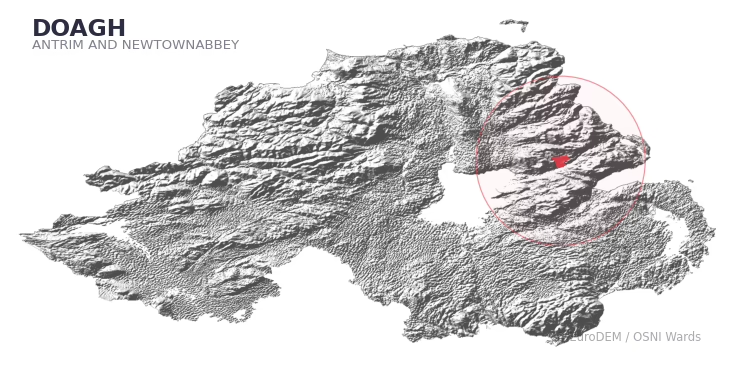
DOAGH covers 43.7 km² in Northern Ireland. With 32 historic sites and 1 scheduled monument on record, the ward sits at the 51st percentile across all 462 NI wards for combined archaeological heritage. It also records 19 listed buildings (HED Historic Buildings Record), the 48th percentile for listed-building density across NI wards. Per 1,000 residents, this works out at 15.0 recorded sites — the 54th percentile across NI wards (a measure of heritage density relative to current population). Dated archaeological evidence runs from the Mesolithic through to the Medieval period, spanning 5 archaeological periods, around the NI median for chronological depth.
Heritage at a glance
Percentile rankings throughout this profile compare each ward only against the other 461 Northern Ireland wards.
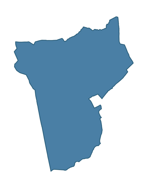
Population context
The recorded heritage of DOAGH
Of the 32 historic sites recorded, the most common are Souterrain (7, 22% of historic sites), Enclosure (2), and Mound – Motte? (2). For Souterrains, this is the 71st percentile among NI wards that record this type. For Enclosures, this is the 18th percentile across NI wards that record this type. Across the ward's 43.7 km², this gives a recorded density of 1.19 sites per km² (all heritage types combined).
Most common monument types
| Type | Count | Description |
|---|---|---|
| Souterrain | 7 | — |
| Enclosure | 2 | — |
| Mound – Motte? | 2 | — |
Chronological distribution
Terrain and environment
With a mean elevation of 104m, this ward sits above the NI median (74th percentile), with a maximum of 264m giving the ward meaningful vertical relief. Mean slope is 3.4° (30th percentile across NI), giving moderately undulating terrain. The Topographic Wetness Index of 10.7 (66th NI percentile) indicates moderate drainage, balanced between upland shedding and lowland accumulation. The land-cover mosaic combines improved grassland (80%), woodland (9%), and arable farmland (8%), giving a mixed agricultural and semi-natural landscape.
Terrain measurements
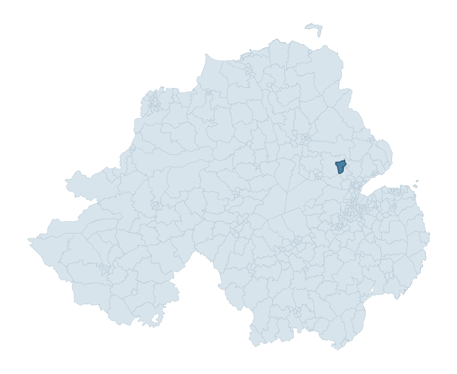
Where this ward sits in NI
Geology and preservation
The dominant bedrock formed during the Cainozoic era (Palaeogene period). Relatively young rock formed in the last 66 million years. In Ulster, Cainozoic basalt — the lava that created the Antrim Plateau and Giant's Causeway — dominates much of the eastern landscape. Bedrock composition is uniform (complexity index 0.00), with a single dominant geological unit underlying most of the ward. A uniform geology narrows the natural lithic-resource base available to past inhabitants.
Placename evidence
The placename record for this ward is small — 10 names in total — but it does include 1 pre-Christian defensive and 1 ecclesiastical placenames. With this few records, the count should be treated as indicative rather than a firm characterisation.
Placename categories
Scheduled monuments in DOAGH
Scheduled monuments are sites legally protected under the Historic Monuments and Archaeological Objects (Northern Ireland) Order 1995, designated by the Historic Environment Division (HED).
| Monument | Type | Period |
|---|---|---|
| Motte | Motte | Medieval |
Recorded historic sites
| Name | Period | Type |
|---|---|---|
| A.P. SITE – FIELD SYSTEM | Middle-Late Bronze Age | Agriculture |
| A.P. SITE – circular cropmark | Early Medieval | Unknown |
| AP Site- Possible barrow cemetery | Mesolithic | Ritual/Funerary |
| CAIRN & URN BURIAL (unlocated) | Mesolithic | Ritual/Funerary |
| Doagh Historic Settlement | Medieval | Domestic |
| ENCLOSURE | Iron Age | Unknown |
| ENCLOSURE | Iron Age | Unknown |
| ENCLOSURE & SOUTERRAIN(S) (O.S. memoir site; unlocated) | Early Medieval | Defence |
| ENCLOSURE: KNOWEHEAD | Iron Age | Unknown |
| ENCLOSURE? | Iron Age | Unknown |
Listed buildings in DOAGH
| Address / Name | Grade | Period |
|---|---|---|
| Fisherwick Lodge 5 & 7 Mill Road Doagh, Ballyclare Co Antrim BT39 0PQ | B+ | 1800 – 1819 |
| Stephenson Mausoleum Kilbride Cemetery Moyra Road Doagh Co Antrim BT39 0JD | B+ | 1820 – 1839 |
| Invermuir 53 Bridge Road Doagh Co Antrim BT39 0PS | B2 | 1840 – 1859 |
| Ballyhamage House The Burn Road Doagh Co Antrim BT39 0RD | B2 | 1800 – 1819 |
| Cogry Cottage 51 Bridge Road Cogry, Doagh Co. Antrim BT39 0PS | B1 | 1840 – 1859 |
| Rowan Memorial Main Street Doagh, Co. Antrim BT39 0QL | B1 | 1840 – 1859 |
| METHODIST CHURCH THE ENTRY DOAGH Ballyclare CO.ANTRIM | Record Only | 1840 – 1859 |
| St. Bride's Church of Ireland Church Kilbride Road Kilbride Doagh Co. Antrim BT39 0RH | B1 | 1860 – 1879 |
| Kilbride Presbyterian Church, Moyra Road, Doagh, Co Antrim, BT39 0JD | B2 | 1840 – 1859 |
| Bessy Grae Bridge, Station Road, Doagh | B1 | 1780 – 1799 |
Discover more in Antrim and Newtownabbey
- Jordanstown
- Rostulla
- Clady
- Glebe
- Fountain Hill
- Parkgate
- Ballyrobert
- Derryaghy — Lisburn and Castlereagh
- Derryboy — Newry, Mourne and Down
- Donard — Newry, Mourne and Down
See all 462 wards in the Northern Ireland Heritage Tool.

Want a deeper view?
Grounding History: 10 Maps of Northern Ireland’s Past
A spatial history report bringing together analysis of all 462 wards into one place through 10 high-quality maps — covering monument density, archaeological periods, placename heritage, terrain, wetland, and the historic landscape at first survey.
About this profile
What is a ward?
A ward is the smallest electoral and statistical geography used by the Northern Ireland Statistics and Research Agency (NISRA). The boundaries used here are the 2014 NISRA / OSNI Wards (462 across Northern Ireland), each typically covering 1-700 km² and a population of a few thousand. Wards do not align with parishes, townlands, or any historic administrative unit — they are a modern statistical convenience, used here only as a fixed spatial frame within which to summarise heritage records.
What counts as a site?
Three distinct heritage record types are reported separately, not combined: (1) Historic Sites — entries in the Northern Ireland Sites and Monuments Record (NISMR), the inventory of recorded archaeological sites and findspots, dated from prehistoric to early-modern; (2) Scheduled Monuments — sites legally protected under the Historic Monuments and Archaeological Objects (NI) Order 1995 and maintained by the Historic Environment Division (HED); (3) Listed Buildings — buildings of architectural or historic interest protected under the Planning Act (NI) 2011 and graded A, B+, B1, B2, or Record-Only by HED. A site appearing in more than one register is counted in each register independently.
Editorial principles
These ward profiles describe evidence, not history. They report what is recorded, not what occurred. Where the data is ambiguous, we say so. We do not infer historical processes — population movements, settlement expansion, periods of decline — from patterns in the record. Absence of evidence is not evidence of absence: in Northern Ireland, where antiquarian survey was uneven and modern excavation is geographically biased, a gap in the record almost always reflects the limits of recording rather than a genuine historical absence. We mark such gaps explicitly where they appear in the data.
Limits of coverage and known caveats
Several caveats apply to every ward profile: (1) NISMR coverage is uneven across NI — some areas (notably parts of the south-east and the Belfast urban fringe) have been more intensively surveyed than others, so a low recorded site count does not reliably indicate a low past density of activity; (2) period attributions in NISMR are often 'Unknown', and chronological breakdowns reported here reflect only the dated subset; (3) placename classification depends on the Irish-language form (name_ga), which is recorded for approximately 50% of NI placenames in the combined sources, so ecclesiastical and pre-Christian counts may be understated where anglicised forms remain unparsed; (4) terrain percentile ranks compare each ward only to the other 461 NI wards; they are not absolute thresholds. For absence-dominant land cover categories (wetland, water, cropland), percentile ranks are suppressed below 1% raw value, since the ranking of zero-value wards is not meaningful.
Data sources (11)
- Northern Ireland Sites and Monuments Record (NISMR) https://www.communities-ni.gov.uk/articles/nismr-public-mapviewer
- HED Scheduled Monuments Dataset https://www.opendatani.gov.uk/@historic-environment-division/scheduled-monuments-northern-ireland
- HED Historic Buildings Record https://www.communities-ni.gov.uk/topics/historic-environment/listed-buildings
- OSNI OS Open Names (Northern Ireland) https://www.opendatani.gov.uk/@ordnance-survey-of-northern-ireland/osni-open-data—50k-gazetteer
- Logainm — Placenames Database of Ireland https://www.logainm.ie/
- GeoNames https://www.geonames.org/
- Census 2021 (Northern Ireland) https://www.nisra.gov.uk/statistics/2021-census
- OSNI Open Data — Largescale Boundaries https://www.opendatani.gov.uk/@ordnance-survey-of-northern-ireland/osni-open-data-largescale-boundaries-wards-2012
- Copernicus GLO-30 DEM https://spacedata.copernicus.eu/collections/copernicus-digital-elevation-model
- ESA WorldCover https://esa-worldcover.org/
- GSNI 1:250,000 Geology https://www.bgs.ac.uk/geological-data/maps/