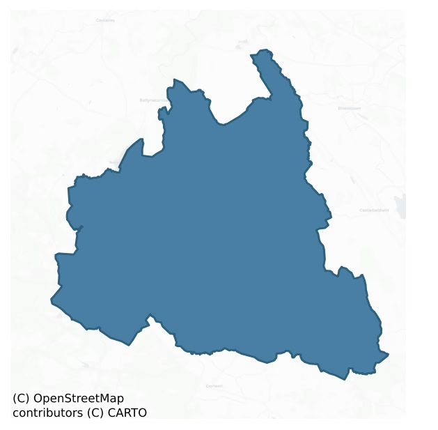
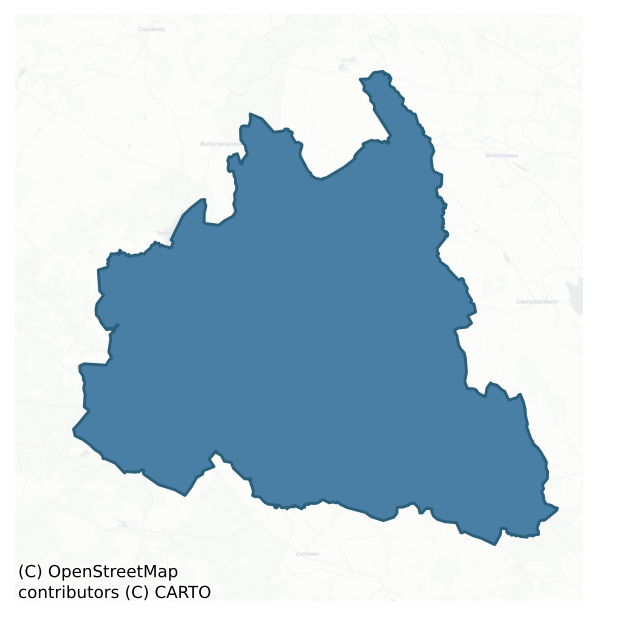
Corran is a barony of County Sligo, in the historical province of Connacht (Irish: An Corann), covering 185 km² of land. The barony records 618 NMS archaeological sites and 58 NIAH listed buildings, placing it at around the 88th percentile among 280 ROI baronies for sites per km². This means it is in the top fifth of all baronies for sites per km². Dated archaeological evidence runs from the Neolithic through to the Modern, spanning 8 of 9 archaeological periods, placing the barony in the 66th percentile among 280 ROI baronies for chronological depth. This means it is in the upper half of all baronies for chronological depth. The largest dated subset of recorded sites dates to the Early Medieval. Logainm flags 48 placenames in the barony as carrying a recognised heritage root; the largest share — around 46% — are names associated with pre-christian defensive.
Heritage at a glance
Percentile rankings throughout this profile compare each barony only against the other 279 Republic of Ireland baronies.
The recorded heritage of Corran
The National Monuments Service Sites and Monuments Record (SMR) is the statutory inventory of archaeological sites for the Republic of Ireland, maintained by the Department of Tourism, Culture, Arts, Gaeltacht, Sport and Media. Sites recorded here include earthworks, ringforts, megalithic tombs, ecclesiastical remains, and post-medieval features; not every record is legally protected, but each is registered as a monument of archaeological interest.
The National Monuments Service records 618 archaeological sites in Corran, putting it at the 88th percentile among 280 ROI baronies for sites per km². This means it is in the top fifth of all baronies for sites per km². Protection coverage is near-universal — 606 sites (98%) fall within a recorded monument protection zone, indicating an extensively surveyed landscape. The dominant category is defensive sites — ringforts, enclosures, hillforts, and stone forts (366 sites, 59% of the record). Ringfort – rath is the most prevalent type, making up 39% of the barony's recorded sites (241 records) — well above the ROI average of 20% across all baronies where this type occurs. Ringfort – rath is an earthen ringfort enclosed by a bank and external ditch — the most common Early Medieval farmstead, broadly dated 500–1000 AD. Other significant types include Enclosure (52) and Souterrain (31). Enclosure is a banked or ditched feature of uncertain type, used as a catch-all where the original function cannot be determined from surface evidence; Souterrain is an underground stone-built passage and chamber, generally Early Medieval and often associated with ringforts as a defensive or storage feature. Across the barony's 185 km², this gives a recorded density of 3.35 sites per km².
Most common monument types
Hover or tap a monument type to see its definition.
| Type | Count |
|---|---|
| Ringfort – rath an earthen ringfort enclosed by a bank and external ditch — the most common Early Medieval farmstead, broadly dated 500–1000 AD | 241 |
| Enclosure a banked or ditched feature of uncertain type, used as a catch-all where the original function cannot be determined from surface evidence | 52 |
| Souterrain an underground stone-built passage and chamber, generally Early Medieval and often associated with ringforts as a defensive or storage feature | 31 |
| Hut site a low stone or earthen foundation enclosing a small circular or oval area, generally interpreted as a former dwelling, of any date from prehistory to the medieval period | 21 |
| Ringfort – cashel the stone-walled equivalent of the rath, found mainly in upland or western areas, broadly dated 500–1000 AD | 15 |
| Barrow – ring-barrow a Bronze/Iron Age burial monument: a low circular area enclosed by ditch and outer bank | 13 |
| Church a building used for public Christian worship, of any date from c. 500 AD onwards | 13 |
Chronological distribution
The dated archaeological record for Corran spans from the Neolithic through to the Modern, with activity attested across 8 of 9 archaeological periods. Every period from earliest to latest is represented in the record — an unbroken sequence of dated activity across the full chronological span. Activity concentrates most heavily in the Early Medieval (331 sites, 59% of dated material), with the Early Bronze Age forming a secondary peak (79 sites, 14%). A further 59 recorded sites (10% of the overall NMS register for the barony) carry no period attribution — appearing as 'Unknown' in the bar chart below. This typically reflects either records that pre-date the standardised period vocabulary or sites awaiting specialist dating review, rather than a genuine absence of chronological evidence.
Sample of recorded monuments
Show 25 sample monuments (of 618 total)
A representative sample of 25 recorded monuments drawn from the barony’s 618 total NMS entries. Sites within a recorded monument protection zone and rarer site types are prioritised so the list shows a meaningful cross-section rather than only the most common type. Each entry shows the official Sites and Monuments Record reference number and the description published by the National Monuments Service.
Enclosure – large enclosure
In gently undulating pasture. A roughly circular area (98m N-S; 99m E-W) defined by two earthen banks and an intervening fosse. The inner bank (int. H 0.5m; ext. H 1m) is evident W-NNW while elsewhere the interior is…
In gently undulating pasture. A roughly circular area (98m N-S; 99m E-W) defined by two earthen banks and an intervening fosse. The inner bank (int. H 0.5m; ext. H 1m) is evident W-NNW while elsewhere the interior is defined by a scarp. There is a possible entrance (Wth 16m) at WNW with breaches in both banks and slight infilling of the fosse. The fosse is evident all round and has a broad U-shaped profile (Wth 4.5m at base). The outer bank (int. H 0.75m; ext. H 0.3m) is evident SE-NE with a further short stretch at ESE. It is broken by gaps at NW (Wth 12m) and NNW (Wth 6m) and has been incorporated into a field boundary NE-ESE. The interior undulates gently and slopes gently from the centre toward the enclosing elements. A relict field boundary (see SL033-075001-) with a fosse on its E side crosses the interior on a NNW-SSE axis. There is a rath (SL033-077001-) and souterrain (SL033-077003-) in the SE quadrant, abutting the inner edge of the fosse at SSE. Another rath (SL033-076—-) is 14m to NNW and a third (SL033-078—-) c. 100m to SE. A field system (SL033-075001-) lies immediately to E.
The above description is derived from the published 'Archaeological Inventory of County Sligo' compiled by Ursula Egan, Elizabeth Byrne, Mary Sleeman with Sheila Ronan and Connie Murphy (Dublin Stationery Office, 2005).
Date of upload: 18 January 2008
Armorial plaque
At Emlaghnaghtan rath (SL033-083—-). In the S half is a circular earthwork surrounded by a stone wall; on top of the enclosing bank on the S side of the earthwork is a stone memorial with a plaque bearing a coat of…
At Emlaghnaghtan rath (SL033-083—-). In the S half is a circular earthwork surrounded by a stone wall; on top of the enclosing bank on the S side of the earthwork is a stone memorial with a plaque bearing a coat of arms and inscribed 'RICHARD FLEMING WHO MADE THIS IN THE YEARE 1712'; there is an upright flower stem between the 17 and the 12. According to local tradition, this monument does not mark a burial and Richard Fleming is probably buried in Emlaghfad (SL033-144002-) with other members of that family (Flynn 2003-4, 22-3).
Compiled by: Archaeological Survey Unit, UCC with revisions by Patrick F. O'Donovan and Paul Walsh
Date of upload: 20 June 2011
Castle – motte
On top of a ridge, in undulating pasture. A circular conical mound (H c. 6m) with a flat top (diam. 29m), enclosed by a fosse (Wth 8m) with an external earthen bank (Wth 3.5m; int. H 1.8m; ext. H 2m). The entrance (Wth…
On top of a ridge, in undulating pasture. A circular conical mound (H c. 6m) with a flat top (diam. 29m), enclosed by a fosse (Wth 8m) with an external earthen bank (Wth 3.5m; int. H 1.8m; ext. H 2m). The entrance (Wth 3.5m) is at S where there is a ramp up to the side of the mound. There is an oval hollow (L c. 5m) in the E half of the top of the mound. Knox (1911, 222-3) considered the site had 'the appearance of a high Norman mote', and it is listed as a motte by Glasscock (1975, 109). This may be the site of the castle of Ath-na-Gail, erected in 1265 by MacWilliam Burke and demolished in 1270 by Aedh O Connor (Graham 1988, 121).
The above description is derived from the published 'Archaeological Inventory of County Sligo' compiled by Ursula Egan, Elizabeth Byrne, Mary Sleeman with Sheila Ronan and Connie Murphy (Dublin Stationery Office, 2005).
Date of upload: 18 January 2008
Castle – Anglo-Norman masonry castle
In low-lying level terrain, skirted by a stream, on the W side of Ballymote town. A late 13th-century Anglo-Norman fortress built by Richard de Burgh c. 1300 (Leask 1941, 69-70; Sweetman 1985-6; McNeill 1997, 101 and…
In low-lying level terrain, skirted by a stream, on the W side of Ballymote town. A late 13th-century Anglo-Norman fortress built by Richard de Burgh c. 1300 (Leask 1941, 69-70; Sweetman 1985-6; McNeill 1997, 101 and fig. 56; Sweetman 1999, 105-8). It appears to have been occupied for a short time before it was taken by the MacDonaghs in 1317 though probably not held permanently by them until after 1350 when the de Burgh influence started to wane. It is a large enclosure castle typical of the period and having close affinities with the castles built by Edward I in Wales.
The castle is almost square in plan (int. dims. 41.9m E-W; 40.1m N-S) and consists of a large twin-towered gateway, in the middle of the N wall, four angle towers and a tower midway along the E and W curtain walls (see plan Sweetman 1985-6, fig. 2). Similar castles of the same period are to be found at Ballintober and Roscommon town in county Roscommon, as well as at Ballyloughan, county Carlow (Brindley and Kilfeather 1993, Inv. no. 699). Another castle with close connections is the no longer extant Sligo Castle (O'Conor 2002).
The gatehouse is much ruined and has only its southern portion (back wall) standing to its full height. The northern section has been destroyed down to ground level. Partial excavation in 1981 revealed the full plan of the twin-towered gatehouse. The towers are three storeys high with a central gate passage which has the remains of a portcullis slot at its northern end. The chamb…
Standing stone
In the NE quadrant of a rath (SL033-106001-), standing against the internal face of the bank at NNE. An upright weathered limestone stone (H 1.8m; L 1.85m; T 0.45m), triangular in shape and rectangular in plan. It is…
In the NE quadrant of a rath (SL033-106001-), standing against the internal face of the bank at NNE. An upright weathered limestone stone (H 1.8m; L 1.85m; T 0.45m), triangular in shape and rectangular in plan. It is thought to be 'one of the idols of the Druids of Corran' (MacDonagh, 1936, 199).
The above description is derived from the published 'Archaeological Inventory of County Sligo' compiled by Ursula Egan, Elizabeth Byrne, Mary Sleeman with Sheila Ronan and Connie Murphy (Dublin Stationery Office, 2005).
Date of upload: 18 January 2008
Font (present location)
This was listed in the SMR (1989) as 'Font (original location)' under the number SL039-132004-. This monument is located in the R. C. Church in Ballymote and was believed locally to have come from Battlefield church and…
This was listed in the SMR (1989) as 'Font (original location)' under the number SL039-132004-. This monument is located in the R. C. Church in Ballymote and was believed locally to have come from Battlefield church and graveyard (SL039-132001 and SL039-132002-). However, in Feb. 2004 Martin Timoney informed the Archaeological Survey unit, UCC, that the font was brought to the church in Ballymote in 1948 by James. P. McGarry from Battlefield House and not from Battlefield church. Its original location is not known and it has been assigned a record number (SL033-115001-) at its present location in Ballymote.
The font is a sub-cubical sandstone block (L 0.35m; Wth 0.3m; H 0.28m) into which a round-bottomed sub-cylindrical bowl (diam. 0.2m; D 0.19m) has been cut, leaving walls 0.04m thick. In section the block is subcircular at the top, octagonal midway down and square at the base. There are bulbous projections at the bottom of the four smaller chamfered faces. The broken off section at the top has been repaired with cement. It was at one time stored on the lawn in fornt of the church at Ballymote but was moved inside into the boiler house.
Compiled by: Archaeological Survey Unit, University College Cork.
Date of upload: 15 May 2009
Dovecote
On a steep E-facing slope, in an area of unused ground between a drystone field boundary and a recently erected farm building (5m to S). A rectangular gable-ended structure (4.2m NE-SW; 3.95m NW-SE; wall T 0.7m) built…
On a steep E-facing slope, in an area of unused ground between a drystone field boundary and a recently erected farm building (5m to S). A rectangular gable-ended structure (4.2m NE-SW; 3.95m NW-SE; wall T 0.7m) built of uncoursed limestone rubble in lime mortar. A ground-floor doorway, at the SE end of the NE wall, gives access to a barrel-vaulted chamber without windows. There is a small lintelled ope in the SE wall at first-floor level; access to this area was not gained but at least four tiers of nesting-boxes are visible. Projecting from the centre of the NW wall is a flat stone directly above which is a small opening in the wall; this must have been the entry point for pigeons accessing the loft. This structure is presumably associated with Ballynaglogh church (SL033-140001-) 40m to the ENE.
The above description is derived from the published 'Archaeological Inventory of County Sligo' compiled by Ursula Egan, Elizabeth Byrne, Mary Sleeman with Sheila Ronan and Connie Murphy (Dublin Stationery Office, 2005).
Date of upload: 18 January 2008
Fish-pond
In pasture, at the foot of a NE-facing slope, c. 180m SW of the Owenmore River. An almost circular area (18.6m NW-SE; 18.2m NE-SW), slightly set into the upslope on the SW side, enclosed by a low broad earthen bank (Wth…
In pasture, at the foot of a NE-facing slope, c. 180m SW of the Owenmore River. An almost circular area (18.6m NW-SE; 18.2m NE-SW), slightly set into the upslope on the SW side, enclosed by a low broad earthen bank (Wth c. 1.85m; int. H c. 0.35m, ext. H c. 0.55m). Short sections of drystone facing survive on both faces of the bank. The interior is level and under grass with rushes growing in the E third. At the centre is an oval dome-shaped sod-covered mound (base: c. 5.8m N-S; c. 5.4m E-W; H c. 1.2m). There is a rough break in the bank on the W side (Wth c. 6m) where it blends into the upslope. The remains of a probable leat (Wth c. 6m), which extend E from the E side along the foot of the slope, are defined by an upscarp on the S side (H c. 2m) and by an earthen bank on the N side (Wth c. 4m; H c. 1m). Presumably associated with Ballynaglogh church (SL033-140001-) 30m to the NW.
The above description is derived from the published 'Archaeological Inventory of County Sligo' compiled by Ursula Egan, Elizabeth Byrne, Mary Sleeman with Sheila Ronan and Connie Murphy (Dublin Stationery Office, 2005).
Date of upload: 18 January 2008
Hospital
Listed in the SMR (1989) and RMP (1995) as 'Hospital' and 'Hospital, site' respectively. J.C. MacDonagh records in his 'History of Ballymote and the Parish of Emlaghfad' (Dublin, 1936, 192) that 'attached to it was one…
Listed in the SMR (1989) and RMP (1995) as 'Hospital' and 'Hospital, site' respectively. J.C. MacDonagh records in his 'History of Ballymote and the Parish of Emlaghfad' (Dublin, 1936, 192) that 'attached to it was one of the hospitals, founded by St. Attracta, the patroness of the diocese of Achonry.' This 'hospital' is not listed in 'Medieval Religious Houses. Ireland' by Gwynn & Hadcock (1970).
Compiled by: Archaeological Survey Unit, UCC with revisions by Patrick F. O'Donovan and Paul Walsh
Date of upload: 20 June 2011
Religious house – Franciscan Third Order Regular
On the W side of Ballymote town; in the NE corner of Ballymote graveyard (SL033-163002-). The remains of this friary consist of a rectangular gable-ended church (int. 28.5m E-W; 6.7m N-S; wall T c. 1.05m), built of…
On the W side of Ballymote town; in the NE corner of Ballymote graveyard (SL033-163002-). The remains of this friary consist of a rectangular gable-ended church (int. 28.5m E-W; 6.7m N-S; wall T c. 1.05m), built of roughly coursed limestone in a lime mortar. The N and E walls stand to near full height but the S and W walls are reduced a little in height. The structure was repaired in the 20th century by the OPW.
The central doorway in the W wall is missing its door surround. Directly overhead, externally, is a limestone head with a three-tiered crown/tiara surmounted by a cross; H. G. Leask in an unpublished report dated 1940 (SMR (1989) file) noted that this might be the representation of a pope (but see Conlan 1991, 5). There is a smaller doorway near the E end of the N wall, which is rebuilt. Inside it, on the E side, is a broken limestone stoup, on the undersurface of which is a damaged carving of a beast, possibly an amphisbaena (pers. comm. M. A. Timoney). The E gable contains a large central window. The internal edge of the embrasure is plain except for a soffit rib with chamfered edges. Only a single jambstone and bottom corner stone, both on the N side, survive of the window tracery. Near the W end of the S wall is a tall wide, open archway (Wth 3.5m). A drawing dating from 1779 (Harbison 2002, fig. 67) shows a gabled structure against the S wall in this area but nothing of it stands. In the same illustration, a second gabled projection is shown further E on the…
Megalithic tomb – unclassified
On a low ridge in pasture c. 20m to W of a rath (SL033-044—-). In 1836 this feature is referred to as a 'Giant's Grave' (OSNB, vol. 1, 395) but no details of the site are provided. There are three stones at the site.…
On a low ridge in pasture c. 20m to W of a rath (SL033-044—-). In 1836 this feature is referred to as a 'Giant's Grave' (OSNB, vol. 1, 395) but no details of the site are provided. There are three stones at the site. To the N there is an upright stone (L 0.95m N-S; Wth 0.6m E-W; H 1.4m). The second stone (1.6m x 1.1m; T 0.3m) lies prostrate 1.7m to the S and the third example (2.5m x 0.8m; T 0.55m), also prostrate, is a further 2.3m in the same direction. While it is possible that the stones at the site are the last remains of a megalithic tomb, other interpretations are possible, e.g. a stone row, and so its nature must remain uncertain.
The above description is derived from the published 'Archaeological Inventory of County Sligo' compiled by Ursula Egan, Elizabeth Byrne, Mary Sleeman with Sheila Ronan and Connie Murphy (Dublin Stationery Office, 2005).
Date of upload: 18 January 2008
House – 16th/17th century
According to MacDonagh (1936, 197) this ruin is 'the remains of the fortified house' built by Jasper Brett; Brett was High Sheriff of Sligo in 1627-28 and 1635 (O'Dowd 1991, 58). Access to the ruined structure, which is…
According to MacDonagh (1936, 197) this ruin is 'the remains of the fortified house' built by Jasper Brett; Brett was High Sheriff of Sligo in 1627-28 and 1635 (O'Dowd 1991, 58). Access to the ruined structure, which is known locally as a 'castle', was denied by the landowner but it was observed from the roadside. It consists of a SW gable wall (L 10.35m; T 0.25-0.45m) and returns of the NW (L 6.5m) and SE (L 3.1m) walls, of a two-storey house (wall measurements in Flynn 2003). The walls (H c. 5m) are of random mortared rubble with undressed corner quoins. Some red brick was also noted in the fabric of the walls, particularly at the broken ends of the NW and SE walls. No window embrasures survive. Joist-holes are visible on the inner face of the gable wall c. 2.5m above ground level. A lean-to shed stands against the external face of the gable wall. A series of low earthworks, evident immediately to the NE, E and S of the ruin, may be the remains of a bawn or structures associated with the house.
The above description is derived from the published 'Archaeological Inventory of County Sligo' compiled by Ursula Egan, Elizabeth Byrne, Mary Sleeman with Sheila Ronan and Connie Murphy (Dublin Stationery Office, 2005).
Date of upload: 18 January 2008
Well
In pasture, on a break of a SE-facing slope. This well comprises a circular stone-built platform (Wth 2m; H 0.2m). The opening (Wth 0.8m) in the centre of the platform is infilled with stones. It is not indicated on the…
In pasture, on a break of a SE-facing slope. This well comprises a circular stone-built platform (Wth 2m; H 0.2m). The opening (Wth 0.8m) in the centre of the platform is infilled with stones. It is not indicated on the 1838 OS 6-inch map and there is no evidence that this is a holy well.
Compiled by: Archaeological Survey Unit, UCC with revisions by Patrick F. O'Donovan and Paul Walsh
Date of upload: 20 June 2011
Castle – tower house
In a marshy area, covered in rushes, on the SE bank of the Bunnanaddan river. Fragmentary remains of a rectangular structure (int. dims. 11m NE-SW; 5.95m NW-SE) stand in the centre of a slightly raised roughly D-shaped…
In a marshy area, covered in rushes, on the SE bank of the Bunnanaddan river. Fragmentary remains of a rectangular structure (int. dims. 11m NE-SW; 5.95m NW-SE) stand in the centre of a slightly raised roughly D-shaped area (22m SW-NE; 25m SE-NW) noticeably drier than the surrounding terrain. Parts of the outside face of a battered masonry wall survive at the N, W and S corners (max. H 3.3m; Wth c. 1.9m) of the rectangular structure. A central gap on the NE side may indicate the doorway position. The interior is now c. 1m above the level of the outside ground, probably due to the accumulation of fallen masonry. The arc of a fosse (Wth 5m; D 0.1m) is evident at the edge of the raised area on the S side and the arc of a second fosse (Wth 7m) is evident E-SE, 13m outside the edge of the raised area. Field boundaries abut the edge of the raised area to NE and E. A silted-up tailrace (SL038-065003-), associated with a 19th-century corn mill to NE, skirts the edge of the raised area at N.
Recorded in 1836 as 'Cáislean Bhun na Neadáin' (OSL, 171); Lewis (1837, vol. 1, 380) credits its building to the MacDonaghs.
The above description is derived from the published 'Archaeological Inventory of County Sligo' compiled by Ursula Egan, Elizabeth Byrne, Mary Sleeman with Sheila Ronan and Connie Murphy (Dublin Stationery Office, 2005).
Date of upload: 18 January 2008
Mill – corn
Not included in the SMR (1989). Listed in the RMP (1995) and classified 'Mill Race'. In a marshy area, covered in rushes, on the SE bank of the Bunnanaddan river. Fragmentary remains of a tower house stand in the centre…
Not included in the SMR (1989). Listed in the RMP (1995) and classified 'Mill Race'. In a marshy area, covered in rushes, on the SE bank of the Bunnanaddan river. Fragmentary remains of a tower house stand in the centre of a slightly raised roughly D-shaped area (22m SW-NE; 25m SE-NW) noticeably drier than the surrounding terrain. The arc of a fosse (Wth 5m; D 0.1m) is evident at the edge of the raised area on the S side and the arc of a second fosse (Wth 7m) is evident E-SE, 13m outside the edge of the raised area. Field boundaries abut the edge of the raised area to NE and E. A silted-up tailrace (Wth 5m), possibly associated with a 19th-century corn mill to NE, skirts the edge of the raised area at N. It can be traced north-eastwards for c. 100m. The millrace is likely to be post 1700 AD in date and is noted under the record for the tower house (SL038-065001-).
Compiled by: Archaeological Survey Unit, UCC
Date of upload: 05 January 2012
Barrow – stepped barrow
In low-lying poorly drained pasture, on the W bank of a stream. A low circular platform (22.6m N-S; c. 21m E-W) defined by a low bank (Wth 1.2m; int. H 0.2m; ext. H 0.6m) from which some stones protrude. Centrally…
In low-lying poorly drained pasture, on the W bank of a stream. A low circular platform (22.6m N-S; c. 21m E-W) defined by a low bank (Wth 1.2m; int. H 0.2m; ext. H 0.6m) from which some stones protrude. Centrally placed on top of this platform is a smaller flat-topped platform (10.8m N-S; 11m E-W) defined by scarp (H 0.7m). On the S side of this and visible where the scarp has been eroded, is a quantity (c. 4m E-W) of heat-shattered stones in a dark soil matrix, possibly reused fulacht fia material. The barrow is slightly eroded by the adjacent stream N-NE. A holy well (SL038-120002-), cut into the perimeter of the barrow at SE, is surrounded by a cross-slab (SL038-120003-) and a millstone (SL038-120005-). (Farrelly and Keane 2002, 100-101)
The above description is derived from the published 'Archaeological Inventory of County Sligo' compiled by Ursula Egan, Elizabeth Byrne, Mary Sleeman with Sheila Ronan and Connie Murphy (Dublin Stationery Office, 2005).
Date of upload: 18 January 2008
Religious house – Dominican friars
On the S-facing slope of a drumlin, close to its base and flanked by a road on the SE side and in the centre of a graveyard (SL039-002002-). The remains of Cloonameehan Dominican priory consist of a rectangular church…
On the S-facing slope of a drumlin, close to its base and flanked by a road on the SE side and in the centre of a graveyard (SL039-002002-). The remains of Cloonameehan Dominican priory consist of a rectangular church (ext. 18.7m E-W; 7.8m N-S) and a range of conventual buildings (ext. dims.: 14m N-S; 7.9m E-W) to the N, forming an overall L-shape in plan (both E walls are in line). It is built of rubble limestone set in lime mortar. The N wall of the church is entirely missing except for short sections at either end. The W gable is featureless and reduced to the height of the side-walls. The S wall stands to full height but has a major structural crack near its W end. Near its centre are the remains of a narrow window ope and near its E end is an inward-facing doorway which is missing its surround. Just short of the SE corner is a poorly preserved piscina (Wth 0.55m; H 0.8m), covered by a rounded arch with a chamfered edge, with a shallow octagonal bowl. The E gable stands to near full height. It has a central window with a double ogee-headed cusped light and a hood-moulding – the entire S jamb is missing (see Conlan 2002, fig. 11); the internal edge of the frame is moulded to house shuttering. Most of the S wall of the conventual range is missing and the other three sides stand only to ground-floor level and are missing most of their facing-stones. Enough evidence survives to show that this 2-storey range had three bluntly pointed wicker-centred E-W vaults covering its g…
Building
In pasture, on top of a drumlin. The remains of a possible structure are evident in the W half of the interior of Aughris rath (SL039-012001-). It consists of two parallel rubble stone walls (on a N-S axis), c. 6m…
In pasture, on top of a drumlin. The remains of a possible structure are evident in the W half of the interior of Aughris rath (SL039-012001-). It consists of two parallel rubble stone walls (on a N-S axis), c. 6m apart. The W wall (T 1.5m; int. H 0.55m; ext. H 0.4m) measures 13.1m in length and the E wall (T 1.5m; int. H 0.25m; ext. H 0.75m) is 11.9m in length.
Compiled by: Archaeological Survey Unit, UCC with revisions by Patrick F. O'Donovan and Paul Walsh
Date of upload: 20 June 2011
Cave
The Kesh Caves penetrate a limestone cliff (H 15-30m) which bisects the western slope of Kesh Corann Hill. This vertical cliff-face is 90m from the base of the hill. Prominently positioned, the caves are visible from a…
The Kesh Caves penetrate a limestone cliff (H 15-30m) which bisects the western slope of Kesh Corann Hill. This vertical cliff-face is 90m from the base of the hill. Prominently positioned, the caves are visible from a distance and in turn command expansive and panoramic views over south Sligo, east Mayo and Roscommon. The caves comprise sixteen simple chambers and fissures, some interconnecting. All are aligned E-W with the entrances orientated to the W. The caves are identified by the letters A to P, from North to South. Cave P was named Plunkett Cave in honour of Thomas Plunkett and Cave J was named Coffey Cave in honour of George Coffey, both of whom were involved in the first excavations at Kesh (Scharff, Coffey, Cole, Ussher and Praeger 1903, 175). In 1901, Caves J and P were excavated and trial trenches were dug in Caves D, E and F (ibid., 171-214); Cave L was investigated in 1929 (Gwynn, Riley and Stelfox 1940, 81-95) and in 1929 and 1930 excavations were conducted in Cave L (Bayley Butler 1930). Five of the caves (J, L, N, O and P) have produced archaeological material.
Cave J (Coffey Cave): A short narrow passage (L 5.5m) decreasing in width from 2.1m at the entrance to 0.3m at the rear. A narrow intersecting passage connects this fissure to Cave H to the north and Cave K to the south. Three strata were encountered in this cave. Archaeological material was recovered from the uppermost stratum at the cave entrance where there was a concentration of animal bone…
Castle – unclassified
In pasture, on the top of a low drumlin. The castle is now reduced to sod-covered foundations outlining a rectangular structure (int. dims: c. 15m N-S; c. 16m E-W; wall T 0.6m). A structure, which appeared to be the…
In pasture, on the top of a low drumlin. The castle is now reduced to sod-covered foundations outlining a rectangular structure (int. dims: c. 15m N-S; c. 16m E-W; wall T 0.6m). A structure, which appeared to be the remains of a tower house, stood here into the 1970s (pers. comm. M. A. Timoney).
The above description is derived from the published 'Archaeological Inventory of County Sligo' compiled by Ursula Egan, Elizabeth Byrne, Mary Sleeman with Sheila Ronan and Connie Murphy (Dublin Stationery Office, 2005).
Date of upload: 18 January 2008
Mass-rock
Not listed in either the SMR (1989) or the RMP (1995). In rolling pasture, on an E-facing slope. An oval partially grass-covered cairn (5.6m N-S; 4.1m E-W; H 1.4m) of medium-sized limestone stones. According to local…
Not listed in either the SMR (1989) or the RMP (1995). In rolling pasture, on an E-facing slope. An oval partially grass-covered cairn (5.6m N-S; 4.1m E-W; H 1.4m) of medium-sized limestone stones. According to local information, the cairn was used as a Mass-rock in penal times. It is likely that this dates to the post-1700 AD period.
Compiled by: Archaeological Survey Unit, UCC
Date of upload: 05 January 2012
Kerb circle
In rocky pasture, on a flat-topped rise overlooking Lough Gowra and within a field system (SL040-063001-). An oval area (int. diam. 13.5m x 10.3m) enclosed by a ruinous wall (Wth 0.95m; int. H 0.55m; ext. H 1.2m) of…
In rocky pasture, on a flat-topped rise overlooking Lough Gowra and within a field system (SL040-063001-). An oval area (int. diam. 13.5m x 10.3m) enclosed by a ruinous wall (Wth 0.95m; int. H 0.55m; ext. H 1.2m) of stone slabs bedded on their sides. There are several sod-covered boulders in the interior. There is a steep slope immediately to E. A cashel (SL040-071001-) and an enclosure (SL040-071002-) lie c. 30m and c. 20m to NW and N respectively.
The above description is derived from the published 'Archaeological Inventory of County Sligo' compiled by Ursula Egan, Elizabeth Byrne, Mary Sleeman with Sheila Ronan and Connie Murphy (Dublin Stationery Office, 2005).
Date of upload: 18 January 2008
Leacht
In the SW quadrant of a graveyard (SL040-140004-), recessed into a low E-facing slope. A low sod-covered cairn (5m N-S; 3m E-W; H 0.7m) with a roughly constructed E-facing drystone facade (H 0.8m) flanked by collapsed…
In the SW quadrant of a graveyard (SL040-140004-), recessed into a low E-facing slope. A low sod-covered cairn (5m N-S; 3m E-W; H 0.7m) with a roughly constructed E-facing drystone facade (H 0.8m) flanked by collapsed walls (Wth 0.6m; H 0.6m) that project to E for c. 3m. Immediately to the E of the facade is a slight depression (3.3m E-W; 3m N-S) containing a saint's stone (SL040-14008-). Along the top of the facade are eleven holy stones (SL040-140006-) and a perforated stone as well as two of the three cross-inscribed slabs (SL040-140005-; SL040-140009-; SL040-140010-) associated with the leacht. The leacht is known locally as the 'Grave of the Kings' (see photograph in Kilgannon 1926, 264) as it is said that following the battle of Ceis Corran in 971, all the chiefs were interred here. Some human bones were found underneath one of the cross-inscribed slabs (SL040-140009-), known as the 'Altar-table', during an exploration of the leacht, instigated by Terence O'Rorke prior to 1889 (O'Rorke [1889] vol. 2, 214).
The above description is derived from the published 'Archaeological Inventory of County Sligo' compiled by Ursula Egan, Elizabeth Byrne, Mary Sleeman with Sheila Ronan and Connie Murphy (Dublin Stationery Office, 2005).
Date of upload: 18 January 2008
Pit-burial
In a mound barrow (SL040-15501-). Raftery (1973, 186-8) recorded the discovery in 1962 of a small pit, covered by a single slab, c. 0.3m below the surface of the mound and c. 4.5m from the short cist (SL040-15503-). The…
In a mound barrow (SL040-15501-). Raftery (1973, 186-8) recorded the discovery in 1962 of a small pit, covered by a single slab, c. 0.3m below the surface of the mound and c. 4.5m from the short cist (SL040-15503-). The pit was not investigated at the time of discovery and was later described from memory by the finder. A decorated bowl food vessel (H 8.9cm; diam. at base 6.6cm; int. diam. at rim 10.3cm) was found mouth upwards in the pit (ibid.) and is now in the National Museum of Ireland. According to the finder, there were no bones or grave-goods associated with the food vessel (Raftery 1973, 188). (Ó Ríordáin and Waddell 1993, 130)
The above description is derived from the published 'Archaeological Inventory of County Sligo' compiled by Ursula Egan, Elizabeth Byrne, Mary Sleeman with Sheila Ronan and Connie Murphy (Dublin Stationery Office, 2005).
Date of upload: 18 January 2008
Ringfort – rath
In pasture, on top of a ridge which slopes gently down to E and W. A roughly circular area (int. diam. 25m) enclosed by an earthen bank (Wth 2.5m; int. H 0.5m; ext. H 1.5m). There is a possible entrance (Wth 4m) at…
In pasture, on top of a ridge which slopes gently down to E and W. A roughly circular area (int. diam. 25m) enclosed by an earthen bank (Wth 2.5m; int. H 0.5m; ext. H 1.5m). There is a possible entrance (Wth 4m) at E.
The above description is derived from the published 'Archaeological Inventory of County Sligo' compiled by Ursula Egan, Elizabeth Byrne, Mary Sleeman with Sheila Ronan and Connie Murphy (Dublin Stationery Office, 2005).
Date of upload: 18 January 2008
Listed buildings
The National Inventory of Architectural Heritage (NIAH) is a state survey appraising buildings of architectural, historical, archaeological, artistic, cultural, scientific, social, or technical interest. Each surveyed structure receives a rating from International (the highest, for buildings of European importance) through National, Regional, Local, and Record-Only.
The NIAH records 58 listed buildings in Corran (28th percentile across ROI baronies). All recorded buildings carry Regional or lower grading; the barony does not contain any structures appraised as being of National or International architectural importance. Construction dates concentrate most heavily in the Victorian (1830-1900) period. The most-recorded building type is house (23 examples, 40% of the listed stock).
Terrain and environment
Mean elevation across the barony is 83m — the 44th percentile among 280 ROI baronies for elevation. This means it is in the lower half of all baronies for elevation. Elevation matters for heritage because higher-altitude baronies typically favour defensive monuments — ringforts and hilltop forts placed on prominent ground — while lowland baronies are more likely to carry the dense settlement and church networks of intensive agricultural landscapes. The barony reaches 355m at its highest point — a vertical span of more than 271m within its boundary, indicating significant topographic diversity. Mean slope is 4.4° — the 67th percentile among 280 ROI baronies for slope. This means it is in the top third of all baronies for slope. Slope is a key control on both land use and archaeological preservation: steep ground resists ploughing and tends to preserve earthworks intact, while gentle slopes favour intensive cultivation that damages or destroys surface archaeology over time. The Topographic Wetness Index averages 10.5, the 36th percentile among 280 ROI baronies for wetness. This means it is in the lower half of all baronies for wetness. Drainage matters for heritage because poorly-drained ground preserves organic archaeology (wooden trackways, leather, textiles, and on rare occasions human remains) far better than free-draining soil; well-drained ground favours arable use but destroys organic material rapidly. The land cover is dominated by improved grassland (85%) and woodland (14%).
Terrain measurements
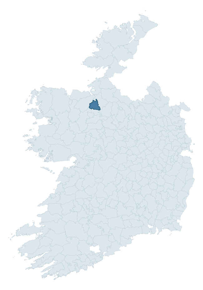
Where this barony sits in the Republic of Ireland
Geology and preservation
Bedrock geology shapes the landscape long before any settlement begins — controlling soil drainage, agricultural potential, the survival of upstanding monuments, and the preservation of buried archaeology. The figures below come from the Geological Survey Ireland 1:100,000 bedrock map.
The bedrock underlying Corran is predominantly limestone (70% of the barony by area), laid down during the Carboniferous period (100% by area, around 359 to 299 million years ago). Limestone is the most heritage-rich bedrock in Ireland. It supports fertile, well-drained soils that favoured dense Early Medieval settlement and Norman manorial agriculture, and it weathers into karst features — sinkholes, caves, swallow holes, and souterrains — that frequently carry archaeology. Where peat overlies limestone, organic preservation can be exceptional. A substantial secondary geology of shale, limestone (21%) adds further variety to the underlying landscape. The single largest mapped unit is the Lower Bricklieve Limestone Formation (51% of the barony's bedrock).
Rock type composition
Largest mapped unit: Lower Bricklieve Limestone Formation (51% of the barony)
Placename evidence
Logainm records 48 heritage-diagnostic placenames for Corran, drawn from townland and civil-parish names across the barony. The dominant stratum is pre-Christian and Early Medieval defensive — ráth-, lios-, dún-, and caiseal-prefixed names that mark Iron Age and early historic settlement. The leading diagnostic roots are cill- (19 — church), ráth- (12 — earthen ringfort), and lios- (8 — ringfort or enclosure). This is above the ROI average of 30.7 heritage placenames per barony. The presence of multiple heritage strata side by side indicates layered occupation of the landscape across successive prehistoric and historic periods. Logainm records 229 placenames for Corran (predominantly townland names). Of these, 48 (21%) carry one of the diagnostic Gaelic roots tracked above; the remainder draw on more generic landscape vocabulary that does not encode a heritage period.
Pre-Christian / Early Medieval Defensive
| Root | Count | Meaning |
|---|---|---|
| ráth- | 12 | earthen ringfort |
| lios- | 8 | ringfort or enclosure |
| dún- | 1 | hilltop or promontory fort |
| caiseal- | 1 | stone ringfort |
Early Christian Ecclesiastical
| Root | Count | Meaning |
|---|---|---|
| cill- | 19 | church (early) |
| teampall- | 1 | church (later medieval) |
Burial, Ritual, and Norse-Contact
| Root | Count | Meaning |
|---|---|---|
| dumha- | 3 | mound |
| tuaim- | 2 | burial mound |
| carn- | 1 | cairn |
About this profile
Click any section below to expand.
What is a barony?
A barony is a historic administrative unit in Ireland, broadly equivalent to an English hundred. The 280 baronies used here are from the OSi 2019 National Statutory Boundaries (generalised 20m), covering the 26 counties of the Republic of Ireland. Baronies derive from the Norman period, were formalised in the 17th century, and have not been redrawn for statistical purposes. They vary enormously in area, from compact urban baronies in Dublin to vast upland baronies in Connacht, and should not be compared by raw site count without accounting for area differences.
What counts as a site?
This profile combines three distinct heritage registers, each with its own definition of what constitutes a recordable site:
- Archaeological sites (NMS). The National Monuments Service Sites and Monuments Record (SMR) catalogues every known archaeological monument or site of archaeological interest in the Republic, from prehistoric burial mounds and ringforts to medieval churches and post-medieval defensive works. Inclusion does not require legal protection — only that the site has been identified, surveyed, and assessed as having archaeological value. A separate subset of these sites lies within a recorded protection zone, which gives them statutory protection under the National Monuments Acts.
- Listed buildings (NIAH). The National Inventory of Architectural Heritage records buildings of architectural, historical, archaeological, artistic, cultural, scientific, social, or technical interest. Each surveyed structure is appraised on a five-tier scale: International, National, Regional, Local, and Record-Only. The NIAH appraisal is informational rather than strictly statutory, but it underpins local-authority Record of Protected Structures (RPS) listings.
- Heritage placenames (Logainm). Logainm is the authoritative database of Irish placenames maintained by the Placenames Branch. This profile applies a heritage-diagnostic classifier to the Irish-language form of each townland name, flagging roots that signal defensive sites (ráth-, lios-, dún-, caiseal-, cathair-), ecclesiastical foundations (cill-, teampall-, domhnach-, mainistir-), prehistoric burial-ritual features (tuaim-, carn-, leaba-), or Norse-contact settlement (gall-). Townlands without one of these diagnostic roots are not flagged here — they may still carry historical significance, but that significance is not encoded in the name itself.
Editorial principles
The narrative sections of this profile follow several explicit principles:
- Evidential. Every claim about this barony’s heritage character is anchored in the underlying register data. Where a site count, a placename count, or a percentile rank is cited, it is computed from the source datasets at export time, not estimated.
- Comparative. Counts and metrics are reported alongside their percentile rank against the other 279 ROI baronies. A barony with 50 ringforts in absolute terms could be unusually high or unusually low depending on its size and regional context; percentile ranking removes that ambiguity.
- Transparent on limits. Where a register has known coverage gaps, survey biases, or data-quality issues that affect this barony’s figures, the profile flags them rather than presenting the numbers as definitive.
- No interpretation beyond what the data supports. The narrative does not speculate about historical events, social dynamics, or cultural meaning beyond what the recorded heritage and placename evidence directly attests.
Data caveats and limits
- NMS Sites and Monuments Record is the product of survey campaigns conducted at different intensities across different counties and decades. Some baronies have been surveyed more thoroughly than others, and absolute counts should be read in that light. Sites destroyed by development before survey are typically not represented; sites in heavily forested or upland terrain are sometimes under-recorded.
- NIAH coverage is broadly complete for the Republic of Ireland but the survey was conducted on a rolling county-by-county basis, and the most recent appraisal date varies. Buildings demolished or substantially altered after their original survey may still appear in the register; conversely, recent buildings of merit may not yet have been appraised.
- Logainm classification applies a deliberately conservative pattern-matching approach to the Irish-language townland forms. The classifier prioritises true positives over recall: a townland may carry a heritage signal that the classifier doesn’t recognise, particularly where the diagnostic root has been heavily anglicised or where the townland name draws on a less common term. The 60,000+ townland records and ~9,800 classified placenames give a substantial signal at barony scale, but individual townland names should be checked against Logainm directly for definitive interpretation.
- Period attribution. The chronological distribution reflects only those NMS sites that carry a recognised period attribution in the source data. Sites listed as “Unknown” period are excluded from the dated subset.
- Boundary changes. Some baronies have undergone minor boundary adjustments since their 19th-century definition; the OSi 2019 generalised boundaries used here are the current statutory definition and may differ slightly from historical maps in border areas.
- Bedrock geology is mapped at 1:100,000 scale, which means local variation within a barony — small pockets of different rock type, mineral veins, alluvium overlying bedrock — is generalised. The dominant-system and rocktype figures are area-weighted, so a barony reading “70% Carboniferous limestone” may still contain small but archaeologically important pockets of older or younger rock. Around 3% of GSI polygons do not match the lexicon and contribute no rocktype or system attribution.
Data sources
- National Monuments Service — Sites and Monuments Record (SMR) https://data.gov.ie/dataset/national-monuments-service-archaeological-survey-of-ireland
- National Inventory of Architectural Heritage (NIAH) https://data.gov.ie/dataset/national-inventory-of-architectural-heritage-niah-national-dataset
- Logainm — Placenames Database of Ireland https://www.logainm.ie/
- Ordnance Survey Ireland — National Statutory Barony Boundaries 2019 https://data-osi.opendata.arcgis.com/
- EURODEM — European Digital Elevation Model https://www.mapsforeurope.org/datasets/euro-dem
- ESA WorldCover https://esa-worldcover.org/en
- Geological Survey Ireland — 1:100,000 Bedrock Geology https://www.gsi.ie/en-ie/data-and-maps/Pages/Bedrock.aspx
Explore more: Search any of the 280 ROI baronies, browse by historical province, or read the methodology and data sources for the full Republic of Ireland Heritage Tool.