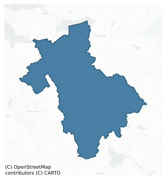
Tirerrill is a barony of County Sligo, in the historical province of Connacht (Irish: Tír Oirill), covering 322 km² of land. The barony records 1,221 NMS archaeological sites and 95 NIAH listed buildings, placing it at around the 91st percentile among 280 ROI baronies for sites per km². This means it is in the top tenth of all baronies for sites per km². Dated archaeological evidence runs from the Neolithic through to the Post Medieval, spanning 7 of 9 archaeological periods, placing the barony in the 44th percentile among 280 ROI baronies for chronological depth. This means it is in the lower half of all baronies for chronological depth. The largest dated subset of recorded sites dates to the Early Medieval. Logainm flags 45 placenames in the barony as carrying a recognised heritage root; the largest share — around 53% — are names associated with pre-christian defensive.
Heritage at a glance
Percentile rankings throughout this profile compare each barony only against the other 279 Republic of Ireland baronies.
The recorded heritage of Tirerrill
The National Monuments Service Sites and Monuments Record (SMR) is the statutory inventory of archaeological sites for the Republic of Ireland, maintained by the Department of Tourism, Culture, Arts, Gaeltacht, Sport and Media. Sites recorded here include earthworks, ringforts, megalithic tombs, ecclesiastical remains, and post-medieval features; not every record is legally protected, but each is registered as a monument of archaeological interest.
The National Monuments Service records 1,221 archaeological sites in Tirerrill, putting it at the 91st percentile among 280 ROI baronies for sites per km². This means it is in the top tenth of all baronies for sites per km². Protection coverage is near-universal — 1,199 sites (98%) fall within a recorded monument protection zone, indicating an extensively surveyed landscape. The dominant category is defensive sites — ringforts, enclosures, hillforts, and stone forts (766 sites, 63% of the record). Ringfort – rath is the most prevalent type, making up 35% of the barony's recorded sites (425 records) — well above the ROI average of 20% across all baronies where this type occurs. Ringfort – rath is an earthen ringfort enclosed by a bank and external ditch — the most common Early Medieval farmstead, broadly dated 500–1000 AD. Other significant types include Enclosure (134) and Souterrain (78). Enclosure is a banked or ditched feature of uncertain type, used as a catch-all where the original function cannot be determined from surface evidence; Souterrain is an underground stone-built passage and chamber, generally Early Medieval and often associated with ringforts as a defensive or storage feature. Across the barony's 322 km², this gives a recorded density of 3.79 sites per km².
Most common monument types
Hover or tap a monument type to see its definition.
| Type | Count |
|---|---|
| Ringfort – rath an earthen ringfort enclosed by a bank and external ditch — the most common Early Medieval farmstead, broadly dated 500–1000 AD | 425 |
| Enclosure a banked or ditched feature of uncertain type, used as a catch-all where the original function cannot be determined from surface evidence | 134 |
| Souterrain an underground stone-built passage and chamber, generally Early Medieval and often associated with ringforts as a defensive or storage feature | 78 |
| Ringfort – cashel the stone-walled equivalent of the rath, found mainly in upland or western areas, broadly dated 500–1000 AD | 74 |
| Hut site a low stone or earthen foundation enclosing a small circular or oval area, generally interpreted as a former dwelling, of any date from prehistory to the medieval period | 45 |
| Ritual site – holy well a well or spring traditionally associated with a saint, often credited with healing properties; many trace earlier ritual origins but devotion is documented from the medieval period onwards | 31 |
| Church a building used for public Christian worship, of any date from c. 500 AD onwards | 23 |
Chronological distribution
The dated archaeological record for Tirerrill spans from the Neolithic through to the Post Medieval, with activity attested across 7 of 9 archaeological periods. Every period from earliest to latest is represented in the record — an unbroken sequence of dated activity across the full chronological span. Activity concentrates most heavily in the Early Medieval (683 sites, 64% of dated material), with the Iron Age forming a secondary peak (183 sites, 17%). A further 161 recorded sites (13% of the overall NMS register for the barony) carry no period attribution — appearing as 'Unknown' in the bar chart below. This typically reflects either records that pre-date the standardised period vocabulary or sites awaiting specialist dating review, rather than a genuine absence of chronological evidence.
Sample of recorded monuments
Show 25 sample monuments (of 1,221 total)
A representative sample of 25 recorded monuments drawn from the barony’s 1,221 total NMS entries. Sites within a recorded monument protection zone and rarer site types are prioritised so the list shows a meaningful cross-section rather than only the most common type. Each entry shows the official Sites and Monuments Record reference number and the description published by the National Monuments Service.
Stone row
In a coniferous forest, on flat ground. A row of three stones, two of which are upright, aligned NNE-SSW. The NNE stone (c. 0.75m x 0.6m) is prostrate but when upright would have been at least 1.6m high. The centre…
In a coniferous forest, on flat ground. A row of three stones, two of which are upright, aligned NNE-SSW. The NNE stone (c. 0.75m x 0.6m) is prostrate but when upright would have been at least 1.6m high. The centre stone is the tallest (H 1.7m; 0.8m x 0.55m) and its long axis is transverse to the alignment of the row. The SSW stone (H 0.6m; 0.6m x 0.6m) is also upright. The stones are known locally as 'Clogh a gadaide or the Thief's stone' (O'Rorke [1889], vol. 2, 239). (Kilgannon 1926, 241-2)
The above description is derived from the published 'Archaeological Inventory of County Sligo' compiled by Ursula Egan, Elizabeth Byrne, Mary Sleeman with Sheila Ronan and Connie Murphy (Dublin Stationery Office, 2005).
Date of upload: 18 January 2008
Mill – unclassified
Not included in the SMR (1989) but listed in the RMP (1995) and classified 'Mill'. On the E bank of the Owenmore river, on the N side of Collooney. Most of the mill complex is demolished though the remains of wheel-pits…
Not included in the SMR (1989) but listed in the RMP (1995) and classified 'Mill'. On the E bank of the Owenmore river, on the N side of Collooney. Most of the mill complex is demolished though the remains of wheel-pits and arched headraces and tailraces are evident. Some ancillary late 19th-century mill buildings remain, the main blocks are around and attached to a church and graveyard (SL020-203001- and SL020-203002-) on the E side of the cleared yard. The ruins of late 18th-century buildings on the river front and to one side of the lumber yard were noted during a previous inspection in 1992 (SMR (1989) file). A substantial bleach mill complex still stands on the opposite bank of the river (see SL020-272—-). According to local information, both mills were owned by the Sims family. Valuation Office Mill Books recorded Alex Sims as the miller of a flour mill in Collooney, powered by a waterwheel (diam. 36ft [10.97m]; breath 8ft [2.43m]), which turned six pairs of stones (Hogg 1998, 108). According to Wood-Martin (1882, 240), Collooney mills 'occupy the site of a much older concern'. This mill is probably post-1700 AD in date.
Compiled by: Archaeological Survey Unit, UCC
Date of upload: 12 December 2011
Altar
In the centre of a cashel (SL020-218002-). A large block of stone named 'Druid's Altar' on the 1913 OS 6-inch map. According to Wood-Martin (1887-8, 262-3), it is known locally as 'Patrick's altar' and described as an…
In the centre of a cashel (SL020-218002-). A large block of stone named 'Druid's Altar' on the 1913 OS 6-inch map. According to Wood-Martin (1887-8, 262-3), it is known locally as 'Patrick's altar' and described as an 'almost quadrangular limestone block, 5 feet 8 inches [1.72m] by 5 feet 4 inches [1.62m] and 2 feet 4 inches [0.7m] in thickness'. The ground surrounding the cashel was known as 'Patrick's pasture' (O'Rorke 1878, 93-4) and St Patrick's well (SL020-217—-) is c. 160m to SSW.
The above description is derived from the published 'Archaeological Inventory of County Sligo' compiled by Ursula Egan, Elizabeth Byrne, Mary Sleeman with Sheila Ronan and Connie Murphy (Dublin Stationery Office, 2005).
Date of upload: 18 January 2008
Embanked enclosure
In pasture, located in the level base of a broad natural depression ringed by rising ground. The Ballygawley Mountains form a dramatic backdrop on the horizon at N-NE. A circular area (45m E-W) enclosed by a broad earth…
In pasture, located in the level base of a broad natural depression ringed by rising ground. The Ballygawley Mountains form a dramatic backdrop on the horizon at N-NE. A circular area (45m E-W) enclosed by a broad earth and stone bank (Wth 5.5m; int. H 0.7m; ext. H 0.7m) with the remains of stone kerbing along the internal bank face along the E arc. The entrance (Wth 9m) is at E. A field boundary curves around the bank along the NE arc.
There is a mound barrow (SL021-102—) 300m to NE and a portal tomb (SL021-058—-) 380m to NNE.
The above description is derived from the published 'Archaeological Inventory of County Sligo' compiled by Ursula Egan, Elizabeth Byrne, Mary Sleeman with Sheila Ronan and Connie Murphy (Dublin Stationery Office, 2005).
Attached images:
SL021-051—-_01.JPG Viewed from SE
SL021-051—-_02.JPG Viewed from E
SL021-051—-_03.JPG Enclosing bank at E
Date of revised upload: 29 November 2018
Country house
Listed in both the SMR (1989) and RMP (1995) and classified 'Castle Possible' and 'Castle Possible Site' respectively. It had originally been classified as a possible castle because, according to Martin Timoney (pers.…
Listed in both the SMR (1989) and RMP (1995) and classified 'Castle Possible' and 'Castle Possible Site' respectively. It had originally been classified as a possible castle because, according to Martin Timoney (pers. comm. SMR (1989) file), there was the 'stump of old tower behind house'. This tower was not located according to the SMR (1989) file. According to Timoney (unpublished archaeological assessment report for Castledargan Golf Course, 2000, 12) the above information was given by a local in the mid-1970s and that Martin Timoney had not seen the tower himself. In his report he describes the above as 'an old water pump' with a walled garden curving around it which could have been 'interpreted as being a tower'. In relation to the Country House, O'Brien (2000, 6) states in his report that, there is no documentary evidence relating to a building date. However in the light of a possible mid-1700s date suggested by architect Dr. F. O'Dwyer (Timoney c. 2000, 13), O'Brien (2000, 6) states that because of 'the improving family circumstances … and the presence of more that one household in the 1949 Elphin Census, the building of Castledargan House in the mid-1700s would not be and unreasonable supposition.' Martin Timoney (phonecall July 2003) adds that three large beams of worked oak with mortice holes and dowels were found in the house, reused as lintels. The house is dated to c. 1750 with much rebuilding in the 1850s.
Compiled by Archaeological Survey Unit, UCC
D…
Designed landscape – folly
Not included in the SMR (1989). Listed in the RMP (1995) and classified 'Church'. This folly is incorporated into the SSE wall of an enclosed orchard immediately to E of Castledargan House (SL021-109001-). The avenue to…
Not included in the SMR (1989). Listed in the RMP (1995) and classified 'Church'. This folly is incorporated into the SSE wall of an enclosed orchard immediately to E of Castledargan House (SL021-109001-). The avenue to the house is located on the SE side of the wall. An intervening border of rhododendron bushes obscures the SE face of the wall. The wall (8.4m NE-SW; H 2.7m) consists of coursed, mortared stone. A round-arched doorway with cut-stone surround is centrally placed in the wall. To E of the door is a round arched window with a cut-stone surround. Both the door and window openings have been carefully blocked up with drystone walling. At the NE end of the wall, two coursed stones protrude from the base of the NW face, possibly a remnant of a return wall to NW. This is not a church or any ancient feature but rather a demesne feature or folly in the walled garden of Castledargan (ibid.). This monument is post-1700 AD in date.
Compiled by: Archaeological Survey Unit, UCC
Date of upload: 11 January 2012
Linear earthwork
On top of a mountain ridge, to the NE of Slieve Daeane, with good views in all directions. A heather and sod-covered rise (Wth 2.2m; H 0.9m), partially topped by a post-and-wire fence, extends in a NE-SW direction for…
On top of a mountain ridge, to the NE of Slieve Daeane, with good views in all directions. A heather and sod-covered rise (Wth 2.2m; H 0.9m), partially topped by a post-and-wire fence, extends in a NE-SW direction for c. 1.6km along the boundary between the baronies of Carbury and Tirerrill.
The above description is derived from the published 'Archaeological Inventory of County Sligo' compiled by Ursula Egan, Elizabeth Byrne, Mary Sleeman with Sheila Ronan and Connie Murphy (Dublin Stationery Office, 2005).
Date of upload: 18 January 2008
Hilltop enclosure
In undulating pasture, on top of a ridge with excellent views of the surrounding countryside. Named 'The Cashel' on the 19 OS 6-inch map, this hilltop enclosure, consists of an oval area (65m N-S; 50m E-W) enclosed by a…
In undulating pasture, on top of a ridge with excellent views of the surrounding countryside. Named 'The Cashel' on the 19 OS 6-inch map, this hilltop enclosure, consists of an oval area (65m N-S; 50m E-W) enclosed by a stone wall. The wall, which is highest along the W arc (T 0.6m; H 1.3m), has a rubble core with a facing of stone. Condit, Gibbons and Timoney (1991, 61-2) suggest that a gap through the wall at S may be the original entrance. The interior rises towards the centre. A field boundary indicated on the 1838 OS 6-inch map bisecting the interior on a NW-SE axis, was not indicated on the 1913 OS 6-inch map. A rath (SL026-140—-) lies c. 190m to SSE.
The above description is derived from the published 'Archaeological Inventory of County Sligo' compiled by Ursula Egan, Elizabeth Byrne, Mary Sleeman with Sheila Ronan and Connie Murphy (Dublin Stationery Office, 2005). In certain instances the entries have been revised and updated.
Date of upload: 18 January 2008
Walled garden
Not included in the SMR (1989) but listed in the RMP (1995) and classified 'Barrack – Infantry, Possible'. The source of the reference to a 'barrack' at Collooney is unknown (see Timoney 2002). This is a rectangular…
Not included in the SMR (1989) but listed in the RMP (1995) and classified 'Barrack – Infantry, Possible'. The source of the reference to a 'barrack' at Collooney is unknown (see Timoney 2002). This is a rectangular field surrounded by high walls and, according to local information, was an orchard for the nearby convent. An archaeological assessment by Martin Timoney (1999) and test trenching (Conway 2000, 274; Timoney 2012) revealed nothing of archaeological significance. This walled garden is probably post-AD 1700 in date.
Compiled by: Paul Walsh
Date of upload: 7 June 2012
Bullaun stone (present location)
In a farmyard. Found in a nearby field and moved to its present location (pers. comm. M. A. Timoney). A stone (H 0.4m; Wth 0.65m) with a central circular hollow (Wth c. 0.45m; D c. 0.2m). A beehive quernstone was also…
In a farmyard. Found in a nearby field and moved to its present location (pers. comm. M. A. Timoney). A stone (H 0.4m; Wth 0.65m) with a central circular hollow (Wth c. 0.45m; D c. 0.2m). A beehive quernstone was also found here.
The above description is derived from the published 'Archaeological Inventory of County Sligo' compiled by Ursula Egan, Elizabeth Byrne, Mary Sleeman with Sheila Ronan and Connie Murphy (Dublin Stationery Office, 2005).
Date of upload: 18 January 2008
Promontory fort – inland
In pasture, occupying a rocky bluff at the N end of a low narrow ridge. The roughly rectangular end of the bluff (28m N-S; 17m E-W) is defined to E, N and W by steep slopes topped by low field boundary walls, and to S…
In pasture, occupying a rocky bluff at the N end of a low narrow ridge. The roughly rectangular end of the bluff (28m N-S; 17m E-W) is defined to E, N and W by steep slopes topped by low field boundary walls, and to S by a scarp (H c. 1m) which slopes irregularly down to S. The site of Castle Douglas (SL027-124001-) is c. 8m to S.
The above description is derived from the published 'Archaeological Inventory of County Sligo' compiled by Ursula Egan, Elizabeth Byrne, Mary Sleeman with Sheila Ronan and Connie Murphy (Dublin Stationery Office, 2005).
Date of upload: 18 January 2008
Cross – High cross
In the centre of a graveyard (SL027-141002-), 4m E of the ruin of Drumcolumb church (SL027-141001-) and within the N half of an ecclesiastical enclosure (SL027-141—-). Described by Crawford (1918, 177) as the 'head of…
In the centre of a graveyard (SL027-141002-), 4m E of the ruin of Drumcolumb church (SL027-141001-) and within the N half of an ecclesiastical enclosure (SL027-141—-). Described by Crawford (1918, 177) as the 'head of a plain cross with solid recessed ring… broken in two places'. A sketch from 1914 shows these two breaks, one above and the other below the ring (SMR (1989) file). The cross (H 0.5m; Wth 0.45m; T 0.1m), which is set upright in a low cairn of stones, is now eroded and weathered and the projecting arm above the ring (at the old break) has broken off. The arms project beyond the ring on one side but not on the other. Harbison (1992b, vol. 1, 74) noted that the four 'depressions' between the arms and the ring which are present on one face are only pecked out on the other face. He also stated that 'the cross-head could be later than 1200' (ibid.).
The above description is derived from the published 'Archaeological Inventory of County Sligo' compiled by Ursula Egan, Elizabeth Byrne, Mary Sleeman with Sheila Ronan and Connie Murphy (Dublin Stationery Office, 2005).
Date of upload: 18 January 2008
Religious house – unclassified
Incorporated into a farmyard, on an E-facing upland terrace overlooking Lough Arrow to the NE. Two discrete sections of walling survive which appear to be the end-walls of a rectangular building (ext. L 17.5m N-S). Both…
Incorporated into a farmyard, on an E-facing upland terrace overlooking Lough Arrow to the NE. Two discrete sections of walling survive which appear to be the end-walls of a rectangular building (ext. L 17.5m N-S). Both sections (T 1.1m) are similar in construction; mortared limestone rubble laid in intermittant courses. The N section (L 5.5m; H 2.25m) contains the NW corner of the building, with a short return of the W wall (L 1.25m). Through the N wall is a blocked-up opening (Wth 1m; H 1.55m) which may have been a doorway. This wall forms the end-wall of a small shed. The S section (L 2.2m; H 2.3m) is very fragmentary and has also been used as the wall of a small shed. On the internal wall-face, 0.65m above ground level, is a wall-press (Wth 0.65m; H 0.55m; D 0.5m). Extending E from this section, and apparently a continuation of it, are low fragmentary wall-footings (H c. 0.3m; L c. 4.5m) ending in a jumble of stones at the foot of a cedar tree. This suggests that the original structure was at least 7m in width.
According to local information, human bones (SL040-186002-) were found on the N side of the structure during construction works. Described in 1836 as 'the remains of old walls called by the people Teach na gCaileachaidh Dúbha [the house of the Black Nuns], which they say was a nunnery' (OSL, 157). Wood-Martin (1882, 66) noted the doorway in the N wall, and also mentioned that the greater portion of the building had fallen down the precipice where its ruins lay…
Blockhouse
In pasture, on a NW-facing slope. The ruin of a four-storey structure consisting of a rectangular block (int.: 6m NE-SW; 4.3m NW-SE) with a circular tower (diam. 4.7m) at each corner (see plan in Waterman 1961, fig.…
In pasture, on a NW-facing slope. The ruin of a four-storey structure consisting of a rectangular block (int.: 6m NE-SW; 4.3m NW-SE) with a circular tower (diam. 4.7m) at each corner (see plan in Waterman 1961, fig. 14.6; photograph Ó Muraíle 2002, 236; photo, plans and drawings Harbison 2002, 98-100 and figs 81-4). It is built of limestone rubble in a lime mortar with a gentle base-batter. The structure was substantially repaired by the OPW c. 1940 when nearly every embrasure was rebuilt to some extent and concrete lintels inserted. The walls of the corner towers stand mostly to full height but the NE and SE walls of the main block are missing and the SW and NW walls are largely rebuilt, especially on the inside. The internal floors were all wooden but none have survived. Also gone is the spiral wooden stairs housed in the W tower.
The lowest floor may have been an unlit basement as there is no apparent access door or windows. The only surviving features are three gun loops: one in the main NW wall and one each in the E and S towers facing each other and covering the front face of the main SE wall. The loops are small splayed embrasures with plain rectangular openings in front (H c. 0.15m; Wth c. 0.5m). The entrance doorway on the first floor at the SW end of the NW wall is almost entirely rebuilt but a socket for a drawbar survives. According to Waterman (1961, 271), the door was reinforced by 'a sliding gate working portcullis-wise which could be raised into a recess a…
Sheela-na-gig
Built into the inside wall of a farm building immediately E of Behy Castle (SL034-001001-). A rectangular punch-dressed limestone block (0.85m x 0.45m) which was probably originally a quoin stone in the adjacent castle.…
Built into the inside wall of a farm building immediately E of Behy Castle (SL034-001001-). A rectangular punch-dressed limestone block (0.85m x 0.45m) which was probably originally a quoin stone in the adjacent castle. Carved in low relief at one end of the stone is a full figure sheela-na-gig (L 0.35m), now painted pink, whilst at the other end is an 'X' picked out in three lines of pick marks. (O'Shaughnessy and Weaver 1992, 8; McMahon and Roberts 2001, 117-18)
The above description is derived from the published 'Archaeological Inventory of County Sligo' compiled by Ursula Egan, Elizabeth Byrne, Mary Sleeman with Sheila Ronan and Connie Murphy (Dublin Stationery Office, 2005).
Date of upload: 18 January 2008
Barrow – embanked barrow
In level pasture, near the SE end of a ridge. Views are good to excellent in all directions. A circular raised area (overall diam. 8.65m) defined by an earthen bank (int. H 0.25-0.35m; ext. H 0.55-0.65m). The internal…
In level pasture, near the SE end of a ridge. Views are good to excellent in all directions. A circular raised area (overall diam. 8.65m) defined by an earthen bank (int. H 0.25-0.35m; ext. H 0.55-0.65m). The internal face of the bank has a long gentle slope while the external face is much sharper. The bank is broken at S (Wth 3m) due to the collapse of a hawthorn tree which has left a small depression in it. The interior (diam. 3.5m) is level and clear of overgrowth.
The above description is derived from the published 'Archaeological Inventory of County Sligo' compiled by Ursula Egan, Elizabeth Byrne, Mary Sleeman with Sheila Ronan and Connie Murphy (Dublin Stationery Office, 2005).
Date of upload: 18 January 2008
Ritual site – holy tree/bush
In rough pasture, on the N-facing slope of a low rise. A mature sycamore tree grows on the S edge of a penitential cairn (SL034-070002-). Wood-Martin (1892, 372) referred to the many legends and traditions attached to…
In rough pasture, on the N-facing slope of a low rise. A mature sycamore tree grows on the S edge of a penitential cairn (SL034-070002-). Wood-Martin (1892, 372) referred to the many legends and traditions attached to this tree 'some of which are yet current'. In 1836 it was noted that Catholics are said to have performed stations here (OSNB vol. 1, 468). It is known locally as a site of stations or 'pattern'.
The above description is derived from the published 'Archaeological Inventory of County Sligo' compiled by Ursula Egan, Elizabeth Byrne, Mary Sleeman with Sheila Ronan and Connie Murphy (Dublin Stationery Office, 2005).
Date of upload: 18 January 2008
Cross – Tau cross
In Tawnagh graveyard (SL034-085002-), just inside the E boundary wall and 10.8m E of the gable of a ruined church (SL034-085001-). A Tau cross (H 0.51m) is set upright in a line of low uninscribed grave-markers and…
In Tawnagh graveyard (SL034-085002-), just inside the E boundary wall and 10.8m E of the gable of a ruined church (SL034-085001-). A Tau cross (H 0.51m) is set upright in a line of low uninscribed grave-markers and positioned directly between two 20th-century headstones. The shaft (H 0.36m) of the cross is 0.28m wide at the base but tapers to 0.21m at the junction with the arms. The arms (H 0.15m) of the cross have rounded ends which project 0.09m on either side of the shaft. The overall width of the upper portion of the cross, is 0.41m. On the E face of the cross, just below the junction of the arms and shaft, is incised a small plain Greek cross.
The above description is derived from the published 'Archaeological Inventory of County Sligo' compiled by Ursula Egan, Elizabeth Byrne, Mary Sleeman with Sheila Ronan and Connie Murphy (Dublin Stationery Office, 2005).
Date of upload: 18 January 2008
Barrow – stepped barrow
In undulating elevated pasture, on a slight NNW-facing slope. There are excellent views N-SE though views are moderate to poor in other directions. A slightly raised circular area (diam. 22m) defined by a fosse (Wth 2m;…
In undulating elevated pasture, on a slight NNW-facing slope. There are excellent views N-SE though views are moderate to poor in other directions. A slightly raised circular area (diam. 22m) defined by a fosse (Wth 2m; D 0.3m) and an external bank (Wth 2m; int. H 1m; ext. H 0.8m). The bank has internal and external stone revetments. In the centre of the interior is a slightly raised circular platform (diam. 6m; H 0.4m) defined by a low bank or sod-covered stone foundations (Wth 0.4m). Extending from it to the inner edge of the fosse at W and N are two linear earthen banks (Wth 1m; H 0.4m; L c. 9m), that to N marked by a boulder at its S terminus. At NNW is a small earthen mound (4m E-W; H 1m), partially incorporated into the enclosing bank but projecting 1.5m from its external face. A N-S field boundary lies immediately to W.
The above description is derived from the published 'Archaeological Inventory of County Sligo' compiled by Ursula Egan, Elizabeth Byrne, Mary Sleeman with Sheila Ronan and Connie Murphy (Dublin Stationery Office, 2005).
Date of upload: 18 January 2008
Holed stone
In a wall bounding a narrow road which forms the townland boundary between Brickeen and Bellanagarrigeeny or Castlebaldwin. A limestone slab (H 0.7m; Wth 0.55) set upright in the stone wall. A circular perforation…
In a wall bounding a narrow road which forms the townland boundary between Brickeen and Bellanagarrigeeny or Castlebaldwin. A limestone slab (H 0.7m; Wth 0.55) set upright in the stone wall. A circular perforation (diam. 0.15m) centrally placed c. 0.55m below the top of the stone, extends obliquely (D c. 0.35m) through the thickness of the stone. This stone was described by Prof. R. A. S. Macalister (d. 1950) in an undated report (SMR (1989) file). The perforation appears to be a natural phenomenon.
Compiled by: Archaeological Survey Unit, UCC with revisions by Patrick F. O'Donovan and Paul Walsh
Date of upload: 20 June 2011
Religious house – Dominican friars
In pasture, on a S-facing slope overlooking Lough Arrow and forming the SW corner of Ballindoon graveyard (SL034-211002-), which lies within an early ecclesiastical enclosure (SL034-21104-). The priory is on a ledge…
In pasture, on a S-facing slope overlooking Lough Arrow and forming the SW corner of Ballindoon graveyard (SL034-211002-), which lies within an early ecclesiastical enclosure (SL034-21104-). The priory is on a ledge from which the ground drops abruptly to Lough Arrow c. 6m below. The remains of the priory (Pl. 52) comprise of the ruin of the church consisting of a nave (int. 13.5m E-W; 6.9m N-S) and chancel (int. 8.2m E-W; 6.9m N-S) divided by a tower with a short transept (int. 4.1m N-S; 4m E-W) at the E end of the N wall of the nave. The church is built of uncoursed limestone in a lime mortar. The interior contains many burial memorials ranging in date from the 17th to the 19th centuries. It is entered through a doorway midway along the N wall of the nave; the chamfered door surround has a pointed arch and a decorated stop-chamfer and a hood-moulding; the doorway is covered by a segmental wicker-centred vault. Inside on its E side, is a stoup with an octagonal basin. The nave is lit by two windows: one in the centre of the W gable and the other near the E end of the S wall. The light of the W window has two mullions rising to three round sub-arches with switchline tracery above. The embrasure is deeply splayed with a rear pointed arch. The window in the S wall has a lintelled embrasure and a double round-headed light which is missing its mullion. The transept is an insertion, entered from the nave through a wide semicircular archway; it is lit by a single window high up…
Kerb circle
In pasture, on an E-facing slope amidst rock outcrops. A roughly circular area (diam. 17m x 18m) enclosed by 25 almost contiguous stones. The stones range in size from 0.95m x 0.45m to 1.3m x 2m. Most are bedded on…
In pasture, on an E-facing slope amidst rock outcrops. A roughly circular area (diam. 17m x 18m) enclosed by 25 almost contiguous stones. The stones range in size from 0.95m x 0.45m to 1.3m x 2m. Most are bedded on their sides though a few of the smaller ones are upright. Several gaps were noted between the stones. The interior is raised slightly on the E side to compensate for the hillslope. Three flat sod-covered slabs were noted in the interior. The townland boundary between Cabragh and Garoke bisects the kerb circle on a NE-SW axis, six of the stones being on the SE side of the boundary.
The above description is derived from the published 'Archaeological Inventory of County Sligo' compiled by Ursula Egan, Elizabeth Byrne, Mary Sleeman with Sheila Ronan and Connie Murphy (Dublin Stationery Office, 2005).
Date of upload: 18 January 2008
Kiln – corn-drying
In the interior of a cashel (SL035-045001-). An oval stone-built structure (int. diam. 5m x 6m; H 0.4m; wall T 1.5m) with a curving entrance passage (L 4.9m; Wth 0.95m) on its E side.
The above description is derived…
In the interior of a cashel (SL035-045001-). An oval stone-built structure (int. diam. 5m x 6m; H 0.4m; wall T 1.5m) with a curving entrance passage (L 4.9m; Wth 0.95m) on its E side.
The above description is derived from the published 'Archaeological Inventory of County Sligo' compiled by Ursula Egan, Elizabeth Byrne, Mary Sleeman with Sheila Ronan and Connie Murphy (Dublin Stationery Office, 2005).
Date of upload: 18 January 2008
Tomb – unclassified
In mountain bog, on a SW-facing slope and 8m NE of 'Toberelba', a holy well (SL035-073001-). 'St Elba's Grave' consists of three elements: a flat slab, an upright slab and a modern cross. The flat uninscribed…
In mountain bog, on a SW-facing slope and 8m NE of 'Toberelba', a holy well (SL035-073001-). 'St Elba's Grave' consists of three elements: a flat slab, an upright slab and a modern cross. The flat uninscribed rectangular limestone slab (L 3m; Wth 1m; T 0.3m; long axis NE-SW) is obscured along its edges by peat and moss. At the NE end of this slab is an upright rectangular limestone slab (Wth 0.46m; H 0.85m; T 0.15m) cemented to the SW side of the plinth on which the modern cross stands. The slab has been shaped, but not dressed, to give angular corners and is inscribed 'I H S' (the 'S' being reversed). Cemented to the top of this slab, on the same alignment, is a roughly square limestone flag (Wth 0.5m; H 0.4m; T 0.08m). To the NE of the flat slab is a modern granite cross (inscribed 'A M D C' across the arms facing SW) on a plinth of three tiers (base 2.05m square; H 2.9m). On the lowest tier (H 1.1m) are tokens, including some euro coins in a tin, indicating recent pilgrim visits. According to tradition, the large flat stone is the grave of Saint Aillbe and people suffering from illness who sleep soundly overnight on the stone are cured of their ailments (ITA). There is a penitential station (SL035-073003-) 1.6m to SE.
The above description is derived from the published 'Archaeological Inventory of County Sligo' compiled by Ursula Egan, Elizabeth Byrne, Mary Sleeman with Sheila Ronan and Connie Murphy (Dublin Stationery Office, 2005).
Date of upload: 18 January 2008
Ringfort – rath
In undulating pasture, on a rise and within the demesne of Markree Castle (SL026-038—-). A raised circular area (int. diam. 21m) enclosed by a ruinous stone wall (T 2.7m; int. H 0.5m; ext. H 3m) and an external fosse…
In undulating pasture, on a rise and within the demesne of Markree Castle (SL026-038—-). A raised circular area (int. diam. 21m) enclosed by a ruinous stone wall (T 2.7m; int. H 0.5m; ext. H 3m) and an external fosse (Wth 5.5m). A terrace (Wth 7m; H 2.5m) skirts the fosse all round. The entrance (Wth 2.5m) is at E with a causeway (Wth 3.5m) across the fosse and a ramp to the interior. The interior is partially covered with overgrowth. There is a possible rath (SL026-029—-) c. 250m to E.
The above description is derived from the published 'Archaeological Inventory of County Sligo' compiled by Ursula Egan, Elizabeth Byrne, Mary Sleeman with Sheila Ronan and Connie Murphy (Dublin Stationery Office, 2005).
Date of upload: 18 January 2008
Listed buildings
The National Inventory of Architectural Heritage (NIAH) is a state survey appraising buildings of architectural, historical, archaeological, artistic, cultural, scientific, social, or technical interest. Each surveyed structure receives a rating from International (the highest, for buildings of European importance) through National, Regional, Local, and Record-Only.
The NIAH records 95 listed buildings in Tirerrill (48th percentile across ROI baronies). The highest-graded structures include 2 of National significance. The Republic holds 937 National-graded buildings in total, so this barony accounts for around 0% of the national total. Construction dates concentrate most heavily in the Victorian (1830-1900) period. The most-recorded building type is house (23 examples, 24% of the listed stock).
Terrain and environment
Mean elevation across the barony is 107m — the 65th percentile among 280 ROI baronies for elevation. This means it is in the upper half of all baronies for elevation. Elevation matters for heritage because higher-altitude baronies typically favour defensive monuments — ringforts and hilltop forts placed on prominent ground — while lowland baronies are more likely to carry the dense settlement and church networks of intensive agricultural landscapes. The barony reaches 452m at its highest point — a vertical span of more than 345m within its boundary, indicating significant topographic diversity. Mean slope is 5.8° — the 81st percentile among 280 ROI baronies for slope. This means it is in the top fifth of all baronies for slope. This is consistently steep terrain by ROI standards, the kind of landscape that tends to preserve upstanding archaeological features well. Slope is a key control on both land use and archaeological preservation: steep ground resists ploughing and tends to preserve earthworks intact, while gentle slopes favour intensive cultivation that damages or destroys surface archaeology over time. The Topographic Wetness Index averages 9.9, the 21st percentile among 280 ROI baronies for wetness. This means it is in the bottom third of all baronies for wetness. This is well-drained ground by ROI standards — typical of upland or steeply-sloping country that sheds water rapidly. Drainage matters for heritage because poorly-drained ground preserves organic archaeology (wooden trackways, leather, textiles, and on rare occasions human remains) far better than free-draining soil; well-drained ground favours arable use but destroys organic material rapidly. The land-cover mosaic combines improved grassland (67%), woodland (27%), and open water (5%), giving a mixed agricultural and semi-natural landscape. In overall character, this is steeply-sloping terrain at modest elevation, with land use dominated by improved grassland.
Terrain measurements
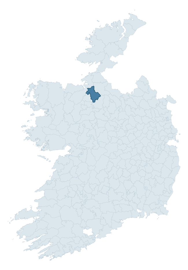
Where this barony sits in the Republic of Ireland
Geology and preservation
Bedrock geology shapes the landscape long before any settlement begins — controlling soil drainage, agricultural potential, the survival of upstanding monuments, and the preservation of buried archaeology. The figures below come from the Geological Survey Ireland 1:100,000 bedrock map.
The bedrock underlying Tirerrill is predominantly limestone (58% of the barony by area), laid down during the Carboniferous period (89% by area, around 359 to 299 million years ago). Limestone is the most heritage-rich bedrock in Ireland. It supports fertile, well-drained soils that favoured dense Early Medieval settlement and Norman manorial agriculture, and it weathers into karst features — sinkholes, caves, swallow holes, and souterrains — that frequently carry archaeology. Where peat overlies limestone, organic preservation can be exceptional. A substantial secondary geology of shale, limestone (16%) adds further variety to the underlying landscape. The single largest mapped unit is the Lower Bricklieve Limestone Formation (34% of the barony's bedrock). With 11 distinct rock types mapped, the barony sits in the top third of ROI baronies for geological diversity (94th percentile) — typically a sign of complex tectonic history or coastal mosaics of differing rock units.
Rock type composition
Largest mapped unit: Lower Bricklieve Limestone Formation (34% of the barony)
Placename evidence
Logainm records 45 heritage-diagnostic placenames for Tirerrill, drawn from townland and civil-parish names across the barony. The dominant stratum is pre-Christian and Early Medieval defensive — ráth-, lios-, dún-, and caiseal-prefixed names that mark Iron Age and early historic settlement. The leading diagnostic roots are cill- (15 — church), lios- (8 — ringfort or enclosure), and ráth- (6 — earthen ringfort). This is above the ROI average of 30.7 heritage placenames per barony. The presence of multiple heritage strata side by side indicates layered occupation of the landscape across successive prehistoric and historic periods. Logainm records 287 placenames for Tirerrill (predominantly townland names). Of these, 45 (16%) carry one of the diagnostic Gaelic roots tracked above; the remainder draw on more generic landscape vocabulary that does not encode a heritage period.
Pre-Christian / Early Medieval Defensive
| Root | Count | Meaning |
|---|---|---|
| lios- | 8 | ringfort or enclosure |
| ráth- | 6 | earthen ringfort |
| dún- | 6 | hilltop or promontory fort |
| caiseal- | 3 | stone ringfort |
Early Christian Ecclesiastical
| Root | Count | Meaning |
|---|---|---|
| cill- | 15 | church (early) |
| tobar- | 4 | holy well |
| cillín- | 1 | unconsecrated burial ground |
Burial, Ritual, and Norse-Contact
| Root | Count | Meaning |
|---|---|---|
| dumha- | 1 | mound |
About this profile
Click any section below to expand.
What is a barony?
A barony is a historic administrative unit in Ireland, broadly equivalent to an English hundred. The 280 baronies used here are from the OSi 2019 National Statutory Boundaries (generalised 20m), covering the 26 counties of the Republic of Ireland. Baronies derive from the Norman period, were formalised in the 17th century, and have not been redrawn for statistical purposes. They vary enormously in area, from compact urban baronies in Dublin to vast upland baronies in Connacht, and should not be compared by raw site count without accounting for area differences.
What counts as a site?
This profile combines three distinct heritage registers, each with its own definition of what constitutes a recordable site:
- Archaeological sites (NMS). The National Monuments Service Sites and Monuments Record (SMR) catalogues every known archaeological monument or site of archaeological interest in the Republic, from prehistoric burial mounds and ringforts to medieval churches and post-medieval defensive works. Inclusion does not require legal protection — only that the site has been identified, surveyed, and assessed as having archaeological value. A separate subset of these sites lies within a recorded protection zone, which gives them statutory protection under the National Monuments Acts.
- Listed buildings (NIAH). The National Inventory of Architectural Heritage records buildings of architectural, historical, archaeological, artistic, cultural, scientific, social, or technical interest. Each surveyed structure is appraised on a five-tier scale: International, National, Regional, Local, and Record-Only. The NIAH appraisal is informational rather than strictly statutory, but it underpins local-authority Record of Protected Structures (RPS) listings.
- Heritage placenames (Logainm). Logainm is the authoritative database of Irish placenames maintained by the Placenames Branch. This profile applies a heritage-diagnostic classifier to the Irish-language form of each townland name, flagging roots that signal defensive sites (ráth-, lios-, dún-, caiseal-, cathair-), ecclesiastical foundations (cill-, teampall-, domhnach-, mainistir-), prehistoric burial-ritual features (tuaim-, carn-, leaba-), or Norse-contact settlement (gall-). Townlands without one of these diagnostic roots are not flagged here — they may still carry historical significance, but that significance is not encoded in the name itself.
Editorial principles
The narrative sections of this profile follow several explicit principles:
- Evidential. Every claim about this barony’s heritage character is anchored in the underlying register data. Where a site count, a placename count, or a percentile rank is cited, it is computed from the source datasets at export time, not estimated.
- Comparative. Counts and metrics are reported alongside their percentile rank against the other 279 ROI baronies. A barony with 50 ringforts in absolute terms could be unusually high or unusually low depending on its size and regional context; percentile ranking removes that ambiguity.
- Transparent on limits. Where a register has known coverage gaps, survey biases, or data-quality issues that affect this barony’s figures, the profile flags them rather than presenting the numbers as definitive.
- No interpretation beyond what the data supports. The narrative does not speculate about historical events, social dynamics, or cultural meaning beyond what the recorded heritage and placename evidence directly attests.
Data caveats and limits
- NMS Sites and Monuments Record is the product of survey campaigns conducted at different intensities across different counties and decades. Some baronies have been surveyed more thoroughly than others, and absolute counts should be read in that light. Sites destroyed by development before survey are typically not represented; sites in heavily forested or upland terrain are sometimes under-recorded.
- NIAH coverage is broadly complete for the Republic of Ireland but the survey was conducted on a rolling county-by-county basis, and the most recent appraisal date varies. Buildings demolished or substantially altered after their original survey may still appear in the register; conversely, recent buildings of merit may not yet have been appraised.
- Logainm classification applies a deliberately conservative pattern-matching approach to the Irish-language townland forms. The classifier prioritises true positives over recall: a townland may carry a heritage signal that the classifier doesn’t recognise, particularly where the diagnostic root has been heavily anglicised or where the townland name draws on a less common term. The 60,000+ townland records and ~9,800 classified placenames give a substantial signal at barony scale, but individual townland names should be checked against Logainm directly for definitive interpretation.
- Period attribution. The chronological distribution reflects only those NMS sites that carry a recognised period attribution in the source data. Sites listed as “Unknown” period are excluded from the dated subset.
- Boundary changes. Some baronies have undergone minor boundary adjustments since their 19th-century definition; the OSi 2019 generalised boundaries used here are the current statutory definition and may differ slightly from historical maps in border areas.
- Bedrock geology is mapped at 1:100,000 scale, which means local variation within a barony — small pockets of different rock type, mineral veins, alluvium overlying bedrock — is generalised. The dominant-system and rocktype figures are area-weighted, so a barony reading “70% Carboniferous limestone” may still contain small but archaeologically important pockets of older or younger rock. Around 3% of GSI polygons do not match the lexicon and contribute no rocktype or system attribution.
Data sources
- National Monuments Service — Sites and Monuments Record (SMR) https://data.gov.ie/dataset/national-monuments-service-archaeological-survey-of-ireland
- National Inventory of Architectural Heritage (NIAH) https://data.gov.ie/dataset/national-inventory-of-architectural-heritage-niah-national-dataset
- Logainm — Placenames Database of Ireland https://www.logainm.ie/
- Ordnance Survey Ireland — National Statutory Barony Boundaries 2019 https://data-osi.opendata.arcgis.com/
- EURODEM — European Digital Elevation Model https://www.mapsforeurope.org/datasets/euro-dem
- ESA WorldCover https://esa-worldcover.org/en
- Geological Survey Ireland — 1:100,000 Bedrock Geology https://www.gsi.ie/en-ie/data-and-maps/Pages/Bedrock.aspx
Explore more: Search any of the 280 ROI baronies, browse by historical province, or read the methodology and data sources for the full Republic of Ireland Heritage Tool.