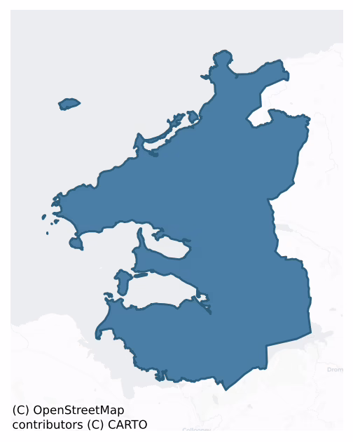
Carbury is a barony of County Sligo, in the historical province of Connacht (Irish: Cairbre), covering 323 km² of land. The barony records 1,751 NMS archaeological sites and 444 NIAH listed buildings, placing it at around the 96th percentile among 280 ROI baronies for sites per km². This means it is in the top tenth of all baronies for sites per km². Dated archaeological evidence runs from the Mesolithic through to the Modern, spanning 9 of 9 archaeological periods, placing the barony in the 98th percentile among 280 ROI baronies for chronological depth. This means it is in the top tenth of all baronies for chronological depth. The largest dated subset of recorded sites dates to the Early Medieval. Logainm flags 56 placenames in the barony as carrying a recognised heritage root; the largest share — around 45% — are names associated with pre-christian defensive.
Heritage at a glance
Percentile rankings throughout this profile compare each barony only against the other 279 Republic of Ireland baronies.
The recorded heritage of Carbury
The National Monuments Service Sites and Monuments Record (SMR) is the statutory inventory of archaeological sites for the Republic of Ireland, maintained by the Department of Tourism, Culture, Arts, Gaeltacht, Sport and Media. Sites recorded here include earthworks, ringforts, megalithic tombs, ecclesiastical remains, and post-medieval features; not every record is legally protected, but each is registered as a monument of archaeological interest.
The National Monuments Service records 1,751 archaeological sites in Carbury, putting it at the 96th percentile among 280 ROI baronies for sites per km². This means it is in the top tenth of all baronies for sites per km². Protection coverage is near-universal — 1,629 sites (93%) fall within a recorded monument protection zone, indicating an extensively surveyed landscape. The dominant category is defensive sites — ringforts, enclosures, hillforts, and stone forts (842 sites, 48% of the record). Ringfort – rath is the most prevalent type, making up 17% of the barony's recorded sites (302 records), broadly in line with the ROI average of 20% across all baronies where this type occurs. Ringfort – rath is an earthen ringfort enclosed by a bank and external ditch — the most common Early Medieval farmstead, broadly dated 500–1000 AD. Other significant types include Enclosure (182) and Ringfort – cashel (159). Enclosure is a banked or ditched feature of uncertain type, used as a catch-all where the original function cannot be determined from surface evidence; Ringfort – cashel is the stone-walled equivalent of the rath, found mainly in upland or western areas, broadly dated 500–1000 AD. Across the barony's 323 km², this gives a recorded density of 5.42 sites per km².
Most common monument types
Hover or tap a monument type to see its definition.
| Type | Count |
|---|---|
| Ringfort – rath an earthen ringfort enclosed by a bank and external ditch — the most common Early Medieval farmstead, broadly dated 500–1000 AD | 302 |
| Enclosure a banked or ditched feature of uncertain type, used as a catch-all where the original function cannot be determined from surface evidence | 182 |
| Ringfort – cashel the stone-walled equivalent of the rath, found mainly in upland or western areas, broadly dated 500–1000 AD | 159 |
| Souterrain an underground stone-built passage and chamber, generally Early Medieval and often associated with ringforts as a defensive or storage feature | 88 |
| Hut site a low stone or earthen foundation enclosing a small circular or oval area, generally interpreted as a former dwelling, of any date from prehistory to the medieval period | 53 |
| Ringfort – unclassified a circular Early Medieval settlement enclosure where surviving evidence does not allow distinction between earthen and stone forms | 53 |
Chronological distribution
The dated archaeological record for Carbury spans from the Mesolithic through to the Modern, with activity attested across 9 of 9 archaeological periods. This places Carbury in the top 2% of ROI baronies for chronological depth — few baronies record evidence across as many distinct archaeological periods. Every period from earliest to latest is represented in the record — an unbroken sequence of dated activity across the full chronological span. Activity concentrates most heavily in the Early Medieval (697 sites, 50% of dated material), with the Iron Age forming a secondary peak (317 sites, 23%). A further 352 recorded sites (20% of the overall NMS register for the barony) carry no period attribution — appearing as 'Unknown' in the bar chart below. This typically reflects either records that pre-date the standardised period vocabulary or sites awaiting specialist dating review, rather than a genuine absence of chronological evidence.
Sample of recorded monuments
Show 25 sample monuments (of 1,751 total)
A representative sample of 25 recorded monuments drawn from the barony’s 1,751 total NMS entries. Sites within a recorded monument protection zone and rarer site types are prioritised so the list shows a meaningful cross-section rather than only the most common type. Each entry shows the official Sites and Monuments Record reference number and the description published by the National Monuments Service.
Stone trough
Located at the SW corner of Templemolaise church (SL001-001009-).
Shallow (depth 50 mm), flat-based, rectilinear basin with a concave underside, rounded corners, and a flat rim (H 0.93 m, W 0.63 m, T 0.2 m). It is…
Located at the SW corner of Templemolaise church (SL001-001009-).
Shallow (depth 50 mm), flat-based, rectilinear basin with a concave underside, rounded corners, and a flat rim (H 0.93 m, W 0.63 m, T 0.2 m). It is broken off abruptly at one end. Roughly centrally positioned on the inner base of the basin is a shallowly incised cross (0.195 by 0.125) with rounded terminals.
This lies immediately adjacent to a very fine cross-inscribed pillar (SL001-001026-) with which it may have had a particular association in antiquity.
The above description is derived from the results of a survey of the archaeological monuments on Inishmurray undertaken in 1997-1999 and published in:
Jerry O’Sullivan and Tomás Ó Carragáin 2008 Inishmurrary. Monks and pilgrims in an Atlantic landscape. Volume 1: Archaeological Survey and Excavations 1997-2000. Cork. The Collins Press.
Date of upload: 16 January 2018
Hearth
Located in the centre of the interior of Templenatinny church (SL001-001011-).
The ‘hearth’ consists of low slabs, edge-set within the floor to form a square kerb 1 m by 1 m.
The above description is derived from…
Located in the centre of the interior of Templenatinny church (SL001-001011-).
The ‘hearth’ consists of low slabs, edge-set within the floor to form a square kerb 1 m by 1 m.
The above description is derived from the results of a survey of the archaeological monuments on Inishmurray undertaken in 1997-1999 and published in:
Jerry O’Sullivan and Tomás Ó Carragáin 2008 Inishmurrary. Monks and pilgrims in an Atlantic landscape. Volume 1: Archaeological Survey and Excavations 1997-2000. Cork. The Collins Press.
Date of upload: 16 January 2018
Cursing stone
This record refers to fifteen cross-carved, rounded stones or cobbles known as the ‘cursing stones’ or ‘clocha breacha’ (speckled stones). They are associated with a leacht (SL001-001013-) in an ecclesiastical enclosure…
This record refers to fifteen cross-carved, rounded stones or cobbles known as the ‘cursing stones’ or ‘clocha breacha’ (speckled stones). They are associated with a leacht (SL001-001013-) in an ecclesiastical enclosure (SL011-011001-), known as ‘The Cashel’ on Inishmurray Island. Eight are in situ on the island, four are in the National Museum together with a possible fifth (DU018-409—-), one is in Alnwick Castle, and the location of one other is unknown. The spherical cobbles vary in size (diam. 0.12-0.41m) and bear a variety of incised designs; the more elaborate examples may date stylistically to between the period between the late 9th and 11th centuries.
Use of cursing stones is recorded in an annotation on an early 17th-century map of Inishmurray, and reads as follows: ‘In this islande there dwelleth a holye man called Scanlon of whom the countrie people holde a superstitious opinion that if he be angry with any one and do turne the speckled stones upon them which he kepeth for that use they shall dye within that yeare.’ (Captain John Baxter’s ‘Map of the North-West Parte of Ireland’ (1603), in The Admiralty Library, Greenwich. Quoted in O’Sullivan and Ó Carragáin 2008, 23, plate 13).
For a detailed description of these stones and associated rituals see:
Jerry O’Sullivan and Tomás Ó Carragáin 2008 Inishmurrary. Monks and pilgrims in an Atlantic landscape. Volume 1: Archaeological Survey and Excavations 1997-2000. Cork. The Collins Press.
pp. 105-110, 33…
Cross-inscribed stone
Located on top of a leacht (Sl001-001013-), in association with cross-carved cobbles, known as the ‘cursing stones’ or ‘clocha breacha’(SL001-001015-).
Cross-inscribed upright oblong block with tapering stem (H: 0.595…
Located on top of a leacht (Sl001-001013-), in association with cross-carved cobbles, known as the ‘cursing stones’ or ‘clocha breacha’(SL001-001015-).
Cross-inscribed upright oblong block with tapering stem (H: 0.595 m, W: 0.255>0.07 m, Th: 0.125 m) and a hollow 0.11 m in diameter in its upper surface. A stone disc with a diameter of 0.24 m has a hemispherical projection on the underside that is fitted into this hollow. The south face is filled with an incised shafted cross (c.0.27 m by 0.2 m) with a lozenge-shaped expansion at the crossing, whose upper arms terminate in large concave-sided squares. Each of the upper quadrants is decorated with a diagonally disposed cross, while each of the lower quadrants is decorated with a vertically-disposed cross with cusped serif terminals whose lower arms turn inwards at their base, apparently to join the shaft of the principal cross. At the base of the lower left quadrant is a linear stepped border. Each of the narrow sides is filled with an incised shafted cross (0.19 m by 0.1 m) with cusped serif terminals and a false-relief hollowed boss at the crossing.
The above description is derived from the results of a survey of the archaeological monuments on Inishmurray undertaken in 1997-1999 and published in:
Jerry O’Sullivan and Tomás Ó Carragáin 2008 Inishmurrary. Monks and pilgrims in an Atlantic landscape. Volume 1: Archaeological Survey and Excavations 1997-2000. Cork. The Collins Press.
Date of upload: 16 January 2018
Cross-inscribed pillar (present location)
Originally at Relickoran, in the south-east corner of the main enclosure (SL001-004001-), close to the eroding cliff-edge. Removed to the Schoolhouse/OPW conservation store during excavations in 2000.
Tall pillar (H:…
Originally at Relickoran, in the south-east corner of the main enclosure (SL001-004001-), close to the eroding cliff-edge. Removed to the Schoolhouse/OPW conservation store during excavations in 2000.
Tall pillar (H: 1.04 m, W: 0.232>0.108 m, Th: 0.08 m) incised with shafted cross (0.70 m by 0.32 m) with cusped-butted terminals and a false relief boss at the crossing. The base fuses with a horizontal bar at the ends of which develops a vertical cross (0.22 m by 0.112 m) in each of the lower quadrants. These are similar to the main cross but their serifs are not as pronounced and they lack a central boss. 0.084 m above the main crossing the upper arm is traversed by a horizontal bar from each end of which develops a vertical cross similar in form but smaller than those in the lower quadrants.
The above description is derived from the results of a programme of survey and excavation undertaken in 1997-2000 on Inishmurray and published in:
Jerry O’Sullivan and Tomás Ó Carragáin 2008 Inishmurrary. Monks and pilgrims in an Atlantic landscape. Volume 1: Archaeological Survey and Excavations 1997-2000. Cork. The Collins Press.
Date of upload: 19 February 2018
Hermitage
On an eroding cliff edge at the most westerly point on Inishmurray, incorporated into NE angle of a later square, stone-built enclosure (SL001-007007-).
This small subcircular building or cell (diam. c. 1.8m), with…
On an eroding cliff edge at the most westerly point on Inishmurray, incorporated into NE angle of a later square, stone-built enclosure (SL001-007007-).
This small subcircular building or cell (diam. c. 1.8m), with walls (Wth c. 0.8m) of drystone construction, was known traditionally as Trahanareear (Trahan na Righ-fhear or Trahan na Riair or Trahan na Rí-Ghear or Trahan Ó Riain), and also ‘Breadserve’. It has been interpreted as a hermitage, which ‘provided shelter and seclusion for fasting, prayer and penance’ for individual monks at an isolated location away from the bustle of the main monastic complex (SL001-001001-) (O’Sullivan and Ó Carragáin 2008, 237).
In the 1990’s it was found to be in a state of collapse -the western part had already succumbed to the eroding cliff- and in 1997 it was fully excavated (licence: 97E0256) in advance of its reconstruction by the OPW at its current location at a safe distance from the cliff edge. The excavators concluded that: ‘in its primary phase, the monument appears to have consisted only of the cell and – immediately before it – a small area of paving which supported an upright timber. Large, undressed stones formed the inner and outer wall faces of the cell. The wall core consisted of medium and large stones in alternating radial and segmental courses (i.e. the stones of each course were all laid either along or across the wall line, so that the wall core formed a compact lattice of large stones). The terminals at either side…
Cairn – ring-cairn
On the coast close to sand dunes. Not marked on any edition of the OS 6-inch map. The remains consist of a circular area (internal diam. 33m E-W) defined by a slight bank (c. 2m W; 0.5m H) with traces an inner and outer…
On the coast close to sand dunes. Not marked on any edition of the OS 6-inch map. The remains consist of a circular area (internal diam. 33m E-W) defined by a slight bank (c. 2m W; 0.5m H) with traces an inner and outer facing of stone slabs visible at NE. There is a record of slabs and stones having been removed from the site. The interior is saucer-shaped with a raised irregular area in the centre (Timoney 2016, 1-4).
Revised by: Paul Walsh
Revised date of upload: 23 January 2017
Settlement cluster
In gently undulating rocky pasture. Carville (1990, 51-2) believes that this deserted settlement represents the remains of a residential grange belonging to the Abbey of Boyle. The area extends over approximately 20…
In gently undulating rocky pasture. Carville (1990, 51-2) believes that this deserted settlement represents the remains of a residential grange belonging to the Abbey of Boyle. The area extends over approximately 20 acres. The area is dominated on the NE side by a low hillock. To the E and SE of the hillock is an area of low, wet pasture within which is a holy well (SL005-034—). The S and E portions of the area consists of gently undulating rocky pasture. Views are good to excellent in all directions. The majority of the features are low in profile and difficult to distinguish from natural rocky undulations across the area. The individual components that make up the settlement are described separately (see SL005-033001- to SL005-033006-).
Compiled by: Mark Keegan, Paul Walsh
Date of upload: 11 June 2013
Stone head
The Archaeological Survey of Ireland (ASI) is in the process of providing information on all monuments on The Historic Environment Viewer (HEV). Currently the information for this record has not been uploaded. To…
The Archaeological Survey of Ireland (ASI) is in the process of providing information on all monuments on The Historic Environment Viewer (HEV). Currently the information for this record has not been uploaded. To access available information for research purposes please make an appointment in advance with the Archive Unit (open Fridays 10.00 am – 5.00 pm), Department of Culture, Heritage and the Gaeltacht, The Custom House, Dublin 1 D01W6XO or email nmarchive@chg.gov.ie.
Boundary stone
The Archaeological Survey of Ireland (ASI) is in the process of providing information on all monuments on The Historic Environment Viewer (HEV). Currently the information for this record has not been uploaded. To…
The Archaeological Survey of Ireland (ASI) is in the process of providing information on all monuments on The Historic Environment Viewer (HEV). Currently the information for this record has not been uploaded. To access available information for research purposes please make an appointment in advance with the Archive Unit (open Fridays 10.00 am – 5.00 pm), Department of Culture, Heritage and the Gaeltacht, The Custom House, Dublin 1 D01W6XO or email nmarchive@chg.gov.ie.
Salt works
Situated on N foreshore of Drumcliff Bay on level ground, 375m W of the mouth of the Drumcliff River. Indicated on the 1837 OS 6-inch map as 'Old Salt Pans'. At this location is a waterlogged rectangular flat-bottomed…
Situated on N foreshore of Drumcliff Bay on level ground, 375m W of the mouth of the Drumcliff River. Indicated on the 1837 OS 6-inch map as 'Old Salt Pans'. At this location is a waterlogged rectangular flat-bottomed depression (6m E-W; 2m N-S; D 0.3m) with vertical sides. A roughly oval irregular depression (6m N-S; 4m E-W; D 0.3m) extends N from the NE corner of the rectangular depression. An E-W orientated channel (L 5m; Wth 0.3-0.6m; D 0.2m) extends from the intersection of the NE corner of the rectangular depression and the oval depression. A second roughly rectangular flat-bottomed depression (1.8m E-W; 0.6m N-S; D 0.3m) with vertical sides, links to the S side of the channel midway along its length.
Compiled by: Patrick F. O'Donovan
Date of upload: 21 April 2011
Bridge
A bridge is shown in this area on the Down Survey (1654-6) map: no visible evidence for it survives. An inspection in 1991 recorded a structure interpreted as the remains of a bridge on the S bank of the river…
A bridge is shown in this area on the Down Survey (1654-6) map: no visible evidence for it survives. An inspection in 1991 recorded a structure interpreted as the remains of a bridge on the S bank of the river immediately to W of the current bridge and was described as follows: ‘S shore of river immediately to W of modern bridge. Ruined. Stone bridge only S portion surviving on S bank. (New bridge now in use). This stone bridge is rendered in part but at the corner and for a stretch 3.6m long irregular cut stone can be seen.' This is probably the remnants of the bridge depicted on the OS 1:2500 plan (surveyed 1909-12). There is no visible trace of this structure.
Compiled by: Paul Walsh
Date of upload: 11 March 2014
Round tower
Located 40m NW of Drumcliff graveyard (DG008-084002-), in the shadow of Ben Bulben, and less than a kilometre from the mouth of the Drumcliff River, on the E side of Drumcliff Bay. It stands within a small walled…
Located 40m NW of Drumcliff graveyard (DG008-084002-), in the shadow of Ben Bulben, and less than a kilometre from the mouth of the Drumcliff River, on the E side of Drumcliff Bay. It stands within a small walled enclosure, bordered on the E side by a road (N15), which intervenes between the tower and the graveyard.
This round tower is a National Monument (no. 119) in state ownership. It consists of a plain, circular tower (diam. c. 5m; current H c. 9m) of coursed, mortared stone rubble, which no longer stands to its full height. At its base there is a low, narrow plinth or offset (W 0.04-0.1m; H c. 0.5m). The rectangular, flat-headed doorway (Wth 0.54m base, 0.53m top) is located on the ESE side, at a height of 1.78m above the offset. There is a square-headed window at SSW, c. 2m below the current top of the tower. (Barrow 1979, 181).
The 1836 OS Letters record that ‘The name of the tower is ‘Claictheach Dhruim Shliabh’; a great part of it was demolished for the erection of a bridge [SL008-072001-] in the neighbourhood…’ (O’Flanagan 1933, 83-5 (31-2)).
There is a high cross (SL008-084004-) c. 50m to ESE and remains of a plain cross (SL008-084005-) c. 40m to SE, both incorporated into the N boundary wall of the graveyard. The round tower and the crosses are the only visible remains of an important monastery, which St Columcille is said to have founded here c. 574 AD on a site granted by Aed son of Ainmire, King of Ireland. He appointed St Thorian (Mothorain) to be the…
College
Within Drumcliff graveyard (SL008-084002-).
There is no visible trace at ground level of this college. It is indicated on the 1837 OS 6-inch map as ‘Site of College’, and is not shown on later map editions. The source…
Within Drumcliff graveyard (SL008-084002-).
There is no visible trace at ground level of this college. It is indicated on the 1837 OS 6-inch map as ‘Site of College’, and is not shown on later map editions. The source of this record is a reference in the 1836 OS Letters: 'There is a tradition that an old church (SL008-084001-) stood where the Protestant church at Drumcliff now stands, which was called Teampull Buidhe. It is also said there was a college in it, which was much frequented by foreigners . . .' ((O'Flanagan 1933, 83 31-2).
Compiled by: Jane O'Shaughnessy
Date of upload: 3 November 2020
Stone sculpture
This record refers to a carved stone known as the ‘Angel stone’. It was listed in the RMP (1995) as 'Cross fragment', based on Wood-Martin’s (1882, 303-304; fig. 19) interpretation of the stone as being ‘a portion of…
This record refers to a carved stone known as the ‘Angel stone’. It was listed in the RMP (1995) as 'Cross fragment', based on Wood-Martin’s (1882, 303-304; fig. 19) interpretation of the stone as being ‘a portion of the shaft and one arm' of a cross. Wood-Martin’s published illustration shows the stone lying on its side and partly embedded in the ground; a carved human figure or angel extends the length of the stone, with a long wing-like element visible along one side of the body, the other side of the body being concealed below ground level. He does not record the dimensions of the stone. Stokes (1901, 555, note) recorded that this 'piece of medieval sculpture called the Angel Stone was found near the round tower, and is now built into the bottom of the wall on the road side. The image of an angel with outspread wings, much mutilated, is carved upon it.' The stone was noted in the fabric of the roadside wall in 1980 (pers. comm. P. Walsh & M.A. Timoney), but was not located during an inspection in 2005.
A free-standing subrectangular block of worked sandstone (L 1m; Wth 0.55m; H 0.6m) is currently located adjacent to the round tower. The two vertical long sides and one short end of the stone have rough, uneven surfaces. The horizontal upper surface of the stone has a lower ‘shelf’ along one long side, which exhibits a punch-dressed band (Wth 0.12m), with three small notches (each Wth 0.05m; D 0.04m), spaced 0.15-0.17m apart, cut into its outer edge. The other vertical…
House – 16th/17th century
The Archaeological Survey of Ireland (ASI) is in the process of providing information on all monuments on The Historic Environment Viewer (HEV). Currently the information for this record has not been uploaded. To…
The Archaeological Survey of Ireland (ASI) is in the process of providing information on all monuments on The Historic Environment Viewer (HEV). Currently the information for this record has not been uploaded. To access available information for research purposes please make an appointment in advance with the Archive Unit (open Fridays 10.00 am – 5.00 pm), Department of Culture, Heritage and the Gaeltacht, The Custom House, Dublin 1 D01W6XO or email nmarchive@chg.gov.ie.
Architectural fragment
Eight architectural fragments set into the wall of a cottage. 1) A slender six-sided, champfered pillar stone fragment (L 38cm, W 27cm). 2) A crude block of stone, cut edged on three sides with two incised panels cut…
Eight architectural fragments set into the wall of a cottage. 1) A slender six-sided, champfered pillar stone fragment (L 38cm, W 27cm). 2) A crude block of stone, cut edged on three sides with two incised panels cut into one of the edges. 3) A block of cut stone (L 30cm, W 20cm). 4) Worked stone (L 93cm, W 34cm), possibly part of a window, T-shaped head with champfered sides. The raised area has two small square indentations with a projecting edge between. The left soffit of the head of the stone has a simple roll moulding. 5) Irregular block with well worked chamfers giving a roll moulding effect in profile (dims. 38cm by 28cm). 6) Irregular block of stone (L 84cm, W 10cm) one face pocked and small cut incision. 7) Block of stone (L 1.12m) deep well at edges. 8) Corner or impost stone (L 28cm) with triangular incised area with triglyph design.
Compiled by: Mark Keegan
Date of upload: 19 January 2011
Barrow – embanked barrow
On level ground in gently undulating pasture. Slightly raised roughly circular area (dims. 14m E-W; 13m N-S) enclosed by a low broad bank of earth (Wth 6.2m; int. H 0.15m). There is no fosse visible at ground level. The…
On level ground in gently undulating pasture. Slightly raised roughly circular area (dims. 14m E-W; 13m N-S) enclosed by a low broad bank of earth (Wth 6.2m; int. H 0.15m). There is no fosse visible at ground level. The bank encloses the site on all sides and has a very uniform profile. There is no break in the bank to indicate the position of an entrance feature.
Compiled by: Patrick F. O'Donovan
Date of upload: 21 April 2011
Burnt spread
Human bones were discovered in 1969 in the course of the widening of the Sligo – Bundoran road and the site was inspected by a member of the National Museum of Ireland (NMI file) who recorded that ‘12 metres from the…
Human bones were discovered in 1969 in the course of the widening of the Sligo – Bundoran road and the site was inspected by a member of the National Museum of Ireland (NMI file) who recorded that ‘12 metres from the apparent edge of the cemetery [SL014-016001-] a large approx. saucer-shaped deposit of burnt clay and stones and flecks of charcoal was visible at approx. the same level as the cemetery. The visible portion of this deposit measured 4 metres across and its bottom was 60cm below the road surface; it consisted of layers of burnt stones, patches of charcoal, layers of ash etc. and was apparently either a hearth or an ash pit. No artifacts were noted.’ The location of this monument is that recorded in the NMI file.
Compiled by: Paul Walsh
Date of upload: 20 January 2014
Designed landscape – folly
A circular two storey stone building (diam. c. 9m; H 6m) stands in the centre of enclosure SL014-04001. It is constructed of roughly coursed limestone and is bonded with a lime mortar. The base of the structure is…
A circular two storey stone building (diam. c. 9m; H 6m) stands in the centre of enclosure SL014-04001. It is constructed of roughly coursed limestone and is bonded with a lime mortar. The base of the structure is obscured due to heavy growth of nettles and brambles and farm machinery. A pointed arch, indicating a doorway or window is located on the north side on ground level but the details of this or any other features cannot be seen through the overgrowth. A string course above the pointed arch ope indicates the first floor. According to the former landowner, Mr Jack Lindsey, access to the building was gained via a doorway on the first floor that is now covered with ivy. Two windows on the first floor, one of which is blocked with modern concrete blocks, both are set in pointed arch opes. A second string course is partly obscured by a waterproofing material overlying the roof, which is of modern concrete construction.
Compiled by: Patrick F. O'Donovan
Date of upload: 21 April 2011
Ceremonial enclosure
The Archaeological Survey of Ireland (ASI) is in the process of providing information on all monuments on The Historic Environment Viewer (HEV). Currently the information for this record has not been uploaded. To…
The Archaeological Survey of Ireland (ASI) is in the process of providing information on all monuments on The Historic Environment Viewer (HEV). Currently the information for this record has not been uploaded. To access available information for research purposes please make an appointment in advance with the Archive Unit (open Fridays 10.00 am – 5.00 pm), Department of Culture, Heritage and the Gaeltacht, The Custom House, Dublin 1 D01W6XO or email nmarchive@chg.gov.ie.
Historic town
The Archaeological Survey of Ireland (ASI) is in the process of providing information on all monuments on The Historic Environment Viewer (HEV). Currently the information for this record has not been uploaded. To…
The Archaeological Survey of Ireland (ASI) is in the process of providing information on all monuments on The Historic Environment Viewer (HEV). Currently the information for this record has not been uploaded. To access available information for research purposes please make an appointment in advance with the Archive Unit (open Fridays 10.00 am – 5.00 pm), Department of Culture, Heritage and the Gaeltacht, The Custom House, Dublin 1 D01W6XO or email nmarchive@chg.gov.ie.
Well
This well is first recorded as an antiquity on the 1st ed. OS 6-inch map where it is named ‘Tobernashelmida’. Thomas O’Conor recorded the following about the well in 1836 (OSL, 211): ‘There is a well in the Town of…
This well is first recorded as an antiquity on the 1st ed. OS 6-inch map where it is named ‘Tobernashelmida’. Thomas O’Conor recorded the following about the well in 1836 (OSL, 211): ‘There is a well in the Town of Sligo called Tobar na Seilmide, Snail’s Well, which, prophetic tradition says, will in time to come overwhelm by its waters the whole town. The reason why it is called Tobar na Selmide is, a snail is seen coming out of the well every seventh year, which is thought to be an enchanted and metamorphosed being, possessing the power of affecting in some time future an overflowing well, which will have the narrated effect.’ There is no local tradition of it being a ‘holy well’ nor is it listed as such in the published historical or antiquarian literature (pers. comm. M.A. Timoney).
Compiled by: Paul Walsh
Date of upload: 5 November 2013
Cairn – clearance cairn
The Archaeological Survey of Ireland (ASI) is in the process of providing information on all monuments on The Historic Environment Viewer (HEV). Currently the information for this record has not been uploaded. To…
The Archaeological Survey of Ireland (ASI) is in the process of providing information on all monuments on The Historic Environment Viewer (HEV). Currently the information for this record has not been uploaded. To access available information for research purposes please make an appointment in advance with the Archive Unit (open Fridays 10.00 am – 5.00 pm), Department of Culture, Heritage and the Gaeltacht, The Custom House, Dublin 1 D01W6XO or email nmarchive@chg.gov.ie.
Ringfort – rath
On a slope in rough pasture. Raised circular area (diam. 26m) enclosed by a bank of earth and stone (Wth. 1m; ext H c.2.1m – 3m) with a silted-up external fosse (Wth.1.3m). Original entrance not recognisable but may…
On a slope in rough pasture. Raised circular area (diam. 26m) enclosed by a bank of earth and stone (Wth. 1m; ext H c.2.1m – 3m) with a silted-up external fosse (Wth.1.3m). Original entrance not recognisable but may have been at ESE.
Compiled by: Patrick F. O'Donovan
Date of upload 07 March 2013
Listed buildings
The National Inventory of Architectural Heritage (NIAH) is a state survey appraising buildings of architectural, historical, archaeological, artistic, cultural, scientific, social, or technical interest. Each surveyed structure receives a rating from International (the highest, for buildings of European importance) through National, Regional, Local, and Record-Only.
The National Inventory of Architectural Heritage records 444 listed buildings in Carbury, placing it in the top 6% of ROI baronies for listed-building density. Among these, 20 are graded National — buildings of interest to the whole of Ireland rather than only its region. The Republic holds 937 National-graded buildings in total, so this barony accounts for around 2% of the national total. Construction dates concentrate most heavily in the Victorian (1830-1900) period. The most-recorded building type is house (252 examples, 57% of the listed stock).
Terrain and environment
Mean elevation across the barony is 88m — the 50th percentile among 280 ROI baronies for elevation. This means it is in the upper half of all baronies for elevation. Elevation matters for heritage because higher-altitude baronies typically favour defensive monuments — ringforts and hilltop forts placed on prominent ground — while lowland baronies are more likely to carry the dense settlement and church networks of intensive agricultural landscapes. The barony reaches 643m at its highest point — a vertical span of more than 555m within its boundary, indicating significant topographic diversity. Mean slope is 6.1° — the 85th percentile among 280 ROI baronies for slope. This means it is in the top fifth of all baronies for slope. This is consistently steep terrain by ROI standards, the kind of landscape that tends to preserve upstanding archaeological features well. Slope is a key control on both land use and archaeological preservation: steep ground resists ploughing and tends to preserve earthworks intact, while gentle slopes favour intensive cultivation that damages or destroys surface archaeology over time. Localised maximum slopes reach 21°, typical of stream-cut valleys, escarpments, or coastal bluffs within the wider landscape. The Topographic Wetness Index averages 10.1, the 25th percentile among 280 ROI baronies for wetness. This means it is in the bottom third of all baronies for wetness. This is well-drained ground by ROI standards — typical of upland or steeply-sloping country that sheds water rapidly. Drainage matters for heritage because poorly-drained ground preserves organic archaeology (wooden trackways, leather, textiles, and on rare occasions human remains) far better than free-draining soil; well-drained ground favours arable use but destroys organic material rapidly. The land cover is dominated by improved grassland (78%) and woodland (16%). In overall character, this is steeply-sloping terrain at modest elevation, with land use dominated by improved grassland.
Terrain measurements
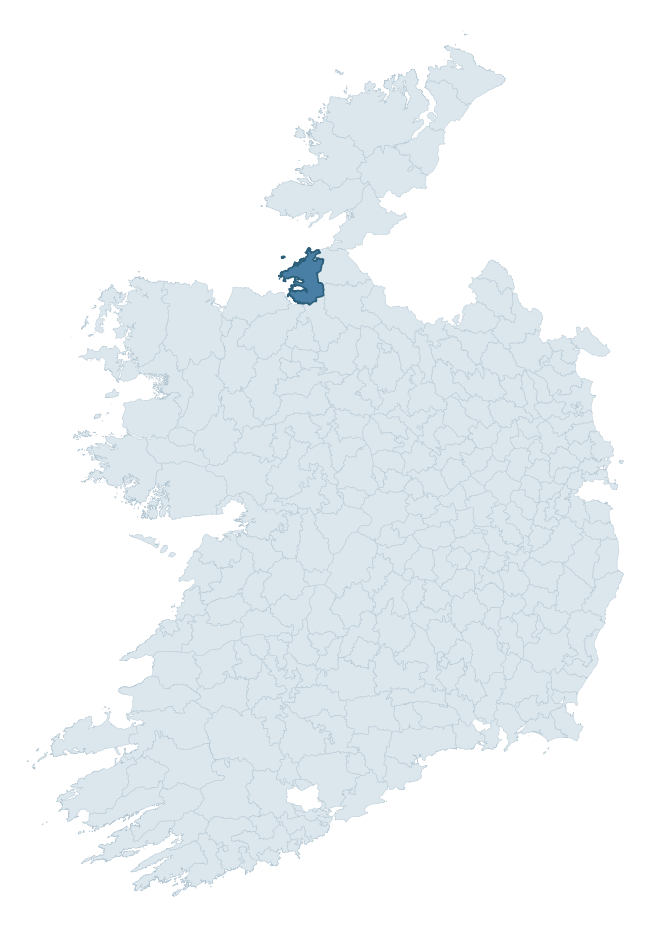
Where this barony sits in the Republic of Ireland
Geology and preservation
Bedrock geology shapes the landscape long before any settlement begins — controlling soil drainage, agricultural potential, the survival of upstanding monuments, and the preservation of buried archaeology. The figures below come from the Geological Survey Ireland 1:100,000 bedrock map.
The bedrock underlying Carbury is predominantly limestone (48% of the barony by area), laid down during the Carboniferous period (97% by area, around 359 to 299 million years ago). Limestone is the most heritage-rich bedrock in Ireland. It supports fertile, well-drained soils that favoured dense Early Medieval settlement and Norman manorial agriculture, and it weathers into karst features — sinkholes, caves, swallow holes, and souterrains — that frequently carry archaeology. Where peat overlies limestone, organic preservation can be exceptional. A substantial secondary geology of limestone and shale (16%) and sandstone (16%) adds further variety to the underlying landscape. The single largest mapped unit is the Dartry Limestone Formation (38% of the barony's bedrock).
Rock type composition
Largest mapped unit: Dartry Limestone Formation (38% of the barony)
Placename evidence
Logainm records 56 heritage-diagnostic placenames for Carbury, drawn from townland and civil-parish names across the barony. The dominant stratum is pre-Christian and Early Medieval defensive — ráth-, lios-, dún-, and caiseal-prefixed names that mark Iron Age and early historic settlement. The leading diagnostic roots are cill- (14 — church), ráth- (10 — earthen ringfort), and lios- (7 — ringfort or enclosure). This is above the ROI average of 30.7 heritage placenames per barony. The presence of multiple heritage strata side by side indicates layered occupation of the landscape across successive prehistoric and historic periods. Logainm records 276 placenames for Carbury (predominantly townland names). Of these, 56 (20%) carry one of the diagnostic Gaelic roots tracked above; the remainder draw on more generic landscape vocabulary that does not encode a heritage period.
Pre-Christian / Early Medieval Defensive
| Root | Count | Meaning |
|---|---|---|
| ráth- | 10 | earthen ringfort |
| lios- | 7 | ringfort or enclosure |
| dún- | 6 | hilltop or promontory fort |
| caiseal- | 2 | stone ringfort |
Early Christian Ecclesiastical
| Root | Count | Meaning |
|---|---|---|
| cill- | 14 | church (early) |
| gráinseach- | 5 | monastic farm / grange |
| teampall- | 4 | church (later medieval) |
| tobar- | 1 | holy well |
Burial, Ritual, and Norse-Contact
| Root | Count | Meaning |
|---|---|---|
| carn- | 5 | cairn |
| uaimh- | 2 | cave / souterrain |
| gall- | 2 | foreigner — Norse settlement marker |

Explore further
Grounding History: 10 Maps of Northern Ireland’s Past
If you’re interested in Irish heritage more widely, the companion report for Northern Ireland brings together the analysis of all 462 NI wards into one place through 10 high-quality maps — covering monument density, archaeological periods, placename heritage, terrain, wetland, and the historic landscape at first survey. Take a look.
About this profile
Click any section below to expand.
What is a barony?
A barony is a historic administrative unit in Ireland, broadly equivalent to an English hundred. The 280 baronies used here are from the OSi 2019 National Statutory Boundaries (generalised 20m), covering the 26 counties of the Republic of Ireland. Baronies derive from the Norman period, were formalised in the 17th century, and have not been redrawn for statistical purposes. They vary enormously in area, from compact urban baronies in Dublin to vast upland baronies in Connacht, and should not be compared by raw site count without accounting for area differences.
What counts as a site?
This profile combines three distinct heritage registers, each with its own definition of what constitutes a recordable site:
- Archaeological sites (NMS). The National Monuments Service Sites and Monuments Record (SMR) catalogues every known archaeological monument or site of archaeological interest in the Republic, from prehistoric burial mounds and ringforts to medieval churches and post-medieval defensive works. Inclusion does not require legal protection — only that the site has been identified, surveyed, and assessed as having archaeological value. A separate subset of these sites lies within a recorded protection zone, which gives them statutory protection under the National Monuments Acts.
- Listed buildings (NIAH). The National Inventory of Architectural Heritage records buildings of architectural, historical, archaeological, artistic, cultural, scientific, social, or technical interest. Each surveyed structure is appraised on a five-tier scale: International, National, Regional, Local, and Record-Only. The NIAH appraisal is informational rather than strictly statutory, but it underpins local-authority Record of Protected Structures (RPS) listings.
- Heritage placenames (Logainm). Logainm is the authoritative database of Irish placenames maintained by the Placenames Branch. This profile applies a heritage-diagnostic classifier to the Irish-language form of each townland name, flagging roots that signal defensive sites (ráth-, lios-, dún-, caiseal-, cathair-), ecclesiastical foundations (cill-, teampall-, domhnach-, mainistir-), prehistoric burial-ritual features (tuaim-, carn-, leaba-), or Norse-contact settlement (gall-). Townlands without one of these diagnostic roots are not flagged here — they may still carry historical significance, but that significance is not encoded in the name itself.
Editorial principles
The narrative sections of this profile follow several explicit principles:
- Evidential. Every claim about this barony’s heritage character is anchored in the underlying register data. Where a site count, a placename count, or a percentile rank is cited, it is computed from the source datasets at export time, not estimated.
- Comparative. Counts and metrics are reported alongside their percentile rank against the other 279 ROI baronies. A barony with 50 ringforts in absolute terms could be unusually high or unusually low depending on its size and regional context; percentile ranking removes that ambiguity.
- Transparent on limits. Where a register has known coverage gaps, survey biases, or data-quality issues that affect this barony’s figures, the profile flags them rather than presenting the numbers as definitive.
- No interpretation beyond what the data supports. The narrative does not speculate about historical events, social dynamics, or cultural meaning beyond what the recorded heritage and placename evidence directly attests.
Data caveats and limits
- NMS Sites and Monuments Record is the product of survey campaigns conducted at different intensities across different counties and decades. Some baronies have been surveyed more thoroughly than others, and absolute counts should be read in that light. Sites destroyed by development before survey are typically not represented; sites in heavily forested or upland terrain are sometimes under-recorded.
- NIAH coverage is broadly complete for the Republic of Ireland but the survey was conducted on a rolling county-by-county basis, and the most recent appraisal date varies. Buildings demolished or substantially altered after their original survey may still appear in the register; conversely, recent buildings of merit may not yet have been appraised.
- Logainm classification applies a deliberately conservative pattern-matching approach to the Irish-language townland forms. The classifier prioritises true positives over recall: a townland may carry a heritage signal that the classifier doesn’t recognise, particularly where the diagnostic root has been heavily anglicised or where the townland name draws on a less common term. The 60,000+ townland records and ~9,800 classified placenames give a substantial signal at barony scale, but individual townland names should be checked against Logainm directly for definitive interpretation.
- Period attribution. The chronological distribution reflects only those NMS sites that carry a recognised period attribution in the source data. Sites listed as “Unknown” period are excluded from the dated subset.
- Boundary changes. Some baronies have undergone minor boundary adjustments since their 19th-century definition; the OSi 2019 generalised boundaries used here are the current statutory definition and may differ slightly from historical maps in border areas.
- Bedrock geology is mapped at 1:100,000 scale, which means local variation within a barony — small pockets of different rock type, mineral veins, alluvium overlying bedrock — is generalised. The dominant-system and rocktype figures are area-weighted, so a barony reading “70% Carboniferous limestone” may still contain small but archaeologically important pockets of older or younger rock. Around 3% of GSI polygons do not match the lexicon and contribute no rocktype or system attribution.
Data sources
- National Monuments Service — Sites and Monuments Record (SMR) https://data.gov.ie/dataset/national-monuments-service-archaeological-survey-of-ireland
- National Inventory of Architectural Heritage (NIAH) https://data.gov.ie/dataset/national-inventory-of-architectural-heritage-niah-national-dataset
- Logainm — Placenames Database of Ireland https://www.logainm.ie/
- Ordnance Survey Ireland — National Statutory Barony Boundaries 2019 https://data-osi.opendata.arcgis.com/
- EURODEM — European Digital Elevation Model https://www.mapsforeurope.org/datasets/euro-dem
- ESA WorldCover https://esa-worldcover.org/en
- Geological Survey Ireland — 1:100,000 Bedrock Geology https://www.gsi.ie/en-ie/data-and-maps/Pages/Bedrock.aspx
Explore more: Search any of the 280 ROI baronies, browse by historical province, or read the methodology and data sources for the full Republic of Ireland Heritage Tool.