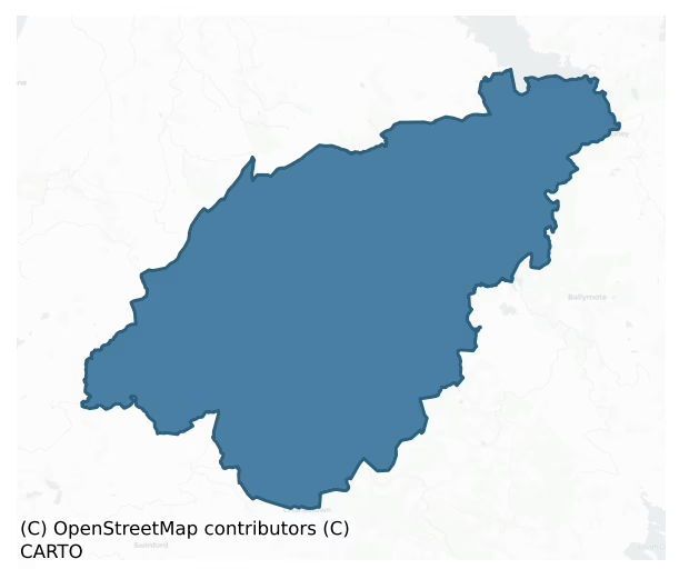
Leyny is a barony of County Sligo, in the historical province of Connacht (Irish: Luíne), covering 494 km² of land. The barony records 1,190 NMS archaeological sites and 97 NIAH listed buildings, placing it at around the 68th percentile among 280 ROI baronies for sites per km². This means it is in the top third of all baronies for sites per km². Dated archaeological evidence runs from the Mesolithic through to the Modern, spanning 9 of 9 archaeological periods, placing the barony in the 98th percentile among 280 ROI baronies for chronological depth. This means it is in the top tenth of all baronies for chronological depth. The largest dated subset of recorded sites dates to the Early Medieval. Logainm flags 43 placenames in the barony as carrying a recognised heritage root; the largest share — around 44% — are names associated with pre-christian defensive.
Heritage at a glance
Percentile rankings throughout this profile compare each barony only against the other 279 Republic of Ireland baronies.
The recorded heritage of Leyny
The National Monuments Service Sites and Monuments Record (SMR) is the statutory inventory of archaeological sites for the Republic of Ireland, maintained by the Department of Tourism, Culture, Arts, Gaeltacht, Sport and Media. Sites recorded here include earthworks, ringforts, megalithic tombs, ecclesiastical remains, and post-medieval features; not every record is legally protected, but each is registered as a monument of archaeological interest.
The National Monuments Service records 1,190 archaeological sites in Leyny, putting it at the 68th percentile among 280 ROI baronies for sites per km². This means it is in the top third of all baronies for sites per km². Protection coverage is near-universal — 1,165 sites (98%) fall within a recorded monument protection zone, indicating an extensively surveyed landscape. The dominant category is defensive sites — ringforts, enclosures, hillforts, and stone forts (819 sites, 69% of the record). Ringfort – rath is the most prevalent type, making up 38% of the barony's recorded sites (457 records) — well above the ROI average of 20% across all baronies where this type occurs. Ringfort – rath is an earthen ringfort enclosed by a bank and external ditch — the most common Early Medieval farmstead, broadly dated 500–1000 AD. Other significant types include Souterrain (121) and Enclosure (107). Souterrain is an underground stone-built passage and chamber, generally Early Medieval and often associated with ringforts as a defensive or storage feature; Enclosure is a banked or ditched feature of uncertain type, used as a catch-all where the original function cannot be determined from surface evidence. Across the barony's 494 km², this gives a recorded density of 2.41 sites per km².
Most common monument types
Hover or tap a monument type to see its definition.
| Type | Count |
|---|---|
| Ringfort – rath an earthen ringfort enclosed by a bank and external ditch — the most common Early Medieval farmstead, broadly dated 500–1000 AD | 457 |
| Souterrain an underground stone-built passage and chamber, generally Early Medieval and often associated with ringforts as a defensive or storage feature | 121 |
| Enclosure a banked or ditched feature of uncertain type, used as a catch-all where the original function cannot be determined from surface evidence | 107 |
| Ringfort – cashel the stone-walled equivalent of the rath, found mainly in upland or western areas, broadly dated 500–1000 AD | 99 |
| Hut site a low stone or earthen foundation enclosing a small circular or oval area, generally interpreted as a former dwelling, of any date from prehistory to the medieval period | 48 |
| Fulacht fia a horseshoe-shaped Bronze Age burnt mound built around a sunken trough beside a water source, traditionally interpreted as a cooking site | 21 |
| Barrow – ring-barrow a Bronze/Iron Age burial monument: a low circular area enclosed by ditch and outer bank | 21 |
| Church a building used for public Christian worship, of any date from c. 500 AD onwards | 16 |
Chronological distribution
The dated archaeological record for Leyny spans from the Mesolithic through to the Modern, with activity attested across 9 of 9 archaeological periods. This places Leyny in the top 2% of ROI baronies for chronological depth — few baronies record evidence across as many distinct archaeological periods. Every period from earliest to latest is represented in the record — an unbroken sequence of dated activity across the full chronological span. Activity concentrates most heavily in the Early Medieval (727 sites, 66% of dated material), with the Iron Age forming a secondary peak (157 sites, 14%). A further 90 recorded sites (8% of the overall NMS register for the barony) carry no period attribution — appearing as 'Unknown' in the bar chart below. This typically reflects either records that pre-date the standardised period vocabulary or sites awaiting specialist dating review, rather than a genuine absence of chronological evidence.
Sample of recorded monuments
Show 25 sample monuments (of 1,190 total)
A representative sample of 25 recorded monuments drawn from the barony’s 1,190 total NMS entries. Sites within a recorded monument protection zone and rarer site types are prioritised so the list shows a meaningful cross-section rather than only the most common type. Each entry shows the official Sites and Monuments Record reference number and the description published by the National Monuments Service.
House – 18th/19th century
Not included in the SMR (1989) but listed in the RMP (1995) and classified 'Field System'. A ruined 18th/19th-century rectangular house (int. 8.8m E-W; 3.5m N-S) is located in the intervening space between the SE walls…
Not included in the SMR (1989) but listed in the RMP (1995) and classified 'Field System'. A ruined 18th/19th-century rectangular house (int. 8.8m E-W; 3.5m N-S) is located in the intervening space between the SE walls of the cashel (SL019-176001-). The stone-built house is gable-ended and is sub-divided into three rooms. There are wall cupboards in the thickness of the walls but no fireplace is evident. There is a window and doorway in the S wall. A second structure of similar size but of irregular in plan is located a few meters to W. The modification/rebuilding of the cashel walls, and various small subdivisions of the intervening space between the two cashel walls, are most likely associated with this settlement. A pattern of subrectangular fields, indicated on the 1913 edition of the OS 6-inch map, links this house with the ruins of another settlement of two houses located on a terrace, c. 300-400m upslope to SE. The fields, on a NE-SW axis, are generally subrectangular and are enclosed by ruined drystone walls (Wth 0.8-1m). They conform to the undulating local topography of irregular bedrock terraces and scarps.
Compiled by: Archaeological Survey Unit, UCC
Date of upload: 11 January 2012
Mine
On the S side of Ballysadare Bay, c. 350m W of an Augustinian abbey (SL020-108—-). The minerals galena (lead sulphide) and sphalerite (zinc sulphide) occur in flat bands in the limestone beds at Abbeytown and silver…
On the S side of Ballysadare Bay, c. 350m W of an Augustinian abbey (SL020-108—-). The minerals galena (lead sulphide) and sphalerite (zinc sulphide) occur in flat bands in the limestone beds at Abbeytown and silver occurs in the lead as an impurity. The earliest documentary evidence for mining at Abbeytown dates to the mid-18th century when Charles O'Hara of Annaghmore (see SL026-049—-) commenced lead mining operations at Abbeytown and Lugawarry (3.2km to SW of Abbeytown) (McTernan 1998, 571-3). However, it is possible that these mines were worked by the monks at the 7th-century monastic site (SL020-109005-) c. 500m to E at a much earlier period for the production of lead and silver (ibid., 571). Some of the smaller mine shafts 'are known as The Monks' Tunnels … and may be Medieval or Early Christian in date' (M. B. Timoney 2002, 150). No remains of these early shafts were noted when the site was inspected in 1992. The mines indicated on the 1838 and 1913 OS 6-inch maps with several shafts shown are the 19th and 20th-century mines.
The above description is derived from the published 'Archaeological Inventory of County Sligo' compiled by Ursula Egan, Elizabeth Byrne, Mary Sleeman with Sheila Ronan and Connie Murphy (Dublin Stationery Office, 2005).
Date of upload: 18 January 2008
Religious house – Augustinian canons
Close to the shoreline of Ballysadare Bay, in the grounds of the limestone quarry and concrete works complex at Abbeytown. This Augustinian abbey is surrounded and largely covered by quarry debris. The visible remains…
Close to the shoreline of Ballysadare Bay, in the grounds of the limestone quarry and concrete works complex at Abbeytown. This Augustinian abbey is surrounded and largely covered by quarry debris. The visible remains consist of the N wall of the nave (L 13.6m) and chancel (L c. 6m) of the church, and the lower part of a tower (6.35m N-S; 3.7m E-W; H c. 6m) which was inserted between them. The walls are built of random-rubble set in a lime mortar. The N wall of the church is covered by debris and ivy, but a drawing made in 1917 (SMR (1989) file) shows an arched recess or opening just E of the tower. The crossing-tower rises from two substantial cross-walls. In the centre of each cross-wall is an opening (Wth 3.55m) covered by a pointed arch of dressed stone; these openings link the nave with the chancel. The underside of each arch has a rib rising from tapering corbels; on the chancel side the corbels have a terminal vine-leaf motif. A barrel vault (H 3.5m) covers the central area of the tower between the openings. The internal ground level is raised with quarry debris to the level of the corbels. The remains are those of the abbey of St Mary of the Canons Regular of St Augustine which existed by the middle of the 13th century but whose foundation date is not known (Gwynn and Hadcock 1970, 160; M. B. Timoney 2002, 150). The N wall could be 13th century, though no datable features are evident, but the tower is a 15th/16th century insertion. In 1585-6 the abbey consisted of…
Graveslab
Found within the graveyard (SL020-109002-) to the SE of the church (SL020-109001-) during a FÁS graveyard clean up in 1995 and 1996 (M. B. Timoney 2002, 152-3). A trapezoidal limestone slab (L 1.88m; Wth at top 0.41m;…
Found within the graveyard (SL020-109002-) to the SE of the church (SL020-109001-) during a FÁS graveyard clean up in 1995 and 1996 (M. B. Timoney 2002, 152-3). A trapezoidal limestone slab (L 1.88m; Wth at top 0.41m; Wth at base 0.35m; T 0.14m) of possible 15th/16th-century date, decorated with a pair of facing animals (possibly a lion and a dragon), a sword and foliage (ibid.); this is in the care of Sligo County Council (ibid., 153).
The above description is derived from the published 'Archaeological Inventory of County Sligo' compiled by Ursula Egan, Elizabeth Byrne, Mary Sleeman with Sheila Ronan and Connie Murphy (Dublin Stationery Office, 2005).
Date of upload: 18 January 2008
Promontory fort – inland
On an elongated ridge, which is enclosed on three sides by the Ballysadare River (which emerges through the Collooney gap in the Ox Mountains) and on the fourth side by a silted marshy lake. The S side of the ridge,…
On an elongated ridge, which is enclosed on three sides by the Ballysadare River (which emerges through the Collooney gap in the Ox Mountains) and on the fourth side by a silted marshy lake. The S side of the ridge, which rises 4m above the surrounding marsh, was cut off from the remainder by a bank and external fosse, which enclosed an area 85m N-S by at least 75m E-W (cut by a railway line at W). According to local information, this bank and ditch were bulldozed in 1978 (Mount 2002, 106). The inland promontory fort was partially excavated in 1994 (ibid., 103-116) prior to the construction of the Collooney to Carraroe by-pass road (N4). The road was realigned to the E in order to cause minimal damage to the interior of the fort (ibid., 103). Based on evidence from aerial photography and the excavation of the fosse, Mount (ibid., 106-7) concluded that the fort's defences consisted of a stone-faced earthen bank as well as the external fosse and that there was an entrance with a causeway (Wth 6.5m) midway along them. Excavation revealed that the fosse had a maximum width of 5m at the top and of 2.08m at the base. The excavations within the fort also revealed a large quantity of butchered animal remains, iron tools and nails, and vast quantities of iron smelting slag and furnace bottoms, indicating that this was an important industrial centre (ibid., 113). An animal bone found in the fosse produced a radiocarbon determination of 1260+/-40 BP (GrA-2452; 660 to 880 cal AD 2 sig…
Salt works
Listed in both the SMR (1989) and the RMP (1995) and classified 'Salt Workings'. In pasture, on the S shore of Ballysadare Bay. The salt workings comprise a series of overgrown ruined buildings. One of the buildings (on…
Listed in both the SMR (1989) and the RMP (1995) and classified 'Salt Workings'. In pasture, on the S shore of Ballysadare Bay. The salt workings comprise a series of overgrown ruined buildings. One of the buildings (on an E-W axis) is a residential, two-storey, gable-ended house (7.3m E-W; 5m N-S) with an enclosed yard (7m E-W) on the E side. There is a chimney on the W gable. There is a small square, single story structure (5.35m x 5.3m) at the E end of the yard with a wide cut-stone arch. There is another building (7.4m N-S; 4.8m E-W) at right-angles to the latter with a door ope at the N end facing onto the seashore. There is the remains of a two-storey building to E with the foundations of other buildings evident. The remains are of 18th/19th century appearance.
Compiled by: Archaeological Survey Unit, UCC
Date of upload: 11 January 2012
Castle – motte
In undulating pasture, on the W bank of the Owenbeg River. A circular flat-topped mound (diam. c. 20m; H 2.5m) with a slightly rounded top. At SE the mound drops c. 5m down to the river. It is densely overgrown with…
In undulating pasture, on the W bank of the Owenbeg River. A circular flat-topped mound (diam. c. 20m; H 2.5m) with a slightly rounded top. At SE the mound drops c. 5m down to the river. It is densely overgrown with brambles and bushes.
The above description is derived from the published 'Archaeological Inventory of County Sligo' compiled by Ursula Egan, Elizabeth Byrne, Mary Sleeman with Sheila Ronan and Connie Murphy (Dublin Stationery Office, 2005).
Date of upload: 18 January 2008
Mass-rock
Not included in the SMR (1989) but listed in the RMP (1995) and classified 'Mass Rock'. In the fosse at the NNE of Rathbarran barrow (SL025-071001-) is a large boulder (1.3m x 1.4m; H 0.75m). It is known by the people…
Not included in the SMR (1989) but listed in the RMP (1995) and classified 'Mass Rock'. In the fosse at the NNE of Rathbarran barrow (SL025-071001-) is a large boulder (1.3m x 1.4m; H 0.75m). It is known by the people in the locality as a mass-rock. The classification mass-rock is likely to be post-1700 AD in date.
Compiled by: Archaeological Survey Unit, UCC
Date of upload: 11 January 2012
Mound
In gently undulating pasture. A linear sod-covered mound (7.5m NW-SE; 3.5m NE-SW; H 0.55m) incorporating some irregularly shaped stones. Though named 'Giants Grave' on the 1914 OS 6-inch map there is insufficient…
In gently undulating pasture. A linear sod-covered mound (7.5m NW-SE; 3.5m NE-SW; H 0.55m) incorporating some irregularly shaped stones. Though named 'Giants Grave' on the 1914 OS 6-inch map there is insufficient evidence to classify it as a megalithic structure (Ó Nualláin 1989, 98, no. 20). There is an enclosure (SL025-086—-) c. 80m to SE.
The above description is derived from the published 'Archaeological Inventory of County Sligo' compiled by Ursula Egan, Elizabeth Byrne, Mary Sleeman with Sheila Ronan and Connie Murphy (Dublin Stationery Office, 2005).
Date of upload: 18 January 2008
Designed landscape – belvedere
Listed in both the SMR (1989) and RMP (1995) and classified 'Earthwork' and 'Kiln' respectively. This is a 19th-century estate featue which, according to the owner of Annaghmore, was built by one of his ancestors as a…
Listed in both the SMR (1989) and RMP (1995) and classified 'Earthwork' and 'Kiln' respectively. This is a 19th-century estate featue which, according to the owner of Annaghmore, was built by one of his ancestors as a viewing point. This belvedere dates to the post-1700 AD period.
Compiled by: Archaeological Survey Unit, UCC
Date of upload: 11 January 2012
Weir – regulating
In the Owenmore River. This monument was listed in the SMR (1989) as ‘Weir’ and in the RMP (1995) as ‘Weir Site’. This is one of seven records for weirs (SL026-122—-; SL026-126—–; SL026-130—-; SL026-159—–;…
In the Owenmore River. This monument was listed in the SMR (1989) as ‘Weir’ and in the RMP (1995) as ‘Weir Site’. This is one of seven records for weirs (SL026-122—-; SL026-126—–; SL026-130—-; SL026-159—–; SL026-159001-; SL026-159002-; SL026-159003-) recorded in the SMR whose only source is noted as ‘Marked on estate map dated 1618’ (SMR file). It has not proved possible to identify this map. It is marked and named ‘Weir’ on the 1837 edition of the OS 6-inch map. It was not marked on the 1913 edition. On inspection in 1992 there were no visible remains of this weir though it is possible that residual elements survive on the river bed. Although the date of this weir is unknown the possibility that it pre-dates 1700 AD cannot be ruled out.
Compiled by: Paul Walsh
Date of upload: 18 October 2011
Hillfort
On the table-top plateau of Knocknashee hill, commanding extensive views in all directions to the Ox Mountains and South Sligo. The generally level plateau is comprised of a series of natural terraces of limestone…
On the table-top plateau of Knocknashee hill, commanding extensive views in all directions to the Ox Mountains and South Sligo. The generally level plateau is comprised of a series of natural terraces of limestone bedrock declining gradually from the centre of the plateau outwards to the abrupt break of slope that marks the outer edge. Described by Condit, Gibbons and Timoney (1991, 59-62) as a roughly oval-shaped area (c. 700m NNE-SSW; c. 350m E-W), comprising c. 21.5 hectares and enclosed by two earth-and-stone banks. The inner bank (Wth 3.8m; max. H 1.5m) is constructed from a series of quarry hollows contiguous to the inner bank face and forming an inner fosse in parts and is topped by a later field boundary wall along the E side (ibid.). A second rampart was described along the E and S arcs, parallel to the inner bank and utilising a natural terrace and turning sharply downhill at NE (ibid.). Along the sheltered E half of the interior are about 30 hut sites, possibly a Neolithic settlement (SL032-013004-). Two possible passage tombs (SL032-013002-; SL032-013003-) c. 120m apart are located at the N end of the plateau. A D-shaped enclosure (SL032-013005-) abuts the inner bank at E. Further evidence of settlement might be provided by the presence of 'scoops and hollows situated at the south and south-west in the hillfort' (ibid., 61).
The above description is derived from the published 'Archaeological Inventory of County Sligo' compiled by Ursula Egan, Elizabeth Byrne…
Religious house – Franciscan Third Order Regular
In flat pasture. There is no evident trace of the roofless rectangular structure (c. 10m NE-SW; c. 5m NW-SE) indicated on the 1838 OS 6-inch map. According to Gwynn and Hadcock (1970, 271), this was not an independent…
In flat pasture. There is no evident trace of the roofless rectangular structure (c. 10m NE-SW; c. 5m NW-SE) indicated on the 1838 OS 6-inch map. According to Gwynn and Hadcock (1970, 271), this was not an independent foundation but 'a small dependency' of the nearby Third Order Regular Franciscan foundation of Court Abbey (SL032-047001-), c. 5km to the E. There is a possible souterrain (SL031-006003-) to the E, a bullaun stone (SL031-006002-) c. 60m to NE and a possible church and graveyard (SL031-005001-; SL031-005002-) c. 60m to the SW.
The above description is derived from the published 'Archaeological Inventory of County Sligo' compiled by Ursula Egan, Elizabeth Byrne, Mary Sleeman with Sheila Ronan and Connie Murphy (Dublin Stationery Office, 2005).
Date of upload: 18 January 2008
House – early medieval
In the N half of the interior of a rath (SL031-019001-). This consists of a square flat area (6m N-S; 6m E-W) defined by a scarp revetted with stones. Immediately to S is a possible hut site (SL031-019003-). Both appear…
In the N half of the interior of a rath (SL031-019001-). This consists of a square flat area (6m N-S; 6m E-W) defined by a scarp revetted with stones. Immediately to S is a possible hut site (SL031-019003-). Both appear to pre-date the cultivation ridges which cross the rath interior.
Compiled by: Archaeological Survey Unit, UCC with revisions by Patrick F. O'Donovan and Paul Walsh
Date of upload: 20 June 2011
Religious house – Franciscan friars
In undulating pasture, straddling a N-S rise; in the NW quadrant of a graveyard (SL032-047002-). A Franciscan foundation known locally as 'Court Abbey', the remains of which consist of a rectangular church with a…
In undulating pasture, straddling a N-S rise; in the NW quadrant of a graveyard (SL032-047002-). A Franciscan foundation known locally as 'Court Abbey', the remains of which consist of a rectangular church with a central tower and a rectangular transept on its S side (see plan Harbison 2002, 97). Built of roughly coursed limestone in a lime mortar, except for the tower which is faced with limestone ashlar. The nave and chancel are of one phase but the tower and transept are later insertions. The interior of the church contains many 19th- and 20th-century burials. The chancel (surviving for c. 10m E-W; int. 6.5m N-S; ) is missing its E end; a slight break in slope, 12.3m from the tower, marks the line of the E wall; an illustration by Grose (1791, vol. 1, 52) shows the stump of it in this position. An 18th-century burial vault of the O'Hara family is set into the NW corner. The nave (int. 12m E-W; 6.5m N-S) walls stand to full height but are masked by ivy. In the centre of the W wall is a doorway, missing its surround. On its N side, on the internal wall-face, is a damaged stoup with a semicircular bowl. Near the W end of the S wall is another doorway. The rectangular tower (4.2m E-W; 6.5m N-S) occupies the full width of the church, between the nave and chancel. It rises from four rectangular piers, butted against the side-walls of the church. These form two identical bluntly pointed arched openings facing respectively into the nave and chancel; both arches have a moulded s…
Hilltop enclosure
In pasture, on top of a steep-sided oval hillock on the SE slope of Muckelty Hill. An oval area (87m N-S; 40m E-W) defined by a collapsed drystone wall (Wth 4m) N-S and by the steep natural slope of the hillock S-N. The…
In pasture, on top of a steep-sided oval hillock on the SE slope of Muckelty Hill. An oval area (87m N-S; 40m E-W) defined by a collapsed drystone wall (Wth 4m) N-S and by the steep natural slope of the hillock S-N. The entrance (Wth 4m) is at the S. The interior slopes gently down to E. When inspected, the hilltop enclosure had been ploughed for forestry but not planted. Included in a list of hillforts and hilltop enclosures by Condit, Gibbons and Timoney (1991, 62) who also noted that the remains of a possible outer enclosing wall, following the contour on the E side of the hill, is visible in an aerial photograph (CUCAP, APF 68) and that the area had been planted with trees.
The above description is derived from the published 'Archaeological Inventory of County Sligo' compiled by Ursula Egan, Elizabeth Byrne, Mary Sleeman with Sheila Ronan and Connie Murphy (Dublin Stationery Office, 2005).
Date of upload: 18 January 2008
Cathedral
At the N end of Achonry graveyard (SL032-188003-) and immediately E of St Crumnathy's, an early 19th-century deconsecrated C of I cathedral. Part of the E gable (int. Wth 6.85m) and the N wall (surviving length 14.7m; H…
At the N end of Achonry graveyard (SL032-188003-) and immediately E of St Crumnathy's, an early 19th-century deconsecrated C of I cathedral. Part of the E gable (int. Wth 6.85m) and the N wall (surviving length 14.7m; H 1.2m) of the church survive in poor repair and heavily clad with ivy. In the centre of the E gable are the fragmentary remains of a window which had three sub-arches with switchline tracery above, cut in limestone, and is late 15th/early 16th century in form. The interior of the church is overshadowed by a sycamore tree, and partially covered by scrub undergrowth. A block of stone decorated with concentric circles, possibly a corbel, was recently found within it where it had been reused as a grave-marker (pers. comm. M. A. Timoney). This is the site of a church founded by St Finnian in the 7th century though 'nothing further is known of the history of Achonry until the twelfth century' (Gwynn and Hadcock 1970, 60). Achonry was a separate diocese during part of the late medieval period (ibid.) and a cathedral is mentioned here in the 1680s (Ó Muraíle 2002, 240, n. 24), so this is probably the remains of this structure. It was inadvertently named 'R.C. Chapel' on the 1914 OS 6-inch map. A possible church (SL032-188001-) lies c. 100m to the NE and a holy well (SL032-188006-) is c. 100m to the SE.
The above description is derived from the published 'Archaeological Inventory of County Sligo' compiled by Ursula Egan, Elizabeth Byrne, Mary Sleeman with Sheila R…
Altar
On top of the penitential cairn (SL032-188007-) is a small square flat-topped structure (1.2m NW-SE; 1.2m NE-SW; H 0.3m at SW, 0.75m at NE) of drystone construction. It is built up on the NE side to compensate for the…
On top of the penitential cairn (SL032-188007-) is a small square flat-topped structure (1.2m NW-SE; 1.2m NE-SW; H 0.3m at SW, 0.75m at NE) of drystone construction. It is built up on the NE side to compensate for the sloping ground. Erected on top of the structure is modern 'Celtic' cross, painted white, and in front of the cross is a horizontal slab providing a flat table-like surface. This structure appears to serve as a crude altar. According to local information, the well is dedicated to St. Finian and the traditional pattern day, which is still observed, is held on 15th August. This is part of the penitential station (see SL032-188007-).
Compiled by: Archaeological Survey Unit, UCC with revisions by Patrick F. O'Donovan and Paul Walsh
Date of upload: 20 June 2011
Boulder-burial
On level ground on N-facing slope of ridge. Three large boulders laid flat on the ground, two to the S and the other to the N, support a fourth which clearly has been deliberately placed on them. This raised boulder…
On level ground on N-facing slope of ridge. Three large boulders laid flat on the ground, two to the S and the other to the N, support a fourth which clearly has been deliberately placed on them. This raised boulder (3.55m x 2.55m; T 1.4m) is the largest of the four while the smallest of the others measures 2.25m x 1.6m x 0.9m T. There is a pad-stone (0.35m x 0.25m; T 0.2m) between the northern supporting boulder and the large raised boulder. The affinities of this curious structure may lie with boulder-burials. (Ó Nualláin 1989, 98, no. 22)
The above description is derived from the published 'Archaeological Inventory of County Sligo' compiled by Ursula Egan, Elizabeth Byrne, Mary Sleeman with Sheila Ronan and Connie Murphy (Dublin Stationery Office, 2005).
Date of upload: 18 January 2008
Castle – hall-house
In level pasture, on the N shore of Templehouse Lake. A rectangular (22m N-S; 12m E-W) two-storey structure (see plans in Lynn 1985-6, 106; Sweetman 1999, fig. 78), standing on the W side of a complex of ruined…
In level pasture, on the N shore of Templehouse Lake. A rectangular (22m N-S; 12m E-W) two-storey structure (see plans in Lynn 1985-6, 106; Sweetman 1999, fig. 78), standing on the W side of a complex of ruined buildings (SL033-026002-, SL033-026003-; SL033-026004-), built of uncoursed limestone in a lime mortar, with a distinct base batter (H c. 2m). The partially ivy-clad walls stand to full height except the W wall which, apart from short returns at either end, does not survive. The structure was refurbished in the 15th/16th century and again in the 19th century. In the former case, vaulting was inserted over the ground floor and the floor levels changed slightly. In the latter case, parts of the interior were used for farm buildings and a bellcote was erected on top of the N wall; Lynn (1985-6, 108) suggests that the bellcote indicates a religious function for the building but bellcotes of this form are typical of 18th/19th-century demesne farmyards.
The vaulting covered the entire ground floor and consisted of two segmental wicker-centred vaults springing from the E and W walls and an inserted medial wall which was arcaded. Only fragments of the vaulting and the medial wall now survive. There are four inserted 15th/16th-century embrasures at ground-floor level: one each in the N and E walls and two in the S wall. These were probably all windows; the best preserved is that in the N wall which has wicker-centred vaulting over the embrasure and a single light. Each one…
Bawn
In level pasture, on the N shore of Templehouse Lake. A complex of ruined buildings (SL033-026001-; SL033-026003-; SL033-026004-) roughly arranged around a square area (L c. 40m). Judging by the appearance of the…
In level pasture, on the N shore of Templehouse Lake. A complex of ruined buildings (SL033-026001-; SL033-026003-; SL033-026004-) roughly arranged around a square area (L c. 40m). Judging by the appearance of the gate-tower (SL033-026003-) in the centre of the N side, the complex was turned into a tower house and bawn arrangement in the 15th/16th century with the 13th-century hall-house (SL033-026001-) converted into the main residential block. By the early 17th century a new residential block (SL033-026004-) was built in the SE corner of the bawn. In the 19th century when the nearby Templehouse country house was built (Bence-Jones 1988, 271) the complex was converted into a farmyard with servants' quarters. The only surviving section of the enclosing bawn wall (H c. 6m; T 1.65m) runs E (L c. 10m) from midway along the E wall of the gate-tower before turning at a right angle to the S (L c. 20m) where it eventually merges with the E wall of the 17th-century house. Midway along this latter section is a 19th-century archway; on the inside face of the keystone of this arch is a carved human head which is probably 15th/16th-century in date.
The above description is derived from the published 'Archaeological Inventory of County Sligo' compiled by Ursula Egan, Elizabeth Byrne, Mary Sleeman with Sheila Ronan and Connie Murphy (Dublin Stationery Office, 2005).
Date of upload: 18 January 2008
Gatehouse
In level pasture, on the N shore of Templehouse Lake. The ivy-clad ruin of a square (5.95m E-W) two-storey gatehouse, stands on the N side of a complex of ruined buildings (SL033-026001-; SL033-026002-; SL033-026004-)…
In level pasture, on the N shore of Templehouse Lake. The ivy-clad ruin of a square (5.95m E-W) two-storey gatehouse, stands on the N side of a complex of ruined buildings (SL033-026001-; SL033-026002-; SL033-026004-) and was probably the entrance into the bawn (see SL033-026002-). The tower stood to full height in the 19th century (see drawing O'Rorke 1878, 315) but now its S wall has entirely collapsed. The N wall still stands to near full height though its top is covered by ivy. Built of uncoursed limestone in a lime mortar, the walls have a distinct base-batter. There is a central ground-floor archway in the N wall (Wth 1.75m); the arch is pointed and the opening framed by dressed limestone blocks. The doorway is choked by fallen masonry and the area inside filled by rubble to 1st-floor level. This area was covered by a groin vault which has almost entirely fallen. Running E from the tower is a high wall set back 2.5m from its N face; the corresponding area on the W side is covered by rubble (see SL033-026002-). The 19th-century drawing (ibid.) shows a plain rectangular opening over the doorway but this area is now covered by ivy. This drawing also shows the remains of battlements on top of the tower. In general appearance the tower would appear to be 15th/16th-century in date and contemporary with the bawn wall (SL033-026002-).
The above description is derived from the published 'Archaeological Inventory of County Sligo' compiled by Ursula Egan, Elizabeth Byrne, Ma…
House – 17th century
In level pasture, on the N shore of Templehouse Lake. The fragmentary ruin of a two-storey gable-ended L-shaped house, standing at the SE corner of a complex of ruined buildings (SL033-026001-, SL033-026002- and…
In level pasture, on the N shore of Templehouse Lake. The fragmentary ruin of a two-storey gable-ended L-shaped house, standing at the SE corner of a complex of ruined buildings (SL033-026001-, SL033-026002- and SL033-026003-). The building is now reduced to rubble apart from its E wall (L 14m), a short return of the S wall (original L c. 12m), and a gable wall which formed the N gable of the eastern arm (L 8m); there is also a gable on the S half of the E wall. The house was extensively rebuilt in the 19th century as part of a farmyard complex but three original windows are evident on the E wall, one at ground-floor level and two above. These are very fragmentary apart from that on the S end at 1st-floor level which is now completely blocked up. The light is a rectangular frame divided by three mullions and a transom, and covered by a hood-moulding. This is typically of an early 17th-century date. Another original feature of the house are the contemporary red bricks which faced the inside wall. Also probably associated with the house is a stone-built chimney stack (H c. 6m) which stands close to the now missing SW corner of the house.
Lying on the ground nearby are fragments of a limestone door arch and an inscribed limestone mantelpiece (SL033-026006-), both of which probably come from the house. The mantelpiece (1.2m x 0.4m x 0.3m) has been damaged in places but its basic form is clear. On its front face are two side-by-side rectangular panels which bear a Latin inscri…
Cross – High cross
Lying on the ground on the line of the missing W wall of Templehouse hall-house (SL033-026001-) is a stone cross-base. This is a limestone block (H 0.4m; at base 0.7m x 0.55m) tapering gently to a rectangular top (0.6m…
Lying on the ground on the line of the missing W wall of Templehouse hall-house (SL033-026001-) is a stone cross-base. This is a limestone block (H 0.4m; at base 0.7m x 0.55m) tapering gently to a rectangular top (0.6m x 0.45m). In the centre of the upper surface is a rectangular mortise-hole (0.3m x 0.22m; D 0.2m) which is surrounded by a plain rectangular rim (H 0.05m; Wth 0.08m), rounded in section. There appears to be no decoration on the stone though it is encrusted by lichen and moss. The form of the stone is characteristic of an early medieval high cross (Edwards 1990, 164-70). It has been suggested (Lynn 1985-6, 108) that the cross might be associated with a possible Knights Templar foundation at Templehouse of which there are no other obvious extant remains (see SL033-026007-). O'Rorke (1878, 320) noted a tradition where 'the country people' of the district called this stone a 'Holy Water Stone'. This stone is included by Harbison (1992b, vol. 1, 393) in a list of bases without crosses which are possibly 'earlier than 1200'.
The above description is derived from the published 'Archaeological Inventory of County Sligo' compiled by Ursula Egan, Elizabeth Byrne, Mary Sleeman with Sheila Ronan and Connie Murphy (Dublin Stationery Office, 2005).
Date of upload: 18 January 2008
Ringfort – rath
In undulating pasture, on top of a hillock. A raised oval area (20.4m NW-SE; 24m NE-SW) defined by the remnants of a low stony bank (Wth 3.5m; int. H 0.4m; ext. H 0.4m) outside of which is a broad sloping terrace (Wth…
In undulating pasture, on top of a hillock. A raised oval area (20.4m NW-SE; 24m NE-SW) defined by the remnants of a low stony bank (Wth 3.5m; int. H 0.4m; ext. H 0.4m) outside of which is a broad sloping terrace (Wth c. 10m) defined by a scarp (H 0.8m). The external slope S-W is obscured by gorse bushes. A NNE-SSW field boundary wall overlies the external terrace along the W and NW arcs. The interior is level with a pile of stones, covered with brambles, against the bank at E.
The above description is derived from the published 'Archaeological Inventory of County Sligo' compiled by Ursula Egan, Elizabeth Byrne, Mary Sleeman with Sheila Ronan and Connie Murphy (Dublin Stationery Office, 2005).
Date of upload: 18 January 2008
Listed buildings
The National Inventory of Architectural Heritage (NIAH) is a state survey appraising buildings of architectural, historical, archaeological, artistic, cultural, scientific, social, or technical interest. Each surveyed structure receives a rating from International (the highest, for buildings of European importance) through National, Regional, Local, and Record-Only.
The NIAH records 97 listed buildings in Leyny (49th percentile across ROI baronies). The highest-graded structure include 1 of National significance. The Republic holds 937 National-graded buildings in total, so this barony accounts for around 0% of the national total. Construction dates concentrate most heavily in the Victorian (1830-1900) period. The most-recorded building type is house (27 examples, 28% of the listed stock).
Terrain and environment
Mean elevation across the barony is 130m — the 79th percentile among 280 ROI baronies for elevation. This means it is in the top third of all baronies for elevation. This is a relatively elevated landscape by ROI standards. Elevation matters for heritage because higher-altitude baronies typically favour defensive monuments — ringforts and hilltop forts placed on prominent ground — while lowland baronies are more likely to carry the dense settlement and church networks of intensive agricultural landscapes. The barony reaches 512m at its highest point — a vertical span of more than 381m within its boundary, indicating significant topographic diversity. Mean slope is 4.6° — the 71st percentile among 280 ROI baronies for slope. This means it is in the top third of all baronies for slope. Slope is a key control on both land use and archaeological preservation: steep ground resists ploughing and tends to preserve earthworks intact, while gentle slopes favour intensive cultivation that damages or destroys surface archaeology over time. The Topographic Wetness Index averages 10.5, the 34th percentile among 280 ROI baronies for wetness. This means it is in the lower half of all baronies for wetness. Drainage matters for heritage because poorly-drained ground preserves organic archaeology (wooden trackways, leather, textiles, and on rare occasions human remains) far better than free-draining soil; well-drained ground favours arable use but destroys organic material rapidly. The land cover is dominated by improved grassland (78%) and woodland (21%). In overall character, this is elevated but relatively gentle terrain — typical of plateau country, with land use dominated by improved grassland.
Terrain measurements
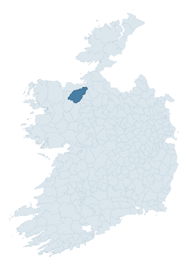
Where this barony sits in the Republic of Ireland
Geology and preservation
Bedrock geology shapes the landscape long before any settlement begins — controlling soil drainage, agricultural potential, the survival of upstanding monuments, and the preservation of buried archaeology. The figures below come from the Geological Survey Ireland 1:100,000 bedrock map.
The bedrock underlying Leyny is predominantly limestone (31% of the barony by area), laid down during the Carboniferous period (62% by area, around 359 to 299 million years ago). Limestone is the most heritage-rich bedrock in Ireland. It supports fertile, well-drained soils that favoured dense Early Medieval settlement and Norman manorial agriculture, and it weathers into karst features — sinkholes, caves, swallow holes, and souterrains — that frequently carry archaeology. Where peat overlies limestone, organic preservation can be exceptional. A substantial secondary geology of shale, limestone (23%) and schists (20%) adds further variety to the underlying landscape. With 9 distinct rock types mapped, the barony sits in the top third of ROI baronies for geological diversity (87th percentile) — typically a sign of complex tectonic history or coastal mosaics of differing rock units.
Rock type composition
Largest mapped unit: Lisgorman Shale Formation (23% of the barony)
Placename evidence
Logainm records 43 heritage-diagnostic placenames for Leyny, drawn from townland and civil-parish names across the barony. The dominant stratum is pre-Christian and Early Medieval defensive — ráth-, lios-, dún-, and caiseal-prefixed names that mark Iron Age and early historic settlement. The leading diagnostic roots are ráth- (12 — earthen ringfort), cill- (12 — church), and lios- (4 — ringfort or enclosure). This is above the ROI average of 30.7 heritage placenames per barony. The presence of multiple heritage strata side by side indicates layered occupation of the landscape across successive prehistoric and historic periods. Logainm records 214 placenames for Leyny (predominantly townland names). Of these, 43 (20%) carry one of the diagnostic Gaelic roots tracked above; the remainder draw on more generic landscape vocabulary that does not encode a heritage period.
Pre-Christian / Early Medieval Defensive
| Root | Count | Meaning |
|---|---|---|
| ráth- | 12 | earthen ringfort |
| lios- | 4 | ringfort or enclosure |
| caiseal- | 3 | stone ringfort |
Early Christian Ecclesiastical
| Root | Count | Meaning |
|---|---|---|
| cill- | 12 | church (early) |
| tobar- | 4 | holy well |
| teampall- | 1 | church (later medieval) |
| bile- | 1 | sacred tree / boundary marker |
Burial, Ritual, and Norse-Contact
| Root | Count | Meaning |
|---|---|---|
| carn- | 2 | cairn |
| dumha- | 2 | mound |
| leacht- | 1 | grave monument |
| uaimh- | 1 | cave / souterrain |

Explore further
Grounding History: 10 Maps of Northern Ireland’s Past
If you’re interested in Irish heritage more widely, the companion report for Northern Ireland brings together the analysis of all 462 NI wards into one place through 10 high-quality maps — covering monument density, archaeological periods, placename heritage, terrain, wetland, and the historic landscape at first survey. Take a look.
About this profile
Click any section below to expand.
What is a barony?
A barony is a historic administrative unit in Ireland, broadly equivalent to an English hundred. The 280 baronies used here are from the OSi 2019 National Statutory Boundaries (generalised 20m), covering the 26 counties of the Republic of Ireland. Baronies derive from the Norman period, were formalised in the 17th century, and have not been redrawn for statistical purposes. They vary enormously in area, from compact urban baronies in Dublin to vast upland baronies in Connacht, and should not be compared by raw site count without accounting for area differences.
What counts as a site?
This profile combines three distinct heritage registers, each with its own definition of what constitutes a recordable site:
- Archaeological sites (NMS). The National Monuments Service Sites and Monuments Record (SMR) catalogues every known archaeological monument or site of archaeological interest in the Republic, from prehistoric burial mounds and ringforts to medieval churches and post-medieval defensive works. Inclusion does not require legal protection — only that the site has been identified, surveyed, and assessed as having archaeological value. A separate subset of these sites lies within a recorded protection zone, which gives them statutory protection under the National Monuments Acts.
- Listed buildings (NIAH). The National Inventory of Architectural Heritage records buildings of architectural, historical, archaeological, artistic, cultural, scientific, social, or technical interest. Each surveyed structure is appraised on a five-tier scale: International, National, Regional, Local, and Record-Only. The NIAH appraisal is informational rather than strictly statutory, but it underpins local-authority Record of Protected Structures (RPS) listings.
- Heritage placenames (Logainm). Logainm is the authoritative database of Irish placenames maintained by the Placenames Branch. This profile applies a heritage-diagnostic classifier to the Irish-language form of each townland name, flagging roots that signal defensive sites (ráth-, lios-, dún-, caiseal-, cathair-), ecclesiastical foundations (cill-, teampall-, domhnach-, mainistir-), prehistoric burial-ritual features (tuaim-, carn-, leaba-), or Norse-contact settlement (gall-). Townlands without one of these diagnostic roots are not flagged here — they may still carry historical significance, but that significance is not encoded in the name itself.
Editorial principles
The narrative sections of this profile follow several explicit principles:
- Evidential. Every claim about this barony’s heritage character is anchored in the underlying register data. Where a site count, a placename count, or a percentile rank is cited, it is computed from the source datasets at export time, not estimated.
- Comparative. Counts and metrics are reported alongside their percentile rank against the other 279 ROI baronies. A barony with 50 ringforts in absolute terms could be unusually high or unusually low depending on its size and regional context; percentile ranking removes that ambiguity.
- Transparent on limits. Where a register has known coverage gaps, survey biases, or data-quality issues that affect this barony’s figures, the profile flags them rather than presenting the numbers as definitive.
- No interpretation beyond what the data supports. The narrative does not speculate about historical events, social dynamics, or cultural meaning beyond what the recorded heritage and placename evidence directly attests.
Data caveats and limits
- NMS Sites and Monuments Record is the product of survey campaigns conducted at different intensities across different counties and decades. Some baronies have been surveyed more thoroughly than others, and absolute counts should be read in that light. Sites destroyed by development before survey are typically not represented; sites in heavily forested or upland terrain are sometimes under-recorded.
- NIAH coverage is broadly complete for the Republic of Ireland but the survey was conducted on a rolling county-by-county basis, and the most recent appraisal date varies. Buildings demolished or substantially altered after their original survey may still appear in the register; conversely, recent buildings of merit may not yet have been appraised.
- Logainm classification applies a deliberately conservative pattern-matching approach to the Irish-language townland forms. The classifier prioritises true positives over recall: a townland may carry a heritage signal that the classifier doesn’t recognise, particularly where the diagnostic root has been heavily anglicised or where the townland name draws on a less common term. The 60,000+ townland records and ~9,800 classified placenames give a substantial signal at barony scale, but individual townland names should be checked against Logainm directly for definitive interpretation.
- Period attribution. The chronological distribution reflects only those NMS sites that carry a recognised period attribution in the source data. Sites listed as “Unknown” period are excluded from the dated subset.
- Boundary changes. Some baronies have undergone minor boundary adjustments since their 19th-century definition; the OSi 2019 generalised boundaries used here are the current statutory definition and may differ slightly from historical maps in border areas.
- Bedrock geology is mapped at 1:100,000 scale, which means local variation within a barony — small pockets of different rock type, mineral veins, alluvium overlying bedrock — is generalised. The dominant-system and rocktype figures are area-weighted, so a barony reading “70% Carboniferous limestone” may still contain small but archaeologically important pockets of older or younger rock. Around 3% of GSI polygons do not match the lexicon and contribute no rocktype or system attribution.
Data sources
- National Monuments Service — Sites and Monuments Record (SMR) https://data.gov.ie/dataset/national-monuments-service-archaeological-survey-of-ireland
- National Inventory of Architectural Heritage (NIAH) https://data.gov.ie/dataset/national-inventory-of-architectural-heritage-niah-national-dataset
- Logainm — Placenames Database of Ireland https://www.logainm.ie/
- Ordnance Survey Ireland — National Statutory Barony Boundaries 2019 https://data-osi.opendata.arcgis.com/
- EURODEM — European Digital Elevation Model https://www.mapsforeurope.org/datasets/euro-dem
- ESA WorldCover https://esa-worldcover.org/en
- Geological Survey Ireland — 1:100,000 Bedrock Geology https://www.gsi.ie/en-ie/data-and-maps/Pages/Bedrock.aspx
Explore more: Search any of the 280 ROI baronies, browse by historical province, or read the methodology and data sources for the full Republic of Ireland Heritage Tool.