
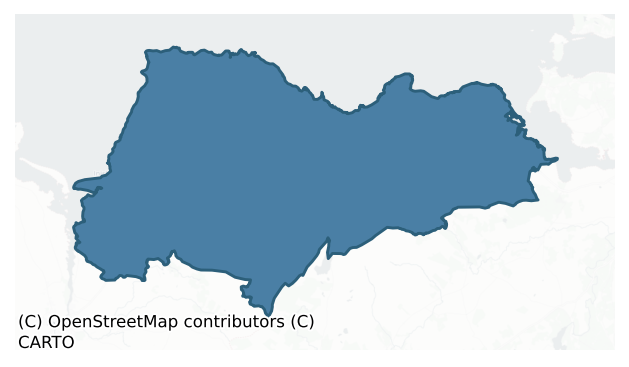
Tireragh is a barony of County Sligo, in the historical province of Connacht (Irish: Tír Fhiachrach), covering 395 km² of land. The barony records 1,187 NMS archaeological sites and 99 NIAH listed buildings, placing it at around the 81st percentile among 280 ROI baronies for sites per km². This means it is in the top fifth of all baronies for sites per km². Dated archaeological evidence runs from the Neolithic through to the Modern, spanning 8 of 9 archaeological periods, placing the barony in the 71st percentile among 280 ROI baronies for chronological depth. This means it is in the top third of all baronies for chronological depth. The largest dated subset of recorded sites dates to the Early Medieval. Logainm flags 47 placenames in the barony as carrying a recognised heritage root; the largest share — around 60% — are names associated with pre-christian defensive.
Heritage at a glance
Percentile rankings throughout this profile compare each barony only against the other 279 Republic of Ireland baronies.
The recorded heritage of Tireragh
The National Monuments Service Sites and Monuments Record (SMR) is the statutory inventory of archaeological sites for the Republic of Ireland, maintained by the Department of Tourism, Culture, Arts, Gaeltacht, Sport and Media. Sites recorded here include earthworks, ringforts, megalithic tombs, ecclesiastical remains, and post-medieval features; not every record is legally protected, but each is registered as a monument of archaeological interest.
The National Monuments Service records 1,187 archaeological sites in Tireragh, putting it at the 81st percentile among 280 ROI baronies for sites per km². This means it is in the top fifth of all baronies for sites per km². Protection coverage is near-universal — 1,152 sites (97%) fall within a recorded monument protection zone, indicating an extensively surveyed landscape. The dominant category is defensive sites — ringforts, enclosures, hillforts, and stone forts (655 sites, 55% of the record). Ringfort – rath is the most prevalent type, making up 26% of the barony's recorded sites (304 records) — well above the ROI average of 20% across all baronies where this type occurs. Ringfort – rath is an earthen ringfort enclosed by a bank and external ditch — the most common Early Medieval farmstead, broadly dated 500–1000 AD. Other significant types include Enclosure (173) and Souterrain (90). Enclosure is a banked or ditched feature of uncertain type, used as a catch-all where the original function cannot be determined from surface evidence; Souterrain is an underground stone-built passage and chamber, generally Early Medieval and often associated with ringforts as a defensive or storage feature. Across the barony's 395 km², this gives a recorded density of 3.01 sites per km².
Most common monument types
Hover or tap a monument type to see its definition.
| Type | Count |
|---|---|
| Ringfort – rath an earthen ringfort enclosed by a bank and external ditch — the most common Early Medieval farmstead, broadly dated 500–1000 AD | 304 |
| Enclosure a banked or ditched feature of uncertain type, used as a catch-all where the original function cannot be determined from surface evidence | 173 |
| Souterrain an underground stone-built passage and chamber, generally Early Medieval and often associated with ringforts as a defensive or storage feature | 90 |
| Hut site a low stone or earthen foundation enclosing a small circular or oval area, generally interpreted as a former dwelling, of any date from prehistory to the medieval period | 61 |
| Burnt mound a heap of fire-cracked stone, ash and charcoal, with no surviving trough, dated Bronze Age to early medieval | 42 |
| Fulacht fia a horseshoe-shaped Bronze Age burnt mound built around a sunken trough beside a water source, traditionally interpreted as a cooking site | 30 |
| Field system a group of related fields forming a coherent agricultural landscape, of any date from the Neolithic onwards | 28 |
| Ringfort – unclassified a circular Early Medieval settlement enclosure where surviving evidence does not allow distinction between earthen and stone forms | 27 |
Chronological distribution
The dated archaeological record for Tireragh spans from the Neolithic through to the Modern, with activity attested across 8 of 9 archaeological periods. This is the 71st percentile across ROI baronies for chronological depth — an above-average span. Every period from earliest to latest is represented in the record — an unbroken sequence of dated activity across the full chronological span. Activity concentrates most heavily in the Early Medieval (494 sites, 47% of dated material), with the Iron Age forming a secondary peak (263 sites, 25%). A further 133 recorded sites (11% of the overall NMS register for the barony) carry no period attribution — appearing as 'Unknown' in the bar chart below. This typically reflects either records that pre-date the standardised period vocabulary or sites awaiting specialist dating review, rather than a genuine absence of chronological evidence.
Sample of recorded monuments
Show 25 sample monuments (of 1,187 total)
A representative sample of 25 recorded monuments drawn from the barony’s 1,187 total NMS entries. Sites within a recorded monument protection zone and rarer site types are prioritised so the list shows a meaningful cross-section rather than only the most common type. Each entry shows the official Sites and Monuments Record reference number and the description published by the National Monuments Service.
Barrow – stepped barrow
In pasture, situated on a rise c. 80 from the S shore of Sligo Bay. Circular, flat-topped mound (diam. at base 21.6m; diam. of summit c. 10m; H 1.9-2.4m) of earth and stone. Centrally positioned upon the summit is a…
In pasture, situated on a rise c. 80 from the S shore of Sligo Bay. Circular, flat-topped mound (diam. at base 21.6m; diam. of summit c. 10m; H 1.9-2.4m) of earth and stone. Centrally positioned upon the summit is a small, circular mound (diam. 7m; H 0.7m) which is well defined at S, W and N but which merges with the slope of the main mound at E. The main mound is encircled at its base by a shallow fosse (Wth. 2.6m – 3.4m; D 0.6m). At its outer lip at S are the remains of a narrow bank (Wth 2.8m; H 0.2m) of uncertain antiquity. A modern field wall overlies the fosse at NE-E. Known locally as 'Coggin's Hill' (FitzPatrick, E. (2001), PRIA, 100).
FitzPatrick, E., with contributions by Fenwick J. (2007), 'Interpreting a cultural landscape: a case for sea-weed harvesting at Aughris, Co. Sligo' JIA, 11-34.
FitzPatrick, E. (2001) 'The gathering place of Tír Fhiachragh: archaeological and folkloric investigations at Aughris, Co. Sligo' PRIA 101C, 67-105.
Compiled by: Patrick F. O'Donovan
Date of upload: 19 January 2011
Kiln
Listed in the SMR (1989) and RMP (1995) and classified 'Kiln Possible' in both. Not marked on any edition of the OS 6-inch map. At Lackan tower house (SL010-018001-). A field report dating to 1983 (SMR file) recorded a…
Listed in the SMR (1989) and RMP (1995) and classified 'Kiln Possible' in both. Not marked on any edition of the OS 6-inch map. At Lackan tower house (SL010-018001-). A field report dating to 1983 (SMR file) recorded a possible doorway centrally positioned in the centre of the S wall which has been filled up with rubble and burnt stone. The fieldworker postulated that this may be part of the back of an kiln abutting the external face of the castle wall. This is a post-1700 feature.
Compiled by: Patrick F. O'Donovan
Date of upload: 26 July 2012
Fortification
Named Castletown Castle on the OS 6-inch maps. Post-medieval fortification, probably of 17th century date. Situated on a rock outcrop on the W side of the estuary of the River Easky. Subrectangular, single-storey,…
Named Castletown Castle on the OS 6-inch maps. Post-medieval fortification, probably of 17th century date. Situated on a rock outcrop on the W side of the estuary of the River Easky. Subrectangular, single-storey, split-level structure (L of N wall 9.9m; L of E wall 22.4m; L of S wall 8.7m; L of W wall 20.9m; Wall T 0.78-1.25m). The smaller, lower level is rectangular in plan (int. dims. 7.6m N-S; 3.3m E-W) and projects out 1.7m over the estuary. It contains a gun port and nine musket loops. A cross-wall divides this room from the larger upper level wihich is subrectangular in plan (int. dims. c. 11.8m N-S; c. 4m E-W) and featureless. Immediately N of these rooms is a third, rectangular room (int. dims. c. 5.7m E-W; c. 3m N-S) which is largely filled with collapse. Between 0.4m and 5.9m out from the W and N sides of this latter room is a low, curving bank of earth and stone (Wth. 1.45-4m; H 0.25-0.4m) which probably marks the circuit of a bawn wall (SL011-019001-).
Compiled by: Patrick F. O'Donovan
Date of upload: 19 January 2011
Castle – motte
Situated on a NNW-facing slope in poorly-drained, lowlying ground adjacent to the SSW bank of the Easky River. Very high (H c. 2m at SSE; c. 10m at NNW), steep-sided, irregularly-shaped mound (dims. of top 20.4m…
Situated on a NNW-facing slope in poorly-drained, lowlying ground adjacent to the SSW bank of the Easky River. Very high (H c. 2m at SSE; c. 10m at NNW), steep-sided, irregularly-shaped mound (dims. of top 20.4m NNW-SSE; 15.1m ENE-WSW) which was formed by scarping the steep, naturally-occurring slope. Some naturally-occurring limestone formations are visible in the W side of the mound. At the upper edge of the mound at SE is a largely grassed-over, short length of a drystone wall (Wth. 1.1m; max. H 0.1m) which may be portion of a defensive feature. Only ephemeral remains of this are visible at the remainder of the perimeter. At the foot of the mound from SSE-S-WSW and from NE-E-ESE are waterlogged areas whose outer extents are defined by modern stone field boundaries.
Compiled by: Patrick F. O'Donovan
Date of upload: 19 January 2011
Bridge
Situated in level wet pasture spanning the S-N flowing Ballymeeny River. Stone bridge (L 7.4m; max. H at centre 1.90m) constructed of roughly quarried limestone blocks bonded with a gravelly limestone mortar. The bridge…
Situated in level wet pasture spanning the S-N flowing Ballymeeny River. Stone bridge (L 7.4m; max. H at centre 1.90m) constructed of roughly quarried limestone blocks bonded with a gravelly limestone mortar. The bridge is supported by three slightly pointed arches evenly spaced across the length of the bridge with the central arch being slightly wider and higher (H 1.5m; Wth 1.45m) while each side arch is smaller (H 1.3m; Wth 1.25m). The arch voussoirs and the key stones are undressed and undifferentiated from the rest of the fabric. The columns (L 1.25m i.e. parallel to water flow; Wth1.15m) on the S side have triangular breakwaters, now partly ruined, of similar fabric to the rest of the bridge. The top of the bridge measures only 1m in width so it is unlikely that walling ever existed.
Attached images:
SL011-119—-_01 viewed from NE
SL011-119—-_02 viewed from S, showing ruined breakwaters
Compiled by: Mark Keegan
Date of upload: 19 January 2011
Designed landscape – folly
Not listed in the SMR (1989) but included in the RMP (1995) and classified ' Tower Site'. Marked on the 1837 edition of the OS 6-inch map as 'Tower' It is named 'Lady Margaret's Tower (in Ruins)' on the 1909 OS 25-inch…
Not listed in the SMR (1989) but included in the RMP (1995) and classified ' Tower Site'. Marked on the 1837 edition of the OS 6-inch map as 'Tower' It is named 'Lady Margaret's Tower (in Ruins)' on the 1909 OS 25-inch plan. There are no surviving upstanding remains visible. This is in all probability a folly.
Compiled by: Paul Walsh and Patrick F. O'Donovan
Date of upload: 31 July 2012
Castle – ringwork and bailey
The Archaeological Survey of Ireland (ASI) is in the process of providing information on all monuments on The Historic Environment Viewer (HEV). Currently the information for this record has not been uploaded. To…
The Archaeological Survey of Ireland (ASI) is in the process of providing information on all monuments on The Historic Environment Viewer (HEV). Currently the information for this record has not been uploaded. To access available information for research purposes please make an appointment in advance with the Archive Unit (open Fridays 10.00 am – 5.00 pm), Department of Culture, Heritage and the Gaeltacht, The Custom House, Dublin 1 D01W6XO or email nmarchive@chg.gov.ie.
Stone sculpture
In a souterrain (SL012-122002-). The landowner told of how that a carved stone slab was removed from here in the 1960s or 1970s. It bore a carving in relief of a human figure which appeared to be wearing a crown. There…
In a souterrain (SL012-122002-). The landowner told of how that a carved stone slab was removed from here in the 1960s or 1970s. It bore a carving in relief of a human figure which appeared to be wearing a crown. There may also have been writing or symbols carved into the stone. Following a death in the family the stone was given away and its current location is unknown.
Compiled by: Patrick F. O'Donovan
Date of upload: 19 January 2011
Castle – Anglo-Norman masonry castle
On a slight rise in good, rough pasture, E of Ardnaglass bridge and N of the main Ballysadare-Easky road with excellent views. Named 'Ardnaglass Castle' on the 1913 OS 6-inch map. Apparently built by the O'Dowds, the…
On a slight rise in good, rough pasture, E of Ardnaglass bridge and N of the main Ballysadare-Easky road with excellent views. Named 'Ardnaglass Castle' on the 1913 OS 6-inch map. Apparently built by the O'Dowds, the Lords of Tireragh. Rectangular castle, (int. dims. c. 32m NW-SE; 21m W-E) aligned NW-SE of which only the SE wall (L 15.3m; H 8-10m) and a corner portion of the NW wall survive. The SE wall has a neatly angular corner champfer on the SW end and on the W end of the wall framing the corner is a solid machicolation projection supported by massy brackets, with an intact gun loop at W. The walls are slightly battered (T 1.35m), the basal plinth acting as a supporting buttress and have an ashlar finish covering a fabric of random rubble and lime mortar. Over the plinth batter is a central window with ashlar surround with a gun loop to E. The ground rises to the NE where the sod-covered remains of the wall may indicate the remains of a bastion-type entrance. The N corner of the NW wall survives, with precisely cut quoins and a similar machicolated projection facing N. To the W are a series of earthworks (SL013-048002-), to the S is a house site (SL013-048003-), to SW is a moated site (SL013-048005-). The castle was the original location of a stone sculpture (DU018-221—- ) which is now in the National Museum of Ireland . It consists of a bas-relief of two intertwined animals, interpreted as a dog killing a wolf (Wood-Martin 1882, 57, fig. 5A; Kilgannon 1926, 293; 29…
Bullaun stone
Situated in a farmyard to rear of shed. The stone (H 0.25m; Wth 0.35m) is roughly pentagonal in plan and is bowl shaped in section with a rounded bottom. The bowl is circular (diam. 0.25m; D 0.16m) and round bottomed.…
Situated in a farmyard to rear of shed. The stone (H 0.25m; Wth 0.35m) is roughly pentagonal in plan and is bowl shaped in section with a rounded bottom. The bowl is circular (diam. 0.25m; D 0.16m) and round bottomed. The stone is purposely shaped but there is no visible tooling or decoration.
Compiled by: Mark Keegan
Date of upload: 19 January 2011
Cross-slab
Situated in farmyard to front of sheds and originally discovered as a flag in the floor of nearby farmhouse. The slab is of a fine grained reddish sandstone, roughly rectangular in shape and section (L 0.95m; Wth 0.63m;…
Situated in farmyard to front of sheds and originally discovered as a flag in the floor of nearby farmhouse. The slab is of a fine grained reddish sandstone, roughly rectangular in shape and section (L 0.95m; Wth 0.63m; T 0. 12m). The top and left side of the stone have been broken. A cross (max. diam. 0.36m) of Maltese type within a circular band is carved in low relief at the top of the slab.
Compiled by: Mark Keegan
Date of upload: 19 January 2011
Penitential station
Located at a holy well (SL016-005001-). High, kidney-shaped cairn (max. dim. c. 10m; H 2m) of loose stones. The holy well is located at the indentation on the west side of the cairn and is partially covered by cairn…
Located at a holy well (SL016-005001-). High, kidney-shaped cairn (max. dim. c. 10m; H 2m) of loose stones. The holy well is located at the indentation on the west side of the cairn and is partially covered by cairn material. According to tradition, visitors to the well placed a stone on the cairn as part of their prayer ritual (OS Name Books, 447).
Compiled by: Patrick F. O'Donovan
Date of upload: 19 January 2011
Tomb – unclassified
The Archaeological Survey of Ireland (ASI) is in the process of providing information on all monuments on The Historic Environment Viewer (HEV). Currently the information for this record has not been uploaded. To…
The Archaeological Survey of Ireland (ASI) is in the process of providing information on all monuments on The Historic Environment Viewer (HEV). Currently the information for this record has not been uploaded. To access available information for research purposes please make an appointment in advance with the Archive Unit (open Fridays 10.00 am – 5.00 pm), Department of Culture, Heritage and the Gaeltacht, The Custom House, Dublin 1 D01W6XO or email nmarchive@chg.gov.ie.
Designed landscape feature
Located in the garden of Carrowneden House. Not indicated on the 1837 OS 6-inch map. Included in the RMP (1995) as a possible enclosure on the basis of its depiction on the 1913 OS 6-inch map, where it is represented as…
Located in the garden of Carrowneden House. Not indicated on the 1837 OS 6-inch map. Included in the RMP (1995) as a possible enclosure on the basis of its depiction on the 1913 OS 6-inch map, where it is represented as a hachured arc (diam. c. 25m), curving NW–NE. It is evident as a terrace (H 1.1m) extending in an arc immediately to NNW of Carrowneden House. The house and yard buildings are constructed upon the platform defined by the terrace. It is very likely that this is a designed landscape feature associated with the house.
Compiled by: Patrick F. O'Donovan, Paul Walsh
Date of upload: 20 June 2013
Barrow – bowl-barrow
Situated atop a low ridge in pasture. Circular, steep-sided mound of earth and stone (diam. at base c. 2 1m; H 2.8m). At the top of the mound is a small irregularly-shaped, almost level area (dims. 5.1m NNE-SSW; 4.2m…
Situated atop a low ridge in pasture. Circular, steep-sided mound of earth and stone (diam. at base c. 2 1m; H 2.8m). At the top of the mound is a small irregularly-shaped, almost level area (dims. 5.1m NNE-SSW; 4.2m WNW-ESE). The mound is encircled by a wide, deep fosse (Wth 3.8m) which has a substantial bank of earth and stone (Wth. 6.5m; max. H 1m) at its outer lip. On the OS 1912 edition of the OS 25-inch map are five irregularly-shaped, recumbent boulders with the collective designation 'Standing Stones (Called the Children of the Mermaid)'. A sixth was identified during the site visit. A seventh is recorded in a legend, much of which is based at the site, which was recorded by Wood-Martin (1887-8, 290). There is no evidence that any of the boulders were ever in an upright position.
Compiled by: Patrick F. O'Donovan
Date of upload: 19 January 2011
Rock art
This is one of two 'flagstones' recorded as bearing incised 'dot and circle' motifs incorporated into a drystone field wall at Tawntruffaun portal tomb (SL017-051—-). This stone is in the base of the wall and is 4.9m…
This is one of two 'flagstones' recorded as bearing incised 'dot and circle' motifs incorporated into a drystone field wall at Tawntruffaun portal tomb (SL017-051—-). This stone is in the base of the wall and is 4.9m SE of the tomb. The upper face upon which the motif is positioned is flat and steep-sided. The carving, which is faint, consists of a single horse-shoe shaped motif at the S angle of the stone. (Wood-Martin 1987-8, 282-3; Kilgannon 1926, 299-300; Weir 1980, 210). The exact location of the second stone (SL017-059—-) is unknown.
Compiled by: Paul Walsh
Date of upload: 25 May 2012
Monumental structure
Situated immediately W of a holy well (SL019-006001-), on the N verge of a modern roadway. This monument consists of a tall, square pillar (H c. 3m; Wth. 0.85m) constructed of cut limestone, and topped with a triangular…
Situated immediately W of a holy well (SL019-006001-), on the N verge of a modern roadway. This monument consists of a tall, square pillar (H c. 3m; Wth. 0.85m) constructed of cut limestone, and topped with a triangular stone-built cap. It stands on a stepped stone plinth. At the upper portion of the S face of the pillar there is a Latin inscription carved in relief which translates as 'Eugene McDonnell, Vicar of this district, had me erected 1591'. (Ordnance Survey 1836, 315 (130); Kilgannon 1926, 295). There is a church (SL019-007001-) and graveyard (SL019-007002-) 80m to WSW.
Compiled by: Patrick F. O'Donovan
Date of upload: 19 January 2011
Religious house – Cistercian monks
Gwynn and Hadcock regard as doubtful the possible establishment of a Cistercian foundation at ‘Ballinley or Ballinig’ which had been suggested, was occupied before they community settled at Boyle, Co. Roscommon (1970,…
Gwynn and Hadcock regard as doubtful the possible establishment of a Cistercian foundation at ‘Ballinley or Ballinig’ which had been suggested, was occupied before they community settled at Boyle, Co. Roscommon (1970, 363). The site is known locally as the 'Abbey Field' and a stoup (SL019-043002-) is incorporated into a field wall to the SE. In addition, there is a possible font or benniter (SL019-193—-) used as a garden ornament at Ballinlig House, c. 200m to the NW. Given the local placename tradition coupled with the presence of the stoup and possible benniter it is possible that this reflects some element of a religious presence. The possibility that this may be site of a grange belonging to Boyle abbey cannot be ruled out.
The remains are indicated as field boundaries on the OS 6-inch maps though the site is not named. It is situated on a natural ridge projection and the SW of the site utilises the precipitous slope of the ridge. It consists of a raised rectangular area (82m NW-SE; 62.5m NE-SW) defined by a scarp (H 1.6-2.3m). At the NE side and at the NE end of the NW side are traces of a possible levelled bank at the upper edge of the scarp. At the SE side the perimeter has either been destroyed or incorporated into modern field boundary walls. At the ENE angle an irregularly-shaped piles of loose stone may mark the site of a tower or other building. At the foot of the scarp at the NE and NW sides is a wide, deep fosse (Wth 7.7m; D 1.6m). At the NW end of the…
Religious house – unclassified
Gwynn & Hadcock (1970, 381) recorded that Bishop Aed mac Bricc (of Killare) visited a monastery of nuns at 'Druimard'. They record how Colgan (Act 422) suggested that this may be 'Kill-aird', Co. Wicklow. However they…
Gwynn & Hadcock (1970, 381) recorded that Bishop Aed mac Bricc (of Killare) visited a monastery of nuns at 'Druimard'. They record how Colgan (Act 422) suggested that this may be 'Kill-aird', Co. Wicklow. However they believed it to be Dromard in County Sligo. It may have located in the vicinity of a church (SL019-150001-) and graveyard (SL019-150002-). There are no visible upstanding remains of this foundation.
Compiled by: Geraldine Stout
Date of upload: 17 July 2013
Cross-inscribed stone
Located at a holy well, 'St. Brigid's Well' (SL019-151002-), which is roofed by a massive slab (dims. 1.9m x 1.4m), known as 'St. Brigid's Flag', which bears numerous crudely inscribed crosses.
Compiled by: Patrick…
Located at a holy well, 'St. Brigid's Well' (SL019-151002-), which is roofed by a massive slab (dims. 1.9m x 1.4m), known as 'St. Brigid's Flag', which bears numerous crudely inscribed crosses.
Compiled by: Patrick F. O'Donovan
Date of upload: 19 January 2011
Pit
The Archaeological Survey of Ireland (ASI) is in the process of providing information on all monuments on The Historic Environment Viewer (HEV). Currently the information for this record has not been uploaded. To…
The Archaeological Survey of Ireland (ASI) is in the process of providing information on all monuments on The Historic Environment Viewer (HEV). Currently the information for this record has not been uploaded. To access available information for research purposes please make an appointment in advance with the Archive Unit (open Fridays 10.00 am – 5.00 pm), Department of Culture, Heritage and the Gaeltacht, The Custom House, Dublin 1 D01W6XO or email nmarchive@chg.gov.ie.
Standing stone – pair
In pasture, located on a SE-facing slope, just below the top of the ridge. Knocknarae is visible to N, and the Ox Mountains define the skyline to S. A large upright boulder (H 1.8m; Wth c. 1.2m; T. c. 0.8m) tapering at…
In pasture, located on a SE-facing slope, just below the top of the ridge. Knocknarae is visible to N, and the Ox Mountains define the skyline to S. A large upright boulder (H 1.8m; Wth c. 1.2m; T. c. 0.8m) tapering at top to give a roughly triangular shape. Roughly in the middle of the S face is a small circular hole (diam. 0.04m; D 0.02m) which appears to be a natural feature. According to local information this stone was one of a pair. A second standing stone was removed and buried during field clearance works. There is a rath (SL019-139) located c. 80m to NW.
Compiled by: Jane O'Shaughnessy
Date of upload: 12 May 2011
Font (present location)
In a modern Catholic Church at Corbally. Rectangular stone block (0.45m x 0.42m; H 0.2m) with circular hollow in upper edge (diam. 0.29m; D 0.14m). The original location (SL022-015003-) of this font was in Killanley…
In a modern Catholic Church at Corbally. Rectangular stone block (0.45m x 0.42m; H 0.2m) with circular hollow in upper edge (diam. 0.29m; D 0.14m). The original location (SL022-015003-) of this font was in Killanley Church (SL022-015001-) (Mary Timoney 1989, pers. comm.).
Compiled by: Patrick F. O'Donovan
Date of upload: 19 January 2011
Cross (present location)
In a modern Catholic church at Corbally. Cross constructed from a single block of stone (H 0.76m; max. Wth. at arms. 0.42m; T 0.14-0.16m) with carvings in relief on both faces, and a short tang (D 0.05m) at the base of…
In a modern Catholic church at Corbally. Cross constructed from a single block of stone (H 0.76m; max. Wth. at arms. 0.42m; T 0.14-0.16m) with carvings in relief on both faces, and a short tang (D 0.05m) at the base of the cross. On one side is a depiction of the crucifixion. The carving of the figure of Christ shows simplified facial features and a loin cloth. Nails are shown piercing each hand and a single nail pierces the overlapping feet. Beneath the feet is a skull. On the other side of the cross is a depiction of a ladder, which extends the full length of the cross, and hammer and tongs, which are carved on one arm of the cross. The original location (SL0016-071—-) of the cross is said to be in Carrowcardin townland where a church, marked 'R. C. Chapel' is shown on the 1837 OS 6-inch map (Mary Timoney 1989, pers. comm.).
Compiled by: Patrick F. O'Donovan
Date of upload: 19 January 2011
Ringfort – rath
Situated on the E-facing slope of a N-S ridge in pasture. Raised circular area (diam. 24m) enclosed by a partly levelled bank of earth and stone (Wth. 3.3m; int. H 0.4m; ext. H 1.1m at S, 2m at E). No fosse. Original…
Situated on the E-facing slope of a N-S ridge in pasture. Raised circular area (diam. 24m) enclosed by a partly levelled bank of earth and stone (Wth. 3.3m; int. H 0.4m; ext. H 1.1m at S, 2m at E). No fosse. Original entrance not recognisable. A linear depression in the NW quadrant may mark a collapsed souterrain (SL012-009002-).
Compiled by: Patrick F. O'Donovan
Date of upload: 19 January 2011
Listed buildings
The National Inventory of Architectural Heritage (NIAH) is a state survey appraising buildings of architectural, historical, archaeological, artistic, cultural, scientific, social, or technical interest. Each surveyed structure receives a rating from International (the highest, for buildings of European importance) through National, Regional, Local, and Record-Only.
The NIAH records 99 listed buildings in Tireragh (49th percentile across ROI baronies). The highest-graded structure include 1 of National significance. The Republic holds 937 National-graded buildings in total, so this barony accounts for around 0% of the national total. Construction dates concentrate most heavily in the Victorian (1830-1900) period. The most-recorded building type is house (41 examples, 41% of the listed stock).
Terrain and environment
Mean elevation across the barony is 99m — the 59th percentile among 280 ROI baronies for elevation. This means it is in the upper half of all baronies for elevation. Elevation matters for heritage because higher-altitude baronies typically favour defensive monuments — ringforts and hilltop forts placed on prominent ground — while lowland baronies are more likely to carry the dense settlement and church networks of intensive agricultural landscapes. The barony reaches 539m at its highest point — a vertical span of more than 439m within its boundary, indicating significant topographic diversity. Mean slope is 3.7° — the 52nd percentile among 280 ROI baronies for slope. This means it is in the upper half of all baronies for slope. Slope is a key control on both land use and archaeological preservation: steep ground resists ploughing and tends to preserve earthworks intact, while gentle slopes favour intensive cultivation that damages or destroys surface archaeology over time. The Topographic Wetness Index averages 11.0, the 56th percentile among 280 ROI baronies for wetness. This means it is in the upper half of all baronies for wetness. Drainage matters for heritage because poorly-drained ground preserves organic archaeology (wooden trackways, leather, textiles, and on rare occasions human remains) far better than free-draining soil; well-drained ground favours arable use but destroys organic material rapidly. The land cover is dominated by improved grassland (86%) and woodland (12%).
Terrain measurements
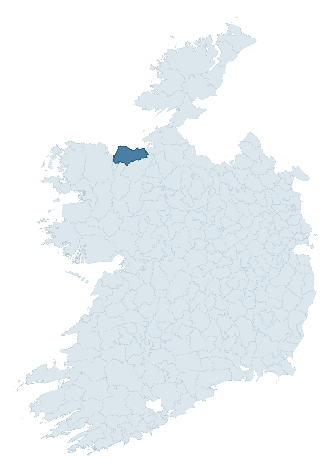
Where this barony sits in the Republic of Ireland
Geology and preservation
Bedrock geology shapes the landscape long before any settlement begins — controlling soil drainage, agricultural potential, the survival of upstanding monuments, and the preservation of buried archaeology. The figures below come from the Geological Survey Ireland 1:100,000 bedrock map.
The bedrock underlying Tireragh is predominantly limestone and shale (64% of the barony by area), laid down during the Carboniferous period (81% by area, around 359 to 299 million years ago). The single largest mapped unit is the Ballina Limestone Formation (Upper) (42% of the barony's bedrock). With 7 distinct rock types mapped, the barony sits in the top third of ROI baronies for geological diversity (72nd percentile) — typically a sign of complex tectonic history or coastal mosaics of differing rock units.
Rock type composition
Largest mapped unit: Ballina Limestone Formation (Upper) (42% of the barony)
Placename evidence
Logainm records 47 heritage-diagnostic placenames for Tireragh, drawn from townland and civil-parish names across the barony. The dominant stratum is pre-Christian and Early Medieval defensive — ráth-, lios-, dún-, and caiseal-prefixed names that mark Iron Age and early historic settlement. The leading diagnostic roots are dún- (14 — hilltop fort or promontory fort), ráth- (10 — earthen ringfort), and cill- (7 — church). This is above the ROI average of 30.7 heritage placenames per barony. The presence of multiple heritage strata side by side indicates layered occupation of the landscape across successive prehistoric and historic periods. Logainm records 254 placenames for Tireragh (predominantly townland names). Of these, 47 (19%) carry one of the diagnostic Gaelic roots tracked above; the remainder draw on more generic landscape vocabulary that does not encode a heritage period.
Pre-Christian / Early Medieval Defensive
| Root | Count | Meaning |
|---|---|---|
| dún- | 14 | hilltop or promontory fort |
| ráth- | 10 | earthen ringfort |
| lios- | 3 | ringfort or enclosure |
| caiseal- | 1 | stone ringfort |
Early Christian Ecclesiastical
| Root | Count | Meaning |
|---|---|---|
| cill- | 7 | church (early) |
| gráinseach- | 4 | monastic farm / grange |
| tobar- | 2 | holy well |
| teampall- | 1 | church (later medieval) |
| cillín- | 1 | unconsecrated burial ground |
Burial, Ritual, and Norse-Contact
| Root | Count | Meaning |
|---|---|---|
| carn- | 1 | cairn |
| feart- | 1 | grave mound |
| leacht- | 1 | grave monument |
| sián- | 1 | fairy mound |
About this profile
Click any section below to expand.
What is a barony?
A barony is a historic administrative unit in Ireland, broadly equivalent to an English hundred. The 280 baronies used here are from the OSi 2019 National Statutory Boundaries (generalised 20m), covering the 26 counties of the Republic of Ireland. Baronies derive from the Norman period, were formalised in the 17th century, and have not been redrawn for statistical purposes. They vary enormously in area, from compact urban baronies in Dublin to vast upland baronies in Connacht, and should not be compared by raw site count without accounting for area differences.
What counts as a site?
This profile combines three distinct heritage registers, each with its own definition of what constitutes a recordable site:
- Archaeological sites (NMS). The National Monuments Service Sites and Monuments Record (SMR) catalogues every known archaeological monument or site of archaeological interest in the Republic, from prehistoric burial mounds and ringforts to medieval churches and post-medieval defensive works. Inclusion does not require legal protection — only that the site has been identified, surveyed, and assessed as having archaeological value. A separate subset of these sites lies within a recorded protection zone, which gives them statutory protection under the National Monuments Acts.
- Listed buildings (NIAH). The National Inventory of Architectural Heritage records buildings of architectural, historical, archaeological, artistic, cultural, scientific, social, or technical interest. Each surveyed structure is appraised on a five-tier scale: International, National, Regional, Local, and Record-Only. The NIAH appraisal is informational rather than strictly statutory, but it underpins local-authority Record of Protected Structures (RPS) listings.
- Heritage placenames (Logainm). Logainm is the authoritative database of Irish placenames maintained by the Placenames Branch. This profile applies a heritage-diagnostic classifier to the Irish-language form of each townland name, flagging roots that signal defensive sites (ráth-, lios-, dún-, caiseal-, cathair-), ecclesiastical foundations (cill-, teampall-, domhnach-, mainistir-), prehistoric burial-ritual features (tuaim-, carn-, leaba-), or Norse-contact settlement (gall-). Townlands without one of these diagnostic roots are not flagged here — they may still carry historical significance, but that significance is not encoded in the name itself.
Editorial principles
The narrative sections of this profile follow several explicit principles:
- Evidential. Every claim about this barony’s heritage character is anchored in the underlying register data. Where a site count, a placename count, or a percentile rank is cited, it is computed from the source datasets at export time, not estimated.
- Comparative. Counts and metrics are reported alongside their percentile rank against the other 279 ROI baronies. A barony with 50 ringforts in absolute terms could be unusually high or unusually low depending on its size and regional context; percentile ranking removes that ambiguity.
- Transparent on limits. Where a register has known coverage gaps, survey biases, or data-quality issues that affect this barony’s figures, the profile flags them rather than presenting the numbers as definitive.
- No interpretation beyond what the data supports. The narrative does not speculate about historical events, social dynamics, or cultural meaning beyond what the recorded heritage and placename evidence directly attests.
Data caveats and limits
- NMS Sites and Monuments Record is the product of survey campaigns conducted at different intensities across different counties and decades. Some baronies have been surveyed more thoroughly than others, and absolute counts should be read in that light. Sites destroyed by development before survey are typically not represented; sites in heavily forested or upland terrain are sometimes under-recorded.
- NIAH coverage is broadly complete for the Republic of Ireland but the survey was conducted on a rolling county-by-county basis, and the most recent appraisal date varies. Buildings demolished or substantially altered after their original survey may still appear in the register; conversely, recent buildings of merit may not yet have been appraised.
- Logainm classification applies a deliberately conservative pattern-matching approach to the Irish-language townland forms. The classifier prioritises true positives over recall: a townland may carry a heritage signal that the classifier doesn’t recognise, particularly where the diagnostic root has been heavily anglicised or where the townland name draws on a less common term. The 60,000+ townland records and ~9,800 classified placenames give a substantial signal at barony scale, but individual townland names should be checked against Logainm directly for definitive interpretation.
- Period attribution. The chronological distribution reflects only those NMS sites that carry a recognised period attribution in the source data. Sites listed as “Unknown” period are excluded from the dated subset.
- Boundary changes. Some baronies have undergone minor boundary adjustments since their 19th-century definition; the OSi 2019 generalised boundaries used here are the current statutory definition and may differ slightly from historical maps in border areas.
- Bedrock geology is mapped at 1:100,000 scale, which means local variation within a barony — small pockets of different rock type, mineral veins, alluvium overlying bedrock — is generalised. The dominant-system and rocktype figures are area-weighted, so a barony reading “70% Carboniferous limestone” may still contain small but archaeologically important pockets of older or younger rock. Around 3% of GSI polygons do not match the lexicon and contribute no rocktype or system attribution.
Data sources
- National Monuments Service — Sites and Monuments Record (SMR) https://data.gov.ie/dataset/national-monuments-service-archaeological-survey-of-ireland
- National Inventory of Architectural Heritage (NIAH) https://data.gov.ie/dataset/national-inventory-of-architectural-heritage-niah-national-dataset
- Logainm — Placenames Database of Ireland https://www.logainm.ie/
- Ordnance Survey Ireland — National Statutory Barony Boundaries 2019 https://data-osi.opendata.arcgis.com/
- EURODEM — European Digital Elevation Model https://www.mapsforeurope.org/datasets/euro-dem
- ESA WorldCover https://esa-worldcover.org/en
- Geological Survey Ireland — 1:100,000 Bedrock Geology https://www.gsi.ie/en-ie/data-and-maps/Pages/Bedrock.aspx
Explore more: Search any of the 280 ROI baronies, browse by historical province, or read the methodology and data sources for the full Republic of Ireland Heritage Tool.