Farney is a barony of County Monaghan, in the historical province of Ulster (Irish: Fearnaigh), covering 273 km² of land. The barony records 612 NMS archaeological sites and 212 NIAH listed buildings, placing it at around the 63rd percentile among 280 ROI baronies for sites per km². This means it is in the upper half of all baronies for sites per km². Dated archaeological evidence runs from the Neolithic through to the Post Medieval, spanning 7 of 9 archaeological periods, placing the barony in the 40th percentile among 280 ROI baronies for chronological depth. This means it is in the lower half of all baronies for chronological depth. The largest dated subset of recorded sites dates to the Early Medieval. Logainm flags 68 placenames in the barony as carrying a recognised heritage root; the largest share — around 57% — are names associated with pre-christian defensive.
Heritage at a glance
Percentile rankings throughout this profile compare each barony only against the other 279 Republic of Ireland baronies.
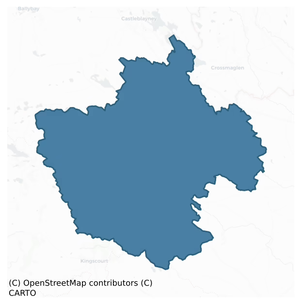
The recorded heritage of Farney
The National Monuments Service Sites and Monuments Record (SMR) is the statutory inventory of archaeological sites for the Republic of Ireland, maintained by the Department of Tourism, Culture, Arts, Gaeltacht, Sport and Media. Sites recorded here include earthworks, ringforts, megalithic tombs, ecclesiastical remains, and post-medieval features; not every record is legally protected, but each is registered as a monument of archaeological interest.
The National Monuments Service records 612 archaeological sites in Farney, putting it at the 63rd percentile among 280 ROI baronies for sites per km². This means it is in the upper half of all baronies for sites per km². Protection coverage is near-universal — 590 sites (96%) fall within a recorded monument protection zone, indicating an extensively surveyed landscape. The dominant category is defensive sites — ringforts, enclosures, hillforts, and stone forts (464 sites, 76% of the record). Ringfort – rath is the most prevalent type, making up 63% of the barony's recorded sites (384 records) — well above the ROI average of 20% across all baronies where this type occurs. Ringfort – rath is an earthen ringfort enclosed by a bank and external ditch — the most common Early Medieval farmstead, broadly dated 500–1000 AD. Other significant types include Rock art (38) and Souterrain (30). Rock art is geometric and other motifs carved on earthfast boulders or rock outcrops, mainly Bronze Age but with possible Neolithic origins; Souterrain is an underground stone-built passage and chamber, generally Early Medieval and often associated with ringforts as a defensive or storage feature. Across the barony's 273 km², this gives a recorded density of 2.24 sites per km².
Most common monument types
Hover or tap a monument type to see its definition.
| Type | Count |
|---|---|
| Ringfort – rath an earthen ringfort enclosed by a bank and external ditch — the most common Early Medieval farmstead, broadly dated 500–1000 AD | 384 |
| Rock art geometric and other motifs carved on earthfast boulders or rock outcrops, mainly Bronze Age but with possible Neolithic origins | 38 |
| Souterrain an underground stone-built passage and chamber, generally Early Medieval and often associated with ringforts as a defensive or storage feature | 30 |
| Enclosure a banked or ditched feature of uncertain type, used as a catch-all where the original function cannot be determined from surface evidence | 21 |
| Ringfort – unclassified a circular Early Medieval settlement enclosure where surviving evidence does not allow distinction between earthen and stone forms | 10 |
| Crannog an artificial or partly artificial island built up on a lake or river bed, in use from the 6th to 17th centuries AD | 9 |
| Hut site a low stone or earthen foundation enclosing a small circular or oval area, generally interpreted as a former dwelling, of any date from prehistory to the medieval period | 8 |
| House – indeterminate date a habitation building whose date cannot be determined from available evidence | 8 |
Chronological distribution
The dated archaeological record for Farney spans from the Neolithic through to the Post Medieval, with activity attested across 7 of 9 archaeological periods. Every period from earliest to latest is represented in the record — an unbroken sequence of dated activity across the full chronological span. Activity concentrates most heavily in the Early Medieval (336 sites, 63% of dated material), with the Iron Age forming a secondary peak (166 sites, 31%). A further 78 recorded sites (13% of the overall NMS register for the barony) carry no period attribution — appearing as 'Unknown' in the bar chart below. This typically reflects either records that pre-date the standardised period vocabulary or sites awaiting specialist dating review, rather than a genuine absence of chronological evidence.
Sample of recorded monuments
Show 25 sample monuments (of 612 total)
A representative sample of 25 recorded monuments drawn from the barony’s 612 total NMS entries. Sites within a recorded monument protection zone and rarer site types are prioritised so the list shows a meaningful cross-section rather than only the most common type. Each entry shows the official Sites and Monuments Record reference number and the description published by the National Monuments Service.
Cairn – unclassified
Located at the summit of Fincairn Hill, a NE-SW drumlin ridge. This is traditionally thought to be the burial place of Fin Mac Cool (IFC Schools’ MSS (931) 183-8: https://www.duchas.ie/en/cbes ). It consists of a kerb…
Located at the summit of Fincairn Hill, a NE-SW drumlin ridge. This is traditionally thought to be the burial place of Fin Mac Cool (IFC Schools’ MSS (931) 183-8: https://www.duchas.ie/en/cbes ). It consists of a kerb of orthostats enclosing a grass-covered stony rise (diam. c. 20m; H c. 1m). The contiguous kerbstones (max. dims c. 1m x c. 0.5m; H 0.1-0.7m) survive on the N side of an ENE-WSW field bank but five displaced stones are on the S side.
The above description is derived from the published 'Archaeological Inventory of County Monaghan' (Dublin: Stationery Office, 1986). In certain instances the entries have been revised and updated in the light of recent research.
Compiled by: Michael Moore
Date of revision: 27 February 2018
Mound
Located on SE-facing spine of a small NW-SE ridge. It is depicted as a circular feature on the 1859 revision of the 1834 edition of the OS 6-inch map and as an oval feature on the 1907 edition. This is an oval…
Located on SE-facing spine of a small NW-SE ridge. It is depicted as a circular feature on the 1859 revision of the 1834 edition of the OS 6-inch map and as an oval feature on the 1907 edition. This is an oval grass-covered mound (dims 40m NW-SE; 26.5m NE-SW) with some bushes that is locally known as ‘the Rock’, and which may be a natural feature.
Date of revision: 12 December 2017
Cross – Wayside cross
Described on the 1834 edition of the OS 6-inch map in gothic lettering as a 'Stone Cross'. It is built into the N-facing boundary wall at the main junction in Inishkeen village. It is a black painted cross (H 1.2m; span…
Described on the 1834 edition of the OS 6-inch map in gothic lettering as a 'Stone Cross'. It is built into the N-facing boundary wall at the main junction in Inishkeen village. It is a black painted cross (H 1.2m; span 0.64m) with the following inscription in gold across the head, transom and shaft 'IHS This cross was erected by Captain Coll MacMahon as a memorial of himself and his family & desires of prayeres of all the faithfull christians Sept the 2D Anno Domini 1729'. A bird with leaves around it, fills the lower part of the shaft. (Ua Cuinn 1908, 83)
Date of upload: 14 April 2011
Cist
A cist aligned NW-SE was uncovered in the 1850s during the construction of the present Church of Ireland church in Inishkeen graveyard (MO029-031004-) (Reade 1855).
The above description is derived from the published…
A cist aligned NW-SE was uncovered in the 1850s during the construction of the present Church of Ireland church in Inishkeen graveyard (MO029-031004-) (Reade 1855).
The above description is derived from the published 'Archaeological Inventory of County Monaghan' (Dublin: Stationery Office, 1986). In certain instances the entries have been revised and updated in the light of recent research.
Date of upload: 17 July 2007
Round tower
The round tower at Inishkeen was described (Reade 1855, 376-7) as having a circumference of ‘51 feet (ext. diam. c. 4.85m) and survives to a height of 42 feet (c. 12.8m)’. The rebuilt lintelled doorway is 4.1m off the…
The round tower at Inishkeen was described (Reade 1855, 376-7) as having a circumference of ‘51 feet (ext. diam. c. 4.85m) and survives to a height of 42 feet (c. 12.8m)’. The rebuilt lintelled doorway is 4.1m off the ground and faces SE. Debris in the interior was cleared to 0.75m below ground level in 1973 (Barrow 1979, 172-3). The tower had three internal floors according to Reade, but only two levels of internal corbels survive (ibid.).
Compiled by: Michael Moore
This is a National Monument in state ownership: No. 208
See the attached views _1 from E; _2 from SE
Date of revosed upload: 1 December 2016
Mausoleum
There are three mausoleums in a N-S line SE of the present Church of Ireland church, now closed, in the Inishkeen graveyard (MO029-031004-). They are now visible as just the base of the walls (T 0.6m; H 0.5-1.5m). The N…
There are three mausoleums in a N-S line SE of the present Church of Ireland church, now closed, in the Inishkeen graveyard (MO029-031004-). They are now visible as just the base of the walls (T 0.6m; H 0.5-1.5m). The N and central ones (N: ext. dims 6.55m E-W; 4.3m N-S; central: 6.55m E-W; 4.55m N-S; S: 5.25m plus N-S; 4.4m E-W) have doorways (Wth 0.95m) on the W side with external rebates, and the central one, which is structurally the earliest, probably had the inscription, now missing, with the date 1672 (Shirley 1879, 387; Bradshaw 1888, 225).
Compiled by: Michael Moore
Date of revised upload: 1 December 2015
Pound
Located on a shelf towards the bottom of a N-facing slope and Immediately NE of the motte and bailey (MO029-033001-). It is depicted as a rectangular enclosure divided in two by an E-W cross-wall and described as a…
Located on a shelf towards the bottom of a N-facing slope and Immediately NE of the motte and bailey (MO029-033001-). It is depicted as a rectangular enclosure divided in two by an E-W cross-wall and described as a 'Pound' in italic letters on the 1834 edition of the OS 6-inch map. This is a rectangular enclosure (dims c. 20m N-S; c. 20m E-W) with high stone walls that had a wide round-headed entrance through a large arch in the W wall. Only the lower courses of the N and E walls survive now.
Date of upload: 14 April 2011
Hilltop enclosure
Located on a rise at the summit of a WNW-ESE drumlin ridge. This is a sub-rectangular or D-shaped grass-covered area (dims c. 50m WNW-ESE at S to 71m WNW-ESE at N; 56m NNE-SSW) defined by scarps (at W: Wth 4.2m; 2.8m;…
Located on a rise at the summit of a WNW-ESE drumlin ridge. This is a sub-rectangular or D-shaped grass-covered area (dims c. 50m WNW-ESE at S to 71m WNW-ESE at N; 56m NNE-SSW) defined by scarps (at W: Wth 4.2m; 2.8m; at N: Wth 7.5m; H 5m) on all sides except at the E which is the natural approach and where there is an earthen bank (Wth of base 4.4-5.7m; int. H 0.3-0.4m; ext. H 1.2-1.7m) but no visible fosse. There is an entrance (Wth of base 4.2m) towards the S end of the bank.
In the interior a grass-covered earthen bank (Wth 1.9-2.2m; int. H 0.2-0.4m; ext. H 0.4-0.6m) with a stone facing creates an inner D-shaped enclosure (dims 56m WNW-ESE at N; 34m NNE-SSW) backing on to the perimeter at N and E. This inner bank has an entrance (Wth 2.5m) at SW and another (Wth of base 2.3m) towards its E end. There were two hut-site inside the inner enclosure, and three in the outer but some of these have been damaged since 1967. There is also a platform inside the entrance to the hilltop enclosure on the N side.
The above description is derived from the published 'Archaeological Inventory of County Monaghan' (Dublin: Stationery Office, 1986). In certain instances the entries have been revised and updated in the light of recent research.
Date of revision: 17 July 2007
Barrow – ring-barrow
Located towards the S end of a N-S ridge and overlooking the W shore of Greaghlone or Beagh Lough, which is c. 250m to the SE. Aerial photographs (GSIAP: H 48/49) from the 1970s show a small circular enclosure. No…
Located towards the S end of a N-S ridge and overlooking the W shore of Greaghlone or Beagh Lough, which is c. 250m to the SE. Aerial photographs (GSIAP: H 48/49) from the 1970s show a small circular enclosure. No archaeological feature is visible at ground level in pasture.
Date of revised upload: 25 August 2017
Promontory fort – inland
Situated at the N edge of a low plateau. It is depicted as a large D-shaped feature (dims c. 150m NW-SE; c. 75m NE-SW) with the straight side at NE and defined by a single field bank on the 1834 edition of the OS 6-inch…
Situated at the N edge of a low plateau. It is depicted as a large D-shaped feature (dims c. 150m NW-SE; c. 75m NE-SW) with the straight side at NE and defined by a single field bank on the 1834 edition of the OS 6-inch map where it is described as a ‘fort’ in gothic lettering. It is represented as an equally large D-shaped hachured feature with a wooded border (Wth c. 10m) on the NW and NE sides on the 1907 edition. It was known locally as the ‘Black Fort’ and the name was recorded by the Ordinance Survey in the 1830s (Herity 2012, 302).
This was a slightly raised triangular grass-covered area (dims 77m NW-SE; c. 58m NE-SW) defined by an overgrown scarp (at NE: H 1.4m) and a berm (at NE: Wth 7m) at the upper edge of the natural slope (total H c. 4m) on the NE side and by a slight scarp (Wth 6m; H 0.8m) on the NW side. The S edge is provided by an uneven grass-covered scarp (at SW: H 1.1m) that was quarried at the SE angle. There is no evidence of a bank, fosse or entrance, but it may have been an inland promontory fort. It had been removed by 1984. The rath (MO031-099—-) is c. 100m to the SW.
The above description is derived from the published 'Archaeological Inventory of County Monaghan' (Dublin: Stationery Office, 1986). In certain instances the entries have been revised and updated in the light of recent research.
Date of revision: 31 July 2017
Bridge
The fortified house that was known as Essex castle (MO031-034—-) was built by the second earl of Essex in 1628-33, and became the core of Carrickmacross town. A drawing of the castle from 1734 and published by Shirley…
The fortified house that was known as Essex castle (MO031-034—-) was built by the second earl of Essex in 1628-33, and became the core of Carrickmacross town. A drawing of the castle from 1734 and published by Shirley (1845, 112) shows the castle overlooking the river with a two-arched bridge, a mill and a well nearby. The core of this bridge could survive within the wide bridge complex (Wth c. 20m) now leading across the NW-SE stream to Castle Street and the Main Street of Carrickmacross. Castle Street is partly excavated into the side of the valley, and the limestone walls retaining the slope have numerous graffiti commemorating historical events.Archaeological monitoring (08E0260) for a sewage scheme in Carrickmacross identified very few archaeological features and these were largely post-medieval walls. Two such walls and three culverts were encountered S of the bridge at the junction of Mullinary Road and Magheross Road (Delaney 2011, 2012).
The above description is derived from the published 'Archaeological Inventory of County Monaghan' (Dublin: Stationery Office, 1986). In certain instances the entries have been revised and updated in the light of recent research.
Date of revision: 31 July 2017
Amended: 16 January 2020
Concentric enclosure
Located on the summit and the SW-facing side of a small NW-SE drumlin ridge. The cropmark of a D-shaped enclosure (diam. c. 30m N-S) defined by a single fosse feature (Wth c. 3m) SSE-W-NNW with an entrance gap (Wth c.…
Located on the summit and the SW-facing side of a small NW-SE drumlin ridge. The cropmark of a D-shaped enclosure (diam. c. 30m N-S) defined by a single fosse feature (Wth c. 3m) SSE-W-NNW with an entrance gap (Wth c. 4m) at SW and backing onto the W boundary of a wooded fox covert at E is recorded on aerial photographs (CUCAP: AOX: 75, 76) dating from c. 1973. This enclosure is eccentrically placed within a larger enclosure (diam. c. 90m N-S) recorded as a single fosse (Wth c. 3m) feature S-NNW on the aerial photographs, which also backs onto the covert at E. The space between the fosses is c. 20-30m. No archaeological feature is visible at ground level in pasture.
The above description is derived from the published 'Archaeological Inventory of County Monaghan' (Dublin: Stationery Office, 1986). In certain instances the entries have been revised and updated in the light of recent research.
Compiled by: Michael Moore
Date of revision: 21 September 2018
Flat cemetery
Shirley (1845, 179) records that 'on a rising ground, human bones enclosed with rough stones in the form of a coffin have often been turned up, with the plough'. A flanged bronzed axe found in one of these graves was…
Shirley (1845, 179) records that 'on a rising ground, human bones enclosed with rough stones in the form of a coffin have often been turned up, with the plough'. A flanged bronzed axe found in one of these graves was acquired by the National Museum of Ireland (Lucas 1968, 103). The exact location is not known.
The above description is derived from the published 'Archaeological Inventory of County Monaghan' (Dublin: Stationery Office, 1986). In certain instances the entries have been revised and updated in the light of recent research.
Date of revision: 28 June 2017
Metalworking site
Discovered during archaeological monitoring (Excavation Licence No. 00E0108). A limited area was excavated to facilitate development. A pit (max. diam. 1.8m; D 0.36m) and spreads of burnt charcoal rich clay were…
Discovered during archaeological monitoring (Excavation Licence No. 00E0108). A limited area was excavated to facilitate development. A pit (max. diam. 1.8m; D 0.36m) and spreads of burnt charcoal rich clay were uncovered. Fragments of slag and pieces of oxidised decayed metal were recovered from the pit. The excavator suggests that this was probably the edge of a more substantial site. (Bermingham 2002, 267-8)
Date of upload: 14 April 2011
Pit-burial
Located on a NW-SE ridge. According to local information a small pit concealed by a flagstone and containing ashes was uncovered during ploughing. It was on the site of or in the vicinity of the ringfort…
Located on a NW-SE ridge. According to local information a small pit concealed by a flagstone and containing ashes was uncovered during ploughing. It was on the site of or in the vicinity of the ringfort (MO032-010001-).
The above description is derived from the published 'Archaeological Inventory of County Monaghan' (Dublin: Stationery Office, 1986). In certain instances the entries have been revised and updated in the light of recent research.
Date of revision: 27 July 2017
Castle – Anglo-Norman masonry castle
This is a National Monument situated on a NW-SE ridge (Harbison 1970, 200). When Murrough O’Carroll, king of Oriel, died c. 1188 a peaceful Anglo-Norman settlement of much of the territory that became Co. Louth seems to…
This is a National Monument situated on a NW-SE ridge (Harbison 1970, 200). When Murrough O’Carroll, king of Oriel, died c. 1188 a peaceful Anglo-Norman settlement of much of the territory that became Co. Louth seems to have occurred (Otway-Ruthven 1968, 52). Farney, as well as the even more remote Monaghan baronies of Cremorne and Dartree, was included with Ardee in the grant to Peter Pipard c. 1190 (ibid. 70), and a castle, undoubtedly the motte and inner bailey (MO028-118001-), is recorded as being built at Domhnaigh Maighen in 1193.
In 1228-34 labour services were recruited by Ralph FitzNicholas, the custodian of Pipard minors, to fortify the castle of Dunelamein. The older castle had been burnt and this new castle was mandated to be a stone castle. By 1244 the stone castle was completed and FitzNicholas’ son, Ralph, was proprietor, probably through marriage with a Pipard ward. However, it proved difficult to hold this outpost and in 1302 the Pipards surrendered the grant of Farney to the King, effectively abandoning it to the native Irish inhabitants (Orpen 1908, 263-5).
Subsequent leases to Walter de Cusack in 1317, John Clinton in 1333, and Roger de Gernon in 1372, the last with instructions to build or re-build the castle, failed to secure Farney. In 1401 Eochaidh Mac Mahon even held the lease, specifically without Donaghmoyne castle, but Farney was confirmed to a Roger de Gernon in 1414. From then on the castle is no longer mentioned in leases of the barony…
Cross-slab
Within the enclosure (MO034-020001-), which is defined by an overgrown scarp NE-S-SW. A crude cross-slab with a ringed cross in relief, together with two bullaun stones were present in 1940 and in 1984 (SMR file). These…
Within the enclosure (MO034-020001-), which is defined by an overgrown scarp NE-S-SW. A crude cross-slab with a ringed cross in relief, together with two bullaun stones were present in 1940 and in 1984 (SMR file). These could not be located in 2016 but are probably present in the overgrown perimeter.
Date of revised upload: 27 June 2017
Rock art (present location)
'Drumirril 33' in Blaze O' Connor's 'Inventory of Rock Art panels' – see O' Connor B. 2006, 270, 'Inscribed Landscapes contextualising prehistoric rock art in Ireland'. Unpublished PHD thesis, University College Dublin.…
'Drumirril 33' in Blaze O' Connor's 'Inventory of Rock Art panels' – see O' Connor B. 2006, 270, 'Inscribed Landscapes contextualising prehistoric rock art in Ireland'. Unpublished PHD thesis, University College Dublin.
Date of upload: 23 August 2010
Field system
Field system identified by Blaze O' Connor – see figure 3.73 in O' Connor B. 2006, 'Inscribed Landscapes contextualising prehistoric rock art in Ireland'. Unpublished PHD thesis, University College Dublin.Date of…
Field system identified by Blaze O' Connor – see figure 3.73 in O' Connor B. 2006, 'Inscribed Landscapes contextualising prehistoric rock art in Ireland'. Unpublished PHD thesis, University College Dublin.Date of upload: 27 August 2010
Cave
An area in Creevy Cave, known as 'Creevy Rising' was first recorded by cavers in the 1960's, however its archaeological significance wasn't noted until 2009. A possible hearth and post-medieval pottery on an earthen…
An area in Creevy Cave, known as 'Creevy Rising' was first recorded by cavers in the 1960's, however its archaeological significance wasn't noted until 2009. A possible hearth and post-medieval pottery on an earthen platform (L 6.5m; Wth 4m) defined by stones along with a stone structure (MO031-137002-) were recorded. (Dowd et al. 2011; 36-9)
Compiled by: Claire Breen
Date of upload: 24 June 2011
Structure
Discovered in 2009 in Creevy Cave alongside an earthen platform, a possible hearth and post-medieval pottery. A stone structure (L c. 3m; Wth 0.75m; H 1m) which was constructed both above and below ground at an opening…
Discovered in 2009 in Creevy Cave alongside an earthen platform, a possible hearth and post-medieval pottery. A stone structure (L c. 3m; Wth 0.75m; H 1m) which was constructed both above and below ground at an opening into the cave. This opening is now blocked and is only visible as a slight depression above ground. The side walls are composed of small rounded stones and it is roofed with lintel slabs. Its appearance is very similar to a souterrain. (Dowd et al. 2011; 36-9)
Compiled by: Claire Breen
Date of upload: 24 June 2011
Cross-slab (present location)
A small tapering flagstone bearing a deeply incised, roughly executed, plain Latin cross and bordered by a thin, lightly incised line (max. L 0.8m, Wth 0.33m). In 1966 the slab was to be seen lying against the wall of…
A small tapering flagstone bearing a deeply incised, roughly executed, plain Latin cross and bordered by a thin, lightly incised line (max. L 0.8m, Wth 0.33m). In 1966 the slab was to be seen lying against the wall of Killaconner church (see LH006-101003-) which was subsequently levelled and at that time the stone was removed to Iniskeen Museum.
Date of upload: 11 May 2012
Enclosure – large enclosure
Situated on top of and on the SE-facing spine of a NW-SE drumlin ridge. This enclosure is not marked on any edition of the OS maps. A large circular enclosure (ext. diam. c. 170m) was identified from a LiDAR survey…
Situated on top of and on the SE-facing spine of a NW-SE drumlin ridge. This enclosure is not marked on any edition of the OS maps. A large circular enclosure (ext. diam. c. 170m) was identified from a LiDAR survey (pers. comm. Steve Davis). It appears to be a circular grass-covered area (diam. c. 90m) defined by a fosse (Wth of base c. 10m) and outer bank (Wth c. c. 15m). There might be a large entrance at NE. It is divided by a NW-SE field bank on the spine of the ridge with a larger part of the enclosure NE of this bank.
The attached image (MO025-052—-_01.jpg) is uploaded courtesy of Dr. Steve Davis, UCD.
Compiled by: Michael Moore
Date of revised upload: 27 February 2018
Mass-rock (present location)
Situated on a steep NE-facing slope and just SE of the Roman Catholic church of Lisdoonan. A fragment of a mill-wheel that was never completed is a D-shaped stone (max. dims 2.25m x 1.3m; T 0.2-0.25m) with an unfinished…
Situated on a steep NE-facing slope and just SE of the Roman Catholic church of Lisdoonan. A fragment of a mill-wheel that was never completed is a D-shaped stone (max. dims 2.25m x 1.3m; T 0.2-0.25m) with an unfinished central perforation (diam. 0.4m) and an unfinished edge. It is set up on two boulders with a level upper surface (H 0.7-0.85m) that is inscribed with ‘Leac an Aifrinn’ and an expanding cross (H 0.26m; span 0.16m). This was done c. 1913 when it was set up here but its original location, thought to be the top of Dunaree (Ó Gallachair 1957, 115), is unlikely, although it may have been in that townland.
See the attached view _1 from N
Compiled by: Michael Moore
Date of upload: 20 June, 2016
Ringfort – rath
Situated on a peninsula (max. dims c. 725m NW-SE; c. 200m NE-SW) jutting into the S part of Muckno Lough from the SE. It is depicted as a subcircular embanked enclosure (ext. diam. c. 50m NW-SE; c. 40m NE-SW) on the…
Situated on a peninsula (max. dims c. 725m NW-SE; c. 200m NE-SW) jutting into the S part of Muckno Lough from the SE. It is depicted as a subcircular embanked enclosure (ext. diam. c. 50m NW-SE; c. 40m NE-SW) on the 1834 edition of the OS 6-inch map where it is described in gothic lettering as a ‘fort’, and as an oval enclosure in woodland on the 1907 edition. Faint traces of an oval enclosure are visible in pasture on OSI aerial photographic images (1995, 2000).
The above description is derived from the published 'Archaeological Inventory of County Monaghan' (Dublin: Stationery Office, 1986). In certain instances the entries have been revised and updated in the light of recent research.
Compiled by: Michael Moore
Date of revision: 27 February 2018
Listed buildings
The National Inventory of Architectural Heritage (NIAH) is a state survey appraising buildings of architectural, historical, archaeological, artistic, cultural, scientific, social, or technical interest. Each surveyed structure receives a rating from International (the highest, for buildings of European importance) through National, Regional, Local, and Record-Only.
The NIAH records 212 listed buildings in Farney, the 81st percentile across ROI baronies for listed-building density. The highest-graded structures include 2 of National significance. The Republic holds 937 National-graded buildings in total, so this barony accounts for around 0% of the national total. Construction dates concentrate most heavily in the Victorian (1830-1900) period. The most-recorded building type is house (58 examples, 27% of the listed stock).
Terrain and environment
Mean elevation across the barony is 94m — the 56th percentile among 280 ROI baronies for elevation. This means it is in the upper half of all baronies for elevation. Elevation matters for heritage because higher-altitude baronies typically favour defensive monuments — ringforts and hilltop forts placed on prominent ground — while lowland baronies are more likely to carry the dense settlement and church networks of intensive agricultural landscapes. A maximum elevation of 240m gives the barony meaningful vertical relief. Mean slope is 5.6° — the 79th percentile among 280 ROI baronies for slope. This means it is in the top third of all baronies for slope. This is consistently steep terrain by ROI standards, the kind of landscape that tends to preserve upstanding archaeological features well. Slope is a key control on both land use and archaeological preservation: steep ground resists ploughing and tends to preserve earthworks intact, while gentle slopes favour intensive cultivation that damages or destroys surface archaeology over time. The Topographic Wetness Index averages 9.8, the 15th percentile among 280 ROI baronies for wetness. This means it is in the bottom fifth of all baronies for wetness. This is well-drained ground by ROI standards — typical of upland or steeply-sloping country that sheds water rapidly. Drainage matters for heritage because poorly-drained ground preserves organic archaeology (wooden trackways, leather, textiles, and on rare occasions human remains) far better than free-draining soil; well-drained ground favours arable use but destroys organic material rapidly. The land cover is dominated by improved grassland (85%) and woodland (12%). In overall character, this is steeply-sloping terrain at modest elevation, with land use dominated by improved grassland.
Terrain measurements
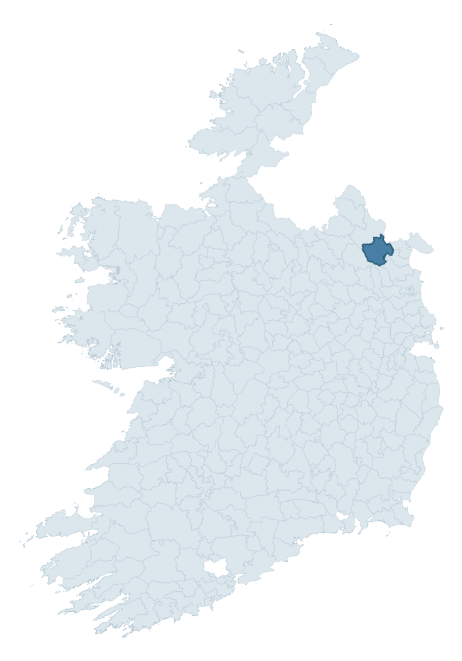
Where this barony sits in the Republic of Ireland
Geology and preservation
Bedrock geology shapes the landscape long before any settlement begins — controlling soil drainage, agricultural potential, the survival of upstanding monuments, and the preservation of buried archaeology. The figures below come from the Geological Survey Ireland 1:100,000 bedrock map.
The bedrock underlying Farney is predominantly greywacke (38% of the barony by area), laid down during the Silurian period (64% by area, around 444 to 419 million years ago). Greywacke is a hard, dark, fine-grained sandstone that weathers to thin upland soils. Greywacke baronies typically carry sparser settlement archaeology but provide high-quality building stone visible in older field walls and farm buildings. A substantial secondary geology of sandstone (29%) and limestone (25%) adds further variety to the underlying landscape.
Rock type composition
Largest mapped unit: Milverton Group (25% of the barony)
Placename evidence
Logainm records 68 heritage-diagnostic placenames for Farney, drawn from townland and civil-parish names across the barony. The dominant stratum is pre-Christian and Early Medieval defensive — ráth-, lios-, dún-, and caiseal-prefixed names that mark Iron Age and early historic settlement. The leading diagnostic roots are lios- (24 — ringfort or enclosure), cill- (13 — church), and ráth- (9 — earthen ringfort). This is well above the ROI average of 30.7 heritage placenames per barony — around 2.2× the typical figure. The presence of multiple heritage strata side by side indicates layered occupation of the landscape across successive prehistoric and historic periods. Logainm records 370 placenames for Farney (predominantly townland names). Of these, 68 (18%) carry one of the diagnostic Gaelic roots tracked above; the remainder draw on more generic landscape vocabulary that does not encode a heritage period.
Pre-Christian / Early Medieval Defensive
| Root | Count | Meaning |
|---|---|---|
| lios- | 24 | ringfort or enclosure |
| ráth- | 9 | earthen ringfort |
| dún- | 5 | hilltop or promontory fort |
Early Christian Ecclesiastical
| Root | Count | Meaning |
|---|---|---|
| cill- | 13 | church (early) |
| domhnach- | 3 | pre-Patrician or earliest Patrician church |
Burial, Ritual, and Norse-Contact
| Root | Count | Meaning |
|---|---|---|
| leacht- | 6 | grave monument |
| feart- | 3 | grave mound |
| tuaim- | 2 | burial mound |
| carn- | 1 | cairn |
| dumha- | 1 | mound |
| gall- | 1 | foreigner — Norse settlement marker |
About this profile
Click any section below to expand.
What is a barony?
A barony is a historic administrative unit in Ireland, broadly equivalent to an English hundred. The 280 baronies used here are from the OSi 2019 National Statutory Boundaries (generalised 20m), covering the 26 counties of the Republic of Ireland. Baronies derive from the Norman period, were formalised in the 17th century, and have not been redrawn for statistical purposes. They vary enormously in area, from compact urban baronies in Dublin to vast upland baronies in Connacht, and should not be compared by raw site count without accounting for area differences.
What counts as a site?
This profile combines three distinct heritage registers, each with its own definition of what constitutes a recordable site:
- Archaeological sites (NMS). The National Monuments Service Sites and Monuments Record (SMR) catalogues every known archaeological monument or site of archaeological interest in the Republic, from prehistoric burial mounds and ringforts to medieval churches and post-medieval defensive works. Inclusion does not require legal protection — only that the site has been identified, surveyed, and assessed as having archaeological value. A separate subset of these sites lies within a recorded protection zone, which gives them statutory protection under the National Monuments Acts.
- Listed buildings (NIAH). The National Inventory of Architectural Heritage records buildings of architectural, historical, archaeological, artistic, cultural, scientific, social, or technical interest. Each surveyed structure is appraised on a five-tier scale: International, National, Regional, Local, and Record-Only. The NIAH appraisal is informational rather than strictly statutory, but it underpins local-authority Record of Protected Structures (RPS) listings.
- Heritage placenames (Logainm). Logainm is the authoritative database of Irish placenames maintained by the Placenames Branch. This profile applies a heritage-diagnostic classifier to the Irish-language form of each townland name, flagging roots that signal defensive sites (ráth-, lios-, dún-, caiseal-, cathair-), ecclesiastical foundations (cill-, teampall-, domhnach-, mainistir-), prehistoric burial-ritual features (tuaim-, carn-, leaba-), or Norse-contact settlement (gall-). Townlands without one of these diagnostic roots are not flagged here — they may still carry historical significance, but that significance is not encoded in the name itself.
Editorial principles
The narrative sections of this profile follow several explicit principles:
- Evidential. Every claim about this barony’s heritage character is anchored in the underlying register data. Where a site count, a placename count, or a percentile rank is cited, it is computed from the source datasets at export time, not estimated.
- Comparative. Counts and metrics are reported alongside their percentile rank against the other 279 ROI baronies. A barony with 50 ringforts in absolute terms could be unusually high or unusually low depending on its size and regional context; percentile ranking removes that ambiguity.
- Transparent on limits. Where a register has known coverage gaps, survey biases, or data-quality issues that affect this barony’s figures, the profile flags them rather than presenting the numbers as definitive.
- No interpretation beyond what the data supports. The narrative does not speculate about historical events, social dynamics, or cultural meaning beyond what the recorded heritage and placename evidence directly attests.
Data caveats and limits
- NMS Sites and Monuments Record is the product of survey campaigns conducted at different intensities across different counties and decades. Some baronies have been surveyed more thoroughly than others, and absolute counts should be read in that light. Sites destroyed by development before survey are typically not represented; sites in heavily forested or upland terrain are sometimes under-recorded.
- NIAH coverage is broadly complete for the Republic of Ireland but the survey was conducted on a rolling county-by-county basis, and the most recent appraisal date varies. Buildings demolished or substantially altered after their original survey may still appear in the register; conversely, recent buildings of merit may not yet have been appraised.
- Logainm classification applies a deliberately conservative pattern-matching approach to the Irish-language townland forms. The classifier prioritises true positives over recall: a townland may carry a heritage signal that the classifier doesn’t recognise, particularly where the diagnostic root has been heavily anglicised or where the townland name draws on a less common term. The 60,000+ townland records and ~9,800 classified placenames give a substantial signal at barony scale, but individual townland names should be checked against Logainm directly for definitive interpretation.
- Period attribution. The chronological distribution reflects only those NMS sites that carry a recognised period attribution in the source data. Sites listed as “Unknown” period are excluded from the dated subset.
- Boundary changes. Some baronies have undergone minor boundary adjustments since their 19th-century definition; the OSi 2019 generalised boundaries used here are the current statutory definition and may differ slightly from historical maps in border areas.
- Bedrock geology is mapped at 1:100,000 scale, which means local variation within a barony — small pockets of different rock type, mineral veins, alluvium overlying bedrock — is generalised. The dominant-system and rocktype figures are area-weighted, so a barony reading “70% Carboniferous limestone” may still contain small but archaeologically important pockets of older or younger rock. Around 3% of GSI polygons do not match the lexicon and contribute no rocktype or system attribution.
Data sources
- National Monuments Service — Sites and Monuments Record (SMR) https://data.gov.ie/dataset/national-monuments-service-archaeological-survey-of-ireland
- National Inventory of Architectural Heritage (NIAH) https://data.gov.ie/dataset/national-inventory-of-architectural-heritage-niah-national-dataset
- Logainm — Placenames Database of Ireland https://www.logainm.ie/
- Ordnance Survey Ireland — National Statutory Barony Boundaries 2019 https://data-osi.opendata.arcgis.com/
- EURODEM — European Digital Elevation Model https://www.mapsforeurope.org/datasets/euro-dem
- ESA WorldCover https://esa-worldcover.org/en
- Geological Survey Ireland — 1:100,000 Bedrock Geology https://www.gsi.ie/en-ie/data-and-maps/Pages/Bedrock.aspx
Explore more: Search any of the 280 ROI baronies, browse by historical province, or read the methodology and data sources for the full Republic of Ireland Heritage Tool.