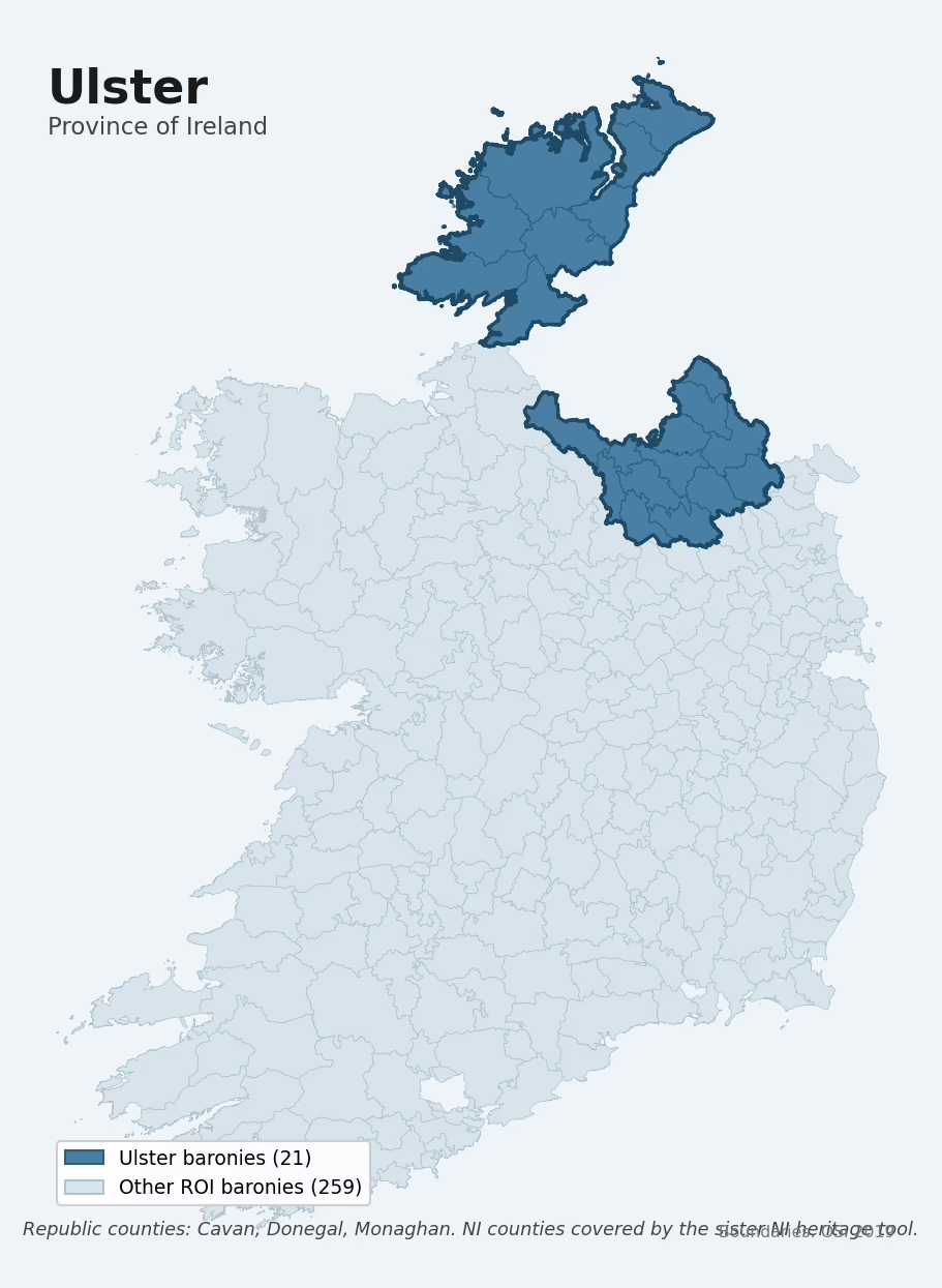
Ulster is one of Ireland's four historical provinces, covering 21 of the Republic's 280 baronies across 3 counties: Cavan, Donegal, Monaghan. The dated archaeological record is dominated by the Early Medieval period, which accounts for 56% of period-attributed sites. The most prevalent single monument type is Ringfort – rath (2,279 records). At a mean elevation of 124m it has the highest mean elevation of the four provinces. Elevated terrain typically correlates with greater survival of upstanding stone monuments and a higher share of defensive ringforts on prominent ground.
Historic Ulster spans both jurisdictions — read this with the NI tool
Six historical Ulster counties (Antrim, Armagh, Derry, Down, Fermanagh, and Tyrone) lie within Northern Ireland and are covered by the sibling Northern Ireland ward heritage tool rather than this Republic-of-Ireland barony tool. This is not a coverage gap or a political choice — the NI counties are comprehensively covered on the same site, using different statutory data sources (DfC Historic Environment Record, HED listed buildings) on ward boundaries instead of baronies. The two tools are designed to be read together; direct head-to-head counts of sites or listed buildings should be made with care because the classifiers and registers differ. Terrain and bedrock geology, however, ARE directly comparable across the two tools.
Open the Northern Ireland ward heritage tool → Read the full Northern Ireland heritage report →
A full narrative report on Northern Ireland's heritage and historical geography is available on this site, drawing on the same NI ward dataset with additional analytical depth.
Heritage at a glance
Archaeological character
The National Monuments Service Sites and Monuments Record holds 7,456 archaeological sites across the 21 baronies of Ulster, of which 7,090 (95%) sit within a formally recorded protection zone. In absolute terms this is the lowest of the four provinces for total recorded archaeological sites. The record is led by defensive sites — ringforts, enclosures, hillforts, and stone forts, making up around 64% of the categorised sites in the province. Within Ulster, the record is relatively evenly spread across baronies. The three baronies holding the largest share of the record by absolute count are Kilmacrenan (Donegal) (776 sites), Banagh (Donegal) (633), and Farney (Monaghan) (612) — together accounting for around 27% of the province's archaeological record. Adjusted for area, the highest site density is in Farney (Monaghan) at 2.2 sites per km², reflecting an unusually heritage-rich landscape rather than simply a large barony with many sites overall.
Most common monument types
| Type | Count |
|---|---|
| Ringfort – rath | 2,279 |
| Enclosure | 388 |
| Standing stone | 380 |
| Crannog | 284 |
| Ringfort – cashel | 278 |
| Souterrain | 233 |
| Rock art | 206 |
| Church | 202 |
Chronological character
Dated archaeological evidence across Ulster runs from the Mesolithic through to the Modern, spanning 9 of 9 canonical archaeological periods. Activity concentrates most heavily in the Early Medieval (3,434 sites, 56% of dated material). A further 1,370 sites (18% of the overall NMS record for Ulster) carry no period attribution — typically records pre-dating the standardised period vocabulary or awaiting specialist dating review.
Architectural heritage
The National Inventory of Architectural Heritage records 4,303 listed buildings across Ulster, appraised on a five-tier scale from Record-Only through Local, Regional, National, and International. Of these, 0 carry an International grading (buildings of European architectural importance) and 42 are graded National. This makes Ulster the lowest of the four provinces for listed-building count. The single largest concentration of listed buildings is in Kilmacrenan (Donegal) with 537 records — around 12% of the province's NIAH total.
Terrain and environment
The mean elevation across Ulster is 124m, the highest of the four provinces. Upland terrain of this kind tends to preserve upstanding stone archaeology well and historically favoured pastoralism and defensive monument-building over arable agriculture. Mean slope is 6.2°, the highest of the four provinces. Steeper terrain resists ploughing and historically shielded surface archaeology from agricultural damage. The Topographic Wetness Index averages 9.7 across the province, the lowest of the four provinces. Well-drained terrain like this is typical of upland or steeply-sloping country and limits organic-archaeology preservation to specific microenvironments. Land cover is dominated by improved grassland (79%) and woodland (17%).
Terrain measurements
Geology and preservation
Bedrock geology shapes the landscape long before any settlement begins — controlling soil drainage, agricultural potential, the survival of upstanding monuments, and the preservation of buried archaeology. The figures below are area-weighted aggregates of the per-barony bedrock data, drawn from the Geological Survey Ireland 1:100,000 bedrock map.
The bedrock underlying Ulster is predominantly schist (18% of the province by area), laid down during the Precambrian period (42% of the province). This schist dominance is distinctive to Ulster among the four provinces.
Placename heritage
Logainm records 6,638 placenames across the baronies of Ulster, predominantly townland names. Of these, 1,003 (15%) carry one of the diagnostic Gaelic roots tracked by the heritage classifier — defensive (ráth-, lios-, dún-, caiseal-), ecclesiastical (cill-, teampall-, domhnach-), burial-ritual, or Norse-contact terms. The dominant stratum is pre-Christian / Early Medieval defensive (439 names), with Early Christian ecclesiastical (413) forming a strong secondary layer. The single most common diagnostic root is cill- (church), appearing in 372 placenames across the province.
Baronies in Ulster
| Barony | County | km² | NMS | NIAH | Dominant period |
|---|---|---|---|---|---|
| Castlerahan | Cavan | 288 | 349 | 96 | Early Medieval |
| Clankee | Cavan | 260 | 289 | 124 | Early Medieval |
| Clanmahon | Cavan | 220 | 324 | 59 | Early Medieval |
| Loughtee Lower | Cavan | 120 | 154 | 64 | Early Medieval |
| Loughtee Upper | Cavan | 269 | 383 | 145 | Early Medieval |
| Tullygarvey | Cavan | 242 | 324 | 127 | Early Medieval |
| Tullyhaw | Cavan | 367 | 409 | 84 | Early Medieval |
| Tullyhunco | Cavan | 165 | 168 | 64 | Early Medieval |
| Banagh | Donegal | 723 | 633 | 285 | Early Medieval |
| Boylagh | Donegal | 645 | 178 | 124 | Early Medieval |
| Inishowen East | Donegal | 501 | 599 | 406 | Early Medieval |
| Inishowen West | Donegal | 312 | 277 | 207 | Early Medieval |
| Kilmacrenan | Donegal | 1,262 | 776 | 537 | Early Medieval |
| Raphoe North | Donegal | 327 | 312 | 272 | Early Bronze Age |
| Raphoe South | Donegal | 570 | 268 | 166 | Early Medieval |
| Tirhugh | Donegal | 520 | 418 | 292 | Early Medieval |
| Cremorne | Monaghan | 346 | 313 | 278 | Early Medieval |
| Dartree | Monaghan | 241 | 309 | 270 | Early Medieval |
| Farney | Monaghan | 273 | 612 | 212 | Early Medieval |
| Monaghan | Monaghan | 283 | 225 | 345 | Early Medieval |
| Trough | Monaghan | 151 | 136 | 146 | Early Medieval |
About this profile
Click any section below to expand.
What is a province?
Ireland’s four historical provinces — Ulster, Munster, Leinster, and Connacht — are pre-modern territorial groupings dating in form to the early medieval period and codified later in the Norman and Tudor administrative reforms. Each province aggregates a fixed set of counties and (for the Republic) a fixed set of baronies. This profile aggregates the per-barony heritage data within Ulster to give a province-level analytical picture.
Data coverage
This profile aggregates the per-barony heritage data for the 21 Ulster baronies in the Republic of Ireland, covering the counties of Cavan, Donegal, Monaghan. The underlying data is drawn from three primary state registers: the National Monuments Service (NMS) Sites and Monuments Record for archaeological sites, the National Inventory of Architectural Heritage (NIAH) for listed buildings, and Logainm for placename heritage. Terrain and geology statistics are derived from the EURODEM digital elevation model, ESA WorldCover land-cover classifications, and the Geological Survey Ireland 1:100,000 bedrock map. Six of historical Ulster's nine counties — Antrim, Armagh, Derry, Down, Fermanagh, and Tyrone — lie within Northern Ireland and are not represented in the figures on this page. This is not a political framing or a coverage gap: those six counties are comprehensively covered by the sibling Northern Ireland ward heritage tool on this same site. The NI counties use different statutory data sources — the Department for Communities Historic Environment Record for archaeology and the Historic Environment Division listed buildings register for architecture — on Local Government Reform 2014 ward boundaries rather than baronies. The two tools therefore use different units, classifiers, and registers, which makes direct head-to-head counts of sites or listed buildings unsafe to compare without caveats. Where the two tools ARE directly comparable is in their terrain (both use EURODEM) and bedrock geology (both use national geological surveys at consistent scales). The terrain and geology sections below carry meaningful comparisons across the four provinces of the Republic and can be read alongside the NI ward profiles to build a full picture of historical Ulster's heritage and geomorphology.
The full breadth of historical Ulster's heritage is best read by combining this page with the Northern Ireland ward heritage profiles, which cover Antrim, Armagh, Derry, Down, Fermanagh, and Tyrone at the equivalent ward level. A full narrative report on Northern Ireland's heritage and historical geography is also available, drawing on the same NI ward dataset with additional analytical depth.
What counts as a site?
This profile combines three distinct heritage registers, each with its own definition of what constitutes a recordable site:
- Archaeological sites (NMS). The National Monuments Service Sites and Monuments Record catalogues every known archaeological monument or site of archaeological interest in the Republic — from prehistoric burial mounds and ringforts to medieval churches and post-medieval defensive works. A subset lies within a recorded protection zone, which gives those sites statutory protection under the National Monuments Acts.
- Listed buildings (NIAH). The National Inventory of Architectural Heritage records buildings of architectural, historical, archaeological, artistic, cultural, scientific, social, or technical interest, appraised on a five-tier scale from International through National, Regional, Local, and Record-Only.
- Heritage placenames (Logainm). A heritage-diagnostic classifier flags Irish-language townland names carrying roots that signal defensive sites, ecclesiastical foundations, prehistoric burial-ritual features, or Norse-contact settlement.
Editorial principles
The narrative sections of this profile follow several explicit principles:
- Evidential. Every claim about this province’s heritage character is anchored in the underlying register data. Where a count, share, or comparative ranking is cited, it is computed from the source datasets at export time.
- Comparative. Counts are reported alongside their rank among the four provinces and within-province distribution among baronies, so the reader can see whether a figure is unusual.
- Transparent on limits. Coverage gaps and survey biases are flagged where they meaningfully affect the figures rather than hidden.
- No interpretation beyond what the data supports. The narrative does not speculate about historical events or social dynamics beyond what the recorded heritage and placename evidence directly attests.
Data caveats and limits
- NMS Sites and Monuments Record is the product of survey campaigns at different intensities across counties and decades. Absolute counts should be read in that light.
- NIAH coverage is broadly complete for the Republic but was conducted on a rolling county-by-county basis. Recently built or recently demolished structures may not be reflected.
- Logainm classification applies a deliberately conservative pattern-matching approach. A townland may carry a heritage signal the classifier doesn’t recognise.
- Period attribution. The chronological distribution reflects only NMS sites with a recognised period attribution in the source data; sites listed as “Unknown” are surfaced in the bar chart but excluded from canonical period totals.
- Bedrock geology is mapped at 1:100,000 scale, which means local variation within a barony is generalised. The dominant-system and rocktype figures are area-weighted.
- Ulster comparability. Direct head-to-head counts of sites or listed buildings between this page and the Northern Ireland ward profiles are not safe — they use different statutory registers on different boundary units. Terrain and geology ARE directly comparable.
Data sources
- National Monuments Service — Sites and Monuments Record (SMR) https://data.gov.ie/dataset/national-monuments-service-archaeological-survey-of-ireland
- National Inventory of Architectural Heritage (NIAH) https://data.gov.ie/dataset/national-inventory-of-architectural-heritage-niah-national-dataset
- Logainm — Placenames Database of Ireland https://www.logainm.ie/
- Ordnance Survey Ireland — National Statutory Barony Boundaries 2019 https://data-osi.opendata.arcgis.com/
- EURODEM — European Digital Elevation Model https://www.mapsforeurope.org/datasets/euro-dem
- ESA WorldCover https://esa-worldcover.org/en
- Geological Survey Ireland — 1:100,000 Bedrock Geology https://www.gsi.ie/en-ie/data-and-maps/Pages/Bedrock.aspx
Explore more: Browse the other historical provinces, search any of the 280 ROI baronies by name or county, or read the methodology and data sources for the full Republic of Ireland Heritage Tool.