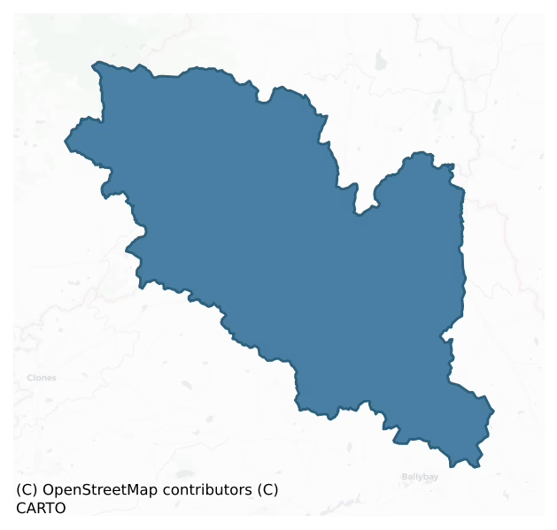
Monaghan is a barony of County Monaghan, in the historical province of Ulster (Irish: Muineachán), covering 283 km² of land. The barony records 225 NMS archaeological sites and 345 NIAH listed buildings, placing it at around the 5th percentile among 280 ROI baronies for sites per km². This means it is in the bottom tenth of all baronies for sites per km². Dated archaeological evidence runs from the Neolithic through to the Post Medieval, spanning 7 of 9 archaeological periods, placing the barony in the 45th percentile among 280 ROI baronies for chronological depth. This means it is in the lower half of all baronies for chronological depth. The largest dated subset of recorded sites dates to the Early Medieval. Logainm flags 85 placenames in the barony as carrying a recognised heritage root; the largest share — around 46% — are names associated with early Christian church and monastic foundations.

Heritage at a glance
Percentile rankings throughout this profile compare each barony only against the other 279 Republic of Ireland baronies.
The recorded heritage of Monaghan
The National Monuments Service Sites and Monuments Record (SMR) is the statutory inventory of archaeological sites for the Republic of Ireland, maintained by the Department of Tourism, Culture, Arts, Gaeltacht, Sport and Media. Sites recorded here include earthworks, ringforts, megalithic tombs, ecclesiastical remains, and post-medieval features; not every record is legally protected, but each is registered as a monument of archaeological interest.
The National Monuments Service records 225 archaeological sites in Monaghan, putting it at the 5th percentile among 280 ROI baronies for sites per km². This means it is in the bottom tenth of all baronies for sites per km². A sparse recorded total of this kind in Ireland often reflects survey priority rather than genuine absence of past activity. Protection coverage is near-universal — 215 sites (96%) fall within a recorded monument protection zone, indicating an extensively surveyed landscape. The dominant category is defensive sites — ringforts, enclosures, hillforts, and stone forts (144 sites, 64% of the record). Ringfort – rath is the most prevalent type, making up 50% of the barony's recorded sites (113 records) — well above the ROI average of 20% across all baronies where this type occurs. Ringfort – rath is an earthen ringfort enclosed by a bank and external ditch — the most common Early Medieval farmstead, broadly dated 500–1000 AD. Other significant types include Crannog (18) and Church (8). Crannog is an artificial or partly artificial island built up on a lake or river bed, in use from the 6th to 17th centuries AD; Church is a building used for public Christian worship, of any date from c. 500 AD onwards. Across the barony's 283 km², this gives a recorded density of 0.80 sites per km².
Most common monument types
Hover or tap a monument type to see its definition.
| Type | Count |
|---|---|
| Ringfort – rath an earthen ringfort enclosed by a bank and external ditch — the most common Early Medieval farmstead, broadly dated 500–1000 AD | 113 |
| Crannog an artificial or partly artificial island built up on a lake or river bed, in use from the 6th to 17th centuries AD | 18 |
| Church a building used for public Christian worship, of any date from c. 500 AD onwards | 8 |
| Graveyard a burial area associated with a church, in use from the medieval period onwards | 7 |
| Enclosure a banked or ditched feature of uncertain type, used as a catch-all where the original function cannot be determined from surface evidence | 6 |
| Megalithic tomb – unclassified a megalithic tomb whose form cannot be assigned to court, portal, passage, or wedge categories | 5 |
| Burial ground an area set apart for burial that is not associated with a church, in use from the medieval period onwards | 4 |
Chronological distribution
The dated archaeological record for Monaghan spans from the Neolithic through to the Post Medieval, with activity attested across 7 of 9 archaeological periods. Every period from earliest to latest is represented in the record — an unbroken sequence of dated activity across the full chronological span. Activity concentrates most heavily in the Early Medieval (113 sites, 61% of dated material), with the Iron Age forming a secondary peak (43 sites, 23%). A further 40 recorded sites (18% of the overall NMS register for the barony) carry no period attribution — appearing as 'Unknown' in the bar chart below. This typically reflects either records that pre-date the standardised period vocabulary or sites awaiting specialist dating review, rather than a genuine absence of chronological evidence.
Sample of recorded monuments
Show 25 sample monuments (of 225 total)
A representative sample of 25 recorded monuments drawn from the barony’s 225 total NMS entries. Sites within a recorded monument protection zone and rarer site types are prioritised so the list shows a meaningful cross-section rather than only the most common type. Each entry shows the official Sites and Monuments Record reference number and the description published by the National Monuments Service.
Children's burial ground
Located at the S end of a small N-S ridge. At the centre of the early church site (MO008-011—-) is a rectangular grass-covered area (dims c. 20m NE-SW: c. 15m NW-SE) defined by field walls at NW and SW and occasional…
Located at the S end of a small N-S ridge. At the centre of the early church site (MO008-011—-) is a rectangular grass-covered area (dims c. 20m NE-SW: c. 15m NW-SE) defined by field walls at NW and SW and occasional stones on the line of the perimeter elsewhere. This is the burial ground that was thought to have been used exclusively for children after c. 1800 (Smyth 1953, 63) but there are no grave-markers. A shallow drainage trench dug across it N-S during 1983 unearthed bones and a fragment of a decorated shaft of a high cross (MO008-011003-) that is now in the County Monaghan Museum, but two bullaun stones (MO0008-011004-) and the base of a cross (MO008-011005-) are missing from the burial ground. (Brindley 1988, 49-50)
The above description is derived from the published 'Archaeological Inventory of County Monaghan' (Dublin: Stationery Office, 1986).
Revised by: Michael Moore
Date of upload: 30 August 2017
Ecclesiastical enclosure
Located at the S end of a small N-S ridge. The early church (MO008-011—-) that was probably founded by St. Molua in the sixth century is within a circular grass-covered area (diam. c. 80-85m) defined by a scarp that…
Located at the S end of a small N-S ridge. The early church (MO008-011—-) that was probably founded by St. Molua in the sixth century is within a circular grass-covered area (diam. c. 80-85m) defined by a scarp that is best preserved WNW-NE (at N: Wth c. 5m; H c. 1m) and E-SW. The enclosure is overlain by field banks that approach from NE, SE, SW and NW and meet around the burial ground (MO008-011001-) at its centre. (Brindley 1988, 49)
Compiled by: Michael Moore
Date of upload: 30 August 2017
Cross – High cross
Portion of the decorated shaft of sandstone high cross (H 0.2m; Wth 0.18m; T 0.1m) was discovered in a drain across the children’s burial ground at the early church site (MO008-011—-) in 1983. One face has a panel of…
Portion of the decorated shaft of sandstone high cross (H 0.2m; Wth 0.18m; T 0.1m) was discovered in a drain across the children’s burial ground at the early church site (MO008-011—-) in 1983. One face has a panel of fretwork but while the opposite face was prepared for carving no pattern was executed; the shorter sides were intended to be plain. It is now in Monaghan County Museum. (Brindley 1988, 50; Harbison 1992, 167; No. 201)
Compiled by: Michael Moore
Date of upload: 30 August 2017
Ringfort – unclassified
Situated on a S-facing slope. A small oval area (dims c. 35m NE-SW; c. 25m NW-SE) is depicted on the 1834 edition of the OS 6-inch map where it is described in gothic lettering as a ’fort’ and the interior is traversed…
Situated on a S-facing slope. A small oval area (dims c. 35m NE-SW; c. 25m NW-SE) is depicted on the 1834 edition of the OS 6-inch map where it is described in gothic lettering as a ’fort’ and the interior is traversed by a NW-SE path or farm track. The SW portion survives as a D-shaped overgrown area (dims c. 20m NW-SE; c. 15m NE-SW) defined by earthen banks SE-SW.
The above description is derived from the published 'Archaeological Inventory of County Monaghan' (Dublin: Stationery Office, 1986). In certain instances the entries have been revised and updated in the light of recent research.
Date of revision: 13 December 2017
Religious house – Franciscan friars
A Franciscan friary was founded in 1462 by Phelim McMahon, but suggestions by Archdall (Gwynn and Hadcock 1970, 255) that it may have been on an older church site can be discounted (McKenna 1920, 1,3). Phelim McGuire…
A Franciscan friary was founded in 1462 by Phelim McMahon, but suggestions by Archdall (Gwynn and Hadcock 1970, 255) that it may have been on an older church site can be discounted (McKenna 1920, 1,3). Phelim McGuire was buried there in 1519 and Ruaraí Mac Redmond Mac Mahon was dragged from sanctuary there and murdered in 1539 (AU). The friary became Observant in 1567, and in 1589 it was sacked by English forces under the Lord Deputy, Sir William FitzWilliam, when the guardian and five others were killed. However, this is recorded under 1540 (AFM) when it might equally well have been perpetrated by a force under the Lord Deputy, Lord Leonard Grey. FitzWilliam left a garrison at the friary, but it was probably withdrawn after the battle of Clontibret in 1595 (Ó Mearáin 1956). Its lands were granted initially to Edward White, but these lands were granted to Edward Blayney in 1606 and confirmed to him in 1612 (Coyle 1980). He is said to have built a castle (MO009-060003-) from the materials of the friary, of which no trace remains.
An image of the friary survives on a map of c. 1590 (Mooney 1957, Pl. 12) which shows a simple rectangular structure with a tower attached on the N side of what may have been the junction of the nave and chancel. The tower has battlements and a pointed roof, but a cloister and other buildings are not depicted (Mooney 1955, 140-1) and probably did not exist. The ruins of the friary are also illustrated on Bartlett’s map of c. 1602 as a more comp…
House – fortified house
A castle was being built at Monaghan after 1604 by Sir Edward Blayney using material derived from the Franciscan friary (MO009-060002-). It was described in 1606 by John Davies, the attorney general, as ‘the foundation…
A castle was being built at Monaghan after 1604 by Sir Edward Blayney using material derived from the Franciscan friary (MO009-060002-). It was described in 1606 by John Davies, the attorney general, as ‘the foundation of a new castle, which being raised ten or twelve feet from the ground, and so left and neglected for the space of two years, is now ready to fall into ruin again.’ It is not represented on the Bartlett map of the town of 1602-03, which was more aspirational than actual. In 1611 the castle is described as ‘a fayre castle buylte at Monaghan on the king’s charge wherein Sr. Edward Blayne nowe dwells, who for making of it more convenient for himself for his owne tyme hath layde out good somes of money of his owne. ‘(Hunter 1975, 81). He is reputed to have spent £1200 on it. A map of the town, probably c. 1611-13 and now held in Trinity College Dublin (Ms 1209 (32)), which was illustrated by Ó Gallachair (1962, 145), shows the castle as a rectangular structure that has large rectangular corner towers and a small enclosed court on its N side in the style of fortified houses. The castle was within a rectangular bawn with a gate at the N and bastions at the NW and SE angles. South of the castle and within its curtilage the map shows gardens and fish ponds. In 1835 the site of this castle was pointed out as being on the Diamond opposite Glasslough St. (Herity 2012, 175) followed by Lewis (1837, 2, 384), but this structure was probably at the N side of the bawn, whic…
Town defences
Monaghan town is situated on a hill or low ridge between Peter’s Lake to the N and Convent Lake to the S. Monaghan was incorporated as a county with five baronies in 1585, and this location where there was already a…
Monaghan town is situated on a hill or low ridge between Peter’s Lake to the N and Convent Lake to the S. Monaghan was incorporated as a county with five baronies in 1585, and this location where there was already a friary and a castle or strongpoint of the MacMahons together with a small settlement may have been selected then for future development as a county town. In 1589-91 the lord deputy, Sir William FitzWilliam, took advantage of a Mac Mahon dispute to impose a land settlement, and established a garrison here, effectively abolishing the Mac Mahon chieftainship and the use of Brehon law. The garrison at Monaghan was probably abandoned in 1595 after the battle of Clontibret but it was re-established by John Berkley in 1602. In 1604 Sir Edward Blayney was appointed seneschal or governor of the county and the garrison, and two years later he received extensive lands around the town and what would become Castleblayney (Duffy 1981. 14, fig. 5). These were confirmed to him in 1612, although the castle at Monaghan was specifically excluded (Coyle 1980). In 1606 Sir John Davies, the attorney general, described the town but does not mention any fortifications (Hunter 1975).
A map of Richard Bartlett of c. 1602 shows a fortified enclosure with fourteen thatched houses and eight bastions. This is a fanciful idealised fortified town, which did not exist at Monaghan then. The town is represented on a slightly later map prepared for Sir Edward Blayney, probably c. 1611-13 and now…
Cross – Market cross (present location)
The cross is first recorded in 1714 (McKenna 1920, 1, 80-3) and it is described as ‘Market Cross’ in italic lettering on the 1834 edition of the OS 6-inch map at the centre of the Diamond where it had stood with the…
The cross is first recorded in 1714 (McKenna 1920, 1, 80-3) and it is described as ‘Market Cross’ in italic lettering on the 1834 edition of the OS 6-inch map at the centre of the Diamond where it had stood with the stocks beside it. Around 1875 the Rossmore Memorial, a neo-gothic memorial fountain, was erected in its stead and the Market cross was discarded. This caused great controversy at the time, when Nationalists rescued it and re-erected in the small square known as the Shambles and now called Old Cross Square. By the time Nationalists had a majority on the council in 1898 the heat had gone out of the issue, and the cross remains in Old Cross Square (McKenna 1920 1, 80-3). It is depicted on the 1907 edition of the OS 6-inch map as being in the centre of the square but this location must have caused traffic problems and it is now at the N side of the square. However, in setting up the cross here the head was attached upside down so that it no longer functions as a sun-dial (McMahon and Walsh 1982, 16).
Six limestone steps lead to the rectangular base (dims 0.56m x 0.56m; H 0.446m) which supports a tapering limestone shaft (dims at base 0.44m x 0.43m; H 1.72m) with chamfered edges and curved stops. The head is a polygonal stone with four hemispherical hollows on different facets, each of which was originally aligned on a cardinal point. A gnomen or pointer would cast a shadow on lines in a particular cup depending on the time of day and season of the year. Even the…
House – 17th century
John Burnett, a scion of an Aberdeenshire family, began acquiring land in Monaghan in 1609. He settled at Ballyleck where according to an inquisition of 1622 he had built ‘a fayre castle or cheefehouse, and a bawne of…
John Burnett, a scion of an Aberdeenshire family, began acquiring land in Monaghan in 1609. He settled at Ballyleck where according to an inquisition of 1622 he had built ‘a fayre castle or cheefehouse, and a bawne of lyme and stone, with two fayre flankers very strong and defensable’. At that time he owned land in 130 townlands, all of which are provided in the inquisition together with the names of their previous owners. His children lost this inheritance for supposed rebellion against Charles I and by the reign of Charles II it seems to have descended by the female line and was owned by the Cole and other families. The estate was purchased by Richard Westenra in the early nineteenth century (Shirley 1879, 211-13).
A castle, probably a fortified house, is depicted at Ballyleck on McCrea’s map of County Monaghan (1793), but its precise location is not known although it could be where Ballyleck House now is. Ballyleck House is represented as a house owned by the Montgomery family on the 1783 Taylor and Skinner map of the roads of Ireland (Andrews 1969, 259), and it is still occupied.
The above description is derived from the published 'Archaeological Inventory of County Monaghan' (Dublin: Stationery Office, 1986). In certain instances the entries have been revised and updated in the light of recent research.
Date of revision: 14 December 2017
Bastioned fort
Situated on relatively high ground to the NW of Monaghan town. There was a small settlement at Monaghan in 1589-91 when the lord deputy, Sir William FitzWilliam, took advantage of a Mac Mahon dispute to establish a…
Situated on relatively high ground to the NW of Monaghan town. There was a small settlement at Monaghan in 1589-91 when the lord deputy, Sir William FitzWilliam, took advantage of a Mac Mahon dispute to establish a garrison here at the friary (MO009-060002-). The garrison was probably abandoned after the battle of Clontibret in 1595 but it was re-established by John Berkley in 1602 (Livingstone 1982, 90-4). In 1604 Sir Edward Blayney was appointed seneschal or governor of the county and the garrison, and two years later he received extensive lands around the town and around what would become Castleblayney (Duffy 1981. 14, fig. 5). He commenced to build a house (MO009-060003-) for himself at Monaghan. In 1606 Sir John Davies, the attorney general, described the town as ‘…consisting of divers scattered cabins or cottages, whereof the most part was possessed by the cast soldiers of that garrison. In the northmost part thereof there is a little fort, which is kept by the foot company of Sir Edward Blayney, who is seneschal or governor of the county by patent’. A map of Richard Bartlett of c. 1602-03 shows the town as a fortified enclosure with fourteen thatched houses and eight bastions. This is a fanciful idealised fortified town, which did not exist at Monaghan then, but the plan does show the ruins of the friary (MO009-060002-) in the foreground and this fort that was mentioned by Davies in the background.
Hayes-McCoy (1960, 16) suggests that this fort was built in 1602. L…
Historic town
Monaghan town (Muineacháin – hilly place) is situated on a hill or low ridge between Peter’s Lake to the N and Convent Lake to the S. There are references to a McMahon ‘caislean’ or castle at Monaghan in 1492 (AFM, AU),…
Monaghan town (Muineacháin – hilly place) is situated on a hill or low ridge between Peter’s Lake to the N and Convent Lake to the S. There are references to a McMahon ‘caislean’ or castle at Monaghan in 1492 (AFM, AU), which is described as a ‘house’ in 1496 (AU). It is probably the crannog in Convent Lake (MO009-037—-), which is described on a map of c. 1590 as ‘McMahon’s house’. The foundation of a Franciscan friary (MO009-060002-) nearby in 1462 would have added to the developing nucleus of a settlement, and this has been demonstrated through excavation (MO009-06010-).
Monaghan was incorporated as a county with five baronies in 1585, and this location where there was already a friary and a strongpoint of the MacMahons as well as a small settlement may have been selected then for future development as the county town. In 1589-91 the lord deputy, Sir William Fitzwilliam, took advantage of a Mac Mahon dispute to establish a garrison here at the friary. This was part of a political and land settlement that effectively abolished the Mac Mahon chieftainship and the use of Brehon law in the territory. The land settlement was generally accepted by the larger Gaelic magnates as it secured their personal estates, and it also ensured that the county escaped plantation with the other Ulster counties after 1603. However, the infiltration of settlers through the foreclosure of debt and land purchase continued apace. (Moore 1955, 34-7; MacDuinnshleibhe 1955, 49-50; Duffy 1981, 2)…
Inauguration site
Located at the summit of and at the centre of the E-W drumlin ridge known as the Hill of Leck. The MacMahon chiefs were inaugurated at this location until the seventeenth century, and it is described on an Ulster map…
Located at the summit of and at the centre of the E-W drumlin ridge known as the Hill of Leck. The MacMahon chiefs were inaugurated at this location until the seventeenth century, and it is described on an Ulster map made in 1609 as ‘Mullagh-lest (leach?), so called of a stone there, on which McMahon is made’ (Hamilton 1912, 64-5). It is known in the folk tradition, and a sketch of a spherical stone is provided (IFC: (953) 159-60: https://www.duchas.ie/en/cbes ). The stone was said to have the imprint of a foot, which the landowner obliterated in 1809, and the remains of the stone were removed after 1845 (ibid.; Shirley 1879, 71). It is described as being ‘about 12 feet by 10 feet and about 3 feet high (dims c. 3.65m x c. 3m; H 0.9m), but other measurements of ‘5 feet x 4 feet and 3 feet high (dims c. 1.5m x 1.2m; H c. 0.9m) are also recorded (IFC: (953) 212-3). The location of the ‘MacMahons Stone’ is represented on the 1834 edition of the OS 6-inch map, but it was removed later in the 19th century (Shirley 1879, 71).
The above description is derived from the published 'Archaeological Inventory of County Monaghan' (Dublin: Stationery Office, 1986). In certain instances the entries have been revised and updated in the light of recent research.
Compiled by: Michael Moore
Date of revision: 22 February 2018
Megalithic tomb – wedge tomb
Situated at the crest of a W-facing slope. A large upright stone (L 2.5m; T 0.1m at W to 0.3m at E; H 1-1.1m) oriented NE-SW forms the SE side of a chamber only represented by two small earthfast stones (dims 0.6m…
Situated at the crest of a W-facing slope. A large upright stone (L 2.5m; T 0.1m at W to 0.3m at E; H 1-1.1m) oriented NE-SW forms the SE side of a chamber only represented by two small earthfast stones (dims 0.6m NW-SE; 0.4m NE-SW; H 0.7m: 0.8m NE-SW; x 0.1m; max. H 0.3m) 1.6m distant to the NW.
The above description is derived from the published 'Archaeological Inventory of County Monaghan' (Dublin: Stationery Office, 1986). In certain instances the entries have been revised and updated in the light of recent research.
Compiled by: Michael Moore
Date of revision: 1 December 2016
Standing stone
Situated on a W-E spur. Its location is marked only on the 1907 edition of the OS 6-inch map where it is described in gothic lettering as a ‘Standing Stone’. It is no longer extant and no description of it is…
Situated on a W-E spur. Its location is marked only on the 1907 edition of the OS 6-inch map where it is described in gothic lettering as a ‘Standing Stone’. It is no longer extant and no description of it is known.
The above description is derived from the published 'Archaeological Inventory of County Monaghan' (Dublin: Stationery Office, 1986). In certain instances the entries have been revised and updated in the light of recent research.
Compiled by: Michael Moore
Date of revision: 26 February 2016
Megalithic tomb – portal tomb
Located on the SE-facing spine of a small NW-SE drumlin ridge. It is depicted only on the 1907 edition of the OS 6-inch map where it is described in gothic lettering as a ‘Cromlech’. It was built into the outer (SW)…
Located on the SE-facing spine of a small NW-SE drumlin ridge. It is depicted only on the 1907 edition of the OS 6-inch map where it is described in gothic lettering as a ‘Cromlech’. It was built into the outer (SW) edge of a field bank at the SW angle of a field. The roofstone had been dislodged and the western side-stone damaged in 1847, but a scribbing at the edge of a fissure on the damaged side-stone was recorded by John O’Donovan in 1835 (Herity 2012, 182) and Graves in 1848 (Ferguson 1873). This appears to be more like runes than ogham or any other script, but the present condition of the carving is not known. The field bank had been removed by 1983 when the monument was described as a large roofstone (dims 3.4m x 2.6m; T 0.7m) supported on two side-stones (Ó Nualláin 1983, 100). (Borlase 1897 vol. 1, 294)
The above description is derived from the published 'Archaeological Inventory of County Monaghan' (Dublin: Stationery Office, 1986). In certain instances the entries have been revised and updated in the light of recent research.
See the attached view from Borlase _1, and drawings of the inscription by O'Donovan (above) and Ferguson after Borlase _2
Revised by: Michael Moore
Date of revision: 22 June 2018
Mound
Situated on high ground with excellent views in all directions. A flat topped mound of earth (top: 15m N-S; 16m E-W; base: 28m N-S; 27m E-W; max H c. 1.5m). Defined by a gradual slope on the S-SW side and by a steeper…
Situated on high ground with excellent views in all directions. A flat topped mound of earth (top: 15m N-S; 16m E-W; base: 28m N-S; 27m E-W; max H c. 1.5m). Defined by a gradual slope on the S-SW side and by a steeper slope on the N-NE side. Possible faint traces of an external bank on the NE side. Known locally as 'Tully Fort'.
Date of upload: 14 April 2011
Ritual site – holy tree/bush
Situated on a slight N-S ridge with small S-N streams c. 200m to the E and W. It is described as ‘Confession Bush’ in italic lettering only on the 1907 edition of the OS 6-inch map. A mass rock is thought to be located…
Situated on a slight N-S ridge with small S-N streams c. 200m to the E and W. It is described as ‘Confession Bush’ in italic lettering only on the 1907 edition of the OS 6-inch map. A mass rock is thought to be located here (Ó Galachair 1957, 126) but there is no other information about it, and it is not recorded in the schools’ manuscripts of the Irish Folklore Commission. There is no mass rock present but there is a lone hawthorn bush.
Date of revised upload: 14 December 2017
Architectural fragment
A corner portion of a gable coping with a carving of a head from the medieval parish church of Tullycorbet (MO014-030001-) was noted in the graveyard (MO014-030002-) in 1940 (ITA Survey) and it is probably still…
A corner portion of a gable coping with a carving of a head from the medieval parish church of Tullycorbet (MO014-030001-) was noted in the graveyard (MO014-030002-) in 1940 (ITA Survey) and it is probably still present, but its precise location in the overgrown graveyard is not known.
Compiled by: Michael Moore
Date of revised upload: 25 November 2016
Stone head
Attached to the external front wall of a derelict farmhouse which is indicated on the 1835 'OS 6-inch' map. A stone carving of a human head in raised relief. The head is long and narrow, with oval bulging eyes and a…
Attached to the external front wall of a derelict farmhouse which is indicated on the 1835 'OS 6-inch' map. A stone carving of a human head in raised relief. The head is long and narrow, with oval bulging eyes and a full beard and is wearing a scalloped headpiece. Believed to have come from Faulkland Castle (MO009-059—-) where it was probably used as a corbel. (pers. comm. Shirley Clerkin, Monaghan Heritage Officer).
Date of upload/revision: 23 June 2011
Anomalous stone group
Situated on a rise that slopes down gently to the N and it is overlooking Ghost Lough which is c. 40m to the E. Nine irregularly-shaped limestone boulders are placed close together (3.5m N-S × 3.2m E-W; H c. 0.5m),…
Situated on a rise that slopes down gently to the N and it is overlooking Ghost Lough which is c. 40m to the E. Nine irregularly-shaped limestone boulders are placed close together (3.5m N-S × 3.2m E-W; H c. 0.5m), forming no definite pattern. According to local tradition this feature is known as a 'Giants Grave' and there are various legends and superstition associated with the stones.
Compiled by: Claire Breen
Date of upload: 14 April 2011
House – 16th century
Archaeological excavation (Excavation Licence No. 02E1147) in advance of development at the Westenra Arms Hotel revealed continuous occupation levels dating from the 16th to the 20th century and an earlier phase of…
Archaeological excavation (Excavation Licence No. 02E1147) in advance of development at the Westenra Arms Hotel revealed continuous occupation levels dating from the 16th to the 20th century and an earlier phase of activity of which the exact date is unknown. This early phase of activity was represented by a series of post- and stake-holes and possible traces of wattles. Above this layer was a series of clay floors which are believed to date to between 1550 and 1590. A section of the town ditch (MO009-060004-) was also exposed. (O' Connor 2004, 440-1; O' Connor 2006, 401-2)
References:
O' Connor D. 2004, Westenra Arms Hotel, The Diamond, Monaghan Urban post-medieval. In I. Bennett (ed.), Excavations 2002: summary accounts of archaeological excavations in Ireland, 440-1 (No. 1546). Bray. Wordwell
O' Connor D. 2006, Westenra Arms Hotel, The Diamond, Monaghan Urban. In I. Bennett (ed.), Excavations 2002: summary accounts of archaeological excavations in Ireland, 401-2 (No. 1494). Bray. Wordwell
Date of upload: 14 April 2011
Cupmarked stone
Situated in Tedavnet graveyard (MO006-022002-) c. 5m W of the wall displaying the memorial of Richard Robinson (MO006-022005-), but this is not likely to be its original location. A stone which is set up like a…
Situated in Tedavnet graveyard (MO006-022002-) c. 5m W of the wall displaying the memorial of Richard Robinson (MO006-022005-), but this is not likely to be its original location. A stone which is set up like a headstone (dims of base 0.83m x 7-8cm H 0.7m) has three cup-marks (diam. 11-15cm; D 2-4m), two of which are damaged at the edges of the stone.
See the attached image
Compiled by: Michael Moore
Date of upload: 7 November, 2016
Wall monument
Situated in Tedavnet graveyard (MO006-022002-). A small portion of a wall (L 2.15m; T 0.45m; max. H 1.95m) is said to belong to the medieval church but it is more likely to have been erected to display the funerary…
Situated in Tedavnet graveyard (MO006-022002-). A small portion of a wall (L 2.15m; T 0.45m; max. H 1.95m) is said to belong to the medieval church but it is more likely to have been erected to display the funerary monument of Richard Robinson dated 1716, which is on its S face. The memorial (Wth 0.78m; H 1.38m) is in red sandstone with a raised border and it has a rounded top. It has an oval crest with the crest of the Robinson family. This is an inverted chevron dividing the oval in two, and there are three animals representing deer on the crest. The inscription is incised in roman capitals. It reads: HERE LYETH THE BODY OF / Mr. RICHARD ROBINSON / ATTORNEY AT LALIE (Law) WHO / DEPARTED THIS LIFE 4 / DAY OF APRIL 1716 /AGED 34 YEARS.
See the attached image
Compiled by: Michael Moore
Date of upload: 7 November, 2016
House – indeterminate date
Situated at the highest point and towards the NW end of a NW-SE drumlin ridge. The foundations of a subrectangular house structure (ext. dims 5.7m x 4.7m; int. dims 5m x 4.3m) defined by low banks (Wth 1.1m; H 0.2m) and…
Situated at the highest point and towards the NW end of a NW-SE drumlin ridge. The foundations of a subrectangular house structure (ext. dims 5.7m x 4.7m; int. dims 5m x 4.3m) defined by low banks (Wth 1.1m; H 0.2m) and with a probable entrance at ENE is visible SW of the NW-SE field bank that bisects rath (MO019-002—-).
Compiled by: Michael Moore
Date of upload: 22 June 2018
Ringfort – rath
Located on a slight rise at the bottom of a W-facing slope. Traces of an enclosure are visible on aerial photographs (GSIAP: H 271/272) from the 1970s. This is a raised overgrown area, which is known locally as a…
Located on a slight rise at the bottom of a W-facing slope. Traces of an enclosure are visible on aerial photographs (GSIAP: H 271/272) from the 1970s. This is a raised overgrown area, which is known locally as a ‘fort’.
Date of revised upload: 29 August 2017
Listed buildings
The National Inventory of Architectural Heritage (NIAH) is a state survey appraising buildings of architectural, historical, archaeological, artistic, cultural, scientific, social, or technical interest. Each surveyed structure receives a rating from International (the highest, for buildings of European importance) through National, Regional, Local, and Record-Only.
The National Inventory of Architectural Heritage records 345 listed buildings in Monaghan, placing it in the top 10% of ROI baronies for listed-building density. Among these, 6 are graded National — buildings of interest to the whole of Ireland rather than only its region. The Republic holds 937 National-graded buildings in total, so this barony accounts for around 1% of the national total. Construction dates concentrate most heavily in the Victorian (1830-1900) period. The most-recorded building type is house (105 examples, 30% of the listed stock).
Terrain and environment
Mean elevation across the barony is 112m — the 68th percentile among 280 ROI baronies for elevation. This means it is in the top third of all baronies for elevation. Elevation matters for heritage because higher-altitude baronies typically favour defensive monuments — ringforts and hilltop forts placed on prominent ground — while lowland baronies are more likely to carry the dense settlement and church networks of intensive agricultural landscapes. The barony reaches 372m at its highest point — a vertical span of more than 260m within its boundary, indicating significant topographic diversity. Mean slope is 5.4° — the 77th percentile among 280 ROI baronies for slope. This means it is in the top third of all baronies for slope. This is consistently steep terrain by ROI standards, the kind of landscape that tends to preserve upstanding archaeological features well. Slope is a key control on both land use and archaeological preservation: steep ground resists ploughing and tends to preserve earthworks intact, while gentle slopes favour intensive cultivation that damages or destroys surface archaeology over time. The Topographic Wetness Index averages 9.8, the 18th percentile among 280 ROI baronies for wetness. This means it is in the bottom fifth of all baronies for wetness. This is well-drained ground by ROI standards — typical of upland or steeply-sloping country that sheds water rapidly. Drainage matters for heritage because poorly-drained ground preserves organic archaeology (wooden trackways, leather, textiles, and on rare occasions human remains) far better than free-draining soil; well-drained ground favours arable use but destroys organic material rapidly. The land cover is dominated by improved grassland (79%) and woodland (18%). In overall character, this is steeply-sloping terrain at modest elevation, with land use dominated by improved grassland.
Terrain measurements
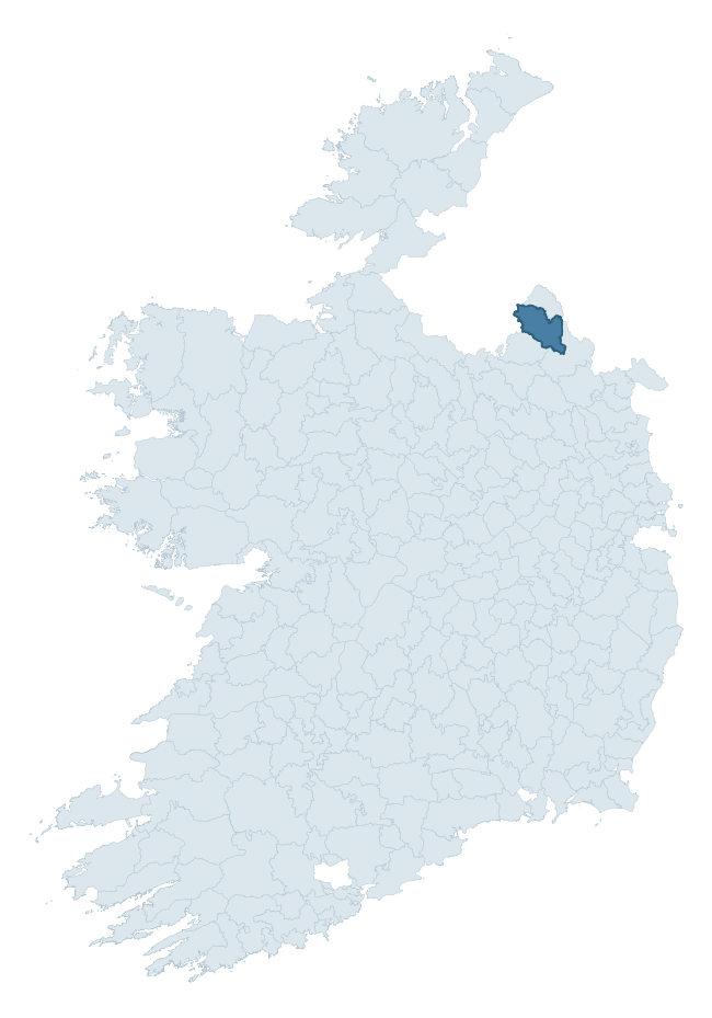
Where this barony sits in the Republic of Ireland
Geology and preservation
Bedrock geology shapes the landscape long before any settlement begins — controlling soil drainage, agricultural potential, the survival of upstanding monuments, and the preservation of buried archaeology. The figures below come from the Geological Survey Ireland 1:100,000 bedrock map.
The bedrock underlying Monaghan is predominantly shale (36% of the barony by area), laid down during the Carboniferous period (61% by area, around 359 to 299 million years ago). Shale weathers to thin, acidic, frequently waterlogged soils, historically marginal for arable but suited to upland pasture and bog development. Shale-dominated baronies often carry sparse ringfort records and a higher representation of bog-preserved archaeology. A substantial secondary geology of limestone (17%) and greywacke and shale (16%) adds further variety to the underlying landscape. With 7 distinct rock types mapped, the barony sits in the top third of ROI baronies for geological diversity (75th percentile) — typically a sign of complex tectonic history or coastal mosaics of differing rock units.
Rock type composition
Largest mapped unit: Coronea Formation (16% of the barony)
Placename evidence
Logainm records 85 heritage-diagnostic placenames for Monaghan, drawn from townland and civil-parish names across the barony. The dominant stratum is Early Christian ecclesiastical — cill-, teampall-, and domhnach-prefixed names that record the dense network of early church foundations established between the fifth and tenth centuries. The leading diagnostic roots are cill- (37 — church), lios- (14 — ringfort or enclosure), and ráth- (12 — earthen ringfort). This is well above the ROI average of 30.7 heritage placenames per barony — around 2.8× the typical figure. The presence of multiple heritage strata side by side indicates layered occupation of the landscape across successive prehistoric and historic periods. Logainm records 470 placenames for Monaghan (predominantly townland names). Of these, 85 (18%) carry one of the diagnostic Gaelic roots tracked above; the remainder draw on more generic landscape vocabulary that does not encode a heritage period.
Pre-Christian / Early Medieval Defensive
| Root | Count | Meaning |
|---|---|---|
| lios- | 14 | ringfort or enclosure |
| ráth- | 12 | earthen ringfort |
| dún- | 5 | hilltop or promontory fort |
Early Christian Ecclesiastical
| Root | Count | Meaning |
|---|---|---|
| cill- | 37 | church (early) |
| teampall- | 1 | church (later medieval) |
| domhnach- | 1 | pre-Patrician or earliest Patrician church |
Burial, Ritual, and Norse-Contact
| Root | Count | Meaning |
|---|---|---|
| leacht- | 6 | grave monument |
| carn- | 4 | cairn |
| gall- | 4 | foreigner — Norse settlement marker |
| feart- | 3 | grave mound |
| uaimh- | 2 | cave / souterrain |
Other baronies in Monaghan
- Farney
- Trough
- Dartree
- Cremorne
- Inishowen East — Donegal
- Banagh — Donegal
- Boylagh — Donegal
- Tullyhunco — Cavan
- Clankee — Cavan
- Loughtee Upper — Cavan
See all 280 baronies in the Republic of Ireland Heritage Tool.

Explore further
Grounding History: 10 Maps of Northern Ireland’s Past
If you’re interested in Irish heritage more widely, the companion report for Northern Ireland brings together the analysis of all 462 NI wards into one place through 10 high-quality maps — covering monument density, archaeological periods, placename heritage, terrain, wetland, and the historic landscape at first survey. Take a look.
About this profile
Click any section below to expand.
What is a barony?
A barony is a historic administrative unit in Ireland, broadly equivalent to an English hundred. The 280 baronies used here are from the OSi 2019 National Statutory Boundaries (generalised 20m), covering the 26 counties of the Republic of Ireland. Baronies derive from the Norman period, were formalised in the 17th century, and have not been redrawn for statistical purposes. They vary enormously in area, from compact urban baronies in Dublin to vast upland baronies in Connacht, and should not be compared by raw site count without accounting for area differences.
What counts as a site?
This profile combines three distinct heritage registers, each with its own definition of what constitutes a recordable site:
- Archaeological sites (NMS). The National Monuments Service Sites and Monuments Record (SMR) catalogues every known archaeological monument or site of archaeological interest in the Republic, from prehistoric burial mounds and ringforts to medieval churches and post-medieval defensive works. Inclusion does not require legal protection — only that the site has been identified, surveyed, and assessed as having archaeological value. A separate subset of these sites lies within a recorded protection zone, which gives them statutory protection under the National Monuments Acts.
- Listed buildings (NIAH). The National Inventory of Architectural Heritage records buildings of architectural, historical, archaeological, artistic, cultural, scientific, social, or technical interest. Each surveyed structure is appraised on a five-tier scale: International, National, Regional, Local, and Record-Only. The NIAH appraisal is informational rather than strictly statutory, but it underpins local-authority Record of Protected Structures (RPS) listings.
- Heritage placenames (Logainm). Logainm is the authoritative database of Irish placenames maintained by the Placenames Branch. This profile applies a heritage-diagnostic classifier to the Irish-language form of each townland name, flagging roots that signal defensive sites (ráth-, lios-, dún-, caiseal-, cathair-), ecclesiastical foundations (cill-, teampall-, domhnach-, mainistir-), prehistoric burial-ritual features (tuaim-, carn-, leaba-), or Norse-contact settlement (gall-). Townlands without one of these diagnostic roots are not flagged here — they may still carry historical significance, but that significance is not encoded in the name itself.
Editorial principles
The narrative sections of this profile follow several explicit principles:
- Evidential. Every claim about this barony’s heritage character is anchored in the underlying register data. Where a site count, a placename count, or a percentile rank is cited, it is computed from the source datasets at export time, not estimated.
- Comparative. Counts and metrics are reported alongside their percentile rank against the other 279 ROI baronies. A barony with 50 ringforts in absolute terms could be unusually high or unusually low depending on its size and regional context; percentile ranking removes that ambiguity.
- Transparent on limits. Where a register has known coverage gaps, survey biases, or data-quality issues that affect this barony’s figures, the profile flags them rather than presenting the numbers as definitive.
- No interpretation beyond what the data supports. The narrative does not speculate about historical events, social dynamics, or cultural meaning beyond what the recorded heritage and placename evidence directly attests.
Data caveats and limits
- NMS Sites and Monuments Record is the product of survey campaigns conducted at different intensities across different counties and decades. Some baronies have been surveyed more thoroughly than others, and absolute counts should be read in that light. Sites destroyed by development before survey are typically not represented; sites in heavily forested or upland terrain are sometimes under-recorded.
- NIAH coverage is broadly complete for the Republic of Ireland but the survey was conducted on a rolling county-by-county basis, and the most recent appraisal date varies. Buildings demolished or substantially altered after their original survey may still appear in the register; conversely, recent buildings of merit may not yet have been appraised.
- Logainm classification applies a deliberately conservative pattern-matching approach to the Irish-language townland forms. The classifier prioritises true positives over recall: a townland may carry a heritage signal that the classifier doesn’t recognise, particularly where the diagnostic root has been heavily anglicised or where the townland name draws on a less common term. The 60,000+ townland records and ~9,800 classified placenames give a substantial signal at barony scale, but individual townland names should be checked against Logainm directly for definitive interpretation.
- Period attribution. The chronological distribution reflects only those NMS sites that carry a recognised period attribution in the source data. Sites listed as “Unknown” period are excluded from the dated subset.
- Boundary changes. Some baronies have undergone minor boundary adjustments since their 19th-century definition; the OSi 2019 generalised boundaries used here are the current statutory definition and may differ slightly from historical maps in border areas.
- Bedrock geology is mapped at 1:100,000 scale, which means local variation within a barony — small pockets of different rock type, mineral veins, alluvium overlying bedrock — is generalised. The dominant-system and rocktype figures are area-weighted, so a barony reading “70% Carboniferous limestone” may still contain small but archaeologically important pockets of older or younger rock. Around 3% of GSI polygons do not match the lexicon and contribute no rocktype or system attribution.
Data sources
- National Monuments Service — Sites and Monuments Record (SMR) https://data.gov.ie/dataset/national-monuments-service-archaeological-survey-of-ireland
- National Inventory of Architectural Heritage (NIAH) https://data.gov.ie/dataset/national-inventory-of-architectural-heritage-niah-national-dataset
- Logainm — Placenames Database of Ireland https://www.logainm.ie/
- Ordnance Survey Ireland — National Statutory Barony Boundaries 2019 https://data-osi.opendata.arcgis.com/
- EURODEM — European Digital Elevation Model https://www.mapsforeurope.org/datasets/euro-dem
- ESA WorldCover https://esa-worldcover.org/en
- Geological Survey Ireland — 1:100,000 Bedrock Geology https://www.gsi.ie/en-ie/data-and-maps/Pages/Bedrock.aspx
Explore more: Search any of the 280 ROI baronies, browse by historical province, or read the methodology and data sources for the full Republic of Ireland Heritage Tool.