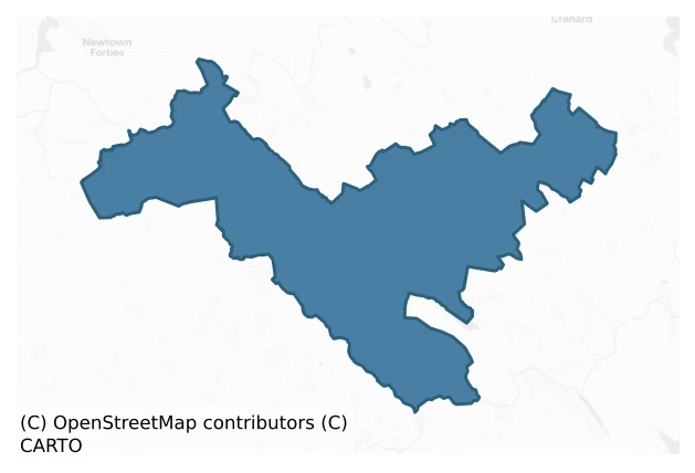
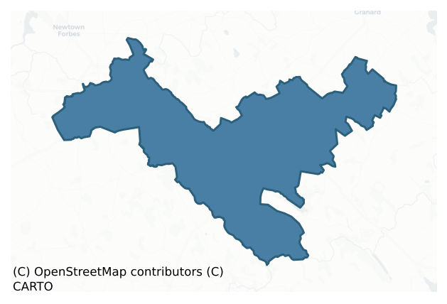
Ardagh is a barony of County Longford, in the historical province of Leinster (Irish: Ardach), covering 163 km² of land. The barony records 322 NMS archaeological sites and 235 NIAH listed buildings, placing it at around the 54th percentile among 280 ROI baronies for sites per km². This means it is in the upper half of all baronies for sites per km². Dated archaeological evidence runs from the Early Bronze Age through to the Modern, spanning 7 of 9 archaeological periods, placing the barony in the 39th percentile among 280 ROI baronies for chronological depth. This means it is in the lower half of all baronies for chronological depth. The largest dated subset of recorded sites dates to the Early Medieval. Logainm flags 38 placenames in the barony as carrying a recognised heritage root; the largest share — around 61% — are names associated with pre-christian defensive.
Heritage at a glance
Percentile rankings throughout this profile compare each barony only against the other 279 Republic of Ireland baronies.
The recorded heritage of Ardagh
The National Monuments Service Sites and Monuments Record (SMR) is the statutory inventory of archaeological sites for the Republic of Ireland, maintained by the Department of Tourism, Culture, Arts, Gaeltacht, Sport and Media. Sites recorded here include earthworks, ringforts, megalithic tombs, ecclesiastical remains, and post-medieval features; not every record is legally protected, but each is registered as a monument of archaeological interest.
The National Monuments Service records 322 archaeological sites in Ardagh, putting it at the 54th percentile among 280 ROI baronies for sites per km². This means it is in the upper half of all baronies for sites per km². Protection coverage is near-universal — 298 sites (92%) fall within a recorded monument protection zone, indicating an extensively surveyed landscape. The dominant category is defensive sites — ringforts, enclosures, hillforts, and stone forts (219 sites, 68% of the record). Ringfort – rath is the most prevalent type, making up 55% of the barony's recorded sites (176 records) — well above the ROI average of 20% across all baronies where this type occurs. Ringfort – rath is an earthen ringfort enclosed by a bank and external ditch — the most common Early Medieval farmstead, broadly dated 500–1000 AD. Other significant types include Enclosure (26) and Church (10). Enclosure is a banked or ditched feature of uncertain type, used as a catch-all where the original function cannot be determined from surface evidence; Church is a building used for public Christian worship, of any date from c. 500 AD onwards. Across the barony's 163 km², this gives a recorded density of 1.98 sites per km².
Most common monument types
Hover or tap a monument type to see its definition.
| Type | Count |
|---|---|
| Ringfort – rath an earthen ringfort enclosed by a bank and external ditch — the most common Early Medieval farmstead, broadly dated 500–1000 AD | 176 |
| Enclosure a banked or ditched feature of uncertain type, used as a catch-all where the original function cannot be determined from surface evidence | 26 |
| Church a building used for public Christian worship, of any date from c. 500 AD onwards | 10 |
| Graveyard a burial area associated with a church, in use from the medieval period onwards | 8 |
| Fulacht fia a horseshoe-shaped Bronze Age burnt mound built around a sunken trough beside a water source, traditionally interpreted as a cooking site | 7 |
| Structure – peatland a construction of unknown function, either extant or implied by archaeological evidence, of any date | 6 |
| Ritual site – holy well a well or spring traditionally associated with a saint, often credited with healing properties; many trace earlier ritual origins but devotion is documented from the medieval period onwards | 5 |
| Excavation – miscellaneous | 5 |
Chronological distribution
The dated archaeological record for Ardagh spans from the Early Bronze Age through to the Modern, with activity attested across 7 of 9 archaeological periods. Every period from earliest to latest is represented in the record — an unbroken sequence of dated activity across the full chronological span. Activity concentrates most heavily in the Early Medieval (157 sites, 55% of dated material), with the Iron Age forming a secondary peak (82 sites, 29%). A further 35 recorded sites (11% of the overall NMS register for the barony) carry no period attribution — appearing as 'Unknown' in the bar chart below. This typically reflects either records that pre-date the standardised period vocabulary or sites awaiting specialist dating review, rather than a genuine absence of chronological evidence.
Sample of recorded monuments
Show 25 sample monuments (of 322 total)
A representative sample of 25 recorded monuments drawn from the barony’s 322 total NMS entries. Sites within a recorded monument protection zone and rarer site types are prioritised so the list shows a meaningful cross-section rather than only the most common type. Each entry shows the official Sites and Monuments Record reference number and the description published by the National Monuments Service.
Barrow – pond barrow
In wet, low-lying pasture. A circular, saucer-shaped depression (diam. 12.8m; D 0.45m) enclosed by a wide, low bank of earth and stone (Wth 5.95m; H 0.45m) with an external fosse (Wth 3.6m; D 0.5m). From SSW-W-WNW the…
In wet, low-lying pasture. A circular, saucer-shaped depression (diam. 12.8m; D 0.45m) enclosed by a wide, low bank of earth and stone (Wth 5.95m; H 0.45m) with an external fosse (Wth 3.6m; D 0.5m). From SSW-W-WNW the outer face of the bank and the fosse have been modified and incorporated into a field boundary. From E-S-SW the fosse has been infilled and its outline is barely identifiable. The original entrance is not recognisable.
Compiled by: Patrick F. O'Donovan
Date of upload: 26 August 2011
Barrow – embanked barrow
On an ENE-facing slope in low-lying pasture. A raised circular area (diam. at base 9.8m) enclosed by a wide, low bank of earth and stone (Wth 5.5m; H 0.3-1.1m). From NE-E-SE the outer face of the bank has been modified…
On an ENE-facing slope in low-lying pasture. A raised circular area (diam. at base 9.8m) enclosed by a wide, low bank of earth and stone (Wth 5.5m; H 0.3-1.1m). From NE-E-SE the outer face of the bank has been modified and incorporated into a field boundary. A break (Wth 2.5m) at SSE marks the original entrance. A stepped barrow (LF015-037002-) is c. 5m to the N.
Compiled by: Patrick F. O'Donovan
Date of upload: 26 August 2011
Barrow – stepped barrow
On an ENE-facing slope in low-lying pasture. A low, almost D-shaped, mound of earth and stone (dims. at base 9.3m ENE-WSW; 6.9m NNW-SSE; H 0.8m) with the straight side at SSE. It is enclosed by a wide, very low bank of…
On an ENE-facing slope in low-lying pasture. A low, almost D-shaped, mound of earth and stone (dims. at base 9.3m ENE-WSW; 6.9m NNW-SSE; H 0.8m) with the straight side at SSE. It is enclosed by a wide, very low bank of earth and stone (Wth 6.2m; H 0.1m) from WSW-N-NNE. Elsewhere no visible surface trace of the bank survives. An embanked barrow (LF015-037001-) lies c. 5m to the S.Compiled by: Patrick F. O'Donovan
Date of upload: 24 November 2011
Religious house – Franciscan Third Order Regular
Within a tree plantation on low-lying ground, c. 45m to the NE of a small stream. Founded by Geoffrey O'Ferrall in the 15th century and dedicated to St John the Baptist (Conlan 1978, 79; Gwynn and Hadcock 1970, 268).…
Within a tree plantation on low-lying ground, c. 45m to the NE of a small stream. Founded by Geoffrey O'Ferrall in the 15th century and dedicated to St John the Baptist (Conlan 1978, 79; Gwynn and Hadcock 1970, 268). Granted to Sir John Davies in 1611 (Cal. pat. rolls Ire., Jas I, 213) and to James Metcalfe in 1621 (ibid., 505). A nunnery may have been associated (Anon. 1826, 3 Jac. 1). The church is depicted on an early 17th-century map of Ardagh barony (BL, Cotton MS Augustus I.ii.25) but is not shown on the Down Survey (1655-6) map of Mastrim parish (NLI, MS 719). On the 1837 ed. of the OS 6-inch map a T-shaped, roofed building, within in the NW half of a roughly rectangular enclosure, is designated ‘Abbey’. On the OS 25-inch plan (surveyed 1911) only a section of walling, L-shaped in plan, is shown.
Although now densely overgrown with briars and nettles, the outline of the T-shaped building is defined by low wall-footings. The main block (int. dims. c. 22m NE-SW; 6.6m NW-SE; wall T 0.9m) was aligned NE-SW and the smaller block (int. dims. 9.5m NW-SE; 5.6m NE-SW; wall T 0.9m) extended off its SE side and was aligned NW-SE. One architectural fragment, half of the sillstone of a mullioned window, was noted lying on the ground. The enclosure (int. dims. c. 55m NW-SE; 38m NE-SW) is defined by a tree-lined earthen bank, which has been reduced to a scarp in places, and a wide outer fosse. In 1975 (SMR file) a semicircular platform defined by an irregular scarp with possibl…
House – fortified house
Within the interior of a possible early medieval ringwork (LF016-018003-) that was subsequently reused as a bawn (LF016-018002-). Possibly the residence of Thomas Nugent, one of the commissioners for Plantation of…
Within the interior of a possible early medieval ringwork (LF016-018003-) that was subsequently reused as a bawn (LF016-018002-). Possibly the residence of Thomas Nugent, one of the commissioners for Plantation of Longford in 1620 (Cal. pat. rolls Ire., Jas I, 469). Described by Lewis (1837, vol. 2, 581) as ‘the ruins of an old castle, which was beseiged by Oliver Cromwell, it formed the boundary of the English Pale’.
This fortified house (overall ext. dims. 23.3m N–S; 10.75m E–W) consisted of a two-storey block with an adjoining four-storey tower at its N end. Only fragmentary remains of the walls (max. H 2m) of the two-storey block (approx. int. dims. 16m N–S; 7.5m E–W; wall T 1.6m) survive. Springers in the external face of the S wall of the tower indicate that there was a barrel vault over its ground floor, probably covering the area over the entrance chamber. There would have been another room to the S of this. No trace of the original doorway survives but it may have been in the E wall where there is a large breach opposite the causewayed entrance into the bawn. No architectural features survive. A scar line noted on the external face of the S wall of the tower in 1975 (SMR file) indicates that the roof over this block was gabled.
The N and E walls of the tower (ext. dims. 10.6m E–W; 5.6m N–S) survive to wall-walk level, while the W end of the S wall and the W wall have collapsed. The internal face of the N wall is partially covered in ivy at second- and third-flo…
Barrow – bowl-barrow
In wet, low-lying pasture. Depicted as a small circular enclosure with the designation 'Fort' on the 1837 ed. of the OS 6-inch map. A circular, steep-sided mound of earth and stone (diam. at base 14m; H 1.2-1.4m)…
In wet, low-lying pasture. Depicted as a small circular enclosure with the designation 'Fort' on the 1837 ed. of the OS 6-inch map. A circular, steep-sided mound of earth and stone (diam. at base 14m; H 1.2-1.4m) encircled by a shallow fosse (Wth 2m; D 0.2-0.3m). At the outer lip of the fosse are fragmentary traces of a possible bank. The top of the mound is slightly dished (D 0.2m). Four mature oak trees are growing on the monument.
Compiled by: Patrick F. O'Donovan
Date of upload: 26 August 2011
Burial ground
On a S-facing slope. Named 'Caldragh Church Yard' on the 1837 ed. of the OS 6-inch map and 'Site of' on the 1914 ed. This townland was known as: 'Gleann na n-Easbog, Vallis Episcoporum, Valley of the Bishops’ and was so…
On a S-facing slope. Named 'Caldragh Church Yard' on the 1837 ed. of the OS 6-inch map and 'Site of' on the 1914 ed. This townland was known as: 'Gleann na n-Easbog, Vallis Episcoporum, Valley of the Bishops’ and was so named because ‘it contains an old graveyard, in which, according to tradition, four bishops are buried' (OSNB, Ardagh parish, 1836-7, book 4, 51). The OS Letters (1837) refer to it as a 'churchyard’ (OSL, 39). The English form of the name 'Caldragh' derives from the Irish Cealltrach meaning ‘old churchyard’: the element ceall meaning ‘church’, but the name was generally used to refer to a place of burial. The name has also come to be associated with locations used as the burial grounds of unbaptised children. However, there is no evidence to suggest that a children's burial ground existed here. The site is occupied by a modern house. A quantity of bone was discovered during the excavation of the house foundations (local information).
Compiled by: Patrick F. O'Donovan, Caimin O'Brien
Date of upload: 15 April 2013
Children's burial ground
Associated with a possible ecclesiastical enclosure (LF020-033—-). It is locally believed that the enclosure is the site of a children's burial ground, a suggestion reinforced by the townland name. However, no…
Associated with a possible ecclesiastical enclosure (LF020-033—-). It is locally believed that the enclosure is the site of a children's burial ground, a suggestion reinforced by the townland name. However, no grave-markers are visible. (Crawford 1926, 124-5)
Compiled by: Patrick F. O'Donovan
Date of upload: 7 June 2013
Pillar stone
Within the SE half of a possible ecclesiastical enclosure (LF020-033—-). Described by Crawford (1926, 124-5) as a tall pillar stone 'spike-like' in appearance, located 'on the top and rather to the south' of the…
Within the SE half of a possible ecclesiastical enclosure (LF020-033—-). Described by Crawford (1926, 124-5) as a tall pillar stone 'spike-like' in appearance, located 'on the top and rather to the south' of the children's burial ground (LF020-033001-). It was set into a rectangular socket within a circular flat base stone (diam. c. 0.9m; T 0.25m) that was broken into two pieces. These were drawn by du Noyer (1864, vol. VI (20)). A report in 1976 (SMR file) noted the socket stone but no visible surface trace of it or the pillar stone survives.
Compiled by: Patrick F. O'Donovan, Caimin O'Brien
Date of upload: 5 June 2013
Cross-inscribed stone
Originally located within the SE quadrant of a possible ecclesiastical enclosure (LF020-033—-). Crawford (1913, 326; 1926, 125) recorded a cross-inscribed stone at the base of a low mound of stones within the…
Originally located within the SE quadrant of a possible ecclesiastical enclosure (LF020-033—-). Crawford (1913, 326; 1926, 125) recorded a cross-inscribed stone at the base of a low mound of stones within the enclosure. The stone (H 0.90m; Wth 0.42m; T 0.25m) was originally rectangular in plan. On one face are two incised Greek crosses within incised circles, which are connected by a linear bar. Both crosses and the bar are defined by incised bands. Now in the National Museum of Ireland (see DU018-182—-). (English 1971, 147)
Compiled by: Patrick F. O'Donovan, Caimin O'Brien
Date of upload: 6 June 2013
Cross-inscribed pillar
Formerly located within the SE quadrant of an ecclesiastical enclosure (LF013-034001-), this cross-inscribed pillar is now in St Mel’s College (see LF013-034003-) in Longford town (LF013-026—-). It comprises a large,…
Formerly located within the SE quadrant of an ecclesiastical enclosure (LF013-034001-), this cross-inscribed pillar is now in St Mel’s College (see LF013-034003-) in Longford town (LF013-026—-). It comprises a large, rectangular, limestone pillar (H 2.45m; Wth 0.35m; T 0.25m) on which a simple Latin cross is carved in relief. In the angles of the arms of the cross, the stone has been cut away to give a ringed effect. The stem is decorated with a transverse groove.
Compiled by: Patrick F. O'Donovan, Caimin O'Brien
Date of upload: 6 June 2013
Wall monument – effigial
Within the interior of a church (LF024-030001-), set against the blank N wall is the limestone Fox wall monument. The reclining effigy of Sir Nathaniel Fox dressed in full armour, of which only the torso and thighs…
Within the interior of a church (LF024-030001-), set against the blank N wall is the limestone Fox wall monument. The reclining effigy of Sir Nathaniel Fox dressed in full armour, of which only the torso and thighs survive, rests on an altar-type base. Rising, from either side of the base, are paired Ionic columns surmounted by entablatures, the dentillated cornices of which form the imposts of a round arch enclosing a heraldic achievement above a Latin inscription, surmounted on either side by a shield. There is a Greek sphinx flanking either side of the round-headed arch, with a cherub in each spandrel. The whole is surmounted by strapwork forming a type of pediment, flanked by obelisks, resting on a moulded dentillated cornice. The inscription, translated by Du Noyer (Anon. 1895, 107), reads: 'Here lies Nathaniel Fox of Rathreagh, Esquire, the founder of this church, son and heir of PATRICK FOX, soldier, of Moynor, in the county of Westmeath, and very like him. He married ELIZABETH, daughter of WALTER HUSSY, Esqre., of Moyl-Hussy, by whom he had eight sons and five daughters, of whom eight sons and three daughters still survive. PATRICK, son and heir of the above-named NATHANIEL, married BARBARA, daughter of the most noble lord PATRICK PLUNKET, Baron of Dunsany. The said NATHANIEL and ELIZABETH lived twenty-five years in the state of holy matrimony, and he died at Rathreagh on the 2nd of February, 1634, in the 46th year of his age'. (ITA Survey 1944; Casey and Rowan 199…
Cathedral
On level ground close, to the E edge of Ardagh village, and within the SE corner of a graveyard (LF019-051002-). A 19th-century church (C of I) is located c. 30m to the NW. The foundation at Ardagh is traditionally…
On level ground close, to the E edge of Ardagh village, and within the SE corner of a graveyard (LF019-051002-). A 19th-century church (C of I) is located c. 30m to the NW. The foundation at Ardagh is traditionally linked with St Patrick; St Mel was its first bishop. Under the 12th-century church reform it became the centre of the diocese and the church was subsequently used as the cathedral, which in 1516 was so ruined that Mass was celebrated only occasionally by one priest at an altar open to the sky (Gwynn and Hadcock 1970, 61-2). Depicted on an early 17th-century map of Ardagh barony (BL, Cotton MS Augustus I.ii.25) as a small ruined church in the vicinity of a larger roofed church with a possible bell tower (LF019-050001-) and described in the late 17th century as 'a mightie small chapel' (Downing 1932, 23). In the late 19th century Farrell (1891, 174) recorded that the windows were 'of the lancet description common to such buildings in old times'. Excavations in 1967 revealed that the church was constructed upon the site of an earlier timber church (LF019-051003-), which was possibly of 8th-century date (Harbison 1992a, 229). Remains comprise a partially reconstructed early medieval church (ext. dims. 10.35m E-W; 7.7m N-S; wall T 0.9m; int. dims. 8.6m E-W; 5.83m N-S) with projecting antae (D 0.53m) on both gables. The cyclopean walls, which rest upon a projecting plinth (Wth 0.28m; H 0.2m), are constructed of massive blocks interspersed with smaller stones, similar…
Castle – Anglo-Norman masonry castle
According to Orpen (1910, 224), this castle was located 'to the immediate north of the mote' (LF014-071001-). In 1377 the annals recorded that the castle of ‘Lis-ard-abhla was erected by John O’Ferrall, Lord of Annaly’…
According to Orpen (1910, 224), this castle was located 'to the immediate north of the mote' (LF014-071001-). In 1377 the annals recorded that the castle of ‘Lis-ard-abhla was erected by John O’Ferrall, Lord of Annaly’ (AFM, vol. 3, 669). In 1417 ‘Lissardowlin Castle outside the bawn [LF014-071004-] was burned’ (Ann. Conn., 437). Depicted in the townland of Lisnedila on the Down Survey (1655-6) map of Templemichael parish (NLI, MS 719), in the area where the motte is located. In 1891 it was described as ‘a few crumbling old walls at the foot of the moat’ and it was noted that the ‘ruins of the castle … prove it to have been a large and important erection’ but ‘nearly all the main portions of the structure, which was in a tolerable state of preservation up to some short time ago, have been removed’ (Farrell 1891, 303). By 1910 only the foundations were traceable (Orpen ibid.). Not visible at ground level.
Compiled by: Caimin O'Brien
Date of upload: 13 December 2012
Souterrain
Within a rath (LF014-074001-). According to local tradition, there is a 'passage' (possible souterrain) running underneath the rath. Not visible at ground level.
Compiled by: Patrick F. O'Donovan
Date of upload: 5…
Within a rath (LF014-074001-). According to local tradition, there is a 'passage' (possible souterrain) running underneath the rath. Not visible at ground level.
Compiled by: Patrick F. O'Donovan
Date of upload: 5 September 2012
Cross-inscribed pillar (present location)
Formerly located within the SE quadrant of an ecclesiastical enclosure (LF013-034001-), this cross-inscribed pillar is now in St Mel’s College in Longford town (LF013-026—-). It comprises a large, rectangular,…
Formerly located within the SE quadrant of an ecclesiastical enclosure (LF013-034001-), this cross-inscribed pillar is now in St Mel’s College in Longford town (LF013-026—-). It comprises a large, rectangular, limestone pillar (H 2.45m; Wth 0.35m; T 0.25m) on which a simple Latin cross is carved in relief. In the angles of the cross arms, the stone has been cut away to give a ringed effect. The stem is decorated with a transverse groove.
Compiled by: Patrick F. O'Donovan, Caimin O'Brien
Date of upload: 6 June 2013
Field boundary
At the motte and bailey castle at Lissardowlan (LF014-071001-). Bradley et al. (1985, 32) recorded a narrow raised area running from the S of the motte to the modern road c. 110m S. This is not marked on any ed. of the…
At the motte and bailey castle at Lissardowlan (LF014-071001-). Bradley et al. (1985, 32) recorded a narrow raised area running from the S of the motte to the modern road c. 110m S. This is not marked on any ed. of the OS 6-inch map but its outline (Wth 2.3, H 0.1m) is still identifiable, albeit intermittently, in the field as a low linear feature. Although Bradley et al. (ibid.) postulated that this may have been part of an old roadway. However, O'Conor and De Meulemeester (2007, 90) believed it to be the remains of a plough head, associated with ridge-and-furrow cultivation and dating to the post-medieval period. This feature appears to be part of the enclosing element of a small field to the SW of the motte and bailey containing ridge and furrow ridges. The ridges can be seen extending down the slope from NE to SW and are contained within a small field, the boundary bank of which can be seen on the E and S sides.
Compiled by: Caimin O'Brien
Date of upload: 26 August 2011
Ritual site – holy tree/bush
Circa 1m to the SW of a holy well (LF019-073—-). Many small pieces of cloth have been tied to the branches of this thorn tree. A small number of stones have been built up at its base.
Compiled by: Patrick F.…
Circa 1m to the SW of a holy well (LF019-073—-). Many small pieces of cloth have been tied to the branches of this thorn tree. A small number of stones have been built up at its base.
Compiled by: Patrick F. O'Donovan
Date of upload: 5 June 2013
Bridge
At the N end of Longford town (LF013-026—-), spanning the Camlin River. Described in 1682 as ‘a Stone bridge lately built’ (Gillespie and Moran 1991, 210). No visible remains survive but the present bridge, a…
At the N end of Longford town (LF013-026—-), spanning the Camlin River. Described in 1682 as ‘a Stone bridge lately built’ (Gillespie and Moran 1991, 210). No visible remains survive but the present bridge, a single-arched road bridge built c. 1819 and widened on its W side in 1993 (www.buildingsofireland.ie, Reg. 13008022, last accessed 26 March 2012), was probably built on its site.
Compiled by: Caimin O'Brien
Date of upload: 5 September 2012
Metalworking site
Archaeological testing and excavation (Excavation Licence no. 05E0762, 05E0762 ext.) undertaken in 2005 in advance of development works revealed a bowl furnace used for smelting metal and a number of associated linear…
Archaeological testing and excavation (Excavation Licence no. 05E0762, 05E0762 ext.) undertaken in 2005 in advance of development works revealed a bowl furnace used for smelting metal and a number of associated linear features. A large linear feature which extended through the site contained large quantities of iron slag and a fragment of a glass bead (Carroll 2008, 252). Radiocarbon results are awaited to confirm the dating.
Compiled by: Patrick F. O'Donovan
Date of upload: 19 September 2013
Cremation pit
The first phase of monitoring of a residential development in Lisnamuck and Templemichael Glebe townlands in 2006 revealed what the excavator interpreted to be a cremation pit. The pit (c. 45m; D 0.15m) was sub-oval in…
The first phase of monitoring of a residential development in Lisnamuck and Templemichael Glebe townlands in 2006 revealed what the excavator interpreted to be a cremation pit. The pit (c. 45m; D 0.15m) was sub-oval in shape, with concave sides leading to a flattish base. It was filled with dark brown silty clay, mottled with pale brown naturally occurring subsoil, packed with charcoal and burnt bone. The material within the pit was retained for archaeo-osteological analysis. A second pit (0.7m E-W; 0.3m E-W) filled with mid-brown loose topsoil lay 0.3m to the SW. (Giacometti 2006, 7; 2009, 339).
Compiled by: Patrick F. O'Donovan
Date of upload: 22 November 2011
Ringfort – unclassified
On a low rise with good views in all directions. Discovered in 2013 during the course of a review of LIDAR data where it is visible as a raised area (diam. c. 45m) with an external fosse (pers. comm. Dr Steve Davis,…
On a low rise with good views in all directions. Discovered in 2013 during the course of a review of LIDAR data where it is visible as a raised area (diam. c. 45m) with an external fosse (pers. comm. Dr Steve Davis, UCD). The raised subcircular area (diam. 44m E-W; 40m N-S) is defined by a low scarp (H 0.2m) with the remains of a waterlogged external fosse (Wth 4m; ext. D 1m), now re-used as a field boundary, from SW-W-N. No other features are visible. Possibly a levelled ringfort. A possible enclosure (LF015-092—-) lies 80m to NNW and a ringfort (LF015-047—-) 160m to the NW.
The attached LIDAR image is uploaded courtesy of Dr Steve Davis.
Compiled by: Paul Walsh and Caimin O'Brien
Date of upload: 11 October 2013
Castle – tower house
The remains of a tower house are incorporated within this Georgian house that was formerly used as a charter school (c. 1753-1826) (pers. comm. Nicola Matthews). (National Inventory of Architectural Heritage, Reg. No.…
The remains of a tower house are incorporated within this Georgian house that was formerly used as a charter school (c. 1753-1826) (pers. comm. Nicola Matthews). (National Inventory of Architectural Heritage, Reg. No. 13007038)
Compiled by: Paul Walsh
Date of upload: 13 January 2014
Barrow – unclassified
On a steep NNW-facing slope within a modern golf course. Described in 1986 (SMR file) as a raised platform (diam. c. 15m) with a wide, shallow fosse, suggesting that it might be a possible barrow. On a revisit in 1998…
On a steep NNW-facing slope within a modern golf course. Described in 1986 (SMR file) as a raised platform (diam. c. 15m) with a wide, shallow fosse, suggesting that it might be a possible barrow. On a revisit in 1998 the monument had been levelled and was not visible at ground level.
Compiled by: Patrick F. O'Donovan
Date of upload: 17 November 2011
Ringfort – rath
At the SE end of a low NE-SW ridge in pasture. A report in 1976 (SMR file) indicated that this raised oval area (c. 60m N-S; c. 50m E-W) was defined by a low bank of earth and stone with an external fosse. It is defined…
At the SE end of a low NE-SW ridge in pasture. A report in 1976 (SMR file) indicated that this raised oval area (c. 60m N-S; c. 50m E-W) was defined by a low bank of earth and stone with an external fosse. It is defined by a scarp (H 0.3-1.2m), which has been altered slightly and incorporated into a field boundary from SW-W-NW. The original entrance is not recognisable. Archaeological excavations were undertaken at the site during the summer of 1967 by Liam de Paor. An assessment of the excavation record (Coleman 2014) noted that ‘The artefacts, structures and industrial evidence recovered during the excavation of Back of the Hill suggest that the enclosure is an early medieval settlement site likely to have been inhabited by a high status group. The excavation produced a number of copper alloy objects of high quality, notably a zoomorphic penannular brooch, a buckle and a copper alloy toilet implement. . . The northern half of the site produced key evidence of occupation, with up to four possible structures identified. . . . The features identified during the excavation and the finds that were recovered determine that the activity earned out at Back of the Hill included food production, textile working, metalworking and woodworking. Human occupation was restricted to the northern half of the site, with the southern half likely to have been used for the enclosing of small animals. The excavation revealed a number of phases of activity at the site, with the primary phase of…
Listed buildings
The National Inventory of Architectural Heritage (NIAH) is a state survey appraising buildings of architectural, historical, archaeological, artistic, cultural, scientific, social, or technical interest. Each surveyed structure receives a rating from International (the highest, for buildings of European importance) through National, Regional, Local, and Record-Only.
The NIAH records 235 listed buildings in Ardagh, the 83rd percentile across ROI baronies for listed-building density. Among these, 5 are graded National — buildings of interest to the whole of Ireland rather than only its region. The Republic holds 937 National-graded buildings in total, so this barony accounts for around 1% of the national total. Construction dates concentrate most heavily in the Victorian (1830-1900) period. The most-recorded building type is house (70 examples, 30% of the listed stock).
Terrain and environment
Mean elevation across the barony is 81m — the 43rd percentile among 280 ROI baronies for elevation. This means it is in the lower half of all baronies for elevation. Elevation matters for heritage because higher-altitude baronies typically favour defensive monuments — ringforts and hilltop forts placed on prominent ground — while lowland baronies are more likely to carry the dense settlement and church networks of intensive agricultural landscapes. Mean slope is 2.1° — the 10th percentile among 280 ROI baronies for slope. This means it is in the bottom fifth of all baronies for slope. This is broadly flat terrain, the kind of landscape best suited to intensive agriculture. Slope is a key control on both land use and archaeological preservation: steep ground resists ploughing and tends to preserve earthworks intact, while gentle slopes favour intensive cultivation that damages or destroys surface archaeology over time. The Topographic Wetness Index averages 11.7, the 87th percentile among 280 ROI baronies for wetness. This means it is in the top fifth of all baronies for wetness. This is wet, slow-draining ground by ROI standards — the kind of landscape that may carry waterlogged archaeological sites of unusual preservation value. Drainage matters for heritage because poorly-drained ground preserves organic archaeology (wooden trackways, leather, textiles, and on rare occasions human remains) far better than free-draining soil; well-drained ground favours arable use but destroys organic material rapidly. The land cover is dominated by improved grassland (77%) and woodland (19%).
Terrain measurements
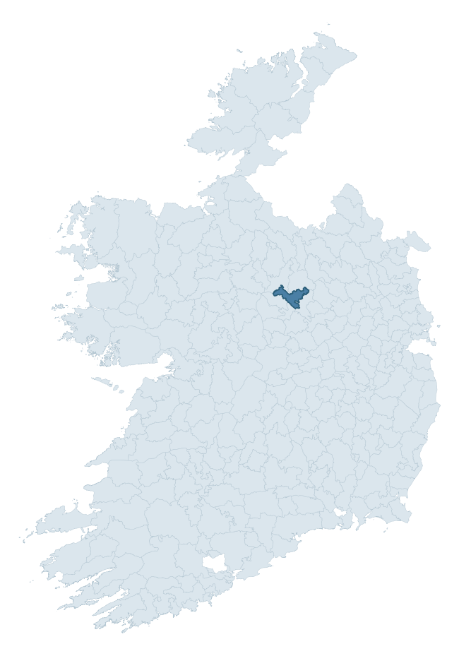
Where this barony sits in the Republic of Ireland
Geology and preservation
Bedrock geology shapes the landscape long before any settlement begins — controlling soil drainage, agricultural potential, the survival of upstanding monuments, and the preservation of buried archaeology. The figures below come from the Geological Survey Ireland 1:100,000 bedrock map.
The bedrock underlying Ardagh is predominantly limestone (83% of the barony by area), laid down during the Carboniferous period (98% by area, around 359 to 299 million years ago). Limestone is the most heritage-rich bedrock in Ireland. It supports fertile, well-drained soils that favoured dense Early Medieval settlement and Norman manorial agriculture, and it weathers into karst features — sinkholes, caves, swallow holes, and souterrains — that frequently carry archaeology. Where peat overlies limestone, organic preservation can be exceptional. The single largest mapped unit is the Lucan Formation (59% of the barony's bedrock).
Rock type composition
Largest mapped unit: Lucan Formation (59% of the barony)
Placename evidence
Logainm records 38 heritage-diagnostic placenames for Ardagh, drawn from townland and civil-parish names across the barony. The dominant stratum is pre-Christian and Early Medieval defensive — ráth-, lios-, dún-, and caiseal-prefixed names that mark Iron Age and early historic settlement. The leading diagnostic roots are lios- (15 — ringfort or enclosure), cill- (8 — church), and ráth- (7 — earthen ringfort). This is broadly in line with the ROI average of 30.7 heritage placenames per barony. The presence of multiple heritage strata side by side indicates layered occupation of the landscape across successive prehistoric and historic periods. Logainm records 179 placenames for Ardagh (predominantly townland names). Of these, 38 (21%) carry one of the diagnostic Gaelic roots tracked above; the remainder draw on more generic landscape vocabulary that does not encode a heritage period.
Pre-Christian / Early Medieval Defensive
| Root | Count | Meaning |
|---|---|---|
| lios- | 15 | ringfort or enclosure |
| ráth- | 7 | earthen ringfort |
| caiseal- | 1 | stone ringfort |
Early Christian Ecclesiastical
| Root | Count | Meaning |
|---|---|---|
| cill- | 8 | church (early) |
| teampall- | 2 | church (later medieval) |
| cillín- | 2 | unconsecrated burial ground |
| domhnach- | 1 | pre-Patrician or earliest Patrician church |
Burial, Ritual, and Norse-Contact
| Root | Count | Meaning |
|---|---|---|
| carn- | 1 | cairn |
| feart- | 1 | grave mound |
About this profile
Click any section below to expand.
What is a barony?
A barony is a historic administrative unit in Ireland, broadly equivalent to an English hundred. The 280 baronies used here are from the OSi 2019 National Statutory Boundaries (generalised 20m), covering the 26 counties of the Republic of Ireland. Baronies derive from the Norman period, were formalised in the 17th century, and have not been redrawn for statistical purposes. They vary enormously in area, from compact urban baronies in Dublin to vast upland baronies in Connacht, and should not be compared by raw site count without accounting for area differences.
What counts as a site?
This profile combines three distinct heritage registers, each with its own definition of what constitutes a recordable site:
- Archaeological sites (NMS). The National Monuments Service Sites and Monuments Record (SMR) catalogues every known archaeological monument or site of archaeological interest in the Republic, from prehistoric burial mounds and ringforts to medieval churches and post-medieval defensive works. Inclusion does not require legal protection — only that the site has been identified, surveyed, and assessed as having archaeological value. A separate subset of these sites lies within a recorded protection zone, which gives them statutory protection under the National Monuments Acts.
- Listed buildings (NIAH). The National Inventory of Architectural Heritage records buildings of architectural, historical, archaeological, artistic, cultural, scientific, social, or technical interest. Each surveyed structure is appraised on a five-tier scale: International, National, Regional, Local, and Record-Only. The NIAH appraisal is informational rather than strictly statutory, but it underpins local-authority Record of Protected Structures (RPS) listings.
- Heritage placenames (Logainm). Logainm is the authoritative database of Irish placenames maintained by the Placenames Branch. This profile applies a heritage-diagnostic classifier to the Irish-language form of each townland name, flagging roots that signal defensive sites (ráth-, lios-, dún-, caiseal-, cathair-), ecclesiastical foundations (cill-, teampall-, domhnach-, mainistir-), prehistoric burial-ritual features (tuaim-, carn-, leaba-), or Norse-contact settlement (gall-). Townlands without one of these diagnostic roots are not flagged here — they may still carry historical significance, but that significance is not encoded in the name itself.
Editorial principles
The narrative sections of this profile follow several explicit principles:
- Evidential. Every claim about this barony’s heritage character is anchored in the underlying register data. Where a site count, a placename count, or a percentile rank is cited, it is computed from the source datasets at export time, not estimated.
- Comparative. Counts and metrics are reported alongside their percentile rank against the other 279 ROI baronies. A barony with 50 ringforts in absolute terms could be unusually high or unusually low depending on its size and regional context; percentile ranking removes that ambiguity.
- Transparent on limits. Where a register has known coverage gaps, survey biases, or data-quality issues that affect this barony’s figures, the profile flags them rather than presenting the numbers as definitive.
- No interpretation beyond what the data supports. The narrative does not speculate about historical events, social dynamics, or cultural meaning beyond what the recorded heritage and placename evidence directly attests.
Data caveats and limits
- NMS Sites and Monuments Record is the product of survey campaigns conducted at different intensities across different counties and decades. Some baronies have been surveyed more thoroughly than others, and absolute counts should be read in that light. Sites destroyed by development before survey are typically not represented; sites in heavily forested or upland terrain are sometimes under-recorded.
- NIAH coverage is broadly complete for the Republic of Ireland but the survey was conducted on a rolling county-by-county basis, and the most recent appraisal date varies. Buildings demolished or substantially altered after their original survey may still appear in the register; conversely, recent buildings of merit may not yet have been appraised.
- Logainm classification applies a deliberately conservative pattern-matching approach to the Irish-language townland forms. The classifier prioritises true positives over recall: a townland may carry a heritage signal that the classifier doesn’t recognise, particularly where the diagnostic root has been heavily anglicised or where the townland name draws on a less common term. The 60,000+ townland records and ~9,800 classified placenames give a substantial signal at barony scale, but individual townland names should be checked against Logainm directly for definitive interpretation.
- Period attribution. The chronological distribution reflects only those NMS sites that carry a recognised period attribution in the source data. Sites listed as “Unknown” period are excluded from the dated subset.
- Boundary changes. Some baronies have undergone minor boundary adjustments since their 19th-century definition; the OSi 2019 generalised boundaries used here are the current statutory definition and may differ slightly from historical maps in border areas.
- Bedrock geology is mapped at 1:100,000 scale, which means local variation within a barony — small pockets of different rock type, mineral veins, alluvium overlying bedrock — is generalised. The dominant-system and rocktype figures are area-weighted, so a barony reading “70% Carboniferous limestone” may still contain small but archaeologically important pockets of older or younger rock. Around 3% of GSI polygons do not match the lexicon and contribute no rocktype or system attribution.
Data sources
- National Monuments Service — Sites and Monuments Record (SMR) https://data.gov.ie/dataset/national-monuments-service-archaeological-survey-of-ireland
- National Inventory of Architectural Heritage (NIAH) https://data.gov.ie/dataset/national-inventory-of-architectural-heritage-niah-national-dataset
- Logainm — Placenames Database of Ireland https://www.logainm.ie/
- Ordnance Survey Ireland — National Statutory Barony Boundaries 2019 https://data-osi.opendata.arcgis.com/
- EURODEM — European Digital Elevation Model https://www.mapsforeurope.org/datasets/euro-dem
- ESA WorldCover https://esa-worldcover.org/en
- Geological Survey Ireland — 1:100,000 Bedrock Geology https://www.gsi.ie/en-ie/data-and-maps/Pages/Bedrock.aspx
Explore more: Search any of the 280 ROI baronies, browse by historical province, or read the methodology and data sources for the full Republic of Ireland Heritage Tool.