Shrule is a barony of County Longford, in the historical province of Leinster (Irish: Sruthail), covering 85 km² of land. The barony records 181 NMS archaeological sites and 95 NIAH listed buildings, placing it at around the 60th percentile among 280 ROI baronies for sites per km². This means it is in the upper half of all baronies for sites per km². Dated archaeological evidence runs from the Early Bronze Age through to the Modern, spanning 6 of 9 archaeological periods, placing the barony in the 11th percentile among 280 ROI baronies for chronological depth. This means it is in the bottom fifth of all baronies for chronological depth. The largest dated subset of recorded sites dates to the Early Medieval. Logainm flags 23 placenames in the barony as carrying a recognised heritage root; the largest share — around 52% — are names associated with pre-christian defensive.
Heritage at a glance
Percentile rankings throughout this profile compare each barony only against the other 279 Republic of Ireland baronies.
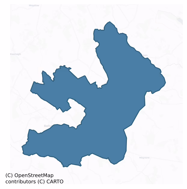
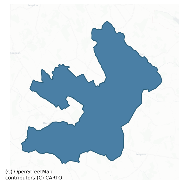
The recorded heritage of Shrule
The National Monuments Service Sites and Monuments Record (SMR) is the statutory inventory of archaeological sites for the Republic of Ireland, maintained by the Department of Tourism, Culture, Arts, Gaeltacht, Sport and Media. Sites recorded here include earthworks, ringforts, megalithic tombs, ecclesiastical remains, and post-medieval features; not every record is legally protected, but each is registered as a monument of archaeological interest.
The National Monuments Service records 181 archaeological sites in Shrule, putting it at the 60th percentile among 280 ROI baronies for sites per km². This means it is in the upper half of all baronies for sites per km². Protection coverage is near-universal — 168 sites (93%) fall within a recorded monument protection zone, indicating an extensively surveyed landscape. The dominant category is defensive sites — ringforts, enclosures, hillforts, and stone forts (102 sites, 56% of the record). Ringfort – rath is the most prevalent type, making up 39% of the barony's recorded sites (71 records) — well above the ROI average of 20% across all baronies where this type occurs. Ringfort – rath is an earthen ringfort enclosed by a bank and external ditch — the most common Early Medieval farmstead, broadly dated 500–1000 AD. Other significant types include Enclosure (14) and Graveslab (9). Enclosure is a banked or ditched feature of uncertain type, used as a catch-all where the original function cannot be determined from surface evidence; Graveslab is a recumbent grave-marking slab, dated 1200–1700 AD. Across the barony's 85 km², this gives a recorded density of 2.13 sites per km².
Most common monument types
Hover or tap a monument type to see its definition.
| Type | Count |
|---|---|
| Ringfort – rath an earthen ringfort enclosed by a bank and external ditch — the most common Early Medieval farmstead, broadly dated 500–1000 AD | 71 |
| Enclosure a banked or ditched feature of uncertain type, used as a catch-all where the original function cannot be determined from surface evidence | 14 |
| Graveslab a recumbent grave-marking slab, dated 1200–1700 AD | 9 |
| House – indeterminate date a habitation building whose date cannot be determined from available evidence | 7 |
| Fulacht fia a horseshoe-shaped Bronze Age burnt mound built around a sunken trough beside a water source, traditionally interpreted as a cooking site | 6 |
| Bridge a built structure spanning a river or ravine to allow crossing, dated medieval onwards | 6 |
| Earthwork an unclassified earthen structure with no diagnostic features that allow a more specific classification | 6 |
| Ritual site – holy well a well or spring traditionally associated with a saint, often credited with healing properties; many trace earlier ritual origins but devotion is documented from the medieval period onwards | 5 |
Chronological distribution
The dated archaeological record for Shrule spans from the Early Bronze Age through to the Modern, with activity attested across 6 of 9 archaeological periods. This is the 11th percentile across ROI baronies — a relatively narrow chronological band, with much of Irish prehistory not represented in the dated record. The record is near-continuous, with only the Post Medieval period falling inside the span without any recorded sites. Activity concentrates most heavily in the Early Medieval (76 sites, 51% of dated material), with the Iron Age forming a secondary peak (38 sites, 26%). A further 33 recorded sites (18% of the overall NMS register for the barony) carry no period attribution — appearing as 'Unknown' in the bar chart below. This typically reflects either records that pre-date the standardised period vocabulary or sites awaiting specialist dating review, rather than a genuine absence of chronological evidence.
Sample of recorded monuments
Show 25 sample monuments (of 181 total)
A representative sample of 25 recorded monuments drawn from the barony’s 181 total NMS entries. Sites within a recorded monument protection zone and rarer site types are prioritised so the list shows a meaningful cross-section rather than only the most common type. Each entry shows the official Sites and Monuments Record reference number and the description published by the National Monuments Service.
Castle – motte
On the E edge of a N-S ridge in pastureland with good views in all directions. A circular steep-sided mound of earth and stone (H 1.3 2.6m; diam. at base c. 20m). On the summit (diam. 9m) a square-shaped depression (N-S…
On the E edge of a N-S ridge in pastureland with good views in all directions. A circular steep-sided mound of earth and stone (H 1.3 2.6m; diam. at base c. 20m). On the summit (diam. 9m) a square-shaped depression (N-S 4m; E-W 4m; D 0.2-0.3m), enclosed by wall-footings, is evident. It may be the remains of a building that is depicted on the 1837 ed. of the OS 6 inch map or the remains a stone castle, or possibly a gazebo or summer house associated with the Richmount Hill house, c. 60m to the SW. Traces of possible stone steps are visible on the W face of the motte and there is evidence of stone facing or revetting on the E and W faces. These features may be associated with subsequent landscaping. A report in 1976 (SMR file) noted an irregular platform to the S that might be the remains of a bailey. The platform, which is defined by a low barely visible earthen bank, may be also be associated with landscaping.
Compiled by: Patrick F. O'Donovan
Date of upload: 28 March 2012
Barrow – ring-barrow
On low-lying ground, in the flood-plain of a stream. Depicted as a circular enclosure with the designation 'Fort' on the 1837 ed. of the OS 6-inch map. A circular mound of earth and stone (diam. at base c. 18m; H…
On low-lying ground, in the flood-plain of a stream. Depicted as a circular enclosure with the designation 'Fort' on the 1837 ed. of the OS 6-inch map. A circular mound of earth and stone (diam. at base c. 18m; H 0.85-1m). The top is flat (diam. 12.8m) and is enclosed by fragmentary remains of a low bank of earth and stone (H 0.1-0.3m). At the base of the mound is a shallow fosse (Wth 3.1-3.5m; D 0.4m). At the outer lip of the fosse is a second bank (Wth 2-2.8m; H 0.2-0.45m) with traces of an external fosse (Wth 1.7m; D 0.15m) which is identifiable from SE-S-W. The original entrance is not recognisable.
Compiled by: Patrick F. O'Donovan
Date of upload: 26 August 2011
Chapel
In rough pasture, at the foot of a rocky outcrop. Depicted as a rectangular building, orientated E-W, with the designation 'Chapel' on the 1837 ed. of the OS 6-inch map. No visible surface trace survives. The outline of…
In rough pasture, at the foot of a rocky outcrop. Depicted as a rectangular building, orientated E-W, with the designation 'Chapel' on the 1837 ed. of the OS 6-inch map. No visible surface trace survives. The outline of the chapel site has been demarcated by rows of beech trees set so as to form a bower that conforms to the shape of a building. An altar and wooden benchs have been placed in the interior. A holy well (LF023-040—-) and a bullaun stone (LF023-041—-) lie c. 10m to the SE and c. 45m to the SW respectively. An inscribed stone plaque built into the enclosing wall of the well reads: 'Pray for John Ferrall of / Ardenragh Esq. Consort / and family who erected this monument and left / the ground where of ye Chapple and Well / stands in Honr. of the / Blessed Virgin Mary / Ano Domi 1730'. The date of the chapel is unknown but the stone plaque suggests that it may have been built in the 18th century.
Compiled by: Caimin O'Brien, Paul Walsh
Date of upload: 07 June 2013
Bullaun stone
In an area of outcropping rock. The bullaun has been carved into an exposed section of bedrock that forms part of a NW-SE roadside fence. The bullaun (diam. 0.3m; D 0.14m) undoubtedly is an enhancement of a pre-existing…
In an area of outcropping rock. The bullaun has been carved into an exposed section of bedrock that forms part of a NW-SE roadside fence. The bullaun (diam. 0.3m; D 0.14m) undoubtedly is an enhancement of a pre-existing depression in the limestone caused by natural weathering. There is a holy well (LF023-040—-) c. 44m to the NE. (English 1971, 147)
Compiled by: Paul Walsh
Date of upload: 07 June 2013
Ringfort – unclassified
On the S-facing slope of a ridge in reclaimed grassland with good views in all directions. A cashel (LF023-071—-) lies c. 300m to the SSE. A saucer-shaped area (diam. c. 22m) is enclosed by a wide, low denuded bank of…
On the S-facing slope of a ridge in reclaimed grassland with good views in all directions. A cashel (LF023-071—-) lies c. 300m to the SSE. A saucer-shaped area (diam. c. 22m) is enclosed by a wide, low denuded bank of earth and stone (Wth c. 6-8m; H c. 1m) that has been levelled at N due to the removal of an E–W field boundary into which it had been incorporated. The original entrance is not recognisable. Possibly the remains of a levelled rath or cashel. On the 1837 edition of the OS 6-inch map a post-medieval limekiln is depicted c. 15m to the NW. (CUCAP, AVJ 51)
Compiled by: Caimin O'Brien
Date of upload: 24 January 2012
Religious house – Cistercian monks
In pasture on a low rise, c. 75m to the E of the Inny River, and within the N half of a graveyard (LF023-113016-). Gwynn and Hadcock (1970, 125-6) note that the abbey ‘Flumen Dei’ was colonized in 1200 by the…
In pasture on a low rise, c. 75m to the E of the Inny River, and within the N half of a graveyard (LF023-113016-). Gwynn and Hadcock (1970, 125-6) note that the abbey ‘Flumen Dei’ was colonized in 1200 by the Cistercians from Mellifont (LH023-007002-), county Louth under the patronage of the O'Farrells of Annaly. The affiliation changed to Bective (ME031-026—-) in 1228. According to Lewis (1837, vol. 1, 4), it was dedicated to the Blessed Virgin and in 1475 it was burnt by the English. In 1568 the monastery was granted by Queen Elizabeth to Sir Robert Dillon (ibid., 5). In 1592 it was surrendered to the English Crown (Langan 1942, 32) and in 1611 Robert Nangle of Ballysax in county Kildare was regranted the 'rectory of Shrowell otherwise Urre' (Cal. pat. rolls Ire., Jas I, 214).
Surviving remains comprise the poorly preserved church. The cloister, which lay to its S, was flanked on its E side by a range of monastic buildings (L c. 20m), now collapsed. A late 16th-century tower house (LF023-113001-) was built at the SE end of the range.
The long rectangular church (ext. dims. 45.6m E-W; 9.5m N-S; wall T 1.05m) is built of roughly coursed limestone rubble. Three phases of construction are evident. Of the original building, dating to the late 12th/early 13th century, the chancel, remains of a possible crossing tower, the S wall of the nave and the foundations of the other walls are still identifiable. The lower springing stones of two arches in the S wall suggest the fo…
Wall monument (present location)
Incorporated into a wall at the entrance to the farmyard adjacent to Lisglassock House. This rectangular plaque (H 0.63m; Wth 0.51m; T 0.12m) bears a Latin inscription, in Roman letters carved in relief, which reads:…
Incorporated into a wall at the entrance to the farmyard adjacent to Lisglassock House. This rectangular plaque (H 0.63m; Wth 0.51m; T 0.12m) bears a Latin inscription, in Roman letters carved in relief, which reads: 'Faemina virque torus vivos quos / iunxerat unus uno hoc in tumulo / faemina virque jacent'. This has been translated as 'a wife and husband whom one bed had joined when alive lie in this one tomb a wife and husband' (English 1975, 158). On stylistic grounds it has been dated c. 1550-1600 (ibid.). Its original provenance is unknown.
Compiled by: Patrick F. O'Donovan
Date of upload: 5 June 2013
Ritual site – holy tree/bush
Associated with a holy well (LF023-048001-); this thorn bush is growing from the enclosing a wall of the well at NW. A report in 1977 (SMR file) recorded that rags had been tied it. As none were visible at the time of…
Associated with a holy well (LF023-048001-); this thorn bush is growing from the enclosing a wall of the well at NW. A report in 1977 (SMR file) recorded that rags had been tied it. As none were visible at the time of inspection, this practice appears to have been discontinued.
Compiled by: Patrick F. O'Donovan
Date of upload: 7 June 2013
Burial ground
Circa 30m to the NE of the Cistercian abbey (LF023-113—-). This rectangular burial ground(100m NE-SW; 62m NW-SE) is enclosed by a 19th-century stone wall. It is no longer is use and memorials date from the 17th to the…
Circa 30m to the NE of the Cistercian abbey (LF023-113—-). This rectangular burial ground(100m NE-SW; 62m NW-SE) is enclosed by a 19th-century stone wall. It is no longer is use and memorials date from the 17th to the 20th centuries. A possible cross-slab (LF023-113003-), four late-medieval graveslabs (LF023-113004-, LF023-113010-, LF023-113011-, LF023-113012-), an architectural fragment (LF023-113005-) and a 17th-century graveslab (LF023-113007-) are located within it. A high cross (LF023-113006-) formerly located here was moved to the sacristy of the RC church in Abbeyshrule (see LF023-129—-).
Compiled by: Patrick F. O'Donovan, Caimin O'Brien
Date of upload: 4 June 2013
Cross – High cross
Originally located in the burial ground (LF023-113002-) c. 30m to the NE of the Cistercian abbey (LF023-113—-), this high cross has been moved to the sacristy of the RC church in the village of Abbeyshrule for…
Originally located in the burial ground (LF023-113002-) c. 30m to the NE of the Cistercian abbey (LF023-113—-), this high cross has been moved to the sacristy of the RC church in the village of Abbeyshrule for safe-keeping (see LF023-129—-). Crawford (1924, 171) recorded that the shaft of the cross was broken off above the socket and was loose in the graveyard; the arms were missing. Described by Harbison (1992, vol. 1, 9) as an armless sandstone cross (H 0. 97m; max. Wth 0.27m; T 0.1m) with a thistle-shaped head. There is a possible ringed cross at the centre of the E face. The shaft of the W face is decorated with interlace, and on the head there is a central round boss enclosed by two roll mouldings. Decoration on the sides includes vertical ribs in false relief and a meander pattern. Similar crosses are found at Laughanstown (DU026-023003-), county Dublin, Layd, county Antrim and Kildalton on the island of Islay in Scotland (Crawford 1908, 190; 1924, 171).
Compiled by: Caimin O'Brien
Date of upload: 5 August 2013
Souterrain
Within the interior of a rath (LF023-080001-). A linear hollow (L c. 16m; Wth 2.2-2.4m; D 0.4-0.5m), aligned E-W, extends from the perimeter of the rath at W towards the centre of the interior. It may mark the remains…
Within the interior of a rath (LF023-080001-). A linear hollow (L c. 16m; Wth 2.2-2.4m; D 0.4-0.5m), aligned E-W, extends from the perimeter of the rath at W towards the centre of the interior. It may mark the remains of a souterrain.
Compiled by: Patrick F. O'Donovan
Date of upload: 5 September 2012
Ford
Described in the Civil Survey (1654-6) as 'a foord called Ballagurtcullan', located at a 'brooke mearing between Ardagh and Doumming [Druming] in the barony of Moydow' (Simington 1961, vol. 10, 47). A 'Ford & F.S.'…
Described in the Civil Survey (1654-6) as 'a foord called Ballagurtcullan', located at a 'brooke mearing between Ardagh and Doumming [Druming] in the barony of Moydow' (Simington 1961, vol. 10, 47). A 'Ford & F.S.' (foot-stone) marked on the 1913 edition of the OS 6-inch map at the junction of both parishes may be the ford referred to. However, no visible remains of it or the foot-stone survive.
Compiled by: Caimin O'Brien
Date of upload: 5 September 2012
Burial
Human remains, of unknown date, were discovered in the course of excavation works on a farm. The bones were found among pieces of stones, bottles and sherds of modern ceramics at a depth of 0.60m below ground level…
Human remains, of unknown date, were discovered in the course of excavation works on a farm. The bones were found among pieces of stones, bottles and sherds of modern ceramics at a depth of 0.60m below ground level (Cahill and Sikora 2011, ii, 494).
Compiled by: Paul Walsh
Date of upload: 26 August 2011
Cross – High cross (present location)
Now in the sacristy of the R.C. church in the village of Abbeyshrule, this high cross was originally located in the burial ground (LF023-113002-) c. 70m to the NE of the Cistercian abbey (LF023-113—-). Crawford…
Now in the sacristy of the R.C. church in the village of Abbeyshrule, this high cross was originally located in the burial ground (LF023-113002-) c. 70m to the NE of the Cistercian abbey (LF023-113—-). Crawford (1924, 171) recorded that the shaft of the cross was broken off above the socket and was loose in the graveyard; the arms were missing.
Described by Harbison (1992, vol. 1, 9) as an armless sandstone cross (H 0. 97m; max. Wth 0.27m; T 0.1m) with a thistle-shaped head. There is a possible ringed cross at the centre of the E face. The shaft of the W face is decorated with interlace, and on the head there is a central round boss enclosed by two roll mouldings. Decoration on the sides includes vertical ribs in false relief and a meander pattern. Similar crosses are found at Laughanstown (DU026-023003-), county Dublin, Layd, county Antrim and Kildalton on the island of Islay in Scotland (Crawford 1907, 190; 1924, 171).
Compiled by: Caimin O'Brien
Date of upload: 6 June 2013
Cross
Within the burial ground (LF023-113002-) c. 30m to the NE of the Cistercian abbey (LF023-113—-). This rectangular limestone cross-base (L 0.43m; Wth 0.23m; H 0.2m) has a square-shaped central socket (0.09m N-S; 0.09m…
Within the burial ground (LF023-113002-) c. 30m to the NE of the Cistercian abbey (LF023-113—-). This rectangular limestone cross-base (L 0.43m; Wth 0.23m; H 0.2m) has a square-shaped central socket (0.09m N-S; 0.09m E-W; D 0.09m) into which coins have been placed as offerings.
Compiled by: Caimin O'Brien
Date of upload: 6 June 2013
Deer park
This townland (dims. 1.3km E-W; 720m N-S) may mark the location of a deer park associated with a 17th-century house (LF023-123001-), c. 3.2km to its S (www.buildingsofireland.ie, Reg. 13402348, last accessed 16 October…
This townland (dims. 1.3km E-W; 720m N-S) may mark the location of a deer park associated with a 17th-century house (LF023-123001-), c. 3.2km to its S (www.buildingsofireland.ie, Reg. 13402348, last accessed 16 October 2012). The deer park is defined by a drystone wall (H 0.5-0.2m; wall T 0.6m) and is best preserved on the E and S sides of the townland.
Compiled by: Caimin O'Brien
Date of upload: 26 February 2013
Enclosure – large enclosure
Outline of possible large oval-shaped enclosure (approx. overall diam. 100m) bisected by a public road (R393) which forms the townland boundary between Liscormick and Deerpark.
Compiled by: Caimin O'Brien based on…
Outline of possible large oval-shaped enclosure (approx. overall diam. 100m) bisected by a public road (R393) which forms the townland boundary between Liscormick and Deerpark.
Compiled by: Caimin O'Brien based on details provided by Edmond O'Donovan
Date of upload: 30 October 2019
Ringfort – cashel
On a low rise in unimproved grassland peppered with outcropping rock and within a walled deerpark (LF023-135—-). This monument is very unusual in that it combines natural rock outcrop with drystone walling to form a…
On a low rise in unimproved grassland peppered with outcropping rock and within a walled deerpark (LF023-135—-). This monument is very unusual in that it combines natural rock outcrop with drystone walling to form a possible cashel-like enclosure. There is no evidence of any levelling of the rock outcrop which protrudes everywhere within the interior. The uneven rocky nature of the latter may suggest that the cashel was constructed as a livestock enclosure – associated with two houses (LF023-071001-; LF023-071002-) that lie c. 25m to the NW and c. 15m to the SW respectively, and the surrounding field system (LF023-071003-).
The enclosure consists of a subcircular area (47.8m N–S; 42.2m E–W) defined by a collapsed drystone wall (wall T c. 4m), which appears to follow the line of rock outcrop. A break (Wth 3m) at NW may indicate an entrance feature, but a second break (Wth 4m) at SSE appears to be more convincing as the original entrance. There is evidence of internal walling or outcrop forming small subdivisions or paddocks within the interior. There is a field-clearance cairn (diam. c. 6m; H 0.4m) in the S sector. A series of low drystone field walls radiate from the external face of the enclosing wall from NW-N-E and run into a curving field bank, associated with the field system, forming a series of small enclosures or paddocks, some of which contain ridge and furrow. The houses, field system and cashel all appear to be of contemporary date. (CUCAP, AVJ 51)
Comp…
Moated site
On wet, low-lying ground in pasture. A raised almost square area (c. 24m NW-SE; c. 23m NE-SW), with rounded corners, enclosed by a partially denuded, wide, low bank of earth and stone (Wth 6m; H 0.35m) with a wide,…
On wet, low-lying ground in pasture. A raised almost square area (c. 24m NW-SE; c. 23m NE-SW), with rounded corners, enclosed by a partially denuded, wide, low bank of earth and stone (Wth 6m; H 0.35m) with a wide, shallow, external fosse (Wth 5.5m; D 0.3m). The bank is truncated along the SE side by a NE-SW hedgerow. The fosse has been largely infilled along the SW, NW and NE sides. The original entrance is not recognisable. Ardanragh castle (LF024-005—-) is located c. 700m to the ESE.
Compiled by: Patrick F. O'Donovan
Date of upload: 3 May 2012
Castle – unclassified
On the highest point of the ridge affording panoramic views over the surrounding countryside; within the NE quadrant of a possible moated site (LF023-076001-). In 1401 the annals record that the ‘castle of Barrcha was…
On the highest point of the ridge affording panoramic views over the surrounding countryside; within the NE quadrant of a possible moated site (LF023-076001-). In 1401 the annals record that the ‘castle of Barrcha was being built by Cathal son of Tomás Ó Fearghail, and the castle of Baile Í Mhathan [see LF027-003004-] was begun by Muiris son of Conchobhar ’[Ó Fearghail] (Ó hInnse 1947, 164). The latter family demolished Cathal’s castle two years later in 1403 but he rebuilt it in 1405 (ibid., 171, 175). In 1424 the castle was involved in a feud between two branches of the descendants of Murchad O Fergail when a ‘Great war among the posterity of Murchad O Fergail’ broke out (Ann. Conn., 469). In the same year it was recorded that ‘Barry Castle was demolished by the Justiciar’ (ibid.). In 1518 the ninth earl of Kildare received rent from ‘Kedagh mc Lyshe mic Kyady mic Thomas’ Ó Fearghail, the owner of Barry castle, the sum of £20 13s. 4d. (Mac Niocaill 1992, 274; Farrell 2010, 123). In 1621 Gerald McRory Farrall received a land grant including the ‘castle and lands of Barry and Bunuvalla alias Cartrondrome and a watermill [LF023-126—-] … and a fishing wear [LF023-136—-] on the river Enny’ (Cal. pat. rolls 19 Jas. 1, 533). On the Down Survey (1655–6) map of Abbeyshrule parish (NLI, MS 719) it is depicted as the ‘Old Castle’ and the mill is located to its S.
All that survives of the castle is a grassed-over mound (c. 19m N–S; c. 15m E–W; H 2m) of collapsed rubble, which o…
Ringfort – cashel
On a gentle SW-facing slope in pasture. A raised circular area (diam. c. 43m) enclosed from NE-E-SSE by a collapsed stone wall (Wth 2.5m; H 0.2m) and defined from SSE-S-SW by a scarp (H 1m). Elsewhere a low rise…
On a gentle SW-facing slope in pasture. A raised circular area (diam. c. 43m) enclosed from NE-E-SSE by a collapsed stone wall (Wth 2.5m; H 0.2m) and defined from SSE-S-SW by a scarp (H 1m). Elsewhere a low rise indicates its outline. There is no trace of a fosse and the original entrance is not recognisable. A report in 1976 (SMR file) recorded a shallow L-shaped depression, of unknown significance, to the NE of the centre of the interior.
Compiled by: Patrick F. O'Donovan
Date of upload: 26 November 2011
Castle – unclassified
On low-lying ground on the S bank of the Inny River. Depicted as a roughly sub-rectangular/trapezoidal earthwork with the designation 'Fort' on the 1837 edition of the OS 6-inch map. An eel weir is shown opposite it. …
On low-lying ground on the S bank of the Inny River. Depicted as a roughly sub-rectangular/trapezoidal earthwork with the designation 'Fort' on the 1837 edition of the OS 6-inch map. An eel weir is shown opposite it. Known locally as the site of a castle, it may have been one of the strongholds of the Clann Murchadha branch of the O'Ferral family who ruled over southern Longford (Verstaten Veach 2010, 58), but see also the unclassified castle (LF027-051—-) in the adjoining townland of Pallas More. It is possible that this was an earlier castle that was abandoned when the latter castle was built.
A raised subrectangular earthwork (c. 30m NE-SW; c. 25m NW-SE) defined by a steep scarp (H 2–3m) with a wide, deep external fosse (base Wth 2m; top Wth 6.4m; D 1.1m). Traces of a possible ramp (Wth 3m) across the fosse at SE may mark the original entrance. A possible outer bank may be preserved in the field boundary running along the W side of the monument. The N sector of the monument has been destroyed due to OPW river-drainage works and is occupied by a massive spoil heap. Some quarrying has occurred at NW. A report in 1976 (SMR File) recorded an irregular stony area in the interior at W. The N and W walls of a building (ext. dims. 13m E-W; c. 7m N-S), possibly a levelled castle, are evident here. The N wall (L c. 13m E-W; Wall T 1.8m; H 0.6m) is better preserved and sections of the external face of its mortared rubble wall survive. The W wall (L 7m) runs along the W edg…
Castle – tower house
On a low rise in otherwise level pasture, immediately to the SW of a 19th-century farmhouse. A land grant to John Farrell in 1620, under the commission for the Plantation of Longford, included ‘The lordship, castle,…
On a low rise in otherwise level pasture, immediately to the SW of a 19th-century farmhouse. A land grant to John Farrell in 1620, under the commission for the Plantation of Longford, included ‘The lordship, castle, town and lands of Ardenragh’ (Cal. pat. rolls Ire., Jas I, 466). The castle is depicted on an early 17th-century map of Shrule barony (BL, Cotton MS Augustus I.ii.26) and is shown as a large castellated structure, within a cluster of smaller buildings, on the Down Survey (1655-6) map of the barony (NLI, MS 719). The 1641 depositions record that ‘Bryan fferrall of Ardanragh’ was standing ‘on the battlements of the Castle of Ardanragh about ffebruary last was a yeare watching the Cattle belonging to himselfe and his Nephew for feare of the Toryes’ (TCD, MS 817, fol. 242r). A report in 1977 (SMR file) noted that no was no visible surface trace of the castle. Part of it may have been incorporated into the farmhouse but there was no indication of this to be seen on ground or in the appearance of the house.
In February 2021, photographs posted on Facebook by the owner of the house at Ardanragh, Co. Longford, included an old postcard of the castle dated 1881 and photographs of punch-dressed cut stone lying around the place. The post on facebook stated that 'Some of the decorative stones from the historic Ardandragh Castle, demolished in 1906 when some of the stepping stones around the rooftop became loose. This house built in 1814 as an addition to the castle (front…
Ecclesiastical site
In level pasture c. 10m to the W of a stream, church (LF023-097—-) and graveyard (LF023-097001-) on the N side of Taghshinny (Teach Sinche / House of Sineach) village was probably built on the site of an early…
In level pasture c. 10m to the W of a stream, church (LF023-097—-) and graveyard (LF023-097001-) on the N side of Taghshinny (Teach Sinche / House of Sineach) village was probably built on the site of an early Christian monastery founded by St. Sineach. There are references in the annals to a church here in the 1220s, possibly associated with the monastery on Inchcleraun in Lough Ree (LF021-48—-) (ALC, vol. 1; Corlett 1998, 115-18). There is a Saint Sineach of Inis-Clothrann whose feastday was April 20th and who may be the founder of the monastery at Taghshinny. According to Ó Riain (2011, 563) the name Sineach is probably; 'derived from sean, old, this name, also written as Sinche, was popular enough to be included in the list of homonymous saints, which contains twelve (otherwise mainly unattested) representatives of the cult'. Ó Riain (2011, 267) has suggested that this monastery was associated with 'Díona daughter of the king of the Saxons. This person is known only from the tract on the mothers of the saints which attributes to her the motherhood of the sons of Brachan, king of the Britons, and eponym of Brycheiniog in south Wales. She may also have been adopted by the Síol Maine of Longford/Westmeath who numbered among their four cailleacha, 'nuns', a certain Díne daughter of Bracán, the other three being Forbhaise daughter of Aodh. Lasair daughter of Rónán, and Sineach of the Longford church of Taghshinny'.
The 18th-century C. of I. church in the centre of…
Ringfort – rath
On a terrace on a NE-facing slope in pasture. A slightly raised oval area (42.5m E-W; 39m N-S) defined by a scarp (H 1.3-1.6m) with traces of an external fosse (Wth 1.3m; D 0.2m). A report in 1976 (SMR file) recorded an…
On a terrace on a NE-facing slope in pasture. A slightly raised oval area (42.5m E-W; 39m N-S) defined by a scarp (H 1.3-1.6m) with traces of an external fosse (Wth 1.3m; D 0.2m). A report in 1976 (SMR file) recorded an outer bank of earth and stone and suggested that the original entrance may have been at NE. This bank is no longer identifiable. A modern-looking entrance is evident at SW. Another ringfort (LF027-024—-) lies c. 100m to the E. (CUCAP, AOY062)
Compiled by: Patrick F. O'Donovan
Date of upload: 11 January 2012
Listed buildings
The National Inventory of Architectural Heritage (NIAH) is a state survey appraising buildings of architectural, historical, archaeological, artistic, cultural, scientific, social, or technical interest. Each surveyed structure receives a rating from International (the highest, for buildings of European importance) through National, Regional, Local, and Record-Only.
The NIAH records 95 listed buildings in Shrule (47th percentile across ROI baronies). The highest-graded structures include 3 of National significance. The Republic holds 937 National-graded buildings in total, so this barony accounts for around 0% of the national total. Construction dates concentrate most heavily in the Late Georgian (1800-1830) period. The most-recorded building type is house (24 examples, 25% of the listed stock).
Terrain and environment
Mean elevation across the barony is 67m — the 29th percentile among 280 ROI baronies for elevation. This means it is in the bottom third of all baronies for elevation. This is a relatively low-lying landscape by ROI standards. Elevation matters for heritage because higher-altitude baronies typically favour defensive monuments — ringforts and hilltop forts placed on prominent ground — while lowland baronies are more likely to carry the dense settlement and church networks of intensive agricultural landscapes. Mean slope is 2.4° — the 21st percentile among 280 ROI baronies for slope. This means it is in the bottom third of all baronies for slope. This is broadly flat terrain, the kind of landscape best suited to intensive agriculture. Slope is a key control on both land use and archaeological preservation: steep ground resists ploughing and tends to preserve earthworks intact, while gentle slopes favour intensive cultivation that damages or destroys surface archaeology over time. The Topographic Wetness Index averages 11.5, the 74th percentile among 280 ROI baronies for wetness. This means it is in the top third of all baronies for wetness. Drainage matters for heritage because poorly-drained ground preserves organic archaeology (wooden trackways, leather, textiles, and on rare occasions human remains) far better than free-draining soil; well-drained ground favours arable use but destroys organic material rapidly. The land cover is dominated by improved grassland (80%) and woodland (18%). In overall character, this is low-lying, gently-sloping terrain — characteristic of Ireland's central plain and coastal lowlands, with land use dominated by improved grassland.
Terrain measurements
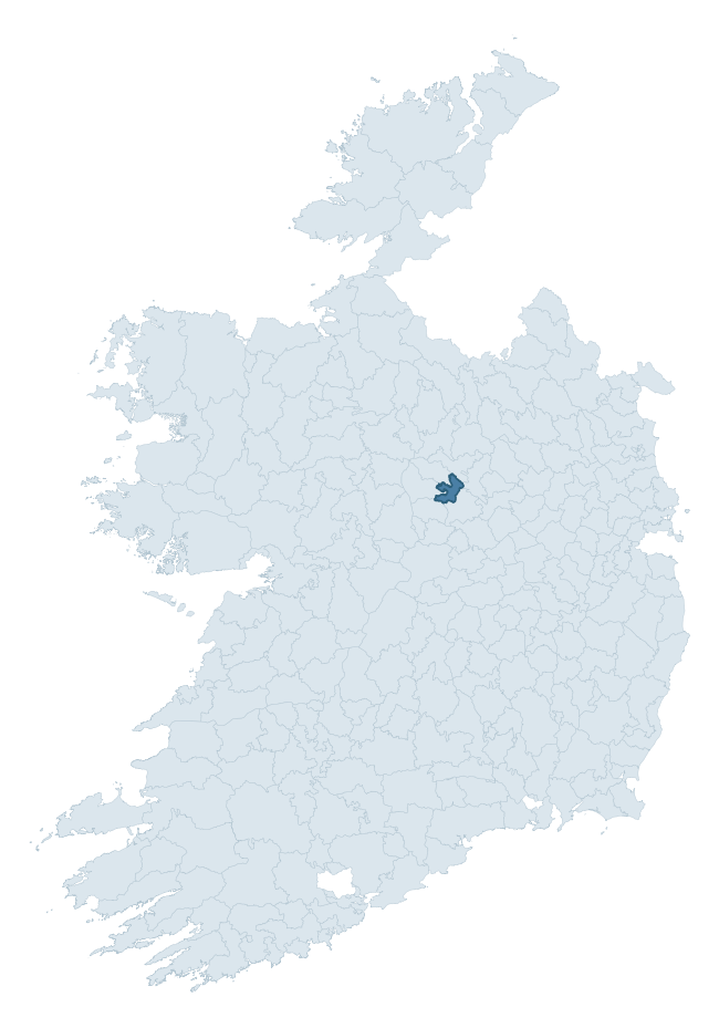
Where this barony sits in the Republic of Ireland
Geology and preservation
Bedrock geology shapes the landscape long before any settlement begins — controlling soil drainage, agricultural potential, the survival of upstanding monuments, and the preservation of buried archaeology. The figures below come from the Geological Survey Ireland 1:100,000 bedrock map.
The bedrock underlying Shrule is predominantly limestone (95% of the barony by area), laid down during the Carboniferous period (100% by area, around 359 to 299 million years ago). Limestone is the most heritage-rich bedrock in Ireland. It supports fertile, well-drained soils that favoured dense Early Medieval settlement and Norman manorial agriculture, and it weathers into karst features — sinkholes, caves, swallow holes, and souterrains — that frequently carry archaeology. Where peat overlies limestone, organic preservation can be exceptional. The single largest mapped unit is the Waulsortian Limestones (44% of the barony's bedrock). With only 2 distinct rock types mapped, the barony is geologically uniform compared to the rest of the Republic (6th percentile for diversity) — a single coherent bedrock landscape.
Rock type composition
Largest mapped unit: Waulsortian Limestones (44% of the barony)
Placename evidence
Logainm records 23 heritage-diagnostic placenames for Shrule, drawn from townland and civil-parish names across the barony. The dominant stratum is pre-Christian and Early Medieval defensive — ráth-, lios-, dún-, and caiseal-prefixed names that mark Iron Age and early historic settlement. The leading diagnostic roots are lios- (7 — ringfort or enclosure), ráth- (5 — earthen ringfort), and cill- (5 — church). This is below the ROI average of 30.7 heritage placenames per barony, suggesting either lighter survey coverage or a townland-naming tradition that draws more on generic landscape vocabulary. The presence of multiple heritage strata side by side indicates layered occupation of the landscape across successive prehistoric and historic periods. Logainm records 72 placenames for Shrule (predominantly townland names). Of these, 23 (32%) carry one of the diagnostic Gaelic roots tracked above; the remainder draw on more generic landscape vocabulary that does not encode a heritage period.
Pre-Christian / Early Medieval Defensive
| Root | Count | Meaning |
|---|---|---|
| lios- | 7 | ringfort or enclosure |
| ráth- | 5 | earthen ringfort |
Early Christian Ecclesiastical
| Root | Count | Meaning |
|---|---|---|
| cill- | 5 | church (early) |
| mainistir- | 2 | monastery |
| tobar- | 1 | holy well |
| cillín- | 1 | unconsecrated burial ground |
Burial, Ritual, and Norse-Contact
| Root | Count | Meaning |
|---|---|---|
| tuaim- | 1 | burial mound |
| carn- | 1 | cairn |

Explore further
Grounding History: 10 Maps of Northern Ireland’s Past
If you’re interested in Irish heritage more widely, the companion report for Northern Ireland brings together the analysis of all 462 NI wards into one place through 10 high-quality maps — covering monument density, archaeological periods, placename heritage, terrain, wetland, and the historic landscape at first survey. Take a look.
About this profile
Click any section below to expand.
What is a barony?
A barony is a historic administrative unit in Ireland, broadly equivalent to an English hundred. The 280 baronies used here are from the OSi 2019 National Statutory Boundaries (generalised 20m), covering the 26 counties of the Republic of Ireland. Baronies derive from the Norman period, were formalised in the 17th century, and have not been redrawn for statistical purposes. They vary enormously in area, from compact urban baronies in Dublin to vast upland baronies in Connacht, and should not be compared by raw site count without accounting for area differences.
What counts as a site?
This profile combines three distinct heritage registers, each with its own definition of what constitutes a recordable site:
- Archaeological sites (NMS). The National Monuments Service Sites and Monuments Record (SMR) catalogues every known archaeological monument or site of archaeological interest in the Republic, from prehistoric burial mounds and ringforts to medieval churches and post-medieval defensive works. Inclusion does not require legal protection — only that the site has been identified, surveyed, and assessed as having archaeological value. A separate subset of these sites lies within a recorded protection zone, which gives them statutory protection under the National Monuments Acts.
- Listed buildings (NIAH). The National Inventory of Architectural Heritage records buildings of architectural, historical, archaeological, artistic, cultural, scientific, social, or technical interest. Each surveyed structure is appraised on a five-tier scale: International, National, Regional, Local, and Record-Only. The NIAH appraisal is informational rather than strictly statutory, but it underpins local-authority Record of Protected Structures (RPS) listings.
- Heritage placenames (Logainm). Logainm is the authoritative database of Irish placenames maintained by the Placenames Branch. This profile applies a heritage-diagnostic classifier to the Irish-language form of each townland name, flagging roots that signal defensive sites (ráth-, lios-, dún-, caiseal-, cathair-), ecclesiastical foundations (cill-, teampall-, domhnach-, mainistir-), prehistoric burial-ritual features (tuaim-, carn-, leaba-), or Norse-contact settlement (gall-). Townlands without one of these diagnostic roots are not flagged here — they may still carry historical significance, but that significance is not encoded in the name itself.
Editorial principles
The narrative sections of this profile follow several explicit principles:
- Evidential. Every claim about this barony’s heritage character is anchored in the underlying register data. Where a site count, a placename count, or a percentile rank is cited, it is computed from the source datasets at export time, not estimated.
- Comparative. Counts and metrics are reported alongside their percentile rank against the other 279 ROI baronies. A barony with 50 ringforts in absolute terms could be unusually high or unusually low depending on its size and regional context; percentile ranking removes that ambiguity.
- Transparent on limits. Where a register has known coverage gaps, survey biases, or data-quality issues that affect this barony’s figures, the profile flags them rather than presenting the numbers as definitive.
- No interpretation beyond what the data supports. The narrative does not speculate about historical events, social dynamics, or cultural meaning beyond what the recorded heritage and placename evidence directly attests.
Data caveats and limits
- NMS Sites and Monuments Record is the product of survey campaigns conducted at different intensities across different counties and decades. Some baronies have been surveyed more thoroughly than others, and absolute counts should be read in that light. Sites destroyed by development before survey are typically not represented; sites in heavily forested or upland terrain are sometimes under-recorded.
- NIAH coverage is broadly complete for the Republic of Ireland but the survey was conducted on a rolling county-by-county basis, and the most recent appraisal date varies. Buildings demolished or substantially altered after their original survey may still appear in the register; conversely, recent buildings of merit may not yet have been appraised.
- Logainm classification applies a deliberately conservative pattern-matching approach to the Irish-language townland forms. The classifier prioritises true positives over recall: a townland may carry a heritage signal that the classifier doesn’t recognise, particularly where the diagnostic root has been heavily anglicised or where the townland name draws on a less common term. The 60,000+ townland records and ~9,800 classified placenames give a substantial signal at barony scale, but individual townland names should be checked against Logainm directly for definitive interpretation.
- Period attribution. The chronological distribution reflects only those NMS sites that carry a recognised period attribution in the source data. Sites listed as “Unknown” period are excluded from the dated subset.
- Boundary changes. Some baronies have undergone minor boundary adjustments since their 19th-century definition; the OSi 2019 generalised boundaries used here are the current statutory definition and may differ slightly from historical maps in border areas.
- Bedrock geology is mapped at 1:100,000 scale, which means local variation within a barony — small pockets of different rock type, mineral veins, alluvium overlying bedrock — is generalised. The dominant-system and rocktype figures are area-weighted, so a barony reading “70% Carboniferous limestone” may still contain small but archaeologically important pockets of older or younger rock. Around 3% of GSI polygons do not match the lexicon and contribute no rocktype or system attribution.
Data sources
- National Monuments Service — Sites and Monuments Record (SMR) https://data.gov.ie/dataset/national-monuments-service-archaeological-survey-of-ireland
- National Inventory of Architectural Heritage (NIAH) https://data.gov.ie/dataset/national-inventory-of-architectural-heritage-niah-national-dataset
- Logainm — Placenames Database of Ireland https://www.logainm.ie/
- Ordnance Survey Ireland — National Statutory Barony Boundaries 2019 https://data-osi.opendata.arcgis.com/
- EURODEM — European Digital Elevation Model https://www.mapsforeurope.org/datasets/euro-dem
- ESA WorldCover https://esa-worldcover.org/en
- Geological Survey Ireland — 1:100,000 Bedrock Geology https://www.gsi.ie/en-ie/data-and-maps/Pages/Bedrock.aspx
Explore more: Search any of the 280 ROI baronies, browse by historical province, or read the methodology and data sources for the full Republic of Ireland Heritage Tool.