
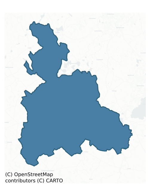
Granard is a barony of County Longford, in the historical province of Leinster (Irish: Gránard), covering 270 km² of land. The barony records 445 NMS archaeological sites and 136 NIAH listed buildings, placing it at around the 40th percentile among 280 ROI baronies for sites per km². This means it is in the lower half of all baronies for sites per km². Dated archaeological evidence runs from the Mesolithic through to the Modern, spanning 9 of 9 archaeological periods, placing the barony in the 95th percentile among 280 ROI baronies for chronological depth. This means it is in the top tenth of all baronies for chronological depth. The largest dated subset of recorded sites dates to the Early Medieval. Logainm flags 39 placenames in the barony as carrying a recognised heritage root; the largest share — around 46% — are names associated with pre-christian defensive.
Heritage at a glance
Percentile rankings throughout this profile compare each barony only against the other 279 Republic of Ireland baronies.
The recorded heritage of Granard
The National Monuments Service Sites and Monuments Record (SMR) is the statutory inventory of archaeological sites for the Republic of Ireland, maintained by the Department of Tourism, Culture, Arts, Gaeltacht, Sport and Media. Sites recorded here include earthworks, ringforts, megalithic tombs, ecclesiastical remains, and post-medieval features; not every record is legally protected, but each is registered as a monument of archaeological interest.
The National Monuments Service records 445 archaeological sites in Granard, putting it at the 40th percentile among 280 ROI baronies for sites per km². This means it is in the lower half of all baronies for sites per km². Protection coverage is near-universal — 441 sites (99%) fall within a recorded monument protection zone, indicating an extensively surveyed landscape. The dominant category is defensive sites — ringforts, enclosures, hillforts, and stone forts (316 sites, 71% of the record). Ringfort – rath is the most prevalent type, making up 55% of the barony's recorded sites (244 records) — well above the ROI average of 20% across all baronies where this type occurs. Ringfort – rath is an earthen ringfort enclosed by a bank and external ditch — the most common Early Medieval farmstead, broadly dated 500–1000 AD. Other significant types include Enclosure (26) and Standing stone (20). Enclosure is a banked or ditched feature of uncertain type, used as a catch-all where the original function cannot be determined from surface evidence; Standing stone is a deliberately set upright stone, used variously as a Bronze/Iron Age burial marker, route marker or commemorative monument. Across the barony's 270 km², this gives a recorded density of 1.65 sites per km².
Most common monument types
Hover or tap a monument type to see its definition.
| Type | Count |
|---|---|
| Ringfort – rath an earthen ringfort enclosed by a bank and external ditch — the most common Early Medieval farmstead, broadly dated 500–1000 AD | 244 |
| Enclosure a banked or ditched feature of uncertain type, used as a catch-all where the original function cannot be determined from surface evidence | 26 |
| Standing stone a deliberately set upright stone, used variously as a Bronze/Iron Age burial marker, route marker or commemorative monument | 20 |
| Crannog an artificial or partly artificial island built up on a lake or river bed, in use from the 6th to 17th centuries AD | 15 |
| Church a building used for public Christian worship, of any date from c. 500 AD onwards | 11 |
| Graveyard a burial area associated with a church, in use from the medieval period onwards | 10 |
| House – indeterminate date a habitation building whose date cannot be determined from available evidence | 10 |
| Barrow – ring-barrow a Bronze/Iron Age burial monument: a low circular area enclosed by ditch and outer bank | 8 |
Chronological distribution
The dated archaeological record for Granard spans from the Mesolithic through to the Modern, with activity attested across 9 of 9 archaeological periods. This places Granard in the top 5% of ROI baronies for chronological depth — few baronies record evidence across as many distinct archaeological periods. Every period from earliest to latest is represented in the record — an unbroken sequence of dated activity across the full chronological span. Activity concentrates most heavily in the Early Medieval (213 sites, 53% of dated material), with the Iron Age forming a secondary peak (111 sites, 28%). A further 42 recorded sites (9% of the overall NMS register for the barony) carry no period attribution — appearing as 'Unknown' in the bar chart below. This typically reflects either records that pre-date the standardised period vocabulary or sites awaiting specialist dating review, rather than a genuine absence of chronological evidence.
Sample of recorded monuments
Show 25 sample monuments (of 445 total)
A representative sample of 25 recorded monuments drawn from the barony’s 445 total NMS entries. Sites within a recorded monument protection zone and rarer site types are prioritised so the list shows a meaningful cross-section rather than only the most common type. Each entry shows the official Sites and Monuments Record reference number and the description published by the National Monuments Service.
Burnt spread
On low-lying, wet ground. Indicated in pencil on the NMS copy of the 1837 OS 6-inch map as ‘patch of burnt earth’. Not visible at ground level.
Compiled by: Olive Alcock
Date of upload: 22 November 2011
Religious house – Augustinian canons
At the NW end of a graveyard (LF006-032-001-). A monastery was founded here by St Colmcille and the early church was ‘Teampull Choluim Cille’. The Augustinian rule, presumably of Arrouaise, was subsequently introduced…
At the NW end of a graveyard (LF006-032-001-). A monastery was founded here by St Colmcille and the early church was ‘Teampull Choluim Cille’. The Augustinian rule, presumably of Arrouaise, was subsequently introduced and the early monastery became the priory of St Mary probably before 1170; by 1540 it was dissolved (Gwynn and Hadcock 1970, 154, 179). In 1567 it was leased to Christopher Nugent, Lord of Delvin and in 1570 to Thomas Philipps (Nicholls 1994, vol. 2, 134, 198). In 1605 Mary, Lady Delvin, the widow of Christopher Nugent, and her son, Sir Richard Nugent were granted the 'late monastery or priory of canons of the Holy-Island' (Cal. pat. rolls Ire., Jas I, 74). All that survives is the S wall (L 19.2m; wall T 0.9m) of the building marked 'Abbey' on OS 6-inch maps. It may have been part of the N range. It is featureless except for the remains of a window at its W end, which is similar to that in the nave of the church (LF006-032003-) that lies in the graveyard c. 30m to the SE. A bronze bell, reputedly from this site, is now in St Columbkille's (RC) Church (built 1834) in Aghnacliff village. A holy stone (LF006-033—-) is c. 150m to the SSE and a fortification (LF006-034—-) is c. 330m to the SE. (ITA Survey 1944; Columb 1978, 282-6; 2002, 27-56; O'Donovan 2003, 29)
Compiled by: Caimin O'Brien
Date of upload: 5 June 2013
Fortification
On the SE shore of Inchmore Island at the S end of Lough Gowna. Depicted as an enclosure with the designation 'Fort' on the 1837 ed. of the OS 6-inch map where it is represented as a C-shaped bank, curving from S-W-NNE,…
On the SE shore of Inchmore Island at the S end of Lough Gowna. Depicted as an enclosure with the designation 'Fort' on the 1837 ed. of the OS 6-inch map where it is represented as a C-shaped bank, curving from S-W-NNE, with the lakeshore forming its E boundary. The lake levels were lowered during the 20th century and the monument now consists of a raised subrectangular area (c. 44.5m NNE-SSW; c. 25.6m NNW-SSE), which is defined from WSW-W-NW by a substantial bank of earth and stone (Wth 2.9-4.9m; H 0.5-1.4m) with a wide, deep, flat bottomed, external fosse (Wth c. 6.8-8.2m; D 0.9-1.2m). The remains of an outer bank (Wth c. 2m; H 0.2-0.4m) are visible from S-W-NNW. Elsewhere the banks have been levelled but ephemeral remains of the inner bank are visible and the fosse is clearly recognisable as a depression (D 0.2-0.5m) occupied by scrub. The SE edge towards the lake is defined by a scarp (H c. 0.3–c. 1.5m). At the S end of the enclosure is a raised, flat-topped, triangular-shaped feature with the acute angle pointing to the S. This has the appearance of a bastion or redoubt (Wth 6.9m; H 0.75-2.2m) though there is no record of such ever having been built on the island. The relationship between it and the enclosure is unclear and the possibility that the bastion-like feature may be a later addition cannot be ruled out.
Compiled by: Patrick F. O'Donovan
Date of upload: 26 June 2013
Linear earthwork
In pasture. Marked on all editions of the OS 6-inch map running in a NW–SE direction between Lough Gowna and Lough Kinale, a distance of c. 10.6km (Keegan 2010). Where best preserved, in the NW of Cartronbore townland,…
In pasture. Marked on all editions of the OS 6-inch map running in a NW–SE direction between Lough Gowna and Lough Kinale, a distance of c. 10.6km (Keegan 2010). Where best preserved, in the NW of Cartronbore townland, it comprises two substantial banks of earth and stone (Wth c. 8m; H c. 1.2m), similar in morphology, with a wide, steep-sided, flat-bottomed, intermediate fosse (Wth 7m; D c. 1m). However, almost all other sections of it have been levelled to a greater or lesser extent but its circuit is preserved in field boundaries and drains. The precise function of this linear earthwork is unknown though according to local tradition, it was seen as the territorial boundary between the provinces of Ulster and Leinster and between the Gaelic regions of Annaly and Breifne (Farrell 1891, 270). It seems more likely that it functioned as a territorial boundary marker rather than a defensive frontier line. (ITA Survey 1944; English 1971, 150; Williams 1989, 12–19; Columb 2002, 20–6; O’Donovan 2003, 24; Keegan 2010; CUCAP, AJO 50)
Compiled by: Patrick F. O'Donovan
Date of upload: 2 March 2012
House – fortified house
On a rise in pastureland overlooking a stream to the NW. A large, gable-fronted, two-storey building, within a square-shaped enclosure or bawn (LF009-022003-), is depicted on the Down Survey (1655-6) map of Clonbroney…
On a rise in pastureland overlooking a stream to the NW. A large, gable-fronted, two-storey building, within a square-shaped enclosure or bawn (LF009-022003-), is depicted on the Down Survey (1655-6) map of Clonbroney parish (NLI, MS 719). Described in 1986 (SMR file) as a level platform on the brow of a low hill bounded by a scarp on the NW, N and E. No visible surface trace of the house survived. Archaeological testing carried out in 2004 to the NE revealed no evidence of any settlement of 17th-century date (Halpin 2007, 250).
Compiled by: Caimin O'Brien
Date of upload: 20 September 2012
Burial ground
On top of a low hill, on the W side of Ballinalee or Saint Johnstown village (LF009-023—-). Named 'Grave Yard' on the 1837 ed. of the OS 6-inch map and 'Bullys Acre Grave Yard (Disused)' on the 1911 OS 25-inch plan,…
On top of a low hill, on the W side of Ballinalee or Saint Johnstown village (LF009-023—-). Named 'Grave Yard' on the 1837 ed. of the OS 6-inch map and 'Bullys Acre Grave Yard (Disused)' on the 1911 OS 25-inch plan, where it is shown planted with coniferous trees. The term 'Bully's Acre' often refers to the burial grounds of insurgents who were hanged in the aftermath of the 1798 rebellion. This subrectangular burial ground (max. dims. c. 72m E-W; c. 32m N-S) is defined by a post-and-wire fence along the N, E and most of the S sides. The E end of the S side is occupied by a farm building. A largely collapsed stone wall (Wth c. 1m; max. H 0.8m) encloses the W side, which is bounded by a laneway. Access is via an entrance in the centre of this wall. Centrally located within the interior is a large, shallow rectangular depression of unknown significance. A considerable number of very low, upright stones presumably mark burials. Only two inscribed memorials were noted. One dates to 1763; the second inscription was incomplete. Trial excavations in 1995 and 1996 (Carroll 1996, 56; 1997, 72), in advance of a residential development immediately to the S of the burial ground, yielded traces of human remains and remnants of post-medieval fences (LF009-023005-). In 1998 a stone structure, comprising four large thin stone slabs forming three sides of a rough box and a capstone (H 1.5m; Wth 1.05m), which did not conform to any known archaeological monument type, was exposed, surveyed…
Castle – ringwork
At the SE end of a hillock, surrounded by marshy wet terrain from E-S-W, c. 90m to the S of the properties facing onto the main street of the medieval borough of Granard (LF010-055—-) and 500m E of the motte and…
At the SE end of a hillock, surrounded by marshy wet terrain from E-S-W, c. 90m to the S of the properties facing onto the main street of the medieval borough of Granard (LF010-055—-) and 500m E of the motte and bailey (LF010-080001-) and possible medieval church (LF010-055001-).
A raised almost circular area (c. 50m E-W; c. 48m N-S; H 1-1.8m) enclosed from SE-SSE-S and from SW-W-N by a bank of earth and stone (Wth 3m; H 0.2-1.8m) and elsewhere defined by a scarp (H 1 1.8m). The remains of a berm (Wth 6m; D 0.15m) from SW-W appear to indicate that the hillock was cut into and levelled to create the raised platform. There is no evidence of any enclosing fosse or of the original entrance. A livestock gap is visible in the S half.
The wetland siting of this monument is atypical of a ringfort. Its location in the centre of the possible medieval borough suggests that it may be the site of an Anglo-Norman manor house or the fortified residence of a high-status family of the borough. However, it is very similar morphologically to the excavated ringfort (RO022-114003-) and tower house (LF022-114011-) at Tulsk, county Roscommon (Brady 2011, 309-10).
Compiled by: Caimin O'Brien
Date of upload: 28 March 2012
Settlement deserted – medieval
On a terrace on a W-facing slope in pasture, c. 1km to the SW of the modern town of Granard. Marked on the OS 6-inch maps as 'Old Town of Granard (Site of)' because in 1837 O’Donovan recorded that the 'town of Granard…
On a terrace on a W-facing slope in pasture, c. 1km to the SW of the modern town of Granard. Marked on the OS 6-inch maps as 'Old Town of Granard (Site of)' because in 1837 O’Donovan recorded that the 'town of Granard was removed from its original site shortly after the Battle of Aughrim [1691]. It stood originally near the present R.C. Chapel, in the townland of Granardkille, where its ruins are yet traceable' (OSL, 23 4). According to local tradition, it was believed to be the site of the historically attested Anglo-Norman borough of Granard (see LF010-055—-). There is little doubt but that these earthworks are the remains of a settlement mentioned in 1611 in a lease from the King to Richard Hardinge, which listed 'One ruinous church [LF010-078002-], 3 messuages [dwellings], 40a arable and 30a pasture, parcel of the lands of the hospital of St Patrick [LF010-078003-], called Granard Kille in O'Ferrall's country; rent 1[pound] 10s [shillings] 0d [pence]' (Cal. pat. Rolls Ire., Jas I, 213). The settlement extends over c. 2.5 hectares and comprises up to 25 houses and hut sites as well as a series of rectangular, wedge and D-shaped enclosures of various sizes, and some grassed-over streets (O’Conor 2006, 319). Archaeological research excavations were carried out over three seasons between 2002 and 2004 in order to establish, primarily, the date of the earthworks (ibid.). One house site and two enclosures were partially excavated, yielding evidence dating to the 16th and e…
Barrow – bowl-barrow
On a NE-facing slope in pasture. A circular, steep-sided mound of earth and stone (diam. at base c. 19.5m; H c. 3m) tapering to a point. It is encircled by traces of a levelled bank of earth and stone with a wide, deep,…
On a NE-facing slope in pasture. A circular, steep-sided mound of earth and stone (diam. at base c. 19.5m; H c. 3m) tapering to a point. It is encircled by traces of a levelled bank of earth and stone with a wide, deep, steep-sided, flat-bottomed internal fosse (Wth 5.5m; depth 1.4m). At NE the fosse has been largely infilled and the bank is missing.
Compiled by: Patrick F. O'Donovan
Date of upload: 26 August 2011
Megalithic structure
On a slight ridge in an area of thin soiled pasture. A rectangular area (c. 2m E W; c. 1m N S) is defined by three upright stones along the E (H 0.25m; Wth 0.45m; T 0.1m), S (H 0.8m; Wth 0.65m; T 0.25m) and W (H 0.5m;…
On a slight ridge in an area of thin soiled pasture. A rectangular area (c. 2m E W; c. 1m N S) is defined by three upright stones along the E (H 0.25m; Wth 0.45m; T 0.1m), S (H 0.8m; Wth 0.65m; T 0.25m) and W (H 0.5m; Wth 0.9m; T 0.25m) sides. The stones are not securely set. A prostrate slab lies to the SW of the structure. The origin and purpose of this monument remain to be determined and it may not be ancient.
Compiled by: Eamon Cody
Date of upload: 1 March 2012
Megalithic tomb – unclassified
On a slight slope in farmland. Not indicated on the 1837 or 1887 eds. of the OS 6-inch map. An upright stone (H 1m), aligned approximately E-W, stands 2.5m E of two prostrate slabs, the larger almost 2m in maximum…
On a slight slope in farmland. Not indicated on the 1837 or 1887 eds. of the OS 6-inch map. An upright stone (H 1m), aligned approximately E-W, stands 2.5m E of two prostrate slabs, the larger almost 2m in maximum dimension. Although not included by de Valera and Ó Nualláin (1972, 89) in their main list these three stones might be the last vestiges of a megalithic tomb. (ITA Survey 1944; de Valera and Ó Nualláin 1972, 89, no. 2)
Compiled by: Eamon Cody
Date of upload: 22 November 2012
See linked documents with plan (LF011-004—-_02) and details (LF011-004—-_01) from Ruaidhrí de Valera and Seán Ó Nualláin, Survey of the Megalithic Tombs of Ireland. Volume III. Counties Galway, Roscommon, Leitrim, Longford, Westmeath, Laoighis, Offaly, Kildare, Cavan. (Dublin: Stationery Office, 1972).
House – 18th/19th century
On a prominent rise of ground with good views of the surrounding countryside in all directions. A ringfort (LF014-056—-) and moated site (LF014-051—-) are 180m and 495m to the N respectively, a church…
On a prominent rise of ground with good views of the surrounding countryside in all directions. A ringfort (LF014-056—-) and moated site (LF014-051—-) are 180m and 495m to the N respectively, a church (LF014-058001-) and graveyard (LF014-058002-) are 230m to the SSW and a motte and bailey (LF014-050) with a stone castle (LF014-050002-) are 580m to the NNW. Known locally as 'Charlton's Folly' which was an 18th century building built by Thomas Charlton that was never finished (Farrell 1891, 285-6). Present remains consist of the ruins of a rectangular, single pile house (ext. dims. 16.6m NE-SW, 9.6m NW-SE, Wall T 1.2m – 0.6m) orientated on a NE-SW axis, standing two storeys high with an attic and a partially sunken basement. The doorway is in the centre of the SE wall at ground floor level. The walls have no batter and are built with coursed limestone rubble, the tall rectangular windows with flat arches are 18th century in date and there is a semi-circular shaped tower projecting from the centre of the NE (ext. diam. c. 4.6m) gable. In 1836 the OS Field Name Books recorded that in this townland there were 'the ruins of two castles (LF014-051002-)' (OSFNB Parish of Clonbroney, Book no. 7, 139). This building is named 'castle' on all eds. of the OS 6-inch maps. The lower courses of the walls of the NE and SW gables measure c. 1.2m thick which narrow to 0.6m at ground floor level. This is the only evidence to suggest that there may have been an earlier building on this sit…
Ringfort – cashel
In relatively level pasture. This monument appears as a circular enclosure defined by a collapsed wall of drystone masonry on an aerial photograph, which was taken in the 1960s (CUCAP, ALV 2). Not visible at ground…
In relatively level pasture. This monument appears as a circular enclosure defined by a collapsed wall of drystone masonry on an aerial photograph, which was taken in the 1960s (CUCAP, ALV 2). Not visible at ground level.
Compiled by: Patrick F. O'Donovan
Date of upload: 17 January 2012
Cross-inscribed pillar
A short distance to the NNW of the highest point of a prominent NNW-SSE ridge. This low, narrow, subrectangular pillar stone (max. H 1.1m; Wth 0.28m; max. T 0.14m) is aligned ENE-WSW and tapers to a point. The upper…
A short distance to the NNW of the highest point of a prominent NNW-SSE ridge. This low, narrow, subrectangular pillar stone (max. H 1.1m; Wth 0.28m; max. T 0.14m) is aligned ENE-WSW and tapers to a point. The upper part of the WSW face is irregular in profile. A very small Latin cross with expanded terminals is visible close to the top of the SSE face.
Compiled by: Patrick F. O'Donovan
Date of upload: 6 June 2013
Ritual site – holy tree/bush
Associated with a holy well (LF006-025001-), which lies immediately to its NW. A number of rags are tied to this low hawthorn tree.
Compiled by: Patrick F. O'Donovan
Date of upload: 7 June 2013
Religious house – Cistercian monks
On low-lying ground, c. 40m to the NE of a stream, and within a graveyard (LF011-036004-). Said to have been ‘founded by St Patrick, who appointed St Guasacht its first abbot: it was refounded for monks of the…
On low-lying ground, c. 40m to the NE of a stream, and within a graveyard (LF011-036004-). Said to have been ‘founded by St Patrick, who appointed St Guasacht its first abbot: it was refounded for monks of the Cistercian order, and dedicated to the Blessed Virgin, in 1205, by Lord Richard Tuit’, who was subsequently interred here in 1211 (Lewis 1837, vol. 1, 3). It is a daughter house of St Mary's abbey (DU018-343—-), Dublin (Cal. papal letters, vol. 6, 198). Also known as the monastery of 'St. Mary's de Lera alias de Grenardo' (ibid. vol. 9, 29). In 1410 the pope issued an indulgence to penitents who gave 'alms for the conservation and repair of church and monastery, which monastery has part of its buildings threatening ruin and collapsed' (ibid., 218). It is not clear if these repairs were undertaken as in 1422 a monk informed the pope that the 'monastery is threatened with ruin by the negligence of abbot Richard' (ibid. vol. 7, 233). A second indulgence was issued in 1434 5 (ibid. vol. 8, 505-6). In 1552, after the dissolution of the monasteries, it was leased to Richard Nugent (Henry VIII-Eliz., vol. 1, 368) and in 1612 it was granted to Francis Shane (Cal. pat. rolls Ire., Jas I, 244).
Upstanding remains indicate that the original 13th-century abbey church consisted of a nave divided from the chancel by a central crossing-tower. Transepts extended off the N and S sides of the crossing-tower and a vaulted chamber or small chapel extended off the N side of the chanc…
Sheela-na-gig
Protruding from the inner face of the S wall of the crossing‑tower of the Cistercian abbey of Abbeylara (LF011‑036001‑), at a height of c. 2.5m, is a decorated figure carving in sandstone (dims. 0.37m x 0.22m). The…
Protruding from the inner face of the S wall of the crossing‑tower of the Cistercian abbey of Abbeylara (LF011‑036001‑), at a height of c. 2.5m, is a decorated figure carving in sandstone (dims. 0.37m x 0.22m). The carving has been interpreted as a very weathered representation of a sheela‑na‑gig (Guest 1936, 118; Andersen 1977, 144; McMahon and Roberts 2001, 111; Freitag 2004, 121; Roberts 2009, No. 84), although an alternative view has been proposed by Harnett (1954, 181) who suggested that it might be 'taken as a crude representation of a Virgin and Child' with the female genitalia being represented as an oval or lozenge-shaped shield in which is a figure in low relief of an infant. The condition of the carving makes it impossible to classify with any degree of certainty and the interpretation given is purely tentative.
Compiled by: Caimin O'Brien
Date of upload: 16 April 2012
Settlement platform
On the foreshore of Lough Kinale. Excavations undertaken in 2003-4 revealed a nearly circular man-made platform (diam. c. 12m) rising 0.4m above the lake-bed. It appeared to be a multiperiod site with layers of peat and…
On the foreshore of Lough Kinale. Excavations undertaken in 2003-4 revealed a nearly circular man-made platform (diam. c. 12m) rising 0.4m above the lake-bed. It appeared to be a multiperiod site with layers of peat and brushwood overlain by a stony surface. Finds included over 15,000 stone artifacts of flint, chert and quartz, mainly of Mesolithic date, and animal bone and worked wood. Much of the bone comprised wild pig with some cattle in evidence. Spreads of ash and hearths indicated that fires had been lit on numerous occasions and the presence of wooden stakes suggested temporary structures. It is possible that this site may be that recorded as the ‘Kinale 1’ crannog (LF011-065002-) (Fredengren et al. 2010, 137, Area A). A crannog (LF011-075—-) lies to the WNW. (Fredengren 2006; Moore 2007, No. 1)
Compiled by: Patrick F. O'Donovan, Paul Walsh
Date of upload: 13 January 2013
Religious house – unclassified
In pasture on the highest point of a low hill, within a graveyard (LF010-062002-). The nunnery of 'Cluain Bronaich' is mentioned in the Tripartite Life of St Patrick and the deaths of a number of abbesses are recorded…
In pasture on the highest point of a low hill, within a graveyard (LF010-062002-). The nunnery of 'Cluain Bronaich' is mentioned in the Tripartite Life of St Patrick and the deaths of a number of abbesses are recorded in the annals from 933 up until 1163, after which it drops into obscurity (Gwynn and Hadcock 1970, 314-15). In 1397 Denis Odunchun is recorded as the perpetual vicar (Cal. papal letters 1904, vol. 5, 105) and in 1444 Marcus Oforgail was appointed (ibid. 1912, vol. 9, 429). A church is depicted on an early 17th-century map of Granard barony (BL, Cotton MS Augustus I.i.47). A report in 1944 (ITA Survey) recorded that the ruins of the nunnery were removed in the 19th century to build a nearby bridge. Described in 1982 (SMR file) as the grass-covered footings of a rectangular structure aligned E-W, probably the remains of a church. The W end was obscured by stones that had been dumped there as a result of clearance in the past. The line of the N wall extended eastwards beyond the presumed line of the E wall, suggesting the presence of another structure immediately to the E (ibid.). All that now survives are the wall-footings of the possible church (ext. dims. 13.2m E-W; 8.5m N-S; wall T 0.84m). A possible cross (LF010-062004-) lay to the SE.
Compiled by: Patrick F. O'Donovan, Caimin O'Brien
Date of upload: 4 June 2013
Cross
Within a graveyard (LF010-062002-). A report in 1982 (SMR file) noted a plain rectangular limestone pillar set in the ground between the SE angle of a possible nunnery (LF010-062001-) and the graveyard wall to the E.…
Within a graveyard (LF010-062002-). A report in 1982 (SMR file) noted a plain rectangular limestone pillar set in the ground between the SE angle of a possible nunnery (LF010-062001-) and the graveyard wall to the E. The top was broken and both faces were smooth and plain; it tapered from bottom to top. Its form suggested the possibility that it was the shaft of a cross but it is of unknown date. Not visible at ground level.
Compiled by: Caimin O'Brien and Olive Alcock
Date of upload: 4 April 2013
Hillfort
National Monument No. 263. On a prominent hill c. 200m to the SW of Granard town (LF010-055—-). The summit of the hill is occupied by a motte and bailey (LF010-080001-). It has been suggested that the latter may have…
National Monument No. 263. On a prominent hill c. 200m to the SW of Granard town (LF010-055—-). The summit of the hill is occupied by a motte and bailey (LF010-080001-). It has been suggested that the latter may have been constructed within a much-larger, pre-existing enclosure, perhaps a hillfort or monastic enclosure (Bradley et al. 1985, 18; K. O’Conor pers. comm.). The enclosure, a large oval-shaped area (c. 220m NNW–SSE; c. 170m ENE–WSW), is evident on aerial photographs (Photographic Unit, NMS) and the 1837 and 1914 editions of the OS 6-inch map. From NNW–N–SSE its footprint can be traced in the curvilinear circuit of a series of field boundaries that also serve as townland boundaries. From SSE–S–WNW it survives as a bank of earth and stone (Wth 5.9m; H 1-2.1m) at the outer edge of the fosse at the base of the bailey. It is best preserved at SW. This bank may mark the re-use of the original enclosing element by the builders of the motte and bailey. The motte at Granard was probably the inauguration site for the Ó Fearghaill Bán from the 14th to the 16th centuries (LF010-080003-).
Recently described in the Atlas of Hillforts of Britain and Ireland as following; 'Possible contour fort positioned on the summit of prominent hill, overlooking Granard town and River Rhine. Summit of hill is occupied by a Medieval motte and bailey castle. The hillfort surrounds these later features and has a total site foot print of 1.8ha. Univallate for the entire circuit with a possi…
Hut site
On a NE-facing slope in pasture. A small, raised, subrectangular area (4.4m NW–SE; 2.25m NE–SW) enclosed by a wide, low bank of earth and stone (Wth 1.45m; int. H. 0.3m). The S half of the interior is divided into…
On a NE-facing slope in pasture. A small, raised, subrectangular area (4.4m NW–SE; 2.25m NE–SW) enclosed by a wide, low bank of earth and stone (Wth 1.45m; int. H. 0.3m). The S half of the interior is divided into roughly two equal portions by a row of five small stones which define a low, wall-like feature (L 1.75m) aligned N–S. There is a rath (LF011-017—-) c. 220m to the NE, a standing stone (LF011-072—-) c. 135m to the SE and a stone circle (LF011-016—-) c. 540m to the WNW.
Compiled by: Patrick F. O'Donovan
Date of upload: 22 November 2011
Graveslab
Within the interior of a church (LF014-052001-), near the S wall. This recumbent rectangular graveslab (L 1.76m; Wth 0.8m; T 0.08m) is decorated in false relief with a Latin cross, with 'IHS' carved at the head and the…
Within the interior of a church (LF014-052001-), near the S wall. This recumbent rectangular graveslab (L 1.76m; Wth 0.8m; T 0.08m) is decorated in false relief with a Latin cross, with 'IHS' carved at the head and the date 1642 at the foot. It is locally believed to be the 'tomb of either Faghny's [Farrell’s] father or a local priest' (Devaney 1981, 4, 8).
Compiled by: Caimin O'Brien
Date of upload: 5 June 2013
Cultivation ridges
Pre-development testing and monitoring of topsoil removal for a housing development immediately to the NE of the site of a possible 17th-century house (LF009-022—-) revealed evidence of cultivation ridges and field…
Pre-development testing and monitoring of topsoil removal for a housing development immediately to the NE of the site of a possible 17th-century house (LF009-022—-) revealed evidence of cultivation ridges and field boundaries (LF009-022002-) (Halpin 2007, 250). There is no evidence to suggest that these ridges date to before AD 1700 and is likely that they may be 18th century or later in date.
Compiled by: Patrick F. O'Donovan
Date of upload: 5 March 2012
Ringfort – rath
On a SE-facing slope close to the S shore of Lough Gowna. A raised circular area (diam. 34.5m), enclosed by a substantial bank of earth and stone (Wth 3.8-5.3m; H 0.8-1.5m) and an external fosse (Wth 4.9-5.9m; D 0.5m),…
On a SE-facing slope close to the S shore of Lough Gowna. A raised circular area (diam. 34.5m), enclosed by a substantial bank of earth and stone (Wth 3.8-5.3m; H 0.8-1.5m) and an external fosse (Wth 4.9-5.9m; D 0.5m), which is identifiable only from E-S-W. Elsewhere it has been levelled but its outline (Wth 3-4m) may still be traced. A report in 1975 (SMR file) recorded that the original entrance was probably at SE. (O'Donovan 2003, 25)
Compiled by: Patrick F. O'Donovan
Date of upload: 26 August 2011
This monument is subject to a preservation order made under the National Monuments Acts 1930 to 2014 (PO no. 1/1964).
Listed buildings
The National Inventory of Architectural Heritage (NIAH) is a state survey appraising buildings of architectural, historical, archaeological, artistic, cultural, scientific, social, or technical interest. Each surveyed structure receives a rating from International (the highest, for buildings of European importance) through National, Regional, Local, and Record-Only.
The NIAH records 136 listed buildings in Granard (63rd percentile across ROI baronies). All recorded buildings carry Regional or lower grading; the barony does not contain any structures appraised as being of National or International architectural importance. Construction dates concentrate most heavily in the Victorian (1830-1900) period. The most-recorded building type is house (45 examples, 33% of the listed stock).
Terrain and environment
Mean elevation across the barony is 92m — the 52nd percentile among 280 ROI baronies for elevation. This means it is in the upper half of all baronies for elevation. Elevation matters for heritage because higher-altitude baronies typically favour defensive monuments — ringforts and hilltop forts placed on prominent ground — while lowland baronies are more likely to carry the dense settlement and church networks of intensive agricultural landscapes. A maximum elevation of 207m gives the barony meaningful vertical relief. Mean slope is 3.4° — the 46th percentile among 280 ROI baronies for slope. This means it is in the lower half of all baronies for slope. Slope is a key control on both land use and archaeological preservation: steep ground resists ploughing and tends to preserve earthworks intact, while gentle slopes favour intensive cultivation that damages or destroys surface archaeology over time. The Topographic Wetness Index averages 10.8, the 51st percentile among 280 ROI baronies for wetness. This means it is in the upper half of all baronies for wetness. Drainage matters for heritage because poorly-drained ground preserves organic archaeology (wooden trackways, leather, textiles, and on rare occasions human remains) far better than free-draining soil; well-drained ground favours arable use but destroys organic material rapidly. The land cover is dominated by improved grassland (78%) and woodland (17%).
Terrain measurements
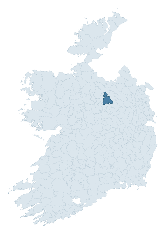
Where this barony sits in the Republic of Ireland
Geology and preservation
Bedrock geology shapes the landscape long before any settlement begins — controlling soil drainage, agricultural potential, the survival of upstanding monuments, and the preservation of buried archaeology. The figures below come from the Geological Survey Ireland 1:100,000 bedrock map.
The bedrock underlying Granard is predominantly limestone (50% of the barony by area), laid down during the Carboniferous period (56% by area, around 359 to 299 million years ago). Limestone is the most heritage-rich bedrock in Ireland. It supports fertile, well-drained soils that favoured dense Early Medieval settlement and Norman manorial agriculture, and it weathers into karst features — sinkholes, caves, swallow holes, and souterrains — that frequently carry archaeology. Where peat overlies limestone, organic preservation can be exceptional. A substantial secondary geology of greywacke (23%) and greywacke and shale (13%) adds further variety to the underlying landscape. The single largest mapped unit is the Lucan Formation (42% of the barony's bedrock). With 8 distinct rock types mapped, the barony sits in the top third of ROI baronies for geological diversity (81st percentile) — typically a sign of complex tectonic history or coastal mosaics of differing rock units.
Rock type composition
Largest mapped unit: Lucan Formation (43% of the barony)
Placename evidence
Logainm records 39 heritage-diagnostic placenames for Granard, drawn from townland and civil-parish names across the barony. The dominant stratum is pre-Christian and Early Medieval defensive — ráth-, lios-, dún-, and caiseal-prefixed names that mark Iron Age and early historic settlement. The leading diagnostic roots are cill- (13 — church), lios- (9 — ringfort or enclosure), and ráth- (8 — earthen ringfort). This is above the ROI average of 30.7 heritage placenames per barony. The presence of multiple heritage strata side by side indicates layered occupation of the landscape across successive prehistoric and historic periods. Logainm records 196 placenames for Granard (predominantly townland names). Of these, 39 (20%) carry one of the diagnostic Gaelic roots tracked above; the remainder draw on more generic landscape vocabulary that does not encode a heritage period.
Pre-Christian / Early Medieval Defensive
| Root | Count | Meaning |
|---|---|---|
| lios- | 9 | ringfort or enclosure |
| ráth- | 8 | earthen ringfort |
| dún- | 1 | hilltop or promontory fort |
Early Christian Ecclesiastical
| Root | Count | Meaning |
|---|---|---|
| cill- | 13 | church (early) |
| mainistir- | 2 | monastery |
| tobar- | 2 | holy well |
| cillín- | 1 | unconsecrated burial ground |
Burial, Ritual, and Norse-Contact
| Root | Count | Meaning |
|---|---|---|
| gall- | 2 | foreigner — Norse settlement marker |
| tuaim- | 1 | burial mound |
| carn- | 1 | cairn |
| feart- | 1 | grave mound |
About this profile
Click any section below to expand.
What is a barony?
A barony is a historic administrative unit in Ireland, broadly equivalent to an English hundred. The 280 baronies used here are from the OSi 2019 National Statutory Boundaries (generalised 20m), covering the 26 counties of the Republic of Ireland. Baronies derive from the Norman period, were formalised in the 17th century, and have not been redrawn for statistical purposes. They vary enormously in area, from compact urban baronies in Dublin to vast upland baronies in Connacht, and should not be compared by raw site count without accounting for area differences.
What counts as a site?
This profile combines three distinct heritage registers, each with its own definition of what constitutes a recordable site:
- Archaeological sites (NMS). The National Monuments Service Sites and Monuments Record (SMR) catalogues every known archaeological monument or site of archaeological interest in the Republic, from prehistoric burial mounds and ringforts to medieval churches and post-medieval defensive works. Inclusion does not require legal protection — only that the site has been identified, surveyed, and assessed as having archaeological value. A separate subset of these sites lies within a recorded protection zone, which gives them statutory protection under the National Monuments Acts.
- Listed buildings (NIAH). The National Inventory of Architectural Heritage records buildings of architectural, historical, archaeological, artistic, cultural, scientific, social, or technical interest. Each surveyed structure is appraised on a five-tier scale: International, National, Regional, Local, and Record-Only. The NIAH appraisal is informational rather than strictly statutory, but it underpins local-authority Record of Protected Structures (RPS) listings.
- Heritage placenames (Logainm). Logainm is the authoritative database of Irish placenames maintained by the Placenames Branch. This profile applies a heritage-diagnostic classifier to the Irish-language form of each townland name, flagging roots that signal defensive sites (ráth-, lios-, dún-, caiseal-, cathair-), ecclesiastical foundations (cill-, teampall-, domhnach-, mainistir-), prehistoric burial-ritual features (tuaim-, carn-, leaba-), or Norse-contact settlement (gall-). Townlands without one of these diagnostic roots are not flagged here — they may still carry historical significance, but that significance is not encoded in the name itself.
Editorial principles
The narrative sections of this profile follow several explicit principles:
- Evidential. Every claim about this barony’s heritage character is anchored in the underlying register data. Where a site count, a placename count, or a percentile rank is cited, it is computed from the source datasets at export time, not estimated.
- Comparative. Counts and metrics are reported alongside their percentile rank against the other 279 ROI baronies. A barony with 50 ringforts in absolute terms could be unusually high or unusually low depending on its size and regional context; percentile ranking removes that ambiguity.
- Transparent on limits. Where a register has known coverage gaps, survey biases, or data-quality issues that affect this barony’s figures, the profile flags them rather than presenting the numbers as definitive.
- No interpretation beyond what the data supports. The narrative does not speculate about historical events, social dynamics, or cultural meaning beyond what the recorded heritage and placename evidence directly attests.
Data caveats and limits
- NMS Sites and Monuments Record is the product of survey campaigns conducted at different intensities across different counties and decades. Some baronies have been surveyed more thoroughly than others, and absolute counts should be read in that light. Sites destroyed by development before survey are typically not represented; sites in heavily forested or upland terrain are sometimes under-recorded.
- NIAH coverage is broadly complete for the Republic of Ireland but the survey was conducted on a rolling county-by-county basis, and the most recent appraisal date varies. Buildings demolished or substantially altered after their original survey may still appear in the register; conversely, recent buildings of merit may not yet have been appraised.
- Logainm classification applies a deliberately conservative pattern-matching approach to the Irish-language townland forms. The classifier prioritises true positives over recall: a townland may carry a heritage signal that the classifier doesn’t recognise, particularly where the diagnostic root has been heavily anglicised or where the townland name draws on a less common term. The 60,000+ townland records and ~9,800 classified placenames give a substantial signal at barony scale, but individual townland names should be checked against Logainm directly for definitive interpretation.
- Period attribution. The chronological distribution reflects only those NMS sites that carry a recognised period attribution in the source data. Sites listed as “Unknown” period are excluded from the dated subset.
- Boundary changes. Some baronies have undergone minor boundary adjustments since their 19th-century definition; the OSi 2019 generalised boundaries used here are the current statutory definition and may differ slightly from historical maps in border areas.
- Bedrock geology is mapped at 1:100,000 scale, which means local variation within a barony — small pockets of different rock type, mineral veins, alluvium overlying bedrock — is generalised. The dominant-system and rocktype figures are area-weighted, so a barony reading “70% Carboniferous limestone” may still contain small but archaeologically important pockets of older or younger rock. Around 3% of GSI polygons do not match the lexicon and contribute no rocktype or system attribution.
Data sources
- National Monuments Service — Sites and Monuments Record (SMR) https://data.gov.ie/dataset/national-monuments-service-archaeological-survey-of-ireland
- National Inventory of Architectural Heritage (NIAH) https://data.gov.ie/dataset/national-inventory-of-architectural-heritage-niah-national-dataset
- Logainm — Placenames Database of Ireland https://www.logainm.ie/
- Ordnance Survey Ireland — National Statutory Barony Boundaries 2019 https://data-osi.opendata.arcgis.com/
- EURODEM — European Digital Elevation Model https://www.mapsforeurope.org/datasets/euro-dem
- ESA WorldCover https://esa-worldcover.org/en
- Geological Survey Ireland — 1:100,000 Bedrock Geology https://www.gsi.ie/en-ie/data-and-maps/Pages/Bedrock.aspx
Explore more: Search any of the 280 ROI baronies, browse by historical province, or read the methodology and data sources for the full Republic of Ireland Heritage Tool.